|
Visher, Stephen Sargent
Climatic Atlas of the United States.
Cambridge., Harvard University Press., 1954. XII, 403S. Mit 1031 Klima-Karten und Diagrammen , schwarzweiß, meist in der Größe 7,5 x 12 cm. Zustand: Ausgeschiedenes Bibliotheksexemplar, Einbandkanten minimal berieben, unterer Rücken mit Kleberesten eines entfernten Aufklebers, Vorsatz mit dem Stempel einer Institutsbibliothek. 4°. OLeinen.
书商的参考编号 : 041769
|
|
|
Visintin, L., Werner Liebing und Wilhelm Goldmannn
Goldmanns Handatlas 87 Kartenseiten, 14 Geschichtskarten, 56 Nebenkarten, 85 Stadtunmgebungspläne, Einführungstexte und Tabellen
München, Wilhelm Goldmann Verlag, 1968. 161 Seiten , 41 cm, Leinen
书商的参考编号 : 35548

|
|
|
Visintin, Luigi (Hrsg.)
Goldmanns Handatlas: 80 Kartenseiten, 56 Nebenkarten, 85 Stadtumgebungspläne, Einführungstexte und Tabellen. hrsg. von L. Visintin [u. a.]. 5., neu bearb. Aufl.
München : Goldmann, 1961. 160 S. überwiegend Kt. 41 cm. Leinen, gebundene Ausgabe.
书商的参考编号 : 181146

|
|
|
Vittorio Magnago Lampugnani, Harald St hlinger, Markus Tubbesing
ATLAS ZUM ST DTEBAU : Band 1: Pl tze Band 2: Stra en
, Hirmer Verlag GmbH, 2018 Hardcover / Gebunden, 732 Seiten, Deutsch, 2 B nde mit 1600 Abbildungen berw. in Farbe !, NEU !!,350 x 265 x 70 mm, *** Eine Pionierleistung: Denn die Gleichartigkeit der Analyse der 68 Pl tze und Stra en aus St dten ganz Europas verhilft nicht nur erstmals jedem Detail der untersuchten Orte zu seinem Recht***. ISBN 9783777429663.
书商的参考编号 : 62626
|
|
|
Vitrac (Maurice) [Sous la direction de :]
La France. Histoire et géographie économiques. Tome I. Les frontières méridionales.
français Sans date (circa 1911). Grand in-8 de 590 pp.; percaline bleue ornée de l'éditeur, tranches dorées. Riche illustration. Tirage sur papier couché.
|
|
|
VIVIEN DE SAINT-MARTIN & SCHRADER
Atlas Universel de Géographie. Nouvelle Edition conforme aux Traités de Paix et Conventions de 1919 - 1922
HACHETTE. Non daté. In-Folio. Relié demi-cuir. A restaurer, 1er plat abîmé, Mors arrachés, Intérieur acceptable. 15 pages + glossaire de 85 pages + 78 doubles-planches de cartes en couleurs (sur 80, manque les cartes n°7 et 57). Pliures sur la pages de titre. Quelques accrocs et petites déchirures en marges de quelques cartes. Ouvrage déboité et débroché, nombreuses planches volantes. Plats et dos détachés. Epidermures sur le dos.. . . . Classification Dewey : 912-Atlas, cartes et plans
书商的参考编号 : RO80107367
|
|
|
VIVIEN DE SAINT MARTIN & SCHRADER
CARTE DU THEATRE DE LA GUERRE FRANCE NORD-EST
HACHETTE. NON DATE. In-Folio. En feuillets. Bon état, Couv. convenable, Dos satisfaisant, Intérieur frais. Carte en couleur, mesurant 65cmx50cm, à l'échelle 1:100 000 000 . Quelques déchirures (altérant un peu la lecture), carte consolidé avec du scotch sur le dos, rousseurs.. . . . Classification Dewey : 912-Atlas, cartes et plans
书商的参考编号 : R240004670
|
|
|
VOGEL C.
Dänemark. Carte N° 41, extraite de Stielers Hand-Atlas.
- Carte 40 x 50 cm, pliée en 2.
书商的参考编号 : 70146
|
|
|
VOGEL C.
Frankreich in 4 Blättern. Cartes N° 26 à 30, extraites de Stielers Hand-Atlas. Une carte d'ensemble et la France en 4 feuilles.
- 5 cartes 40 x 50 cm, pliées en 2.
书商的参考编号 : 70142
|
|
|
VOGEL C.
Spanien und Portugal in 4 Blättern. Cartes N° 31 à 35, extraites de Stielers Hand-Atlas. Une carte d'ensemble et la péninsule ibérique en 4 feuilles.
- 5 cartes 40 x 50 cm, pliées en 2.
书商的参考编号 : 70143
|
|
|
VOGEL C.
Süd-Skandinavien. Carte N° 42, extraite de Stielers Hand-Atlas.
- Carte 40 x 50 cm, pliée en 2.
书商的参考编号 : 70147
|
|
|
Vogel, Günter, und Hartmut Angermann
Atlas zur Biologie : Texte und Tafeln / Günter Vogel
Stuttgart ; München : Dt. Bücherbund, c 1984. 2 Bde: 1 - 2. 658 S. : zahlr. Ill., graph. Darst. 8°. Erw. u. völlig neubearb. Ausg. - Lizenzausg. OLwd mit Rückengoldpräg. u. SU.
书商的参考编号 : 27894
|
|
|
Vogel, Julius
Icones Histologiae Pathologicae. Tabulae Histologiam Pathologicam Illustrantes. Erläuterungstafeln zur pathologischen Histologie mit vorzüglicher Rücksicht auf sein Handbuch der pathologischen Anatomie. Mit deutsch-lateinischem Paralleltext. Herausgegeben von Dr. Julius Vogel, außerordentl. Professor der Medizin in Göttingen.
Leipzig, Verlag Leopold Voss 1843. 26 Tafeln mit 291, teils kolorierten, Figuren, wovon 270 nach der Natur gezeichnet sind., X + 128 Seiten., Folio. privater Halbleineneinband mit mamorierter Pappe und Leinwandecken.,
书商的参考编号 : 67779

|
|
|
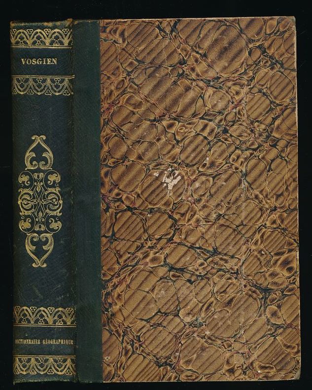
VOSGIEN
Dictionnaire géographique universel des cinq partie du monde
Penaud Paris, Penaud, sans date, vers 1850. Mention de 6e édition. In-8 relié demi-basane verte, dos lisse orné. xxiv +680 pages. Avec 9 cartes dépliantes. Des rousseurs.
书商的参考编号 : 99919754
|
|
|
VOSGIEN / GOIGOUX (J.-D.)
Dictionnaire Géographique ou Description de toutes les parties du monde, Par Vosgien.
Paris, Chez Ménard et Desenne, Fils, Libraires, Rue Git-le-Coeur, N° 8. 1821.Nouvelle édition "Enrichie de sept Cartes neuves, et de plusieurs planches représentant les Pavillons [peints en couleurs] des principales Puissances maritimes, et les Monnaies françaises et étrangères" (6 planches de monnaies in fine). Mappe-monde dépliante en frontispice.In-8 relié plein veau marbré, dos orné, pièce de titre, tranches jaspées, 672 p. + planches. Très bon état intérieur. Cuir : les 2 coiffes absentes - 1 mors inférieur usé - tranches inférieures et les 4 coins très émoussés."Nouvelle édition, entièrement refondue, revue et corrigée avec le plus grand soin, d'après les derniers Traités de paix et les Changemens politiques survenus jusqu'à ce jour ; augmentée de la nomenclature de tous les Chefs-lieux de canton, et d'un grand nombre d'autres endroits connus, omis dans les éditions précédentes ; de l'indication exacte des Foires et Marchés de France et autres pays d'Europe et de toutes les sortes de marchandises qui y sont exposées ; de la valeur réelle et comparative des Monnaies, des Poids et des Mesures français et étrangers ; des Distances légales en kilomètres, et de celles en lieues communes des villes, bourgs et villages de France, soit aux chefs-lieux de département ou d'arrondissement, soit aux bureaux de poste ; de la désignation des Relais, et des lieux par lesquels doivent être adressées les lettres pour les endroits où il n'y a pas de bureau de poste, et de renseignemens précis sur la nécessité ou la liberté d'affranchissement des lettres de France pour l'étranger ; etc., etc."
书商的参考编号 : 12842
|
|
|
VOSGIEN (Chanoine de Vaucouleurs)
Dictionnaire géographique-portatif, ou description des royaumes, provinces, villes, patriarchats, évêchés, duchés, comtés, marquisats, villes impériales et anséatiques, Ports, Forteresses, Citadelles, et autres lieux considérables des quatre parties du Monde, dans lequel on indique en quels Royaumes, Provinces & Contrées ces lieux se trouvent; les Princes dont ils dépendent; les Rivières, Baies, Mers, Montagnes &c. sur lesquelles ils sont situés ; leur distance en lieues françoises des Places remarquables des environs, avec leur longitude & leur latitude selon les meilleures Cartes ; les Sieges que les Villes on soutenus, les grandes Hommes qu'elles ont produit, &c. les lieux où se sont données les principales Batailles. Ouvrage très-utile pour l'intelligence de l'Histoire, traduit de l'Anglois, sur la treizième Edition de Laurent Echard, Avec des additions & des corrections considérables.
1776 A Paris, chez les Libraires Associés, avec approbation & Privilege du Roi - Nouvelle édition, revue, corrigée & augmentée de la Géographie ancienne - 1776 - Fort in-8, pleine basane marron, 4 nerfs au dos avec titre, auteur et fleurons dorés, tranches marbrées - 803 pages - 2 cartes gravées dépliantes
书商的参考编号 : 114112
|
|
|
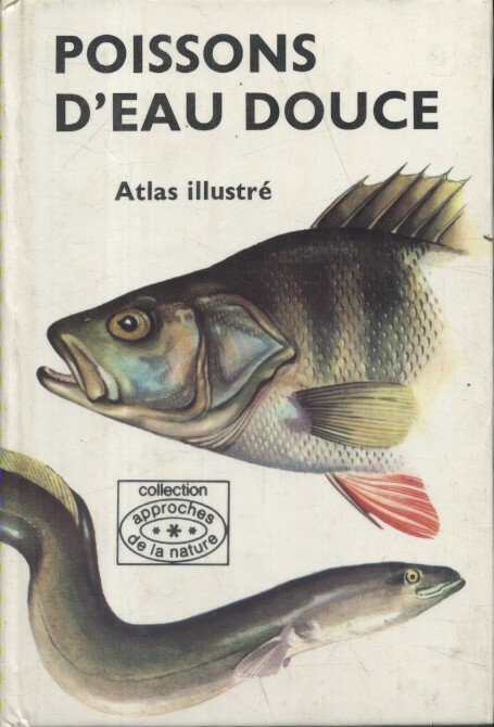
VOSTRADOVSKY Jiri Illustrations de Jiri Maly.
Poissons d'eau douce. Atlas illustré.
Couverture rigide. Cartonné. 256 pages.
书商的参考编号 : 206572
|
|
|
VOSGIEN
Dictionnaire géographique universel des cinq partie du monde
Paris, Penaud, sans date, vers 1850. Mention de 6e édition. In-8 relié demi-basane verte, dos lisse orné. xxiv +680 pages. Avec 9 cartes dépliantes. Des rousseurs.
|
|
|
VROUARD CH. / MANNEVY A.
NOUVEL ATLAS PRIMAIRE - GEOGRAPHIE-CARTOGRAPHIE - enseignement par l'aspect.
LE SOUDIER. NON DATE. In-4. Cartonné. Etat passable, Plats abîmés, Dos abîmé, Intérieur acceptable. 32 pages - nombreuses illustrations et cartes en couleur et noir et blanc dans le texte - VENDU EN L'ETAT - . . . . Classification Dewey : 912-Atlas, cartes et plans
书商的参考编号 : R320103814
|
|
|
VROUARD CH. / MANNEVY A.
NOUVEL ATLAS PRIMAIRE - GEOGRAPHIE-CARTOGRAPHIE - enseignement par l'aspect.
LE SOUDIER. NON DATE. In-4 Carré. Cartonné. Etat passable. Plats abîmés. Dos abîmé. Intérieur acceptable. 32 pages - nombreuses illustrations et cartes en couleur et noir et blanc dans le texte - VENDU EN L'ETAT -
|
|
|
VUILLEMIN A., gravé par VILLEREY - ISIDORE
1 carte gravée en couleurs de la Corrèze - N°18
IMP. MIGEON. XIXe siècle. In-4. En feuillets. Bon état, Livré sans Couverture, Dos satisfaisant, Intérieur acceptable. Une planche ( de 34.5 x 26.5 cm) illustrée d'une carte en couleurs et de quelques gravures en noir et blanc.. . . . Classification Dewey : 912-Atlas, cartes et plans
书商的参考编号 : RO80091062

|
|
|
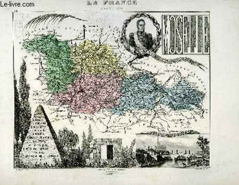
VUILLEMIN A., gravé par ALES - ISIDORE
1 carte gravée en couleurs de la Moselle - N°56
IMP. MIGEON. XIXe siècle. In-4. En feuillets. Bon état, Livré sans Couverture, Dos satisfaisant, Intérieur acceptable. Une planche ( de 34.5 x 26.5 cm) illustrée d'une carte en couleurs et de quelques gravures en noir et blanc.. . . A l'italienne. Classification Dewey : 912-Atlas, cartes et plans
书商的参考编号 : RO80091088
|
|
|
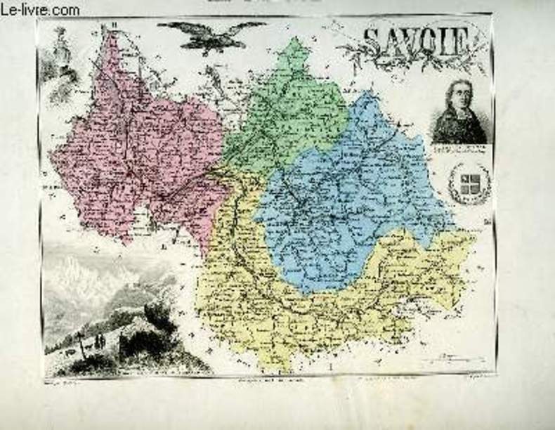
VUILLEMIN A., gravé par GOBERT Th. - BENARD J.
1 carte gravée en couleurs de la Savoie - N°71bis.
IMP. MIGEON. XIXe siècle. In-4. En feuillets. Bon état, Livré sans Couverture, Dos satisfaisant, Intérieur acceptable. Une planche ( de 34.5 x 26.5 cm) illustrée d'une carte en couleurs et de quelques gravures en noir et blanc.. . . A l'italienne. Classification Dewey : 912-Atlas, cartes et plans
书商的参考编号 : RO80091100
|
|
|
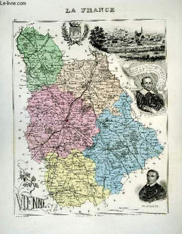
VUILLEMIN A., gravé par COUCHE - ISIDORE
1 carte gravée en couleurs de la Vienne - N°83
IMP. MIGEON. XIXe siècle. In-4. En feuillets. Bon état, Livré sans Couverture, Dos satisfaisant, Intérieur acceptable. Une planche ( de 34.5 x 26.5 cm) illustrée d'une carte en couleurs et de quelques gravures en noir et blanc.. . . . Classification Dewey : 912-Atlas, cartes et plans
书商的参考编号 : RO80091112
|
|
|
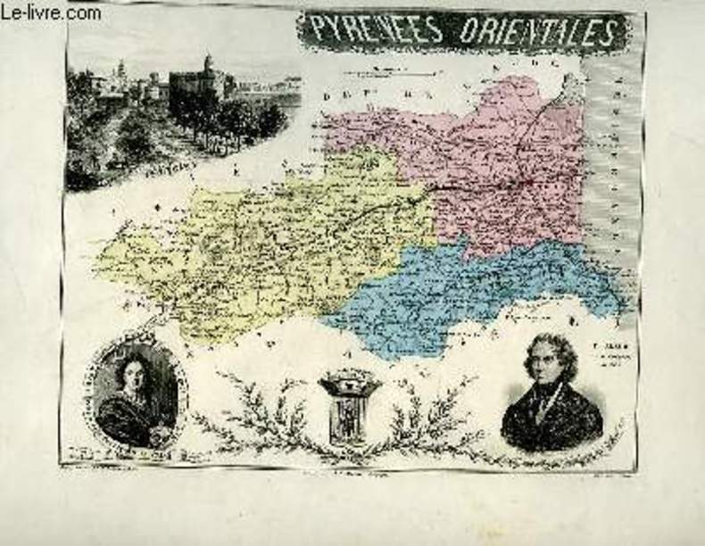
VUILLEMIN A. - ISIDORE
1 carte gravée en couleurs des Pyrénées Orientales - N°65
IMP. MIGEON. XIXe siècle. In-4. En feuillets. Bon état, Livré sans Couverture, Dos satisfaisant, Intérieur acceptable. Une planche ( de 34.5 x 26.5 cm) illustrée d'une carte en couleurs et de quelques gravures en noir et blanc.. . . A l'italienne. Classification Dewey : 912-Atlas, cartes et plans
书商的参考编号 : RO80091093
|
|
|
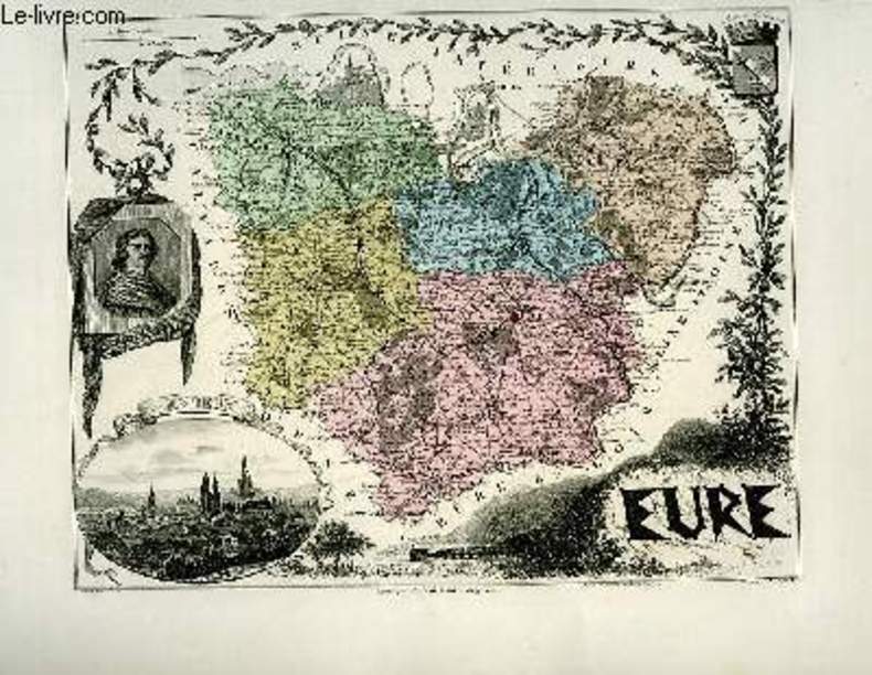
VUILLEMIN A., gravé par ALES - DUVAL
1 carte gravée en couleurs de l'Eure - N°26
IMP. MIGEON. XIXe siècle. In-4. En feuillets. Bon état, Livré sans Couverture, Dos satisfaisant, Intérieur acceptable. Une planche ( de 34.5 x 26.5 cm) illustrée d'une carte en couleurs et de quelques gravures en noir et blanc.. . . A l'italienne. Classification Dewey : 912-Atlas, cartes et plans
书商的参考编号 : RO80091067
|
|
|
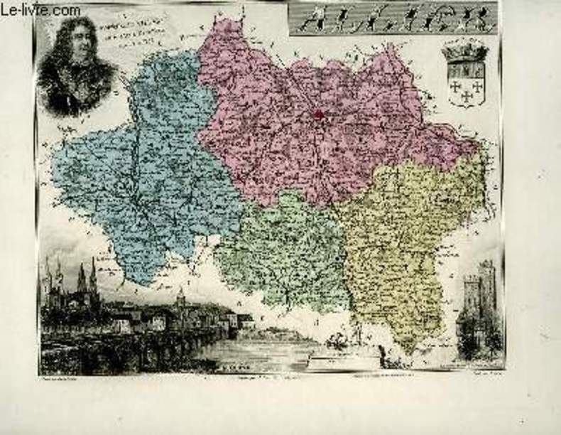
VUILLEMIN A., gravé par LAROULANDIE - ISIDORE
1 carte gravée en couleurs de l'Allier - N°3
IMP. MIGEON. XIXe siècle. In-4. En feuillets. Etat d'usage, Livré sans Couverture, Dos satisfaisant, Intérieur acceptable. Une planche (34.5 x 26.5 cm) illustrée d'une carte en couleurs et de quelques gravures en noir et blanc.. . . . Classification Dewey : 912-Atlas, cartes et plans
书商的参考编号 : RO80091049
|
|
|
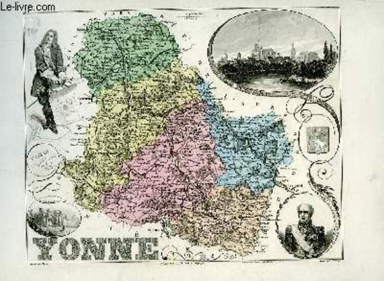
VUILLEMIN A., gravé parALES - ISIDORE
1 carte gravée en couleurs de l'Yonne - N°86.
IMP. MIGEON. XIXe siècle. In-4. En feuillets. Bon état, Livré sans Couverture, Dos satisfaisant, Intérieur acceptable. Une planche (34.5 x 26.5 cm) illustrée d'une carte en couleurs et de quelques gravures en noir et blanc.. . . A l'italienne. Classification Dewey : 912-Atlas, cartes et plans
书商的参考编号 : RO80091043
|
|
|
VUILLEMIN A., gravé par Ch. SMITH - BENARD J.
1 carte gravée en couleurs de la Haute-Savoie - N°71 Ter.
IMP. MIGEON. XIXe siècle. In-4. En feuillets. Bon état, Livré sans Couverture, Dos satisfaisant, Pliures. Une planche (34.5 x 26.5 cm) illustrée d'une carte en couleurs et de quelques gravures en noir et blanc.. . . A l'italienne. Classification Dewey : 912-Atlas, cartes et plans
书商的参考编号 : RO80091042

|
|
|
VUILLEMIN A., gravé par VILLEREY -
1 carte gravée en couleurs du Haut-Rhin - N°67. (La France avant 1870)
IMP. MIGEON. XIXe siècle. In-4. En feuillets. Etat d'usage, Livré sans Couverture, Dos satisfaisant, Quelques rousseurs. Une planche (34.5 x 26.5 cm) illustrée d'une carte en couleurs et de quelques gravures en noir et blanc. Quelques accrocs et petites déchirures en marges, n'atteignant pas les gravures.. . . . Classification Dewey : 912-Atlas, cartes et plans
书商的参考编号 : RO80091041

|
|
|
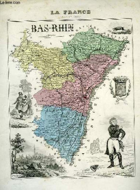
VUILLEMIN A., gravé par VILLEREY - ISIDORE
1 carte gravée en couleurs du Bas-Rhin - N°66. (La France avant 1870)
IMP. MIGEON. XIXe siècle. In-4. En feuillets. Etat d'usage, Livré sans Couverture, Dos satisfaisant, Intérieur acceptable. Une planche ( 34.5x 26.5 cm) illustrée d'une carte en couleurs et de quelques gravures en noir et blanc. Quelques accrocs et petites déchirures en marges, n'atteignant pas les gravures.. . . . Classification Dewey : 912-Atlas, cartes et plans
书商的参考编号 : RO80091040
|
|
|
VUILLEMIN A., gravé par LAROULANDIE - ISIDORE
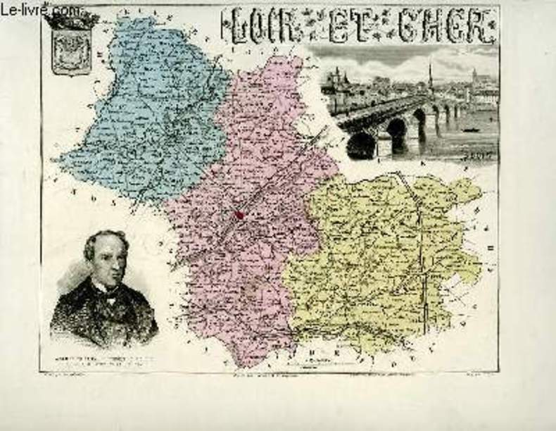
1 carte gravée en couleurs du Loir-et-Cher - N°40
IMP. MIGEON. XIXe siècle. In-4. En feuillets. Bon état, Livré sans Couverture, Dos satisfaisant, Intérieur acceptable. Une planche ( de 34.5 x 26.5 cm) illustrée d'une carte en couleurs et de quelques gravures en noir et blanc.. . . A l'italienne. Classification Dewey : 912-Atlas, cartes et plans
书商的参考编号 : RO80091076
|
|
|
VUILLEMIN A., gravé par DYONNET Ch. - VILLEREY
1 carte gravée en couleurs des Basses-Alpes - N°4
IMP. MIGEON. XIXe siècle. In-4. En feuillets. Etat d'usage, Livré sans Couverture, Dos satisfaisant, Intérieur acceptable. Une planche (34.5 x 23 cm) illustrée d'une carte en couleurs et de quelques gravures en noir et blanc. . . . A l'italienne. Classification Dewey : 912-Atlas, cartes et plans
书商的参考编号 : RO80091046

|
|
|
VUILLEMIN A., gravé par ALES - ISIDORE
1 carte gravée en couleurs de l'Aube - N°9
IMP. MIGEON. XIXe siècle. In-4. En feuillets. Bon état, Livré sans Couverture, Dos satisfaisant, Intérieur acceptable. Une planche (34.5 x 26.5 cm) illustrée d'une carte en couleurs et de quelques gravures en noir et blanc.. . . A l'italienne. Classification Dewey : 912-Atlas, cartes et plans
书商的参考编号 : RO80091055

|
|
|
VUILLEMIN A., gravé par DUCHIER E. - ISIDORE
1 carte gravée en couleurs des Ardennes - N°7
IMP. MIGEON. XIXe siècle. In-4. En feuillets. Bon état, Livré sans Couverture, Dos satisfaisant, Intérieur acceptable. Une planche (34.5 x 26.5 cm) illustrée d'une carte en couleurs et de quelques gravures en noir et blanc.. . . A l'italienne. Classification Dewey : 912-Atlas, cartes et plans
书商的参考编号 : RO80091054

|
|
|
VUILLEMIN A., gravé par VILLEREY - ISIDORE
1 carte gravée en couleurs de l'Afrique Française - Sénégal (N°91)
IMP. MIGEON. XIXe siècle. In-4. En feuillets. Etat d'usage, Livré sans Couverture, Dos satisfaisant, Déchirures. Une planche (34.5 x 26.5 cm) illustrée d'une carte en couleurs et de quelques gravures en noir et blanc. Une déchirure de 4 cm, en marges de tête.. . . A l'italienne. Classification Dewey : 912-Atlas, cartes et plans
书商的参考编号 : RO80091047
|
|
|
VUILLEMIN A., gravé par ALES - ISIDORE
1 carte gravée en couleurs de l'Ain - N°1
IMP. MIGEON. XIXe siècle. In-4. En feuillets. Bon état, Livré sans Couverture, Dos satisfaisant, Intérieur acceptable. Une planche (34.5 x 26.5 cm) illustrée d'une carte en couleurs et de quelques gravures en noir et blanc.. . . A l'italienne. Classification Dewey : 912-Atlas, cartes et plans
书商的参考编号 : RO80091048

|
|
|
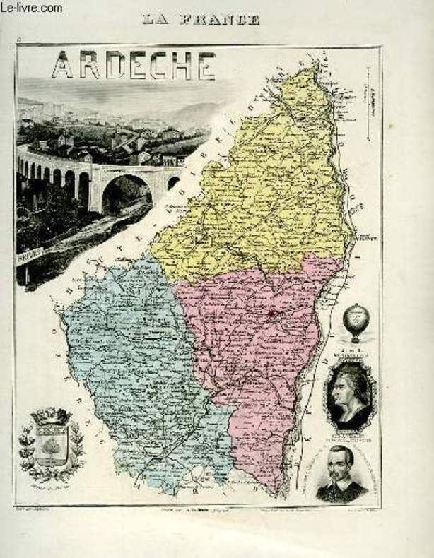
VUILLEMIN A., gravé par LEGENISEL - ISIDORE
1 carte gravée en couleurs de l'Ardèche - N°6
IMP. MIGEON. XIXe siècle. In-4. En feuillets. Bon état, Livré sans Couverture, Dos satisfaisant, Intérieur acceptable. Une planche (34.5 x 26.5 cm) illustrée d'une carte en couleurs et de quelques gravures en noir et blanc.. . . . Classification Dewey : 912-Atlas, cartes et plans
书商的参考编号 : RO80091053
|
|
|
VUILLEMIN A., gravé par DUCHIER E. - ISIDORE
1 carte gravée en couleurs de l'Aisne - N°2
IMP. MIGEON. XIXe siècle. In-4. En feuillets. Bon état, Livré sans Couverture, Dos satisfaisant, Intérieur acceptable. Une planche (34.5 x 26.5 cm) illustrée d'une carte en couleurs et de quelques gravures en noir et blanc.. . . . Classification Dewey : 912-Atlas, cartes et plans
书商的参考编号 : RO80091050

|
|
|
VUILLEMIN A., gravé par DYONNET Ch.
1 carte gravée en couleurs des Hautes-Alpes - N°5
IMP. MIGEON. XIXe siècle. In-4. En feuillets. Bon état, Livré sans Couverture, Dos satisfaisant, Intérieur acceptable. Une planche (34.5 x 26.5 cm) illustrée d'une carte en couleurs et de quelques gravures en noir et blanc.. . . . Classification Dewey : 912-Atlas, cartes et plans
书商的参考编号 : RO80091051

|
|
|
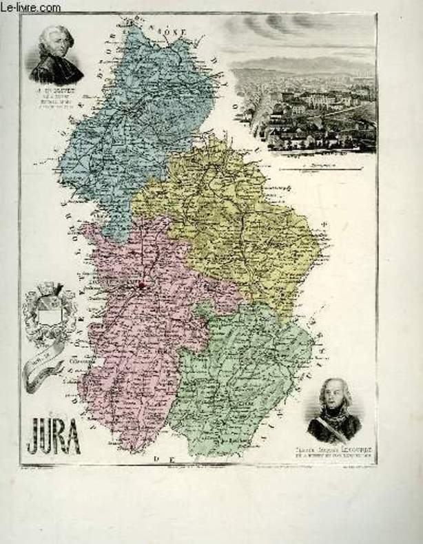
VUILLEMIN A., gravé par DYONNET Ch. - LEGENISEL
1 carte gravée en couleurs du Jura - N°38
IMP. MIGEON. XIXe siècle. In-4. En feuillets. Bon état, Livré sans Couverture, Dos satisfaisant, Intérieur acceptable. Une planche ( de 34.5 x 26.5 cm) illustrée d'une carte en couleurs et de quelques gravures en noir et blanc.. . . . Classification Dewey : 912-Atlas, cartes et plans
书商的参考编号 : RO80091074
|
|
|
VUILLEMIN A., gravé par DYONNET Ch. - COUCHE
1 carte gravée en couleurs des Cotes du Nord - N°21
IMP. MIGEON. XIXe siècle. In-4. En feuillets. Bon état, Livré sans Couverture, Dos satisfaisant, Intérieur acceptable. Une planche ( de 34.5 x 26.5 cm) illustrée d'une carte en couleurs et de quelques gravures en noir et blanc.. . . . Classification Dewey : 912-Atlas, cartes et plans
书商的参考编号 : RO80091063
|
|
|
VUILLEMIN A., gravé par DYONNET Ch.
1 carte gravée en couleurs de l'Ariège - N°8
IMP. MIGEON. XIXe siècle. In-4. En feuillets. Bon état, Livré sans Couverture, Dos satisfaisant, Intérieur acceptable. Une planche (34.5 x 26.5 cm) illustrée d'une carte en couleurs et de quelques gravures en noir et blanc.. . . A l'italienne. Classification Dewey : 912-Atlas, cartes et plans
书商的参考编号 : RO80091056
|
|
|
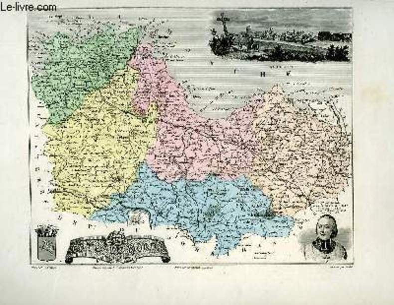
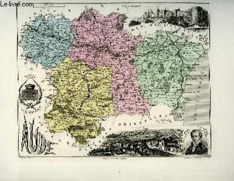
VUILLEMIN A., gravé par FILLATREAU
1 carte gravée en couleurs de l'Aude - N°10
IMP. MIGEON. XIXe siècle. In-4. En feuillets. Bon état, Livré sans Couverture, Dos satisfaisant, Intérieur acceptable. Une planche (34.5 x 26.5 cm) illustrée d'une carte en couleurs et de quelques gravures en noir et blanc.. . . A l'italienne. Classification Dewey : 912-Atlas, cartes et plans
书商的参考编号 : RO80091057
|
|
|
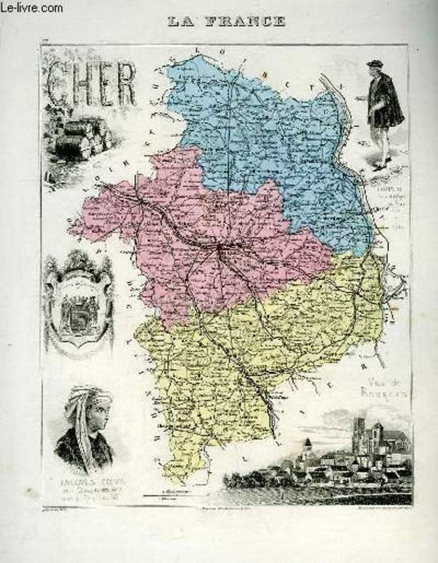
VUILLEMIN A., gravé par FILLATREAU
1 carte gravée en couleurs du Cher - N°17
IMP. MIGEON. XIXe siècle. In-4. En feuillets. Bon état, Livré sans Couverture, Dos satisfaisant, Intérieur acceptable. Une planche ( de 34.5 x 26.5 cm) illustrée d'une carte en couleurs et de quelques gravures en noir et blanc.. . . . Classification Dewey : 912-Atlas, cartes et plans
书商的参考编号 : RO80091061
|
|
|
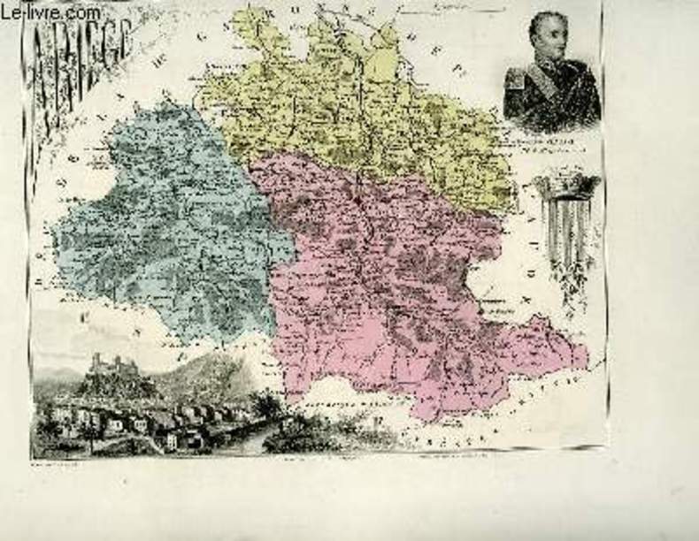
VUILLEMIN A., gravé par FILLATREAU
1 carte gravée en couleurs de l'Isère - N°37
IMP. MIGEON. XIXe siècle. In-4. En feuillets. Bon état, Livré sans Couverture, Dos satisfaisant, Intérieur acceptable. Une planche ( de 34.5 x 26.5 cm) illustrée d'une carte en couleurs et de quelques gravures en noir et blanc.. . . A l'italienne. Classification Dewey : 912-Atlas, cartes et plans
书商的参考编号 : RO80091073
|
|
|
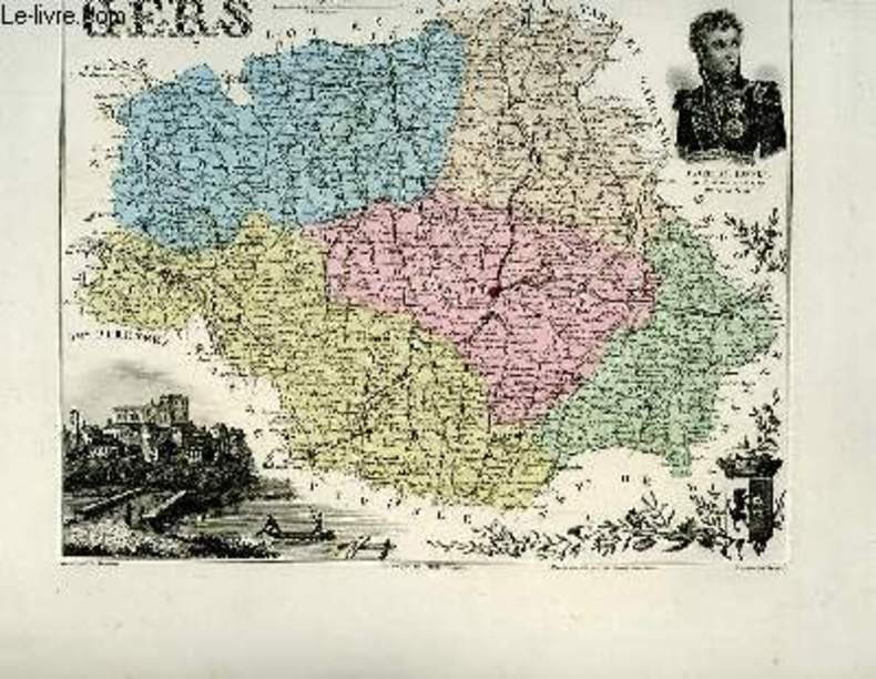
VUILLEMIN A., gravé par DYONNET Ch. - VILLEREY
1 carte gravée en couleurs du Gers - N°31
IMP. MIGEON. XIXe siècle. In-4. En feuillets. Bon état, Livré sans Couverture, Dos satisfaisant, Intérieur acceptable. Une planche ( de 34.5 x 26.5 cm) illustrée d'une carte en couleurs et de quelques gravures en noir et blanc.. . . A l'italienne. Classification Dewey : 912-Atlas, cartes et plans
书商的参考编号 : RO80091069
|
|
|
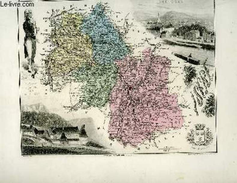
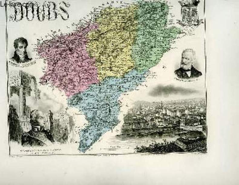
VUILLEMIN A., gravé par DYONNET Ch. - LEGENISEL
1 carte gravée en couleurs du Doubs - N°24
IMP. MIGEON. XIXe siècle. In-4. En feuillets. Bon état, Livré sans Couverture, Dos satisfaisant, Intérieur acceptable. Une planche ( de 34.5 x 26.5 cm) illustrée d'une carte en couleurs et de quelques gravures en noir et blanc.. . . A l'italienne. Classification Dewey : 912-Atlas, cartes et plans
书商的参考编号 : RO80091066
|
|
|
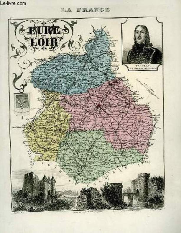
VUILLEMIN A., gravé par ALES - ISIDORE
1 carte gravée en couleurs de l'Eure et Loir - N°27
IMP. MIGEON. XIXe siècle. In-4. En feuillets. Bon état, Livré sans Couverture, Dos satisfaisant, Intérieur acceptable. Une planche ( de 34.5 x 26.5 cm) illustrée d'une carte en couleurs et de quelques gravures en noir et blanc.. . . . Classification Dewey : 912-Atlas, cartes et plans
书商的参考编号 : RO80091068
|
|
|
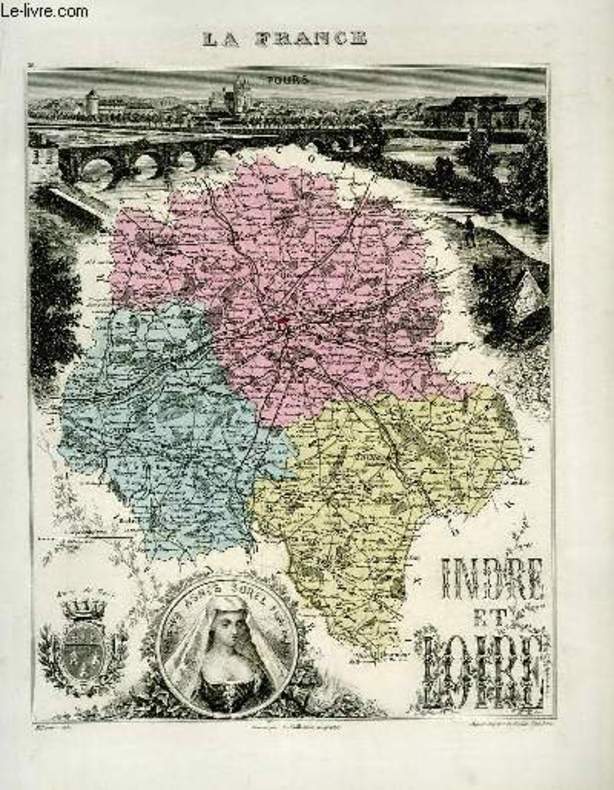
VUILLEMIN A., gravé par FILLATREAU
1 carte gravée en couleurs de l'Indre et Loire - N°36
IMP. MIGEON. XIXe siècle. In-4. En feuillets. Bon état, Livré sans Couverture, Dos satisfaisant, Intérieur acceptable. Une planche ( de 34.5 x 26.5 cm) illustrée d'une carte en couleurs et de quelques gravures en noir et blanc.. . . . Classification Dewey : 912-Atlas, cartes et plans
书商的参考编号 : RO80091072
|
|
 ?????????
 ?????PDF???
 RSS feed


