|
E. Bureau Ex-professeur adjoint d'histoire, professeur de géographie et de statistique militaire à l'école impériale de Saint-Cyr .
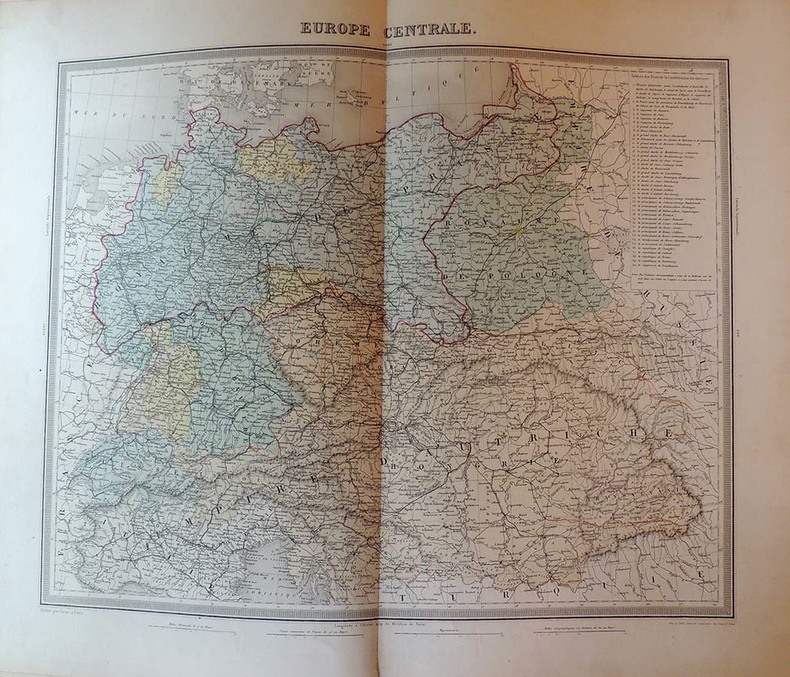
Atlas de géographie militaire adopté par M.le ministre de la guerre pour l'école impériale militaire de Saint-Cyr, accompagné d'un exposé complet de l'organisation politique et administratif de la France et de tableaux statistiques militaires sous la direction de E. Bureau
Furne, Jouvet et Cie, libraires-Editeurs Paris,1871, in-folio (28cm x 42,5cm), demi-percaline à coins façon reptile, 4ff.-39 cartes et plans (sur 40), dont 14 en couleurs et 35 tableaux. Cet atlas est composé de 1° cartes nouvelles et spéciales, dressées par MM. Duvotenay, F. de Lemud, Testarode et Bureau, sous la direction de M. Théodore Lavallée. 2° cartes extraites de l'atlas accompagnant l'Histoire de la Révolution par M. Thiers par Duvotenay et Dyonnet, compétées par Bureau. 3°Cartes extraites de latlas de géographie universelle par M. Ambroise Tardieu, complétées par M. Bureau 4° Cartes nouvelles et spéciales dressées pa M. Bureau. // Ensemble en bon état. Quelques rousseurs sur les pages de texte, frottements sur le premier plat de couverture. Manque la carte des frontières du nord et Belgique pour l'intelligence des guerres de Louis XIV et Louis XV et des campagnes de 1792, 1793, 1794, 1814 et 1815.
Bookseller reference : 14546
|
|
|
E. PEROT SCULPSIT
CARTE EN COULEUR : ATLAS DES PORTS DE FRANCE - PLANCHE 78 - PORT DU CROISIC - 1879
nantes Sarrazin 1879 Une Gravure Originale d'époque en noir et bleu, Format : 66 centimètres de haut par 48,5 centimètres de large, sur papier crème, 1879 Paris : Imp. Sarazin Editeur, [planche tirée de l'Atlas des ports de france , Paris Sarrazin Imprimeur Editeur]
Bookseller reference : 27199
|
|
|
E. PEROT SCULPSIT
CARTE EN COULEUR : ATLAS DES PORTS DE FRANCE - PLANCHE 70 - PORTS DE BELLE-ILE-EN-MER : I- SAUZON - II - LE PALAIS - III - PORT MARIA DE LOCMARIA - IV - PORT DE LA CROIX (ILE D'HOËDIC) - 1879
nantes Sarrazin 1879 Une Gravure Originale d'époque en noir et bleu, Format : 66 centimètres de haut par 48,5 centimètres de large, sur papier crème, 1879 Paris : Imp. Sarazin Editeur, [planche tirée de l'Atlas des ports de france , Paris Sarrazin Imprimeur Editeur]
Bookseller reference : 27213
|
|
|
E. PEROT SCULPSIT
CARTE EN COULEUR : ATLAS DES PORTS DE FRANCE - PLANCHE 77 - I - LA TURBALLE, II - LE POULIGUEN, III - PORNIC - 1879
nantes Sarrazin 1879 Une Gravure Originale d'époque en noir et bleu, Format : 66 centimètres de haut par 48,5 centimètres de large, sur papier crème, 1879 Paris : Imp. Sarazin Editeur, [planche tirée de l'Atlas des ports de france , Paris Sarrazin Imprimeur Editeur]
Bookseller reference : 27281
|
|
|
E. PEROT SCULPSIT
CARTE EN COULEUR : ATLAS DES PORTS DE FRANCE - PLANCHE 87 - PORT DE NOIRMOUTIER - 1879
nantes Sarrazin 1879 Une Gravure Originale d'époque en noir et bleu, Format : 66 centimètres de haut par 48,5 centimètres de large, sur papier crème, 1879 Paris : Imp. Sarazin Editeur, [planche tirée de l'Atlas des ports de france , Paris Sarrazin Imprimeur Editeur]
Bookseller reference : 27775
|
|
|
E. DUNOYER DE NOIRMONT [baron Joseph-Anne-Emile-Edouard (1816-1896)] et MARBOT, baron Alfred de [(1812-1865)].
Les Uniformes de l'Armée Française de 1439 à 1815. Tome I : de 1439 à 1789, tome II : de 1789 à 1815.
Saint-Didier de Charpey, Ed. Quatuor, 2007, 2 vol. in-fol.,pleine soie d’orient grise de l’éditeur, dos lisse avec tomaison étoilée dorée, vignette de titre illustrée contrecollée au premier plat, étui illustré : 474 - 213 pp - illustrations à pleine page d’après les dessins des auteurs rassemblant 450 planches d’uniformes en couleurs légendées et suivies de tables et tableaux. Tirage limité à 600 exemplaires numérotés à la main dont : 1 à 50 reliés plein cuir et 51 à 600 reliés en soie d’orient : N°99. Très belle réédition de ce magnifique et rare monument du costume militaire français publié en trois volumes in-folio, entre 1830 et 1860, offrant 450 planches lithographiées par André et Gustave David d'après des dessins de Noirmont et Marbot et coloriées de manière vive à la main. Bon exemplaire de ce guide définitif du costume militaire français des origines (Charles VII) jusqu'à la fin des guerres napoléoniennes.
Bookseller reference : SHL-36

|
|
|
E. CORTAMBERT
NOUVEL ATLAS DE GEOGRAPHIE. ANCIENNE, DU MOYEN AGE ET MODERNE.
HACHETTE. NON DATE. In-4. Relié toilé. Etat d'usage, Coins frottés, Dos abîmé, Intérieur frais. 100 cartes en couleurs dont plusieurs sont dépliantes. Toile noire, titres, filets at caissons ornés dorés au dos. Filets dorés sur les plats. Manque au dos fané. Un mors partiellement fendu.. . . . Classification Dewey : 912-Atlas, cartes et plans
Bookseller reference : R260148053
|
|
|
E. BUREAU
Atlas de géographie militaire adopté par M. Le Ministre de la Guerre pour l'Ecole Spéciale Militaire de Saint-Cyr par E. BUREAU
PARIS, Furne, Jouvet Et Cie, 1874 - In-folio, 42 x 28 cm - Reliure Pleine toile frottée- Faux-titre. Titre. Préface. Explication du choix et de la disposition des cartes qui composent cet atlas - I) Cartes générales. Europe physique. Politique. France, etc, etc 13 cartes doubles pages en noir et en couleurs - II) Cartes de campagne. Frontières du Nord de la Belgique. Hollande, etc, etc. Cartes des campagnes de 1792 à 1861 et qqs plans de villes, dont Brest, Cherbourg, Lorient et Rochefort, 14 à 41- Bon exemplaire, frais intérieurement
|
|
|
E. NARDIN, (French cartographer), (18.-19. century).
[MAP / THE IMPERIAL OTTOMAN IN 1909 / BALKANS / NORTH AFRICA] Peninsule des Balkans - Empire Ottoman. [Carte géographique].
Very Good French This attractive color lithographed map shows the Imperial Ottoman territories in the Balkan Peninsula, Anatolia, also North African shores and Maghreb countries, Egypt and Vilayet de Tripoli (Libya) and Liva de Benghasi. It has small views with a small scale of Tripoli, Europe, Egypt, and Nubia with the Arabian Peninsula. This map reflects the territories and situation of the last period of the Ottoman Empire soon after the Second Constitutional Era in 1908. Inside the red lines in this map shows the Ottoman territories in 1909 with its maximum extent, just before the Balkan Wars, (1912-1913). In Europe, Western Thrace territories up to Montenegro including Adrianople are within the borders of the Empire. E. Nardin was a French cartographer who prepared more than sixty maps in the early 19th century, especially mapping Middle Eastern, North African, Sub-Saharan African areas. Original color lithograph folded map in its original wrappers. Oblong double elephant folio. (77x95 cm). Wrappers dimensions: (21,5x14 cm). In French. Echelle 1/4.165.000 (Scale). Only two copies in OCLC. Extremely rare. No date.
|
|
|
E.BUREAU
ATLAS DE GEOGRAPHIE MILITAIRE ADOPTE PAR MONSIEUR LE MINISTRE DE LA GUERRE POUR L'ECOLE SPECIALE DE SAINT-CYR
FURNE , JOUVET ET Cie . 1872 . Reliure verte. Cartes et plans en couleur et en noir et blanc . EUROPE , FRANCE ...
Bookseller reference : 131216
|
|
|
E.CORTAMBERT
ATLAS DE GEOGRAPHIE MODERNE CONTENANT 66 CARTES - EDITION NOUVELLE COMPLETEMENT REFONDUE SOUS LA DIRECTION DE PLUSIEURS GEOGRAPHES ET PROFESSEURS.
HACHETTE ET CIE. NON DATE. In-4. Relié. Bon état, Coins frottés, Dos satisfaisant, Intérieur frais. 66 cartes en couleurs hors texte dont quelques unes dépliantes - coins frottés - titre + auteur + filets + ornements dorés sur le dos .. . . . Classification Dewey : 912-Atlas, cartes et plans
Bookseller reference : R240089781
|
|
|
EADE J. V.
THREE KINGS SHELF, BATHYMETRY, MISCELLANEOUS SERIES N° 66, 1:50 000
New Zealand Oceanographic Institute - DSIR. 1988. In-8. En feuillets. Etat du neuf, Couv. fraîche, Dos impeccable, Intérieur frais. 1 carte dépliable très grand format en couleur dans sa pochette plastique d'origine.. . . . Classification Dewey : 912-Atlas, cartes et plans
Bookseller reference : RO40107293
|
|
|
EADE J. V.
THREE KINGS SHELF, BATHYMETRY, MISCELLANEOUS SERIES N° 66, 1:50 000
New Zealand Oceanographic Institute - DSIR. 1988. In-8 Carré. En feuillets. Etat du neuf. Couv. fraîche. Dos impeccable. Intérieur frais. 1 carte dépliable très grand format en couleur dans sa pochette plastique d'origine. N.Z. Ocean. Inst., Division of Marine and Freshwater Science.

|
|
|
Ebeling, Ph. u. E. Morgenroth (Hrsg.)
Atlas der Handels- und Wirtschaftsgeographie : eine Ergänzung zu allen Schulatlanten ; 30 Haupt- u. 19 Nebenkarten auf 22 Kartenseiten.
Bielefeld, Velhagen & Klasing, 1908. 22 Seiten, Karten, H 33 x 25 cm, OHalbLeinen. - Gebrauchsspuren (Einband schadhaft, 3 Seiten Teil-Randverlust); insges. aber noch guter Zustand. fest gebunden/ hardcover
Bookseller reference : ATL1750

|
|
|
Echard (Laurent), Vosgien
Dictionnaire géographique portatif, des quatres parties du monde, traduit de l'anglais sur la dernière édition de Laurent Echard, par Vosgien.
français In-8 de VJ-(2)-822 pp.; basane mouchetée, dos à cinq nerfs orné (reliure de l'époque). Nouvelle édition, revue, rectifiée, mise en ordre & augmentée de plus de trois mille noms de villes, villages ou bourgs qui n'avaient point encore paru dans ce dictionnaire, par J. Fr. Bastien. Illustrée de deux cartes dépliantes ; une mappemonde et l'Europe divisée en ses grands Etats. Manquent les gardes, pièce de titre absente.
|
|
|
Eckardt, Emanuel, und Sebastian Knauer
Kein schöner Land : ein deutscher Umweltatlas.
Goldmann : München, 1982. 331 S. : Ill., graph. Darst., Kt. 8°. Genehm. Taschenbuchausg. OKt. (Tb). (Goldmann ; 11515 : Stern-Bücher)
Bookseller reference : 21862
|
|
|
Eckhard Slawik / Uwe Reichert
Atlas der Sternbilder.
Heidelberg/Berlin, Spektrum Akademischer Verlag, 1998. Origi.Pappband im Schuber, gr.4°, 224 Seiten.
Bookseller reference : 75652
|
|
|
ECOLE
CARTE DE LA MEDITERRANEE AU TEMPS DE L'APOTRE PAUL - DIMENSION 40 x 60 CM ENVIRON.
EOLE. 1988. In-8. Broché. Bon état, Couv. convenable, Dos satisfaisant, Intérieur frais. Carte en couleurs (verso uniquement) de DIMENSION : 40 x 60 cm environ.. . . . Classification Dewey : 912-Atlas, cartes et plans
Bookseller reference : ROD0105439
|
|
|
ECOLE D'ETAT-MAJOR
Géographie - Atlas Cycles I et II
CHEZ L'AUTEUR. 1962 - 1963. In-4. Broché. Bon état, Couv. légèrement passée, Dos satisfaisant, Intérieur frais. 233 pages. Nombreuses planches de cartes en noir et blanc hors-texte.. . . . Classification Dewey : 912-Atlas, cartes et plans
Bookseller reference : RO20046780
|
|
|
Ecole d'application de l'arme blindée...
Recherche méthodique des pannes (moteurs à essence)
Ecole d'application de l'arme blindée et de la cavalerie. 1949. In-18. Broché. Bon état, Couv. convenable, Dos satisfaisant, Papier jauni. Environ 4 pages de texte + 1 carte en couleur dépliante. Un ex-libris à l'encre sur le 1er plat.. . . . Classification Dewey : 912-Atlas, cartes et plans
Bookseller reference : RO30342337

|
|
|
ECOLE SUPERIEURE DE GUERRE, 1ère Division.
Stratégie et Tactique générale. Conférences de 1892 - 1893. Croquis.
CHEZ L'AUTEUR. 1897. In-4. Broché. Etat passable, Plats abîmés, Dos abîmé, Intérieur bon état. 7 planches dépliantes de croquis et cartes en noir et blanc, hors-texte. Plats détachés, avec accrocs et déchirures sur les bords.. . . . Classification Dewey : 912-Atlas, cartes et plans
Bookseller reference : RO80049027
|
|
|
Editions Atlas
Chasser
Glénat 2005 174 pages 28x22x2cm. 2005. Broché. 174 pages.
Bookseller reference : 61199

|
|
|
Editions Atlas
L'atlas - La Mythologie Égyptienne
RELIE. 2005. 240 PAGES. PHOTOS SUR DEMANDE
Bookseller reference : AM8429
|
|
|
Edition Atlas
La poule le coq et les poussins
Atlas. 2006. In-12. Relié. Etat d'usage, Coins frottés, Dos frotté, Intérieur frais. 25 pages illustrées en couleurs.. . . . Classification Dewey : 843.064-BD périodiques
Bookseller reference : RO80206969

|
|
|
Editions Atlas
LA BOITE A OUTILS
Éditions Atlas Sans date.
Bookseller reference : 500275939

|
|
|
Editions Atlas Huyn Peggy Courreau Marie Jose
Le sacre de birmanie
Éditions Atlas 2012 in8. 2012. Bunko broché.
Bookseller reference : 89147

|
|
|
Editions Atlas Atlas EGRET FRANCOIS
LE FOSSE SUIVI DE FLORA DES EMBRUNS
Éditions Atlas 2012 in8. 2012. Cartonné.
Bookseller reference : 100067107

|
|
|
Editions Atlas Atlas EGRET FRANCOIS
LE FOSSE SUIVI DE FLORA DES EMBRUNS
Éditions Atlas 2012 in8. 2012. Cartonné.
Bookseller reference : 100068133

|
|
|
Editions Atlas
Le Grand Atlas du Monde 2006
Éditions Atlas 2005 340 pages 2005. 340 pages.
Bookseller reference : 300002733

|
|
|
Editions Atlas
Nam l'histoire vécue de la guerre du viet-nam 1965-1975 Nº9
Éditions Atlas Sans date.
Bookseller reference : 500274951

|
|
|
EDITIONS ATLAS
Nature en France : La vie surprenant des bords de mer [Board book] EDITIONS ATLAS
PHOTOS SUR DEMANDE
Bookseller reference : FR24366
|
|
|
Editions Atlas
Nature en France : La vie surprenant des bords de mer
Éditions Atlas 2002 2002.
Bookseller reference : 300012747

|
|
|
Editions Atlas
Saveurs indiennes
Éditions Atlas 2009 80 pages 18x19x1cm. 2009. Broché. 80 pages.
Bookseller reference : 100063105

|
|
|
Editions Atlas
Saveurs indiennes
Éditions Atlas 2009 80 pages 18x19x1cm. 2009. Broché. 80 pages.
Bookseller reference : 100066087

|
|
|
Editions Atlas
Saveurs indiennes
Éditions Atlas 2009 80 pages 18x19x1cm. 2009. Broché. 80 pages.
Bookseller reference : 100071480

|
|
|
Edit by: Coskun Yilmaz.
III. Selim. Istanbul at a turning point between two centuries.= III. Selim. Iki asrin dönemecinde Istanbul.
As New As New English Original bdg. Dust wrapper. In the publisher's original slip-case. Mint. 4to. (34 x 25 cm). A heavy volume. B/w and color ills. 520 p. In English and Turkish. III. Selim. Istanbul at a turning point between two centuries.= III. Selim. Iki asrin dönemecinde Istanbul.
|
|
|
Edited by ADAM HART-DAVIS.
Tarih atlasi.
New New Turkish Original bdg. HC. In special publisher's box. 4to. (34 x 34 cm). In Turkish. 612 p., color ills. Tarih atlasi. A very heavy volume.
|
|
|
Edited by BÜLENT ÖZÜKAN.
Maps of Istanbul through the ages.= Tarihte Istanbul haritalari [SPECIAL BOXED EDITION]. Texts by Ilber Ortayli, Dogan Uçar, M. Sinan Genim, Ahmet Isik Dogan, Mehmet Perinçek, Mustafa Kaçar, Dogan Kuban, Cahit Kayra, Murat Önes, Misra Erkaya, Celal Sengör.
New English Original cloth bdg. In publisher's special box. Elephant folio. (51,5 x 35 cm). In English and Turkish. 336 p. The book features maps in Italian, Greek, Hungarian, Armenian and Swedish. The collection is compiled from major museums and libraries around the World. This is a follow up to Maps of Turkey Through the Ages published in 2018. Presented by Prof. Cemal Sengör and preface by Ilber Ortayli. Contributed by Ilber Ortayli, Dogan Uçar, M. Sinan Genim, Ahmet Isik Dogan, Mehmet Perinçek, Mustafa Kaçar, Dogan Kuban, Cahit Kayra, Murat Önes, Misra Erkaya, Celal Sengör Ingiliz, Fransiz, Alman ve Rus kartograflarin Istanbul için özel olarak hazirladiklari 14.-19. yüzyillara ait haritalarin çogunlukta oldugu atlasta ayrica Italyanca, Yunanca, Macarca, Ermenice ve Isveççe Istanbul'un tarihteki haritalari yer aliyor. Roma ile ayni yillarda yerlesim alani olarak seçilen Istanbul'un antik dönemine iliskin Homerus'un anlatimina göre 17. ve 18.yüzyillarda çizilen haritalarin detaylarinda MÖ 513-480 yillarinda Istanbul ve Çanakkale Bogazlari üzerinde kurulan Darius Hispastes ve Kserkses köprülerinin anlatim ve çizim detaylari ilk kez Tarihte Istanbul Haritalari kitabinda yer aliyor. Dünya kütüphanelerinden derlenen pek çok harita ve belge ilk kez bu kitapta bir araya getirildi. Türkçe ve Ingilizce olarak hazirlanan Tarihte Istanbul Haritalari atlasi, Tarihte Türkiye Haritalari atlasinin devami niteliginde. Boyut Yayin Grubu'nun Koleksiyon Kitaplar serisinde Bülent Özükan'in hazirlayarak yayinladigi Tarihte Istanbul Haritalari kitabi, Osmanli ve Türk cografyasina iliskin büyük boyda yayinlanan (51.5 x 35 cm) kitaplar serisinin altincisini olusturuyor.
|
|
|
Edited by COSKUN YILMAZ.
Evliya Çelebi atlasi. Project by Bekir Karliga, Özkul Eren.
New New English Original bdg. Dust wrapper. 4to. (30 x 25 cm). In Turkish. 575 p., color and b/w ills., 1 huge folded map. Atlas and guide to travels of Evliya Çelebi, (1611-1682). A very heavy volume. Evliya Çelebi atlasi. Project by Bekir Karliga, Özkul Eren.
|
|
|
Edited by EKMELEDDIN IHSANOGLU.
History of geographical literature during the Ottoman period.= Osmanli cografya literatürü tarihi (History of Ottoman Literature of Science Series: 3). 2 volumes set.
New New Turkish Original bdg. Dust wrapper. Large roy. 8vo. (25 x 18 cm). Text in Turkish with an English preface and it includes first sentences of books in Ottoman script. 2 volumes set: ([Lxxxix], 396 p., 16 color plts.; 397-912 pp., 8 color plates.). This book contains entries for 1629 printed and manuscript works produced on Ottoman lands during the Ottoman period, on scientific subjects relating to geography, cosmography and cartography. The findings of this comprehensive survey show that advances were made in both western-and Eastern-oriented geographical sciences throughout the Ottoman period. Their parallel progress continued until Western-type geographical science became dominant in the 19th century following the establishment of universities which included geography in their curricula. The main center of geographical research was Istanbul.
|
|
|
Edited by IRFAN KÖKDAS et alli.
International Çelebi Research Symposium Proceedings.= Uluslararasi Kâtip Çelebi Arastirmalari Sempozyumu Bildirileri.
New English Paperback. 4to. Articles in English and Turkish. 386 p., ills. International Çelebi Research Symposium Proceedings.= Uluslararasi Kâtip Çelebi Arastirmalari Sempozyumu Bildirileri.
|
|
|
Edited by JEAN-FRANÇOIS PEROUSE, FEZA GÜNERGÜN.
Entre trois mers: Cartographie Ottomane et Française des Dardanelles et du Bosphore.= Üç denizin arasinda: Osmanli ve Fransiz Bogaz haritalari. [Exhibition catalogue]. Curated by Pascal Lebouteiller. Articles by Jean-Louis Bacque-Grammont, Faruk Bilici, A. M. Celâl Sengör, George Tolias, Catherine Hofmann, Emmanuelle Vagnon et alli.
New English Paperback. Small 4to. (25 x 21 cm). In French and Turkish. 267, [3] p., color and b/w ills. Entre trois mers: Cartographie Ottomane et Française des Dardanelles et du Bosphore.= Üç denizin arasinda: Osmanli ve Fransiz Bogaz haritalari. [Exhibition catalogue]. Curated by Pascal Lebouteiller. Articles by Jean-Louis Bacque-Grammont, Faruk Bilici, A. M. Celâl Sengör, George Tolias, Catherine Hofmann, Emmanuelle Vagnon et alli. Between three seas: Ottoman and French Cartography from the Dardanelles to the Bosphorus (17th - 19th centuries). The exhibition, "Between Three Seas: Ottoman and French Cartography from then Dardanelles to the Bosphorus (17th ¿ 19th Centuries)" is a collaboration between Arkas Art Center and French Institute for Anatolian Studies. Included in the exhibition are maps of the Dardanelles and the Bosphorus that are lent by the French National Library and French National Archives for the first time and important maps borrowed from archives and collections in Turkey. The exhibition sheds light on the close relationship between the Ottoman and French states over centuries through showing transportation routes by sea, military and armed force settlements, surrounding rural and agricultural areas, geographic and cultural boundaries. The maps of Turkish and French origin offer a comparative perspective on the Bosphorus and the Dardanelles as well as on Ottoman and French cartography. The exhibition also includes pilot charts, military maps, sketches, calculations, drafts and scribbles that reveal the production process of the maps.
|
|
|
Edited by JEAN-FRANÇOIS PEROUSE, FEZA GÜNERGÜN.
Entre trois mers: Cartographie Ottomane et Française des Dardanelles et du Bosphore.= Üç denizin arasinda: Osmanli ve Fransiz Bogaz haritalari. [Exhibition catalogue]. Curated by Pascal Lebouteiller. Articles by Jean-Louis Bacque-Grammont, Faruk Bilici, A. M. Celâl Sengör, George Tolias, Catherine Hofmann, Emmanuelle Vagnon et alli.
Fine English Paperback. Small 4to. (25 x 21 cm). In French and Turkish. 267, [3] p., color and b/w ills. Entre trois mers: Cartographie Ottomane et Française des Dardanelles et du Bosphore.= Üç denizin arasinda: Osmanli ve Fransiz Bogaz haritalari. [Exhibition catalogue]. Curated by Pascal Lebouteiller. Articles by Jean-Louis Bacque-Grammont, Faruk Bilici, A. M. Celâl Sengör, George Tolias, Catherine Hofmann, Emmanuelle Vagnon et alli. Between three seas: Ottoman and French Cartography from the Dardanelles to the Bosphorus (17th - 19th centuries). The exhibition, "Between Three Seas: Ottoman and French Cartography from then Dardanelles to the Bosphorus (17th ¿ 19th Centuries)" is a collaboration between Arkas Art Center and French Institute for Anatolian Studies. Included in the exhibition are maps of the Dardanelles and the Bosphorus that are lent by the French National Library and French National Archives for the first time and important maps borrowed from archives and collections in Turkey. The exhibition sheds light on the close relationship between the Ottoman and French states over centuries through showing transportation routes by sea, military and armed force settlements, surrounding rural and agricultural areas, geographic and cultural boundaries. The maps of Turkish and French origin offer a comparative perspective on the Bosphorus and the Dardanelles as well as on Ottoman and French cartography. The exhibition also includes pilot charts, military maps, sketches, calculations, drafts and scribbles that reveal the production process of the maps.
|
|
|
Edited by ORHAN SAKIN.; ISTANBUL PTT MUSEUM MAP COLLECTION.
Istanbul PTT Museum Collections map catalog.= Istanbul PTT Müzesi Koleksiyonlari harita katalogu. Prep. by Kenan Bozgeyik, Selahattin Ekinci, Makbule Akyol.
New English Original bdg. HC. Oblong large folio. (31 x 45 cm). In English and Turkish. [198] p., color maps, 4 maps in end-pocket. Istanbul PTT Museum Collections map catalog.= Istanbul PTT Müzesi Koleksiyonlari harita katalogu. Prep. by Kenan Bozgeyik, Selahattin Ekinci, Makbule Akyol. 3000 copies were printed. Contents: Catalogue of maps, sketchs and graphics.; Maps: Ottoman era: Turkish (Old script), Foreign languuage.; Turkish Republic era: Postal maps, road maps, maps of medical department, maps of civilian administration.; Plans and schemas.; Statistical maps.; Graphics.; Military maps: Anatolia, Rumelia, Outside of Turkey.; Additional.; Today PTT [Turkish Post Office].
|
|
|
Edited by RAMAZAN SESEN.
Müslümanlarda tarih - cografya yaziciligi. (Baslangiçtan XIX. yüzyilin sonuna kadar). Presented by Ekmeleddin Ihsanoglu.
Fine English Paperback. Pbo. Demy 8vo. (22 x 16 cm). In Turkish. [6], [xiii], [1], 451, [9] p., 5 b/w maps. Historiography and geographical writing in Muslim peoples. Müslümanlarda tarih - cografya yaziciligi. (Baslangiçtan XIX. yüzyilin sonuna kadar). Presented by Ekmeleddin Ihsanoglu.
|
|
|
Edited by SEFER GÜVENÇ.
Atlas of old and new toponyms of Northern Greece: Before and after the Population Exchange.= Mübadele öncesi ve sonrasi eski ve yeni adlari ile Kuzey Yunanistan yer adlari atlasi.
New English Original bdg. HC. Folio. (34 x24 cm). In English and Turkish. [xx], 170 p., color maps. One of 1000 copies. Atlas of old and new toponyms of Northern Greece: Before and after the Population Exchange.= Mübadele öncesi ve sonrasi eski ve yeni adlari ile Kuzey Yunanistan yer adlari atlasi.
|
|
|
Edited by ZEKI BIYIK, MEHMET MAZAK, FIRAT KARAHAN, HILMI TÜRKMEN.
Images of Üsküdar from the past. The five star book.= Geçmisten Üsküdar suretleri. Besibiryerde.
New English Paperback. Pbo. Roy. 8vo. (24 x 17 cm). In English and Turkish. 254 p., b/w and color ills. Images of Üsküdar from the past. The five star book.= Geçmisten Üsküdar suretleri. Besibiryerde. Compiling the visual odyssey of our beloved borough of Üsküdar, spanning 500 years from the 1420s up until the 1950s, "The golden city" album aims at presenting the pertinent documents of the historical heritage that Üsküdar possesses. The paintings, etchings, photographs, postcards, and maps incorporated into the book all function to adequately and efficiently reflect and convety a semblance of the likeness of the past times pertaining to the "Eternal city" Üsküdar (Scutari) the our present day, and carry them forward to to posterity. Each page of this book-album ensures the remembrance of an exalted glory and an enduring magnificence of the bygone epochs, and, in a sense, successfully attempts to recreate the memory of a living metropolis. Each visual element and image featuring in the album attests to a diverse and rich accumulation, amassed over hundreds of years, as this impressive and exhilarating pictoral feast defines the magical and enchanted atmosphere of Üsküdar, standing out prominently as a "Dreamland" or the "City of fairy-tales and fantasies. (From introduction).
|
|
|
Editions Atlas
L'atlas : La mythologie égyptienne Editions Atlas
Editions Atlas 2005. 2005. Hardcover. L'atlas : La mythologie égyptienne <br/><br/>L'atlas : La mythologie égyptienne Editions Atlas Editions Atlas hardcover
Bookseller reference : BN206620 ISBN : 2723452751 9782723452755
|
|
|
Editions Atlas
Le crochet: 55 modèles à réaliser
Editions ATLAS 2006. Paperback. Very Good. Ammareal gives back up to 15% of this item's net price to charity organizations. Editions ATLAS paperback
Bookseller reference : H-425-444 ISBN : 2723456870 9782723456876
|
|
|
Editions Atlas
Le crochet: 55 modèles à réaliser Editions Atlas
Editions ATLAS. Softcover. Le crochet: 55 modèles à réaliser <br/><br/>Le crochet: 55 modèles à réaliser Editions ATLAS paperback
Bookseller reference : BN106128 ISBN : 2723456870 9782723456876
|
|

 Receive by email
 Download as PDF document
 RSS feed
 Permanent link


