|
F. PINARDEL
LE MONE, MOINS LE MONDE ET L'ASIE RUSSE.
LES EDITIONS DE L'ECOLE. NON DATE. In-4. Broché. Etat d'usage, Couv. légèrement passée, Dos satisfaisant, Intérieur frais. 32 pages de cartes en couleurs. Premier plat illustré en couleurs.. . . A l'italienne. Classification Dewey : 912-Atlas, cartes et plans
Bookseller reference : R260115669

|
|
|
F. LECOY - Géographe
Méthode simple et facile pour lever les Plans, suivie d'un Traité du Nivellement et d'un abrégé des Régles du Lavis - Avec douze planches dont neuf enluminées -
1805 Paris - Duponcet - 1805 - 1 volume in12 de XXXII - 119 + 12 pages - Reliure pleine basane d'époque - triples filets dorés sur les plats - dos plat orné de fleurons et de filets - mors frottés - coins émoussés -
Bookseller reference : 35565
|
|
|
F. F.
GEOGRAPHIE-ATLAS DU COURS SUPERIEUR, TEXTE ET CARTES
Alfred Mame & Fils - Ch. Poussièlgue. 1901. In-4 Carré. Relié. Etat passable. Plats abîmés. Dos abîmé. Intérieur bon état. 160 pages. Illustré de nombreuses cartes en couleur et gravures en noir et blanc dans le texte. Moitié du dos manquante. Petit manque en surface du 2e plat. Plats tachés et annotés. Couverture détachée. N° 133. Série de Géographies-Atlas (Texte et cartes). La Terre. La France.

|
|
|
F. I. C.
La Terre illustrée.
français In-12 de XVI-656 pp.; cartonnage de percaline rouge décoré de l'éditeur, tranches dorées. Cours spécial de Géographie universelle pour l'enseignement primaire supérieur à l'usage des écoles chrétiennes. Illustré de cartes et gravures.
|
|
|
F. MUHTAR KATIRCIOGLU COLLECTION.
Images of the earth. F. Muhtar Katircioglu Map Collection.= Yeryüzü suretleri. F. Muhtar Katircioglu Harita Koleksiyonu. [Exhibition catalogue]. Edited by Selahattin Özpalabiyiklar.
New English Paperback. 4to. (29 x 21 cm). In English and Turkish. 227 p., color ills. Images of the earth. F. Muhtar Katircioglu Map Collection.= Yeryüzü suretleri. F. Muhtar Katircioglu Harita Koleksiyonu. [Exhibition catalogue]. Edited by Selahattin Özpalabiyiklar. Colour reproductions of collected maps with explanations, 34 pgs. of introductory texts with colour photos and drawings. Catalogue: Ptolemaic Maps, Maps of Istanbul, Maps of Anatolia, Maps of Canakkale (Hellespont), Maps of Ottoman Empire, Nautical Charts. Includes a special section dedicated to the instruments for cartography and navigation from the collection of the Naval Museum. ISBN: 9789750802072. MAP Atlas Geography Asia Minor Archeology Ottomania Collection The Hellespont The Bosphorus Ottoman Empire.
|
|
|
F.I.C.
Atlas de Géographie à l'usage des Ecoles Chrétiennes.
IMP. HERMET. Non daté. In-4. Broché. Bon état, Couv. légèrement passée, Dos satisfaisant, Intérieur frais. Environ 40 planches ou doubles-planches de cartes en couleurs et en noir et blanc et de quelques illustrations en noir et blanc, hors-texte. Dos toilé vert. . . . Classification Dewey : 912-Atlas, cartes et plans
Bookseller reference : RO80031066
|
|
|
F.I.C.
Atlas de géographie physique politique & historique atlas E de 50 (60) cartes à l'usage de l'enseignement secondaire
Procure générale, Poussielgue frères et Alfred Mame et Fils. 1885. In-4. Relié. Bon état, Couv. convenable, Dos satisfaisant, Intérieur frais. 50 cartes géographiques en noir et blanc et en couleurs hors texte.. . . . Classification Dewey : 912-Atlas, cartes et plans
Bookseller reference : RO30351819

|
|
|
F.I.C (Frères des écoles chrétiennes)
Atlas de géographie physique et politique. Atlas C de 14 cartes. A l'usage des écoles chrétiennes des frères.
Couverture rigide. Cartonnage de l'éditeur. 28 pages imprimées recto seul.
Bookseller reference : 103394

|
|
|
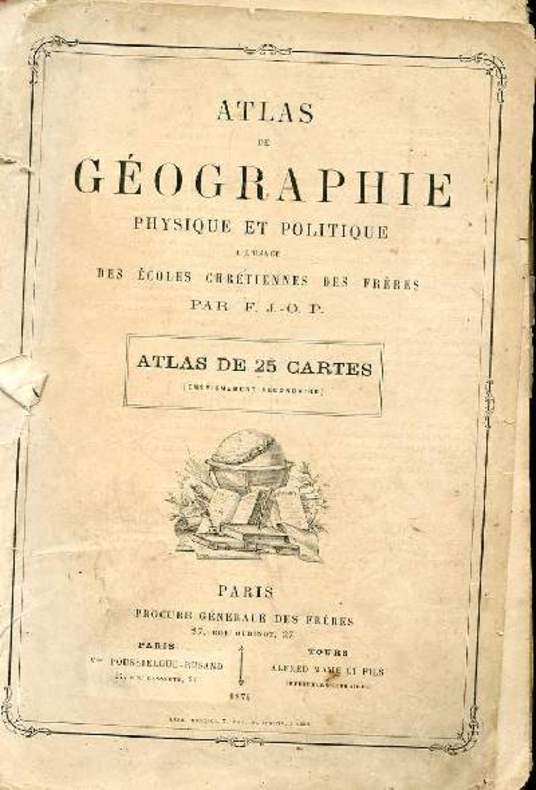
F.J.-O.P.
ATLAS DE GEOGRAPHIE. PHYSIQUE ET POLITIQUE A L'USAGE DES ECOLES CHRETIENNES DES FRERES. 20 CARTES SUR 25
PROCURE GENERALE DES FRERES. 1874. In-4. Broché. A relier, Couv. défraîchie, Dos abîmé, Intérieur acceptable. Atlas incomplet de 20 cartes sur 25. 20 doubles planches de cartes en couleur. Ouvrage débroché. Quelques déchirures et manques sur les plats de couverture. Quelques traces de crayons de couleur en marge. . . . Classification Dewey : 912-Atlas, cartes et plans
Bookseller reference : R160112425
|
|
|
F.Maurette
Petit atlas de la guerre et de la paix - Les Pays où nous nous battons et pour lesquels nous nous battons.
Hachette et cie. 1918. In-8. Broché. Etat d'usage, Couv. convenable, Agraffes rouillées, Papier jauni. 20 pages agrafées - quelques cartes en couleurs dans et hors texte.. . . . Classification Dewey : 912-Atlas, cartes et plans
Bookseller reference : R320136754

|
|
|
F.P.B.
ATLAS DE GEOGRAPHIE ELEMENTAIRE A L'USAGE DES ECOLES CHRETIENNES DES FRERES - ATLAS B - 14 CARTES.
POUSSIELGUE ROUSANT - ALFRED MAME ET CIE. NON DATE. In-4. Cartonné. Etat d'usage, Tâchée, Dos satisfaisant, Intérieur acceptable. 14 cartes en couleurs hors texte - coins et tranches frottés - manque déchirure sur la page de titre - manque sur la page d'introduction ayant des conséquences sur la lecture - annotations sur le 1er contre plat - 2 photos disponibles.. . . . Classification Dewey : 912-Atlas, cartes et plans
Bookseller reference : R240092751
|
|
|
F.Pinardel
Le Monde moins l'Europe et l'Asie Russe.
Les éditions de l'école. 1957. In-4. Broché. Etat d'usage, Couv. légèrement passée, Agraffes rouillées, Intérieur acceptable. 32 pages de cartes en couleurs - tampon sur le 1er plat.. . . A l'italienne. Classification Dewey : 912-Atlas, cartes et plans
Bookseller reference : R320125899

|
|
|
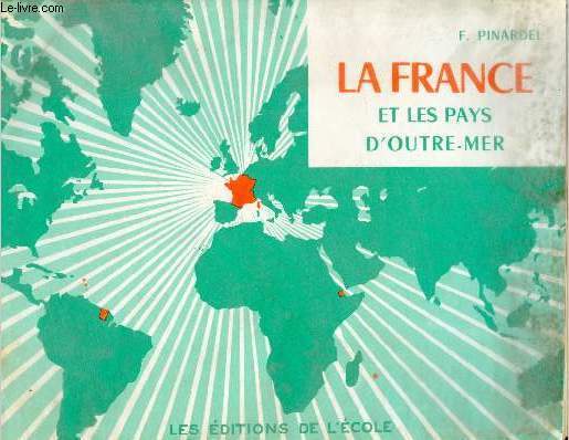
F.Pinardel
Petit atlas de la France et des pays d'Outre-Mer - 9e édition.
Les éditions de l'école. non daté. In-4. Broché. Etat d'usage, Couv. légèrement passée, Dos satisfaisant, Intérieur acceptable. 32 pages de cartes en couleurs.. . . A l'italienne. Classification Dewey : 912-Atlas, cartes et plans
Bookseller reference : R320123801
|
|
|
F.Pinardel
Petit atlas de la France et l'Union française.
Les éditions de l'école. non daté. In-4. Broché. Etat d'usage, Tâchée, Agrafes rouillées, Quelques rousseurs. 32 pages agrafées de cartes en couleurs - tâches d'encre bleu sur les pages 3-4-5-6 - papier jauni.. . . A l'italienne. Classification Dewey : 912-Atlas, cartes et plans
Bookseller reference : R160226425

|
|
|
F.Schrader & L.Gallouedec
Atlas classique de la France.
Hachette. non daté. In-4. Cartonné. Etat d'usage, Couv. légèrement passée, Dos satisfaisant, Intérieur frais. 24 pages de cartes en couleurs - 2 photos disponibles.. . . . Classification Dewey : 912-Atlas, cartes et plans
Bookseller reference : R320116941
|
|
|
F.Schrader & L.Gallouedec
Atlas classique de Géographien ancienne et moderne - Conforme aux programmes officiels de l'enseignement du second degré.
Hachette. 1956. In-4. Cartonné. Etat d'usage, Plats abîmés, Dos satisfaisant, Intérieur acceptable. 96 pages cartes en couleurs + 18 pages (index alphabétique) - coins, tranches et plats frottés.. . . . Classification Dewey : 912-Atlas, cartes et plans
Bookseller reference : R320123813
|
|
|
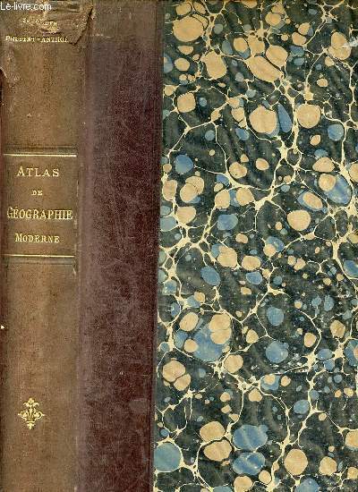
F.Schrader & F.Prudent & E.Anthoine
Atlas de géographie moderne - Nouvelle édition corrigée et mise à jour.
Hachette et Cie. 1911. In-Folio. Relié cuir dos-coins. Etat d'usage, Coins frottés, Coiffe en tête abîmée, Intérieur acceptable. Contenant 64 cartes doubles imprimées en couleurs accompagnées au verso d'un texte géographique, statistique et ethnographique avec 600 cartes de détail et d'un index alphabétique d'environ 50000 noms + 42 pages - coins et tranches frottés - coiffes abîmées - auteur, titre, fleuron, éditeur et filets dorés sur le dos - déchirure sur le second plat.. . . . Classification Dewey : 912-Atlas, cartes et plans
Bookseller reference : R320157949
|
|
|
F.SCHRADER
PETIT ATLAS DE LA GUERRE
HACHETTE ET CIE. NON DATE. In-12. Cartonné. Etat d'usage, Couv. légèrement passée, Dos satisfaisant, Intérieur acceptable. 56 pages - nombreuses cartes en 7 couleurs des divers fronts de france belgique allemagne russie balkans caucase arabie perse euphrate cameroun etc - coins frottés.. . . . Classification Dewey : 912-Atlas, cartes et plans
Bookseller reference : R240067133
|
|
|
F.T.D.
Atlas-Géographie ou nouveau manuel de géographie générale. Cours spécial à l'usage des aspirants aux baccalauréats…
Couverture rigide. Cartonnage de l'éditeur. 205 pages. Légèrement défraîchi. La toile du dos manque.
Bookseller reference : 103395

|
|
|
Facon Patrick Grimaud Renée Pernot François
Les plus belles victoires de Napoléon
Atlas 2003 127 pages 23x30x2cm. 2003. Reliure editeur cartonnée. 127 pages. Cet ouvrage de Patrick Facon publié aux Éditions Atlas en 2003 détaille les plus grandes victoires de Napoléon Bonaparte. Il décrit avec précision les plans les étapes et la stratégie de chaque bataille en mettant l'accent sur l'audace et la prudence de l'Empereur. Le livre est richement illustré et s'inscrit dans la collection 'La glorieuse épopée de Napoléon'
Bookseller reference : 12953

|
|
|
Fackel-Weltatlas
Taschenausgabe. Mit 35 Karten, vielen Statistiken und einem umfangreichen Namenregister für sämtliche Karten.
Olten/Stuttgart/Salzburg, Fackel, 1964. Kl.8°. 156 Seiten. Originalhalblederband mit goldgeprägter Deckelvignette und goldgeprägtem Rückentitel. - Wohlerhalten und frisch.
Bookseller reference : 19980AB
|
|
|
Fahrrad Atlas
Die schönsten Radwanderungen in Deutschland. Touren - Technik - Fitness. Überaus reich illustriert mit Kartenausschnitten, Übersichtskarten, Photos und Zeichnungen.
Ostfildern, Mairs Geographischer Verlag, 1989-1991. 8°. 350 Seiten. Mit einem "Fahrrad-am-Bahnhof-Service". Farbig illustrierter Originalpappband mit 2 Lesebändchen. - Sehr gut erhaltenes, frisches Exemplar. = Offizieller Fahrrad Atlas Bund Deutscher Radfahrer e.V.
Bookseller reference : 27716AB
|
|
|
FAIK SABRI [DURAN], (Turkish geographer, educator, cartographer, journey writer), (1882-1943).
[RARE TURKISH SCHOOL MAP OF AFRICA] Afrika: Müderris Fayik Sabri Beyin talebe haritalari. No: 3. 25 kurus. Kanaat Kütüphanesi. [i.e. Africa: From the corpus of schol maps by Mr. Faik Sabri].
Very Good Turkish, Ottoman (1500-1928) Original pictorial wrappers. Chromo-lithographed photo-montage collage cover with seven b/w photos of African buildings and natives, and a red map of Africa. Complete in wrappers and folded huge Africa map (size: 57 x 82 cm). Cover size: 28.5 x 20.5 cm. In Turkish. Scale: 1/20,000,000. A very rare chromo-lithographed Africa map, prepared for the geography lessons about foreign countries in Turkey in 1930. The map shows the territories of the African continent, which was still politically under European colonialism as of the 1930s. It includes Rio de Oro (Spanish territory), Fas [i.e. Morocco], Algeria, Sahara, Cameroon (French territories), Trabulus [i.e. Libya] as Italian territory; and Liberia, Egypt, East Sudan, Eritre [i.e. Eritrea], Habesistan [i.e. Ethiopia], Somali, Kenya, Belgian Kongo, Angola, Mozambique and South African land including Rhodesia (equivalent in the territory to modern Zimbabwe), Transvaal, The Orange Free State [Oranje-Vrystaat], Natal and Kap [Cape] with Madagascar. An extra panel for the same scale map showing the Suez Canal, Nile Delta, and North Egypt in the lower-left corner. Duran studied in Istanbul and Paris. He worked as a geography teacher in various high schools and afterward he undertook the positions of lecturer and administrator in Ankara Gazi Education Institute for a time. He was known for his writings on various topics and particularly for his works on geography. Born in the imperial period, Duran conducted the first cartographic studies of the Republic of Turkey after the transition to the Republican administration. Sealed. Slight foxing. Otherwise a fine copy. Not in OCLC.
|
|
|
FAIK SABRI [DURAN], (Turkish geographer, journey writer), (1882-1943).
[SCARCE TURKISH ATLAS PRINTED IN LONDON] Ilk atlas. Ilk mekteblere mahsus. [i.e. First atlas for the primary schools].
Very Good Turkish, Ottoman (1500-1928) Original bdg. Large roy. 8vo. (24 x 20 cm). In Ottoman script. (Old Turkish with Arabic letters). 16 p., 15 chromo-lithographed maps. Some markings on the two maps. Otherwise a very good copy. First edition of this scarce atlas for Turkish primary schools drawn and published by Turkish geographical educators and cartographers in the early Republican period of Turkey. This fine atlas was printed in London, in a period after the proclamation of the Republic, before the Letter Revolution in 1928. Duran studied in Istanbul and Paris. He worked as a geography teacher in various high schools then he became a lecturer and a manager at Ankara Gazi Education Institute for a while. He was known for his writings on various topics and especially for his works on geography. Born in the imperial period, Duran signed the first cartographic studies of the Republic of Turkey with the transition to the Republican administration. Özege 8764.
|
|
|
FALK André
DANEMARK.
reliure éditeur - 17,5x27 - 1912pp - 1966 - éditions RENCONTRE, Lausanne.Collection " ATLAS DES VOYAGES, RENCONTRE" dirigée par Charles-Henri FAVROD.Nombreuses illustrations dans et hors texte.
Bookseller reference : 4975
|
|
|
FALLEX MAURICE
NOUVEL ATLAS CLASSIQUE - 2ème EDITION MISE A JOUR.
DELAGRAVE. 1922. In-8. Relié. Bon état, Couv. convenable, Dos satisfaisant, Intérieur frais. 79 pages de cartes en couleurs - 1 carte en couleurs en frontispice.. . . . Classification Dewey : 912-Atlas, cartes et plans
Bookseller reference : RO20182187
|
|
|
FALLEX M. / GIBERT A.
NOUVEL ATLAS CLASSIQUE / NOUVELLE EDITION
DELAGRAVE. 1949. In-12. Broché. Etat d'usage, Couv. convenable, Dos abîmé, Intérieur frais. 79 pages de cartes en couleurs -. . . . Classification Dewey : 912-Atlas, cartes et plans
Bookseller reference : R320074694
|
|
|
FALLEX M. / GIBET A.
NOUVEAU ATLAS CLASSIQUE / NOUVELLE EDITION ENTIEREMENT REFONDUE.
DELAGRAVE. 1949. In-4. Relié. Etat d'usage, Coins frottés, Dos abîmé, Intérieur frais. 79 pages de cartes couleurs + 20 pages - Coins émoussés.. . . . Classification Dewey : 912-Atlas, cartes et plans
Bookseller reference : R320085348
|
|
|
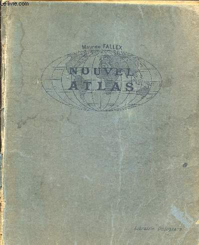
Fallex M.
Nouvel atlas classique
Librairie delagrave. Non daté. In-4. Cartonné. Etat d'usage, Tâchée, Dos abîmé, Papier jauni. Non paginé, environ 60 pages de cartes en couleurs et en noir et blanc . Annotations sur la page de faux-titre au craton à papier et ex-libris au crayon à papier en page de garde. Frontispice en couleurs.Dos manquant. Agraffes rouillées.Quelques rousseurs.. . . . Classification Dewey : 912-Atlas, cartes et plans
Bookseller reference : RO80216597
|
|
|
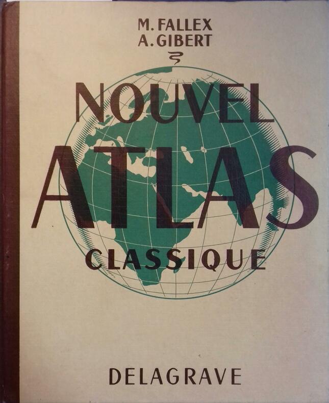
FALLEX M. - GIBERT A.
Nouvel atlas classique.
Couverture rigide. Reliure de l'éditeur. 79 pages de cartes + 16 pages d'index. 22 x 27, 5 cm.
Bookseller reference : 98651
|
|
|
FALLEX M.
NOUVEL ATLAS CLASSIQUE
Librairie Delagrave. 1922. In-4 Carré. Relié. Etat d'usage. Couv. légèrement pliée. Mors fendus. Intérieur acceptable. 79 pages. Cartes en couleur en frontispice. Illustré de nombreuses cartes en couleur et en noir et blanc, dans et hors texte. Dos muet. 1er plat légèrement taché. 1re page de garde pliée. 2e édition mise à jour.

|
|
|
FALLEX M. / GIBET A.
NOUVEAU ATLAS CLASSIQUE / NOUVELLE EDITION ENTIEREMENT REFONDUE.
DELAGRAVE. 1949. In-4 Carré. Relié. Etat d'usage. Coins frottés. Dos abîmé. Intérieur frais. 79 pages de cartes couleurs + 20 pages - Coins émoussés. 111 CARTES ET CARTONS.
|
|
|
FALLEX M. / GIBET A.
NOUVEL ATLAS CLASSIQUE
DELAGRAVE. 1955. In-4 Carré. Cartonné. Bon état. Couv. convenable. Dos frotté. Intérieur frais. 81 pages de cartes en couleur et noir et blanc horsd texte + 21 pages - 125 cartes et cartons.
|
|
|
FALLEX M., GIBERT A.
NOUVEL ATLAS CLASSIQUE
Librairie Delagrave. 1935. In-4 Carré. Relié. Etat d'usage. Couv. défraîchie. Dos abîmé. Intérieur acceptable. 79 pages. Cartes en couleur en frontispice. Illustré de nombreuses cartes en couleur et en noir et blanc, dans et hors texte. Dos muet. Légères mouillures sur les coins supérieurs. 8e édition mise à jour. 104 cartes et cartons.

|
|
|
FALLEX M., GIBERT A.
NOUVEL ATLAS CLASSIQUE
Librairie Delagrave. 1949. In-4 Carré. Relié. Etat d'usage. Couv. légèrement passée. Dos frotté. Intérieur acceptable. 79 pages. Cartes en couleur en frontispice. Illustré de nombreuses cartes en couleur et en noir et blanc, dans et hors texte. Dos muet. Nouvelle édition refondue. 111 cartes et cartons.

|
|
|
Fallex, Gibert (A.), Ozouf (R.)
Géographie (troisième année). La France et ses colonies.
français Petit in-4 de 95 pp.; dos toilé, plats cartonnés imprimés (album de l'éditeur). Texte et illustrations sur deux colonnes.
|
|
|
FARRINGTON KAREN
ATLAS HISTORIQUE DES GRANDES EXPEDITIONS DE LA DECOUVERTE DES AMERIQUES PAR LES VIKINGS AUX DERNIERES EXPLORATIONS SCIENTIFIQUES EN ANTARTICQUE - LES PREMIERES EXPEDITIONS / LES VOYAGES AVANT 1600 / L ASIE APRES 1600 / L AFRIQUE DEPUIS 1600 / ETC.
EDITION DE LA SEINE. 2006. In-4. Relié. Bon état, Couv. convenable, Dos satisfaisant, Intérieur frais. 189 pages augmentées de nombreuses planches en couleur et noir et blanc dans et hors texte - Jaquette en bon etat - Protection plastique.. . . . Classification Dewey : 912-Atlas, cartes et plans
Bookseller reference : R260186576
|
|
|
Farley, A.L.
Atlas of British Columbia: People, Environment and Resource Use
136 pages. "An indispensable reference tool for government officials, businessmen, investors, industrialists, teachers, students, librarians, environmentalists, and all people with a fundamental interest in the past, present, and future development of British Columbia." - from dust jacket. Book clean and unmarked with moderate wear. Moderate wear to dust jacket which is preserved in mylar and is neatly taped to boards.. Sound copy of this handsome work. Book

|
|
|
Fassbender, Karl. Kebschull, Dietrich. (Editor). Voss, Frithjof. (Bearbeiter)
Kalimantan Timur. East Kalimantan Indonesia. Atlas.
Hamburg., HWWA - Institut für Wirtschaftsforschung Hamburg., 1982. (Herausgeber) East Kalimantan Transmigration Area Developement Project (TAD). TAD, a Project for Technical Cooperation between the Republic of Indonesia and the Federal Republic of Germany. Eine Seite Einführung (in Englisch), enthält 52 farbige Karten, Tabellen, Skizzen auf 41 Seiten. Zustand: ausgeschiedenes Bibliotheksexemplar, Vorsatz, titelblatt und Einleitung mit Bibliotheksstempel, teilweise mit Inventarnummer. Vorderer oberer Einbanddeckel mit minimalen Kratzspuren (unscheinbar). Quer-2°. S Kunststoff / Kunstledereinband
Bookseller reference : 041984
|
|
|
FAUQUEMBERG DAVID - SUBTIL JULIE
GEOGUIE SELECTION. BARCELONE ET LA CATALOGNE. EDITION SPECIALE 2006. BARCELONE ET LA CATALOGNE EN AMOUREUX. BARCELONE ET LA CATALOGNE AVEC DES ENFANTS. BARCELONE ET LA CATALOGNE POUR UN LONG WEEK END. BARCELONE ET LA CATALOGNE HORS DES SENTIERS BATTUS.
GUIDES GALLIMARD. 2006. In-12. Broché. Bon état, Couv. convenable, Dos satisfaisant, Intérieur frais. 120 pages augmentées de nombreuses cartes et photos en couleur dans et hors texte.. . . . Classification Dewey : 912-Atlas, cartes et plans
Bookseller reference : RO80171331
|
|
|
Fehn, Hans. (Hrsg.)
Luftbildatlas Bayern. Eine Landeskunde in 72 farbigen Luftaufnahmen auf Kunstdrucktafeln sowie einer Übersichtskarte. Luftbilder von Lothar Beckel.
München/Neumünster, List/Wachholtz., 1973. 4°. [26 : 33,5 cm]. 177 Seiten. Mit einem Register. Originalleinenband mit goldgeprägter Deckelvignette (Bayernwappen), goldgeprägtem Rückentitel und farbig illustriertem Schutzumschlag. - Ein sehr gut erhaltenes, makelloses Exemplar; druckfrisch. 1. Auflage.
Bookseller reference : 57202AB

|
|
|
Fenouil
Carte routière & vicinale du département de l'Hérault dressée sous l'administration de J. M. Pietri Préfet, sous la direction de M. Fenouil, Agent voyer en chef.
français Arrondissement de Béziers ( 9 cartes, 1864). - Arrondissement de Lodève (6 cartes, 1862). - Arrondissement de Saint-Pons (6 cartes, 1862). - Arrondissement de Montpellier (8 cartes, 1862). Chaque carte entoilée divisée en 9 panneaux mesure 46 x 58,5 cm. Chaque arrondissement sous étui cartonné réuni sous coffret de l'époque. Il manque la 6e carte de l'arrondissement de Béziers (Pézenas et alentours). Rare.
|
|
|
FERRAS (Robert).
Atlas d'Espagne. (Trilingue français, espagnol, anglais).
Fayard/Reclus, 1986, in-4°, 96 pp, très nombreuses cartes en noir et en couleurs, cart. éditeur
Bookseller reference : 16290
|
|
|
Fernarnd Nathan
Brochure publicitaire - Atlas des formes du relief - 192 pages - 200 cartes
Nathan. Non daté. In-4. Broché. Bon état, Couv. convenable, Dos satisfaisant, Intérieur frais. Brochure publicitaire de 6 pages illustrées en couleurs.. . . . Classification Dewey : 912-Atlas, cartes et plans
Bookseller reference : RO80215199

|
|
|
FERNAND DAGUIN
CARTE GEOLOGIQUE PROVISOIRE DE LA REGION PRERIFAINE.
INSTITUT CARTOGRAPHIQUE DE PARIS. 1927. In-8. Broché. Etat d'usage, Couv. partiel. décollorée, Dos abîmé, Intérieur frais. Carte dépliante illustrée en couleurs de 110 x 70 cm. Premier plat détaché.. . . . Classification Dewey : 912-Atlas, cartes et plans
Bookseller reference : R260154521
|
|
|
FERRAND M. H.
LES ATLAS FRANCAIS - EXTRAIT DES COMPTES RENDUS DE L'ASSOCIATION FRANCAISE POUR L'AVANCEMENT DES SCIENCES - CONGRES DE GRENOBLE 1904.
SECRETARIAT DE L'ASSOCIATION. 1904?. In-8. Broché. Etat d'usage, Tâchée, Dos satisfaisant, Intérieur frais. 10 pages - 1 tache brune en tête.. . . . Classification Dewey : 912-Atlas, cartes et plans
Bookseller reference : RO20178202
|
|
|
FERRAND Henri.
Les atlas français.
L'atlas de Tavernier publié en 1643, Hötel des sociétés savantes, Paris 1904. Plaquette grand in-8 (24x15). 10 pages. Cartonnage papier moiré de l'époque, pièce de titre rouge, couvertures conservées.
Bookseller reference : 10879
|
|
|
Fernald, James C.; Vizetelly, Frank H
The Handy Standard Dictionary and Atlas Designed To Give The Orthography, Pronunciation, And Meaning of About 38,000 Terms In The English Language, Together With Faulty Diction, Foreign Words and Phrases And A Gazetteer Of The World With Pronunciations, Descriptions, And Populations Of The Names Recorded and Much Indispensable Information On Coinage, Weights And Measures, Poisons And Antidotes, Rulers Of The World etc. 780 pictorial illustrations.
New York a. o., Funk & Wagnalls Company, 1933. original soft cover, small 8vo, 588 pages with numerous pictorial illustrations, atlas is missing!, cover a little bit worn, apart from that good copy
Bookseller reference : ED8-785

|
|
|
FESTSCHRIFT ISENBIKE TOGAN, (1940-).
Horizons of the world: Festschrift for Isenbike Togan.= Hûdudü'l-âlem: Isenbike Togan'a armgan. Edited by Ilker Evrim Binbas, Nurten Kiliç-Schubel.
New English Paperback. Roy. 8vo. (24 x 17 cm). In English and Turkish. 630 p., ills. Horizons of the world: Festschrift for Isenbike Togan.= Hûdudü'l-âlem: Isenbike Togan'a armgan. Edited by Ilker Evrim Binbas, Nurten Kiliç-Schubel. The articles gathered in this volume are dedicated to Professor Isenbike Togan by her students, colleagues, and friends to honor and celebrate her long and continuing career as one of the world's foremost scholars in the field of Central Asian history. The range of articles that the contributors to this festschrift submitted reflects in many ways the depth and breadth of Isenbike Togan's works and her understanding of history. Indeed, from a geographical perspective, her published works cover the vast area from China to Anatolia, and from a chronological perspective they extend from the 7th to the 21st century. While the central historical question with which Isenbike Togan engages most frequently is the nature of political culture, her books and articles address a wide range of issues and questions, including women's history, the dhikr ceremonies of the Naqshbandi order in Eastern Turkestan, legitimacy and state formation in Central Asia, tribal politics from the perspective of anthropological history, and Chinese historiography. Through her command of a wide range of languages, historical issues, and textual sources, she not only makes 'surprising' connections among these seemingly diverse historical topics, but offers systematic and new approaches in the study of the Turco-Mongol peoples. Her intellectual adventure has been shaped by her unique ability to engage with the objects of her inquiry in a truly holistic and integrative manner; her works, while thoroughly rooted in painstaking and careful textual and linguistics analysis, consistently address and illuminate the 'big picture' in history.
|
|
|
Fezer, Fritz und Uwe Muuss
Luftbildatlas Baden-Württemberg. Eine Landeskunde in 72 farbigen Luftaufnahmen auf Kunstdrucktafeln sowie einer Übersichtskarte.
München/Neumünster, List/Wachholtz., 1971. 4°. [26 : 33,5 cm]. 177 Seiten. Mit einem Register. Originalleinenband mit goldgeprägter Deckelvignette (Landeswappen), goldgprägtem Rückentitel und farbig illustriertem Schutzumschlag. - Ein sehr gut erhaltenes, makelloses Exemplar; druckfrisch. 1. Auflage.
Bookseller reference : 57203AB

|
|

 Receive by email
 Download as PDF document
 RSS feed
 Permanent link


