|
|
|
SCHEDEL Hartmann (Norimberga 1440 - ivi 1514)
Roma
Veduta panoramica della città tratta dal celebre Liber Cronicarum del 1493."E' la più nota immagine di Roma data alle stampe alla fine del '400. Essendo stata inserita nella fortunatissima opera di Hartman Schedel comunemente nota con il nome di Cronaca di Norimberga può dirsi senz'altro comune. Si tratta di una derivazione dal prototipo comune a tutte le piante medioevali di Roma e noto come panorama di Mantova, a sua volta ripreso da un presunto ma tuttora sconosciuto panorama inciso nella bottega di Francesco Rosselli verso il 1485. La città è vista da nord-est a volo dìuccello per porre in evidenza la zona Vaticana oggetto di vari lavori tra cui le spine di Borgo, il Belvedere (1485/87), il Santo Spirito ed il palazzo del Papa. Sono inoltre riconoscibili le realizzazioni di Santa Maria del Popolo e ponte Sisto. Tra le antichità spiccano il Pantheon, il Colosseo, la colonna Antonina ed in primo piano i Dioscuri nella originaria collocazione presso le terme di Diocleziano. Manca curiosamente l'Isola Tiberina" (cfr. Marigliani p. 117).La monumentale opera di Schedel, il Liber Cronicarum, rappresenta uno “dei più straordinari lavori mai realizzati” dall’editoria del XV secolo. Gli incisori erano Michael Wolgemut, famoso maestro di Albrecht Dürer, e il figliastro Wilhelm Pleydenwurff. Wolgemut fu il tutore di Albrecht Dürer tra il 1486 e il 1490; recenti studi hanno dimostrato come Durer abbia collaborato alla realizzazione di quest’opera, poiché alcuni dei tratti hanno somiglianze stupefacenti con quelli dell’Apocalisse; alcune opere sono infatti attribuite al maestro di Norimberga. La stampa venne supervisionata dal grande stampatore Anton Koberger, le cui opere erano famose in tutta Europa. Xilografia, finemente colorata a mano, consuete tracce di restauro alla piega centrale, nel complesso in ottimo stato di conservazione.BibliografiaA. P. Frutaz, "Le piante di Roma", XCVI; C. Marigliani, "Le Piante di Roma delle collezioni private", n. 8; M. Gori Sassoli (a cura di), "Roma Veduta" p. 139, n. 5; Scaccia Scarafoni, "Le Piante di Roma", n. 125. It is the most famous image of Rome given to the prints at the end of '400. Having been inserted in the very fortunate work of Hartman Schedel commonly known with the name of Chronicle of Nuremberg can be said without doubt common. It is a derivation from the prototype common to all the medieval map of Rome and known as the Mantua panorama, in turn taken from a presumed but still unknown panorama engraved in the workshop of Francesco Rosselli around 1485. The city is seen from the northeast in a bird's eye view to highlight the Vatican area which has been the subject of various works including the Borgo thorns, the Belvedere (1485/87), the Santo Spirito and the Pope's palace. Also recognizable are the realizations of Santa Maria del Popolo and Ponte Sisto. Among the antiquities stand out the Pantheon, the Colosseum, the Antonine column and in the foreground the Dioscuri in the original location near the Baths of Diocletian. The Tiber Island is curiously missing. (see Marigliani p. 117).Schedel's monumental Liber Cronicarum was “one of the most extraordinary works ever produced” The woodblock cutters were Michael Wolgemut, the well-known teacher of Albrecht Dürer, and his stepson Wilhelm Pleydenwurff. Wohlgemut was Albrecht Dürer's tutor between 1486-90 and recent scholarship has shown, Albrecht Dürer may also have collaborated, since some of the cuts bear a remarkably close resemblance to the Apocalypse illustrations. The printing was carried out under the supervision of the great scholar-printer Anton Koberger, whose printing were famous throughout Europe. Woodcut, fine hand colouring, in good condition.BibliografiaA. P. Frutaz, "Le piante di Roma", XCVI; C. Marigliani, "Le Piante di Roma delle collezioni private", n. 8; M. Gori Sassoli (a cura di), "Roma Veduta" p. 139, n. 5; Scaccia Scarafoni, "Le Piante di Roma", n. 125.

|
|
|
SCHEDEL Hartmann (Norimberga 1440 - ivi 1514)
Roma
Veduta fantastica della città posta nella parte inferiore del foglio che contiene anche il testo descrittivo, tratto dal "Liber cronicarum cum figuris et umaginibus ab initio mudi usus mit temporis" rarissima edizione "tascabile" della celebre cronaca del mondo, edita ad Ausburg presso Johann Schonsperger, nel 1496. Prima edizione in tedesco dello Schonsperger. Egli abbrevia sia il testo sia il formato dello Schedel per produrre un edizione che fosse più maneggevole a commerciabile di quella di A. Koberger. "Nel 1469 venne realizzata un'edizione delle Cronaca di Norimberga in formato ridotto a cura di J. Schonsperger in cui le immagini sono copie ridotte di quelle originali ed anche i testi sono sintetizzati. Questa edizione (la seconda in tedesco) è comunque assai più rara della prima. L'editore Schonsperger è noto in quanto impiegò a Norimberga un nuovo carattere gotico chiamato Fraktur nel poema composto per la morte di Massimiliano I" (cfr. Marigliani p. 117).Silografia finemente colorata a mano, in ottimo stato di conservazione. Molto rara.BibliografiaC. Marigliani, "Le Piante di Roma delle collezioni private", n. 10. Fantastic view of the city placed in the lower part of the sheet that also contains the descriptive text, taken from the "Liber cronicarum cum figuris et umaginibus ab initio mudi usus mit temporis", the very rare "pocket edition" of the famous chronicle of the world, published in Ausburg by Johann Schonsperger, in 1496. First German edition of the Schonsperger. He shortened both the text and the format of the Schedel to produce an edition that was more manageable and marketable than that of A. Koberger. "In 1469 an edition of the Chronicle of Nuremberg was produced in reduced format by J. Schonsperger in which the images are reduced copies of the original ones and also the texts are synthesized. This edition (the second one in German) is however much rarer than the first one. The publisher Schonsperger is known because he used in Nuremberg a new gothic character called Fraktur in the poem composed for the death of Maximilian I" (see Marigliani p. 117).Woodcut, with fine later hand colour, excellent condition. Very rare.BibliografiaC. Marigliani, "Le Piante di Roma delle collezioni private", n. 10.

|
|
|
Schedel, Hartmann (1440-1514)
Parisius & Maguncia - Paris und Mainz.
Nürnberg, Anton Koberger, 1493. Kol. Holzschnitt. Blattgrösse: 45 x 62 cm. + Wichtig: Für unsere Kunden in der EU erfolgt der Versand alle 14 Tage verzollt ab Deutschland / Postbank-Konto in Deutschland vorhanden +
Referenz des Buchhändlers : 591DG

|
|
|
Schelbert, Leo (ed.)
Switzerland Under Siege 1939-1945: A Neutral Nation's Struggle for Survival
As new book in excellent condition in every respect. Binding is solid and square, covers have sharp corners, exterior shows no blemishes, text/interior is clean and free of marking of any kind. Many color detailed maps. 247 pages, institutional stamp on front end paper.
|
|
|
Schenk, Peter der Jüngere
Accurate Geographische Charte dar Graeflichen Stolbergl. als Hohnstein, Stolberg, Hayn, Berenroda, Ebersburg, Ufftrungen, Rosla, und Questen nebst unterschiedliche angräntzenden. [Altkolorierter Original-Kupferstich / original colored copper engraving].
o.J. Peter Schenk der Jüngere, geboren am 15. Februar 1693 in Amsterdam, gestorben am 14. Januar 1775 ebenda. Deutscher Kupferstecher und Kartenverleger, der als bedeutendster Verleger sächsischer Spezialkarten in der ersten Hälfte des 18. Jahrhunderts gilt. [4 Warenabbildungen]
Referenz des Buchhändlers : 12029DB

|
|
|
Schenk, Peter der Jüngere
Accurate Geographische Delineation des Hochf. Sachß. Amtes Weissenfels. Nebst allen darzu gehörigen Städten Flecken Dorffschafften wie auch etlichen angraentzenden Orten. Gestochen von Peter Schenk in Amsterdam mit Königl. und Churfurstl. Sachss. Privilegio. [Altkolorierter Original-Kupferstich / original colored copper engraving].
o.J. Peter Schenk der Jüngere, geboren am 15. Februar 1693 in Amsterdam, gestorben am 14. Januar 1775 ebenda. Deutscher Kupferstecher und Kartenverleger, der als bedeutendster Verleger sächsischer Spezialkarten in der ersten Hälfte des 18. Jahrhunderts gilt. [4 Warenabbildungen]
Referenz des Buchhändlers : 12033DB

|
|
|
Schenk, Peter der Jüngere
Geometrischer Genaral Ris des Stiffts Merseburg. Gestochen von P. Schenk in Amsterdam mit Königl. und Churfl. Sachss. Privilegio. [Altkolorierter Original-Kupferstich / original colored copper engraving].
o.J. Peter Schenk der Jüngere, geboren am 15. Februar 1693 in Amsterdam, gestorben am 14. Januar 1775 ebenda. Deutscher Kupferstecher und Kartenverleger, der als bedeutendster Verleger sächsischer Spezialkarten in der ersten Hälfte des 18. Jahrhunderts gilt. [4 Warenabbildungen]
Referenz des Buchhändlers : 12034DB

|
|
|
SCHERER Henrick (Dilingen 1628 - Monaco 1704)
Globus Terraqueus Ecclesiastico Politicus In Suas Partes et Dominia Divisus.
La stampa decorativa mostra la mano di Dio che tiene sospeso il mondo attraverso una croce fissata sul Polo Nord. I cieli circostanti sono popolati di cherubini, alcuni dei quali reggono corone e capricapi di papi, cardinali e vescovi. Rappresentazioni allegoriche dei continenti d'Europa, Asia, Africa e America. Nel continente americano, la California è rappresentata come un'isola. Decorativa carta geografica pubblicata nell'opera di Heinrich Scherer Atlas Novus exhibens orbem terraguem per naturae opera, historiae navae acveterus monumenta, artistique geographicae leges et praecepta edita in 8 parti, stampate tra il 1702 e il 1710 a Monaco di Baviera. Heinrich Scherer, professore di matematica a Monaco di Baviera, era un gesuita devoto la cui opera sottolineava la gerarchia cattolica e la diffusione delle missioni gesuite in tutto il mondo. Il suo Atlas Novus contiene mappe di tutte le altre parti che mostravano la diffusione del cattolicesimo e delle missioni gesuite. Incisione in rame, finemente colorata a mano, in ottimo stato di conservazione. The page features the hand of God suspending the world from a cross attached at the Pole. The surrounding heavens are filled with winsome cherubs, some of whom hold crowns and the hats of popes, cardinals and bishops, with allegorical representations of the continents of Europe, Asia, Africa and America. All of the continental figures hold a map, with the one representing the Americas featuring California as an island. Heinrich Scherer, professor of mathematics at Munich, was a devout Jesuit whose work emphasized the Catholic hierarchy and the spread of Jesuit missions throughout the world. The important, large river systems are exceptionally well illustrated. Many placenames are included in the interior as well as on the coasts. Heinrich Scherer was a devout Jesuit, and professor of mathematics at Munich. Map taken from the Atlas Novus exhibens orbem terraguem per naturae opera, historiae navae acveterus monumenta, artistique geographicae leges et praecepta, published in 8 parts, printed between 1702 and 1710 in Munich. His 'Atlas Novus' contained maps of all other parts which showed the spread of Catholicism and Jesuit missions. Copperplate with later hand colour, very good condition.

|
|
|
SCHERER Henrick (Dilingen 1628 - Monaco 1704)
Imago Totius Orbis Terraquei cum suo apparatu Ab Auctore Naturae in Suas Partes Distributi Geographice Exhibita. Anno MDCC
Decorativa carta geografica pubblicata nell'opera di Heinrich Scherer Atlas Novus exhibens orbem terraguem per naturae opera, historiae navae acveterus monumenta, artistique geographicae leges et praecepta edita in 8 parti, stampate tra il 1702 e il 1710 a Monaco di Baviera. Questa insolita proiezione polare rappresenta il mondo intero, eccetto il Polo Sud. La California è mostrata come un'isola ed è rappresentata la suggestione del "Passaggio a Nord-Ovest" attraverso la Baia di Hudson. Raffigurata anche una parte distorta dell'Australia, nota come Nova Hollandia. La mappa ha deliziose raffigurazioni di uccelli e teste di vento nei cieli, così come pesci e mostri che nuotano nei mari. Il bellissimo cartiglio è pieno di animali e due piccoli diagrammi astronomici fiancheggiano la mappa. Heinrich Scherer, professore di matematica a Monaco di Baviera, era un gesuita devoto la cui opera sottolineava la gerarchia cattolica e la diffusione delle missioni gesuite in tutto il mondo. Il suo Atlas Novus contiene mappe di tutte le altre parti che mostravano la diffusione del cattolicesimo e delle missioni gesuite. Incisione in rame, in ottimo stato di conservazione. This unusual polar projection depicts the entire world except the South Pole. California is shown as an island and there is a suggestion of a Northwest Passage via Hudson Bay. There is a distorted portion of Australia noted as Nova Hollandia. The map has delightful depictions of birds and wind heads in the heavens as well as fish and monsters swimming the seas. The beautiful cartouche is filled with animals and two small astronomical diagrams flank the map. Heinrich Scherer, professor of mathematics at Munich, was a devout Jesuit whose work emphasized the Catholic hierarchy and the spread of Jesuit missions throughout the world.The important, large river systems are exceptionally well illustrated. Many placenames are included in the interior as well as on the coasts. Heinrich Scherer was a devout Jesuit, and professor of mathematics at Munich. Map taken from the Atlas Novus exhibens orbem terraguem per naturae opera, historiae navae acveterus monumenta, artistique geographicae leges et praecepta, published in 8 parts, printed between 1702 and 1710 in Munich. His 'Atlas Novus' contained maps of all other parts which showed the spread of Catholicism and Jesuit missions. Shirley #627.

|
|
|
SCHERER Henrick (Dilingen 1628 - Monaco 1704)
Repraesentatio Geographica itineris maritimi Navis Victoriae in qua ex personis CCXXXVII finita navigatione ... se voto exs
Splendida carta storico-geografica del mondo costruita con proiezione conica polare che mostra l'intero Mondo ad eccezione del Polo Sud; la California è rappresentata come un'isola. E' anche raffigurata una piccola parte, distorta, dell'Australia, indicata come Nova Hollandia.Sulla mappa è riportato il tracciato della circumnavigazione di Magellano. Sulla sinistra è illustrata la nave Vittoria, la sola nave che rimase dell'equipaggio che saklpò da Siviglia nel 1519 alla ricerca di un passaggio a ovest verso le Isole delle Spezie e le Indie.La vignetta a destra, rappresenta i pochi sopravvissuti - 18, dei 237 membri - in pellegrinaggio alla chiesa di Santa Marea di Siviglia, come ex voto per la grazia ricevuta. Il cartiglio in alto a destra, riporta anche la data del ritorno: 7 settembre 1522. Decorativa carta geografica pubblicata nell'opera di Heinrich Scherer Atlas Novus exhibens orbem terraguem per naturae opera, historiae navae acveterus monumenta, artistique geographicae leges et praecepta edita in 8 parti, stampate tra il 1702 e il 1710 a Monaco di Baviera. Heinrich Scherer, professore di matematica a Monaco di Baviera, era un gesuita devoto la cui opera sottolineava la gerarchia cattolica e la diffusione delle missioni gesuite in tutto il mondo. Il suo Atlas Novus contiene mappe di tutte le altre parti che mostravano la diffusione del cattolicesimo e delle missioni gesuite. Incisione su rame, in ottimo stato di conservazione. Map of the world, shown on a north polar projection and showing the entire world except the South Pole, California is shown as an island and the track of Magellan's voyage around the world is noted. There is a distorted portion of Australia noted as Nova Hollandia. On the left is an illustration of Victoria, the only remaining ship from Magellan's Armada de Molucca that sailed from Seville in 1519 in search of a westward route to the Spice Islands. On the right, the few expedition survivors (18 out of the original 237) are shown making their way to the Santa Marea de la Victoria church in Seville, where they went to give thanks for their safe return. The title cartouche includes the date of their return, September 7, 1522.By Heinrich Scherer for his Atlas Novus exhibens orbem terraguem per naturae opera, historiae navae acveterus monumenta, artistique geographicae leges et praecepta...published in eight volumes from 1702-1710 in Munich. Scherer, a devout Jesuit, produced this geographical compendium to depict the Catholic hierarchy and the spread of Jesuit missions throughout the world.Copper engraving, in very good condition. Tooley, R.V. (Amer) p.132, #88, pl.60; Shirley, World, 626

|
|
|
Scheurer, Christoph:
Das Nürenbergische Gebiet. Mit allen Nürnbergischen Hauptmannschafften, so theils in unterschiedlichen Benachbarter Chur Fürsten, Fürsten und Ständen, theils aber in Nürnbergischen Ämptern gelegen. Kupferstichkarte von Christoph Scheurer.
Format 48 x 55 cm. Blattgröße: 49 x 57 cm. *Originalausgabe der Karte von Scheurer, sie wurde später auch von Lotter nachgedruckt. Rechts eine große Kupferstichkartusche sowie rechts und links mit 17 Wappen. - Geglättete Falzspuren, insgesamt sauber und gut erhalten. Landkarten de
|
|
|
Schlacher, J
General-Karte von MITTEL-EUROPA in 12 Blättern. Maße 1:1,200,000.
Wien, k.k. militär-geografischen Institute (1875). 1 Skelett-Karte, 12 lith.Teilkarten, kol., in Segmente zerschnitten und auf Leinen aufgezog., zus. in modernen Leinenschuber unter Verwendung des Orig. Leder-Einbandrückens, dieser beschabt, eine Karte auf Leinenbezug schwarzfleck., Karte XI doppelt vorha
Referenz des Buchhändlers : KART0094

|
|
|
Schlesien:
Nova mappa geographica totius ducatus Silesiae tam superioris quam inferioris exhibens XVII minores principatus. Kolorierte Kuperstichkarte von Schlesien. Mit Prospect der Hauptstadt Breslau.
49 x 57,5 cm. Blattgröße: 52 x 65 cm. *Mit Planansicht / Prospectus der Stadt Breslau sowie einer großen Titelkartusche. Schön koloriertes Exemplar, sauber und sehr gut erhalten, breitrandig. Landkarten de
|
|
|
Schmid, David Alois (1791-1861)
Thoun vers Niesen et le Stockhorn.
(Zürich, Keller & Füssli), um 1830. Altkolorierte Aquatinta von Rudolf Bodmer (1805-1841). Bildgrösse: 16 x 24,1 cm. Blattgrösse: 19,4 x 27 cm. + Wichtig: Für unsere Kunden in der EU erfolgt der Versand alle 14 Tage verzollt ab Deutschland / Postbank-Konto in Deutschland vorhanden +, Abb.
Referenz des Buchhändlers : 627DG

|
|
|
Schmid, Franz (1796-1851)
Aussicht von Zürich über den See nach den Gebirgen der kleinen Kantone. ? Vue depuis Zurich vers le lac et les montagnes de petits Cantons.
(Zürich, Keller, 1829). Aquatinta auf Papier. Bildgrösse: 10,5 x 38,7 cm. Blattgrösse: 13 x 40,5 cm. + Wichtig: Für unsere Kunden in der EU erfolgt der Versand alle 14 Tage verzollt ab Deutschland / Postbank-Konto in Deutschland vorhanden +, bild
Referenz des Buchhändlers : 597DG

|
|
|
Schmidt, Erich F.
TEPE HISSAR EXCAVATIONS 1931. The Museum Journal. Volume XXIII, Number 4, 1933.
pp. 323 - 487. Illustrated with numerous folding plates, maps and photographs. Quarto. Original printed wraps, chipped. Lacks spine. Front wrap detached. HOLY LAND BOX 1
|
|
|
Schmidt, L[udwig].
Topographische Karte der Gegenden von Wien. Astronomisch trigonometrisch aufgenommen von L. Schmidt. Wien, Johann Schönberg, [um 1850].
Gest. Karte in 16 Segmenten, auf Leinen aufgezogen und zeitgenössisch ankoloriert. 715:595 mm. Maßstab ca. 1:94 000. Nachstich der erstmals 1807 bei Cappi erschienenen Karte, die "ein Gebiet zwischen Altenmarkt a. d. Triesting (Westen) und Bruck a. d. Leitha (Osten) bzw. zwischen Schloß Schönborn (Norden) und Leobersdorf (Süden) dar[stellte]" (Dörflinger II, 502). "Die Brauchbarkeit der Karte wird dokumentiert durch Ausgaben noch Jahrzehnte später, auf denen dann auch bereits die ersten Eisenbahnlinien (Nordbahn, Südbahn) eingetragen sind" (ebd., 503). Die ÖNB hält einen anderen undatierten Nachstich, der den Titelzusatz "seiner Kays: Majestät Alexander I. [...] gewidmet" trägt und im Katalog "um 1813" angesetzt wird. - Leinen zwischen zwei Segmenten eingerissen, sonst sauber und wohlerhalten. Dörflinger II, 503, Fußn. 56. Vgl. Tooley II, 124.

|
|
|
Schofield, Daniel (editor)
The Kingdom of Saudi Arabia (fully revised edition)
Inscription on ffep. No other marks. A lovely clean crisp very tight copy with bright boards and gilt lettering and with no bumping to corners. Dust jacket not price clipped or torn or creased. The delightful slip-case with gilt English and Arabic writing and design on a dark green vellum-type background is in excellent condition. 256pp.

|
|
|
School Maps KK Educational Maps Study Group Edited by Kiyoshi Nobutoki Gakuhiko Miyanaga/Sashie Nishihara Hiroshi
Our Song 1 Compliant with the Ministry of Education's Revised Course of Study
School Maps KK Educational Maps Study Group Edited by Kiyoshi Nobutoki Gakuhiko Miyanaga/Sashie Nishihara Hiroshi 1953. Soft Cover. Fine. The book is in fine condition. School Maps KK Educational Maps Study Group Edited by Kiyoshi Nobutoki Gakuhiko Miyanaga/Sashie Nishihara Hiroshi paperback
Referenz des Buchhändlers : 2083002116202803
|
|
|
SCHRADER, Franz (1844-1924).
Atlas de Géographie Moderne.
Paris, Librairie Hachette et Cie., 1907. Gran folio; 64 mapas dobles impresos en color y 600 mapas y planos entre el texto, impreso al verso de los mapas dobles. Encuadernación de época, en media piel con puntas.

|
|
|
Schreiber, Georg
Chorographia Territorii Naumburgo-Citiensis. Episcopatus olim nomine celebris una cum magna Consiniorum parte exactissime designata a Ioh. Georg Schreibero. Edita curis et impensis Homannianorum Heredum. Norib: A MDCCXXXII. Cum Privilegio. [Altkolorierter Original-Kupferstich / original colored copper engraving].
o.J. Johann George Schreiber (auch Johann Georg Schreiber, geboren am 10. Dezember 1676 in Spremberg, Oberlausitz, gestorben am 31. Juli 1750 in Leipzig. Deutscher Kupferstecher, Kartograph und erster deutsche Kartenverleger im Kurfürstentum Sachsen. [4 Warenabbildungen]
Referenz des Buchhändlers : 12035DB

|
|
|
Schupp, Stefanie
Architekturstadtplan Hamburg. Mit Register nach Epochen, Gebäudetypen, Architekten, Strassen.
(Berlin), Verlagshaus Braun, (2004). 2 mehrfach gefalt. farb. Pläne, beidseitig bedruckt Gesamtplan im Maßstab 1:20000, verso Innenstadt im Maßstab 1:8000 sowie 103 S. Register (dt./engl.). Deckel 10,5 x 25 cm. Stärkerer OKart.
Referenz des Buchhändlers : 81261

|
|
|
Schweidnitz:
Schweidnitz. "Plan der Belagerung der Vestung Schweidnitz in Schlesien im Jahr 1762". Belagerungsplan von Schweidnitz. Kupferstich mit farbigen Truppenaufstellungen aus "Neues Kriegs-Theater ...", No. 49.
Format: 18 x 29,5 cm. *Leicht gebräunt, insgesamt gut erhalten. Landkarten de
|
|
|
Schütt, Ernst Christian (Hrsg.)
Hamburg in historischen Stadtplänen. Die Entwicklung der Stadt seit dem 16. Jahrhundert. Kommentiert von Joachim W. Frank.
(Berlin), Argon, (1995). 18 S. Textheft und 6 mehrf. gefalt. tls. farb. Plänen. 4to. 34,5 cm. Zusammen in OKart.-Mappe. in OPp.-Schuber.
Referenz des Buchhändlers : 39664

|
|
|
Sciuto Giovanni
ABC DE LA Cartomancie
Grancher Broché , format 14x20cm environ , bel ensemble , 221 pages .
Referenz des Buchhändlers : 6490

|
|
|
SCIUTO Giovanni
LE GUIDE DES REUSSITES 30 jeux inédits et leurs significations
1989 cartonné noir éditeur (hard-back percale editor) grand in-octavo, premier plat illustré en couleurs (front cover illustrated in colours), illustrations : bien documenté (well-documented), 277 pages, 1989 à Paris France Loisirs,
Referenz des Buchhändlers : 9358
|
|
|
Sciuto Giovanni
Votre Avenir par les Tarots - Méthode simplifiée en 10 Etapes
Jacques Grancher Broché au format 14x20cm env,couverture ill de cartes ,182 pages très bel ouvrage avec cependant en page 32 un passage surligné au fluo et le manque de la première page de garde.Epuisé
Referenz des Buchhändlers : 4076

|
|
|
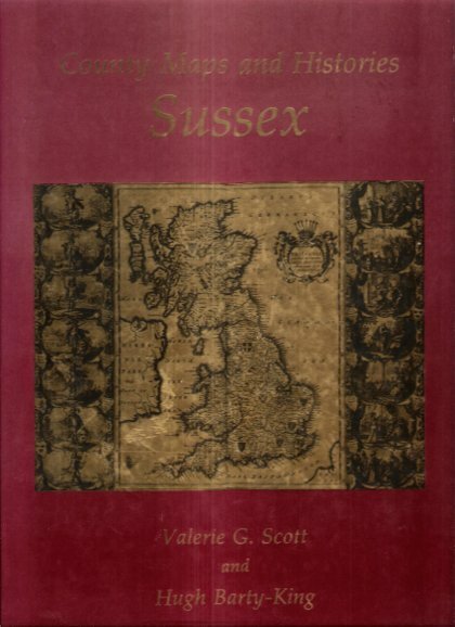
SCOTT Valerie G. , BARTY-KING Hugh
County Maps and Histories Series SUSSEX
Londres Quiller Press 1985 in-4° Nombreuses cartes couleurs et noir et blanc .- 34 p. , 550 gr.
Referenz des Buchhändlers : 023474
|
|
|
SCOTO Francesco (1548 - 1622)
Roma
Pianta a proiezione obliqua della città tratta da "Itinerario, overo nova descrittione de' viaggi principali d'Italia […] di Francesco Scoto" edito a Venezia da Pietro Brigonci nel 1665. "Piazza Navona è posta in bella evidenza con l'obelisco trovata nel Circo di Massenzio e fatto innalzare durante il pontificato di Innocenzo X al centro della fontana dei Fiumi del Bernini, inaugurata nel 1651, ma evidentemente già in corso di realizzazione nel 1650. Manca invece la chiesa di Sant'Agnese in Agone (1652/57) e il colonnato di San Pietro (1656/57)" [cfr. Marigliani p. 209]. Le tavole pubblicate da Brigonci sono riconoscibili dal formato quadrato delle stampe.La sua prima edizione dell'Itinerario d'Italia fu nel 1665 ed aveva il testo ripreso dalla pubblicazione del Cadorin del 1659 la quale ampliava il racconto al Friuli, alla Sicilia, a Malta, al Lazio e alla Terrasanta, quindi nello stesso anno in una ristampa inseriva anche delle tavole su questi territori.Nel 1670, 1673, 1676 e 1679 si collocano le altre edizioni del Brigonci, tutte veneziane, tutte col titolo immutato "Itinerario, overo nova descrittione de' viaggi principali d'Italia […] di Francesco Scoto", tutte arricchite da poco meno di quaranta stampe antiche con vedute di città.Incisione in rame, in buono stato di conservazione. Bibliografia Marigliani (2007) p. 209, n. 115. An oblique projection map of the city taken from "Itinerario, overo nova descrittione de' viaggi principali d'Italia [...] di Francesco Scoto" published in Venice by Pietro Brigonci in 1665. "Piazza Navona is prominently displayed with the obelisk found in the Circus of Maxentius and erected during the pontificate of Innocent X at the centre of Bernini's Fountain of the Rivers, inaugurated in 1651, but evidently already under construction in 1650. The church of Sant'Agnese in Agone (1652/57) and the colonnade of St. Peter's (1656/57) are instead missing'. [cf. Marigliani p. 209]. The plates published by Brigonci can be recognised by the square format of the prints. His first edition of the Itinerary of Italy was in 1665 and had the text taken from Cadorin's publication of 1659, which extended the story to Friuli, Sicily, Malta, Latium and the Holy Land, and in the same year a reprint also included plates on these territories. In 1670, 1673, 1676 and 1679 there were other editions by Brigonci, all Venetian, all with the unchanged title "Itinerario, overo nova descrittione de' viaggi principali d'Italia [...] di Francesco Scoto", all enriched with just under forty antique prints with views of cities. Copper engraving, in good condition. Literature Marigliani (2007) p. 209, n. 115.

|
|
|
Scott Stallard
Title: The Beauty of Bermuda (Signed By Author)
Signed 'Scott Stallard' to title page. No other marks or inscriptions. A lovely clean very tight copy with bright unmarked boards and no bumping to corners. Dust jacket not price clipped or marked or torn or creased with minor traces of storage. pp. Lavishly illustrated book with 117 mainly full-page coloured photographs of Bermuda and an introduction by Peter Benchley.

|
|
|
Scott, Cameron: Editor
Nanaimo Magazine, June 1993 - Gabriola Island Diving Photo on Cover
46 pages. Features: Nice photo of Harleys in front of the Queen's; Beachcombing - photo-illustrated article by Dave Drexhage; Hiking - photo-illustrated article by Jean Macleod le Cheminant - with maps of local hiking destinations; Sanctuary of the Sea - Gabriola Pass may harbour one of Canada's first Marine Reserves - photo-illustrated article by Iain Cuthbert; Nice photo ad for the ill-fated Pacliacchi's Restaurant in the old downtown firehall features photo outside the restaurant with dozens of supporters; Dozens of ads for local small businesses; and more. Moderate wear. Unmarked. A sound copy. Book

|
|
|
Scott, Munroe; McClure, Robert (Signed)
McClure : The China Years of Dr. Bob McClure *SIGNED BY SUBJECT*
409 pages. Dr. McClure's attractive signature upon half-title page. "This book started out to be a full biography of Dr. Bob McClure from his birth in 1900 up to the present time. It gradually transformed itself into something that may seem to fall halfway between an adventure story and a history of China through the first half of the twentieth century." - from Foreward. Prior owner's neatly written gift greetings upon half-title page which has a small piece cleanly clipped from top corner. Maps printed upon endpapers. Contents clean and unmarked. Light wear. Excellent copy. Book
|
|
|
Scott, Schomberg
Culzean : a History and Guidebook
No marks or inscriptions to contents. No creasing to covers. A very clean very tight copy with bright unmarked silightly rubbed boards, staples not rusted and no bumping to corners. 68pp. Culzean in the province of Carrick in South Ayrshire became the stronghold of the Kennedy clan whose roots go back to the 12th century. First edition, second printing. We do not use stock photos, the picture displayed is of the actual book for sale. Every one of our books is in stock in the UK ready for immediate delivery.

|
|
|
Scott-Elliot, W.
THE STORY OF ATLANTIS. A Geographical, Historical, and Ethnological Sketch. With a Preface by A. P. Sinnett.
pp. xiii, 87. Four colored folding maps of the World's Configuration. 8vo. Original full cloth binding. Joints detached. Old water spotting not affecting text. This edition was first issued in 1909. Scarce. **PRICE JUST REDUCED! OCC 6
|
|
|
SCULPTURE MONDIALE par André MALRAUX.
Le musée imaginaire de la sculpture mondiale volume 2 : des bas-reliefs aux grottes sacrées. Richement documenté (planches en couleurs, héliogravures, cartes).
Ed. Gallimard 1954 (coll. la Galerie de la Pléiade). Bel exemplaire relié, reliure pleine toile ornée et jaquette d'éd., gd et fort in-8, 512 pages + planches.
Referenz des Buchhändlers : AUB-6203
|
|
|
Scultetus, Bartholomäus
Misniae Et Lusatiae Tabula. Um 1600. Descripta à M. Bartholomaeo Sculteto Gorlit. Mark Meißen & Lausitz. [Altkolorierter Kupferstich, gerahmt].
o.J.
Referenz des Buchhändlers : 66483CB
|
|
|
SEACHART SCOTLAND - JOHN MARR, JOHN THORNTON.
A New Description of the East Coast of Scotland from Berwick to Bokannais: Wherein is fully shewed the Chief Forelands, Bays, Roads, Rivers, Havens, Creeks, Sands, Shoals, Depths of Water and Anchoridg, with the Course of the Tides, and what Moon make...
(London, ca. 1810). Folio. (45 x 28 cm.). Later hcloth. Gilt lettering on upper cover. 4 pp. in folio. + engraved map (44 x 52 cm.) Chart of the East Coast of Scotland Bu John Thornton. Left and right margins shaved (no loss of image). Light browning and a few brownspots.
Referenz des Buchhändlers : 55309
|
|
|
SEACHART SCOTLAND - JOHN MARR, JOHN THORNTON.
A New Description of the East Coast of Scotland from Berwick to Bokannais: Wherein is fully shewed the Chief Forelands, Bays, Roads, Rivers, Havens, Creeks, Sands, Shoals, Depths of Water and Anchoridg, with the Course of the Tides, and what Moon make...
(London, ca. 1810). Folio. (45 x 28 cm.). Later hcloth. Gilt lettering on upper cover. 4 pp. in folio. + engraved map (44 x 52 cm.) Chart of the East Coast of Scotland Bu John Thornton. Left and right margins shaved (no loss of image). Light browning and a few brownspots.
|
|
|
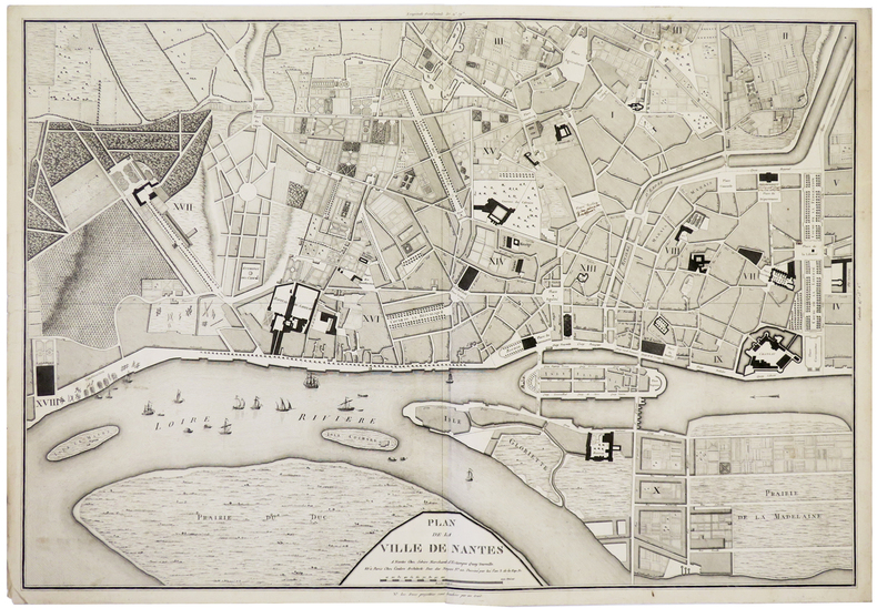
SEBIRE (J.) & COULON.
[NANTES] Plan de la ville de Nantes.
Nantes, Sebire, et Paris, Coulon, An 3. de la Rép. Fr. [1795]. 490 x 707 mm.
Referenz des Buchhändlers : LBW-5910
|
|
|
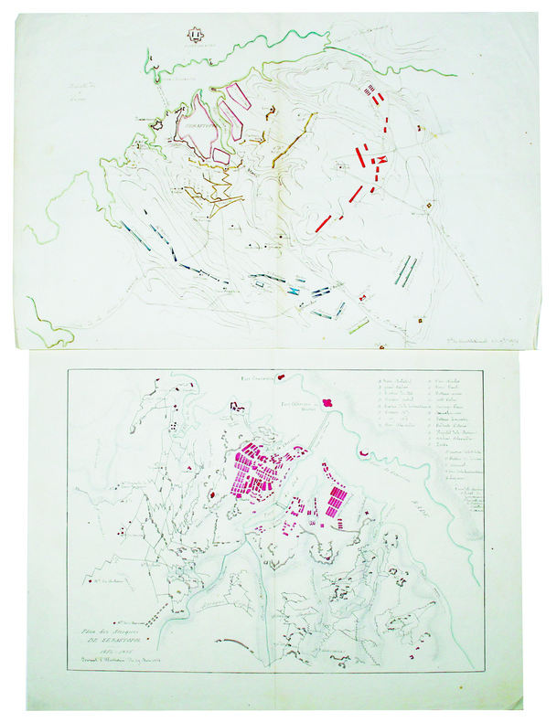
SEBASTOPOL. MANUSCRIT.
[Plan du siège de Sébastopol] [et] Plan des attaques de Sébastopol.
1854-1855. 272 x 422 mm et 288 x 386 mm, sur papier fin.
Referenz des Buchhändlers : LBW-4226
|
|
|
SEBASTIAN MÜNSTER, (Map-maker), (1488-1552).
[HAND-COLOURED MAP of ASIA MINOR by MÜNSTER] Von den Landern Asie.
Very Good German Original hand-colored map. 4to. 27x19 cm, with cartoon frame: 40x30 cm. A decorative small map of Asia Minor, from east to the Euphrates, South to the Mediterranean, North to the Black Sea and including Thracia (Thrace). It shows Thracia, Bithynia, Pontus, Paphlagonia, Galatia, Phrygia Minor, Mysia, Phrygia Maior, Lydia, Ionia, Ephesos, Meandros, Lycus [Valley], Caria, Lycia, Pamphylia, Cilicia, Lycaoni, Pisidia, Argos Mt., Taurus Mt., Sebastia, Cappadocia, Armenia, Syria, Nicopolis. Seas decorated with sea monsters. The land filled with mountains. "Münster's Cosmography was one of the most influential geographical works of the 16th Century. It was published in a number of editions over a half century and was continuously revised and updated to include new illustrations and updated information. Sebastian Münster (1488-1552) was a cosmographer and professor of Hebrew who taught at Tübingen, Heidelberg, and Basel. He settled in the latter in 1529 and died there, of plague, in 1552. As a young man, Münster joined the Franciscan order and studied philosophy in Heidelberg. He also studied geography and mathematics in Loewen, as well as Hebrew at Freiburg. In 1512, he was ordained as a priest and taught philosophy and theology at Tübingen from 1514 to 1518. While in Tübingen, he also conducted further studies in geography. He moved to Basel in 1518 and published a Hebrew grammar, one of the first books in Hebrew published in Germany. In 1521 Münster moved again, back to Heidelberg, where he continued to publish Hebrew texts and the first German-produced books in Aramaic. After converting to Protestantism in 1529, he took over the chair of Hebrew at Basel, where he published his main Hebrew work, a two-volume Old Testament with a Latin translation. Münster made himself the center of a large network of scholars from whom he obtained geographic descriptions, maps, and directions. He published his first known map, a map of Germany, in 1525. Three years later, he released a treatise on sundials. In 1540, he published Geographia universalis vetus et nova, an updated edition of Ptolemy's Geographia. In addition to the Ptolemaic maps, Münster added 21 modern maps. One of Münster's innovations was to include one map for each continent, a concept that would influence Ortelius and other early atlas makers. The Geographia was reprinted in 1542, 1545, and 1552. Münster is best known today for his Cosmographia universalis, the first German-language description of the world. It was first published in 1554 and contained 471 woodcuts and 26 maps over 6 volumes. Many of the maps were taken from the Geographia and modified over time. It was released in at least 46 editions in 6 languages by 1650, with 21 German editions alone. The Cosmographia was widely used in the sixteenth and seventeenth centuries and the text, woodcuts, and maps all influenced geographical thought for generations.".
|
|
|
SEDAN
Carte au 1/200 000e. Sans date.
Une feuille 32x50 cm.
|
|
|
SEGUIN Jean-Pierre - JANDIN Cécile de - GOURDON Marie-Thérèse
Cartes à jouer - Donation faite à la Bibliothèque Nationale par Monsieur Paul Marteau, maître-cartier, juin 1966
Bibliothèque Nationale, 1966, broch. gr. in-8 (19 x 26,5), 44 p., avant-propos de Etienne Dennery, avertissement de Jean Adhémar, gravures in-t., avec son carton d'invitation, tampon sur la couverture, bon état.
Referenz des Buchhändlers : QWA-19411

|
|
|
SEGUIN Jean-Pierre
Le jeu de carte.
Paris: Hermann, 1968 pet. in-4, 346 pages, riche illustration, bibliographie. Reliure toile, jaquette avec pet. marques.
Referenz des Buchhändlers : 13966940
|
|
|
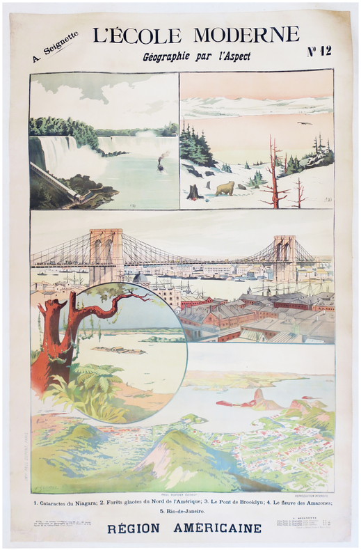
SEIGNETTE (Adrien) & LUNOIS (Alexandre).
L'École moderne. Géographie par l'aspect. N°12. Région américaine.
Paris, Paul Dupont, [1900]. 1,22 x 0,85 m ; montée sur toile.
Referenz des Buchhändlers : LBW-7872
|
|
|
SELF INSTRUCTOR.
The Self Instructor, or, Young Man's Best Companion; being an Introduction to all the various branches of useful Learning and Knowledge. Containing Writing, Grammar, Arithmetic, Astronomy, Geography, Chronology, and Miscellaneous Articles. To which is added, The Artist's Assistant; comprising the Arts of Drawing, Perspective, Etching, Engraving, Mezzotinto, Scraping, Painting, Drying, Colouring of Maps, etc. A brief account of Naval and Military Affairs. Also, various useful Medicinal Receipts.
8vo (218 x 135 mm), [4], 593, [3] pp., 3pp. of contents at end, folding engraved map of the world before the engraved and printed titles, 7 engraved plates, contemporary tree calf, spine gilt, morocco label, a nice copy. The map and the engraved frontispiece are "Published by Nuttall, Fisher, & Co., Liverpool, Sept. 1814, and Aug. 1815", respectively.
|
|
|
SELIGMAN, Adrian (text, illustrations and maps) Konstance Pares (linocut decorations)
No Stars to Guide
Hodder & Stoughton London 1947. 1st Edition. HARDCOVER. 1st printing. Thick 8vo in pale yellow cloth blue lettering to spine. 332pp 6 folding maps frontispiece and 20 other full page plates in blue wash all done by the author facsimile letters and linocut decorations all by Pares __CONDITION : A well preserved near FINE clean and tight copy pages slightly tanned neat inscription dated 1947 on front blank fly-leaf no other marks or inscriptions in a tanned slightly dusty and slightly edge-nicked but otherwise VERY GOOD complete Dust Jacket looks fine in its removable transparent protector. A very nice copy. . __We always ship in PROTECTIVE CARD PARCELS Hodder & Stoughton, London hardcover
Referenz des Buchhändlers : TK222592
|
|
|
Selwyn, Victor
Plan Your Route: The New Approach to Map Reading
Good+ Hardback with good+ dust jacket. Including the electronic technology and satellite navigation. Minor shelf wear. Corners of boards have been knocked very slightly. Clean text. Black & white/colour illustrations. 196p.
|
|
|
SELZ
Carte allemande au 1/80 000?. Fin XIXe.
1 feuille repli?e. 31,5x45 cm.
|
|
|
SEMPÉ
Sempe : A question of balance
2006, Phaidon Press, coffret cartonné toilé contenant 23 cartes postales sur le thème du vélo (dessins et aquarelles) - manque 1 carte postale | Etat : bon, coffret défraîchi, cartes postales en très bon état, manque 1 carte postale (Ref.: ref98251)
Referenz des Buchhändlers : 9782845233112
|
|
|

 Per e-mail erhalten
 Als pdf-Dokument herunterladen
 RSS feed
 Permanenter link


