|
Trakker Maps
Orlando Area
Trakker Maps Inc. Trade paperback. Good. Prompt shipment with tracking. we ship in CLEAN SECURE NEW boxes Good trade paperback map some stains Trakker Maps, Inc paperback
Bookseller reference : GrayTPB2KW087
|
|
|
Trakker Maps Inc
Orlando Area: Seminole Orange and Osceola Counties Atlas
acceptable. spiral bound paperback cover and corner wear bent page corners creased covers bent spirals paperback
Bookseller reference : B80513xxxN23323 ISBN : 1877651680 9781877651687
|
|
|
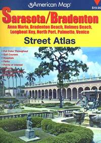
Trakker Maps, Inc
Sarasota Bradenton Street Atlas
spiral_bound. Good. Access codes and supplements are not guaranteed with used items. May be an ex-library book. unknown
Bookseller reference : 0875305318.G ISBN : 0875305318 9780875305318
|
|
|
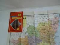
Trakker Maps, Inc.
Trakker Map of Tampa Florida Includes St. Petersburg and Plant City Florida
Miami Florida: Trakker Maps Inc. 1999. No Binding. Fine. A plasticized fold out color map 10" x20" which folds to 4" x10". This is a Trakker City Slicker map of the city streets and metro roads of Tampa with major roads of the metropolitan St Pete-Tampa Bay area including St. Petersburg Clearwater Tarpon Springs and Plant City on the reverse. Dozens of points of interest are numbered and a brief street index is included. Available for immediate shipment carefully packed! <br/> <br/> Trakker Maps, Inc. unknown
Bookseller reference : 012706 ISBN : 1579520448 9781579520441
|
|
|
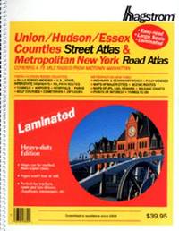
Trakker Maps Inc. [Editor]
Union/Hudson/Essex Counties Atlas
Hagstrom Map Co 2000-01-28. paperback. New. In shrink wrap. Looks like an interesting title! Hagstrom Map Co paperback
Bookseller reference : Q-0880976403 ISBN : 0880976403 9780880976404
|
|
|
TRAMEZINO o TRAMEZINI Francesco & Michele
Anteiquae Urbis Imago Accuratissime ex Vetusteis Monumenteis Formata
Pianta archeologica a proiezione verticale, con rappresentazione in alzato degli edifici antichi. Disegnata ed ideata da Pirro Ligorio, viene incisa da Jacob Bos per l’editore Tramezzino. Si tratta della grande pianta archeologica del Ligorio, frutto della sua valente esperienza di archeologo, che ebbe una grande influenza sulla produzione topografica della città per oltre due secoli. Per elaborare questa pianta, si avvalse della sua profonda conoscenza archeologica delle rovine di Roma, delle fonti classiche e di una vasta documentazione costituita da iscrizioni, bassorilievi e monete antiche. Per la parte topografica il Ligorio si basa sulla pianta del Bufalini del 1551.Roma entro le mura appare come un fantasioso insieme di edifici, alcuni noti e ancora presenti e altri che, sebbene localizzati con una certa esattezza, indubbiamente sono frutto di ricostruzioni abbastanza fantasiose. Non mancano gli errori di localizzazione, come ad esempio il Foro Romano, erroneamente collocato tra il Campidoglio ed il Palatino. Il primo stato della carta è noto solo attraverso gli esemplari conservati al British Museum e alla Philadelphia Library Company. La carta ebbe una ristampa inalterata, circa un secolo dopo per mano di Gian Battista de Rossi. Dopo un altro secolo circa (1773) anche Carlo Losi ne realizza una ristampa dalle lastre originali, che poi furono acquisite da Giovanni Scudellari e ristampate verso il 1820/30.In alto, lungo il bordo superiore, è impresso il titolo: ANTEIQUAE URBIS IMAGO ACCURATISSIME EX VETUSTEIS MONUMENTEIS FORMATA. Nel cartiglio all’angolo superiore sinistro si legge: EFFIGIES ANTIQUAE ROMAE EXVESTIGIIS AEDIFICIORUM RUINIS TESTIMONIO VETERUM AUCTORUM FIDE NUMISMATUM MONUMENTIS AENEIS PLUMBAEIS SAXEIS TIGLINISQUE COLLECTA ATQUE IN HANC TABELLAM REDACTA ATQUE DESCRIPTA A PYRRHO LIGORIO ROMANO PER XIIII REGIONES IN QUAS URBEM DIVISIT IMP CAESAR. AUG. PIOQUE IIII PONT MAX DICATA EXCUDERUNT ROMAE MICHAEL ET FRANCISCUS TRAMEZZINI M.D.LXI. Seguono l’indicazione del privilegio e la firma dell’incisore: Cum privilegio Sum[m]i Pont[ificis] et Senat[us] Venet[iani]. Iacobus Bossius belga incidebat. Orientazione fornita dal punto cardinale SEPTENTRIONE, indicazione collocata nell’angolo in alto a sinistra; il nord-est è in alto. Nella tavola alcuni monumenti e luoghi sono evidenziati attraverso il toponimo.Bulino, stampato su dodici fogli, applicati su tela e più volte ripiegati. Esemplare nel quarto stato finale, della tiratura Scudellari, finemente colorato a mano.Bibliografia:Bifolco - Ronca, Cartografia e Topografia italiana del XVI secolo (2018), pp. 2341-2342, tav. 1207, IV/IV; Destombes (1970): n. 94; Bevilacqua-Fagiolo (2012): p. 25; Caldana (2013): p. 22 e n. I.7; Frutaz (1962): n. XVIIa-b e tavv. 671-684; Hülsen (1915): VIII, pp. 52-53, nn. 31-35; Hülsen (1933): pp. 105-106, VIII; Karrow (1993): n. 51/11 e 51/11.4-51/11.7; Mandowsky-Mitchell (1963): tavv. 75-76; Scaccia Scarafoni (1939: nn. 11-13. Archaeological map with vertical projection, with representation in elevation of ancient buildings. Designed and conceived by Pirro Ligorio, it is engraved by Jacob Bos for the publisher Tramezzino. It is the great archaeological plant of Ligorio, the result of his valuable experience as an archaeologist, which had a great influence on the topographic production of the city for over two centuries. In order to elaborate this plan, he used his deep archaeological knowledge of the ruins of Rome, classical sources and a vast documentation consisting of inscriptions, bas-reliefs and ancient coins. For the topographic part Ligorio is based on the map by Bufalini of 1551.Rome within the walls appears as a fanciful set of buildings, some of them known and still present and others that, although located with a certain accuracy, are undoubtedly the result of quite fanciful reconstructions. There is no lack of localization errors, such as the Roman Forum, erroneously located between the Capitol and the Palatine Hill. The first state of the map is known only through the examples preserved at the British Museum and the Philadelphia Library Company. The ma was reprinted unchanged, about a century later by Gian Battista de Rossi. After another century or so (1773) Carlo Losi also made a reprint from the original plates, which were then acquired by Giovanni Scudellari and reprinted around 1820/30.At the top, along the upper edge, is engraved the title: ANTEIQUAE URBIS IMAGO ACCURATISSIME EX VETUSTEIS MONUMENTEIS FORMATA. In the cartouche in the upper left: EFFIGIES ANTIQUAE ROMAE EXVESTIGIIS AEDIFICIORUM RUINIS TESTIMONIO VETERUM AUCTORUM FIDE NUMISMATUM MONUMENTS AENEIS PLUMBAEIS SAXEIS TIGLINISQUE COLLECTA ATQUE IN HANC TABELLAM REDACTA ATQUE DESCRIPTA A PYRRHO LIGORIO ROMANO PER XIIII REGIONES IN QUAS URBEM DIVISIT IMP CAESAR. AUG. PIOQUE IIII PONT MAX DICATA EXCUDERUNT ROMAE MICHAEL ET FRANCISCUS TRAMEZZINI M.D.LXI. Follow the indication of the privilege and the signature of the engraver: Cum privilegio Sum[m]i Pont[ificis] et Senat[us] Venet[iani]. Iacobus Bossius Belgian incidebat. Orientation provided by the cardinal point SEPTENTRION, indication located in the upper left corner; the northeast is at the top. Engraving, printed on twelve sheets, applied on canvas and folded several times. Exemple in the fourth final state, of the edition by Scudellari. Literature:Bifolco - Ronca, Cartografia e Topografia italiana del XVI secolo (2018), pp. 2341-2342, tav. 1207, IV/IV; Destombes (1970): n. 94; Bevilacqua-Fagiolo (2012): p. 25; Caldana (2013): p. 22 e n. I.7; Frutaz (1962): n. XVIIa-b e tavv. 671-684; Hülsen (1915): VIII, pp. 52-53, nn. 31-35; Hülsen (1933): pp. 105-106, VIII; Karrow (1993): n. 51/11 e 51/11.4-51/11.7; Mandowsky-Mitchell (1963): tavv. 75-76; Scaccia Scarafoni (1939: nn. 11-13. Bifolco - Ronca, Cartografia e Topografia italiana del XVI secolo (2018), pp. 2341-2342, tav. 1207, IV/IV.

|
|
|
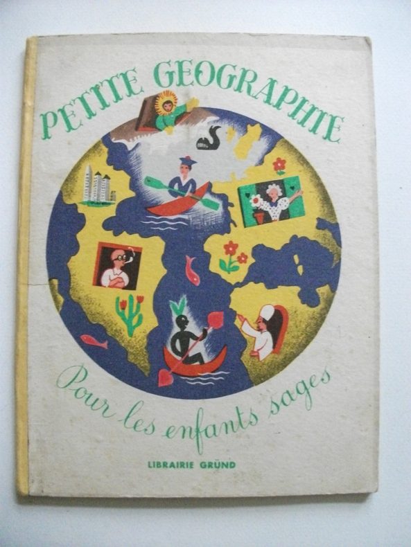
TRANCHANT Maurice
petite géographie pour tous les enfants sages
petit in 8 cartonné,dos pincé jaune,couverture illustrée en couleurs,titre illustré en couleurs 24 pages,20 charmantes illustrations en couleurs pleine page,ainsi qu’une double page de Maurice TRANCHANT Gründ éditeur 1947 Bon exemplaire,coloris frais
Bookseller reference : 6237
|
|
|
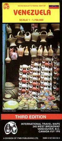
Treaty Oak & International Travel Maps
Venezuela Travel Reference Map
ITMB Publishing 02/21/1998. 3. Map. Used; Very Good. WE SHIP WITHIN 24 HRS FROM LONDON UK 98% OF OUR ORDERS ARE RECEIVED WITHIN 7-10 DAYS. We believe you will be completely satisfied with our quick and reliable service. All orders are dispatched as swiftly as possible! Buy with confidence! Greener Books. ITMB Publishing unknown
Bookseller reference : 4868350 ISBN : 0921463596 9780921463597
|
|
|
TREMAINE Jon
Tours de cartes. Collection : Image par image.
Paris, Solar, 1995. 24 x 27, 125 pp., très nombreuses illustrations en couleurs, cartonnage d'édition imprimé, bon état.
Bookseller reference : 37107
|
|
|
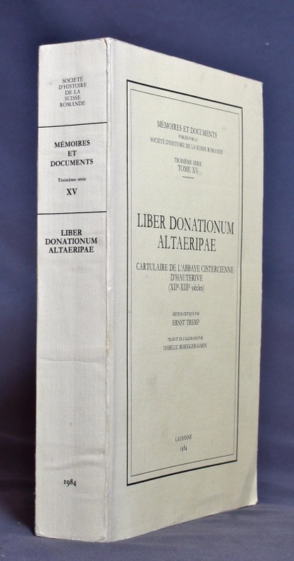
TREMP Ernst:
Liber donationum altaeripae. Cartulaire de l’abbaye cistercienne d’Hauterive (XIIe - XIIIe siècles).
Lausanne, Société d’histoire de la Suisse romande, 1984. In-8 broché de XII-433 pages, couverture imprimée.
Bookseller reference : 1149
|
|
|
Trench, Richard, with a foreword by Wilfred Thesiger, last of the great Arabia; Endpaper maps, color illustrations and black/whi
Arabian Travellers The European discovery of Arabia
MacMillan 1986-01-01. Hardcover. New. New. In shrink wrap. Looks like an interesting title! MacMillan hardcover
Bookseller reference : Q-0333428897 ISBN : 0333428897 9780333428894
|
|
|
Trent, Christopher
Motoring on Regional Byways : Midland England : 50 Miles from Birmingham
Ex-library copy with usual (mininal) marks and stamps - to front end paper and reverse of title page only. Mainly clean tight pages with bright unmarked tape-free boards, dusty page edges and no bumping to corners. Dust jacket not price clipped or marked or torn or creased with minor traces of handling. 144pp. Many places deserving of exploration within fifty miles motoring of Birmingham.

|
|
|
Trevelyan Raleigh & B/W Illus; Maps & Cartoons
Rome '44 the Battle for the Eternal City
Easton Press. Very Good with no dust jacket. 1990. Hardcover. Leather-bound hard cover published by Easton Press in 1990. No dust jacket. Black leather covers with gilt decorations and lettering. Corners are slightly bumped. Spine has three raised bands. Page edges are gilt-covered. Silk moire endpapers. Gray satin bookmark ribbon is attached to headband. Included are an unused and unattached bookplate from Easton Press and the Collector's Notes from Easton Press. Book is in very good plus condition. Large 8vo 366 pages 2.2 lb. ; Large 8vo 9" - 10" tall; 366 pages . Easton Press hardcover
Bookseller reference : MST13651
|
|
|
Trigiani, Elaine
Top 10 Sicily (revised edition)
No marks or inscriptions. No creasing to covers or to spine. A lovely clean crisp very tight copy with bright covers and no bumping to corners. 160pp. The self-wraps open up to present a map of the island (front) and a map of Central Palermo (rear). This is the revised edition of the guide to the 10 best of everything in Sicily, eg, beaches, resorts, sights, restaurants, etc.

|
|
|
Tring Urban District Council
Tring Urban District : The Official Guide
No marks or inscriptions. Minor creasing to covers adjacent to spine. A very clean very tight booklet with bright unmarked boards and no bumping to corners. Large fold-out street plan and map on rear in excellent condition. 40pp. Official guide the the Hertfordshire town of Tring with history, Local Authority information and photographs of the town in the early 1970s. Extremely scarce.

|
|
|
TRINQUIER (Jean).
[LAVAUR] Diocèse de Lavaur.
Paris, H. Jaillot, 1683. 351 x 451 mm.
Bookseller reference : LBW-2754

|
|
|
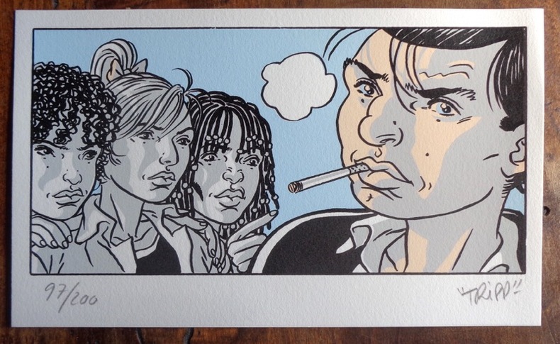
Tripp:
Petite sérigaphie couleurs.
2012 Sérigraphie au format 20 x 12.
Bookseller reference : 984
|
|
|
Tripp:
Petite sérigaphie couleurs.
Sérigraphie au format 20 x 12.
Bookseller reference : 26117

|
|
|
TRULLEN, Pablo [Comisario].
La Cartografía de Aragón. Primera Muestra de Documentación Histórica Aragonesa.
Zaragoza, 1988. Folio; 79 pp., 4 hs. Con 24 láminas. Cubiertas originales.

|
|
|
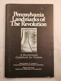
Trussell, John B. B. Jr with maps by Roy Saum
Pennsylvania Landmarks of The Revolution A Bicentennial Guidebook for Visitors
Harrisburg PA: Bicentennial Commission of Pennsylvania in Corp. with the Pennsylvania Historical and Museum Commission and the Pennsylvania Dept. of Transportation 1976. 8vo.; illustrated wraps with stapled binding softcover; 57 pages; black and white illustrations and maps; wraps are rubbed else very good. <br/><br/> Harrisburg, PA: Bicentennial Commission of Pennsylvania in Corp. with the Pennsylvania Historical and Museum Commission and the paperback
Bookseller reference : 48674
|
|
|
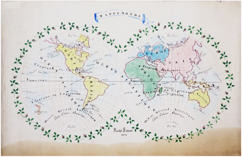
TRUSSON (Rachel).
Mappemonde.
1878. 61 x 90 cm.
Bookseller reference : LBW-6628
|
|
|
TRÉMAUX (Pierre).
[LE CREUSOT] Le Creusot. (1847). Saône et Loire. Vue prise du nord au sud.
Paris, Lemercier, 1847. 480 x 708 mm.
Bookseller reference : LBW-8626

|
|
|
TSCHUDI, Iwan von:
Der Tourist in der Schweiz nebst Grenzgebieten. Reisetaschenbuch. 36., neu bearb. Auflage v. C. Täuber. In 3 Bden.
Zürich, Orell Füssli, 1921, 21, 22, kl. in-8°, Frontispiz Porträt Iwan v. Tschudie & ca. 600 S., mit Karten und Panoramen ill., grüner Original-Leinenband.
Bookseller reference : 56401aaf
|
|
|
TSCHUDI, Iwan von:
Der Tourist in der Schweiz nebst Grenzgebieten. Reisetaschenbuch. 34., neu bearb. Auflage. In 3 Bde.
Zürich, Orell Füssli, 1899, kl. in-8°, 534 S., mit vielen Karten, Gebirgsprofilen und Stadtplänen, roter Original-Leinenband, Schuber.
Bookseller reference : 90011aaf
|
|
|
TSCHUDI, Iwan von:
Der Tourist in der Schweiz und Grenzgebieten. Reisetaschenbuch. 35., neu bearb. Auflage v. C. Täuber. In 3 Bden.
Zürich, Orell Füssli, 1918, kl. in-8°, ca. 600 S., mit vielen Karten, Gebirgsprofilen und Stadtplänen illustriert, Original-Leinenbde
Bookseller reference : 119935aaf
|
|
|
TSCHUDI, Iwan von:
Der Tourist in der Schweiz und Grenzgebieten. Reisetaschenbuch. 36., neu bearb. Auflage v. C. Täuber. In 3 Bden.
Zürich, Orell Füssli, 1921, kl. in-8°, ca. 600 S., mit vielen Karten, Gebirgsprofilen und Stadtplänen illustriert, Original-Leinenbde.
Bookseller reference : 119936aaf
|
|
|
TSCHUDI, Iwan von:
Der Turist in der Schweiz und den Grenzrayons. Reisetaschenbuch. 33., neu bearb. Auflage.
Zürich, Orell Füssli, 1895, kl. in-8°, 6 gelbe Blätter (Werbung & Index) + XXXIV + 534 S. + 9 gefalt. Panoramas + 6 gefalt. Stadtplänen + 11 Karten, und als Vorsatz hinten 1 Doppelblattgrosses Routekärtchen der Schweiz + 1 gef. Touristenkarte der Schweiz am Schlusse des Buches, roter Original-Leinenband, Schönes Exemplar.
Bookseller reference : 137129aaf
|
|
|
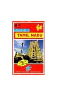
Tt Maps & Publications Ltd
A road guide to Tamil Nadu
Tt Maps Madras 1992. 28 S. Text sowie 1 Landkarte Maßstab: 76 cm x 50 cm kartonierter Einband Name on cover/small stamp on the backside of map. unknown
Bookseller reference : 6d2935 ISBN : 8170531276 9788170531272
|
|
|
Tt Maps & Publications Ltd
An Atlas of India
Paperback. Very Good. paperback
Bookseller reference : GOR008632806 ISBN : 0195625536 9780195625530
|
|
|
Tt Maps & Publications Ltd
Kerala Discover India Series
paperback. Good. Access codes and supplements are not guaranteed with used items. May be an ex-library book. paperback
Bookseller reference : 8170530164.G ISBN : 8170530164 9788170530169
|
|
|
Tt Maps & Publications Private Ltd
Maharashtra Road Guide
paperback. Good. Access codes and supplements are not guaranteed with used items. May be an ex-library book. paperback
Bookseller reference : 8170530156.G ISBN : 8170530156 9788170530152
|
|
|
Tt Maps & Publications Ltd
Tamilnadu Road Guide
Paperback. Very Good. paperback
Bookseller reference : GOR009380450 ISBN : 8170531276 9788170531272
|
|
|
TT. Maps & Publications Ltd
A Road Guide to Delhi Discover India series / TTK Maps
paperback. Good. Access codes and supplements are not guaranteed with used items. May be an ex-library book. paperback
Bookseller reference : 8170530202.G ISBN : 8170530202 9788170530206
|
|
|
TT. Maps & Publications Ltd
A ttk atlas to India's wildlife TTK discover India series
paperback. Good. Access codes and supplements are not guaranteed with used items. May be an ex-library book. paperback
Bookseller reference : 8170531322.G ISBN : 8170531322 9788170531326
|
|
|
TT. Maps & Publications Ltd
Andhra Pradesh TTK discover India series
paperback. Good. Access codes and supplements are not guaranteed with used items. May be an ex-library book. paperback
Bookseller reference : 817053013X.G ISBN : 817053013X 9788170530138
|
|
|
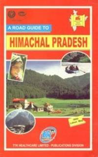
TT. Maps & Publications Ltd
Himachal Pradesh: With trekking routes TTK discover India series
paperback. Good. Access codes and supplements are not guaranteed with used items. May be an ex-library book. paperback
Bookseller reference : 8170530660.G ISBN : 8170530660 9788170530664
|
|
|
TT. Maps & Publications Ltd
Hyderabad and Secunderabad TTK discover India series
paperback. Good. Access codes and supplements are not guaranteed with used items. May be an ex-library book. paperback
Bookseller reference : 8170530113.G ISBN : 8170530113 9788170530114
|
|
|
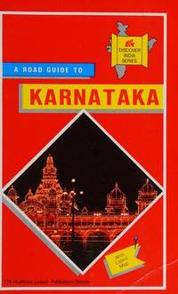
TT. Maps & Publications Ltd
Karnataka TTK discover India series
paperback. Good. Access codes and supplements are not guaranteed with used items. May be an ex-library book. paperback
Bookseller reference : 8170530008.G ISBN : 8170530008 9788170530008
|
|
|
TT. Maps & Publications Ltd
Madhya Pradesh TTK discover India series
paperback. Good. Access codes and supplements are not guaranteed with used items. May be an ex-library book. paperback
Bookseller reference : 8170530148.G ISBN : 8170530148 9788170530145
|
|
|
TT. Maps & Publications Ltd
Odisha Road Guide
paperback. Good. Access codes and supplements are not guaranteed with used items. May be an ex-library book. paperback
Bookseller reference : 8170530857.G ISBN : 8170530857 9788170530855
|
|
|
TT. Maps & Publications Ltd
Pondicherry Discover India series / TT. Maps
paperback. Good. Access codes and supplements are not guaranteed with used items. May be an ex-library book. paperback
Bookseller reference : 8170530253.G ISBN : 8170530253 9788170530251
|
|
|
TT. Maps & Publications Ltd
Road Guidebook to Punjab TTK discover India series
TT Maps & Publications Pvt.Ltd India 1990-02-06. paperback. Acceptable. 7x5x1. TT Maps & Publications Pvt.Ltd ,India paperback
Bookseller reference : 8170530733-4-34601846 ISBN : 8170530733 9788170530732
|
|
|
TT. Maps & Publications Ltd
Road Guidebook to Punjab TTK discover India series
paperback. Good. Access codes and supplements are not guaranteed with used items. May be an ex-library book. paperback
Bookseller reference : 8170530733.G ISBN : 8170530733 9788170530732
|
|
|
TT. Maps & Publications Ltd
Sikkim Discover India series / TT. Maps
paperback. Good. Access codes and supplements are not guaranteed with used items. May be an ex-library book. paperback
Bookseller reference : 8170530962.G ISBN : 8170530962 9788170530961
|
|
|
TT. Maps & Publications Ltd
TT. Maps' road atlas of India
paperback. Good. Access codes and supplements are not guaranteed with used items. May be an ex-library book. paperback
Bookseller reference : 8170530334.G ISBN : 8170530334 9788170530336
|
|
|
TT. Maps & Publications Ltd
Uttar Pradesh: With trekking routes TTK discover India series
paperback. Good. Access codes and supplements are not guaranteed with used items. May be an ex-library book. paperback
Bookseller reference : 8170530954.G ISBN : 8170530954 9788170530954
|
|
|
Tucazinsky, Nissan Aharon
The Borders of the Holy Land: Jerusalem in Pictures [IN HEBREW] Supplement to the Book "The Holy City & Temple"
In Hebrew. 180X250 mm. 43+4+12 + 55 Plates. Gilt Hard cover with dust jacket. Dust Jacket slightly torn on the upper edge. Cover and spine slightly worn. Yellow pages. Name of previous owner written on the first white page and on title page. Else in good condition. Includes Maps, Photos and Illustrations.
|
|
|
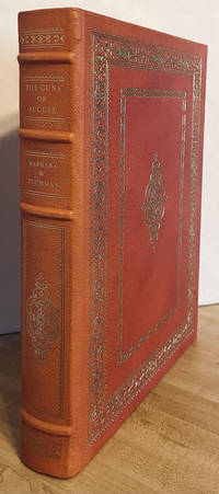
Tuchman, Barbara W.; with photographs from the First Edition and Maps by Raphael Palacios
The Guns of August Franklin Library of Pulitzer Prize Classics
<p>Franklin Library 1984 Full-Leather Pulitzer Prize Classics Edition with gilt page edges 4 raised spine hubs marbled endsheets & bound-in silk ribbon marker 1st Thus with publisher Collector Letter laid in no markings NOT ex-lib scant shelf wear to boards & gilt edges else Fine unread copy; 8vo; xxvi 511pp indexed & illus. First Edition. Full-Leather. Near Fine.</p> Franklin Library hardcover
Bookseller reference : 33709
|
|
|
Tucker Glenn; maps by Dorothy Thomas Tucker
Dawn Like Thunder: The Barbary Wars and the Birth of the U.S. Navy
Indianapolis: Bobbs-Merrill 1963. 1st. Hardcover. Book fine Dust jacket fine. The dust jacket is price clipped and has minor chips and closed tears to the extremities. <br/><br/> Bobbs-Merrill hardcover books
Bookseller reference : 9010503
|
|
|
Tucker Glenn; Tucker Maps WT. W. T.
Poltroons and Patriots: A Popular Account of the War of 1812 Two volumes
Bobbs-Merrill 1954. Very Good. Tucker Glenn. Poltroons and Patriots: A Popular Account of the War of 1812 Two volumes. Tucker Maps W.T. Indianapolis: Bobbs-Merrill 1954. 812pp. Indexed. Illustrated. 8vo. Cloth with gilt lettering. Book condition: Very good with lightly bumped and yellowed spines. Slipcase is very good with light rubbing and yellowing. Includes monthly bulletin of American History Publication Society. Bobbs-Merrill hardcover books
Bookseller reference : UTUCPOL00JMJ
|
|
 Receive by email
 Download as PDF document
 RSS feed


