|
Benchmark Maps
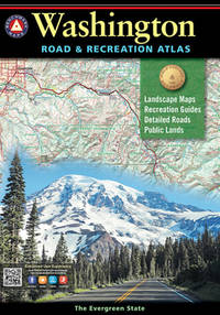
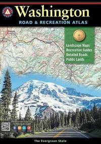
Washington Road & Recreation Atlas - 10th Edition 2022 Benchmark
Benchmark Maps 2020-06-01. 2020. map. Used: Good. 10.50x0.50x15.00. Buy with confidence. Excellent Customer Service & Return policy. Benchmark Maps unknown
Referentie van de boekhandelaar : SONG1734315016 ISBN : 1734315016 9781734315011
|
|
|
Benchmark Maps and Atlases
Washington Recreation Map Benchmark Maps
Benchmark Maps 2016-01-01. 2016. map. New. 4.28x0.23x9.01. Buy with confidence. Excellent Customer Service & Return policy. Benchmark Maps unknown
Referentie van de boekhandelaar : DADAX0783499086 ISBN : 0783499086 9780783499086
|
|
|
Benchmark Maps
Washington Road & Recreation Atlas - 10th Edition 2022 Benchmark
Benchmark Maps 2020-06-01. 2020. map. New. 10.50x0.50x15.00. Buy with confidence. Excellent Customer Service & Return policy. Benchmark Maps unknown
Referentie van de boekhandelaar : DADAX1734315016 ISBN : 1734315016 9781734315011
|
|
|
Benchmark Maps
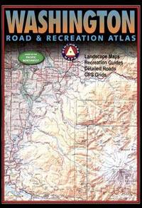
Washington Road and Recreation Atlas Benchmark Road & Recreation Atlas
Benchmark Maps 2017-09-01. 8th Edition. paperback. Used: Good. 10.75x0.50x15.50. Buy with confidence. Excellent Customer Service & Return policy. Benchmark Maps paperback
Referentie van de boekhandelaar : SONG0929591402 ISBN : 0929591402 9780929591407
|
|
|
Benchmark Maps
Washington Road and Recreation Atlas Benchmark Road & Recreation Atlas
paperback. Good. Access codes and supplements are not guaranteed with used items. May be an ex-library book. paperback
Referentie van de boekhandelaar : 0929591402.G ISBN : 0929591402 9780929591407
|
|
|
Benchmark Maps
Washington Recreation Map Benchmark
map. Good. Access codes and supplements are not guaranteed with used items. May be an ex-library book. unknown
Referentie van de boekhandelaar : 0783499086.G ISBN : 0783499086 9780783499086
|
|
|
Benchmark Maps Staff
Washington Road and Recreation Atlas
Benchmark LLC. Used - Good. Used book that is in clean average condition without any missing pages. Benchmark LLC unknown
Referentie van de boekhandelaar : 38592933-75 ISBN : 0929591836 9780929591834
|
|
|
Benchmark Maps [Compiler]
Washington Benchmark Road & Recreation Atlas
National Geographic Maps 2015-10-01. Paperback. New. In shrink wrap. Looks like an interesting title! National Geographic Maps paperback
Referentie van de boekhandelaar : Q-0929591984 ISBN : 0929591984 9780929591988

|
|
|
Benchmark Maps
Washington Road and Recreation Atlas Benchmark Road & Recreation Atlas
Benchmark Maps 2017-09-01. 8th Edition. paperback. New. 10.75x0.50x15.50. Buy with confidence. Excellent Customer Service & Return policy. Benchmark Maps paperback
Referentie van de boekhandelaar : DADAX0929591402 ISBN : 0929591402 9780929591407
|
|
|
Benchmark Maps
Washington Benchmark Road & Recreation Atlas
National Geographic Maps 2015-10-01. 2015. paperback. New. 11.00x0.25x15.25. Buy with confidence. Excellent Customer Service & Return policy. National Geographic Maps paperback
Referentie van de boekhandelaar : DADAX0929591984 ISBN : 0929591984 9780929591988
|
|
|
Benchmark Maps
Washington Road & Recreation Atlas
Brand: Benchmark Maps 0000-00-00. 3rd. paperback. Used: Good. 10.75x0.50x15.50. Buy with confidence. Excellent Customer Service & Return policy. Brand: Benchmark Maps paperback
Referentie van de boekhandelaar : SONG0929591836 ISBN : 0929591836 9780929591834
|
|
|
Benchmark Maps
Washington Benchmark Road & Recreation Atlas
National Geographic Maps 2015-10-01. 2015. paperback. Used: Good. 11.00x0.25x15.25. Buy with confidence. Excellent Customer Service & Return policy. National Geographic Maps paperback
Referentie van de boekhandelaar : SONG0929591984 ISBN : 0929591984 9780929591988
|
|
|
Benchmark Maps
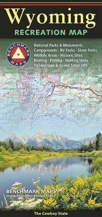
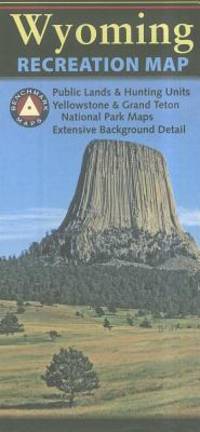
Wyoming Recreation Map
Sheet map folded. New. New Book; Fast Shipping from UK; Not signed; Not First Edition; One side provides a full state map that features Public & Tribal Lands extensive highway detail point-to-point mileages recreation attractions campgrounds parks and wildlife areas fishing access points and hunting units GMU unknown
Referentie van de boekhandelaar : ria9780783499741_inp ISBN : 0783499744 9780783499741
|
|
|
Benchmark Maps
Wyoming Recreation Map
map. Good. Access codes and supplements are not guaranteed with used items. May be an ex-library book. unknown
Referentie van de boekhandelaar : 0783499027.G ISBN : 0783499027 9780783499024
|
|
|
Benchmark Maps and Atlases
Wyoming Recreation Map Benchmark Maps
map. Good. Access codes and supplements are not guaranteed with used items. May be an ex-library book. unknown
Referentie van de boekhandelaar : 0783499213.G ISBN : 0783499213 9780783499215

|
|
|
Benchmark Maps
Wyoming Road & Recreation Atlas - 5th Edition 2022 Benchmark Road & Recreation Atlases
Benchmark Maps 2022-05-01. paperback. Good. 10x0x15. Benchmark Maps paperback
Referentie van de boekhandelaar : 0929591798-3-35739547 ISBN : 0929591798 9780929591797

|
|
|
Benchmark Maps &. Atlases
Wyoming Road and Recreation Atlas
unknown
Referentie van de boekhandelaar : BIBUP61025-A51056
|
|
|
Benchmark Maps and Atlases
Wyoming Road & Recreation Atlas Benchmark Recreation Atlases
Benchmark 2018-01-01. 2018. map. Used: Good. 10.75x0.50x15.75. Buy with confidence. Excellent Customer Service & Return policy. Benchmark unknown
Referentie van de boekhandelaar : SONG092959102X ISBN : 092959102X 9780929591025

|
|
|
Benchmark Maps & Atlases
Wyoming Road & Recreation Atlas: The Cowboy State
Benchmark Maps 2020. Paperback. New. map edition. 95 pages. 15.00x10.25x0.50 inches. Benchmark Maps paperback
Referentie van de boekhandelaar : 1-0929591798 ISBN : 0929591798 9780929591797
|
|
|
Benchmark Maps
Wyoming Road & Recreation Atlas - 5th Edition 2022 Benchmark Road & Recreation Atlases
Benchmark Maps 2022-05-01. 5th Edition 2022. paperback. New. 10.25x0.50x15.00. Buy with confidence. Excellent Customer Service & Return policy. Benchmark Maps paperback
Referentie van de boekhandelaar : DADAX0929591798 ISBN : 0929591798 9780929591797
|
|
|
Benchmark Maps
Wyoming Road & Recreation Atlas - 5th Edition 2022 Benchmark Road & Recreation Atlases
Benchmark Maps 2022-05-01. 5th Edition 2022. paperback. Used: Good. 10.25x0.50x15.00. Buy with confidence. Excellent Customer Service & Return policy. Benchmark Maps paperback
Referentie van de boekhandelaar : SONG0929591798 ISBN : 0929591798 9780929591797
|
|
|
Benchmark Maps
Wyoming Road & Recreation Atlas - 5th Edition 2022 Benchmark Road & Recreation Atlases
paperback. Good. Access codes and supplements are not guaranteed with used items. May be an ex-library book. paperback
Referentie van de boekhandelaar : 0929591798.G ISBN : 0929591798 9780929591797
|
|
|
Benchmark Maps and Atlases
Wyoming Road & Recreation Atlas Benchmark Recreation Atlases
Benchmark 2018-01-01. 2018. map. New. 10.75x0.50x15.75. Buy with confidence. Excellent Customer Service & Return policy. Benchmark unknown
Referentie van de boekhandelaar : DADAX092959102X ISBN : 092959102X 9780929591025
|
|
|
Benchmark Maps
Wyoming The Cowboy State Recreation Map - 2025 Edition Benchmark
Benchmark Maps 01-12-2024. 2021st ed. map. New. 4.25x0.20x9.00. Buy with confidence. Excellent Customer Service & Return policy. Benchmark Maps unknown
Referentie van de boekhandelaar : DADAX0783499744 ISBN : 0783499744 9780783499741
|
|
|
Benchmark Maps
Wyoming The Cowboy State Recreation Map - 2025 Edition Benchmark
map. Good. Access codes and supplements are not guaranteed with used items. May be an ex-library book. unknown
Referentie van de boekhandelaar : 0783499744.G ISBN : 0783499744 9780783499741
|
|
|
Benchmark Maps
Yosemite National Park California Recreation Map Benchmark
Benchmark Maps 8/15/2021 12:00:01 A. map. Very Good. 0.2362 in x 8.9764 in x 3.8976 in. Benchmark Maps unknown
Referentie van de boekhandelaar : mon0000704396 ISBN : 0783499256 9780783499253
|
|
|
Benchmark Maps
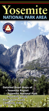
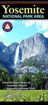
Yosemite National Park Area
Benchmark Maps 2021. Map. New. 2021 edition. 1 pages. 9.40x4.20x0.20 inches. Benchmark Maps unknown
Referentie van de boekhandelaar : 1-0783499256 ISBN : 0783499256 9780783499253
|
|
|
Benchmark Maps
Yosemite National Park California Recreation Map
map. Good. Access codes and supplements are not guaranteed with used items. May be an ex-library book. unknown
Referentie van de boekhandelaar : 0783499256.G ISBN : 0783499256 9780783499253
|
|
|
Benchmark Maps and Atlases
Yosemite National Park Area
Natl Geographic Society Maps 2018-02-05. 2016. map. New. 0.00x5.08x7.80. Buy with confidence. Excellent Customer Service & Return policy. Natl Geographic Society Maps unknown
Referentie van de boekhandelaar : DADAX0783498497 ISBN : 0783498497 9780783498492
|
|
|
Benchmark Maps and Atlases
Yosemite National Park Area
map. Good. Access codes and supplements are not guaranteed with used items. May be an ex-library book. unknown
Referentie van de boekhandelaar : 0783498497.G ISBN : 0783498497 9780783498492
|
|
|
Benchmark; National Geographic Maps
New Mexico Road & Recreation Atlas
The new National Geographic Benchmark Recreation Atlases are an ideal recreation resource complete with accurate detailed topographic maps. They contain a wealth of robust travel information including campground locations state park maps sports and activity destinations museums hunting and fishing information historic sites and even climate details. Every feature is clearly labelled field-checked and verified and everything is organised for convenience and intuitive ease-of-use. The books feature a double laminated cover to prevent wear and tear. unknown
Referentie van de boekhandelaar : BIBUP61025-A51284
|
|
|
Benchmark; National Geographic Maps
Utah Road & Recreation Atlas
The new National Geographic Benchmark Recreation Atlases are an ideal recreation resource complete with accurate detailed topographic maps. They contain a wealth of robust travel information including campground locations state park maps sports and activity destinations museums hunting and fishing information historic sites and even climate details. Every feature is clearly labelled field-checked and verified and everything is organised for convenience and intuitive ease-of-use. The books feature a double laminated cover to prevent wear and tear. unknown
Referentie van de boekhandelaar : BIBUP61025-A50465
|
|
|
Bender, Arnold (Intro)
Germany : L'Allemagne : Deutschland
No marks or inscriptions. A very clean very tight copy with bright unmarked hessian boards and no bumping to corners. Dust jacket not price clipped with slightly dusty rear, slight rubbing to edges and small tears to corners and spine ends. 224pp. A book of photographs with an Introduction in English, French and German. Undated, ca 1950s.

|
|
|
Bennett, Lindsay
Iceland (Travellers)
Appears unread in mint condition. 192pp. All you need to plan the perfect trip to Iceland and what you can see when you get there.
|
|
|
BENOIST Felix (1818 - 1896)
Plan de Rome
Pianta tratta dalla monumentale opera di Felix Benoist Rome dans sa grandeur. Vues, monument ancient et modernes stampata a Parigi in 3 volumi, da Henri Charpentier, nel 1870. La pubblicazione, illustrata da 100 litografie, fu preceduta da una campagna di disegni preparatori, a far data dal 1864 sino al 1869, eseguita soprattutto da Félix Benoist e in parte da Philippe Benoist. Alla vigilia del Concilio Ecumenico Vaticano I, l’11 agosto 1869, Pio IX decretava la realizzazione di una Esposizione romana delle opere d’ogni arte eseguite per il culto cattolico, che venne inaugurata, il 17 febbraio 1870, nel chiostro della Certosa di Santa Maria degli Angeli. In quell’occasione, vennero presentati i tre volumi in folio Rome dans sa grandeur. I volumi, rilegati in modo sfarzoso, con impresso al centro in oro, lo stemma di Pio IX, sono suddivisi in tre sezioni. Il primo volume tratta di Roma antica, il secondo, di Roma cristiana, ed il terzo, dei monumenti e le realizzazioni della Roma moderna. Una visione preziosa della Roma papale alla vigilia della profonda trasformazione di Roma in capitale dell’Italia unita. Un documento che evidenzia la notevole impronta lasciata da Pio IX nella Città Eterna. L’opera rappresenta il capolavoro dell’artista francese, dove ogni veduta è realizzata in litografia tinta, processo ottenuto usando un diverso numero di pietre. Il risultato è un’opera di grande effetto, tanto da porre il Benoist tra la schiera dei più grandi artisti di interni e vedute del suo tempo. Litografia tinta, finemente colorata a mano, in ottimo stato di conservazione. Map taken from the monumental work of Felix Benoist Rome dans sa grandeur. Vues, monument ancient et modernes printed in Paris in 3 volumes, by Henri Charpentier, in 1870. The publication, illustrated by 100 lithographs, was preceded by a campaign of preparatory drawings, from 1864 to 1869, executed mainly by Felix Benoist and partly by Philippe Benoist. On the eve of the First Vatican Ecumenical Council, August 11, 1869, Pius IX decreed the creation of the Esposizione romana delle opere d’ogni arte eseguite per il culto cattolico (a Roman Exhibition of the works of art created for Catholic worship), which was inaugurated on February 17, 1870, in the cloister of the Charterhouse of Santa Maria degli Angeli. On that occasion, the three volumes in folio Rome dans sa grandeur were presented. The volumes, magnificently bound, with the coat of arms of Pius IX stamped in gold in the center, are divided into three sections. The first volume deals with ancient Rome, the second with “Christian” Rome, and the third with the monuments and achievements of modern Rome. A precious vision of papal Rome on the eve of the profound transformation of Rome into the capital of united Italy. A document that highlights the remarkable imprint left by Pius IX in the Eternal City. The work represents the masterpiece of the French artist, where each view is made in tinted lithography, a process achieved by using a different number of stones. The result is a work of great effect, so much so as to place Benoist among the ranks of the greatest artists of interiors and views of his time. Tinted lithograph, finely hand-colored, in excellent condition.

|
|
|
Bentata Azaz, Victoria A-Z Maps
-Z Oxford Hidden Walks: Discover 20 Routes In And Around The City
Harpercollins Publishers 2022. Paperback / Softback. New. 128 pages. 7.05x4.96x0.55 inches. Harpercollins Publishers paperback
Referentie van de boekhandelaar : __0008496323 ISBN : 0008496323 9780008496326

|
|
|
Bentley, James
A Guide to Eastern Germany
Trace of foxing to front edge. No inscriptions or marks. A very clean very tight copy with unmarked black cloth boards and no bumping to corners. Dust jacket not price clipped or torn with slight creasing to upper edge and traces of shelf wear. 244pp. Written very soon after German re-unification, this authoritative guide comprehensively describes the superb cities and towns, the exquisite countryside and the charming villages which had suddenly been re-opened to the rest of the world after being shut away for so long.

|
|
|
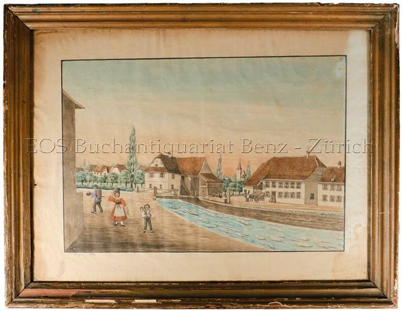
Berger, Jos:
(Dorf im Schweizer Mittelland).
1868. Aqarell. Bildgrösse: 37 x 48 cm. Holzrahmen mit Gebrauchsspuren.
Referentie van de boekhandelaar : 560BG
|
|
|
BERGELIN, L. / e.a.
1) Carte routière ZYMA - Suisse. BERGELIN, L. (carthographe, Paris): La Suisse divisée. en 3 cartes routières dépl. ( GE / ZH / GR. Draeger - Imp. Paris) ens dans l’enveloppe Impr.: „Cartes Zyma, modèles déposées, Nyon“. 2) Strassenkarte der Schweiz = Carte routière s.d. ca. 1930. / ENS. avec: Kinstreisen in der Schweiz. 30 n.n. Bl. + Ausf. Verkehrskarte d. Schweiz. 19393) UBS Werbung Postkarte. Otto M. Müller Touristenkarte d. Schweiz.4) T.C.S. Schweizer-Reise mit Verkehrs-Signalen. Sign. E. Tschudi. Ill. 2 S. Lepéorello mit farb. Zeichnungen u. Strassensignale5) Reisekarte der Schweiz. (Schweiz. Bundesbahnen). 1929. 6 S. Text mit 6 fotogr. Abb. - Zh, Orell Füssli, Orig.-Umschlasg mit Abb.
1930 - 1940 in-8vo, Konvolut Tourisme - Schweizerkarten zus., ill. OU.
Referentie van de boekhandelaar : 135841aaf
|
|
|
BERLOQUIN, Pierre
100 GRANDES RÉUSSITES
Paris Flammarion 1969 in 4 (28x20) 1 volume reliure toilée ornée de l'éditeur sous rhodoïd, plat supérieur illustré, 204 pages, avec de nombreuses illustrations en noir et blanc et en couleurs. Eliminations; constructions diverses; constructions de séries simples; constructions de séries avec séries provisoires Bel exemplaire ( Photographies sur demande / We can send pictures of this book on simple request )
Referentie van de boekhandelaar : 20760
|
|
|
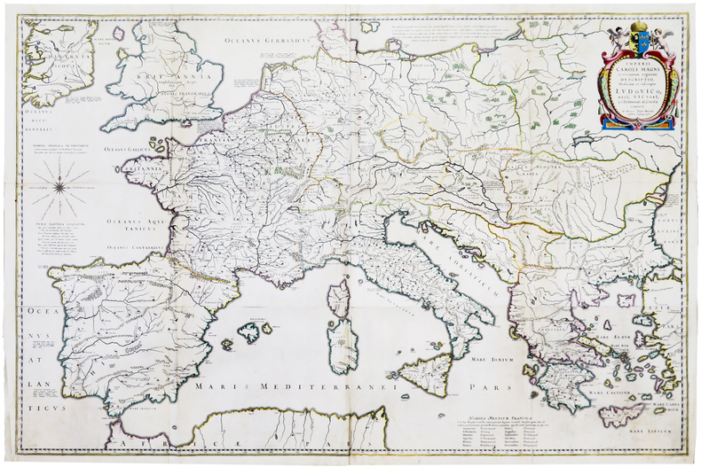
BERTIUS (Petrus).
[EMPIRE de CHARLEMAGNE] Imperii Caroli Magni et vicinarum regionum descriptio.
Paris, [1620]. En quatre feuilles jointes formant une carte de 640 x 975 mm.
Referentie van de boekhandelaar : LBW-5945
|
|
|
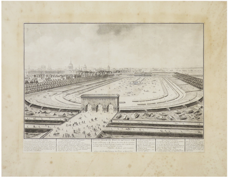
BERTHAULT (Pierre-Gabriel) & MANDAR (Charles-François).
[FÊTE de la FÉDÉRATION] Vue du Champ de Mars, le 14 juillet 1790.
Paris, Berthault, [1790]. 310 x 432 mm, coupé au trait d'encadrement et remonté sur papier ancien.
Referentie van de boekhandelaar : LBW-6422
|
|
|
BERTRAND Alfred
Au Pays de Ba-ROTSI
Haut-Zambèze,voyage d’exploration en Afrique et retour par les chutes Victoria,le Matébeleland,Le Transvaal,Natal,Le Cap. In 4 demi-chagrin rouge époquetitre,roulette,filets dorés,filets à froid,faux-titre,portait de l’auteur sur papier de chine contrecollé sur vélin fort,sous serpente,titre avec vignette,331 pages,sur papier couché,nombreuses illustrations photos dans le texte et hors-texte,carte dépliante deux Royaumes de Marutse,(Ba-Rotsi)deux cartes dépliantes Paris Hachette & Cie 1898, très bon état
Referentie van de boekhandelaar : 5663

|
|
|
BERTRAND Alfred:
Au pays des Ba-Rotsi. Haut Zambèze. Voyage d'exploration en Afrique et retour par les chutes Victoria, le Matébéléland, le Transvaal, Natal, Le Cap.
Paris, Hachette & Cie, 1898. Petit in-4 de [10]-331-[5] pages, pleine percaline verte, titre doré au dos et au premier plat orné d'une tête de buffle, tête dorés, plats biseautés.
Referentie van de boekhandelaar : 20348
|
|
|
Bernard Daniel
Brenne la nature et les hommes
PITTORESQUE 2015 187 pages 2x29x23cm. 2015. Relié. 187 pages.
Referentie van de boekhandelaar : 100153491

|
|
|
BERTIUS (Petrus).
Carte de l'Afrique corrigée, et augmentée, dessus toutes les aultres cy devant faictes par P. Bertius.
[Paris, Melchior Tavernier, 1632]. 376 x 497 mm.
Referentie van de boekhandelaar : LBW-8688

|
|
|
BERTIUS (Petrus).
Carte de l'Europe, corrigée et augmentée dessus toutes les aultres cy devant faictes par P. Bertius.
Paris, Melchior Tavernier, 1627 [1632]. 381 x 505 mm.
Referentie van de boekhandelaar : LBW-8842

|
|
|
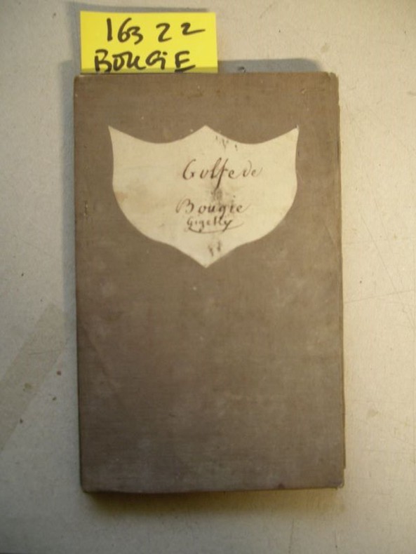
BERARD (Lt. de V. M. A.)
Carte particulière du Golfe de Bougie, levée en 1832 par M. A. Bérard,…, commandant le Brick Le Loiret…
1833 21 sections montées sur toile et pliées formant une carte de 620 x 905 mm. P. Dépôt général de la Marine 1833
Referentie van de boekhandelaar : 16322
|
|
|
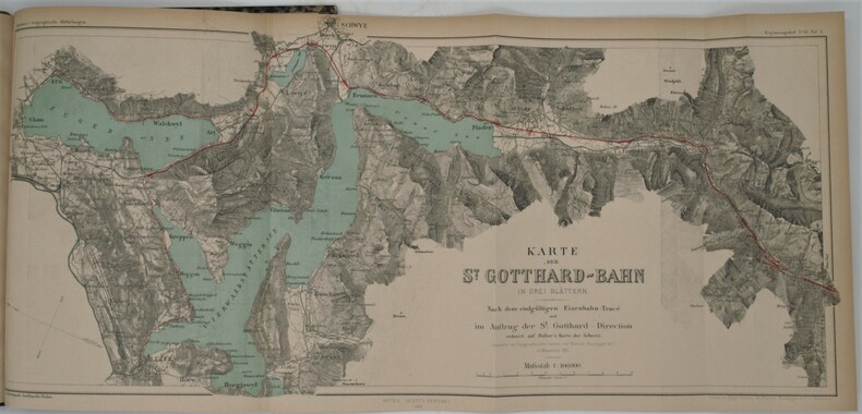
BERLEPSCH , H. A.
Die Gotthard-Bahn. Beschreibendes und Geschichtliches.
Gotha, Julius Perthes, 1881 , in-4 , 2-77pp (1) , illustré de 3 cartes dépliantes et en couleurs, relié demi veau époque ,dos lisse avec pièce d’auteur et titre, cachet ,charnières fendues .
Referentie van de boekhandelaar : PHO-794
|
|
|
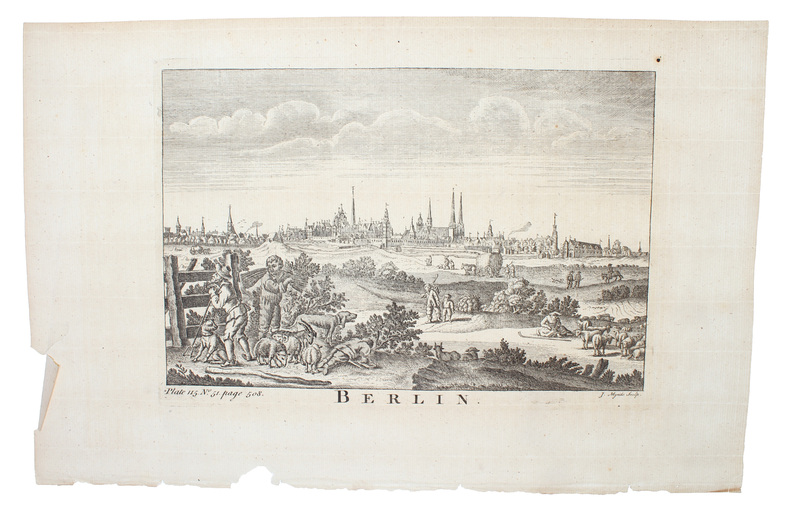
BERLIN -
Gesamtansicht von Berlin.
Um 1750. (18 x 26 cm.). Engraved view of Berlin. Kupferstich von Berlin. J. Mynde Sculp.
Referentie van de boekhandelaar : 53180
|
|
 De zoekresultaten per email ontvangen
 Zoekresultaten downloaden als PDF
 RSS feed


