|
DIRICKX Frères
Commémoration du Centenaire de la Belgique (1830-1930), album souvenir de l'Exposition internationale d'Anvers, 1930/Herdenking van Belgïe's Eeuwfeest (1830-1930), Gedenk-album der Wereldtentoonstelling, Antwerpen 1930.
Anvers, Dirickx Frères, 1930. 20 x 15, sans pagination, plusieurs illustrations, cartonnage d'édition imprimé, bon état.
Referentie van de boekhandelaar : 28016
|
|
|
Direzione Generale del Censo
Pianta Topografica di Roma pubblicata dalla Direzione Generale del Censo ed aggioranta a tutto il corrente anno MDCCCLXVI
Rara pianta della città, a proiezione verticale, orientata con il nord in alto.La pianta fu pubblicata per la prima volta nel 1829: "La pianta del Censo è senz'altro la più accurata e significativa pianta della Roma Papale nel sec. XIX. Gli edifici sono campiti a tratteggio; chiese e monumenti principali sono rappresentate con la pianta interna. L'orografia è chiaramente leggibile così come il disegno del verde. Ampia legenda sul lato sinistro ed in basso a destra elenco dei XIV rioni. È raffigurata la sola città entro il perimentro delle mura che risalta pertanto nitidamente sul fondo bianco. Il Cardinale Cesare Guerrieri, primo presidente della Congregazione dei Catasti (poi Censo) dal 1816 al 1832, fece incidere e pubblicare questa pianta, basandosi sulle mappe manoscritte del Catasto Urbano ordinate da PIO VII nel 1818 e completate nel 1822" (cfr. Marigliani p. 323). Una seconda stesura dell'opera viene alla luce nel 1854, ristampa delle lastre originali, che contiene l'indicazione del ponte di ferro costruito accanto a Ponte Rotto. La pianta fu poi definitivamente emendata nel 1866 - questa nostra edizione."E' la più accurata immagine della città subito prima che diventasse capitale. Compare il ponte di ferro a San Giovanni dei Fiorentini (1863) ed è indicata la fabbrica dei tabacchi (1863) con l'antistante Piazza Matai (1864). Ci sono le linee ferroviarie a Termini (1862) mentre manca ovviamente il fabbricato die viaggiatori (1867). È riportato infine il primo tratto di via Nazionale (fino a via Quattro Fontane), tracciata proprio nel 1866" (cfr. Marigliani p. 411).Acquaforte, stampata da 4 lastre su altrettanti fogli di carta coeva, tagliati, applicati su tela e montati ad astuccio. Tela leggermente lesionata nelle pieghe, per il resto in buono stato di conservazione.Esemplare con ex-libris della libreria di Ulderico Bossi, che aveva sede in Roma a via del Corso 401.BibliografiaA. P. Frutaz, "Le piante di Roma", n. 191; C. Marigliani, "Le Piante di Roma delle collezioni private", n. 354; Scaccia Scarafoni, "Le Piante di Roma", n. 312. Rare map of the city, with vertical projection, oriented with the north at the top.The map was published for the first time in 1829, and is undoubtedly the most accurate and significant map of Papal Rome in the nineteenth century. Wide key-legend on the left side and at the bottom right list of the XIV districts. It is represented the only city within the perimeter of the walls that stands out clearly on the white background. Cardinal Cesare Guerrieri, first president of the Congregazione dei Catasti (later Censo) from 1816 to 1832, had this map engraved and published, based on the manuscript maps of the Catasto Urban ordered by PIO VII in 1818 and completed in 1822. A second issue of the map comes to light in 1854, reprint of the original plates, which contains the indication of the iron bridge built next to Ponte Rotto. The map was then definitively amended in 1866 - our edition.It is the most accurate image of the town just before it became capital of Italy. The iron bridge appears in San Giovanni dei Fiorentini (1863) and the tobacco factory (1863) is indicated with the opposite Piazza Matai (1864). There are the railway lines at Termini (1862) while the travellers' building (1867) is obviously missing. Finally, shows the first part of Via Nazionale, traced in 1866.Etching, printed from 4 plates on 4 sheets of contemporary paper, cut, applied on canvas and mounted in a box. Canvas slightly damaged in the folds, otherwise in good condition.Exemple with ex-libris of the book seller Ulderico Bossi, which was based in Rome in via del Corso 401.BibliografiaA. P. Frutaz, "Le piante di Roma", n. 191; C. Marigliani, "Le Piante di Roma delle collezioni private", n. 354; Scaccia Scarafoni, "Le Piante di Roma", n. 312. A. P. Frutaz, "Le piante di Roma", n. 191; C. Marigliani, "Le Piante di Roma delle collezioni private", n. 354; Scaccia Scarafoni, "Le Piante di Roma", n. 312.

|
|
|
Disney Walt:
Mickey Mouse - petite sérigraphie.
Christian Desbois, 1999. Rare petite sérigraphie au format 15 x 22, avec sa serpente muette. A l'état de neuf.
Referentie van de boekhandelaar : 828

|
|
|
Disney Walt:
Mickey Mouse - petite sérigraphie.
Christian Desbois, 1999. Rare petite sérigraphie au format 15 x 22, avec sa serpente muette. A l'état de neuf.
Referentie van de boekhandelaar : 24997

|
|
|
Diverse
Brunn's Neuester Plan von München mit Hausnummern. Und Straßenverzeichnis.,Nymphenburg mit botanischem Garten. Angabe der Sehenswürdigkeiten.,
Brunn:München.0. 13 Seiten.19 cm x 12 cm. Originalbroschur
Referentie van de boekhandelaar : K42085

|
|
|
DIXON George.
Voyage autour du monde, et principalement à la côte nord-ouest de l'Amérique, fait en 1785, 1786, 1787 et 1788, à bord du King-George et de la Queen-Charlotte, par les capitaines Portock et Dixon. Traduit de l'anglois par M. Lebas.
Paris, chez Maradan, 1789. in-8 (20,5 x 13 cm), [6]-581 + [4]-292-46-[4] p. + h.-t. 2 vol. reliés époque , dos lisse avec titre , tomaison et nom du collectionneur en queue. Édition originale de la traduction française, cet exemplaire comporte bien les tables dépliantes à la fin du volume 2 mais compte 19/22 planches et cartes hors-texte (manquent 18, 21, 22). Marques d'usure aux reliures, plusieurs fentes aux mors, restaurations de papier à la p. de titre et la suivante dans le vol. 1, mouillure claire sur quelques ff. du vol. 2 et tache en marge haute des derniers ff. Sabin, 20366, Chadenat, n°1593
Referentie van de boekhandelaar : PHO-853

|
|
|
DIXON, George
Voyage autour du monde, et principalement à la côte nord-ouest de l’Amérique, fait en 1785, 1786, 1787 et 1788, à bord du King-George et de la Queen-Charlotte, par les Capitaines Portlock et Dixon. Dédié, par permission, à Sir Joseph Banks, baronet, traduit de l’Anglois par M. Lebas.
Paris, Maradan, 1789, in-4 (28x21,5cm), 2ff.-499pp.-46pp.-1f., reliure d’attente, dos manquant, coins usés, quelques rousseurs.
Referentie van de boekhandelaar : PHO-2526

|
|
|
Documents Annexes Et Cartes
La Campagne de 1805 en Allemagne Vol. 1
paperback. Good. Access codes and supplements are not guaranteed with used items. May be an ex-library book. paperback
Referentie van de boekhandelaar : 0666372810.G ISBN : 0666372810 9780666372819
|
|
|
Doerflinger, Frederic
Slow Boat Through England
No marks or inscriptions. No creasing to covers or to spine. A lovely clean very tight copy with bright unmarked covers and no bumping to corners. 256pp.

|
|
|
DOETECUM Johannes van (Attivo tra il 1554 - 1606)
Totius Orbis Cogniti Universalis Descriptio
Magnifica mappa del mondo a doppio emisfero finemente incisa, incisa da Jan Van Doetecum per Paulus Merula nel 1605. La raffinata incisione di Van Doetcum si basa su una mappa di suo padre Baptista van Doetecum per Petrus Plancius nel 1590, con diversi importanti aggiornamenti, tra cui l'aggiunta della recentemente esplorata Nova Zemlya (esplorata da Barentsz durante i suoi 3 viaggi nelle regioni artiche alla ricerca del “Passaggio a Nord-Est”) e l'aggiunta di due emisferi celesti, basati sulla mappa del mondo di Plancius del 1594. La mappa aggiunge, agli angoli, l’ingrandimento di 4 isole, Giappone, Isola, Ceylon e Sant'Elena. Include le quattro grandi isole dell'Artico, così come appaiono sullemappa di Mercatore del 1595. Il “Passaggio a Nord-Ovest” è aperto e chiaramente definito, permettendo un passaggio attraverso lo Stretto di Anian nel Pacifico verso l'Atlantico. California e Quivira sono nominati, insieme alle annotazioni sulla scoperta dell'America da parte di Colombo nel 1492 e alle note sulle regioni settentrionali conosciute e sconosciute dell'America. L'enorme continente meridionale è chiamato Magellanica, Terra Australis, e anche Terra del Fuoco, prima del viaggio di Le Maire e Schouten che avrebbe iniziato a riscrivere la credenza allora prevalente che lo stretto scoperto da Ferdinando Magellano fosse l'unico passaggio d'acqua tra l'Atlantico e l'Oceano Pacifico nell'emisfero meridionale. Viene mostrata una massiccia Guinea Nova, senza alcun segno delle moderne scoperte in Australia e Nuova Zelanda, con i resti delle informazioni di Marco Polo ancora presenti nella regione. C'è una prima apparizione delle Filippine (I. Filipinae). La costa cinese, pur essendo ricca di informazioni, precede la comparsa della Corea e fornisce una presentazione molto curiosa del Giappone. La mappa è riccamente impreziosita da decorazioni di velieri, che riflettono la mano del maestro incisore caratteristica della famiglia Van Doetcum, allora forse i migliori incisori impegnati attivamente nella realizzazione di mappe commerciali. Acquaforte e bulino, in ottimo stato di conservazione. Magnifico esemplare. Striking dark impression of this finely engraved double hemisphere map of the World, engraved by Jan Van Doetecum for Paulus Merula in 1605. Van Doetcum's fine engraving his based upon a map engraved by his father Baptista van Doetecum for Petrus Plancius in 1590, with several important updates, including the addition of the recently explored Nova Zemlya (explored by Barentsz during his 3 voyages to the arctic regions in search of the Northeast Passage) and the addition of two celestial hemispheres, based upon Plancius' world map of 1594. The map also adds fine large format images of 4 islands, Japan, Island, Ceylon and St. Helena, presenting fine enlargements of these islands as they appearon the map. The map includes the four large islands in the Arctic, as they appeared on Mercator's maps, including his very rare 1595 map of the Polar Regions. The Northwest Passage is open and clearly defined, allowing a passage via the Straits of Anian in the Pacific to the Atlantic. California and Quivira are named, along with annotations on the discovery of America by Columbus in 1492 and notes on the known and unknown northern regions of America. The massive southern continent is called Magellanica, Terra Australis, and also Terra del Fuego, pre-dating the voyage of Le Maire and Schouten which would begin to re-write the then prevailing belief that the strait discovered by Ferdinand Magellan was the only water passage from between the Atlantic and Pacific Ocean in the Southern Hemisphere. A massive Nova Guinea is shown, with no signs of the modern discoveries in Australia and New Zealand, with remnants of the information from Marco Polo still present in the region (Beach). There is an early appearance of the Philippines (I. Filipinae). The Chinese coastline, while filled with information, pre-dates the appearance of Korea and provides a very curious presentation of Japan. The map is richly embellished with strapwork decorations and sailing ships, reflecting the master-engraver's hand characteristic of the Van Doetcum family, which were then perhaps the finest engravers actively engaged in commercial map making. Etching with engraving, very good condition. R. W. Shirley, "The Mapping of the world", 254; New Hollstein, Doetecum IV, 995

|
|
|
DOLLFUS (Gustave-Frédéric) & BIGOT (Alexandre) & THOMAS (H.).
[PARIS/GÉOLOGIE] Carte topographique de l'État-Major. Carte géologique générale. Paris au 320,000e. Feuille n°13.
1852-1892. En 21 sections montées sur toile et repliées, formant une carte de 667 x 937 mm ; étiquette au dos de l'éditeur Baudry et Cie portant le titre.
Referentie van de boekhandelaar : LBW-8262

|
|
|
DOMENY DE RIENZI Grégoire Louis:
Océanie ou cinquième partie du monde. Revue géographique et ethnographique de la Malaisie, de la Micronésie, de la Polynésie et de la Mélanésie; offrant les résultats des voyages et des découvertes de l'auteur et de ses devanciers, ainsi que ses nouvelles classifications et divisions de ces contrées.
Paris, Firmin Didot frères, 1836-1837. 3 volumes in-8 de [4]-399-[3]; [4]-397-[3]; [4]-635-[5] pages demi-chagrin rouges, dos lisses ornés de filets et fleurons dorés, tranches marbrées.
Referentie van de boekhandelaar : 21048

|
|
|
Domestic and foreign land maps
Map of Saga Prefecture Fishing port location stamp
Not Available 1950. Soft Cover. Fine. The book is in fine condition. Not Available paperback
Referentie van de boekhandelaar : 2080502106911444
|
|
|
Domestic and foreign land maps
Saga prefecture map
Not Available 1950. Soft Cover. Fine. The book is in fine condition. Not Available paperback
Referentie van de boekhandelaar : 2080502106911445
|
|
|
DONNET (Alexis) & FRÉMIN (Antoine-Rémy).
[CÔTES d'ARMOR] Département des Côtes du Nord.
Paris, Dusillion, 1841. 534 x 662 mm.
Referentie van de boekhandelaar : LBW-7259

|
|
|
DONNET (Alexis) & FRÉMIN (Antoine-Rémy).
[DOUBS] Département du Doubs.
Paris, Dusillion, 1841. 525 x 662 mm.
Referentie van de boekhandelaar : LBW-7260

|
|
|
DONNET (Alexis) & FRÉMIN (Antoine-Rémy).
[GERS] Département du Gers.
Paris, Dusillion, 1841. 531x 655 mm.
Referentie van de boekhandelaar : LBW-7261

|
|
|
DONNET (Alexis) & FRÉMIN (Antoine-Rémy) & MONIN (Charles V.).
[GIRONDE] Départ.t de la Gironde.
Paris, Dusillion, 1841. 693x 506 mm.
Referentie van de boekhandelaar : LBW-7262

|
|
|
DONNET (Alexis) & FRÉMIN (Antoine-Rémy).
[HAUTE-MARNE] Département de la Haute Marne.
Paris, Dusillion, 1841. 704x 498 mm.
Referentie van de boekhandelaar : LBW-7266

|
|
|
DONNET (Alexis) & FRÉMIN (Antoine-Rémy).
[LANDES] Département des Landes.
Paris, Dusillion, 1841. 555x 661 mm.
Referentie van de boekhandelaar : LBW-7264

|
|
|
DONNET (Alexis) & FRÉMIN (Antoine-Rémy).
[MAYENNE] Département de la Mayenne.
Paris, Dusillion, 1841. 530 x 667 mm.
Referentie van de boekhandelaar : LBW-7267

|
|
|
DONNET (Alexis) & FRÉMIN (Antoine-Rémy).
[MORBIHAN] Département du Morbihan.
Paris, Dusillion, 1841. 524 x 664 mm.
Referentie van de boekhandelaar : LBW-7268

|
|
|
DONNET (Alexis) & FRÉMIN (Antoine-Rémy).
[MOSELLE] Département de la Moselle.
Paris, Dusillion, 1841. 546x 662 mm.
Referentie van de boekhandelaar : LBW-7269

|
|
|
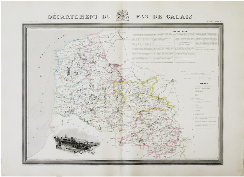
DONNET (Alexis) & FRÉMIN (Antoine-Rémy) & MONIN (Charles V.).
[PAS-de-CALAIS] Département du Pas de Calais.
Paris, Dusillion, 1841. 525x 675 mm.
Referentie van de boekhandelaar : LBW-7270
|
|
|
DONNET (Alexis) & FRÉMIN (Antoine-Rémy).
[PYRÉNÉES-ATLANTIQUES] Département des Basses Pyrennées.
Paris, Dusillion, 1841. 533x 663 mm.
Referentie van de boekhandelaar : LBW-7271

|
|
|
DONNET (Alexis) & FRÉMIN (Antoine-Rémy).
[PYRÉNÉES-ORIENTALES] Département des Pyrénnées-Orientales.
Paris, Dusillion, 1841. 538x 663 mm.
Referentie van de boekhandelaar : LBW-7272

|
|
|
DONNET (Alexis) & FRÉMIN (Antoine-Rémy).
[SAÔNE-et-LOIRE] Département de Saône et Loire.
Paris, Dusillion, 1841. 523x 665 mm.
Referentie van de boekhandelaar : LBW-7273

|
|
|
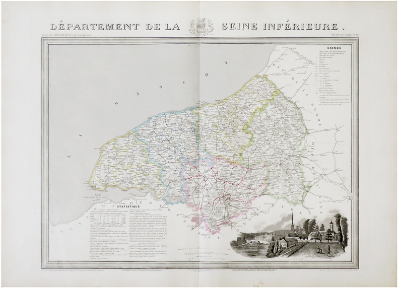
DONNET (Alexis) & FRÉMIN (Antoine-Rémy) & MONIN (Charles V.).
[SEINE-MARITIME] Département de la Seine Inférieure.
Paris, Dusillion, 1841. 522 x 656 mm.
Referentie van de boekhandelaar : LBW-7274
|
|
|
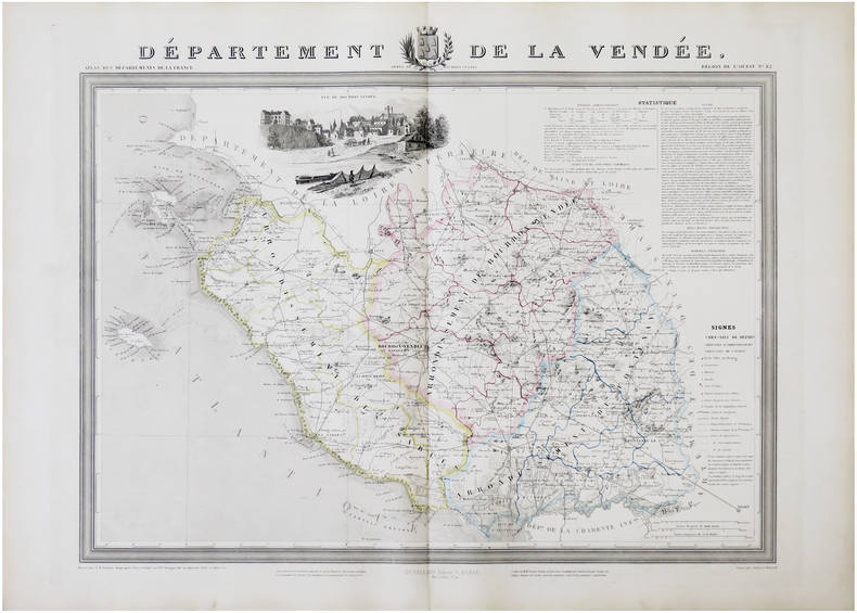
DONNET (Alexis) & FRÉMIN (Antoine-Rémy).
[VENDÉE] Département de la Vendée.
Paris, Dusillion, 1841. 532 x 671 mm.
Referentie van de boekhandelaar : LBW-7276
|
|
|
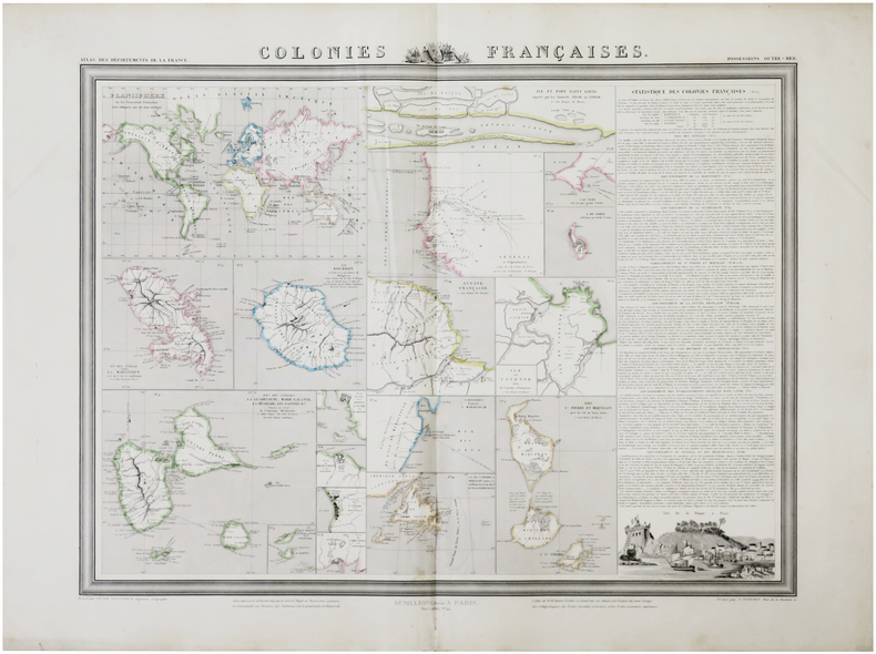
DONNET (Alexis) & FRÉMIN (Antoine-Rémy) & LEVASSEUR (Victor).
Colonies françaises.
Paris, Dusillion, 1841. 515 x 654 mm.
Referentie van de boekhandelaar : LBW-7277
|
|
|
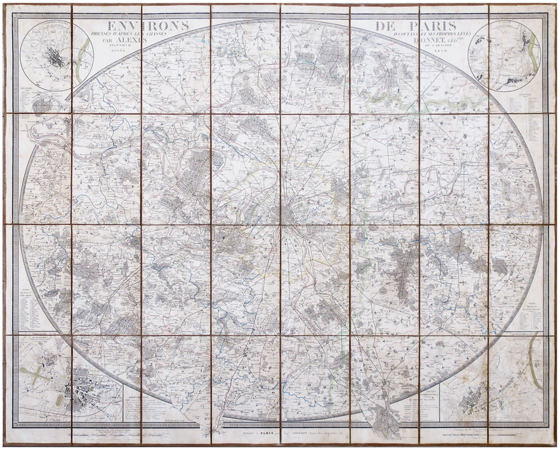
DONNET (Alexis).
Environs de Paris, dressés d'après les Chasses, D. Coutans, et ses propres levés.
Paris, Aug.te Logerot, 1850. En 28 sections montées sur toile et pliées, formant une carte de 770 x 940 mm ; étiquette au dos de l'éditeur parisien Heuguet.
Referentie van de boekhandelaar : LBW-6848
|
|
|
Donald, J.R.
The Cape Breton Coal Problem
178 pages. At the behest of the Federal Minister of Finance (Mitchell Sharp), this volume presents the results of an investigation into the Cape Breton Coal Problem plus recommended policies which might be appropriate to the situation. Confirms the steadily increasing amount of subsidy required to support the Cape Breton coal industry and stresses the urgency of adopting and implementing new policies. Contains illustrations, maps and graphs. Prior owner's signature and date upon title page. Minimal marginalia and underlining in blue ball point pen. Average wear overall with top of spine open. Book
|
|
|
Donvez, Jacques & Mills, Hugh
Paris
No marks or inscriptions. No creasing to covers or to spine. A very clean copy with bright unmarked boards and no bumping to corners. 64pp. Introduction in English and French. Colour photograhs with dual language captions of Paris around 1951.

|
|
|
Doody, Margaret Anne; Maps on End Papers [Illustrator]
Aristotle and the Secrets of Life
Century 2003-01-01. Hardcover. New. In shrink wrap. Looks like an interesting title! Century hardcover
Referentie van de boekhandelaar : Q-0712616152 ISBN : 0712616152 9780712616157

|
|
|
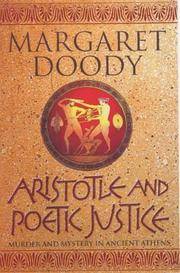
Doody, Margaret Anne; Maps & Floor-plans [Illustrator]
Aristotle And Poetic Justice
Century. Hardcover. New. New. In shrink wrap. Looks like an interesting title! Century hardcover
Referentie van de boekhandelaar : Q-0712615601 ISBN : 0712615601 9780712615600
|
|
|
Doré Gustave:
Gustave Doré - 15 tableaux de la Sainte Russie.
2024, 2019. 15 cartes postales dans leur étui et emballage d'origine, donc à l'état de neuf.
Referentie van de boekhandelaar : 24062

|
|
|
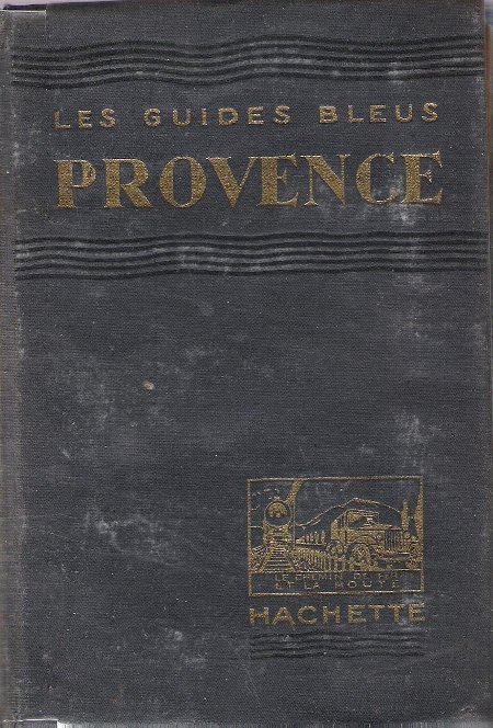
DORE Robert , LEONARD Emile G.
Les Guides Bleus : Provence . Complet De Ses Cartes Dépliantes En Couleurs
Paris Librairie Hachette 1933 In 16 Collection " Les Guides Bleus " . Excursions , nombreux plans de voyage et de villes en couleurs et noir et blanc . Une grande carte dépliante en fin d'ouvrage . Index . Cartes et Plans .- 510 p. + plans , 550 gr.
Referentie van de boekhandelaar : 012341
|
|
|
DORE Robert , LEONARD Emile G.
Les Guides Bleus : Provence . Complet De Ses Cartes Dépliantes En Couleurs
Collection " Les Guides Bleus " . Excursions , nombreux plans de voyage et de villes en couleurs et noir et blanc . Une grande carte dépliante en fin d'ouvrage . Index . Cartes et Plans .- 510 p. + plans , 550 gr.
|
|
|
Dore, R.N.
Cheshire
Ex-library book with usual marks and stamps. A very clean very tight copy with bright unmarked boards and no bumping to corners. Dust jacket not price clipped or marked or torn or creased with minor traces of storage. 192pp. A study of the County of Cheshire based on the old pre-1974 boundaries.

|
|
|
Dorin, Patrick C.
The Canadian National Railways' Story
206 pages including index. An operational and geographical study of the Canadian National and its equipment from its formation in 1919 through 1975. Told with knowledgeable text and over 400 fine black and white photos, maps and equipment rosters, enough to thrill and delight the hearts of al railroaders and railroad fans. Light wear to clean unmarked book. Dust jacket is price-clipped, moderately worn and bears several small tears each under one quarter inch in length. Very nice copy. Book
|
|
|
DOSSERAY (J.).
Tableau historique et les uniformes des différents règnes de la France depuis les Gaules jusqu'à nos jours.
Paris, J. Dosseray, [vers 1880]. 535 x 648 mm.
Referentie van de boekhandelaar : LBW-8945

|
|
|
DOWNIE (Murdo).
[ÉCOSSE] Carte particulière de la côte orientale d'Écosse depuis S.t Abb's Head jusqu'à Duncansby Head.
[Paris] Dépôt Général de la Marine, 1803. 883 x 609 mm.
Referentie van de boekhandelaar : LBW-7579

|
|
|
Dr Jonathan Andrews MAPS FCCLP
The Reconnected Heart: How Relationships Can Help Us Heal
like new. unknown
Referentie van de boekhandelaar : 42599476 ISBN : 1664215654 9781664215658

|
|
|
Dr. Jan-M. Goris,
Kaartboek van de Abdij van Tongerlo 1655-1794 (Cartografische en iconografische bronnen voor de geschiedenis van het landschap in Belgie, V)
, rijksarchief, 2001 Gebonden in een vollinnen band.groot formaat (33,5 x 24 cm). in prima staat.
Referentie van de boekhandelaar : 41943
|
|
|
Drach, Paul-Louis-Bernard; A R Fremin (Maps by); Antonio Lanzani, Johann Jacob Falkeisen, Angelini (Engravings by)
Sacra Bibbia di Vence : prima edizione italiana - opera dedicata a S. M. I. R. A. Francesco 1. Atlante contenente le carte geografiche ed iconografiche relative al testo ed alle dissertazioni
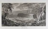
Milano: Fortunato Stella e Figli 1833. First Italian edition. Hardcover. f to vg. Oblong folio 12 6/8 x 18 1/2". 1 leaf Title 38 leaves Plates 1 leaf List of content. Original half morocco over burgundy paper covered boards. Gold lettering and tooling on spine. Rare first Italian edition of Paul-Louis-Bernard Drach's atlas volume of his "Sainte Bible de Vence" a series which was originally published in 27 volumes in Paris from 1827 to 1833. The striking 38 engraved plates featured in this atlas are composed of 13 maps by A. R. Fremin and 25 engravings signed by Falkeisen Angelini and Lanzani. The engraved plates have been laid down on beautiful hand-made paper and describe the following: 1. Map of the place of Eden Mesopotamy and Persian Gulf; 2. Noah's Arch construction; 3. Noah's Arch; 4. Map of the land divided among Noah's sons; 5. The Babel Tower; 6. Map of the Land of Canaan; 7. Map of Jews' Pilgrimage; 8. The Jerusalem Sahnedrin; 9. The Temple of Jerusalem plans and sections; 10. The Temple of Jerusalem square plan; 11. Map of ancient Jerusalem; 12. The Temple of Salomon; 13. The Temple's foundations; 14. The East Gate; 15. The Buildings of the Temple; 16. Musical Instruments of the Jews; 17. Hebrew Alphabet; 18. Jew's Vestments and worship's objects; 19. Two Menorah; 20. High Priest's vestments and Golden Menorah; 21. Moses' Tabernacle; 22. The Loaves of Proposition; 23. Plan and section of the Tabernacle; 24. The encampment of the Israelites; 25. Map of the Holy Land South; 26. Map of the Holy Land North; 27. Map of Syria; 28.Map of Israel under Salomon; 29. Plan of the House of the Forest of Lebanon; 30. The House of the Forest of Lebanon; 31. The Bronze Sea; 32. The Washings; 33. The Altars of the Holocausts; 34. Map of the Persian Empire; 35. Map of the Land of Canaan according to Ezechiel; 36. Map of Herod's Reign; 37. Zachary's Vision; 38. Map of the travels of Saint Peter and Saint Paul. The plates measure appr. 12 1/2 x 18 1/4" image size appr. : 9 1/2 x 14 6/8". Binding rubbed on covers and along edges. Head and tail of spine chipped. Previous owner's Ex-libris Calvin Bullock on inside of front cover. Minor and sporadic foxing along paper margin not affecting plates. Title and captions in Italian. Binding in overall fair interior in very good plates in near fine to fine condition. About the author: "David Paul Drach aka Paul-Louis-Bernard Drach after his conversion 1791-1865 was a Catholic convert from Judaism and librarian of the College of Propaganda in Rome. Drach received his early education from his father who was a rabbi. After spending some time in various Talmudic schools he became a teacher at Rappoltsweiler though only sixteen years of age. The love of the secular sciences brought him to Paris where he was welcomed by his coreligionists and became tutor in a wealthy Jewish family. His reputation as a teacher brought him Christian pupils; and this may have had some influence on his subsequent conversion; in fact he had always manifested some leaning toward Christianity. Drach had already begun the study of Greek and Latin so as to become acquainted with the Christian doctrines in their original sources. Struck by the accusation of some of the Fathers that the Jews had corrupted the Hebrew text he began a comparative study of the Hebrew and the Septuagint which study he continued in spite of the remonstrances of the president of the Central Consistory. Drach was received into the Catholic faith in 1823 together with his two daughters and his son Paul who afterward became a priest and a distinguished Biblical scholar. In 1827 Drach accepted the position of librarian of the Propaganda in Rome which position he held until the year of his death." From the Jewish Encyclopedia. Fortunato Stella e Figli hardcover
Referentie van de boekhandelaar : 18856
|
|
|
Drews, John
The Lakeland One Hundred
Name/date to front end paper. No other marks or inscriptions. A very clean very tight copy with bright unmarked boards and no bumping to corners. Dust jacket not price clipped or marked or torn with minor creasing to edges and a little indenting. 189pp. Circular walks to the 100 highest peaks in England's Lake District. Well illustrated.

|
|
|
Dries, Jean
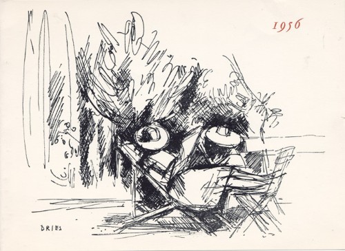
Jean Dries : carte de voeux pour 1956 et gravure originale
1956 Carte de voeux de Jean et Henriette Dries pour l'année 1956. 14,5 x 20 cm, 2ff., portant une gravure en noir en page 3, signée dans la planche et les voeux imprimés en regard.
Referentie van de boekhandelaar : 1479
|
|
|
Driver, S. R
Notes on the Hebrew Text and the Topography of the Books of Samuel. With an introduction on Hebrew palaeography and the ancient versions, and facsimiles of inscriptions and maps. [By the Rev. S. R. Driver]. 2. edition, revised and enlarged.
Oxford: The Clarendon Press 1913. XCVI, 390 Seiten. Gr. 8° (22,5-25 cm). Orig.-Leinenband. [Hardcover / fest gebunden].
Referentie van de boekhandelaar : 154154

|
|
|
DROUOT Lucien
L'AUVERGNE D'AUTREFOIS
1980 br. gd. in-8, pl. ill., envoi, nombr. repro. de cartes postales anciennes commentées, sans pagination, 144 p., 1980 horvath éd.,
Referentie van de boekhandelaar : 1180
|
|
|
Drouot Lucien
L'Auvergne d'Autrefois
Editions Horvath In-8, broché, couverture chocolat ill (Carte p.) l'ensemble est non paginé (140pp) et comporte essentiellement des reproductions de Cartes Postales légendée et commentées.Hormis une marque de pliure discrète, cet ouvrage est en bon état et de bel aspect.
Referentie van de boekhandelaar : 10753
|
|

 De zoekresultaten per email ontvangen
 Zoekresultaten downloaden als PDF
 RSS feed
 Permanente link


