|
Granzer, Randolf
Reichenberg - Stadt Und Land Im NeiBetal
796 pages. Written in German. Abundantly illustrated with black and white photographs. Includes two detailed maps stored in pocket inside back board. "Dieses Buch sollte ein Werk unseres hochverdienten Heimatfreundes Josef PreuBler werden. Es kam nicht dazu. Der Tod riB dieson besten Kenner unsurer Heimat and Bewahrer ihrer werte viel zu fruh aus unserer Mitte. Bis zur Halfte des 18. Jahrhunderts war die "Geschichte" fertiggestellt. Doch die Vielen LebensauBerungen unserer Stadt auf allen Gebieten der Kultur, Wirtschaft und Kunst blieben ungeschrieben. Wie aber wuBte er unsere Heimat gerade aus dieser Sicht in unzahliegn Vortragen, Beitragen, besonders fur die Reichenberger Zeitun und in Buchern vollendet darzustellen! Auch das Reichenberger archiv verdankt ihm eine Sammlung wertvollster Unterlagen, die er durch sein Ansehen in einem groBen BekanntenKreis und durch einen jahrelangen, umfangreichen Briefwechsel gewinnen konnte. So war reiches Material vorhanden, das nun fur den ganzen Inhalt des Buches verwendet werden konnte. Ohne seine bemuhungen hatte es nicht geschrieben werden konnen. So gesehen ist es in den Grundlagen auch sein Werk." - from Author's Foreward. Blue cloth boards decorated with partially worn gilt lettering and graphic. Front hinge open. Bit of writing upon front endpaper and reverse side of one map, else generally clean and unmarked. Contents partially yellowed. Average wear to book. Dust jacket heavily worn. Remains a useful copy. Book
|
|
|
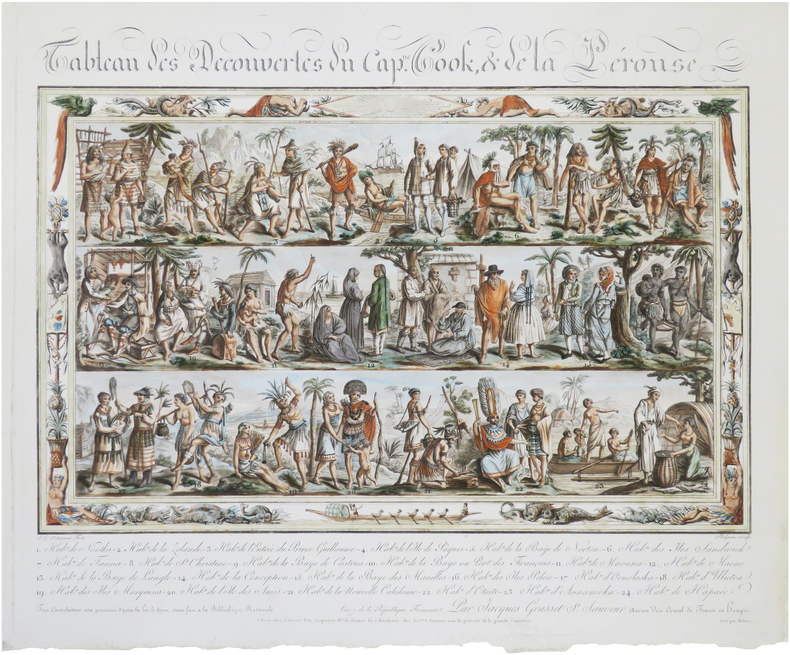
GRASSET DE SAINT-SAUVEUR (Jacques).
Tableau des découvertes du Cap.ne Cook, & de La Pérouse.
Paris, chez l'auteur, et à Bordeaux, chez la C.ne S. Sauveur, An 7 [1799]. 417 x 497 mm.
书商的参考编号 : LBW-8988
|
|
|
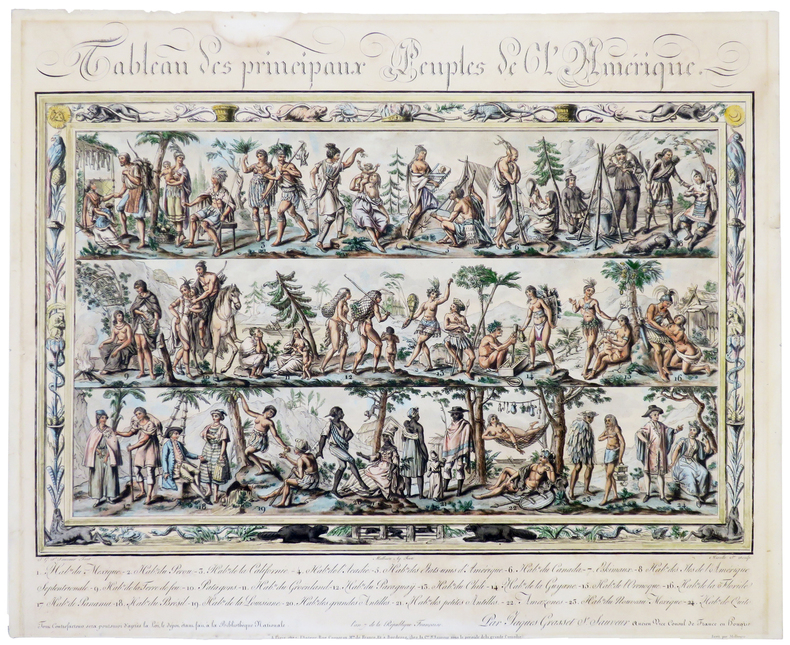
GRASSET de SAINT-SAUVEUR (Jacques).
Tableau des principaux peuples de l'Amérique.
Paris, chez l'auteur, An 7 [1799]. 417 x 497 mm, montée sur carton et sous passe-partout.
书商的参考编号 : LBW-5392
|
|
|
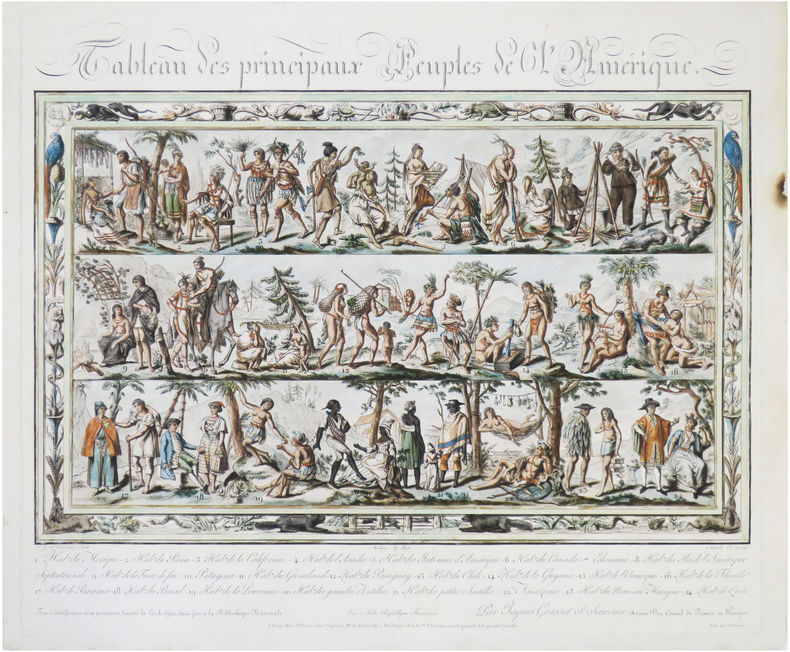
GRASSET DE SAINT-SAUVEUR (Jacques).
Tableau des principaux peuples de l'Amérique.
Paris, chez l'auteur, et à Bordeaux, chez la C.ne S.t Sauveur, An 7 [1799]. 425 x 498 mm.
书商的参考编号 : LBW-9022
|
|
|
GRASSET DE SAINT-SAUVEUR (Jacques).
Voyages pittoresques dans les quatre parties du monde, ou troisième édition de l’Encyclopédie des voyages, Contenant les Costumes des principaux Peuples de l’Europe, de l’Asie, de l’Afrique, et des Sauvages de la mer du Sud ; gravés et coloriés avec soins. Suivis d’un Précis historiques sur les Mœurs de chaque Peuple. Planches Seules
Paris, Madame veuve Hocquart, 1806, in-8, sous étui, 123 planches (160) en couleurs, gravées par Lachaussée Jeune, de costumes d'Europe (50 sur 80), d'Asie (34 sur 36), d'Afrique (18) et d'Amérique (21 sur 22), accompagnées de 5 cartes en couleurs (Amérique septentrionale, Amérique méridionale, Afrique, Asie, Europe, toutes datées de 1806, sur 6), manque les 4 frontispices, tache sur une planche sinon aucun défaut.
书商的参考编号 : PHO-1894

|
|
|
GRASSET DE SAINT-SAUVEUR (Jacques).
Voyages pittoresques dans les quatre parties du monde, ou troisième édition de l’Encyclopédie des voyages, Contenant les Costumes des principaux Peuples de l’Europe. Suivis d’un Précis historiques sur les Mœurs de chaque Peuple. EUROPE seule.
Paris, Madame veuve Hocquart, 1806, petit In-4, basane havane, dos lisse orné de compartiments finement dorés avec pièces de titre, plats ornés d'une frise dorée formant encadrements, dentelle intérieure dorée, tranches dorées. Ex-libris G. Cottereau (Coins frottés, coiffe supérieure abimée, frottements, quelques légères rousseurs.
书商的参考编号 : PHO-1913

|
|
|
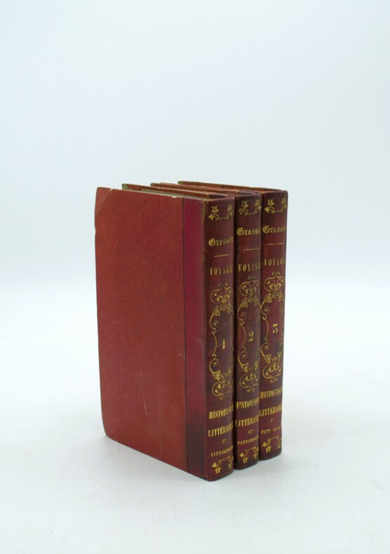
GRASSET DE SAINT-SAUVEUR, André.
Voyage historique, littéraire et pittoresque dans les isles et possessions ci-devant vénitiennes du Levant ; savoir : Corfou, Paxo, Bucintro, Parga, Prevesa, Vonizza, Sainte-Maure, Thiaqui, Cephalonie, Zante. Texte seul
Paris, Tavernier, An VIII (1800), 3 vol. in-8°, XVI, 407 ; 358 ; 383 pp., Demi veau rouge, dos lisse à décor de rocaille avec auteur,titre et tomaison au dos, rousseurs et petits frottements aux plats, cachet répété. De la bibliothèque de sa SAR le Duc de Gènes avec son étiquette en page de garde et son cachet
书商的参考编号 : PHO-2106
|
|
|
Grau, J.
Acapulco
No marks or inscriptions. A very clean very tight copy with bright unmarked boards and no bumping to corners. Dust jacket not price clipped or marked or torn with rubbing/nicks to corners. 94pp. A guide to Acapulco in Mexico -- very well illustrated in colour. Scarce in the UK.

|
|
|
Grauert, Hans / Remmert, Reinhold
Theory of Stein Spaces.
Berlin, Heidelberg : Springer (Classics in Mathematics), 2004. XXI, 254 S. (23,5 cm) Broschierte Ausgabe
书商的参考编号 : 62366
|
|
|
GRAVIER, Henri.
La Colonisation de la Louisiane à l'époque de Law. Octobre 1717 - Janvier 1721.
Paris, Masson et Cie, éditeurs, 1904. In-8 - 16x24cm. Broché, couverture rempliée. 2ff, IV, 78pp, 2 cartes. Ouvrage rare. Tirage à très petit nombre d'exemplaires. Bien complet de sa grande carte dépliante in fine.
书商的参考编号 : 1623

|
|
|
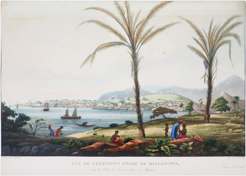
GRAY (James).
[SIERRA LEONE/FREETOWN] Vue de Freetown prise de Kingstown, sur la côte de Sierra Leone en Afrique.
[circa 1830]. 307 x 436 mm.
书商的参考编号 : LBW-8071
|
|
|
Gray, Terence.
"AND IN THE TOMB WERE FOUND." Plays and Portraits of Old Egypt. With Illustrations by W. M. Brunton.
pp. xxii, 236 + Frontis and full page drawings and maps by W. M. Brunton. Inked ownership of Mrs. C. F. Klunk, York, Pa. Tall 8vo. Original full green cloth binding, gold lettered. Binding slightly soiled. Hardbound. Includes pieces on: the Kyksos; Dirges; and the Songs in the Tomb of Yntuf the Justified.HOLY LAND BOX 1
|
|
|
Greene, Patrick (translator)
Looking at Paris
Hardcover in slip-case. Extremely slight foxing to end papers. No other marks or inscriptions. No creasing to covers or to spine. A very clean very tight copy with bright unmarked boards and no bumping to corners. Slip case repaired at lower edge with tape and with bumping to corners. 156pp. Very well illustrated study of the French capital with emphasis on its architecture and art plus its culture, food and the French people.

|
|
|
GREENHILL, Basil & WILLIS, Lionel:
The Coastal Trade. Sailing Craft of British Waters 900-1900. With paintings by Lionel Willis.
London, The Burton Press, 1975, gr. in-4to, 45 plates in color and 53 black & white illustrations, o. clothbound, o. jacket, o. slipcase.
书商的参考编号 : 77379aaf
|
|
|
Greenhood, David
Down to Earth: Mapping for Everybody
A clean, unmarked book with a tight binding. 262 pages. Full tan cloth covered boards. 8 5/8"w x 11 1/4"h. Delightful black and white line drawings by Ralph Graeter. Previous owner's name and in pencil and bookstore stamp on front endpaper.

|
|
|
GREGOIRE L.
Géographie générale.
physique,politique et économique,fort in 4 demi-chagrin rouge à nerfs,titre,filets dorés.Faux-titre,frontispice en chromolithographie indien Mandan Etats-Unis,titre avec vignette,1210 pages,16 gravures hors-texte en chromolithographie,20 illustrations hors-texte gravées sur acier, plus de 300 gravures sur bois dans le texte et à pleine page et 100 cartes dans le texte et hors texte en noir et en couleurs.. Garnier frères 1888 quelques rousseurs à certaines pages en début et fin de volume
书商的参考编号 : 6687

|
|
|
GREGOIRE L.
GEOGRAPHIE GENERALE, PHYSIQUE, POLITIQUE ET ECONOMIQUE ILLUSTREE .
Paris Garnier fréres 1877, trés fort In-4 relié demi chagrin rouge, dos à nerfs et caissons trés décorés, plats de percaline rouge, toutes tranches dorées, 1206 pages. Avec 100 cartes, certaines en couleurs et dépliantes, de nombreuses gravures intercalées dans le texte, 12 planches de types en chromolithographie couleurs sous serpentes et des gravures sur acier en hors texte. Trés bon exemplaire, complet, bien relié, bel état.
|
|
|
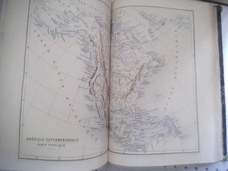
GREGOIRE L.
Géographie générale
Géographie générale Physique, politique et économique, fort in 4 demi-chagrin rouge à nerfs, titre, filets dorés. Faux-titre, frontispice en chromolithographie indien Mandan Etats-Unis, titre avec vignette, 1210 pages, 18 gravures hors-texte en chromolithographie, 20 illustrations hors-texte gravées sur acier, plus de 300 gravures sur bois dans le texte et à pleine page et 100 cartes dans le texte et hors texte en noir et en couleurs.. Garnier frères 1876 quelques rousseurs à certaines pages en début et fin de volume. Un manque angle inférieur droit au premier plat
书商的参考编号 : 13316
|
|
|
GRELIER Joseph 64 planches hors texte en héliogravure - 8 planches hors texte en couleur - 22 cartes et croquis dans le texte.
Cuba, carrefour des Caraïbes.
Couverture rigide. Cartonnage de l'éditeur. 356 pages. Jaquette défraîchie.
书商的参考编号 : 28965
|
|
|
GRENOBLE
Carte allemande couleurs au 1/200 000e.
Une feuille 56x80 cm.
|
|
|
GRENOBLE
Environs de Grenoble. Carte au 1/80 000?, r?vis?e en 1897. Tirage de 1941.
Une feuille 58x55 cm, r?par?e.
|
|
|
GRENOBLE
Grenoble N. E. Carte au 1/50 000?, type 1889, r?vis?e en 1897. Tirage de 1935.
Une feuille 75x53 cm.
|
|
|
GRENOBLE
Grenoble N. O. Carte au 1/50 000?, type 1889 ; r?vis?e en 1932. Tirage de 1936.
Une feuille 75x53 cm.
|
|
|
GRENOBLE
Grenoble S. E. Carte au 1/50 000?, type 1889, r?vis?e en 1897. Tirage de 1934.
Une feuille 75x53 cm.
|
|
|
GRENOBLE
Grenoble S. O. Carte au 1/50 000?, type 1889, r?vis?e en 1932. Tirage de 1941.
Une feuille 75x53 cm.
|
|
|
GREVIN Emmanuel.
voyage au Hoggar.Tourisme au Sahara.
Stock 1936 In-8 Broché, couverture illustrée Dédicacé par l'auteur
书商的参考编号 : 013160
|
|
|
Grierson, E.
Things Seen in Edinburgh
Lengthy inscription on reverse of frontis. No other marks. A very clean very tight copy with bright unmarked boards, slightly sunned spine, dusty/foxed page edges and no bumping to corners. Dust jacket not price clipped with small pieces missing, nicks, chips and small tears to edges and sunned spine. 157pp. Illustrated account of what to see on a visit to Edinburgh.

|
|
|
GRIFFIN (Frederick).
[IRLANDE du NORD] Northern Ireland. Ulster.
Londres, The British Travel and Holidays Association, 1955. 904 x 550 mm ; monté sur toile.
书商的参考编号 : LBW-8598

|
|
|
GRIFFIN (Frederick).
Scotland.
The Scottish Tourist Board, [circa 1960]. 972 x 587 mm.
书商的参考编号 : LBW-8438

|
|
|
Griffith, John
Charte von Klein-Asien für die Reise von Griffith. Routenkolorierte Kupferstich-Karte.
[Leipzig, J. H. Hinrichs, 1814]. 26 x 36 cm. Unter Passepartout.
书商的参考编号 : 78823

|
|
|
Griffith, John
Charte von Syrien, Mesopotamine, und einem Theile von Persien. neu entworfen von J. Griffith. Grenzkolorierte Kupferstich-Karte.
[Leipzig, J. H. Hinrichs, 1814]. 26 x 37 cm. Unter Passepartout.
书商的参考编号 : 78822

|
|
|
Grimm, Maximilian von.
Grundriss der k. k. Haupt- und Residenzstadt Wien mit ihren Vorstädten nach den neuen Hausnummern. Plan de la Ville de Vienne et de ses Fauxbourgs [...]. Wien, Artaria und Comp., 1797.
1373 x 1388 mm. Kolorierte Kupferstichkarte. 48 Segmente auf Leinen aufgezogen. Mit figürlicher Kartusche von Hieronymus Benedicti nach Grimm. In marmoriertem Schuber der Zeit mit blindgepr. Titelschild ("Plan de la Ville de Vienne et de ses Fauxbourgs") sowie einem handschriftlichen Rückenschildchen ("Plan de Vienne 1797"). Erste Auflage des sog. Grimm-Plans von Wien und Umgebung, mit den Hausnummern der 2. Häusernumerierung 1795, der den veralteten Nagel-Plan von 1780/81 ersetzte. "Ausgezeichnet ausgeführt" (Dörflinger). Grimm verkleinerte Nagels Plan um das anderthalbfache und brachte ihn auf den neuesten Stand; "das abgebildete Gebiet deckt sich fast zur Gänze mit dem der Vorlage, auch die Darstellungsweise ist nahezu identisch - lediglich die Orientierung wurde um 180° gedreht (nordost- statt südwestorientiert [...] Blatt VI enthält in tabellarischer Form ein alphabetisch geordnetes 'Verzeichniss der K. Kön. und Aerarial Gebäude', der fürstlichen, gräflichen und geistlichen Häuser, der 'Kirchen und Pfarren', der 'Academien, Schulen, Spitäler' und der 'Sehenswürdigkeiten für Fremde' sowie ein 'Register der Plätze, Straßen und Gassen'" (ebda.). - Der Schuber an den Ecken etwas berieben; die Karte wohlerhalten. Dörflinger S. 297, Art 24. Austria Picta 108.
|
|
|
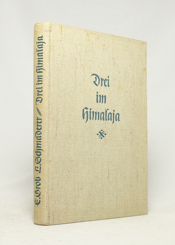
GROB Ernst; SCHMADERER Ludwig:
Drei im Himalaja.
München, Verlag F. Bruckmann, 1938. In-8 de 97 pages, pleine toile grège.
书商的参考编号 : 16735
|
|
|
GROB, Richard:
Geschichte der schweizerischen Kartographie.
Bern, Kümmerly & Frey, 1941, in-8°, 195 S. + XXVIII (Kartographische Tafeln, 31 Fig.), Original-Broschüre.
书商的参考编号 : 126363aaf
|
|
|
GROMAIRE (Marcel)
L'HOMME DE TROUPE
Paris A la belle édition 1918 In-12 carré Broché
书商的参考编号 : 011312
|
|
|
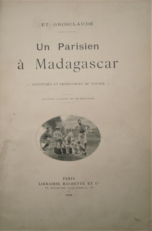
GROSCLAUDE , Étienne
Un parisien à Madagascar - Aventures et impressions de voyage
Paris, Librairie Hachette et Cie, 1898. In-4 relié demi-basane blanche de l'époque , dos lisse orné avec auteur , titre et date en pied , XVI + 368 pages. Ouvrage illustré de 138 gravures. 1 carte dépliante en couleurs( brunie partiellement) , avec une dédicace de l’auteur .
书商的参考编号 : PHO-1066
|
|
|
GROSIER (Jean-Baptiste Gabriel Alexandre).
De la Chine, ou description générale de cet Empire, rédigée d’après les Mémoires de la Mission de Pékin. Ouvrage qui contient la description topographique des quinze provinces de la Chine, celle de la Tartarie, des îles… le tableau de sa population… et l’exposé de toutes les connaissances acquises et parvenues jusqu’ici en Europe sur le gouvernement, la religion, les lois, les mœurs, les usages, les sciences et les arts des Chinois.
Paris, chez Pillet, 1818-1820. 7 vol. in-8, demi-basane époque, dos lisse avec pièces d’auteur et titre cerise et tomaison noire, tranches mouchetées, étiquette de bibliothèque en pied, quelques frottements et épidermures aux dos, petit accroc (tome 3)
书商的参考编号 : PHO-2140

|
|
|
GROSJEAN, Georges / KINAUER, Rudolf:
Kartenkunst und Kartentechnik vom Altertum bis zum Barock.
Bern; Hallwag, 1970, in-4to, 143 S. mit zahlr. Kartenabb. Original-Leinenband. Ill. Orig.-Umschlag.
书商的参考编号 : 129542aaf
|
|
|
GROSS, A.G. FREIHERRN von.
Historisch-militärisches Handbuch für die Kriegsgeschichte der Jahre 1792 bis 1808, enthaltend eine genaue Uebersicht aller Feldzüge und Landungen, welche in diesem Zeitraume Statt gefunden haben. Mit einem topographisch-militairischen Atlasses von 17...
Amsterdam, Kunst- und Industrie - Comptoir, 1808. 8vo. and folio. Textvol. bound in modest hcalf., spine worn. Atlas-volume in contemp. boards with printed title from orig frontwrapper pasted on frontboard, and later clothbacking. Corners bumped. Stamps on titlepage and old owners name. First and last leaves a little brownspotted, scattered brownspots. Atlas-volume with titlepage on which content of maps. 17 large folded engraved maps, mostly folded and in double-folio, with outline and position colouring. Maps uncut and clean.
|
|
|
GROSS, A.G. FREIHERRN von.
Historisch-militärisches Handbuch für die Kriegsgeschichte der Jahre 1792 bis 1808, enthaltend eine genaue Uebersicht aller Feldzüge und Landungen, welche in diesem Zeitraume Statt gefunden haben. Mit einem topographisch-militairischen Atlasses von 17...
Amsterdam, Kunst- und Industrie - Comptoir, 1808. 8vo. and folio. Textvol. bound in modest hcalf., spine worn. Atlas-volume in contemp. boards with printed title from orig frontwrapper pasted on frontboard, and later clothbacking. Corners bumped. Stamps on titlepage and old owners name. First and last leaves a little brownspotted, scattered brownspots. Atlas-volume with titlepage on which content of maps. 17 large folded engraved maps, mostly folded and in double-folio, with outline and position colouring. Maps uncut and clean.
书商的参考编号 : 40611
|
|
|
Gross, Alexander
The Authentic Map of London : With Index of Streets and Place of Interest
Undated, with a special underground railway map on the back cover. eng
|
|
|
Gross-Jaegerndorf:
Gross-Jaegerndorf in Preussen. "Plan der bey Gross-Jaegerndorf in Preussen den 30.Augusti A.1757 zwischen denen Kayserl. Russischen u. Königl. Preussischen Armeen vorgefallenen Bataille". Schlachtenplan von Gross-Jaegerndorf. Kupferstich mit farbigen Truppenaufstellungen aus "Neues Kriegs-Theater ...", No. 10.
Format: 18 x 29,5 cm. *Leicht gebräunt, insgesamt gut erhalten. Landkarten de
|
|
|
GROUT Jack 45 photographies de Jean-Louis Duboc. 7 croquis et cartes de Georges Commarmond.
Dans le sillage de la flibuste. Léopard normand aux Antilles.
Couverture souple. Broché. 269 pages. Couverture légèrement défraîchie.
书商的参考编号 : 147064
|
|
|
Groß-Jägerndorf:
Groß-Jägerndorf. "Plan der Bataille welche d. 30. Aug. 1757 von der Kayserl. Russischen und Königl. Preussischen Armee bei Groß-Jägerndorf in Preussen geliefert worden". Schlachtenplan von Groß-Jägerndorf. Kupferstich mit farbigen Truppenaufstellungen aus "Neues Kriegs-Theater ...", 2. Supplement.
Format: 18 x 29,5 cm. *Leicht gebräunt, insgesamt gut erhalten. Landkarten de
|
|
|
Groß-Jägerndorf:
Groß-Jägerndorf. "Plan der bey Gross-Jägerndorf, den 30 Augusti A.1757 zwischen denen Kaiserl. Russischen und Königl. Preussischen Armeen vorgefallenen Bataille". Schlachtenplan von Groß-Jägerndorf . Kupferstich mit farbigen Truppenaufstellungen aus: "Die Geschichte des jetzigen Kriegs zu unparteyischer Erkenntniß seines Anfangs ..."
Format: 18,5 x 30 cm. *Leicht gebräunt, am unteren Blattrand mit unterlegter Fehlstelle. Insgesamt gut erhalten. Landkarten de
|
|
|
Grunberg, Karl; Ernst Rath (Text); Karl Lewke (Cover design by); Helmut Klos (Maps by)
Die Sowjetarmee unser Waffenbruder The Soviet Army our brothers in arms
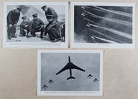
Berlin: Verlag des Ministeriums für Nationale Verteidigung 1958. First edition. Paperback. g to vg. 18 2pp text 48 loose plates 2 loose folded maps as issued. Original photo-illustrated wrap around. Published by the East German Ministry of National Defense on the occasion of the 40th anniversary of the Red Army this work features 48 b/w photographic plates depicting the Soviet Army in action during the Russian Civil War 1917-1922 the Second World War 1941-1945 to the annual Moscow Military Parade held on the 40th anniversary of the Bolshevik Revolution November 7 1957. Includes two color folded maps The fronts of the civil war and the armed intervention 1918-1920; and The Great Patriotic War 1941-1945. Moderate rubbing along edges of wrappers. Text and captions in German. Wraps in overall good interior in good to very good condition. Verlag des Ministeriums für Nationale Verteidigung paperback
书商的参考编号 : 37615
|
|
|
GRUNER Gottlieb Sigmund:
Histoire naturelle des glacières de la Suisse. Traduction libre de l'allemand de M. Grouner par M. de Kéralio.
Paris, Panckoucke, 1770. In-4 de XIV-[2]- XIV-372 pages, demi-veau brun, dos à nerfs orné de filets dorés, pièce de titre en maroquin rouge, tranches rouges. Reliure pastiche XXème.
书商的参考编号 : 18491
|
|
|
GRÆVIUS (Johann Georg) & AA (Pieter van der).
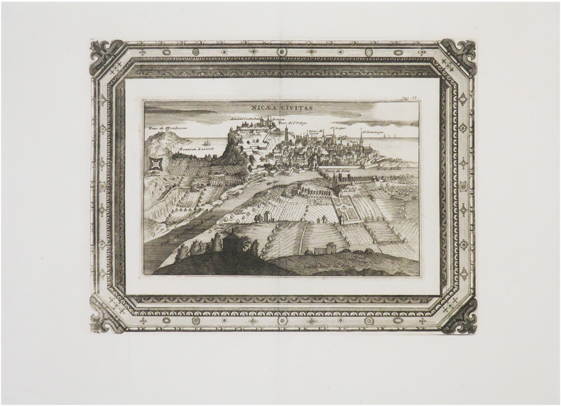
[NICE] Nicæa civitas.
[Leyde, Petrus van der Aa, 1723]. 220 x 292 mm.
书商的参考编号 : LBW-8965
|
|
|
Grégoire Jean-Yves
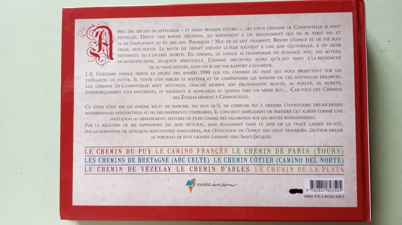
Tous les chemins mènent à Compostelle
Rando Editions 2007 254 pages 24 6x2x17 4cm. 2007. Broché. 254 pages.
书商的参考编号 : 500196802
|
|
|
Gróf, László L
Ortelius' Maps of Hungary.
Tring, Herfordshire, Map Collector Publ. Ltd, 1979. 30 x 21 cm. 10 (num. 2-11) S. mit zahlr. Abb. Illustrierter Originalkarton (Softcover). Schönes gepflegtes Exemplar. In: The Map Collector ; #6, March 1979.
书商的参考编号 : 16775AB

|
|

 ?????????
 ?????PDF???
 RSS feed
 ??
??


