|
Collins Maps
World Atlas
HarperCollins Publishers Limited. Used - Very Good. Ships from the UK. Used book that is in excellent condition. May show signs of wear or have minor defects. HarperCollins Publishers Limited unknown
Bookseller reference : 12520044-6 ISBN : 0007393571 9780007393572

|
|
|
Collins Maps
World Atlas: Essential Edition
Collins. Paperback. Used; Very Good. Simply Brit welcome to our online used book store where affordability meets great quality. Dive into a world of captivating reads without breaking the bank. We take pride in offering a wide selection of used books from classics to hidden gems ensuring theres something for every literary palate. All orders are shipped within 24 hours and our lightning fast-delivery within 48 hours coupled with our prompt customer service ensures a smooth journey from ordering to delivery. Discover the joy of reading with us your trusted source for affordable books that do not compromise on quality. 03/03/2011 Collins paperback
Bookseller reference : 3583377 ISBN : 0007419767 9780007419760

|
|
|
Collins Maps
World Atlas: Paperback Edition
Collins. Paperback. Used; Very Good. Simply Brit welcome to our online used book store where affordability meets great quality. Dive into a world of captivating reads without breaking the bank. We take pride in offering a wide selection of used books from classics to hidden gems ensuring theres something for every literary palate. All orders are shipped within 24 hours and our lightning fast-delivery within 48 hours coupled with our prompt customer service ensures a smooth journey from ordering to delivery. Discover the joy of reading with us your trusted source for affordable books that do not compromise on quality. 02/03/2011 Collins paperback
Bookseller reference : 3710363 ISBN : 0007419759 9780007419753

|
|
|
Collins Maps
World Atlas
HarperCollins Publishers Limited. Used - Very Good. Ships from the UK. Former library book; may include library markings. Used book that is in excellent condition. May show signs of wear or have minor defects. HarperCollins Publishers Limited unknown
Bookseller reference : 18771348-20 ISBN : 0008102074 9780008102074

|
|
|
Collins Maps
World Atlas
HarperCollins Publishers Limited. Used - Good. Ships from the UK. Used book that is in clean average condition without any missing pages. HarperCollins Publishers Limited unknown
Bookseller reference : 199483-20 ISBN : 000743782x 9780007437825

|
|
|
Collins Maps
World Atlas
HarperCollins Publishers Limited. Used - Good. Ships from the UK. Used book that is in clean average condition without any missing pages. HarperCollins Publishers Limited unknown
Bookseller reference : 17986317-6 ISBN : 0007393571 9780007393572
|
|
|
Collins Maps
World Atlas : Paperback Edition
HarperCollins Publishers Limited. Used - Good. Ships from the UK. Former library book; may include library markings. Used book that is in clean average condition without any missing pages. HarperCollins Publishers Limited unknown
Bookseller reference : 14001318-6 ISBN : 0007419759 9780007419753
|
|
|
Collins Maps
World Atlas
HarperCollins Publishers Limited. Used - Good. Ships from the UK. Former library book; may include library markings. Used book that is in clean average condition without any missing pages. HarperCollins Publishers Limited unknown
Bookseller reference : 13555054-6 ISBN : 0008102074 9780008102074
|
|
|
Collins Maps
World Atlas Collins Junior Atlas
Collins 02/03/2011. New Second edition. Paperback. Used; Very Good. WE SHIP WITHIN 24 HRS FROM LONDON UK 98% OF OUR ORDERS ARE RECEIVED WITHIN 7-10 DAYS. We believe you will be completely satisfied with our quick and reliable service. All orders are dispatched as swiftly as possible! Buy with confidence! Greener Books. Collins paperback
Bookseller reference : 2791408 ISBN : 0007393571 9780007393572
|
|
|
Collins Maps
World Atlas Collins Junior Atlas
Collins 02/03/2011. New Second edition. Paperback. Used; Good. WE SHIP WITHIN 24 HRS FROM LONDON UK 98% OF OUR ORDERS ARE RECEIVED WITHIN 7-10 DAYS. We believe you will be completely satisfied with our quick and reliable service. All orders are dispatched as swiftly as possible! Buy with confidence! Greener Books. Collins paperback
Bookseller reference : 1801181 ISBN : 0007393571 9780007393572
|
|
|
Collins Maps
World Atlas: Reference Edition
Paperback. Very Good. paperback
Bookseller reference : GOR006449065 ISBN : 0007500378 9780007500376

|
|
|
Collins Maps
World Atlas Collins Student Atlas
Paperback. Very Good. paperback
Bookseller reference : GOR004807438 ISBN : 0007437811 9780007437818

|
|
|
Collins Maps
World Atlas Collins Student Atlas
Paperback. Very Good. paperback
Bookseller reference : GOR004807439 ISBN : 000743782X 9780007437825

|
|
|
Collins Maps
World Atlas: Paperback Edition
Paperback. Very Good. paperback
Bookseller reference : GOR003880076 ISBN : 0007419759 9780007419753

|
|
|
Collins Maps National Parks UK
Yorkshire Dales National Park Pocket Map: The perfect guide to explore this area of outstanding natural beauty
Harper Collins Publishers pp. 1 . Hardback. New. Harper Collins Publishers hardcover
Bookseller reference : 6384734575 ISBN : 0008439249 9780008439248
|
|
|
Collins Maps
Yorkshire Dales National Park Pocket Map
Sheet map folded. New. New Book; Fast Shipping from UK; Not signed; Not First Edition; Handy little full-colour map and guide of Yorkshire Dales National Park. Detailed mapping and visitor information to the National Park along with a selection of photographs. Map at a scale of 1:140 000 1cm to 1.40km 2.2 mi unknown
Bookseller reference : ria9780008439248_inp ISBN : 0008439249 9780008439248

|
|
|
Collins Maps
Yorkshire Dales National Park Pocket Map: The perfect guide to explore this area of outstanding natural beauty
Paperback. Very Good. paperback
Bookseller reference : GOR011934852 ISBN : 0008439249 9780008439248

|
|
|
Collins Maps
London Pocket Atlas
POCHE EN TRES BON ETAT. HARPER COLLINS, 2015. 144 PAGES. PHOTOS SUR DEMANDE
Bookseller reference : PM840C20 ISBN : 8104573
|
|
|
Collins, Maps
Short Walks in the North York Moors
HarperCollins UK 2015. Paperback. Very Good. May have limited writing in cover pages. Pages are unmarked. ~ ThriftBooks: Read More Spend Less.Dust jacket quality is not guaranteed. HarperCollins UK paperback
Bookseller reference : G0008101574I4N00 ISBN : 0008101574 9780008101572

|
|
|
COLMAR
Carte allemande au 1/80 000?. Fin XIXe.
1 feuille repli?e. 31,5x45 cm.
|
|
|
COLMAR
Carte d'Etat-Major au 1/200 000?. Fin XIXe.
1 feuille repli?e. 32x49 cm.
|
|
|
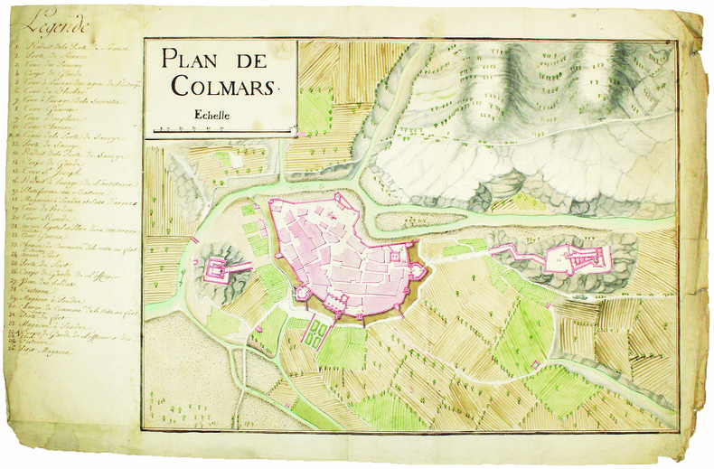
COLMARS. MANUSCRIT.
Plan de Colmars.
[circa 1750]. En deux feuilles jointes de 395 x 600 mm.
Bookseller reference : LBW-4174
|
|
|
color maps throughout
The Prentice-Hall American world atlas
Prentice-Hall Inc. hardcover. Good. Buy with confidence. Excellent Customer Service & Return policy. Prentice-Hall, Inc hardcover
Bookseller reference : ANAIS-0136950248 ISBN : 0136950248 9780136950240

|
|
|
color maps throughout
The Prentice-Hall American world atlas
0000-00-00. hardcover. Used: Good. xx. Buy with confidence. Excellent Customer Service & Return policy. hardcover
Bookseller reference : SONG0136950248 ISBN : 0136950248 9780136950240
|
|
|
COLTON (Joseph Hutchins).
[DANEMARK] Denmark.
New York, 1855. 402 x 327 mm.
Bookseller reference : LBW0394f
|
|
|
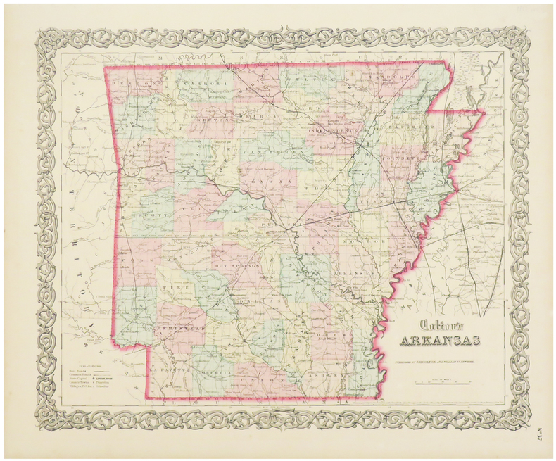
COLTON (Joseph Hutchins).
Arkansas.
New York, 1855. 402 x 327 mm.
Bookseller reference : LBW03588
|
|
|
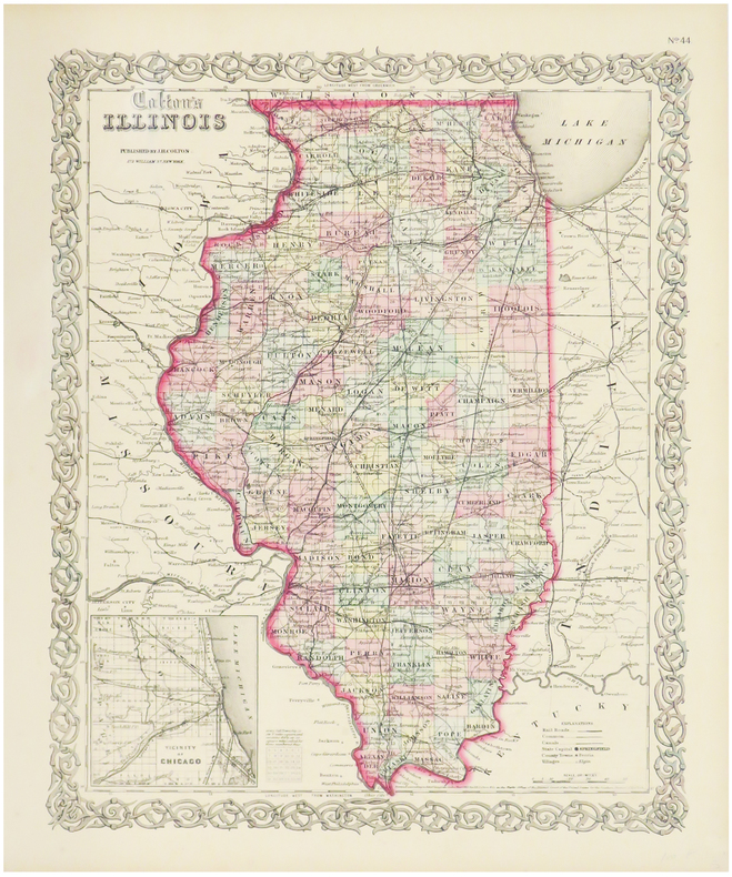
COLTON (Joseph Hutchins).
Illinois.
New York, 1855. 400 x 327 mm.
Bookseller reference : LBW0357e
|
|
|
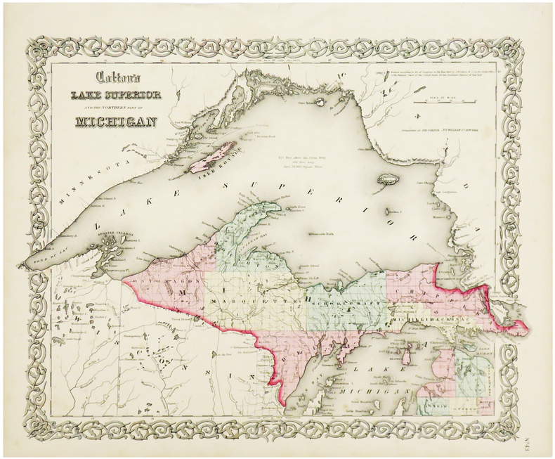
COLTON (Joseph Hutchins).
Lake Superior and the northern part of Michigan.
New York, 1855. 327 x 415 mm.
Bookseller reference : LBW0358a
|
|
|
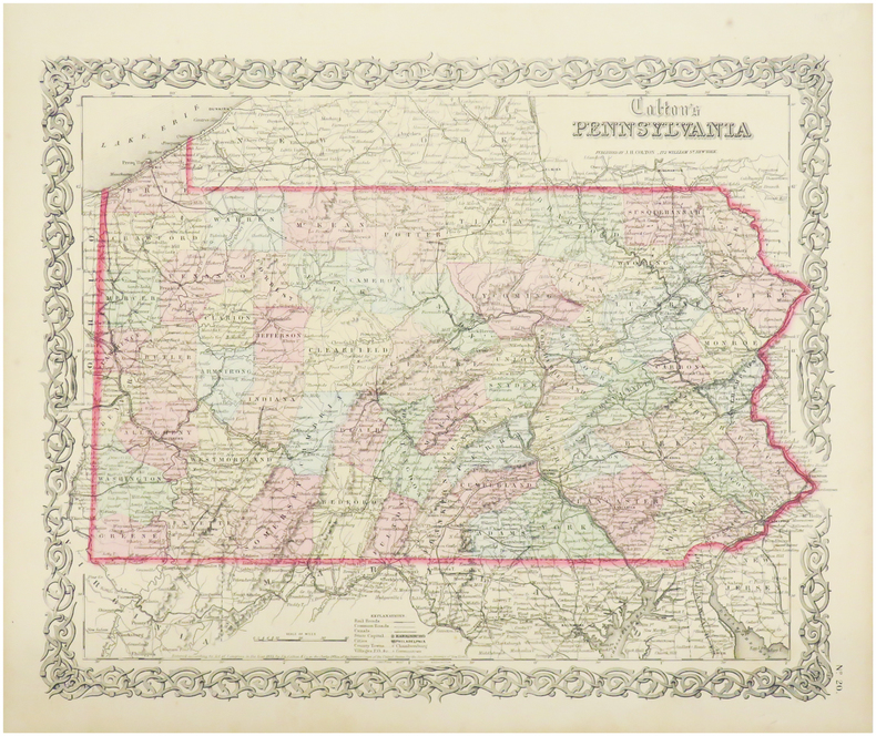
COLTON (Joseph Hutchins).
Pennsylvania.
New York, 1855. 330 x 405 mm.
Bookseller reference : LBW0358c
|
|
|
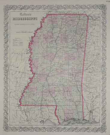
COLTON (Joseph Hutchins);
Mississippi.
New York 1855 402 x 325 mm.
Bookseller reference : LBW0358b
|
|
|
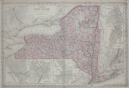
COLTON (Joseph Hutchins);
New York.
New York 1858 434 x 637 mm.
Bookseller reference : LBW03587
|
|
|
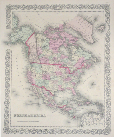
COLTON (Joseph Hutchins);
North America.
New York 1855 403 x 338 mm.
Bookseller reference : LBW0357f
|
|
|
COLTON (Joseph Hutchins);
Turkey in Europe.
New York 1855 332 x 402 mm.
Bookseller reference : LBW0394e
|
|
|
Columbia Fun Maps Co
Columbia Fun Maps: Mapping the Gay and Lesbian World Manhattan 2001 Edition
New York: Columbia Fun Map Co 2001. Softcover. Very Good with a bit of handling. Twelve pp. 9 1/2" x 8" folded in half to create 48 9 1/2" x 4" pp. With full page color map of Manhattan and detailed map of Chelsea and Greenwich Village. Uncommon item. WorldCat lists only a handful of each of the 1992 1995 and 2005 editions. Columbia Fun Map Co unknown
Bookseller reference : 621202501

|
|
|
Combeaud Bernard
La Gironde
Editions Milan 1998 22 098x0 762x28 194cm. 1998. album.
Bookseller reference : 500082382

|
|
|
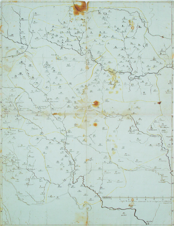
COMBET (Emile). MANUSCRIT.
Carte routière de quelques communes du canton de St Germain de Calberte en grande partie.
[circa 1790]. 524 x 400 mm, sur papier bleuté.
Bookseller reference : LBW-4167
|
|
|
Combinatorial Maps: Efficient Data Structures For Computer Graphics And Image Processing
4
CRC Press: Academic & Professional United Kingdom. Hardbound/Brand New. 9781482206524. Damiand Guillaume. Academic & Professional hardcover
Bookseller reference : STM-9781482206524
|
|
|
Combined Maps
Combined Maps of Greater London and Central London
London: Combined Maps Inc. Good with no dust jacket. No pub date. Paperback. New & revised . Combined Maps, Inc. paperback
Bookseller reference : 83448
|
|
|
Comite national de geographie ; Margerie, Emmanuel de (pref.) ; Perret, Robert (dir.)
Atlas de France métropole
Paris: C.N.R.S. 1959. Livre. Bon. En Feuilles. Grand In-folio. Paris Centre national de la recherche scientifique CNRS Editions géographiques de France sd 1959. 50 x 32 cm grand in-folio 4 ff. 80 cartes à doubles page réhaussées de couleurs légendées au recto en feuilles sous portefeuille vert de l'éditeur. Nouvelle et meilleure édition de ce rare atlas fruit de 30 années de recherches scientifiques. Déchirures au portefeuille dont le premier plat est détaché tampons de la bibliothèque d'un lycée sur la page de titre et au recto de chaque planche sinon un bon exemplaire. C.N.R.S. Paperback
Bookseller reference : 0658

|
|
|
Comité de Coordination des Comités d'Action.
C.R.S. dans les usines...
Paris Comité de Coordination des Comités d'Action 1968 1 vol. en feuilles Tract dactylographié non daté (7 juin) dénonçant les violences policières pour disperser grévistes et étudiants à Flins, et appelant à rejoindre la manifestation organisée à la gare Saint-Lazare le soir même.
Bookseller reference : 93132
|
|
|
Commandant BOUVIER DE LAMOTTE
Précis de la Grande Guerre (France et Belgique) (1914-1915-1916-1917-1918)
1919 Le Pays de France, Paris - 1919 - In-8, broché - 160 pages - Contient "36 cartes et plans et un curieux graphiques de la guerre" - "Ouvrage destiné spécialement aux touristes qui voudront visiter et suivre les opérations sur les champs de bataille. "
Bookseller reference : 123947

|
|
|
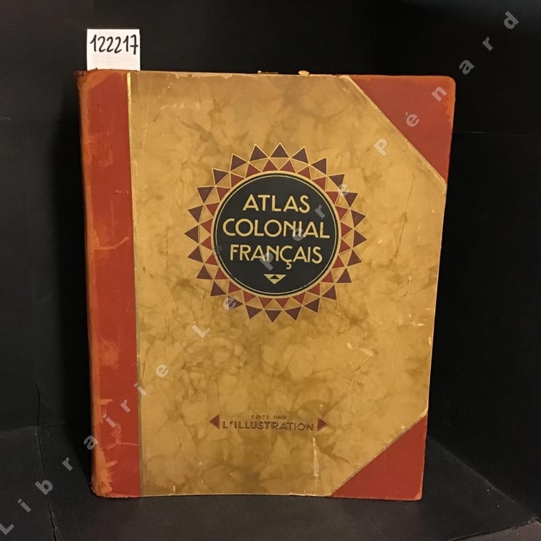
Commandant P. POLLACCHI
Atlas colonial français. Colonies, protectorat et pays sous mandat.
1929 Editions L'Illustration - 1929 - Grand in-folio, reliure de l'éditeur, demi basane à coins, titre et décoration sur le premier plat - 320 pages - 56 cartes en couleurs et très nombreuses illustrations et reproductions photographiques en N&B in et hors-texte
Bookseller reference : 122217
|
|
|
COMMERCY
Carte au 1/80 000e. Voies carrossables et population indiqu?es en rouge.
Une feuille 89x64 cm.
|
|
|
Commission, Massachusetts Historical; Illus. With Maps (Illustrator)
Historic and Archaeological Resources of the Connecticut Valley: A Framework for Preservation Decisions
MA Historical Commission 1988. Paperback. Very Good. L 4to 9.75 - 12'' tall. Paperback. Book Condition: Very Good. MA Historical Commission 1988. 321 pages. Nice Firm Clean copy ! Light general wear. Size: L 4to 9.75 - 12'' tall. History::Archaeology New England::History 6958L 6958L MA Historical Commission paperback
Bookseller reference : 106854
|
|
|
COMMISSION des PHARES;
[PHARES] Carte des phares des côtes de France.
1876 En 18 sections montées sur toile et pliées, formant une carte de 743 x 992 mm montée dans une reliure en demi-chagrin vert de l'époque.
Bookseller reference : LBW-1497

|
|
|
Common English Bible; National Geographic Maps [Illustrator]
CEB Common English Bible New Testament Decotone: DecoTone Tan/Chocolate Brown
Common English Bible 2010-10-01. Imitation Leather. New. In shrink wrap. Looks like an interesting title! Common English Bible hardcover
Bookseller reference : Q-1609260015 ISBN : 1609260015 9781609260019

|
|
|
Common English Bible; National Geographic Maps [Illustrator]
CEB Common English Bible New Testament Softcover
Common English Bible 2010-10-01. Paperback. New. 84x16x132. Common English Bible paperback
Bookseller reference : 1609260066-11-25160307 ISBN : 1609260066 9781609260064

|
|
|
Common English Bible; National Geographic Maps [Illustrator]
CEB Common English Bible New Testament Softcover
Common English Bible 2010-10-01. Paperback. Good. 5x1x8. Common English Bible paperback
Bookseller reference : 1609260066-3-24234765 ISBN : 1609260066 9781609260064
|
|
|
Common English Bible; National Geographic Maps [Illustrator]
CEB Common English Bible New Testament Softcover
Common English Bible 2010-10-01. Paperback. New. New. In shrink wrap. Looks like an interesting title! Common English Bible paperback
Bookseller reference : Q-1609260066 ISBN : 1609260066 9781609260064
|
|
 Receive by email
 Download as PDF document
 RSS feed


