|
|
|
MUNSTER
Carte couleurs au 1/50 000e. Carroyage kilom?trique. Type 1922. Tirage de 1944.
Une feuille 60x78 cm.
|
|
|
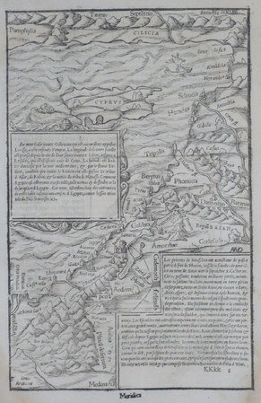
MUNSTER (Sebastian);
[CHYPRE/TERRE SAINTE].
1555 263 x 169 mm.
书商的参考编号 : LBW06203
|
|
|
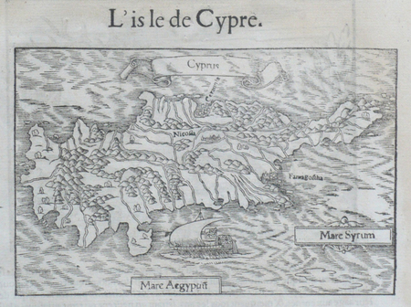
MUNSTER (Sebastian);
[CHYPRE] L'Isle de Cypre.
1555 96 x 150 mm.
书商的参考编号 : LBW06206
|
|
|
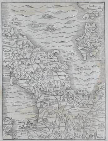
MUNSTER (Sebastian);
[ITALIE DU NORD].
1555 228 x 172 mm.
书商的参考编号 : LBW061fe
|
|
|
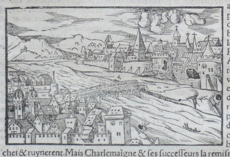
MUNSTER (Sebastian);
[PADOUE] Padoue.
1555 65 x 102 mm.
书商的参考编号 : LBW06205
|
|
|
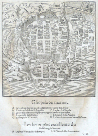
MUNSTER (Sebastian);
[SARDAIGNE] Calaris Sardiniae caput.
1555 181 x 179 mm.
书商的参考编号 : LBW06200
|
|
|
MUNSTER (Sebastian);
[SYRACUSE].
1555 104 x 112 mm.
书商的参考编号 : LBW06202

|
|
|
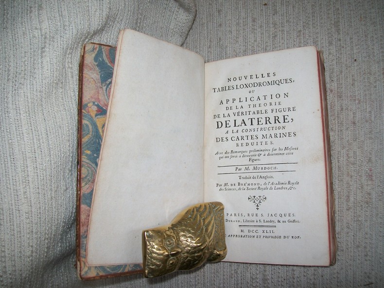
MURDOCH
NOUVELLES TABLES LOXODROMIQUES ou application de la théorie de la véritable figure de la Terre à la construction des cartes marines réduites. Traduit de l'anglois par M de Brémond.
A Paris chez Durand 1742. In-8 1f n ch IV-XVI 2-158pp. Pleine basane havane, dos à nerfs orné de compartiments dorés, tranches brique, rel époque. Orné de 4 planches hors texte dépliantes regroupant 14 figures. Coiffes et 3 coins usés avac manques, 1 mors fendu sur 3cm, plats frottés, parfait état intérieur. Poggendorff II, 241. Polak 6923. 1re édition.
书商的参考编号 : GIT00868
|
|
|
Murdoch, James with Maps by Isoh Yamagata
A History of Japan 3 Volumes : Vol I - from the Origins to the Arrival of the Portuguese in 1542 Vol II - During the Century of Early Foreign Intercourse 1542-1651 Vol III - the Tokugawa Epoch 1652-1868
Kegan Paul Trench Trubner 1949-01-01. Hardcover. Good. 3 volume set. Bound in publisher's green cloth with gilt lettering. Very good bindings and covers. Spines slightly sunned. viii 667 viii 743 xvi 823 pp index many color folding maps. Light foxing. Contents: Vol. 1. From the origins to the arrival of the Portuguese in 1542 A.D.; Vol. 2. During the century of early foreign intercourse 1542-1651; Vol. 3. Tokugawa epoch 1652-1868. <br> Vol. 1-2 3rd impression. Vol. 3 1st impression. Vol. 3 revised and edited by Joseph H. Longford. At Longford's death the work was transferred to L.M.C. Hall. Maps by Isoh Yamagata. First published in 1903 Murdoch's work quickly became an important reference in Japanese history. <br> This is an oversized or heavy book which requires additional postage for international delivery outside the US. Kegan Paul, Trench, Trubner hardcover
书商的参考编号 : 1807230045

|
|
|
Murdoch, James with Maps by Isoh Yamagata
A History of Japan 3 Volumes : Vol I - from the Origins to the Arrival of the Portuguese in 1542 Vol II - During the Century of Early Foreign Intercourse 1542-1651 Vol III - the Tokugawa Epoch 1652-1868
Kegan Paul Trench Trubner 1926. Hardcover. Very Good. 3 volume set. Bound in publisher's green cloth with gilt lettering. Very good bindings and covers. viii 667 viii 743 xvi 823 pp index many color folding maps. Light foxing. Contents: Vol. 1. From the origins to the arrival of the Portuguese in 1542 A.D.; Vol. 2. During the century of early foreign intercourse 1542-1651; Vol. 3. Tokugawa epoch 1652-1868. Vol. 3 revised and edited by Joseph H. Longford. At Longford's death the work was transferred to L.M.C. Hall. Maps by Isoh Yamagata. First published in 1903 Murdoch's work quickly became an important reference in Japanese history. <br> This is an oversized or heavy book which requires additional postage for international delivery outside the US. Kegan Paul, Trench, Trubner hardcover
书商的参考编号 : 1808090055
|
|
|
Murer, Josef
Der uralten wytbekannten Statt Zürich gestalt und gelägenheit, wie sy zu diser zyt in wäsen, ufgerissen und in grund gelegt, durch Josefen Murer und durch Christoffel Froschower, zu Eeren dem Vatterland getruckt, Im M.D.LXXVI Jar
Gattikon, Verlag Dorfpresse., 1966. Zehnfarben Lithografie auf festem Papier. Blattgrösse: 97 x 139 cm. + Wichtig: Für unsere Kunden in der EU erfolgt der Versand alle 14 Tage verzollt ab Deutschland / Postbank-Konto in Deutschland vorhanden +, Abbildung
书商的参考编号 : 1123DG

|
|
|
Murer, Josef
Der uralten wytbekannten Statt Zürich gestalt und gelägenheit, wie sy zu diser zyt in wäsen, ufgerissen und in grund gelegt, durch Josefen Murer und durch Christoffel Froschower, zu Eeren dem Vatterland getruckt, Im M.D.LXXVI Jar
Gattikon, Verlag Dorfpresse., 1966. Lithografie auf festem Papier. Blattgrösse: 97 x 139 cm. + Wichtig: Für unsere Kunden in der EU erfolgt der Versand alle 14 Tage verzollt ab Deutschland / Postbank-Konto in Deutschland vorhanden +, A|B [2 Warenabbildungen]
书商的参考编号 : 1733AG

|
|
|
Murer, Josef
Der uralten wytbekannten Statt Zürich gestalt und gelägenheit, wie sy zu diser zyt in wäsen, ufgerissen und in grund gelegt, durch Josefen Murer und durch Christoffel Froschower, zu Eeren dem Vatterland getruckt, Im M.D.LXXVI Jar
Gattikon, Verlag Dorfpresse., 1966. Zehnfarben Lithografie auf festem Papier. Blattgrösse: 97 x 139 cm. + Wichtig: Für unsere Kunden in der EU erfolgt der Versand alle 14 Tage verzollt ab Deutschland / Postbank-Konto in Deutschland vorhanden +, A
书商的参考编号 : 744DG

|
|
|
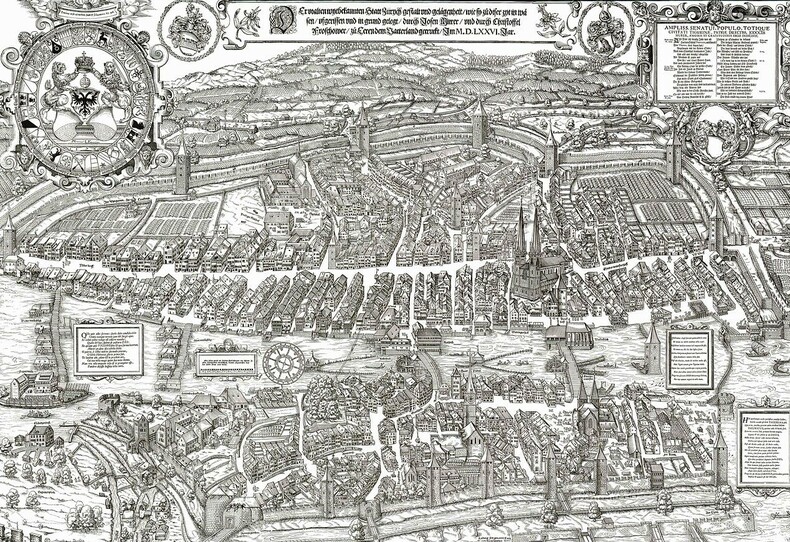
Murer, Josef:
Der uralten wytbekannten Statt Zürich gestalt und gelägenheit, wie sy zu diser zyt in wäsen, ufgerissen und in grund gelegt, durch Josefen Murer und durch Christoffel Froschower, zu Eeren dem Vatterland getruckt, Im M.D.LXXVI Jar
Gattikon, Verlag Dorfpresse. 1966. Lithografie auf festem Papier. Blattgrösse: 97 x 139 cm.
书商的参考编号 : 1733AG
|
|
|
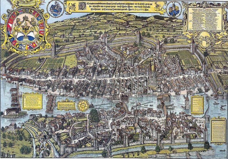
Murer, Josef:
Der uralten wytbekannten Statt Zürich gestalt und gelägenheit, wie sy zu diser zyt in wäsen, ufgerissen und in grund gelegt, durch Josefen Murer und durch Christoffel Froschower, zu Eeren dem Vatterland getruckt, Im M.D.LXXVI Jar
Gattikon, Verlag Dorfpresse. 1966. Zehnfarben Lithografie auf festem Papier. Blattgrösse: 97 x 139 cm.
书商的参考编号 : 744DG
|
|
|
MURER, Josen und FROSCHAUER, Christoffel:
Vogelschau-Plan von Zürich. Anno 1576.
Zürich, Lithogr. J.J. Hofer & Burger, n-8vo, gef. 1 Blatt mit Abb. und Beschreibung von 63 Nummern der Murer-Karte / + gef. kolorierte Murer-Karte (ausgefaltet: 55 x 72 cm.), ill. Original-Umschlag, Leinen Rückenstreifen.
书商的参考编号 : 140615aaf
|
|
|
MURGIER H. Cartes et illustrations de A. Vasset.
La France et les cinq parties du monde. Cours pratique de géographie.
Couverture rigide. Cartonnage de l'éditeur. 116 pages. 18 x 23 cm.
书商的参考编号 : 6598

|
|
|
MURRAY'S HANDY CLASSICAL MAPS.
Italia and Sicilia. Edited by G.B. Grundy. (Including) Index.
London, John Murray, n.d. (ca. 1903)
书商的参考编号 : 155159
|
|
|
MURRAY, G.W.
Sons of Ishmael. A Study of the Egyptian Bedouin
London. George Routledge & Sons. 1935. grand in-8 , illustré de 1 frontispice ,31 planches HT ,figures et cartes dans le texte ainsi qu’un tableau généalogique .
书商的参考编号 : PHO-938

|
|
|
Murray, Hugh (1779-1846).
THE ENCYCLOPEDIA OF GEOGRAPHY, COMPRISING A COMPLETE DESCRIPTION OF THE EARTH. Revised, With Additions By Thomas G. Bradford. In Three Volumes.
Three Volumes. Illustrated with 82 maps and about 1100 other wood engravings. Also a color folding map of the United States in Volume III. Early manuscript ownership of Martin Buckhart and A. B. Burkhart, 1895 in all three volumes. 4to. 260 mm. Original full leather bindings. Original leather spine labels. Spine of volume III worn with loss at tail. Hardbound. Very good. Title continues: 'Physical, Statistical, Civil, And Political; Exhibiting Its Relation To The Heavenly Bodies, Its Physical Structure, The Natural History Of Each Country, And The Industry, Commerce, Political Institutions, And Civil And Social State Of All Nations.' S&S/AI 40-4803. Handsome set. PALIB 4
|
|
|
Musham, H.A.
The Technique of the Terrain: Maps and Their Use in the Field in Peace and War
228 pages. Index. "Intended as a text on maps and their uses in field operations in war and peace." - from Preface. Prior owner's details inside front board. Book

|
|
|
Musée Postal
Notices historiques sur la poste aux lettres/Historische toelichtingen over de brievenpost.
Bruxelles, Musée Postal, 1936. "15 x 23, 47 pp., 2 figures, broché, bon état; accompagné de 9 cartes postale anciennes."
书商的参考编号 : 46927
|
|
|
Muthiah, S. and R. P. Arya
The Map's Road Atlas of India
TPT - Tamilnad Printers and Traders (formerly Maps & Atlases Publications), Chromepet, Madras, 1982. 22 cm ; broschiert
书商的参考编号 : 99394

|
|
|
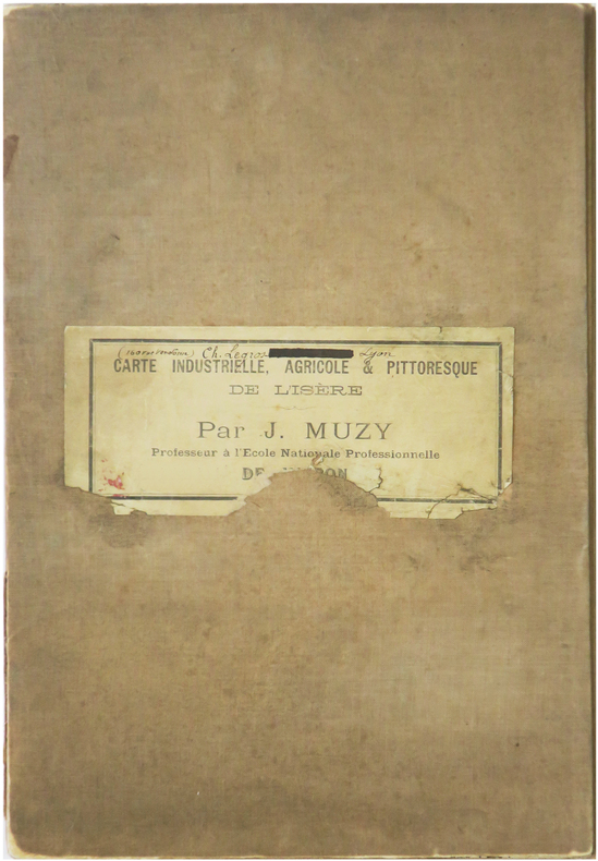
MUZY (Jean-François).
[ISÈRE] Le Département de l'Isère, industriel, agricole & pittoresque.
Voiron, chez l'auteur, [1897]. En 28 sections montées sur toile et repliées, formant une carte de 1,15 x 1,39 m ; étiquette au dos portant le titre et le nom de l'auteur.
书商的参考编号 : LBW-9024
|
|
|
Mylonas, George E.
Ancient Mycenae: The Capital City of Agamemnon
Book shows light wear to covers only: slight edge wear, small stain at lower front cover. Binding is solid and square, covers have sharp corners, text/interior is clean and free of marking of any kind. 201 pages with another 87 images over the last section of the book, mostly b&w photos, some maps, drawings. Contents include: Mycenae and her walls, The palace and the houses of the citadel, Houses and graves , Grave circle A, Grave circle B and the new shaft graves.
|
|
|
MYTHOLOGIES par Pierre GRIMAL et collaborateurs.
Mythologies. Préhistoire, Egypte, Sumer, Babylone, Hittites, Sémites, Grèce, Rome, Perse, Inde. Richement documenté (planches, gravures, héliogravures, dessins, cartes).
Paris, éd. Larousse 1963. Bon exemplaire relié, reliure usagée, fort in-4, 282 pages avec annexes dont index.
书商的参考编号 : AUB-4191
|
|
|
MYTHOLOGIES par Pierre GRIMAL et collaborateurs.
Mythologies. Préhistoire, Egypte, Sumer, Babylone, Hittites, Sémites, Grèce, Rome, Perse, Inde. Richement documenté (planches, gravures, héliogravures, dessins, cartes).
Paris, éd. Larousse 1963. Bel exemplaire relié, reliure et jaquette ornées d'éd, fort in-4, 282 pages avec annexes dont index.
书商的参考编号 : AUB-4443
|
|
|
MÉGRET (Luc)
Prestidigitation. Escamotage. Passe-Passe. Tours de Cartes.
L'Illusionniste Amateur. Première série: Prestidigitation. Escamotage. Passe-Passe. Tours de Cartes. Neuvième édition. Ornée de figures hors-texte et dans le texte. Paris, Édition André Lesot, sans date (1954). In-12 (18,5x12cm) broché, petit manque sur l'angle de la couverture supérieure. 72pp.
书商的参考编号 : WOC-1973

|
|
|
Ménard, Ganneau, Libert, Tournier, Holtzer, René Libert, Ferdinand d'Or, G.D. Raffalovitch
11 cartes de visites aéronautiques Ménard, Ganneau, Libert, Tournier, Holtzer...
Collection de cartes de visites aéronautiques - René Libert, Ferdinand d'Or etc Cartes de visites d'aviateurs – Collection G.D. Raffalovitch – Signature manuscrite authentique Provenance : Ce document provient de la remarquable collection de G.D. Raffalovitch, journaliste et historien de l’aviation. Ses archives, dispersées lors de la vente aux enchères du 26 juin 1968 à Nice, rassemblaient plusieurs centaines de documents originaux liés à l’histoire de l’aviation mondiale, dont de nombreux autographes, photographies, plans techniques, cartes postales et objets commémoratifs. Détails matériels : Page : 8 Format : 5,5 x 9,5 cm Signatures
书商的参考编号 : boz_004573

|
|
|
MÉNÉTRIER (F.) & LECONTE (André).
Nouveau Paris monumental. Itinéraire pratique de l'étranger dans Paris. [et] Monuments et vues des environs de Paris.
Paris, A. Leconte, [entre 1949 et 1952]. 535 x 688 mm et 520 x 681 ; replié.
书商的参考编号 : LBW-8929

|
|
|
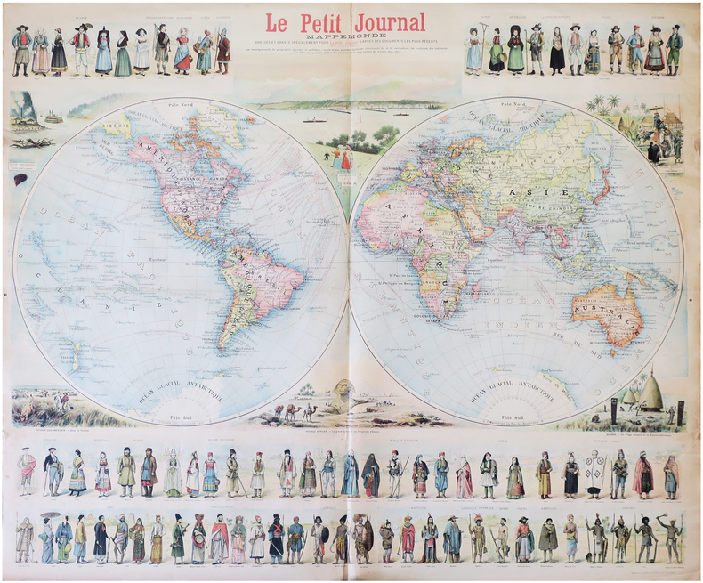
MÉNÉTRIER (F.).
Mappemonde dressée et gravée spécialement pour Le Petit Journal d'après les documents les plus récents.
Paris, Le Petit Journal, [1897]. 0,90 x 1,06 m.
书商的参考编号 : LBW-8232
|
|
|
MÉSOPOTAMIE par André PARROT.
Découverte des mondes ensevelis. Richement documenté ( héliogravures, cartes).
Editions Delachaux & Niestlé 1954. Bel exemplaire broché, couverture ornée d'éd., in-8, 154 pages + planches.
书商的参考编号 : AUB-5683
|
|
|
Météorologie Nationale
Livres pratiques
Stock 1989 127 pages 19 2x1x27 6cm. 1989. Broché. 127 pages.
书商的参考编号 : 7946

|
|
|
MÉXICO.
Anuario Turístico de México 1947 de la Asociación Nacional Automovilística. Travel Guide for Mexico. Director: Guillermo López G.
México, Asociación Nacional Automovilística, 1947. 4to. mayor; 416 pp. Edición bilingüe, español-inglés, impresa a doble columna. Numerosas ilustraciones y anuncios entre el texto y 18 mapas plegados fuera de texto. Cubiertas originales.

|
|
|
Möller, A.W.:
Wandkarte des Römischen Reiches in seinem grössten Umfange für den Schulgebrauch entworfen . Maassstab 1 : 4,750,000. Grenzkolorierte Lithographie.
Format: 63 x 100 cm (Blattgröße: 75 x 104 cm). Mehrfach gefaltet. *Seltene großformatige Wandkarte des römischen Reiches, offenbar von 2 großen Steinplatten gedruckt. - Die Falze teils mit hinterlegten Einrissen. Insgesamt in guter Erhaltung mit Rand. Bücher de
|
|
|
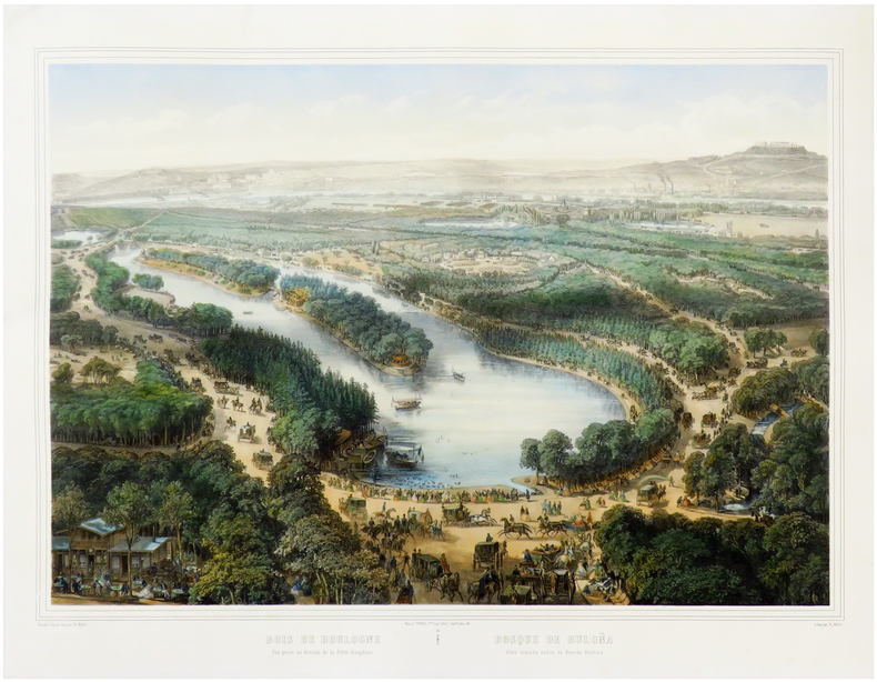
MÜLLER (Théodore).
[BOIS de BOULOGNE] Bois de Boulogne. Vue prise au dessus de la Porte Dauphine - Bosque de Buloña. Vista tomada sobre la Puerta Delfina.
Paris, L. Turgis J.ne, [circa 1860]. 450 x 600 mm.
书商的参考编号 : LBW-6666
|
|
|
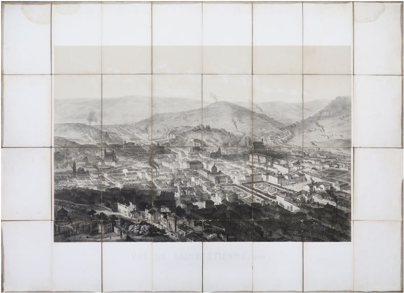
MÜLLER (Théodore).
[SAINT-ÉTIENNE] Vue de Saint Étienne (Loire).
Paris, Lemercier & C.ie, [1867]. En 32 sections montées sur toile et repliées, formant une vue de 63 x 85,5 cm hors marges, 85,5 x 115,5 cm avec les marges.
书商的参考编号 : LBW-8046
|
|
|
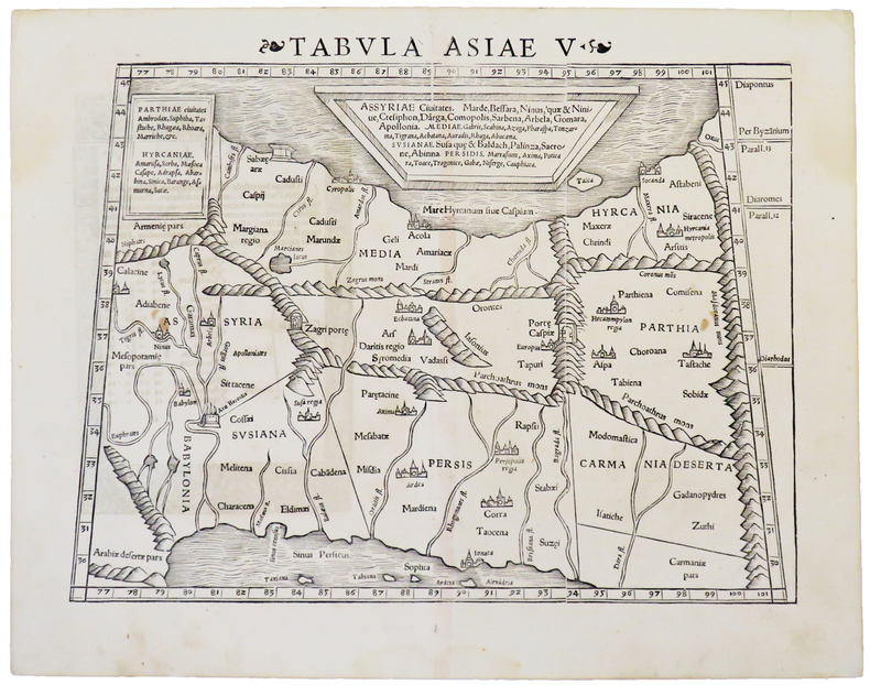
MÜNSTER (Sebastian).
[GÉORGIE/AZERBAÏDJAN] Tabula Asiæ V.
[Bâle, circa 1550]. 266 x 344 mm.
书商的参考编号 : LBW-4933
|
|
|
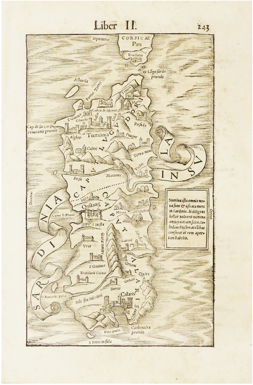
MÜNSTER (Sebastian).
[SARDAIGNE] Sardinia insula.
[Bâle, 1550]. 254 x 153 mm.
书商的参考编号 : LBW-6654
|
|
|
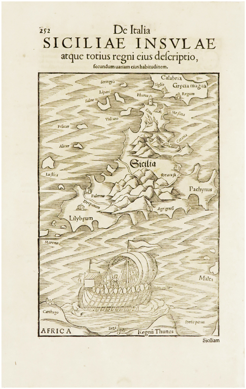
MÜNSTER (Sebastian).
[SICILE] De Italia Siciliæ insulæ atque totius regni eius descriptio.
[Bâle, 1550]. 213 x 148 mm.
书商的参考编号 : LBW-6659
|
|
|
Münster Sebastian (1488 - 1552)
(Roma)
Tavola tratta dalla Cosmographiae Universalis, edizione in tedesco, Basilea, seconda metà del XVI secolo.La Cosmographiae Universalis di Sebastian Münster (1488-1552), stampata per la prima volta Basilea nel 1544 dall’editore Heinrich Petri, venne più volte aggiornata e aumentata di nuove carte geografiche e rappresentazioni urbane nelle sue numerose edizioni che arrivano all’inizio del secolo successivo. Münster aveva lavorato a raccogliere informazioni al fine di ottenere un'opera che non deludesse le aspettative e, dopo un'ulteriore pubblicazione in tedesco abbellita da 910 stampe su legno, giunse nel 1550 all'edizione definitiva in latino, illustrata da 970 silografie. Vi furono poi numerose edizioni in diverse lingue, fra cui latino, francese, italiano, inglese e ceco. Dopo la sua morte di Münster (1552), Heinrich Petri prima, e il figlio Sebastian poi, continuarono la pubblicazione dell’opera. La Cosmographia universalis fu uno dei libri più popolari e di successo del XVI secolo, e vide ben 24 edizioni in 100 anni: l'ultima edizione tedesca venne pubblicata nel 1628, molto tempo dopo la morte dell'autore. La Cosmographia conteneva non solo le ultime mappe e vedute di tutte le città più famose, ma anche una serie di notizie enciclopediche di dettagli relative al mondo conosciuto, e sconosciuto. Il particolare successo anche commerciale di quest'opera fu dovuto in parte alle belle incisioni (tra i cui autori si possono citate Hans Holbein il Giovane, Urs Graf, Hans Rudolph Manuel Deutsch, David Kandel). Silografia, bella coloritura a mano, in buone condizioni. Plate taken from the Cosmographiae Universalis, German edition, Basel, second half of the 16th Century. The Cosmographiae Universalis of Sebastian Münster (1488-1552), printed for the first time in Basel in 1544 by the publisher Heinrich Petri, was updated several times and increased with new maps and urban representations in its many editions until the beginning of the next century. Münster had worked to collect information in order to obtain a work that did not disappoint expectations and, after a further publication in German embellished with 910 woodblock prints, arrived in 1550 to the final edition in Latin, illustrated by 970 woodcuts. There were then numerous editions in different languages, including Latin, French, Italian, English and Czech. After his death in Münster (1552), Heinrich Petri first, and then his son Sebastian, continued the publication of the work. The Cosmographia universalis was one of the most popular and successful books of the 16th century, and saw as many as 24 editions in 100 years: the last German edition was published in 1628, long after the author's death. The Cosmographia contained not only the latest maps and views of all the most famous cities, but also a series of encyclopedic details related to the known, and unknown, world. The particular commercial success of this work was due in part to the beautiful engravings (among whose authors can be mentioned Hans Holbein the Younger, Urs Graf, Hans Rudolph Manuel Deutsch, David Kandel). Woodcut, beautiful hand-coloring, in good condition.

|
|
|
Münster Sebastian (1488 - 1552)
Das Under Buch
Tavola tratta dalla Cosmographiae Universalis, edizione in tedesco, Basilea, seconda metà del XVI secolo.La Cosmographiae Universalis di Sebastian Münster (1488-1552), stampata per la prima volta Basilea nel 1544 dall’editore Heinrich Petri, venne più volte aggiornata e aumentata di nuove carte geografiche e rappresentazioni urbane nelle sue numerose edizioni che arrivano all’inizio del secolo successivo. Münster aveva lavorato a raccogliere informazioni al fine di ottenere un'opera che non deludesse le aspettative e, dopo un'ulteriore pubblicazione in tedesco abbellita da 910 stampe su legno, giunse nel 1550 all'edizione definitiva in latino, illustrata da 970 silografie. Vi furono poi numerose edizioni in diverse lingue, fra cui latino, francese, italiano, inglese e ceco. Dopo la sua morte di Münster (1552), Heinrich Petri prima, e il figlio Sebastian poi, continuarono la pubblicazione dell’opera. La Cosmographia universalis fu uno dei libri più popolari e di successo del XVI secolo, e vide ben 24 edizioni in 100 anni: l'ultima edizione tedesca venne pubblicata nel 1628, molto tempo dopo la morte dell'autore. La Cosmographia conteneva non solo le ultime mappe e vedute di tutte le città più famose, ma anche una serie di notizie enciclopediche di dettagli relative al mondo conosciuto, e sconosciuto. Il particolare successo anche commerciale di quest'opera fu dovuto in parte alle belle incisioni (tra i cui autori si possono citate Hans Holbein il Giovane, Urs Graf, Hans Rudolph Manuel Deutsch, David Kandel). Silografia, bella coloritura a mano, in buone condizioni. Plate taken from the Cosmographiae Universalis, German edition, Basel, second half of the 16th Century. The Cosmographiae Universalis of Sebastian Münster (1488-1552), printed for the first time in Basel in 1544 by the publisher Heinrich Petri, was updated several times and increased with new maps and urban representations in its many editions until the beginning of the next century. Münster had worked to collect information in order to obtain a work that did not disappoint expectations and, after a further publication in German embellished with 910 woodblock prints, arrived in 1550 to the final edition in Latin, illustrated by 970 woodcuts. There were then numerous editions in different languages, including Latin, French, Italian, English and Czech. After his death in Münster (1552), Heinrich Petri first, and then his son Sebastian, continued the publication of the work. The Cosmographia universalis was one of the most popular and successful books of the 16th century, and saw as many as 24 editions in 100 years: the last German edition was published in 1628, long after the author's death. The Cosmographia contained not only the latest maps and views of all the most famous cities, but also a series of encyclopedic details related to the known, and unknown, world. The particular commercial success of this work was due in part to the beautiful engravings (among whose authors can be mentioned Hans Holbein the Younger, Urs Graf, Hans Rudolph Manuel Deutsch, David Kandel). Woodcut, beautiful hand-coloring, in good condition.

|
|
|
Münster Sebastian (1488 - 1552)
Der Statt Rom in aller Welt bekannt Contrashetung nach jetziger gelegenheit
Bella veduta di Roma tratta dalla Cosmographiae Universalis, edizione in tedesco, Basilea fine del XVI secolo.La veduta di Munster cattura con raffinatezza le mura fortificate e i Sette Colli della Città Eterna, con attività significative lungo il fiume Tevere. Molti dei principali monumenti di Roma sono chiaramente identificabili. In basso una legenda che individua circa 23 punti di riferimento."Seppure incisa mezzo secolo dopo le piante del Bergomense e dello Schedel, la veduta ritrae la città come si presentava alla fine del '400 attingendo al medesimo prototipo comunemente indicato nel panorama di Mantova a sua volta ripreso da un presunto ma tuttora sconosciuto panorama inciso nella bottega di Francesco Rosselli verso il 1485. L'immagine venne inserita in una delle opere più note del '500, la Cosmographiae Universalis per la prima volta edita in latino nel 1550 e poi ristampata più volte in italiano, francese e tedesco. […] è stata più volte rilevata dai critici l'assenza del Colosseo dall'autore stesso curiosamente giustificata alla lettera G della legenda "per mancanza di spazio". Oltre ai Dioscuri presso le Terme di Diocleziano, presenti anche nelle piante di Bergomense e Schedel, è qui indicata acnhe la statua equestre del Marco Aurelio nella sua originale collocazione presso San Giovanni in Laterano da cui fu spostata nel 1538 per la visista di Carlo V a Roma e collocata da Michelangelo in Campidoglio. È ancora in piedi la Meta Romuli sebbene demolita nel 1499 e le due edicole alla fine di Castel Sant'Angelo demolite dopo il Sacco di Roma del 1527. L'edificio più recente raffigurato è il Belvedere Vaticano (1485/87" (cfr. Marigliani p. 118). La Cosmographiae Universalis di Sebastian Münster (1488-1552), stampata per la prima volta Basilea nel 1544 dall’editore Heinrich Petri, venne più volte aggiornata e aumentata di nuove carte geografiche e rappresentazioni urbane nelle sue numerose edizioni che arrivano all’inizio del secolo successivo. Münster aveva lavorato a raccogliere informazioni al fine di ottenere un'opera che non deludesse le aspettative e, dopo un'ulteriore pubblicazione in tedesco abbellita da 910 stampe su legno, giunse nel 1550 all'edizione definitiva in latino, illustrata da 970 silografie. Vi furono poi numerose edizioni in diverse lingue, fra cui latino, francese, italiano, inglese e ceco. Dopo la sua morte di Münster (1552), Heinrich Petri prima, e il figlio Sebastian poi, continuarono la pubblicazione dell’opera. La Cosmographia universalis fu uno dei libri più popolari e di successo del XVI secolo, e vide ben 24 edizioni in 100 anni: l'ultima edizione tedesca venne pubblicata nel 1628, molto tempo dopo la morte dell'autore. La Cosmographia conteneva non solo le ultime mappe e vedute di tutte le città più famose, ma anche una serie di notizie enciclopediche di dettagli relative al mondo conosciuto, e sconosciuto. Il particolare successo anche commerciale di quest'opera fu dovuto in parte alle belle incisioni (tra i cui autori si possono citate Hans Holbein il Giovane, Urs Graf, Hans Rudolph Manuel Deutsch, David Kandel). Silografia, bella coloritura a mano, in buone condizioni. BibliografiaA. P. Frutaz, "Le piante di Roma", XCVIII, tav. 170; C. Marigliani, "Le Piante di Roma delle collezioni private", tav. 14; M. Gori Sassoli (a cura di), "Roma Veduta" p. 140, n. 6; Scaccia Scarafoni, n. 126. Munster's view captures a fine sense of the fortified walls and Seven Hills of the Eternal City, with significant activity along the Tiber River. Many of Rome's great landmarks are clearly identifiable in this important early view. The key at the bottom locates approximately 23 landmarks.Although engraved half a century later from the maps by Bergomensis and Schedel, the view depicts the city as it was at the end of the 15th century, drawing on the same prototype commonly indicated in the panorama of Mantua in turn taken from a still unknown panorama engraved in the workshop of Francesco Rosselli around 1485. The image was included in one of the most famous works of the '500, the Cosmographiae Universalis for the first time published in Latin in 1550 and then reprinted several times in Italian, French and German. The absence of the Colosseum - justified by the author himself by the letter G of the legend "for lack of space" - has been noted several times by critics. In addition to the Dioscuri at the Baths of Diocletian, also present in the plants of Bergomensis and Schedel, the equestrian statue of Marcus Aurelius in its original location near San Giovanni in Laterano, from which it was moved in 1538 for the visist of Charles V in Rome and placed by Michelangelo in the Capitoline Hill, is here indicated. It is still standing the Meta Romuli although demolished in 1499 and the two "edicole" at the end of Castel Sant'Angelo, demolished after the Sack of Rome of 1527. The most recent building depicted is the Vatican Belvedere, built in 1485/87. (see Marigliani p. 118). Plate taken from the Cosmographiae Universalis, German edition, Basel, second half of the 16th Century. The Cosmographiae Universalis of Sebastian Münster (1488-1552), printed for the first time in Basel in 1544 by the publisher Heinrich Petri, was updated several times and increased with new maps and urban representations in its many editions until the beginning of the next century. Münster had worked to collect information in order to obtain a work that did not disappoint expectations and, after a further publication in German embellished with 910 woodblock prints, arrived in 1550 to the final edition in Latin, illustrated by 970 woodcuts. There were then numerous editions in different languages, including Latin, French, Italian, English and Czech. After his death in Münster (1552), Heinrich Petri first, and then his son Sebastian, continued the publication of the work. The Cosmographia universalis was one of the most popular and successful books of the 16th century, and saw as many as 24 editions in 100 years: the last German edition was published in 1628, long after the author's death. The Cosmographia contained not only the latest maps and views of all the most famous cities, but also a series of encyclopedic details related to the known, and unknown, world. The particular commercial success of this work was due in part to the beautiful engravings (among whose authors can be mentioned Hans Holbein the Younger, Urs Graf, Hans Rudolph Manuel Deutsch, David Kandel). Woodcut, beautiful hand-coloring, in good condition. BibliografiaA. P. Frutaz, "Le piante di Roma", XCVIII, tav. 170; C. Marigliani, "Le Piante di Roma delle collezioni private", tavv. 11/14; M. Gori Sassoli (a cura di), "Roma Veduta" p. 140, n. 6; Scaccia Scarafoni, n. 126.

|
|
|
Münster Sebastian (1488 - 1552)
Roma
Tavola tratta dalla Cosmographiae Universalis, edizione in tedesco, Basilea, seconda metà del XVI secolo.La Cosmographiae Universalis di Sebastian Münster (1488-1552), stampata per la prima volta Basilea nel 1544 dall’editore Heinrich Petri, venne più volte aggiornata e aumentata di nuove carte geografiche e rappresentazioni urbane nelle sue numerose edizioni che arrivano all’inizio del secolo successivo. Münster aveva lavorato a raccogliere informazioni al fine di ottenere un'opera che non deludesse le aspettative e, dopo un'ulteriore pubblicazione in tedesco abbellita da 910 stampe su legno, giunse nel 1550 all'edizione definitiva in latino, illustrata da 970 silografie. Vi furono poi numerose edizioni in diverse lingue, fra cui latino, francese, italiano, inglese e ceco. Dopo la sua morte di Münster (1552), Heinrich Petri prima, e il figlio Sebastian poi, continuarono la pubblicazione dell’opera. La Cosmographia universalis fu uno dei libri più popolari e di successo del XVI secolo, e vide ben 24 edizioni in 100 anni: l'ultima edizione tedesca venne pubblicata nel 1628, molto tempo dopo la morte dell'autore. La Cosmographia conteneva non solo le ultime mappe e vedute di tutte le città più famose, ma anche una serie di notizie enciclopediche di dettagli relative al mondo conosciuto, e sconosciuto. Il particolare successo anche commerciale di quest'opera fu dovuto in parte alle belle incisioni (tra i cui autori si possono citate Hans Holbein il Giovane, Urs Graf, Hans Rudolph Manuel Deutsch, David Kandel). Silografia, bella coloritura a mano, in buone condizioni. Plate taken from the Cosmographiae Universalis, German edition, Basel, second half of the 16th Century. The Cosmographiae Universalis of Sebastian Münster (1488-1552), printed for the first time in Basel in 1544 by the publisher Heinrich Petri, was updated several times and increased with new maps and urban representations in its many editions until the beginning of the next century. Münster had worked to collect information in order to obtain a work that did not disappoint expectations and, after a further publication in German embellished with 910 woodblock prints, arrived in 1550 to the final edition in Latin, illustrated by 970 woodcuts. There were then numerous editions in different languages, including Latin, French, Italian, English and Czech. After his death in Münster (1552), Heinrich Petri first, and then his son Sebastian, continued the publication of the work. The Cosmographia universalis was one of the most popular and successful books of the 16th century, and saw as many as 24 editions in 100 years: the last German edition was published in 1628, long after the author's death. The Cosmographia contained not only the latest maps and views of all the most famous cities, but also a series of encyclopedic details related to the known, and unknown, world. The particular commercial success of this work was due in part to the beautiful engravings (among whose authors can be mentioned Hans Holbein the Younger, Urs Graf, Hans Rudolph Manuel Deutsch, David Kandel). Woodcut, beautiful hand-coloring, in good condition.

|
|
|
N. BAILLEUL et Mr CASSINY DE THURY, de l'Académie Royale des Sciences
CARTE DE LA FRANCE DIVISEE EN XXXI GOUVERNEMENTS MILITAIRES ET EN TOUTES SES PROVINCES, Dressée par N. Bailleul, sur les meilleures Cartes qui ont paruës jusqu'à présent Et sur les Observations Géométriques de la Carte des Triangles, mise au jour par Mr CASSINY DE THURY, de l'Académie Royale des Sciences - 1754 -
Lyon DAUDET 1754 une carte ancienne avec Limites colorée d'époque en vert , rouge et jaune, cartouche non coloré, gravée sur cuivre en noir par N. BAILLEUL, Format total : 100 centimètres de haut par 125,5 centimètres de large, 1754 Lyon DAUDET Editeur,
书商的参考编号 : 27639
|
|
|
N/a
Van Mercator tot computerkaart , Een geschiedenis van de cartografie.
, Brepols, 2001 Hardback,approx. 160 p., 30 b/w ill. 54 colour ill., 210 x 285 mm, in Dutch. ISBN 9789056220402.
书商的参考编号 : 28741
|
|
|
N/A.
"Libro del Conosçimiento de todos los Regnos et Tierras et Señorios que son por el Mundo, et de las señales et armas que han" Edición facsimilar, transcripción, estudio y notas del Manuscrito Z de la Bayerische Staatsbibliothek, de Munich [Cod. Hisp. 150] procedente de la "Alacena de Zurita", realizada por Maria Jesús Lacarra, Maria del Carmen Lacarra Ducay y Alberto Montaner.
Zaragoza, 1999. Folio; 279 pp., cincuenta y dos de ellas y tres láminas, dos de ellas plegadas, con la reproducción facsímilar del Códice. Cubiertas originales.

|
|
|
N/A.
Paris en Main. La Vrai Guide d'après un plan fractionné par arrondissements et divisé par quartiers.
Paris, A. V. Vallad fils et Cie., 1886. 4to.; 12-45 pp., 20 hojas sin paginar, 20 planos impresos en color y un plano plegado. Encuadernación original en tela estampada.

|
|
|
Nabelt / maps and more
Motorrad Powerkarten - Nord- und Ostdeutschland - 8 Karten laminiert Nabelt / maps and more
Good Vibrations- Verlag 2005. Motorrad Powerkarten - Nord- und Ostdeutschland - 8 Karten laminiert <br/><br/>Motorrad Powerkarten - Nord- und Ostdeutschland - 8 Karten laminiert Nabelt / maps and more Good Vibrations- Verlag, 2005 unknown
书商的参考编号 : BN209964 ???????? : 3937418202 9783937418209
|
|
|
NAESSENS, HERMAN (VERTALING
Museum van de Kleine Koningin. [Het fietsmuseum van Falmignoul]
Flamignoul, Fietsmuseum, s.d. (ca.1970) Gebonden, kunstleder met titelillustr., 209pp., 16.5x24.5cm., oblong, ills. in z/w., goede staat. Zeldzaam!!
书商的参考编号 : 46143
|
|
|

 ?????????
 ?????PDF???
 RSS feed
 ??
??


