|
|
|
NEUDIN Gérard, NEUDIN Joëlle
Neudin 1983 - cartes postales
1983, Neudin, in-8 broché de 542 pages, couverture grise, illustrations noir et blanc, et couleurs hors-texte | Etat : Bon état général, couverture défraîchie (Ref.: ref82183)
Referenz des Buchhändlers : 32538
|
|
|
NEUDIN Gérard, NEUDIN Joëlle
Neudin 1984 - cartes postales
1984, Neudin, in-8 broché de 540 pages, couverture dorée, illustrations noir et blanc, et couleurs hors-texte | Etat : Bon état général (Ref.: ref82179)
Referenz des Buchhändlers : 32534
|
|
|
NEUDIN Gérard, NEUDIN Joëlle
Neudin 1985 - cartes postales
1985, Neudin, in-8 broché de 542 pages, couverture rouge, illustrations noir et blanc, et couleurs hors-texte | Etat : Bon état général (Ref.: ref82180)
Referenz des Buchhändlers : 32535
|
|
|
NEUDIN Gérard, NEUDIN Joëlle
Neudin 1986 - cartes postales
1986, Neudin, in-8 broché de 536 pages, couverture noire, illustrations noir et blanc, et couleurs hors-texte | Etat : Bon état général (Ref.: ref82181)
Referenz des Buchhändlers : 32536
|
|
|
NEUDIN Gérard, NEUDIN Joëlle
Neudin 1986 - cartes postales
1986, Neudin, in-8 broché de 536 pages, couverture noire, illustrations noir et blanc, et couleurs hors-texte | Etat : Bon état général, couverture défraîchie (Ref.: ref82182)
Referenz des Buchhändlers : 32537
|
|
|
NEUDIN Gérard, NEUDIN Joëlle
Neudin 1994 - cartes postales
1994, Neudin, in-8 broché de 512 pages, couverture orange illustrée en couleurs, 400 illustrations noir et blanc, et couleurs hors-texte | Etat : Bon état général (Ref.: ref82233)
Referenz des Buchhändlers : 32636
|
|
|
NEUDIN Gérard, NEUDIN Joëlle
Neudin, l'argus international des cartes postales
1977, Neudin, in-8 broché de 183 pages, couverture illustrée en couleurs, illustrations noir et blanc, et couleurs hors-texte. Tous les résultats des ventes, conseils et adresses, classements chronologique, thématique et géographique avec 10 000 rubriques cotées, étude d'environ 3000 illustrateurs. | Etat : Bon état général (Ref.: ref9553)
Referenz des Buchhändlers : 18437
|
|
|
NEUDIN Joëlle et Gérard
REPERTOIRE OFFICIEL INTERNATIONAL DE CARTES POSTALES
1984 broché in-octavo, dos bleu-marine et couverture illustrée en couleurs sur le recto / verso, illustrations : nombreuses reproductions de cartes postales, 538 pages, 1984 Paris Editions Image-Document,
Referenz des Buchhändlers : 1344
|
|
|
NEUFCHATEAU
Carte d'Etat-Major au 1/200 000?. Fin XIXe.
1 feuille repli?e. 32x49 cm.
|
|
|
NEUILLY
Carte au 1/20 000?me. Fin XIXe.
Une feuille. 64x46 cm.
|
|
|
Neumann, R
Über den Angriff auf die Düppeler Schanzen in der Zeit vom 15. März bis zum 18. April 1864. Ein Vortrag gehalten in der militairischen Gesellschaft zu Berlin am 14. November 1864.
Berlin, Druck und Verlag von F. G. Mittler und Sohn, 1865. 8°. 22 cm. 54 Seiten. Einfacher Halblederband der Zeit.
Referenz des Buchhändlers : 8064DB

|
|
|
NEUMONT (Maurice).
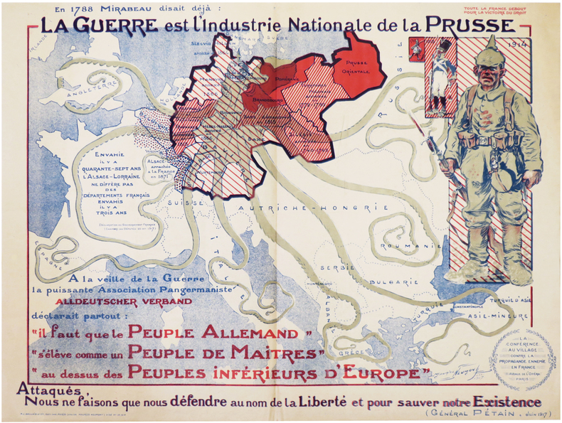
[PROPAGANDE GRANDE GUERRE] La Conférence au village contre la propagande ennemie en France. En 1788 Mirabeau disait déjà : la Guerre est l'industrie nationale de la Prusse. Attaqués, nous ne faisons que nous défendre au nom de la Liberté et pour sauver notre existence (Général Pétain, juin 1917).
Paris, P.J. Gallais et Cie, Déc. 1917. Lithographie en couleurs de 580 x 775 mm.
Referenz des Buchhändlers : LBW-7258
|
|
|
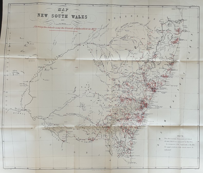
NEW SOUTH WALES
REPORT OF THE COUNCIL OF EDUCATION
Referenz des Buchhändlers : PHO-303
|
|
|
Nichele, Franc
Cuba
No marks or inscriptions. A lovely clean very tight copy with bright unmarked boards and no bumping to corners. Dust jacket not price clipped or marked or torn or creased with slight traces of storage. 159pp. With a wealth of colour photographs giving the architecture, culture, social life and texture of the island of Cuba..

|
|
|
Nichollls, Margaret W.; Sivertz, Barbara P.
The/A History of Nanoose Bay - Second Edition
196 pages. Index. Two fold-out maps. Many black and white illustrations. Topics include: The First People, Explorers, Pioneers, Nanoose areas, Biographies, The Community. Moderate wear. Unmarked. A sound copy of this substantial work. Book

|
|
|
Nichollls, Margaret W.; Sivertz, Barbara P.
The/A History of Nanoose Bay - Third Edition
204 pages. Index. Two fold-out maps. Many black and white illustrations. Topics include: The First People, Explorers, Pioneers, Nanoose areas, Biographies, The Community, The Next Decade (1980-1990) which provides some coverage of Fairwinds. Gift greetings inside front cover else unmarked. Light wear. A nice copy of this substantial work. Book

|
|
|
Nicholson Maps
London Streetplan Map
Hippocrene Books. Used - Good. Good condition. A copy that has been read but remains intact. May contain markings such as bookplates stamps limited notes and highlighting or a few light stains. Hippocrene Books unknown
Referenz des Buchhändlers : X04I-00807 ISBN : 0092018203 9780092018206

|
|
|
Nicolaus Gurtler (1654-1711).
ORIGINES MUNDI & in eo Regnorum, Rerumpubl. Populorum.
pp. [12], 915, (41) [Index] + Engraved frontis title page (drawn by Joseph Mulder and engraved by Willem de Broen) showing an enormous globe, the author and allegorical figures; Plus + Folding engraved map of the Old World (31 x 42 cm.) - "Orbis Terrarum Veteribus Cogniti Tabula" by Christoph CELLARIUS, showing not only Europe, Africa and Asia, but also Australia; and four woodcut decorated initial letters. Regular title printed in red and black with the Wetstein's engraved whetstone publisher's device. Latin text in roman types, with extensive passages in italic and Greek, and occasional Hebrew and fraktur. 4to. 205 mm. Old damp stain on the first few leaves. The early full leather binding is quite worn. ** The front pastedown bears an early autograph ownership - apparently that of Noel Antoine Pluche (1688-1761), noted French naturalist and writer. Full Title: Nicolai Gurtleri Origines Mundi & in eo Regnorum, Rerumpubl. Populorum; horumque Duces, Migrationes, Dii, Religio, Mores, Instituta, Res gesta, civiles, sacra, bellica. Referuntur omnia ad loca & tempora sua, & ex ipsis fontibus, fereque propriis Historicorum verbis ad modum Historiae Universalis, cum maxime Ecclesiasticae reprasentantur. Cum Indicibus necessariis, iisque locupletissimis. First and only edition of a detailed history of the ancient world, covering and comparing the cultures, religions, governments, (civil and ecclesiastical) legal systems, etc. of societies throughout the Old World. After a brief discussion of the pre-diluvian world, it covers the ancient Middle East, Africa, Asia and Europe country by country or region by region, citing both biblical and classical sources. The Cellarius map appears to be based on the 1664 map of the same title by Johannes Strubius (Shirley 434, in the same projection and showing the same regions, but not including Australia), but its more accurate and up-to-date cartographic data appears to have been taken from one of the world maps in two hemispheres that were common from at least 1658 (Visscher's, Shirley 406). As in those maps, the coast of Australia shows a small break at 30 degrees south latitude. Cellarius (1638-1707) had produced a series of historical maps for his Notitia Orbis Antiqui, first published at Leipzig in 1701, and the present map may be based on one from that book. A detailed ancient history, with an attractive and unusually accurate folding map of the Old World. SCARCE. NCC (5 copies); OCLC WorldCat (7 copies); STCN (1 copy). **PRICE JUST REDUCED! W153
|
|
|
NICOLAY Nicolas De, Dauphinois
Description Générale Du Paîs et duché De Berry et Diocèse De Bourges Avec Les Cartes Géographiques (...) précédé D'une Notice Sur Nicolas De Nicolay Par M. Victor Advielle
Chateauroux A.Aupetit 1883 In-8 217 pp 5 exceptionnelles cartes couleurs des baillages de Bourges,Dun le roy Issoudun, Mehun sur Yevre et Concressault. Compte tenu de ce qui est annoncé sur le titre, je n'affirme pas que ce livre est complet ( Vierzon ? , Plan de Bourges, peut-être lmanquants ) Impression sur beau papier, rousseurs sur le premier cahier, sans couvertures
Referenz des Buchhändlers : 22215
|
|
|
NICOLLE DE LA CROIX Abbé
Géographie moderne
précédé d’un petit traité de la sphère et du globe ornée de traits d’histoire naturelle & politique,d’une géographie sacrée & une géographie ecclésiastique où l’on trouve tous les archevêchés & Evêchés de l’église catholique & les principaux des églises schismatiques Nouvelle édition tome second seul in 12 plein cuir fauve raciné à nerfs,roulette dorée sur nerfs,pièce de titre cuir beige,roulette dorée sur coupes,titre,XVI,648 pages,tranches rouges,8 cartes dépliantes dont Russie Européenne,Turquie Européenne, Afrique, Amérique Septentrionale Amérique Méridionale. Delalain 1812 une tache au coin supérieur gauche du deuxième plat de couverture pâle mouillure partie inférieur de la page 610 à la fin,quelques traces de manipulations table des matières
Referenz des Buchhändlers : 5248
|
|
|
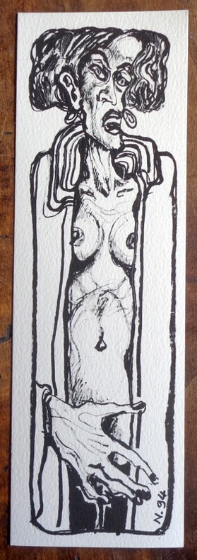
Nicollet Jean-Michel:
Petite sérigraphie en noir.
1994. Sérigraphie au format 7 x 22 cm., à l'état de neuf. Non signée.
Referenz des Buchhändlers : 2004
|
|
|
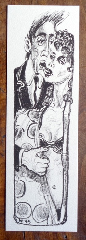
Nicollet Jean-Michel:
Petite sérigraphie en noir.
1995. Sérigraphie au format 7 x 22 cm., à l'état de neuf. Non signée.
Referenz des Buchhändlers : 2005
|
|
|
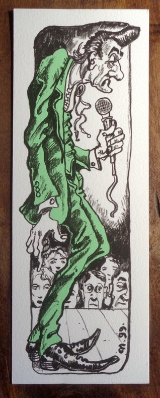
Nicollet Jean-Michel::
Petite sérigraphie en deux tons.
1999. Sérigraphie au format 8 x 22 cm., à l'état de neuf. Non signée.
Referenz des Buchhändlers : 2006
|
|
|
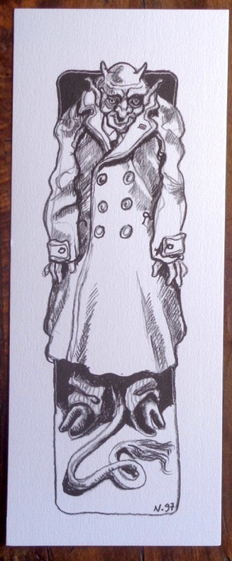
Nicollet Jean-Michel::
Petite sérigraphie en noir.
1997. Sérigraphie au format 10 x 25 cm., à l'état de neuf. Non signée.
Referenz des Buchhändlers : 2007
|
|
|
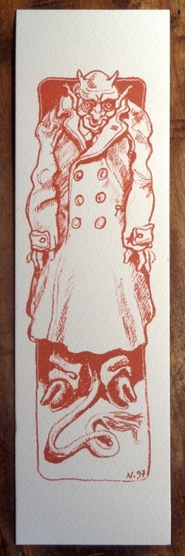
Nicollet Jean-Michel::
Petite sérigraphie sépia.
1997. Sérigraphie au format 8 x 28 cm., à l'état de neuf. Non signée.
Referenz des Buchhändlers : 2008
|
|
|
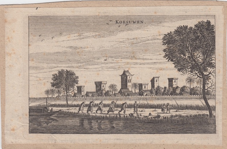
NIEUHOF, Joan.
View on Koesuwen.Antique Print-KOESUWEN-CHINA-Nieuhof-
1699 Amsterdam, 1699. original copper-engraving, 10 x 16 cm, taken from Joan Nieuhof: Het Gezandtschap der Neêrlandtsche Oost-Indische Compagnie, aan den grooten Tartarischen Cham, den tegenwoordigen Keizer van China, Amsterdam, 1666-99
Referenz des Buchhändlers : 26061
|
|
|
Nihat Bey, Mehmet.
[The Ottoman Empire and the Balkan Wars]. Istanbul, [1924 and] 1928.
Folio (ca. 410 x 570 to 570 x 820 mm). 22 folded original military maps, 8 of which in colour (scales 1:20,000 - 1:420,000). - Includes 56 ff. of Ottoman Turkish manuscript notes on military history, loosely stored. A rare and substantial set of military maps of the Balkan Wars, issued as rear-pocket matter to accompany the three-volume work "1328-29 Balkan Harbi, Trakya Seferi" (1924-28) by the topographer and military historian Nihat Bey. Never seen at auction; merely three copies could be traced in libraries worldwide (Istanbul, Princeton, and Washington). The maps show the Ottoman military campaigns on the Balkan peninsula against Bulgaria, Serbia, Greece, and Montenegro in 1912 and 1913, wars which resulted in the Ottoman Empire losing the bulk of its European territory. - Nihad Bey (1886-1928) of Bursa held the rank of Lieutenant Colonel but is remembered as a scholar rather than a soldier. The first and foremost military historian of the Turkish Republic, he published no fewer than 39 books in which he meticulously evaluated operational mistakes and emphasized lessons to be learned from past wars. - Includes a set of manuscript notes in pencil, presumably taken by one of Nihat Bey's students at the military academy in the course of lectures on early 20th century Ottoman military history. Bey probably incorporated the maps in his lectures, as is suggested by marks and notes found on several map sheets, mostly in blue or red crayon, corresponding to the colours and patterns used in printing eight of the maps. - Small tears and holes to several maps, mostly along the folds. The manuscript notes show traces of stapling. An unusual and important specimen of Turkish military history.
|
|
|
No Author
Chin Coulee, Alberta, West of Fourth Meridian, Scale 1:50,000
36" x 25.5". Indicates 25 foot contours, water bodies, roads, rail lines, structures, etc. Average soiling and wear. Book

|
|
|
No Author
Dial Map of Greater Vancouver, British Columbia - Street Cars, Buses / Map of Burnaby - New Westminster and Parts of Adjacent Municipalities (including Surrey) Circa 1950
25 inches wide by 19 inches high. Vancouver map indicates parks and water in shades of green, transit routes in red. Shows route of the B.C. Electric Railway, Lulu Island Interurban, Fourth (4th) Ave. Trolley, Granville-Marpole Trolley, Cambie Trolley Coach, Powell Trolley, and various bus routes. Original price $0.35. Four-digit phone numbers. Advertisement suggests printing date circa 1950. Average wear and soiling overall with moderate sunning/tanning along some creases. Above-average soiling to front panel. A worthy copy of this rare vintage map. Book

|
|
|
No Author
Handy Map & Guide to London with index to Streets Cruchley's Handy Map of London
<p>Gall & Inglis' 1870's-1880's. Paperback. Very good. VGC.Gall & Inglis'.No date given but probably 1870's to 1880's prior to London Tower Bridge build which is not included on the map.Green hardbacksmall dentsnicks and light shelf wear on the cover with folded map in VGC.The map is in VGC but with small stain marks and foxing marks on the edgessmall tear on the edge of the map.The map is hand coloured and includes:RailwaysRailway StationsSteamer RoutesOmnibus and Tramway RoutesParks.The size of the map is: 30x20 inch.The scale of the map is: 3 3/4 to 1 mile.The map covers: From Hyde Parkincluding parts of Kensington Palace to Blackwall and from Mildmay Park to South Lambeth.The map is in VGC for its age. A collectable and scarce map.</p> Gall & Inglis' paperback
Referenz des Buchhändlers : 5388

|
|
|
No Author
Map of Grassy Lake, Alberta, West of Fourth Meridian, Scale 1:50,000
36" x 25.5". Indicates 25 foot contours, water bodies, roads, rail lines, structures, etc. Light wear. Unmarked. Book

|
|
|
No Author
Map of Hays Alberta, West of Fourth Meridian, Scale 1:50,000
36" x 25.5". Indicates 25 foot contours, water bodies, roads, rail lines, structures, etc. Light wear. Unmarked. Book

|
|
|
No Author
Map of Raymond, Alberta, West of Fourth Meridian, Scale 1:50,000
36" x 25.5". Indicates 25 foot contours, water bodies, roads, rail lines, structures, etc. Light wear. Unmarked. Book

|
|
|
No Author
Map of Township of Guelph, Ontario
25.5" x 16 3/8". Grey colouring. Includes owners' names for most acreages outside the city of Guelph. Map of Village of Hartfield (where Fergus Road meets Woolwich Road) in upper left corner, Date lightly handwritten in pencil (twice). 5" opening near left side of bottom edge is barely visible. A wonderful historical and genealogical reference ideally suited to framing and displaying in home or office. Please note that our photo shows only the left half of the map. Book

|
|
|
No Author
Map of Warner County, Alberta, West of Fourth Meridian, Scale 1:50,000
36" x 25.5". Indicates 25 foot contours, water bodies, roads, rail lines, structures, etc. Light wear. Unmarked. Book

|
|
|
No Author
Mapas Turisticos Provinciales - Islas Canarias: Aprobados Por El Consejo Superior Geographico
Text in Spanish. One-sided color map of the Islas Canarias. 69 x 45cm. Clean and unmarked with moderate wear. Includes tourist information. A quality vintage copy. Book

|
|
|
No author
Newnes Motorists Touring Maps and Gazetteer
15th edition 2nd impression. 4to, 64 pages, maps, maps on front and back endpapers. Poor condition hardback gilt writing on spine and front cover, hinge loose, some damage to bottom of spine some loss at head of spine. Edges of pages browning. 39096. eng
|
|
|
No Author
Picture Butte, Lethbridge County, Alberta, West of Fourth Meridian, Scale 1:50,000
36" x 25.5". Indicates 25 foot contours, water bodies, roads, rail lines, structures, etc. Light wear. Book

|
|
|
No Author
Rochester Guidebook
Ex-library book with the usual stamps, stickers, etc. Binding is solid and text/interior is clean and free of marking of any kind. 128 pages in small format. Rochester, New York's first guide book, an alphabetical listing of sites, businesses, educational facilities, government, pastimes, clubs, philanthropies "and other interests." Fold-out city map at front with a few small tears at attachment points to book, b&w photos, a few ads at back. Binding is worn and appears to be the library's with paperback covers adhered to hardback boards.

|
|
|
No Author
Skiff, Alberta, West of Fourth Meridian, Scale 1:50,000
36" x 25.5". Indicates 25 foot contours, water bodies, roads, rail lines, structures, etc. Light wear. Book

|
|
|
No Author
Travers, Alberta - West of Fourth Meridian, Scale 1:50,000
36" x 25.5". Indicates 25 foot contours, water bodies, roads, rail lines, structures, etc. Light wear. Book

|
|
|
Noble, Isabella; Noble, John; Quintero, Josephine; Sainsbury, Brendan
Andalucia : Lonely Planet Guide
Appears unused. No marks or inscriptions. No creasing to covers or to spine. A very clean very tight copy with bright unmarked boards and no bumping to corners. 391pp. Lonely Planet guide to the Andalucia region of Spain including Seville and Gibraltar.

|
|
|
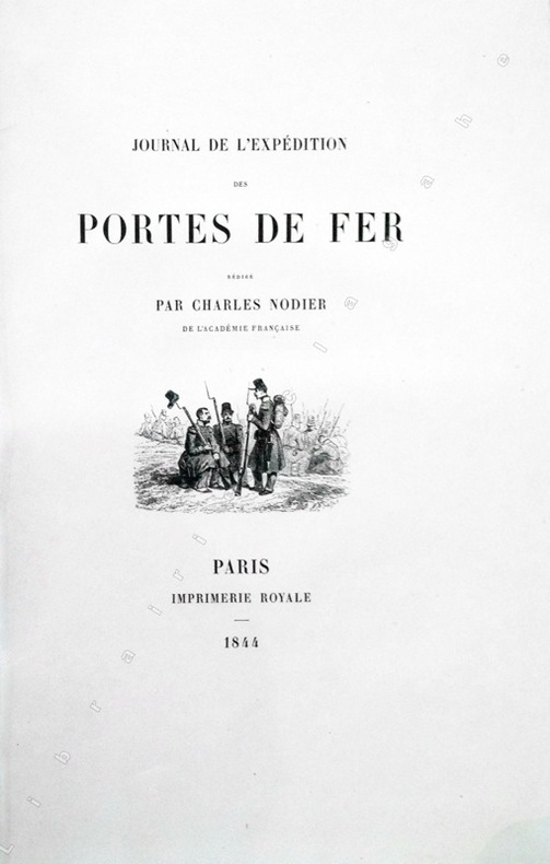
Nodier (Charles) :
Journal de l'Expédition des Portes de Fer.
Paris, Imprimerie Royale, 1844 ; grand in-8 ; cartonnage à la bradel de l'éditeur ; [4], XVI, 329 pp., [1] f. blanc, 40 planches hors-textes tirées sur chine contrecollées, protégées par des serpentes légendées et une carte dépliante en fin d'ouvrage et 200 vignettes gravées sur bois dans le texte.
Referenz des Buchhändlers : 13368
|
|
|
NOEL (Joseph).
Harper's ferry en 1865.
Paris, [circa 1860]. 129 x 166 mm.
Referenz des Buchhändlers : LBW-1254

|
|
|
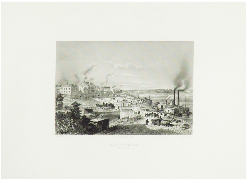
NOEL (Joseph).
Louisville (Kentucky).
Paris, [circa 1860]. 128 x 162 mm.
Referenz des Buchhändlers : LBW-1253
|
|
|
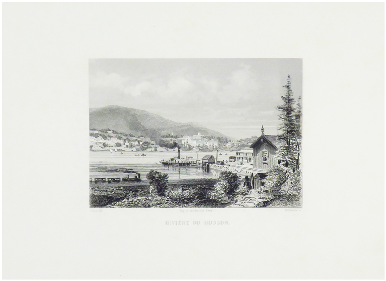
NOEL (Joseph).
Rivière du Hudson.
Paris, [circa 1860]. 124 x 159 mm.
Referenz des Buchhändlers : LBW-1251
|
|
|
NOEL M
Carte routière de la France à l'usage des voyageurs
BassetM. Paris ,Chez Basset, 1829. Grande carte dépliante de 92*63 cm, repliée sous cartonnage. Carte en noir avec en bord, des suppléments pour : Madrid et Lisbonne. Turin, Florence, Milan, Rome et Naples. Vienne et Constantinople. Dresde, Berlin, Varsovie, Moscou et Saint Petersbourg. Copenhague et Stockholm. Amsterdam. Indiquant exactement les différentes espèces de routes et les distances intermédiaires des villes, bourgs, villages en lieues de poste de 2000 toises. Quelques déchirures aux pliures.
Referenz des Buchhändlers : 188514

|
|
|
NOELLAT (Jean-Baptiste).
[RHÔNE] Nouvelle carte topographique et statistique du département du Rhône réduite d'après la grande carte de Cassini.
Lyon et Villefranche, 1827. 821 x 593 mm.
Referenz des Buchhändlers : LBW-5138

|
|
|
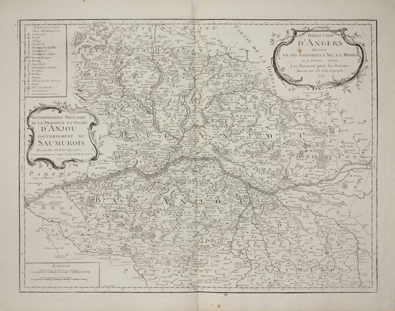
NOLIN (Jean-Baptiste).
[ANJOU/GRENIERS à SEL] Direction d'Angers divisée en ses greniers à sel et dépôts, on y trouve aussy les bureaux pour les traites - Gouvernement militaire de la province et duché d'Anjou, gouvernement du Saumurois.
Paris, Longchamps, 1759. 474 x 613 mm.
Referenz des Buchhändlers : LBW-2797
|
|
|
NOLIN (Jean-Baptiste).
[ANJOU/GRENIERS à SEL] Gouvernement militaire de la province et Duché d'Anjou. Gouvernement du Saumurois - Direction d'Angers divisée en ses greniers à sel et dépôts, on y trouve aussy les bureaux pour les traites.
Paris, Mondhare et Jean. 1787 472 x 614 mm ; repliée sous couverture cartonnée recouverte de papier bleu de l'époque (200 x 127mm) ; étiquette sur le premier plat portant le titre manuscrit à l'encre.
Referenz des Buchhändlers : LBW-8429

|
|
|

 Per e-mail erhalten
 Als pdf-Dokument herunterladen
 RSS feed
 Permanenter link


