|
Redding, M. Wolcott.
ANTIQUITIES OF THE ORIENT UNVEILED. A Concise Description of the Ruins of King Solomon's Cities.
pp. 541, (3) [Publisher's catalogue] + Color lithograph folding map of Jerusalem and Color lithograph Frontis + Ninety full page engravings. Map has 1 1/2" tear in left margin with no loss. Some engravings have dampstaining in margins. Text elaborately ruled throughout. Lacks front and rear marbled fly leaves. 225mm. Front board detached. Spine very worn. Virtually disbound. This perhaps should best be considered a candidate for rebinding. **PRICE JUST REDUCED! HOLY LAND BX 1
|
|
|
REED KILNE, Naomi.
Maps of Medieval Thought.
Suffolk, The Boydell Pres 2001, 240x170mm, XIII - 261pages, paperback. Book in good condition.
Referenz des Buchhändlers : 89919

|
|
|
Regards. Gérant : Zeyons
Regards En couverture : Les dessous des cartes. Révélations sur la presse françaiseM. Boussac - M. Dubridet veut fonder un journal (Louis Maréchot) - Les journaux communistes et démocratiques mènent l'offensive - Au service de la vérité (Serge Zeyons, photos Jacques Kanapa) - Les journaux qui vous défendent, vous conseillent, vous distraient - Des ouvriers imprimeurs vous racontent (eux-même) la naissance de "Regards" - Le journal des lecteurs. L'insigne, nouvelle de Paul Saux - Travailleurs de France - Gosses de Paris et d'ailleurs - Akoutou, et le préjugé du Zoe, nouvelle de Fozoo Ekabe (Cameroun) - Vallauris la pacifique (reportage photo André Villers) - Poèmes pour la paix - Une petite ville - Dans le monde des champignons - ...
n° 371 - novembre 1953 - nouvelle série - revue illustrée - in-4 broché - 50 pages
Referenz des Buchhändlers : 60930
|
|
|
REGUIN Olivier:
Saint-Georges. Village, prieuré et seigneurie à la fin du Moyen Age.
Lausanne, Bibliothèque Historique Vaudoise, 2000. In-8 broché de 219 pages, couverture illustrée en couleurs.
Referenz des Buchhändlers : 1104

|
|
|
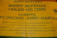
Reg Grundy Productions; Bruce Beresford (director & producer); MAPS Litho Pty Ltd (litho).
Barry Humphries' 'Barry McKenzie Holds His Own'.
Sydney Australia: Reg Grundy Productions 1974. Lithograph Poster. 40" x 20.5" Folded Poster Good with some minor tears at edges. [Sydney], Australia: Reg Grundy Productions, 1974. unknown
Referenz des Buchhändlers : 68-0786
|
|
|
REGNE Jean
R?pertoire des plans cadastraux parcellaires de l'Ard?che. Lettre-pr?face de Marc Bloch.
Broch?. 70 pages. Couverture en mauvais ?tat. Importantes rousseurs.
|
|
|
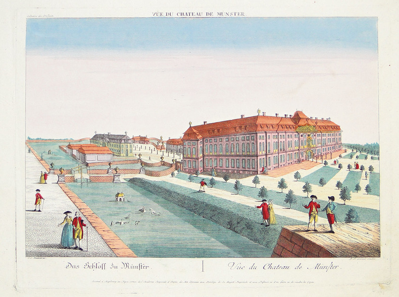
REINHOLD (Christian Ludolph) & LEIZELT (Balthasar Friedrich).
[MÜNSTER] Vüe du château de Münster.
Augsbourg, Négoce commun de l'Académie Impériale d'Empire des Arts Libéraux, [circa 1790]. 307 x 400 mm.
Referenz des Buchhändlers : LBW-2792
|
|
|
REICH, HANS/ VALK, MAPS.
KINDEREN UIT HEEL DE WERELD.
, Den Haag, Nederlandse Boekenclub, 1958., Gebonden, originele geillustreerde uitgeversomslag in kleur, 18,5x23,5cm, 119pp, rijkelijk geillustreerd z/w.
Referenz des Buchhändlers : 9746
|
|
|
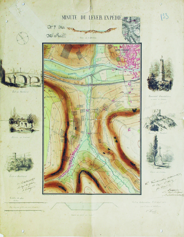
REILLE (Victor).
Minute du lever expédié.
Fontainebleau, 1871. 47,8 x 38,3 cm.
Referenz des Buchhändlers : LBW-6565
|
|
|
Reich, Erhard - Ortelius, Abraham
Palatinatus Bavariae descriptio, Erhardo Reych Tirolense Auctore. [um 1590]. [Altkolorierter Original-Kupferstich, gerahmt / old colored original copper engraving, framed]
o.J. Abraham Ortelius, geboren am 4. oder 14. April 1527 in Antwerpen, gestorben am 28. Juni 1598 ebenda. Flämischer Geograph und Kartograf. [3 Warenabbildungen]
Referenz des Buchhändlers : 59507BB

|
|
|
Reilly, Franz Johann Joseph von
Das Herzogthum Geldern. Kurbrandenburgischen Antheils mit dem Fürstenthume Mörs. Nro. 268 (um 1790). [Altkolorierter Kupferstich, gerahmt / handcoloured copper engraving, framed].
o.J. [3 Warenabbildungen] (Franz Johann Joseph von Reilly, geb. 18.08.1766 in Wien, gest, 06.07.1820 ebenda, österreichischer Verleger, Kartograf
Referenz des Buchhändlers : 66102CB

|
|
|
Reilly, Franz Johann Joseph von
Das Koenigreich Sklavonien und Herzogthum Syrmien (No. 3). Teilkolorierte Kupferstichkarte aus "Schauplatz der fünf Theile der Welt".
Wien, Reilly, ca. 1789. 20 x 29 cm (Blattgröße 22 x 32 cm).
Referenz des Buchhändlers : 110609

|
|
|
Reilly, Franz Johann Joseph von
Der gefürsteten Grafschaft Tirol Viertel Unterinn und Wipp-Thal. Teilkolorierte Kupferstichkarte (No. 146) aus "Schauplatz der fünf Theile der Welt".
Wien, Reilly, ca. 1791. 22 x 29 cm (Blattgröße 24 x 32 cm).
Referenz des Buchhändlers : 110618

|
|
|
Reilly, Franz Johann Joseph von:
Das Koenigreich Sklavonien und Herzogthum Syrmien (No. 3). Teilkolorierte Kupferstichkarte aus "Schauplatz der fünf Theile der Welt".
20 x 29 cm (Blattgröße 22 x 32 cm). *Reilly ist bekannt für seine exakten Detailkarten, die vorliegende Karte Slowenien mit Belgrad im Osten und die Kleine Walachei mit Kialiova im Westen (linke Ecke oben mit leichtem Fleck). - Map from the Atlas of Reilly`s "Schauplatz der fünf Theile der Welt", which appeared 1789 to 1806 in 3 parts with more than 1000 maps of Europe. This atlas is famous for his exact and detailed maps. - Original copperplate engraving [Vienna, about 1789]. Some original colouring, good condition. Landkarten de
|
|
|
Reilly, Franz Johann Joseph von:
Der gefürsteten Grafschaft Tirol Viertel Unterinn und Wipp-Thal. Teilkolorierte Kupferstichkarte (No. 146) aus "Schauplatz der fünf Theile der Welt".
22 x 29 cm (Blattgröße 24 x 32 cm). *Reilly ist bekannt für seine exakten Detailkarten, die vorliegende Karte zeigt das Österreichische Teilgebiet Unterinn mit Kufstein im Norden. - Map from the Atlas of Reilly`s "Schauplatz der fünf Theile der Welt", which appeared 1789 to 1806 in 3 parts with more than 1000 maps of Europe. This atlas is famous for his exact and detailed maps. - Original copperplate engraving [Vienna, 1789]. Some original colouring, good condition. Landkarten de
|
|
|
Reilly, Franz Johann Joseph von:
Die Markgrafschaft Niederlausitz chursächsischen und preussischen Antheils und in ihre Kreise eingetheilt. Nro 104"
22 x 29 cm. Blattgröße 30 x 42 cm. Teilkolorierte Kupferstichkarte. *Reilly ist bekannt für seine exakten Detailkarten, die vorliegende Karte zeigt das Gebiet der Niederlausitz mit Lübben, Spreewald, Cottbus und Guben. Aus dem Werk "Aus: Schauplatz der fünf Theile der Welt". - Sehr gut erhalten. Landkarten de
|
|
|
Reilly, Franz Johann Joseph von:
Generalkarte von Spanien und Portugal. Landkarte No. 524 aus dem Atlas von Reilly "Schauplatz der fünf Theile der Welt" (1789-1806).
23 x 28 cm (Blattgröße 33 x 52 cm). Teilkolorierte Kupferstichkarte. *Reilly ist bekannt für seine exakten Detailkarten, die vorliegende Karte zeigt die gesamte Iberische Halbinsel. - Sehr gut erhalten. - Map from the Atlas of Franz Johann Joseph von Reilly "Schauplatz der fünf Theile der Welt", which appeared 1789 to 1806 in 3 parts with more than 1000 maps of Europe. This atlas is famous for his exact and detailed maps. Here one map of the Iberian part - No. 524 (General map of Spain and Portugal). - Fine condition. Landkarten de
|
|
|
Reilly, Franz Johann Joseph von:
Karte von dem Königreiche Slavonien. Neunzehende Schulkarte ... aus "Schul Atlas" herausgegeben von F.I.I. von Reilly und zu finden im Verlage des Herausgebers.
Blattgröße 30 x 44,5 cm. Teilkolorierte Kupferstichkarte. *Reilly ist bekannt für seine exakten Detailkarten, die vorliegende Karte zeigt das gesamte Slavonien in Flächenkolorit. - Karte aus dem Schul-Atlas "Schulkarte zu ... der Erdbeschreibung zum Gebrauche der studirenden Jugend in den Kaiserlichen Königlichen Staaten". Dieser frühe Österreichische Schulatlas wurde von dem Landkartenstecher Reilly angefertigt und ist recht selten. Die Karten sind hier etwas größer als in seinem gleichzeitig begonnenen Hauptwerk "Schauplatz ...". - Leicht gebräunt, insgesamt gut erhalten. Landkarten de
|
|
|
Reilly, Franz Johann Joseph von:
Karte von den Königreichen Gallizien und Lodomerien den Herzogthümern Auschwitz und Zator und der Landschaft Bukovina. Zwanzigste Schulkarte ... aus "Schul Atlas" herausgegeben von F.I.I. von Reilly und zu finden im Verlage des Herausgebers.
Blattgröße 30 x 44,5 cm. Teilkolorierte Kupferstichkarte. *Reilly ist bekannt für seine exakten Detailkarten, die vorliegende Karte mit Grenz- und Flächenkolorit. - Karte aus dem Schul-Atlas "Schulkarte zu ... der Erdbeschreibung zum Gebrauche der studirenden Jugend in den Kaiserlichen Königlichen Staaten". Dieser frühe Österreichische Schulatlas wurde von dem Landkartenstecher Reilly angefertigt und ist recht selten. Die Karten sind hier etwas größer als in seinem gleichzeitig begonnenen Hauptwerk "Schauplatz ...". - Leicht gebräunt, insgesamt gut erhalten. Landkarten de
|
|
|
Reilly, Franz Johann Joseph von:
Karte von Europa überhaupt und der Östreichischen Monarchie insbesondere. Zweyte Schulkarte ... aus "Schul Atlas" herausgegeben von F.I.I. von Reilly und zu finden im Verlage des Herausgebers.
Blattgröße 30 x 44,5 cm. Teilkolorierte Kupferstichkarte. *Reilly ist bekannt für seine exakten Detailkarten, die vorliegende Karte zeigt Europa. - Karte aus dem Schul-Atlas "Schulkarte zu ... der Erdbeschreibung zum Gebrauche der studirenden Jugend in den Kaiserlichen Königlichen Staaten". Dieser frühe Österreichische Schulatlas wurde von dem Landkartenstecher Reilly angefertigt und ist recht selten. Die Karten sind hier etwas größer als in seinem gleichzeitig begonnenen Hauptwerk "Schauplatz ...". - Sehr gut erhalten. Landkarten de
|
|
|
Reilly, Franz Johann Joseph von:
Karte von Oberhungarn in die zween Kreise diesseits und jenseits der Theyss abgetheilt. Siebenzehende Schulkarte ... aus "Schul Atlas" herausgegeben von F.I.I. von Reilly und zu finden im Verlage des Herausgebers.
Blattgröße 30 x 44,5 cm. Teilkolorierte Kupferstichkarte. *Reilly ist bekannt für seine exakten Detailkarten, die vorliegende Karte zeigt das östliche Ungarn. - Karte aus dem Schul-Atlas "Schulkarte zu ... der Erdbeschreibung zum Gebrauche der studirenden Jugend in den Kaiserlichen Königlichen Staaten". Dieser frühe Österreichische Schulatlas wurde von dem Landkartenstecher Reilly angefertigt und ist recht selten. Die Karten sind hier etwas größer als in seinem gleichzeitig begonnenen Hauptwerk "Schauplatz ...". - Leicht gebräunt, insgesamt gut erhalten. Landkarten de
|
|
|
Reilly, Franz Johann Joseph von:
Karte von Oberoestreich oder der Grafschaft Tirol. Sechste Schulkarte ... aus "Schul Atlas" herausgegeben von F.I.I. von Reilly und zu finden im Verlage des Herausgebers.
Blattgröße 29,5 x 40 cm. Teilkolorierte Kupferstichkarte. *Reilly ist bekannt für seine exakten Detailkarten, die vorliegende Karte zeigt Gebiet Tirol vom von der Bayerischen und Schwäbischen Grenze im Norden bis zum Gardasee im Süden mit leichtem Grenz- und Flächenkolorit. - Karte aus dem Schul-Atlas "Schulkarte zu ... der Erdbeschreibung zum Gebrauche der studirenden Jugend in den Kaiserlichen Königlichen Staaten". Dieser frühe Österreichische Schulatlas wurde von dem Landkartenstecher Reilly angefertigt und ist recht selten. Die Karten sind hier etwas größer als in seinem gleichzeitig begonnenen Hauptwerk "Schauplatz ...". - Sehr gut erhalten. Landkarten de
|
|
|
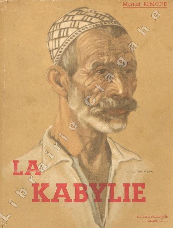
Remond (Martial) :
La Kabylie. Préface de Marcel Larnaude. Ouvrage orné de 16 hors-texte et de 17 cartes et itinéraires. Dessins de Mme Kleiss-Herzig - Photos de l'auteur.
Alger, Editions Baconnier, 1937 ; in-8 (205 mm), broché ; 157, [1] pp., 16 ff. hors-texte de photographies en héliogravures, portraits, scènes et paysages, couverture illustrée d'un portrait en couleur par Mme Yvonne Kleiss-Herzig.
Referenz des Buchhändlers : 20384
|
|
|
REMIREMONT
Carte d'Etat-Major au 1/200 000e. Fin XIXe.
1 feuille repli?e. 32x49 cm.
|
|
|
REMONDINI Tipografia (Bassano 1650 - 1860)
Carte generale du globe terrestre construite & publiee par le S.r Jsaac Brouckner geographe de S.M.I.C. exaninee & approuvee
Raro planisfero pubblicato a Venezia dalla tipografia Remondini ed occasionalmente inserito nel Dizionario geografico portatile, 1761.Interessante mappa del mondo presentata nella proiezione di Mercator e centrata sull'Australia.La Groenlandia è mostrata collegata al Nord America. Il titolo riporta che la mappa fu approvata da Daniel Bernoulli (1700-1782), medico, fisico e matematico olandese, attivo a San Pietroburgo e in Svizzera. Acquaforte, consuete pieghe di carta, leggere ossidazioni, per il resto in ottimo stato di conservazione. Unusual world map by Remondini, taken from Dizionario Geografico portatile. After Isaac Brouckner.Attractive Italian world map presented in Mercator's projection and centered on Australia. Featuring the voyage of Spanberg, among others in the years of 1709-1739. Greenland is shown connected to North America. According to the title the map was approved by Daniel Bernoulli (1700-1782), Dutch physician, physicist and mathematician, active in St. Petersburg and Switzerland.Printed by Remondini, who was a famous publisher of prints and books all with a popular character. He flourished in Bassano in 1661 and was active until 1860.Founded by Giovanni Antonio Remondini (1634 - 1711), the house reached its peak in the second half of the eighteenth century, under the leadership of Joseph Remondini (1745 - 1811).

|
|
|
RENOY Georges
"Bruxelles sous Léopold Ier; 25 ans de cartes porcelaine, 1840-1865."
Bruxelles, Crédit Communal de Belgique, 1979. 21 x 30, 192 pp., très nombreuses illustrations en couleurs et en N/B, broché, bon état.
Referenz des Buchhändlers : 101.308
|
|
|
RENOY Georges
"Bruxelles sous Léopold Ier; 25 ans de cartes porcelaine, 1840-1865."
Bruxelles, Crédit Communal de Belgique, 1979. 21 x 30, 192 pp., très nombreuses illustrations en couleurs et en N/B, broché, bon état (1 pli à la couverture).
Referenz des Buchhändlers : 101.309
|
|
|
RENAUD (Chevalier).
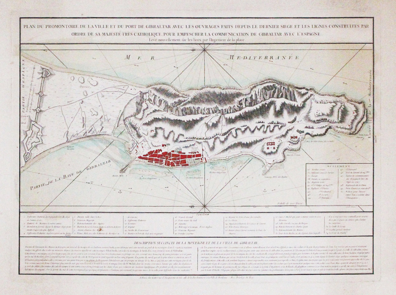
[GIBRALTAR] Plan du promontoire, de la ville et du port de Gibraltar avec les ouvrages faits depuis le dernier siège et les lignes construites par ordre de Sa Majesté Très Catholique, pour empescher la communication de Gibraltar avec l'Espagne. Levé nouvellement sur les lieux par l'ingénieur de la place.
Paris, Lattré, [circa 1780]. 400 x 550 mm.
Referenz des Buchhändlers : LBW-3315
|
|
|
Renoy. Georges.
Brussel onder Leopold I. 25 jaar porseleinenkaarten 1840-1865.
, Brussel, Gemeentekrediet, 1979 , Ingenaaid, In-4, 192 pp., talrijke ills. in zw/w en in kleur, goede staat. ISBN X.
Referenz des Buchhändlers : 18102
|
|
|
RENAUDET B
Jeux de cartes pour joueurs nombreuxA jouer en famille et en société.
broché - 11,5x17,5 - 31 pp - sans date - éditions S. BORNEMANN, Paris.
Referenz des Buchhändlers : 1919
|
|
|
RENAUDET B
La manille manille parlée - manille muette - manille avec un mort - le dix sept - manille à l'envers - manille aux enchères - manille de misère - manille à deux joueurs.règles complètes et commentairesLa science du jeu
broché - 11,5x17,5 - 31 pp - sans date - éditions S. BORNEMANN, Paris.
Referenz des Buchhändlers : 1920
|
|
|
Renaudet B.
Le poker, règles complètes et commentaires. L'art de gagner au poker
Bornemann Tous les jeux et leurs règles Broché In-8, (18x11.5 cm), broché, couverture illustrée, 31 pages, sans date, poker à 52 cartes, à 48, 44, 36 et 32 cartes, freeze-out, la partie à la cave, calcul des probabilités, le bluff, physiologie du jeu ; plats jaunis et légèrement défraîchis, assez bon état. Livraison a domicile (La Poste) ou en Mondial Relay sur simple demande.
Referenz des Buchhändlers : nf174
|
|
|
RENAUD Jean-Jacques
Les chasses coloniales par les cartes postales.
Paris: Editions Le Faubourg, 1993 in-4 oblong, 139 pages, nomb. illustrations en noir. Cartonné, jaquette. très bon état. Cartes postales anciennes sur la chasse dans les colonies d'Afrique et d'Asie. ** Oblong 4to. 139 pp., num. monochrome ills. Hb., d.w., very fine. A collection of ancient postal cards with hunting scenes in colonial days in Africa and Asia.
Referenz des Buchhändlers : 13974400
|
|
|
RENAUDET B.
Tous les jeux et leurs règles : Le piquet, règles complètes et commentaires, le piquet à 2 joueurs, le piquet à 3 joueurs, le piquet à 4 joueurs, le rubicon, la capote. La science du jeu.
Paris, Librairie S. Bornemann, s.d. 11 x 18, 32 pp., quelques illustrations, broché, bon état (couverture défraîchie).
Referenz des Buchhändlers : 23686
|
|
|
RENAUD Alexandre (traduction)
UTAH BEACH à Cherbourg : toute la bataille du Cotentin, 6 juin - 1er juillet 1944.
Editions Leclerc Imprimeur, Saint-Lo, Edité en Amérique par La Division historique du Département de l'Armée, traduit par Alexandre Renaud, sans date, VIII-197 p. et XIV cartes in fine, demi-maroquin à coins marron, environ 28x22cm. Une tache discrète sur le mors-peau du premier plat, premier plat d'origine découpé et contrecollé, un dessin au stylo sur la page de titre, de pâles rousseurs, certaines pages sont un peu froissées, la carte I a été restaurée, de petites déchirures sur les bords des cartes. Bon état pour le reste.
Referenz des Buchhändlers : 117558

|
|
|
Rene' Des Cartes
Les passions de l'ame 1679 Full Leather Bound
2020. Full Leather Bound. NEW. Size: 14.60 x 22.86 cms A Unique Premium Leather-Bound book for elite readers/collectors of old rare books. An Original Leather is being used for binding this book with Golden Leaf Printing and designing on Spine front and Back of the book with edge gilding. WE HAVE MULTIPLE OPTIONS IN COLOR OF LEATHER RED GREEN BLUE MAGENTA TAN PURPLE DEEP BROWN BLACK AND WITH DIFFERENT COLOR LABELS. YOU MAY CHOOSE ANY COLOR OF YOUR CHOICE AND MAIL US. This service is chargeable. Original edition was published in 1679 and this unique edition is Reprinted in 2020 with the help of original edition. Black & white printing on high quality natural shade paper with sewing binding for longer life professionally processed without changing its contents. As these are old books we processed each page manually on computer and make them readable. We give our best to give you the best book but in some cases we have to adjust few pages which are blur or missing or black spots. If it is multi volume set then it is only single volume. We hope that you understand these issues in these old treasure. This is an important book for the readers who want to know more about our old treasure. Our dedicated team is trying to bring these rare books back to the shelves. We are also giving service of printing the hard-to-find books which are not listed in our store. Hope you will like it and give your comments and suggestions. Lang: - French Pages 336. Product Disclaimer: Please be aware that because leather is a natural material slight discoloration or change in texture may be visible. FOLIO EDITION Size 12x19 Inches IS ALSO AVAILABLE ON REQUEST. hardcover
Referenz des Buchhändlers : BIBSD006643746
|
|
|
RENNES
Carte couleurs au 1/200 000?me France en 48 feuilles. Carte n? 14. Sans date.
Une feuille 100x44 cm.
|
|
|
Reported by EBUL'ULA MARDIN, (Turkish jurist, academician and politician), (1881-1957).
[UNPUBLISHED AND RARE MANUSCRIPT NOTES ON THE OTTOMAN AND TURKISH LAND LAW] Toprak hukuku, 1942-1943.
Very Good Turkish Paperback. A manuscript notebook. Roy. 8vo. (23 x 16 cm). In Turkish (Modern). 145, [10] p., schemes. Toprak hukuku, 1942-1943. These extremely rare and unpublished manuscript notes on 'land law' or 'real property law', were taken by a student between the years of 1942-44 during Mardin's lessons in Istanbul University. Very legible script. Fine manuscript with extra papers inside. Mardin was a Turkish jurist, academician and politician. He was one of the ends of the Ottoman Empire and the firsts of Turkish Republic lawyers. He worked as a lecturer at Istanbul University during his whole life, where he graduated, and became a professor of the Civil Law. He ws born in Shkodra. Extremely rare.
|
|
|
Reps, John W.
Cities on Stone: Nineteenth Century Lithograph Images of the Urban West
A clean, unmarked book with a tight binding. 100 pages. 10 3/4"w x 8 1/2"h.

|
|
|
RETHORÉ.
[CHANTILLY/HALATTE/ERMENONVILLE] Carte forestière de Chantilly, Halatte et Ermenonville.
1900. 583 x 780 mm.
Referenz des Buchhändlers : LBW-6788

|
|
|
RETHEL
Carte au 1/200 000e. Sans date.
Une feuille 32x50 cm.
|
|
|
REVIL Joseph; CORCELLE Joseph:
La Savoie. Guide du touriste, du naturaliste et de l'archéologue.
Paris, Masson et Cie, [1903]. In-12 de 12-[2]-VI-280-7 pages, pleine percaline noire, frottée, premier plat décoré en couleurs, pastille de l'éditeur rouge au second plat, titre rouge au dos. Nom de possesseur et toute petite déchirure sans perte au premier ff.
Referenz des Buchhändlers : 10218
|
|
|
Revue de la Bibliothèque nationale de France
Revue de la Bibliothèque nationale de France - N° 40 de 1991voyager Voyager dans le temps : Le grand arbre de la mémoire - Mes trois Renoir inconnus de la BN - les étrangers à Moscou au XVIème et XVIIème siècles - Le journal de marche de JeanJacques Turpin ( 1793 - 1810 ) Les premières cartes routières de France ( XVIième - XIXème siècles ) - l'éveil de la vitesse : la France au galop de la malle-poste - Les voyages pittoreques et romantiques du Baron Taylor - L'art de l'affiche à l'exposition universelle de 1889
In-4 - N° 40 de 1991
Referenz des Buchhändlers : 18169
|
|
|
Revue Française de psychanalyse - Revue Bimestrielle - Organe officiel de la Société Psychanalytique de Paris
Revue Française de psychanalyse : Position Dépressive et Complexe d'OedipeLes cartes et le territoire (Jacqueline Schaeffer) - Prémisses à la position dépressive (Cléôpatre Athanassiou) - Interprétations et processus psychanalytique (René Diatkine) - Influence théorique, emprunt interprétatif (Jean-Luc Donnet) - D'un manque à l'autre (François Duparc) - Exilés...habitez votre nom (Pierre Jordas) - Oedipe avant Thèbes (Jean Bergeret) - Contre-transfert et interprétation freudienne ou Kleinienne (Luisa de Urtubey) - Apogée du sadisme, position dépressive et Oedipe (Didier Houzel) - Pendant la séance...(Michelle Luquet) - Du langage kleinien dans la cure psychanalytique : entre le sens et la réalité des mots (Augustin Jeanneau) - De certains concepts psychanalytiques, vu de ma fenêtre (Florence Bégoin-Guignard) - Réflexions sur les mécanismes contraphobiques et la position dépreessive (James Gammill) / Le Magazine : A propos d'une lecture d'Italo Calvino. Temps zéro: l'attente (Haydée Faimberg) - Les rubriques: Dominique ou les vicissitudes de la relation d'objet (Roger Perron) - Entre les angoisses et les dépressions "pré-dépressives" et le niveau oedipien génital: un moment technique (Geneviève Haag) - Les théories de l'angoisse chez Freud et Mélanie Klein et leur statut métapsychologique (Elizabeth de Bianchedi) - critique et notes de lecture...
1989 N°3, Tome LIII - mai-juint 1989 - Presse Universitaire de France - 250 pages
Referenz des Buchhändlers : 18622
|
|
|
Revue des deux mondes - François Buloz, fondateur
Revue des deux mondes - 1er avril 1864 Dévadatta, scène et récit de la vie hindoue (Théodore Pavie) - Naples et le brigandage de 1860 à 1864 (Marc Monnier) - Gustave III et la cour de France d'après des papiers inédits. III. Le coup d'état du 19 août 1772 (A. Geffroy) - Les cartes géographiques des divers états. La mesure et la représentation du globe terrestre (H. Blerzy) - L'économie rurale en Néerlande, scènes et souvenirs d'un voyage agricole. IV. Les cultures et la production hollandaises, dernière partie (Emile de Laveleye) - La fin de la liberté à Rome. Pompée, Cicéron et César (J.-J. Ampère) - Les idées libérale et la nouvelle littérature. Deux publicistes (Charles de Mazade) - ...
Seconde période - Tome cinquantième - XXXIVe année - 1er avril 1858 - 3e livraison - Paris. Bureau de La Revue des Deux Mondes - grand in-8 broché - 256 pages
Referenz des Buchhändlers : 72833
|
|
|
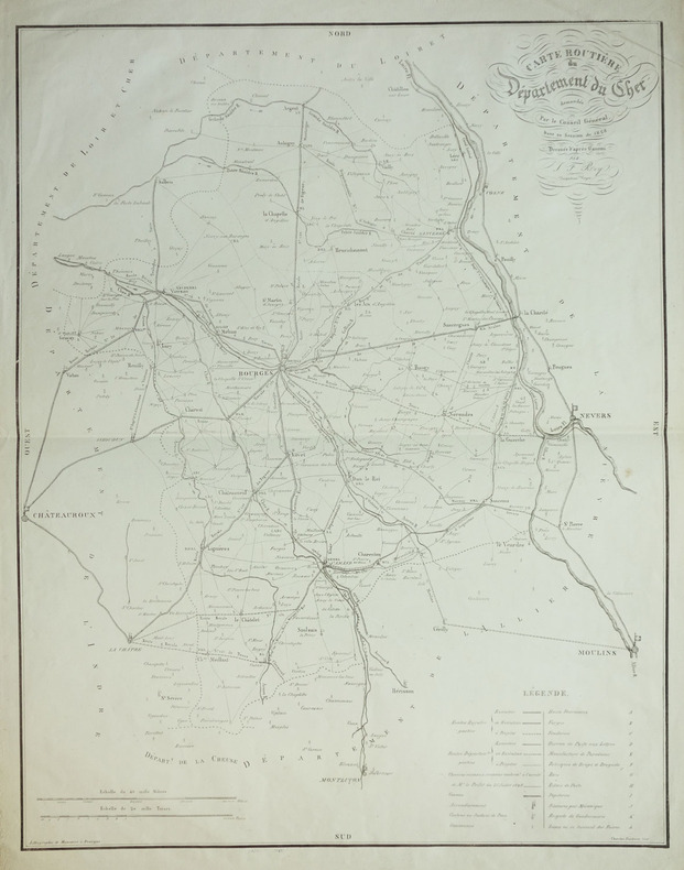
REY (J.F.).
[CHER] Carte routière du département du Cher demandée par le Conseil Général, dans sa session de 1828.
Bourges, Manceron, 1828. 624 x 490 mm.
Referenz des Buchhändlers : LBW-1911
|
|
|
REYNAL DE SAINT-MICHEL, Alain de
Carte géologique à l'échelle du 1/50.000. Feuilles de Basse-Terre et des Saintes [ Guadeloupe ]
2 cartes géologiques format 72 x 90 cm sous chemise commune, Carte géologique détaillée de la France, Département de la Guadeloupe, Ministère de l'Industrie, Paris, 1966
Referenz des Buchhändlers : 61213

|
|
|
Reynier Jean-Jacques
Les Guides Bol d'Air. FInistère Nord Bretagne, de la balade familiale à la randonnée sportive, 445 km de découvertes (29/N)
Cartothèque Edition Les guides Bol d'Air Reliure spirale 2005 In-8 (12 x 21 cm.), format oblong, guide à spirale, couverture illustrée pelliculée à large rabat, 171 pages, très nombreuses illustrations couleurs, plans, indications cartographiques, sites remarquables, données IGN ; une page non-rognée, trois minimes déchirures sans manques au niveau des spirales, un pli au 1er plat, par ailleurs bon état. Livraison a domicile (La Poste) ou en Mondial Relay sur simple demande.
Referenz des Buchhändlers : sb281

|
|
|
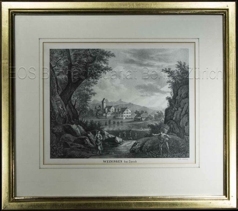
Rey, R.:
Weiningen bei Zürich.
(um 1850). Lithographie von R. Rey. Bildausschnitt: 16,3 x 21 cm. Rahmen: 31 x 35 cm.
Referenz des Buchhändlers : 603BG
|
|
|
Rey, R
Weiningen bei Zürich.
(um 1850). Lithographie von R. Rey. Bildausschnitt: 16,3 x 21 cm. Rahmen: 31 x 35 cm. + Wichtig: Für unsere Kunden in der EU erfolgt der Versand alle 14 Tage verzollt ab Deutschland / Postbank-Konto in Deutschland vorhanden +, Abb.
Referenz des Buchhändlers : 603BG

|
|

 Per e-mail erhalten
 Als pdf-Dokument herunterladen
 RSS feed
 Permanenter link


