|
|
|
SOCIETIES FOR THE PROMOTION OF HELLENIC AND ROMAN STUDIES
A classified Catalogue of the Books, Pamphlets and Maps in the Library of the Societies for the Promotion of Hellenic and Roman Studies.
Roy. 8vo., with a large folding ley; boards, cloth back, covers somewhat age-marked but internally a very good, clean copy of a scarce work. THE SIGNET LIBRARY COPY, with its ownership inscriptions on cover and paste-down. The catalogue, which is well classified by subject, contains over 80,000 items of which some 200 are pamphlets

|
|
|
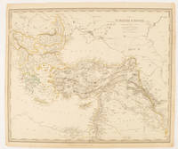
SOCIETY FOR THE DIFFUSION OF USEFUL KNOWLEDGE (SDUK), J & C WALKER (ENGRAVERS)
The Turkish Empire in Europe and Asia with the Kingdom of Greece.
London.: Charles Knight & Co. circa1840s. Lithographed map with original outline hand-colour 31.9 x 39.1 cm small marginal tears neatly repaired with archival material but no loss small surface abrasion affecting the border at the foot edgewear and browning inked pagination in an early hand but in very good condition. A handsome map with fine topographical engraving also showing the borders with Hungary Russia and Persia. . Charles Knight & Co. unknown
Bookseller reference : 174957
|
|
|
Society for the Diffusion of Useful Knowledge
The World on Mercator's Projection
Carta del Mondo in proiezione mercatoriana, in due fogli, tratta dal Family Atlas. Questa mappa dettagliata presenta una notevole quantità di informazioni. Gli Stati Uniti sono mostrati escludendo il sud-ovest e il Texas. Il Texas è stato un paese indipendente dal 1836 al 1845, ma è mostrato qui come parte del Messico. Il confine settentrionale degli Stati Uniti e del Canada mostra il conteso confine per l'Oregon, scendendo fino a circa il 45° parallelo, che riflette le rivendicazioni britanniche in quella regione. La questione fu finalmente risolta nel 1846 con il trattato dell'Oregon che fissava quel confine al 49° parallelo. La regione artica mostra l'estensione delle conoscenze contemporanee, non notando nulla oltre al "Packed Ice" a nord dello stretto di Bering. L'Africa è mostrata con gran parte del suo interno non mappato - quella regione non è stata mappata a fondo fino all'ultima parte del XIX secolo. La Society for the Diffusion of Useful Knowledge, o SDUK, fu fondata nel 1826 per fornire informazioni scientifiche e di altro tipo alla classe media e ai lavoratori britannici. This delicately detailed map on two separate sheets presents a considerable amount of information. The United States is shown excluding the Southwest and Texas. Texas was an independent country from 1836-1845, but it is shown here as part of Mexico. The northern border of the United States and Canada shows the disputed border for Oregon Territory coming down to about the 45th parallel, which reflects British claims in that region. This was finally solved in 1846 with the Oregon Treaty fixing that border at the 49th parallel. The Arctic region shows the extent of contemporary knowledge, noting nothing besides Packed Ice north of the Bering Strait. Africa is shown with much of its interior left unmapped - that region was not mapped thoroughly until the latter part of the 19th century. An attractive an informative map surrounded with a keyboard style border. The Society for the Diffusion of Useful Knowledge, or SDUK, was established in 1826 to provide scientific and other information to the British middle and working classes. The Family Atlas was published by Society for the Diffusion of Useful Knowledge. The SDUK published several editions of its atlas. Dates I have seen quoted are 1829-32, 1840, 1844, and 1846. In 1848 the SDUK ceased to be active, but works which it had commissioned continued to be published.

|
|
|
Società CALCOGRAFICA (1799 - 1805)
Mappemonde ou Description du Globe Terrestre
La carta in esame appartiene a un progetto di atlante – in ambito antiquario noto come “Zattone” – mai portato a compimento, della così denominata Societè Calcographique, un’operazione commerciale messa su da due editori leader del mercato veneto del XVIII secolo, Antonio Zatta (1722-1804) e Giuseppe Antonio Remondini (1747-1811). La denominazione dell’impresa editoriale è nota attraverso una carta del mondo che, nella parte bassa del cartiglio, reca l’iscrizione a` Venise Chez la Societè Chalcographique 1799. (Sicilia 2014: 287). Il progetto sembra non sia stato portato a compimento poiché nessun atlante, con un proprio titolo, indice e frontespizio, contenente queste mappe, è noto in bibliografia. Probabilmente le carte venivano vendute singolarmente o a fascicoli come era comune per imprese editoriali di un certo costo. Le carte a tutt’oggi note sono realizzate mediante l’utilizzo di rami più antichi, appositamente modificati. Le matrici originali hanno molteplici origini: alcune appartengono a un altro sconosciuto Atlante d'Italia dedicato alli Augusti Viaggiatori il Conte, e la Contessa, Del Nort stampato con imprint Venezia MDCCLXXXII presso Vincenzo Formaleoni. Nessun esemplare completo di questa raccolta ci è noto, alcune di queste carte fanno parte di una raccolta fattizia conservata alla Biblioteca Nazionale Marciana di Venezia [284. c. 86], altre sono comparse di tanto in tanto nel mercato antiquario. Il frontespizio dell’atlante di Vincenzo Formaleoni (1752-1797) – che qui pubblichiamo e che ci ha consentito di formulare questa ipotesi – è recentemente apparso in una vendita all’asta Cambi di Genova. Altre mappe dello “Zattone” derivano da lastre di Paolo e Francesco Santini, riusate da Remondini per l’Atlas Universel nell’edizione degli anni 1782/84; altre da matrici impiegate da Antonio Zatta per il Nuovo Atlante pubblicato nel 1796. Le carte dei Santini sono abilmente arricchite, tramite la sovrapposizione di cartigli realizzati, nel classico stile di Zatta, su piccole lastre di rame le cui impronte calcografiche sono chiaramente visibili sulle mappe. I cartigli, realizzati dagli stretti collaboratori di Zatta Pasquali, Zuliani e Pitteri, spesso contengono brevi descrizioni storiche, e le mappe furono realizzate probabilmente per illustrare i notevoli cambiamenti geo-politici cui fu soggetta la penisola italiana durante il periodo napoleonico. Le 60 mappe di questa raccolta a tutt’oggi note, datate tra il 1795 e il 1805, sono principalmente dedicate a illustrare la penisola, ma anche altre regioni europee, i continenti e la già menzionata carta del mondo che riporta l’imprint editoriale della Societè Calcographique. Alcune di queste carte, raffiguranti la Repubblica Cisalpina, sono state descritte come parte di un Atlas très Nouveau del solo Remondini, edito a partire dal 1800: “In sostanza siamo di fronte a una semplice operazione commerciale che pensiamo sia stata operata dal Remondini, sebbene egli non si firmi come editore, poiché proprio nel 1799 egli stava acquisendo i rami dello Zatta” (Terre di Langobardia 2005:14). È molto più probabile che i due editori abbiano collaborato in questa avventura editoriale almeno fino alla morte di Antonio Zatta nel 1804, e che il progetto di un atlante completo non sia stato portato a termine anche per la morte, di pochi anni successiva, di Giuseppe Antonio Remondini. Acquaforte, finemente colorata a mano in epoca, in perfetto stato di conservazione. Bibliografia Il Piemonte nella Cartografia del Cinquecento e Seicento 1991, 75; Terre di Langobardia 2005:14; Le Grandi Alpi nella cartografia 2005: 147, 148; Sicilia 2014: 287. Zeno Davoli, Roberto Sanfelici, Terre di Langobardia - La "Lombardia" e il Ducato Estense nella cartografia a st... A large double-hemisphere map with ornate cartouches in each cusp. Published after Cook's first circumnaviation it has been updated with his discoveries: New Zealand is shown properly as two main islands and the east coast of Australia has been corrected, although still with Tasmania connected to the mainland. In the North Pacific the spurious North West Passage is shown. This very rare map belongs to a never finished project for the atlas of the so called Società Calcografia, a simple commercial trade realized by the two main Venetian publishers of the XVIII century, Antonio Zatta and Giuseppe Antonio Remondini. The term Società Calcografica has been deduced from the map of the world, which is part of the collection and bears in the lower cartouche the French writing “à Venise Chez la Societè Chalcographique 1799”. As already stated, the project was never finished for no atlas containing these maps has ever been listed in any bibliography. Very likely, then, the maps have been sold individually, or maybe as part of smaller, custom collections. The maps of the collection derive from Paolo and Francesco Santini’s plates, used by Remondini in his 1782/4 Atlas Universelle, and from the plates of Antonio Zatta’s Nuovo Atlante published in 1796. Santini’s maps have been beautifully enriched, using the system of small, masked plates which can be perceived through the platemarks on the paper, with great cartouches according to the classical style of Zatta and have been probably engraved by the members of his staff, Pasquali, Zuliani and Pitteri. The cartouches bear very often historical descriptions and maybe the maps have been realized to depict the great geographic changes of the peninsula during the Napoleonic period. The modern bibliography Terre di Langobardia describes some of the maps depicting the Repubblica Cisalpina, presenting them as part of Remondini’s “Atlas très Nouveau”, which was printed starting from 1800. In our opinion, the two publishers worked together to the realization of the project until Antonio Zatta died (1804), and the complete atlas was never finished because Giuseppe Antonio Remondini also died in 1811. I personally know 61 maps which were part of the project. Copper engraving, fine hand color, in excellent condition.

|
|
|
Socony-Vacum Oil Company
Mobilgas Miracle Fold Road Map of the Central United States
Undated but appears to be circa late 1950s. Approx. 18" x 33". Two-sided. Printed in red and blue. Covers from the Gulf Coast to the Canadian border and from Pittsburgh to Denver. Unmarked with moderate wear. A nice vintage copy. Book

|
|
|
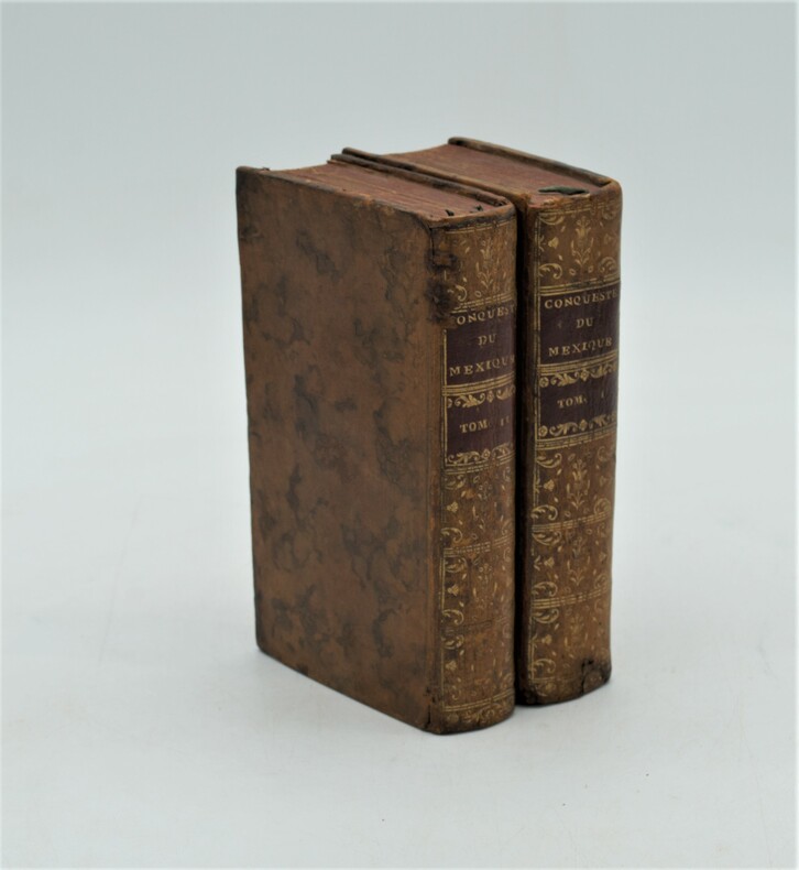
SOLIS (Antoine de).
Histoire de la Conqueste du Mexique, ou de la Nouvelle Espagne, par Fernand Cortez, traduite de...par l'Auteur du Triumvirat. Cinquième édition .
Paris, Compagnie des Libraires, 1730 ; 2 volumes in-12 de 15 ffnch., 606 pp., 13 ffnch., 6 ffnch., 560 pp.,12 ff. Et illustré de 2 cartes ( Golfe du Mexique et environs du lac du Mexique) et 11 planches ,la plupart dépliantes (Vue du Rio de Canoas, l'Ile de Cuba au port St Jacques, vaisseaux de Cortez désagréés sur une plage, bataille dans la vallée d'Otumba, vue de Mexico, etc..), relié plein basane marbré , dos lisse orné avec pièces de titre et tomaison rouge , tranches rouges , quelques petits accidents et restaurations aux reliures , petit manque de papier au titre du tome 1 sans atteinte.
Bookseller reference : PHO-1238
|
|
|
SOLIS, DON ANTOINE DE.
Histoire de La Conquête du Mexique, ou de la Nouvelle Espagne, traduite de l’espagnol de Don Antoine de Solis
Paris, Jean Bouillerot, 1691. Édition originale in-4° (25x19,5cm), 16ff.-630pp.-12ff. , illustré de 2 cartes et 12 planches , la plupart dépliantes , relié plein veau époque , dos à nerfs orné avec titre , restauration au dos , mouillure en fin d’ouvrage.
Bookseller reference : PHO-1239

|
|
|
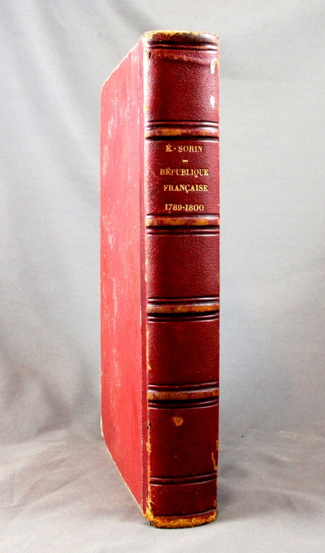
SORIN Elie:
Histoire de la République française. 1789-1800.
Paris, F. Polo, 1873. In-4 de 796 pages, demi-basane rouge, dos à nerfs orné à froid. Dos et coiffes frottés, léger accroc à la coiffe inférieures, rousseurs.
Bookseller reference : 1646
|
|
|
SORIN J.
Rapport sur la carte historique et arch?ologique de l'Anjou de M. La Bessi?re, instituteur primaire ? St-Georges-sur-Loire. Article (6 pages) dans le Bulletin de la Socoi?t? Industrielle d'Angers.
Num?ro complet.
|
|
|
Soseki Natsume / Written by Meiji Maps
Botchan Java sparrow Meiji Zhusho Junior High School Student Library 1
Not Available 1979. Soft Cover. Fine. The book is in fine condition. Not Available paperback
Bookseller reference : 2090502113710012
|
|
|
Soseki Natsume / Written by Meiji Maps
I am a cat Upper and lower volume set
Not Available 1993. Soft Cover. Fine. The book is in fine condition. Not Available paperback
Bookseller reference : 2090502113711564
|
|
|
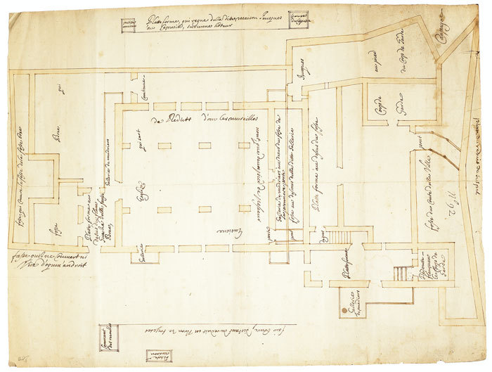
SOSPEL. MANUSCRIT.
Plan du réduit de Sospel.
1740-1748. 558 x 427 mm.
Bookseller reference : LBW-670
|
|
|
Sotheby's
Sotheby's : Atlases, Travel and Natural History : 22 June 1990
No inscriptions or marks. No creasing to covers or to spine. A very clean very tight copy with bright unmarked boards, small scratch to front and no bumping to corners. 298pp. Images and description of 576 Lots of maps, natural history prints and paintings and travel and exploration paintings etc.

|
|
|
Sotheby's
The Benevento Collection
This is a fine softcover copy with no wear at all. Completely clean inside and out. This is a sale catalog for an auction held at Sotheby's London on May 5, 2010. Sale code: L10409 "CORONELLI". The sale consisted of the Benevento Collection (71 lots) of important maps and atlases. All illustrated in color. Prices realized sheet included. 11" high X 8" wide, 88 pages.
|
|
|
SOTHEBY'S
The Travel Sale: Books, Maps, Atlases, Natural History and Topographical Pictures
4to [27 x 21 cm]; 225, [i] pp, hundreds of colored & uncolored illustrations & maps, including many full-page, bibliography, index. original pictorial heavy paper wraps, title on cover and spine, few minor notes, near fine, clean. A picture of this book is available upon request by email. A beautifully illustrated Sotheby's sale of books, maps and paintings on Africa, Australasia, Near & Middle East, Americas, Asia, Europe, wall maps, atlases, etc describing 447 lots in detail, very well-illustrated, sale held in London 2 December 1999. A very useful reference. Sale L09215.
|
|
|
SOTHEBY'S
The Travel Sale: Books, Maps, Atlases, Natural History and Topographical Pictures
4to [27 x 21 cm]; 272 pp, hundreds of colored & uncolored illustrations & maps, including many full-page, bibliography, index. original pictorial heavy paper wraps, title on cover and spine, few minor notes, near fine, clean. A picture of this book is available upon request by email. A beautifully illustrated Sotheby's sale of books, maps and paintings on Africa, Australasia, Tahiti, South Seas, North & Central America, Caribbean, Europe, etc describing 454 lots in detail, very well-illustrated, sale held in London 14 December 2000. A very useful reference. Sale L00720.
|
|
|
SOTHEBY'S
The Travel Sale: Mediterranean & Middle East
4to [27 x 21 cm]; 219, [iii] pp, hundreds of colored illustrations & maps, including many full-page, some black & white illustrations, bibliography, index. original pictorial heavy paper wraps, title on cover and spine, fine, clean, with the prices realized on loose sheets. A picture of this book is available upon request by email. A beautifully illustrated Sotheby's sale of books, maps and paintings on the middle east, describing 603 lots in detail, very well-illustrated, sale held in London 17 October 2001. A very useful reference. Includes large sections on Greece, Turkey, North Africa, etc. Sale L01956.
|
|
|
Sotheby's
The Travel Sale: Pictures and Near & Middle Eastern Books & Maps
This is a very good softcover copy with just light wear. Completely clean inside and out. Spine not creased, binding firm. There are some handling marks here and there and a scratch to the right page-edge, and spine. This is a sale catalog for an auction held at Sotheby's in London on October 14-15, 2003. Sale number: L03622. The sale consisted of paintings, watercolors, drawings, books, maps and photpgraphs of the Near and Middle East. 762 lots in the sale. Many illustrated in color. 11" high X 8" wide, 292 pages. Prices realized sheets included.
|
|
|
SOTHEBY'S
The Travel Sale; Pictures and Near & Middle Eastern Books and Maps
4to [27 x 21 cm]; 292 pp, hundreds of illustrations, almost all in color, including many full-page, index. original pictorial heavy paper wraps, title on spine and cover, light corner wear, else fine, clean and unmarked, includes the loose list of prices realized. A picture of this book is available upon request by email. One of Sotheby's better sales of book and paintings on the middle east, describing 762 lots in detail, very well-illustrated. Sale L03622.
|
|
|
SOTZMANN (D. F.)
Special Karte von der Prignitz miçt Genehmhaltung der Königl. Academie der Wissenschastem zu Berlin.
1795 toilée, étui. 1 carte pliante, 51 x 74 cms, Berlin, D.F. Sotzmann, 1795,
Bookseller reference : 11802
|
|
|
SOTZMANN (Daniel Friedrich).
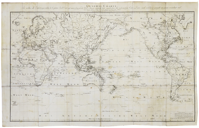
General Charte, in welcher alle Entdeckungen welche der Capitain Jacob Cook auf seinem drey grossen Welt Reisen gemacht hat.
Berlin, Haude und Spener, 1785. 574 x 896 mm.
Bookseller reference : LBW-5889
|
|
|
SOULIER (E.) & ANDRIVEAU-GOUJON (Eugène).
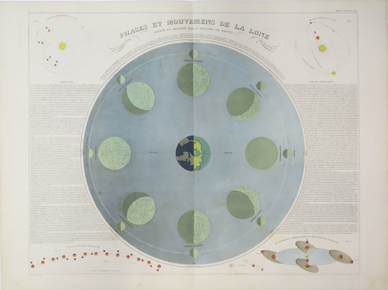
[LUNE] Phases et mouvemens de la lune. Dressé et dessiné par E. Soulier (de Sauve).
Paris, E. Andriveau-Goujon, 1889. 469 x 669 mm.
Bookseller reference : LBW-3523
|
|
|
SOULIÉ, Docteur Frédéric
LES CONSEILS DU VIEUX BRIDGEUR
Paris Edité par Les Laboratoires Pépin Leboucq / Draeger, Imp. Sans date in 12 (18,5x13,5) 1 volume broché, couverture illustrée, 64 pages, avec des illustrations en couleurs. Bon exemplaire ( Photographies sur demande / We can send pictures of this book on simple request )
Bookseller reference : 27889
|
|
|
sous la direction de M. Dumont d'Urville,... [Rédigé par Louis Reybaud.] - (AMBROISE TARDIEU - GRAVEUR)
PLANCHE N°64 - CARTE DES ILES TAÏTI POUR SERVIR AU VOYAGE PITTORESQUE AUTOUR DU MONDE PAR M. D'URVILLE - 1834 - ["Voyage pittoresque autour du monde, résumé général des voyages de découvertes de Magellan, Tasman, Dampier,... etc.", publié sous la direction de M. Dumont d'Urville,... [Rédigé par Louis Reybaud], 1834-1835 Paris : L. Tenré Editeur,]
Paris L. Tenré 1834/1835 une carte ancienne gravée en noir par Ambroise TARDIEU, Format : 37 x 22 cm, Tirée de : "Voyage pittoresque autour du monde, résumé général des voyages de découvertes de Magellan, Tasman, Dampier,... etc.", publié sous la direction de M. Dumont d'Urville,... [Rédigé par Louis Reybaud], 1834-1835 Paris : L. Tenré Editeur,
Bookseller reference : 27140
|
|
|
South Africa - Südafrika
Ephemera. Konvolut in 11 Teilen.
Johannesburg, 1940-1958. Das Konvolut bestehend aus 4 geografischen Karten: Map of Cape Town, 1948 / Tourist Map of Johannesburg,1951 / Map Your Holiday in South Africa (2 Ex.) und aus 7 Broschüren: Visit the Home of the White Rhino, Historic Pretoria, Sauk, Heart Vol. 4, 1949, Reports on the State of South Africa, 1958, South Africa - Land of Contrast, Pretoria. Good condition.
Bookseller reference : 24914

|
|
|
SOUTH DEVON & DARTMOOR.
Map of South Devon and Dartmoor, compiled from the Ordnance Survey shewing River, Road and Railway, distinctly defined and coloured. [Scale Two Miles to an Inch.] A RARE SURVIVAL
8vo., folding coloured map on cloth measuring 20 x 30 inches (approx. 51 x 76 cms) folding in 21 panels to 7 x 4.5 inches (approx. 18 x 12 cms), some mild age-soiling and a few small annotations; patterned cloth boards, upper board with printed paper label, backstrip frayed else a sound copy. Locally published version of W.H. Smith's Reduced Ordnance Survey map. EXTREMELY SCARCE IN THIS CONDITION.
|
|
|
South World Maps
South America:Ports Of Call & Routes - Mapa Eng/Esp
unknown_binding. Good. Access codes and supplements are not guaranteed with used items. May be an ex-library book. unknown
Bookseller reference : 987238181X.G ISBN : 987238181X 9789872381813
|
|
|
SOUTH-AMERICA - JAILLOT, HUBERT/ BRION DE LA TOUR.
Amerique Meridionale divisée en ses Principales Parties au sont distinqués les une des autres Les Estats suivant Francois, Castillans, Portugais, Hollandois. Revüe et Corrigée par Mr. brion.
A Paris, chez le Sr Desnos, 1783. 46x64 cm. Engraved map of South America, contemporary handcoloured. The 2 large cartouches uncoloured. Right margin shaved, small tear showing into scale, of which a small part lost (1x1 cm.).
|
|
|
SOUTH-AMERICA - JAILLOT, HUBERT/ BRION DE LA TOUR.
Amerique Meridionale divisée en ses Principales Parties au sont distinqués les une des autres Les Estats suivant Francois, Castillans, Portugais, Hollandois. Revüe et Corrigée par Mr. brion.
A Paris, chez le Sr Desnos, 1783. 46x64 cm. Engraved map of South America, contemporary handcoloured. The 2 large cartouches uncoloured. Right margin shaved, small tear showing into scale, of which a small part lost (1x1 cm.).
Bookseller reference : 25418
|
|
|
Southern Pacific Company
Map of San Francisco: Showing points of special interest to attendants the Fifth International Convention of the Epworth League July 18-21 1901
<p>Map of San Francisco: Showing points of special interest to attendants the Fifth International Convention of the Epworth League July 18-21 1901 folding map of 21" x 28" printed in black & red.With numbered locations of places of Methodist interest and historical. Verso of map with 23 panels detailing trips excursions to Yosemite Valley Southern California including Pasadena Redlands Riverside Palo Alto Santa Cruz Lick Observatory. Very good minor wear; short tears at folds.</p><p>San Francisco before the 1906 devastating earthquake.</p> unknown
Bookseller reference : 2221875

|
|
|
Southern Pacific Company
Map of San Francisco: Showing points of special interest to attendants the Fifth International Convention of the Epworth League July 18-21 1901
<p>Map of San Francisco: Showing points of special interest to attendants the Fifth International Convention of the Epworth League July 18-21 1901 folding map of 21" x 28" printed in black & red.With numbered locations of places of Methodist interest and historical. Verso of map with 23 panels detailing trips excursions to Yosemite Valley Southern California including Pasadena Redlands Riverside Palo Alto Santa Cruz Lick Observatory. Very good minor wear; short tears at folds.</p><p>San Francisco before the 1906 devastating earthquake.</p> unknown books
Bookseller reference : 2221875
|
|
|
Soviet Union Information Bureau.
THE SOVIET UNION. Facts. Descriptions. Statistics.
288p. + Plus two color folding maps. Decorated title page. Lacks first endpaper. 8vo. Original full red cloth binding, stamped in gold. Original dust jacket, very slightly worn with a few tears but no loss. With mimeographed sheet listing the Council of People's Commissars of the Soviet Union as of February, 1932. First American edition. Coldwar/Economics 7
|
|
|
Spaeth (Marcel) :
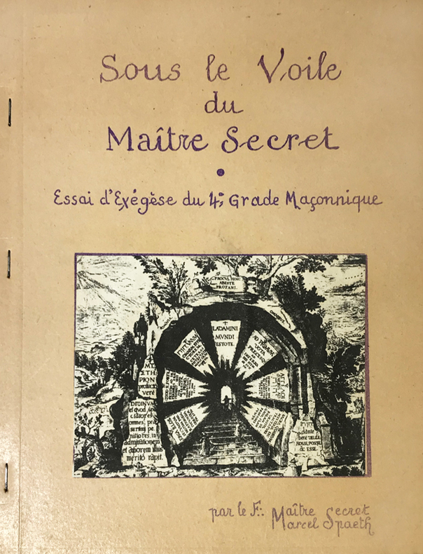
Sous le Voile du Maître Secret. Essai d'Exegèse du 4e grade Maçonnique. Par le F.: Maître Secret, Marcel Spaeth.
Rueil-Malmaison, Marcel Spaeth, s.d. (circa années 1960) ; in-4, broché agrafé sur le côté, polycopié de 53, (3) ff. de planches, couverture beige illustrée, titre indigo reproduction d'écriture, (1) f. de papier bleu en frontispice, nombreuses figures, texte recto.
Bookseller reference : 14763
|
|
|
SPARRMAN
Voyage au Cap de Bonne-Espérance et autour du monde avec le capitaine Cook, et principalement dans le pays des Hottentots et des Caffres
Paris, Buisson, 1787. 2 vol in-4° (26 x 20 cm) , 2ff.-XXI-3pp.-478pp.[2] ff., 2ff.-462 pp., illustré d’un frontispice, une carte et 15 planches, relié plein basane époque, dos à nerfs orné avec pièces de titre et tomaison vertes, triple filets aux plats et roulette intérieure, tranches marbrées, coiffe sup. réparée, tache au coin, travail de ver (tome 2) sur 15 feuillets, 2 cahiers brunis, petite mouillure marginale.
Bookseller reference : PHO-1778

|
|
|
SPARRMAN (Anders)
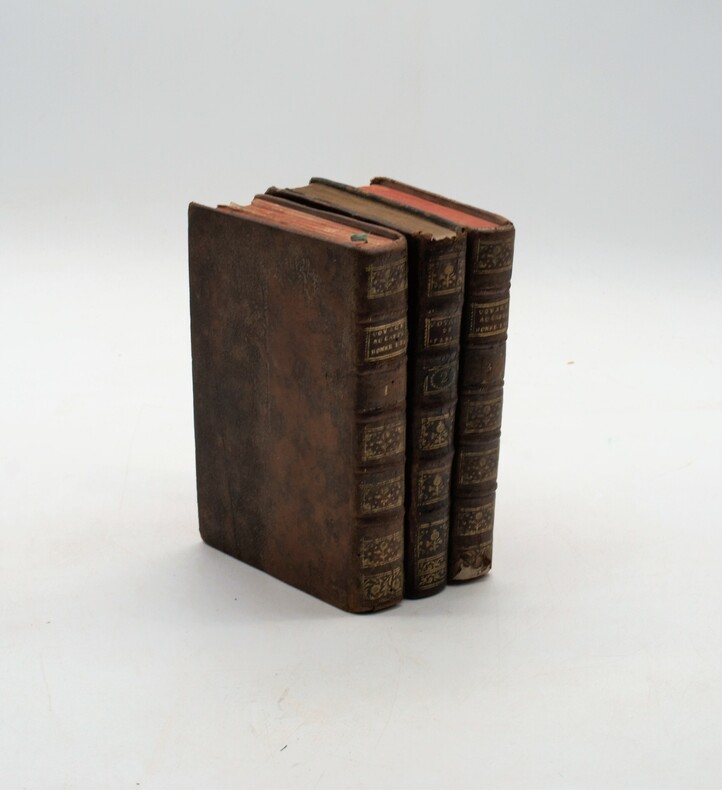
Voyage au cap de Bonne-Espérance, et autour du monde avec le capitaine Cook, et principalement dans le pays des Hottentots et des Caffres.
À Paris, chez Buisson, 1787, in-8, 3 volumes, XXXII-388pp-366pp-363pp , illustré de 16 gravures (6 en répétition) , relié plein cuir marbré époque , dos à nerf orné avec pièce de titre , dos du tome 2 différent , accident aux coiffes , 1 planche détachée , fente intérieure tome 1.
Bookseller reference : PHO-1121
|
|
|
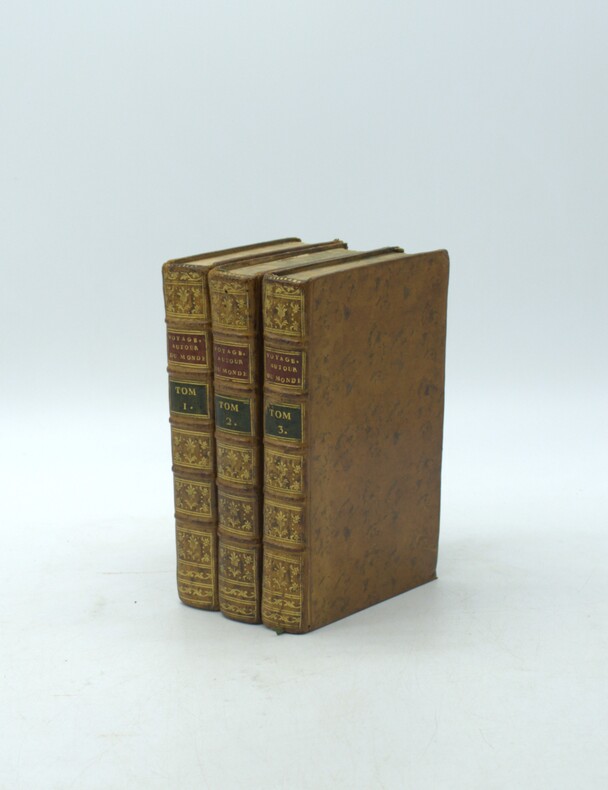
SPARRMAN, André.
Voyage au Cap de Bonne-Espérance, et autour du monde avec le capitaine Cook. et principalement dans les pays des Hottentots et des Caffres.
Paris, Buisson, 1787. Trois volumes in-8 (198x120mm), xxxii-388pp.-2 pl., 2ff.-366pp.- 8 pl., 2ff.-363pp.- 6pl.. Basane marbrée de l'époque, tranches marbrées, dos à nerfs ornés avec pièce de titre (rouge) et tomaison (verte) mouillure au t2, carte volante.
Bookseller reference : PHO-2220
|
|
|
SPARRMAN, André.
Voyage au Cap de Bonne-Espérance, et autour du monde avec le capitaine Cook. et principalement dans les pays des Hottentots et des Caffres.
Paris, Buisson, 1787. Trois volumes in-8 (203x130mm), xxxii-388pp.-2 pl., 2ff.-366pp.- 8 pl., 2ff.-363pp.- 6pl.. Basane porphyre époque, dos lisse orné avec tomaison et pièce de titre, frises aux plats, tranches dorées, coins usés dont 1 émoussé, accroc à la coiffe tome 3, frottements, épidermures au tome 1 avec petites pertes de matière, charnières fendillées tome 1, petite mouillure marginale sur quelques feuillets, légères rousseurs et brunissures, carte détachée avec trace de renforcement, réparation sur 1 planche.
Bookseller reference : PHO-2223

|
|
|
Special Feature/Flower Journey, Dumpling Journey Maps are said to be "in your head" by Toemon Sano and others
Lapin Ropan May 1997
Not Available 1997. Soft Cover. Fine. The book is in fine condition. Not Available paperback
Bookseller reference : 2090502113711262
|
|
|
Special Feature/Tourist Maps of Eguro - Kenji Takarabe, Motoaki Tawara, Tatsuo Shihashi and others Urabun Publishing
The eyes of the eyes Touch the heart of antique arts and crafts November 1985 No.108
Not Available 1985. Soft Cover. Fine. The book is in fine condition. Not Available paperback
Bookseller reference : 2090502113716172
|
|
|
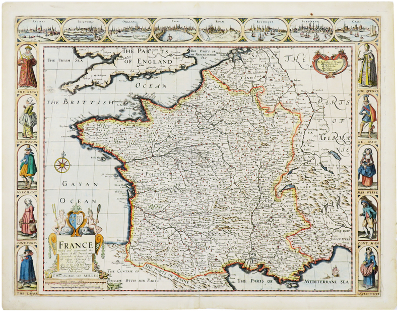
SPEED (John).
France revised and augmented, the attires of the French and situations of their cheifest cityes.
Londres, Thomas Bassett and Richard Chiswell, [1676]. 402 x 522 mm.
Bookseller reference : LBW-7057
|
|
|
Speed, John maps
NORTHUMBERLAND reproduction
FINE map. Reproduction from Speed's "THEATRE OF THE EMPIRE .". Softcover. FINE map. Overall 17.5"x23.5" image 15.25"x20". This is not a photographic reproduction. Attractive & colorful. . FLAWLESS image. Not even the faintest aging foxing etc. VERSO FLAWS: light but extensive surface damage from some sort of adhesive with some loss of lettering. Verso only effected not into recto. . paperback
Bookseller reference : 001174
|
|
|
Speed, John
Shropshyre Described: The Situation of Shrowesbury Shewed with the Armies of Thos Earles, and Other Memorable Things Observed
Undated facsimile reprint of map of Shropshire originally issued in the early 1600s. eng
|
|
|
SPEED, JOHN.
John Speed's England. A coloured Facsimile of the Maps and text from the Theatre of the Empire of Great Britaine. First Edtion, 1611.
London, Phoenix House Limited, (1953-54). Folio. 4 orig. hcloth, all in orig. slicase. Fine and clean. Text and fine facsimile-maps in colour.
|
|
|
SPEED, JOHN.
John Speed's England. A coloured Facsimile of the Maps and text from the Theatre of the Empire of Great Britaine. First Edtion, 1611.
London, Phoenix House Limited, (1953-54). Folio. 4 orig. hcloth, all in orig. slicase. Fine and clean. Text and fine facsimile-maps in colour.
Bookseller reference : 49146
|
|
|
Spencer, Brian
A Visitor's Guide to the Lake District (revised edition)
No marks or inscriptions. A lovely clean very tight copy with bright unmarked boards and no bumping to corners. Dust jacket price clipped but not marked or torn or creased. 139pp.

|
|
|
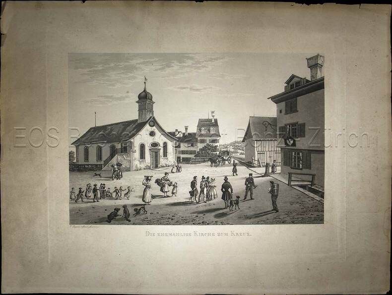
Sperli, Johann Jakob (1794-1843)
Die ehemahlige Kirche zum Kreuz.
(1838). Aquatinta, gezeichnet und gestochen von Johann Jakob Sperli d. Ä. Blattgrösse: 40 x 53 cm. Plattengrösse: 31 x 40 cm. Bildausschnitt: 23,2 x 34,5 cm. + Wichtig: Für unsere Kunden in der EU erfolgt der Versand alle 14 Tage verzollt ab Deutschland / Postbank-Konto in Deutschland vorhanden +, Abb.
Bookseller reference : 845CG

|
|
|
Sperli, Johann Jakob (1794-1843):
Die ehemahlige Kirche zum Kreuz.
(1838). Aquatinta, gezeichnet und gestochen von Johann Jakob Sperli d. Ä. Blattgrösse: 40 x 53 cm. Plattengrösse: 31 x 40 cm. Bildausschnitt: 23,2 x 34,5 cm.
Bookseller reference : 845CG
|
|
|
Sphyroeras, Vasilis & Avramea , Anna & Asdrahas, Spyros
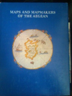
Maps and Mapmakers of the Aegean
Athens: Olkos Publishers 1985 Book. As New. Hardcover. 1st Greek Edition. Translated by G. Cox J. Solman. The charting of the Aegean Sea or the Greek Archipelago from the 15th up to the 19th century. 236p. Map Index; General Index. 166 color and black & white maps. Olkos Publishers hardcover
Bookseller reference : 040277
|
|
|
SPHYROERAS
Maps and mapmakers of the aegean
apla6. In-4, relié toilé marron d'édition, jaquette illustrée (legerement frottée sur les coins), livre en tres bon état. 267 pages. Illustré. Éditeur : Athens, Olkos LTD texte en anglais. Date d'édition : 1985
Bookseller reference : CCC00460
|
|
|
Sphyroeras, Vasilis & Avramea , Anna & Asdrahas, Spyros
Maps and Mapmakers of the Aegean
Translated by G. Cox, J. Solman. The charting of the Aegean Sea, or the Greek Archipelago, from the 15th up to the 19th century. 236p. Map Index; General Index. 166 color and black & white maps Book
|
|
|

 Receive by email
 Download as PDF document
 RSS feed
 Permanent link


