|
PARIS.
Plan de Paris Actuel.
Paris, Maison Ligerot et Gaultier, 1881. Plan en couleurs entoilé de 84 cm x 60 cm. Plan replié dans un porte-feuille en percaline rouge d'éditeur, avec son index des rues.
Bookseller reference : 5441
|
|
|
Parish, Steve
A Souvenir of Sydney : New South Wales Australia
No marks or inscriptions. No creasing to covers. A very clean very tight copy with bright unmarked boards, very minor traces of storage and no bumping to corners. 57pp. A mainly illustrated tribute to the beauty and diversity of the Australian city of Sydney.

|
|
|
Parker Robert M. author; Wong Jeanyee maps; Wormell Christopher drawings
BURGUNDY : A COMPREHENSIVE GUIDE TO THE PRODUCES APPELLATIONS AND WINES SIGNED
New York: Simon and Schuster 1990. Hardcover. Octavo; VG/VG-; Hardcover with DJ; DJ spine black with gold print; DJ has slight edgewear but is clean and bright; Boards quarter bound with red cloth to spine and grey paper to boards clean and strong; Text block clean and tight; Signed in ink by the author on front endpaper; 1052 pages illustrated 2-color. 1334823. FP New Rockville Stock. Simon and Schuster hardcover books
Bookseller reference : 1334823 ISBN : 0671633783 9780671633783

|
|
|
Parker, Dave
First Water, Tigers! - A History of the Victoria Fire Department
234 pages including bibliography and index. "Tells the colourful story of the Victoria Fire Department through a well-researched absorbing text and in hundreds of eloquent photographs. Included also are maps, appendices of the department's apparatus over the years, and sections of aural history dating back to 1912, as well as numerous anecdotes. Many original archival sources and the official records of the Victoria Fire Department were used in research." - from dust jacket. Black and white illustrations throughout, plus several in colour. Book clean, bright and unmarked but for date written atop decorated front endpaper. Average wear but no tears to dust jacket. Very nice copy. Book
|
|
|
Parks, William A.
Report on the Building and Ornamental Stones of Canada - Volume III: Province of Quebec
304 pages. Index. Colour and black and white photographic plates. Maps. Foldouts. Chapters include: Limestones; Sandstones; Granites and Gneisses; The So-Called Black Granites and Related Rocks; Marbles; Serpenties and Serpentine Marbles; Slates; Glacial Drift; Rarer Decorative Materials; plus appendices. Average wear and soiling externally. Binding intact. Tears to top of spine. Solid copy of this authoritative reference. Book

|
|
|
PARROT (André)
Babylone et l'Ancien Testament. Richement documenté (planches et cartes, figures).
Ed. Delachaux & Niestlé 1956. Bel exemplaire broché, in-8, 141 pages + planches.
Bookseller reference : AUB-7542
|
|
|
Part 1, Books, Dramatic Compositions, Maps and Cha
Catalogue of Copyright Entries Vol. 1
paperback. Good. Access codes and supplements are not guaranteed with used items. May be an ex-library book. paperback
Bookseller reference : 0266024866.G ISBN : 0266024866 9780266024866

|
|
|
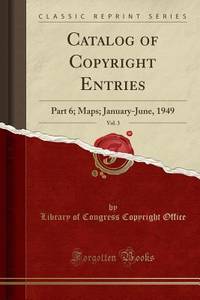
Part 6; Maps; January-June, 1949
Catalog of Copyright Entries Vol. 3
paperback. Good. Access codes and supplements are not guaranteed with used items. May be an ex-library book. paperback
Bookseller reference : 025907957X.G ISBN : 025907957X 9780259079576
|
|
|
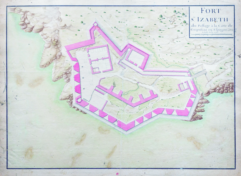
PASAIA. MANUSCRIT.
Fort S.te Izabeth du Passage à la côte de Guipuscöa en Espagne.
[circa 1750]. 362 x 506 mm.
Bookseller reference : LBW-4129
|
|
|
Pascoe, John
New Zealand from the Air in Colour
Very slight marks to a few pages. No inscriptions. A very clean very tight copy with bright unmarked boards and no bumping to corners. Dust jacket not price clipped with very slight marking, creasing/rubbing to edges and small tears to spine ends. 111pp. New Zealand in 1968 in fifty-two full page colour plates with extensive detail and caption on opposite pages. A very scarce book.

|
|
|
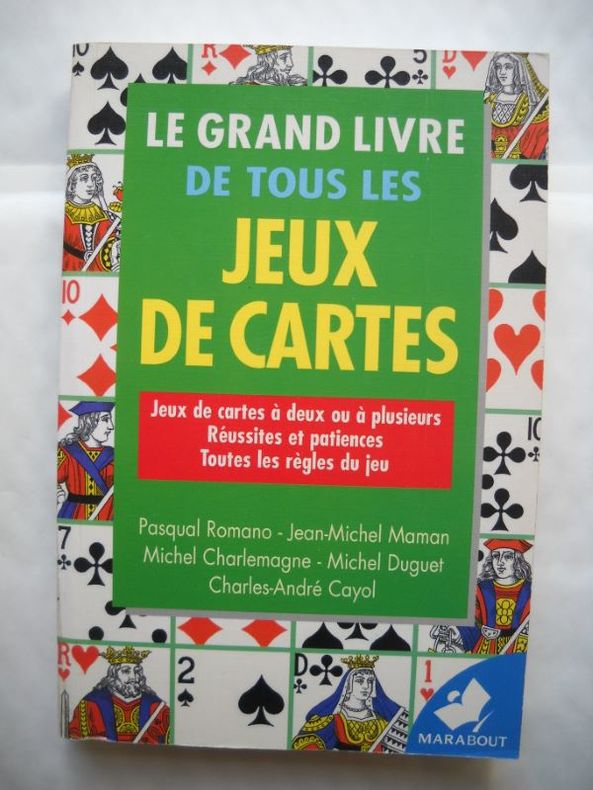
PASQUAL ROMANO - JEAN MICHEL MAMAN - MICHEL CHARLEMAGNE - MICHEL DUGUET - CHARLES ANDRE CAYOL -
LE GRAND LIVRE DE TOUS LES JEUX DE CARTES Jeux de cartes à deux ou a plusieurs Réussites et patiences Toutes les règles du jeu
Broché - 13 x 19,5 - 479 pp - année 1999 - Editions Marabout - Illustrations
Bookseller reference : 18648
|
|
|
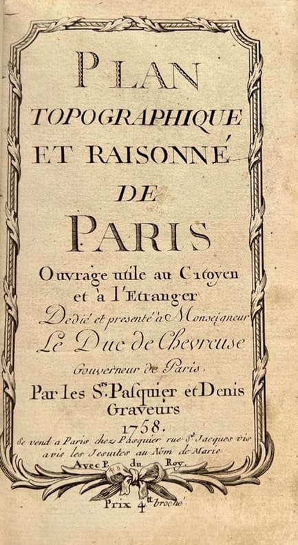
PASQUIER & DENIS.
Plan topographique et raisonné de Paris. Ouvrage utile au Citoyen et à l'Etranger, dédié et présenté à Monseigneur le Duc de Chevreuse, Gouverneur de Paris.
Se vend à Paris, chez Pasquier et Denis, 1758. Petit in-8 de 3 ff.n.ch., 149 pp., 1 f.n.ch., veau lisse brun, dos orné, pièce de titre en maroquin rouge (reliure de l'époque).
Bookseller reference : 42372
|
|
|
Passchier Anne
La France de A à Z
TIGRE ET CIE 2021 24 pages 20 7x20 7x1 9cm. 2021. board_book. 24 pages.
Bookseller reference : 500115097

|
|
|
Passchier Anne
La France de A à Z
TIGRE ET CIE 2021 24 pages 20 7x20 7x1 9cm. 2021. board_book. 24 pages.
Bookseller reference : 500115200

|
|
|
PASSELAIGUE LOUIS
HISTOIRE DES RUES DE CLERMONT ET MONTFERRAND
CLERMONT- FERRAND DE BOREE 1997 1 volume in-4 de 207 pages , dans sa couverture cartonnée éditeur en couleurs , très nombreuses reproductions de photos , gravures et cartes postales anciennes , envoi autographe , un léger écrasement à l'angle inférieur du mors du deuxième plat , bon exemplaire . Bon Couverture rigide
Bookseller reference : 004587
|
|
|
PASTOUREAU Mireille
Voies Océanes de l' Ancien au Nouveau Monde.
P, Editions Hervas,1990, in4° reliure éditeur; 185pp, 164 illustrations. Une histoire de la cartographie des deux Indes par la Spécialiste du sujet. Indispensable et, .passionnant .!
Bookseller reference : M3569
|
|
|
PASTOUREAU Mireille , HOMET Jean-Marie , PICHARD Georges
Rivages & Terres De Provence : Cartographie d'une Province
Depuis la Gaule Romaine , les cartes n'ont cessé de préciser l'image de la Provence et des régions avoisinantes . Voici l'album des anciennes cartes et des premiers plans . Nombreuses illustrations de cartes en couleurs et noir et blanc . Très beau cadeau à faire . Cartes et plans . Voyages . - 176 p. , 1 kg 850 gr.

|
|
|
PASTOUREAU Mireille , HOMET Jean-Marie , PICHARD Georges
Rivages & Terres De Provence : Cartographie d'une Province
Avignon A. Barthélemy 1991 Grand In Quarto Depuis la Gaule Romaine , les cartes n'ont cessé de préciser l'image de la Provence et des régions avoisinantes . Voici l'album des anciennes cartes et des premiers plans . Nombreuses illustrations de cartes en couleurs et noir et blanc . Très beau cadeau à faire . Cartes et plans . Voyages . - 176 p. , 1 kg 850 gr.
Bookseller reference : 022234

|
|
|
PASUMOT François:
Voyages physiques dans les Pyrénées en 1788 et 1789. Histoire naturelle d'une partie de ces montagnes, particulièrement des environs de Baège, Bagnères, Cautères et Garvanie.
Paris, Le Clere, 1797. In-8 de [4]-XXIV-420-[4] p., plein veau marbré, dos lisse orné de filets et fleurons dorés, étiquette de titre rouge.
Bookseller reference : 6471

|
|
|
PATCH Joseph Dorst; Fitzhugh Turner ed.; Virgil Carrington Jones intro.; Marjorie Keen maps
The Battle of Ball's Bluff Limited Edition Inscribed
Leesburg VA: Potomac Press 1958. First Edition. Limited to an unspecified number of copies. Slim octavo 23.5cm.; original cloth in white pictorial dust jacket; 2123pp.; 4 leaves of illus. printed on rectos and versos text illus. throughout map endpapers additional bookplate of maps laid in. Jacket extremities chipped and worn spine crown pulled but present three small losses to spine one touching one letter without loss of meaning. Near Fine in Good or better jacket. Inscribed and signed to local historian and educator Garland Quarles on half title page: "For: Garland R. Quarles / With best wishes / Joseph Dorst Patch. Potomac Press unknown books
Bookseller reference : 30952

|
|
|
PAUL KAHLE.
Piri Re'îs [sic. Pirî Reis] Bahrîje. Das türkische Segelhandbuch für das Mittellandische Meer vom Jahre 1521. Band II: Übersetzung. 1. Lieferung, Kapitel 1-28.
Very Good German Paperback. Small 4to. (26 x 18 cm). In German. [xLviii], 88 p., 4 numerous b/w plates (Tafeln). Piri Re'îs [sic. Pirî Reis] Bahrîje. Das türkische Segelhandbuch für das Mittellandische Meer vom Jahre 1521. Band II: Übersetzung. 1. Lieferung, Kapitel 1-28. First Edition.
|
|
|
PAULHAN (Jean).
L'Oniroscope.
S.l.n.d. [1957] 1 vol. Broché Double feuillet in-4 (50 x 32 cm ouvert). Édition originale de cet hommage poétique à la peintre et sculptrice Yolande Fièvre (1907-1982) sous la forme d'un fac-similé du manuscrit de Paulhan illustré de trois vignettes représentant une paire d'yeux. Paru en juillet 1957 dans la revue Bizarre, ce placard sur vergé crème filigrané est rarissime selon Lacroix (Bibliographie des écrits de Jean Paulhan, p. 189). En belle condition.
Bookseller reference : 111197
|
|
|
PAULHAN (Jean).
L'Oniroscope.
S.l.n.d. [1957] 1 vol. Broché Double feuillet in-4 (50 x 32 cm ouvert). Édition originale de cet hommage poétique à la peintre et sculptrice Yolande Fièvre (1907-1982) sous la forme d'un fac-similé du manuscrit de Paulhan illustré de trois vignettes représentant une paire d'yeux. Paru en juillet 1957 dans la revue Bizarre, ce placard sur vergé crème filigrané est rarissime selon Lacroix (Bibliographie des écrits de Jean Paulhan, p. 189). En belle condition.
Bookseller reference : 111197
|
|
|
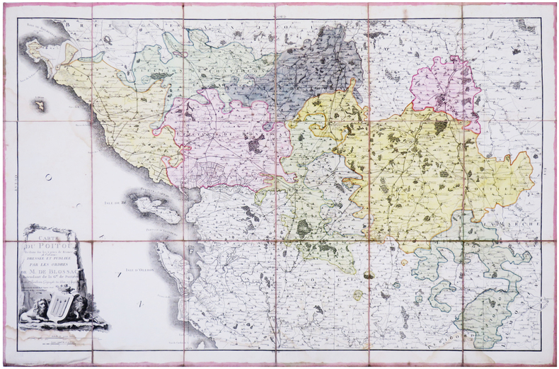
PAULLEAU (Jean-Charles).
[POITOU] Carte du Poitou, réduite sur les cartes de France de Cassini. Dressée et publiée par les ordres de M. de Blossac intendant de la G.té de Poitiers.
1784. En 18 sections montées sur toile et repliées, formant une carte de 620 x 945 mm.
Bookseller reference : LBW-7870
|
|
|
PAULMIER (L.-A.) et BRANVILLE (Eugène de).
DEPARTEMENT DU CALVADOS, divisé en 6 Arrondissements et en 37 Cantons.
Paris, Paulmier et De Branville, sd.(XIXe) Carte (100x68 cm). Limites en couleurs, marques de pliures, rousseurs.
Bookseller reference : 6800
|
|
|
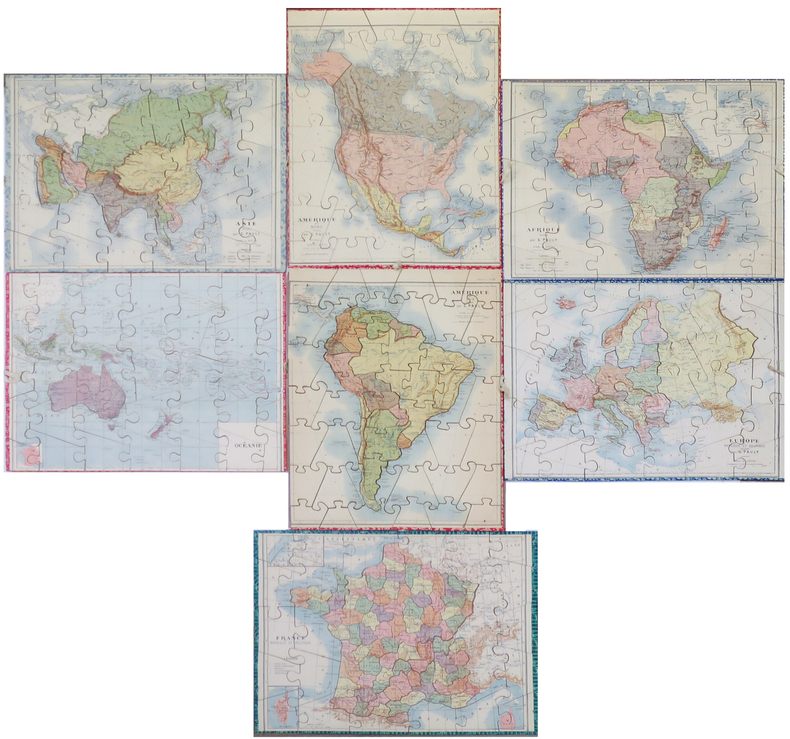
PAULY (Gustave).
Atlas géographique.
Paris, Saussine, [vers 1900]. 7 puzzles cartographiques coloriés (env. 29 x 38 cm), présentés dans leur boîte d'origine illustrée (32 x 40 x 5 cm).
Bookseller reference : LBW-8525
|
|
|
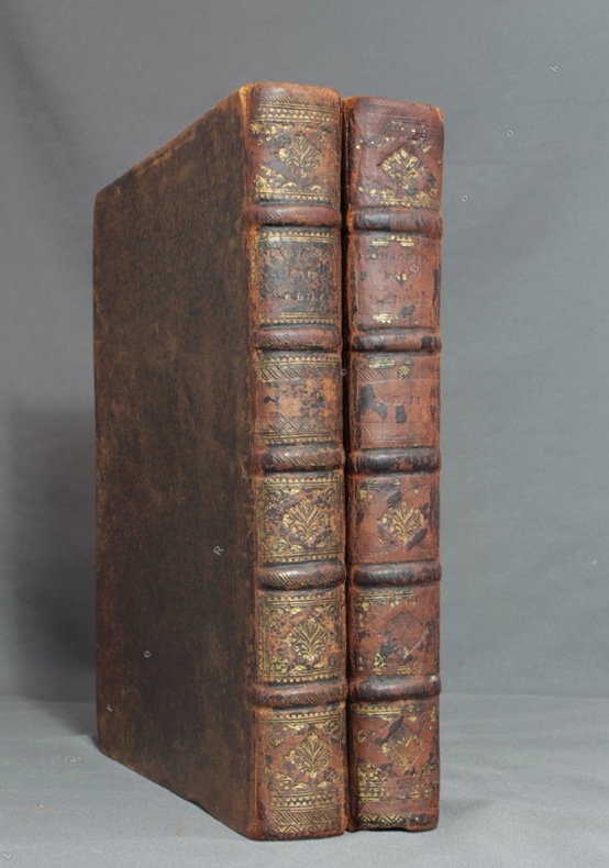
PAUSANIAS; GEDOYN Abbé:
Pausanias, ou voyage historique de la Grèce, traduit en français avec des remarques par M. l'abbé Gedoyn.
Paris, F. G. Quillau, 1731. 2 volumes grand in-4 de [2]-VIII-XXIV-478-[4] et [2]-VI-524 pages, pleine basane brune, dos à nerfs épidermés, manque la coiffe inf. du second volume. Rousseurs et brunissures.
Bookseller reference : 8782
|
|
|
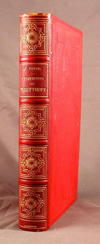
PAYER J.; GOURDAULT Jules (trad.):
L’expédition de Tegetthoff. Voyage et découvertes aux 80°-83° degrés de latitude nord.
Paris, Librairie Hachette et Cie, 1878. In-8 de 381 pages, demi-chagrin rouge, dos à nerfs orné, plats de percaline, tranches dorées, gardes moirées blanches.
Bookseller reference : 2104
|
|
|
PAZZINI CARLI Vincenzo (Siena ? - 1769)
Mappa-Mondo tagliato sul piano di un meridiano Emisfero Orientle - Mappa Mondo tagliato sul piano di un meridiano Emisfero O
Carta tratta dalla rara raccolta di carte geografiche denominata Atlante Geografico, prima stesura delle opera dell’abate Bartolomeo Borghi, pubblicata in Siena dal Pazzini Carli. Molte delle carte, datate tra il 1788 ed il 1800, sono incise da Agostino Costa e poi successivamente inserite nell’opera Atlante generale dell'ab. Bartolommeo Borghi, pubblicato a Firenze nel 1819.Bartolomeo Borghi, che Vermiglioli (Biografia degli scrittori perugini, 1829) definisce "uno dei migliori geografi dell'Europa", nacque nel 1750 a Monte del Lago, piccola frazione del comune di Magione, in provincia di Perugia, sulle rive del Trasimeno. Ordinato sacerdote nel 1774, trascorse i primi anni del suo mandato nel paese natale, poi a Magione e quindi a Sorbello (Cortona).Appassionato studioso di geografia, applicò dapprima le sue conoscenze all'analisi delle terre a lui più familiari: nel 1770 scrisse Descrizione geografica, fisica e naturale del Lago Trasimeno (che sarà tuttavia data alle stampe per la prima volta solo nel 1821), e nel 1791 pubblicò negli atti dell'Accademia etrusca di Cortona una Dissertazione sopra l'antica geografia dell'Etruria, Umbria e Piceno, arricchendo entrambe le opere di una carta delle regioni descritte. Intanto la sua fama di cartografo, oltre che di geografo, cresceva, tanto da fargli ottenere le nomine a membro delle Accademie Cortonese e Reale di Firenze, e procurargli l'incarico, da parte di Pietro Leopoldo, di delineare la carta del catasto pubblico di Cortona e del contado di Castiglione.Nello stesso tempo gli orizzonti geografici della sua attività si allargavano sensibilmente, e se nell'Atlante Novissimo, illustrato ed accresciuto sulle osservazioni, e scoperte fatte dai più celebri e più recenti cartografi di Antonio Zatta (Venezia 1779-1785) il suo contributo fu ancora legato all'area toscana, nell'Atlante geografico che si pubblicò a Siena da Pazzini Carli tra il 1798 ed il 1800 il Borghi tracciò la maggior parte delle carte e spaziò dalle province del Sud-Est dell'Inghilterra, al Regno di Danimarca, alla Romania. Una sorta di prova generale, quest'ultima, della sua opera più importante, quell'Atlante generale dell'ab. Bartolommeo Borghi, pubblicato a Firenze nel 1819. L'Atlante, corredato da brevi descrizioni storiche, politiche, civili e naturali che introducono le carte relative ai territori afferenti a ciascun Impero o Regno illustrato, rispecchia il nuovo assetto geo-politico attuato dal Congresso di Vienna. Incisione in rame, in buone condizioni. Due fogli da 330x250mm. Map taken form the very rare Atlante Geografico, the first draft of the abbot Bartolomeo Borghi, published in Siena by Pazzini Carli. Many of the mapss, dated between 1788 and 1800, are engraved by Agostino Costa and then later incorporated in the Atlante Generale di Bartolomeo Borghi, published in Florence in 1819.Bartolomeo Borghi, who Vermiglioli (Biography of writers Perugini, 1829) calls "one of the best geographers of Europe", was born in 1750 in Monte del Lago, a small fraction of the town of Mansfield, in the province of Perugia, on the shores of Lake Trasimeno. Ordained in 1774, spent the first years of his term in his hometown, then to Mansfield and then Sorbello (Cortona).A passionate student of geography, first applied his knowledge to the analysis of land more familiar to him: Cortona and Tuscany. Meanwhile, his fame as a cartographer, as well as a geographer, was growing, so that he get the nomination as a member of the Royal Academies of Florence and Cortona, and give him the job, by Pietro Leopoldo, to outline the map's of the public land Cortona and the county of Castiglione.At the same time the geographical horizons of its activities widened considerably, and if in the Atlas Novissimo, illustrated and amplified the observations and discoveries made by the most recent and most famous cartographer Antonio Zatta (Venice 1779-1785) his contribution was still related area of Tuscany, in the Atlas geographic monthly published in Siena by Pazzini Carli between 1798 and 1800 the villages drew most of the maps and spaced from the provinces of South-East of England, the Kingdom of Denmark, Romania.A sort of dress rehearsal, the latter, his most important work, the Atlante General of AB. Bartolomeo Borghi, published in Florence in 1819. The Atlas, accompanied by brief descriptions of historical, political, civil and natural to introduce the papers relating to the territories belonging to each United Empire or illustrated, reflects the new geo-political structure implemented by the Congress of Vienna.Two sheets of 330x250mm.

|
|
|
Peace, D. B.
A Historic Buildings Map of the Peak District and Sherwood Forest
Folded map. No marks or inscriptions. No creasing to covers. A very clean very tight copy, bright unmarked, not torn and no bumping to corners. 1pp. Some 450 historic buildings, including 228 churches, are illustrated on the map from sketches and with Heraldic Emblems. On the reverse side is a comprehensive guide arranged alphabetically to the places of interest in towns and villages from Abney to Youlgreave. The map covers parts of Yorkshire West Riding, Cheshire, Staffordshire, Derbyshire and Nottinghamshire. Both map sides are held open to photograph with laid-on metal supports.

|
|
|
Pearsons, Howard
B.C. (British Columbia) Gem Trails - With Maps
30 pages. Undated. Appears to be circa 1970s. Suggests 30 gem-hunting areas in B.C. Two stickers on front cover. Doodling on back cover. Somewhat above-average wear. A sound copy. Book

|
|
|
PEAUX-ROUGES par Jean PICTET.
L'épopée des Peaux-Rouges. Documenté (héliogravures, table des tribus, cartes ... index).
Lausanne, éd. Favre S.A. 1988. Bel exemplaire broché, couverture ornée d'éd., fort in-8, 826 pages + planches.
Bookseller reference : AUB-7853
|
|
|
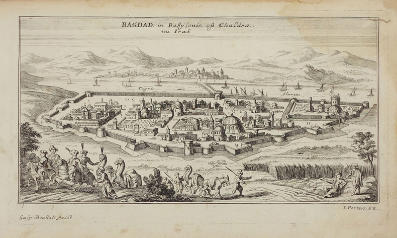
PEETERS (Jan).
[IRAK] Bagdad in Babylonie oft Chaldea nu Irak.
[circa 1690]. 121 x 231 mm.
Bookseller reference : LBW02507
|
|
|
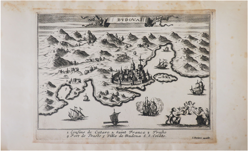
PEETERS (Jan).
[MONTENEGRO] Budova.
[circa 1690]. 150 x 210 mm.
Bookseller reference : LBW045d9
|
|
|
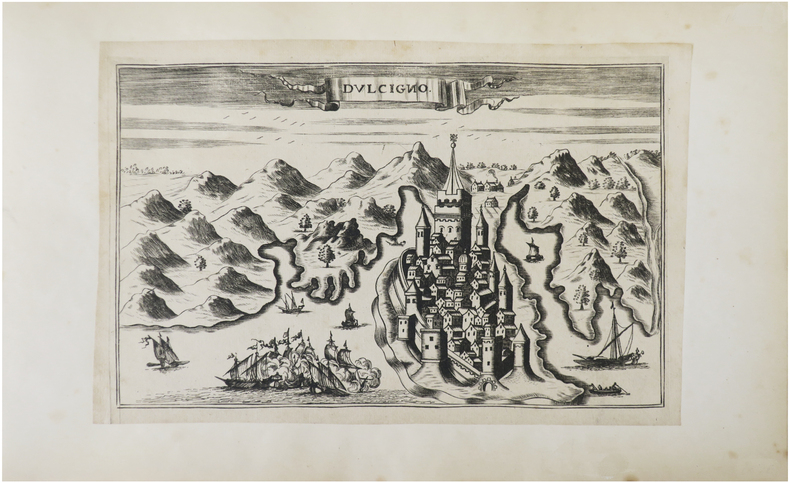
PEETERS (Jan).
[MONTENEGRO] Dulcigno.
[circa 1690]. 132 x 209 mm.
Bookseller reference : LBW045f8
|
|
|
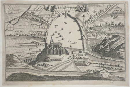
PEETERS (Jan);
[ATHENES] Ville d'Athènes.
circa 1690 128 x 200 mm.
Bookseller reference : LBW045fd
|
|
|
PEETERS (Jan);
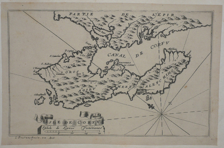
[CORFOU] Isle de Corfu.
circa 1690 130 x 206 mm.
Bookseller reference : LBW045df
|
|
|
PEETERS (Jan);
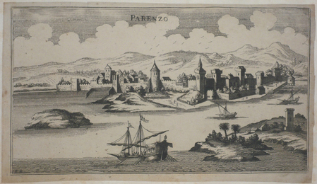
[CROATIE] Parenzo.
circa 1690 133 x 238 mm.
Bookseller reference : LBW045ec
|
|
|
PEETERS (Jan);
[DARDANELLES] Gli Dardanelli.
circa 1690 104 x 263 mm.
Bookseller reference : LBW02e6c
|
|
|
PEETERS (Jan);
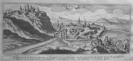
[EGER] Erla.
circa 1690 100 x 247 mm.
Bookseller reference : LBW0279c
|
|
|
PEETERS (Jan);
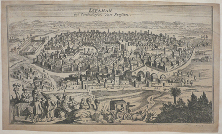
[IRAN] Ispahan int Coninckryck van Persien.
circa 1690 139 x 234 mm.
Bookseller reference : LBW045ed
|
|
|
PEETERS (Jan);
[IRAN] Kaschan int koningryck van Persien.
circa 1690 127 x 236 mm.
Bookseller reference : LBW02508

|
|
|
PEETERS (Jan);
[MONT DES OLIVIERS] Den Bergh van Oliveten.
circa 1690 115 x 259 mm.
Bookseller reference : LBW024dd
|
|
|
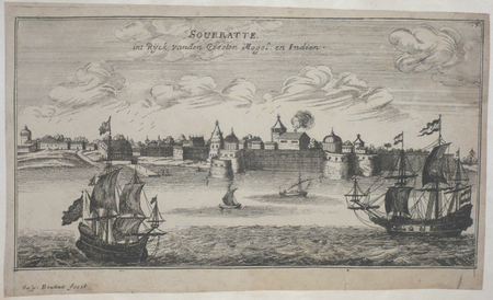
PEETERS (Jan);
[SURAT] Sourratte int Ryck vanden Grooten Mogol en Indien.
circa 1690 129 x 236 mm.
Bookseller reference : LBW045f2
|
|
|
PEETERS (Jan);
[SZARVAS] St. Servaes.
circa 1690 96 x 244 mm.
Bookseller reference : LBW02799

|
|
|
PEETERS (Jan);
[SZIGETVAR] Ziget.
circa 1690 101 x 270 mm.
Bookseller reference : LBW0279e

|
|
|
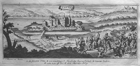
PEETERS (Jan);
[TATA] Tottis.
circa 1690 101 x 248 mm.
Bookseller reference : LBW027a0
|
|
|
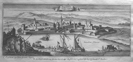
PEETERS (Jan);
[VAC] Waitzen vulgo Vacia.
circa 1690 105 x 256 mm.
Bookseller reference : LBW0279a
|
|
|
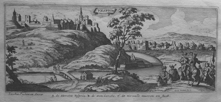
PEETERS (Jan);
[VESZPREM] Vesprin.
circa 1690 101 x 245 mm.
Bookseller reference : LBW0279f
|
|
|
PEETERS (Jan);
[VISEGRAD] Vicegrad.
circa 1690 103 x 265 mm.
Bookseller reference : LBW0279b

|
|

 Receive by email
 Download as PDF document
 RSS feed
 Permanent link


