|
|
|
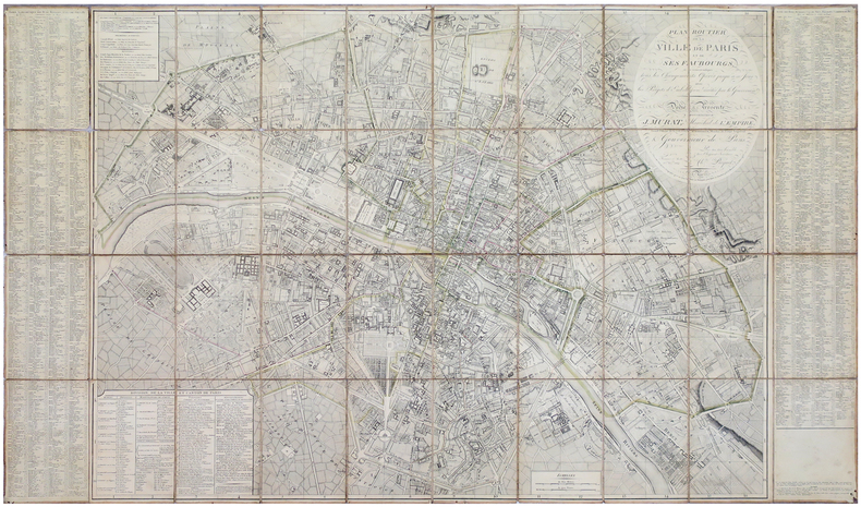
PICQUET (Charles).
Plan routier de la ville de Paris et de ses faubourgs, où se trouvent indiqués tous les changements opérés jusqu'à ce jour avec les projets d'embellissem.t arrêtés par le gouvernem.t.
Paris, Ch.les Picquet, 1er Frimaire An 13-22 nov.bre 1804. En 40 sections montées sur toile et pliées, formant une carte de 0,83 x 1,39 m, étiquette de l'éditeur au dos de la carte.
Référence libraire : LBW-5881
|
|
|
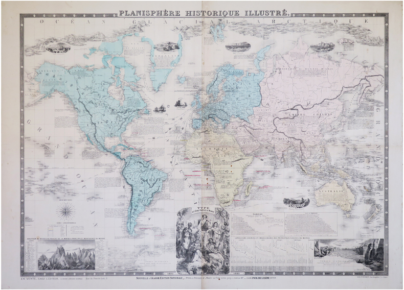
PICK (Eugène).
Planisphère historique illustré.
Paris, Eugène Pick, 1880. 0,76 x 1,02 m.
Référence libraire : LBW-6284
|
|
|
PICARD Marcel
Tarots, pratiques et interprétations. La sagesse des arts divinatoires.
Paris, Albin Michel, 1987. 13 x 21, 346 pp., quelques illustrations, reliure souple d'éditions bon état.
Référence libraire : 79968
|
|
|
Pickering, Charles; Hall, John Charles.
THE RACES OF MAN AND THEIR GEOGRAPHICAL DISTRIBUTION. By Charles Pickering; To Which is Prefixed, AN ANALYTICAL SYNOPSIS OF THE NATURAL HISTORY OF MAN, by John Charles Hall. New Edition.
pp. lxxii, 445 + Folding Colored Map + Twelve Engraved Plates showing the different major Human Races. Text browned, but not brittle. Blue printed endpapers with fourteen pages of publisher's advertisements. Original full cloth binding, decorated in blind, and lettered in gilt. Joints cracked. Hardbound. Very good. It is interesting to see this famous illustrated racial analysis being published during the American Civil War. **PRICE JUST REDUCED! W145
|
|
|
PICQUET, Charles
Carte de la Principauté des Deux-Ponts jusqu'à Landau et Lauter-bourg ; Carte de Otlingen à Philisbourg ((2 cartes entoilées sous étui commun).
2 cartes entoilées sous chemise et étui commun, carte de la France n° 161 (Landau), 92 x 59 cm, et n°173 (Philipsbourg), 46 x 59 cm, Charles Picquet, Géographe graveur du cabinet topographique de S.M. L'Empereur, Paris, s.d. (vers 1805) Bon état. Français

|
|
|
PICQUET, Charles
Carte de la région de Strasbourg ; Carte de la région de Colmar. (2 cartes entoilées sous étui commun).
2 cartes entoilées sous chemise et étui commun, carte de la France n° 162 (Strasbourg), 92 x 52 cm, et n°163 (Colmar), 77 x 59 cm, Charles Picquet, Géographe graveur du cabinet topographique de S.M. L'Empereur, Paris, s.d. (vers 1805) Bel exemplaire. Français

|
|
|
PICQUET, Charles
Carte de Neubrisack au marquisat de Durlach ; Carte des Cantons de Bâle, de Soleure et de la principauté de Porrentrui. (2 cartes entoilées sous étui commun).
2 cartes entoilées sous chemise et étui, carte de la France n° 164 (Neuf-Brisach), 77 x 59 cm, et n°165 (Basle), 79 x 59 cm, Charles Picquet, Géographe graveur du cabinet topographique de S.M. L'Empereur, Paris, s.d. (vers 1805) Bel exemplaire. Français

|
|
|
Piet Lombaerde et Katelijne Geerts
Anvers imaginé/Antwerpen verbeeld/Antwerp portrayed
Museum Plantin-Moretus/Prentenkabinet, Antwerpen, 2015. In-12, format à l'italienne, cartonnage éditeur illustré en couleur, 112 pp. Anvers imaginé. L'âge d'or en cartes et en estampes - Préface. - La ville d'Anvers dans son évolution cartographique, par Piet Lombaerde. - Anvers imaginé. L'âge d'or en cartes et en estampes, par Katelijne Geerts - Planches.
Référence libraire : 3579
|
|
|
Pierre Deffontaines et Mariel Jean-Brunhes Delamarre. Cartes Jacques Brtin
Atlas aérien. France Tome 5. Alsace, Vosges, Lorraine, Ardennes, Champagne, Morvan, Bourgogne, Jura
Paris, Gallimard, 1964, Cartonnage éditeur avec jacquette, 187 pages. Bon état.
Référence libraire : 17564

|
|
|
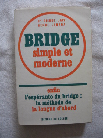
Pierre Jaïs, Henri Lahana
Bridge simple et moderne
1975 Editions du Rocher broché, 277p. Bon état
Référence libraire : 2465
|
|
|
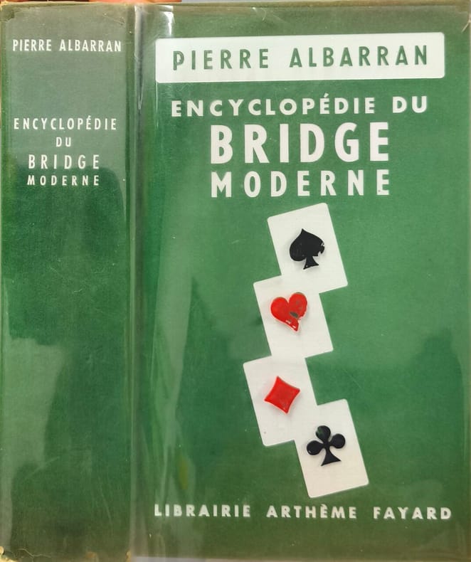
Pierre Albarran
Encyclopédie du Bridge Moderne
Librairie Arthème Fayard 1963 800 pages in8. 1963. reliure editeur sous rhodoid. 800 pages.
Référence libraire : 14197
|
|
|
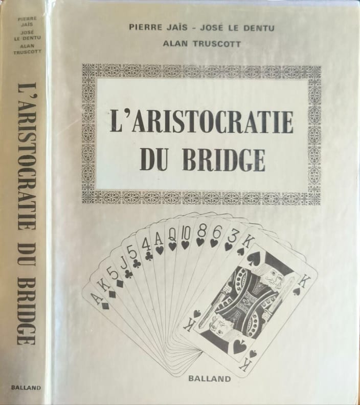
Pierre Jaïs - José Le Dentu Alan Truscott
L'aristocratie du bridge
BALLAND 1973 315 pages IN4. 1973. reliure editeur sous rodhoid. 315 pages. L'aristocratie du bridge est un livre de bridge écrit par Pierre Jaïs José Le Dentu et Alan Truscott publié par Balland en 1973. C'est un ouvrage de collection souvent recherché pour le style littéraire de Le Dentu qui transforme les donnes de bridge en récits dramatiques. Le livre est présenté comme un volume relié in-4 avec cartonnage argenté et photos en noir
Référence libraire : 12223
|
|
|
PIEROTTI (Ermete).
Paris et ses fortifications avec le numérotage des bastions.
Paris, l'Auteur, imp. Monrocq, s.d. (1870). 1 plan chromolithographié et replié (205 x 155 mm), cartonnage imprimé.
Référence libraire : 40186
|
|
|
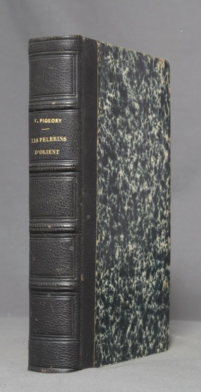
PIGEORY Félix:
Les Pèlerins d'Orient. Lettres artistiques et historiques sur un voyage dans les Provinces danubiennes, la Turquie, la Syrie et la Palestine avec mission du gouvernement.
Paris, E. Dentu, 1854. In-12 de [4]-XVIII-554-[2] pages, demi-chagrin noir, dos à 4 petits nerfs avec titre doré, tranches mouchetées. Rousseurs.
Référence libraire : 9913
|
|
|
PIGAULT M.
Carte topographique et itin?raire du d?partement de la Manche. R?vis?e en 1880. Grav?e par M. Ch. Dyonnet.
Carte entoil?e. 75x106 cm. Tr?s d?fra?chie. Toile r?par?e.
|
|
|
PILLET (Louis)
Cartes Géologiques.
I-Carte Géologique des Environs d'Aix et de Chambéry. 1863. Explication des signes et couleurs (40x30cm). II-Carte Géologique des Environs d'Aix et de Chambéry, 1863. Explication des signes et couleurs. (41x30c). III-Carte Agronomique des Environs d'Aix & de Chambéry. 1865. Explication des signes & couleurs. (40,5x30cm).Chambéry,Imprimerie de F. Puthod, 1865. In-8 (22,5x15cm) broché de couverture rose passée. 18pp. + 3 cartes repliées.
Référence libraire : WOC-2389

|
|
|
Pillement, Georges
Unknown Greece : Volume One : Athens & The Peloponnesus
No marks or inscriptions. No creasing to covers or to spine. A very clean very tight copy with bright unmarked cream cloth boards, slight rubbing to spine ends and no bumping to corners. Dust jacket price clipped but not marked with nicks to upper and lower edges and traces of storage. 200pp. Three itineraries which take us firstly through the ancient buildings of Athens, Cape Sounion, Marathon and Delphi and then Corinth, Epidaurus, Sparta, Mycenae and Olympia.

|
|
|
PINKERTON (J.)
Abrégé de la Géographie moderne, rédigée sur un nouveau plan. Traduit le l’anglais par C.A. Walckenaer (...) Orné de neuf belles cartes
Paris, imp.-lib. Dentu, 1805 - in-8 : xxxi, 780 pp., 9 cartes dépl. h.t. - demi-rel. bas. de l’ép. défraîchie (1 coiffe manquante) ; très belles cartes dépl. gravées de la mappe-monde (déchirure sans manque) et ses continents, dont les contours sont coloriés .
Référence libraire : 14
|
|
|
PINSON
CARTE DU DEPARTEMENT DE LA LOIRE INFERIEURE DRESSE D'APRES LES PLANS CADASTRAUX COMPLETES ET REDUITS
1877 carte entoil., repliée in-12, cart. défr.,- 1877 -
Référence libraire : 708
|
|
|
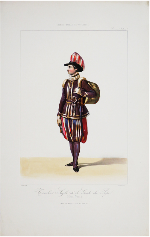
PINGRET (Edouard).
Galerie royale de costumes. Costumes italiens. Tambour suisse de la Garde du Pape (Grande tenue).
Paris, Aubert & C.ie, [1842]. 403 x 240 mm.
Référence libraire : LBW-7572
|
|
|
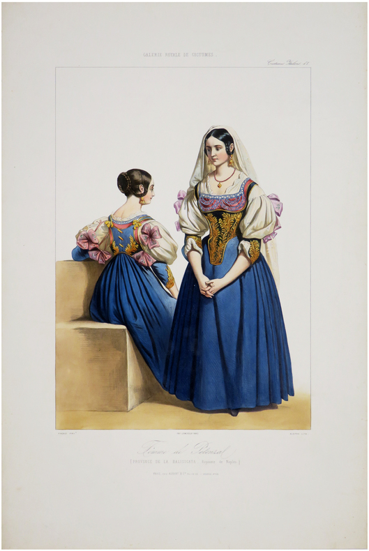
PINGRET (Edouard).
Galerie royale de costumes. Costumes italiens. Femme de Potenza (Province de la Basilicata, Royaume de Naples).
Paris, Aubert & C.ie, [1842]. 394 x 238 mm.
Référence libraire : LBW-7574
|
|
|
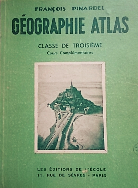
PINARDEL François Sans le recueil hors texte de cartes en couleurs.
Géographie atlas : La France métropolitaine et les pays extra-métropolitains de l'Union Française. Classe de troisième - Cours complémentaires.
Couverture rigide. Cartonnage de l'éditeur. 21 x 27 cm. 246 pages. Couverture légèrement défraîchie.
Référence libraire : 74844
|
|
|
PINCHON (Émile Joseph Porphyre).
Les arrondissements de Paris illustrés en 20 cartes postales.
Paris, Blondel La Rougery, 1945. 20 cartes postales au format 105 x 150 mm, sur papier brillant ; sous chemise illustrée.
Référence libraire : LBW-8629

|
|
|
PINSON F. J. , Agent Voyer
PLAN CADASTRAL DU CANTON DE MACHECOUL PAR F. J. PINSON , VERIFIÉ ET PUBLIÉ AVEC L'AUTORISATION DU CONSEIL GÉNÉRAL PAR CHARLES DE TOLLENARE, AGENT VOYER EN CHEF DE LA LOIRE-INFÉRIEURE - 1850
1850 une carte imprimée en noir avec délimitations en rouge, rose et bleu, format : 59,5 x 84,5 cm, 1850, lithographie CHENEVEAU NANTES Editeur,
Référence libraire : 27558
|
|
|
PINSON Félix Joseph - Charles de TOLLENARE (Cartographes)
PLAN CADASTRAL DU CANTON DE BOURGNEUF, Arrondissement de Paimboeuf, complété et réduit à l'échelle d'1 à 40 000 par Félix Joseph Pinson (Cartographe) ; vérifié et publié par Charles de Tollenare (Cartographe), 1851 Nantes Imprimerie de Chéneveau Editeur
Nantes Baulard-Blanchard 1887 in-8 une carte gravée en noir avec les limites colorées en rouge et bleu, format : 86 centimètres de large par 60,5 centimètres de haut, titre : PLAN CADASTRAL DU CANTON DE BOURGNEUF, Arrondissement de Paimboeuf, complété et réduit à l'échelle d'1 à 40 000 par Félix Joseph Pinson (Cartographe) ; vérifié et publié par Charles de Tollenare (Cartographe), 1851 Nantes Imprimerie de Chéneveau Editeur,
Référence libraire : 28152
|
|
|
PINSON Félix Joseph - Charles de TOLLENARE (Cartographes)
PLAN CADASTRAL DU CANTON DE RIAILLÉ, Arrondissement d'Ancenis, complété et réduit à l'échelle d'1 à 40 000 par Félix Joseph Pinson (Cartographe) ; vérifié et publié par Charles de Tollenare (Cartographe), revu et corrigé sous la direction de J. Menet, Agent Voyer en chef, par J. Vincent Agent-Voyer-Dessinateur : 1887
Nantes Baulard-Blanchard 1887 une carte en couleurs, Format : 60,5 x 85,5 cm, PLAN CADASTRAL DU CANTON DE RIAILLÉ, Arrondissement d'Ancenis, complété et réduit à l'échelle d'1 à 40 000 par Félix Joseph Pinson (Cartographe) ; vérifié et publié par Charles de Tollenare (Cartographe), revu et corrigé sous la direction de J. Menet, Agent Voyer en chef, par J. Vincent Agent-Voyer-Dessinateur : 1887 Nantes Baulard-Blanchard Editeur ,
Référence libraire : 28311
|
|
|
PINSON Félix Joseph - Charles de TOLLENARE (Cartographes)
PLAN CADASTRAL DU CANTON DE SAINT-MARS-LA-JAILLE( Arrondisserment d'ANCENIS) , complété et réduit à l'échelle d'1 à 40 000 par Félix Joseph Pinson (Cartographe) ; vérifié et publié par Charles de Tollenare (Cartographe) : 1853
Nantes Lithographie Cheneveau 1853 une carte en noir, Format : 62 x 86,5 cm, PLAN CADASTRAL DU CANTON DE SAINT-MARS-LA-JAILLE( Arrondisserment d'ANCENIS) , complété et réduit à l'échelle d'1 à 40 000 par Félix Joseph Pinson (Cartographe) ; vérifié et publié par Charles de Tollenare (Cartographe) : 1853 Nantes Lithographie Cheneveau Editeur ,
Référence libraire : 28310
|
|
|
PINSON Félix Joseph - Charles de TOLLENARE (Cartographes)
PLAN CADASTRAL DU CANTON DE MACHECOUL, Arrondissement de Nantes, complété et réduit à l'échelle d'1 à 40 000 par Félix Joseph Pinson (Cartographe) ; vérifié et publié par Charles de Tollenare (Cartographe), revu et corrigé sous la direction de J. Menet, Agent Voyer en chef, par J. Vincent Agent-Voyer-Dessinateur : 1888
Nantes Baulard-Blanchard 1888 une carte en couleurs, Format : 60,5 x 85,5 cm,PLAN CADASTRAL DU CANTON DE MACHECOUL, Arrondissement de Nantes, complété et réduit à l'échelle d'1 à 40 000 par Félix Joseph Pinson (Cartographe) ; vérifié et publié par Charles de Tollenare (Cartographe), revu et corrigé sous la direction de J. Menet, Agent Voyer en chef, par J. Vincent Agent-Voyer-Dessinateur : 1888 Nantes Baulard-Blanchard Editeur ,
Référence libraire : 28309
|
|
|
PINSON Félix Joseph - Charles de TOLLENARE (Cartographes)
PLAN CADASTRAL DU CANTON DE St PHILBERT DE GRAND LIEU, Arrondissement de Nantes, complété et réduit à l'échelle d'1 à 40 000 par Félix Joseph Pinson (Cartographe) ; vérifié et publié par Charles de Tollenare (Cartographe), revu et corrigé sous la direction de J. Menet, Agent Voyer en chef, par J. Vincent Agent-Voyer-Dessinateur : 1888
Nantes Baulard-Blanchard 1888 une carte en couleurs, Format : 60,5 x 85,5 cm, PLAN CADASTRAL DES CANTONS DE St PHILBERT DE GRAND LIEU, Arrondissement de Nantes, complété et réduit à l'échelle d'1 à 40 000 par Félix Joseph Pinson (Cartographe) ; vérifié et publié par Charles de Tollenare (Cartographe), revu et corrigé sous la direction de J. Menet, Agent Voyer en chef, par J. Vincent Agent-Voyer-Dessinateur : 1888 Nantes Baulard-Blanchard Editeur ,
Référence libraire : 28308
|
|
|
PINSON Félix Joseph - Charles de TOLLENARE (Cartographes)
PLAN CADASTRAL DU CANTON DE BOURGNEUF ( Arrondisserment de Paimboeuf) , complété et réduit à l'échelle d'1 à 40 000 par Félix Joseph Pinson (Cartographe) ; vérifié et publié par Charles de Tollenare (Cartographe) : 1851
Nantes Lithographie Cheneveau 1851 une carte en noir, Format : 62 x 86,5 cm, PLAN CADASTRAL DU CANTON DE BOURGNEUF ( Arrondisserment de Paimboeuf) , complété et réduit à l'échelle d'1 à 40 000 par Félix Joseph Pinson (Cartographe) ; vérifié et publié par Charles de Tollenare (Cartographe) : 1851 Nantes Lithographie Cheneveau Editeur ,
Référence libraire : 28307
|
|
|
PINSON Félix Joseph - Charles de TOLLENARE (Cartographes)
PLAN CADASTRAL DU CANTON DE MACHECOUL ( Arrondisserment de Nantes) , complété et réduit à l'échelle d'1 à 40 000 par Félix Joseph Pinson (Cartographe) ; vérifié et publié par Charles de Tollenare (Cartographe) : 1850
Nantes Lithographie Cheneveau 1850 une carte en noir, Format : 62 x 86,5 cm, PLAN CADASTRAL DU CANTON DE MACHECOUL ( Arrondisserment de Nantes) , complété et réduit à l'échelle d'1 à 40 000 par Félix Joseph Pinson (Cartographe) ; vérifié et publié par Charles de Tollenare (Cartographe) : 1850 Nantes Lithographie Cheneveau Editeur ,
Référence libraire : 28306
|
|
|
PINSON Félix Joseph - Charles de TOLLENARE (Cartographes)
PLAN CADASTRAL DE L'ARRONDISSEMENT D'ANCENIS, complété et réduit à l'échelle d'1 à 40 000 par Félix Joseph Pinson (Cartographe) ; vérifié et publié par Charles de Tollenare (Cartographe) : 1856
Nantes Lithographie Cheneveau 1856 une carte en noir, Format : 62 x 86,5 cm, PLAN CADASTRAL DE L'ARRONDISSEMENT D'ANCENIS, complété et réduit à l'échelle d'1 à 40 000 par Félix Joseph Pinson (Cartographe) ; vérifié et publié par Charles de Tollenare (Cartographe) : 1856 Nantes Lithographie Cheneveau Editeur ,
Référence libraire : 28305
|
|
|
PINSON Félix Joseph - Charles de TOLLENARE (Cartographes)
PLAN CADASTRAL DU CANTON DE St NICOLAS DE REDON ( Arrondissement de SAVENAY), complété et réduit à l'échelle d'1 à 40 000 par Félix Joseph Pinson (Cartographe) ; vérifié et publié par Charles de Tollenare (Cartographe) : 1856
Nantes Lithographie Cheneveau 1856 une carte en noir, Format : 62 x 86,5 cm, PLAN CADASTRAL DU CANTON DE St NICOLAS DE REDON ( Arrondissement de SAVENAY), complété et réduit à l'échelle d'1 à 40 000 par Félix Joseph Pinson (Cartographe) ; vérifié et publié par Charles de Tollenare (Cartographe) : 1856Nantes Lithographie Cheneveau Editeur ,
Référence libraire : 28304
|
|
|
PINSON Félix Joseph - Charles de TOLLENARE (Cartographes)
PLAN CADASTRAL DES CANTONS DE CLISSON ET VALLET, Arrondissement de Nantes, complété et réduit à l'échelle d'1 à 40 000 par Félix Joseph Pinson (Cartographe) ; vérifié et publié par Charles de Tollenare (Cartographe), revu et corrigé sous la direction de J. Menet, Agent Voyer en chef, par J. Vincent Agent-Voyer-Dessinateur : 1888
Nantes Baulard-Blanchard 1888 une carte en couleurs, Format : 60,5 x 85,5 cm, PLAN CADASTRAL DES CANTONS DE CLISSON ET VALLET, Arrondissement de Nantes, complété et réduit à l'échelle d'1 à 40 000 par Félix Joseph Pinson (Cartographe) ; vérifié et publié par Charles de Tollenare (Cartographe), revu et corrigé sous la direction de J. Menet, Agent Voyer en chef, par J. Vincent Agent-Voyer-Dessinateur : 1888 Nantes Baulard-Blanchard Editeur ,
Référence libraire : 28303
|
|
|
PINSON Félix Joseph - Charles de TOLLENARE (Cartographes)
PLAN CADASTRAL DU CANTON D'HERBIGNAC ( Arrondisserment DE SAVENAY) , complété et réduit à l'échelle d'1 à 40 000 par Félix Joseph Pinson (Cartographe) ; vérifié et publié par Charles de Tollenare (Cartographe) : 1855
Nantes Lithographie Cheneveau 1855 une carte en noir, Format : 62 x 86,5 cm, PLAN CADASTRAL DU CANTON D'HERBIGNAC ( Arrondisserment DE SAVENAY) , complété et réduit à l'échelle d'1 à 40 000 par Félix Joseph Pinson (Cartographe) ; vérifié et publié par Charles de Tollenare (Cartographe) : 1855 Nantes Lithographie Cheneveau Editeur ,
Référence libraire : 28318
|
|
|
PINSON Félix Joseph - Charles de TOLLENARE (Cartographes)
PLAN CADASTRAL DES CANTONS DE CHATEAUBRIANT ET ROUGÉ ( Arrondisserment DE CHATEAUBRIANT , complété et réduit à l'échelle d'1 à 40 000 par Félix Joseph Pinson (Cartographe) ; vérifié et publié par Charles de Tollenare (Cartographe) : 1854
Nantes Lithographie Cheneveau 1854 une carte en noir, Format : 62 x 86,5 cm,PLAN CADASTRAL DES CANTONS DE CHATEAUBRIANT ET ROUGÉ ( Arrondisserment DE CHATEAUBRIANT , complété et réduit à l'échelle d'1 à 40 000 par Félix Joseph Pinson (Cartographe) ; vérifié et publié par Charles de Tollenare (Cartographe) : 1854 Nantes Lithographie Cheneveau Editeur ,
Référence libraire : 28317
|
|
|
PINSON Félix Joseph - Charles de TOLLENARE (Cartographes)
PLAN CADASTRAL DU CANTON DE LIGNÉ, Arrondissement d'Ancenis, complété et réduit à l'échelle d'1 à 40 000 par Félix Joseph Pinson (Cartographe) ; vérifié et publié par Charles de Tollenare (Cartographe), revu et corrigé sous la direction de J. Menet, Agent Voyer en chef, par J. Vincent Agent-Voyer-Dessinateur : 1887
Nantes Baulard-Blanchard 1887 une carte en couleurs, Format : 60,5 x 85,5 cm, PLAN CADASTRAL DU CANTON DE LIGNÉ, Arrondissement d'Ancenis, complété et réduit à l'échelle d'1 à 40 000 par Félix Joseph Pinson (Cartographe) ; vérifié et publié par Charles de Tollenare (Cartographe), revu et corrigé sous la direction de J. Menet, Agent Voyer en chef, par J. Vincent Agent-Voyer-Dessinateur : 1887 Nantes Baulard-Blanchard Editeur ,
Référence libraire : 28316
|
|
|
Piper, David
London : An Illustrated Companion Guide
No marks or inscriptions. Dust jacket not price clipped. A lovely clean crisp tight copy. Very light creasing to some dust jacket edges. 286pp. The first fully illustrated edition of this book. Beautifully illustrated in colour and b/w photos and paintings.

|
|
|
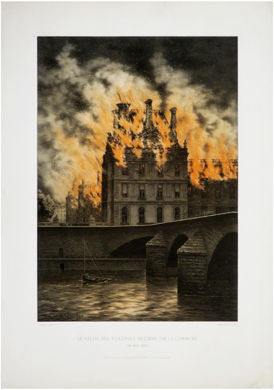
PIRODON (Eugène Louis).
[INCENDIES de PARIS] Le Palais des Tuileries incendié par la Commune (24 mai 1871).
Paris, Photographie Bingham, 1871. 465 x 290 mm.
Référence libraire : LBW-6541
|
|
|
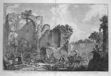
PIRANESI (Giovanni Battista);
[ROME] Veduta degli avanzi delle camere sepolcrali dei liberti, e servi, ec. della famiglia di Augusto.
Rome circa 1780 380 x 593 mm.
Référence libraire : LBW02e4f
|
|
|
PIRANESI Giovan Battista (Mogliano Veneto 1720 - Roma 1778)
Pianta di Roma disegnata colla situazione..
Pianta di Roma disegnata colla situazione di tutti i Monumenti antichi : de' quali in oggi ancora se ne vedono gli avanzi, ed illustrata colli Framm.ti di Marmo della Pianta di Roma antica, scavati, saranno due secoli, nelle Rovine del Tempio di Romolo; ed ora esistenti nel Museo di Campidoglio. Acquaforte e bulino, 1756 circa, firmata in lastra in basso a destra. Dalla serie Le Antichità Romane. Meravigliosa prova, ricca di toni, impressa a inchiostro bruno su carta vergata coeva, con pieni margini ed in perfetto stato di conservazione. Opera tratta dalla prima edizione, pubblicata a Roma nel 1756 nella stamperia di Angelo Rotili a Palazzo Massimo alle Colonne, dai signori Bouchard e Gravier, librai e mercanti in Roma con sede presso San Marcello al Corso. La raccolta conteneva un ritratto del Piranesi, inciso da Felice Polanzani, e recava una dedica a James Caulfield conte di Charlemont, dedica poi eliminata in seguito ad un litigio. Di questa edizione originale, che venne alla luce nel maggio del 1756, sono note tre diverse tirature, connesse con le vicende del litigio con lord Charlemont, vicende documentate dal Piranesi stesso nelle sue Lettere di Giustificazione del 1757. Le diverse tirature sono riconoscibili tra loro proprio nel frontespizio del primo tomo, quello originariamente dedicato al nobile inglese, che successivamente si presenta con dedica e stemma araldico abraso, quindi con l’aggiunta di una dedica dell’autore Aevo Suo Posteri set Utilitari Publicae. Henry Focillon, nel suo saggio del 1918, suppone che il Piranesi prepari ed incida le tavole per l’opera tra il 1750 ed il 1756, tuttavia, elementi architettonici fanno risalire alcune al 1746. In realtà le tavole più antiche utilizzate nella raccolta risalgono probabilmente ad anni ancora precedenti, come sembra suggerire sia l’estrema complessità dell’opera, legata ad un lunghissimo lavoro di preparazione e ricerca, sia l’oscillazione stilistica riscontrabile comparando le varie tavole. Ad ogni modo, la grandiosità delle Antichità Romane del Piranesi non sta solamente nel grande lavoro grafico prodotto dall’artista: l’opera risulta infatti fondamentale come innovazione metodologica nel settore dell’archeologia a lei contemporanea, con l’utilizzo di scritti che sono essenziali per comprendere il pensiero dell’autore e l’innovazione del metodo piranesiano. Si può quindi sostenere, come giustamente fa notare il Focillon, che l’artista veneziano fondi l’archeologia moderna. Questa innovazione comporta, però, un enorme stacco e una grande divergenza con il pensiero e la cultura ufficiale ed accademica del periodo - di derivazione anglosassone - causando enormi polemiche di cui Piranesi fu bersaglio, e il fiorire di una negativa aneddotica intorno alla sua persona, il cui scopo era quello di ristabilire l’egemonia minacciata della cultura “classica”. Il principale pensiero espresso nelle Antichità Romane consiste nel documentare e conservare in effige un patrimonio monumentale che andava di giorno in giorno sgretolandosi, linea di condotta che andava contro l’atteggiamento culturale di amatori ed antiquari, il cui piacere era puramente estetico, non disdegnando all’occorrenza, l’asporto di frammenti anche vistosi di antichità a titolo di puro collezionismo o alla stregua di souvenir. La principale novità della sua impostazione consiste nell’unificare in un solo momento le operazioni di scavo, di rilievo, le indagini strutturali e la misurazione con lo studio delle fonti letterarie, a cui egli fa riferimento diretto. Questo momento di unificazione è rappresentato dallo studio topografico, che unito alla tecnica di rilievo, alla conoscenza dei materiali e delle tecniche antiche, allo scavo ed al sopralluogo dava luce all’archeologia, ovvero lo studio della storia antica. Stampata su contemporanea carta vergata con filigrana “doppio cerchio e giglio con lettere CB” (Robison 33), tipica di ques... Pianta di Roma disegnata colla situazione di tutti i Monumenti antichi : de' quali in oggi ancora se ne vedono gli avanzi, ed illustrata colli Framm.ti di Marmo della Pianta di Roma antica, scavati, saranno due secoli, nelle Rovine del Tempio di Romolo; ed ora esistenti nel Museo di Campidoglio. Etching with engraving, 1756, signed at the bottom margin. From the Antichità Romane, first edition by the French publisher Bouchard and Gravier in 1756. A great impression, printed with brown ink on contemporary laid, strong, paper, with margins, perfect conditions. The first edition of this work, in four volumes, was published in Rome in 1756 at the printing-works of Angelo Rotili at the Massimo alle Colonne Palace, by Bouchard and Gravier, book-dealers and tradesmen located in Rome near the church of St. Marcel at the Via del Corso. This collection included a portrait of Piranesi, engraved by Felice Porziani, and a dedication to James Caulfield, count of Charlemont. This dedication was later abolished in the aftermath of a quarrel, described by Piranesi in his Lettere di Giustificazione [Letters of Justification] (1757), which also gave rise to three different versions of this first original edition (May 1756). These different versions are distinguishable from the title-page of the first volume, which initially was dedicated to the Irish aristocrat, then exhibited a cancelled dedication and coat of arms and, finally, bore a Latin motto written by the artist "Aevo Suo Posteri set Utilitari Publicae". Henry Focillon, in his 1918 treatise, presumed that Piranesi prepared and engraved the plates for this collection between 1750 and 1756, although some architectural features could have a few of them dating back to 1746. Actually, the oldest plates included in this collection probably date back even further, as suggested by the extraordinary complexity of this work, due to a prolonged phase of preparation and research, together with the stylistic alterations which can be observed by comparing the different plates. The magnificence of Piranesi's Antichità Romane, however, is not only in the artist's large graphic output. Indeed, this work is of primary importance from the standpoint of methodological innovation within the framework of contemporary archaeology, with the utilisation of texts which are of essential importance for the comprehension of the author's ideas and of the innovations implied in Piranesi's methodology. It can be asserted, as correctly emphasised by Focillon, that the Venetian architect founded modern archaeology. However, this new-fashioned approach implied an important disassociation and a significant deviation from the convictions and the official and academic culture of the time, which was of Anglo-Saxon derivation. This gave rise to a serious controversy, whose target was Piranesi, and to an adverse anecdotal literature concerning his person, the objective being the re-establishment of the endangered authority of the culture it was threatening. The main motivation behind the Antichità Romane was the documentation and preservation, utilising illustrations, of a heritage of ancient monuments which was being ravaged on a daily basis. This approach was incompatible with the one held by amateurs and antiquarians who only took pleasure from aesthetic contemplation and would not refrain from occasionally removing rather imposing parts from ancient relics for their private collections or, more simply, as souvenirs. The main new feature in his procedure was to unify into a single space the acts of excavating, surveying, structural inquiries and measurement together with the analysis of literary sources, the latter of which he examined for himself. This step of unification is characterised by the study of topography which, together with surveying techniques, the knowledge of antique procedures and materials, excavations and on-site inspections, gave rise to archaeology, in other words to the study of ancient h... Focillon 153, Wilton Ely 288; A. P. Frutaz, "Le piante di Roma", XXXV, tav. 69.

|
|
|
PIRANESI Giovan Battista (Mogliano Veneto 1720 - Roma 1778)
Pianta di Roma e del Campo Marzo
La Pianta di Roma e del Campo Marzio appartiene al culmine della carriera del Piranesi.Nata dalla necessità di offrire una pianta di riferimento che accompagnasse le 135 tavole delle Vedute di Roma, l'opera fu intesa come tavola finale e indice dell'opera, con con cui veniva spesso venduta e rilegata. Attraverso le tre lastre che compongono questa grande piante, l'autore ha cercato di mettere in relazione le rovine superstiti di epoca antica con la contemporanea topografia di Roma, e di offrire dei riferimenti per i monumenti elencati ai due lati della mappa. Nella parte superiore ha realizzato una mappa della città contemporanea compresa entro le Mura Aureliane, estendendola a nord, a includere il territorio tra Porta del Popolo e Ponte Milvio, e inglobando anche l'area del Campo Marzio.Quest'area è mostrata nel dettaglio in una mappa isolata, in basso a destra, che mostra le antichità più importanti evidenziate da un numero che trova corrispondenza con quelli della mappa più grande. Ai lati, un indice dettagliato dei monumenti, con i numeri corrispondenti nella pianta grande, e con i rimandi ai passaggi più rilevanti delle sue opere maggiori: le Antichità Romane, Della Magnificenza ed Archittettura dei Romani e il Campo Marzio. L'opera è dedicata a papa Clemente XIV (1769-1774).La datazione dell'opera è complessa: - nel catalogo del 1792 di Francesco Piranesi, figlio dell'autore, l'opera è assegnata al 1778, data che, sebbene molto tarda - l'autore muore infatti il 9 novembre di quell'anno - viene accettata da Focillon e Hind. Questa datazione, tuttavia, è certamente basata su un errore, poiché nell'Avvertimento nella parte superiore della mappa, l'autore fa riferimento alla "approvazione che si è degnata mostrarne la Santità di N.ro Sig.re PAPA CLEMENTE XIV felicemente regnante", per cui l'opera non può essere successiva al 1774.A supporto di questa datazione, è un esemplare del Catalogo delle Opere, descritto da Scott, che contiene tre voci manoscritte per tre Vedute di Roma databili al 1774, e indica che la mappa era già disponibile.Esemplare dalla contemporanea edizione romana.Acquaforte e bulino, stampata da tre matrici su tre fogli carta vergata coeva uniti insieme, con filigrana "doppio cerchio e giglio", in ottimo stato di conservazione.Dimensione complessiva dei tre fogli: 132.1 x 82.1 cm Dimensioni complessive delle lastre: 121.2 x 71.1 cm Map of Rome and the Campus Martius, formed by three plates and usually found in association with the Vedute di Roma. He may have felt the need for a reference map to accompany collections of these plates and devised this work to fill this need. Exercising his skills in presenting formidable quantities of information coherently, he sought to relate the surviving remains of antiquity to the contemporary topography of Rome and to offer an easy reference to published information about them. He therefore produced a large map of the modern city within the Aurelian Walls, together with an extension showing the territory to the north, between Porta del Popolo and Ponte Milvio and including the Campus Martius area.This is augmented by a smaller map isolating the principal antiquities, which were marked with numbers correspondending to those in the larger map. Around these Piranesi arranged a detailed index listing the monuments according to their assigned numbers and referring to relevant passages in his major pubblications, including the Antichità Romane, Della Magnificenza ed Archittettura dei Romani and Campo Marzio.The dating of the map is problematic, since, although it is dedicated to Clemente XIV (1769-1774), Francesco Piranesi's 1792 cataloghe assigns is to 1778 and most authorities, including Giesecke, Focillon and Hind, have accepted a late, if not posthumous date; however this date is certainly based on error, since Giambattista, in his Avvertimento at the top of the main map, refers to "l'approvazione che si è degnata mostrarne la Santità di N.ro Sig.re PAPA CLEMENTE XIV felicemente regnante". Supporting evidence for an earlier date comes from an impression of the Catalogo delle Opere, referred to by Scott, which contains manuscript entries for the three Vedute di Roma datable to 1774 and indicates that the map was already available. Etching, printed from the plates on three sheets of contemporary laid paper with watermark, double circle with the fleurs-de-lys.A very good early impression for the contemporary roman edition. Hind, p. 87, [1778-9.]; Focillon 600; Ficacci 700; Wilton-Ely, II, 1008.

|
|
|
PIRANESI Giovan Battista (Mogliano Veneto 1720 - Roma 1778)
Tavola Topografica di Roma in cui si dimostrano gli andamenti degli Antichi Acquedotti…
Bella tavola topografica di Roma che riporta il tracciato degli antichi acquedotti romani. Il contenuto della tavola è dichiarato in alto a sinitra: "Dichiarazione delle note della Tavola: A. Mura odierne di Roma B. Mura di Roma anteriori all'Imperatore Aureliano Aquedotto arcuato della Marcia, Tepula, e Giulia Aquedotto arcuato della Claudia e Anione Nuovo Archi Neroniani Archi Antoniniani Aquedotto sostruito Aquedotto sotterraneo Rivo sotterraneo, porzionario delle acque Circonferenza delle Regioni antiche di Roma Nota delle Vie antiche Le rimanenti note son dichiarate o nella Tavola, o nella Spiegazione consecutiva della medesima Piedi Antichi Romani"Le tre "figure" sono disegni tecnici che rappresentano le sezioni e il funzionamento degli antichi acquedotti. La tavola è la n. XXXVIII del tomo I delle Antichità Romane, prima edizione del 1756 edita da Bouchard e Gravier. Meravigliosa prova, ricca di toni, impressa a inchiostro bruno su carta vergata coeva con la tipica filigrana del “doppio cerchio e giglio con lettere CB” (Robison 33), con pieni margini, in ottimo stato di conservazione. A topographical map of Rome depicting the paths of the ancient aqueducts. The inscription "Dichiarazione delle note della Tavola", explains the contents that include named walls of Rome and subterranean aqueducts as well as identifying footprints of ancient remains."Dichiarazione delle note della Tavola: A. Mura odierne di Roma B. Mura di Roma anteriori all'Imperatore Aureliano Aquedotto arcuato della Marcia, Tepula, e Giulia Aquedotto arcuato della Claudia e Anione Nuovo Archi Neroniani Archi Antoniniani Aquedotto sostruito Aquedotto sotterraneo Rivo sotterraneo, porzionario delle acque Circonferenza delle Regioni antiche di Roma Nota delle Vie antiche Le rimanenti note son dichiarate o nella Tavola, o nella Spiegazione consecutiva della medesima Piedi Antichi Romani "Inset are technical drawings of aqueduct mechanisms. This is the plate XXXVIII of tome I of Antichità Romane, first edition by the French publisher Bouchard and Gravier in 1756. A great impression, printed with brown ink on contemporary laid, strong, paper with “double encircled fleur-de-lys with letter CB” watermark (Robison 33), with margins, perfect conditions. Wilton-Ely, 352; Focillon 217

|
|
|
PIRINEOS.
Pirineos. Revista del Instituto de Estudios Pirenaicos. Números 28-29-30. [Jesús Elosegui Irazusta: Catálogo dolménico del País Vasco; Pedro Montserrat: El Turbón y su flora; Ramón Margalef: Algunos organismos interesantes de las aguas dulces de los Pirineos, y otros textos].
Zaragoza, CSIC, 1953. 4to.; 355 pp. Ilustraciones entre el texto, 18 láminas fotográficas y un gran mapa plegado "Mapa de la situación de 340 dólmenes y túmulos descritos en el "Catálogo dolménico del País Vasco"". Cubiertas originales.

|
|
|
PIRÎ REIS.
Proceedings of the International Piri Reis Symposium.= Uluslararasi Piri Reis Sempozyumu Tebligler kitabi. 27-29 September 2004.
New English Original bdg. HC. 4to. (31 x 21 cm). In English and Turkish. [xv], 84, 53, 41, 64, 54, 131, 12, 32, [7] p., color ills. Symposium contains 8 sessions and pages numbered session by session. Proceedings of the International Piri Reis Symposium.= Uluslararasi Piri Reis Sempozyumu Tebligler kitabi. 27-29 September 2004.
|
|
|
PITIE, Jean
Cartes Historiques Jean Pitié. Classe de 3e [ Lot de 14 cartes historiques dépliantes avec la brochure explicative sous classeur commun ] La France 1715-1789 - L'Amérique du Nord au XVIIIe siècle - Les guerres de la Révolution 1792-1802 - La formation du Grand Empire - La chute de Napoléon - La France : 1815-1870 - Paris vers 1870 - Les Balkans et le Proche-Orient : 1815-1870 - L'indépendance de l'Amérique Latine - L'Empire d'Autriche - L'Unité italienne - L'Unité allemande - La guerre de 1870-1871 - Les Etats-Unis au XIXe siècle
14 grandes cartes dépliantes en couleurs (env. 89x90 cm) sous chemise éditeur à velcros avec brochure jointe, Editions Rossignol, Montmorillon, 1967. Rappel du titre complet : Cartes Historiques Jean Pitié. Classe de 3e [ Lot de 14 cartes historiques dépliantes avec la brochure explicative sous classeur commun ] La France 1715-1789 - L'Amérique du Nord au XVIIIe siècle - Les guerres de la Révolution 1792-1802 - La formation du Grand Empire - La chute de Napoléon - La France : 1815-1870 - Paris vers 1870 - Les Balkans et le Proche-Orient : 1815-1870 - L'indépendance de l'Amérique Latine - L'Empire d'Autriche - L'Unité italienne - L'Unité allemande - La guerre de 1870-1871 - Les Etats-Unis au XIXe siècle
Référence libraire : 45054

|
|
|
PITIE, Jean
Cartes Historiques Jean Pitié. Classe de 3e [ Lot de 14 cartes historiques dépliantes avec la brochure explicative sous classeur commun ] La France 1715-1789 - L'Amérique du Nord au XVIIIe siècle - Les guerres de la Révolution 1792-1802 - La formation du Grand Empire - La chute de Napoléon - La France : 1815-1870 - Paris vers 1870 - Les Balkans et le Proche-Orient : 1815-1870 - L'indépendance de l'Amérique Latine - L'Empire d'Autriche - L'Unité italienne - L'Unité allemande - La guerre de 1870-1871 - Les Etats-Unis au XIXe siècle
14 grandes cartes dépliantes en couleurs (env. 89x90 cm) sous chemise éditeur à velcros avec brochure jointe, Editions Rossignol, Montmorillon, 1967. Rappel du titre complet : Cartes Historiques Jean Pitié. Classe de 3e [ Lot de 14 cartes historiques dépliantes avec la brochure explicative sous classeur commun ] La France 1715-1789 - L'Amérique du Nord au XVIIIe siècle - Les guerres de la Révolution 1792-1802 - La formation du Grand Empire - La chute de Napoléon - La France : 1815-1870 - Paris vers 1870 - Les Balkans et le Proche-Orient : 1815-1870 - L'indépendance de l'Amérique Latine - L'Empire d'Autriche - L'Unité italienne - L'Unité allemande - La guerre de 1870-1871 - Les Etats-Unis au XIXe siècle Rare exemplaire bien complet de la collection des cartes historiques Jean Pitié pour la classe de troisième. La brochure jointe précise à chaque fois les chapitres et les pages correspondants à chaque carte dans les manuels Isaac ou Bonifacio et Maréchal (publiés chez Hachette). Bel ensemble. Français

|
|
|
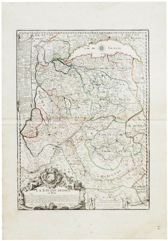
PLACIDE de SAINTE-HÉLÈNE (père).
[SAVOIE] La Savoye, dédiée au Roy.
Paris, Sr. Jaillot, [circa 1710]. 576 x 429 mm.
Référence libraire : LBW-6287
|
|
|
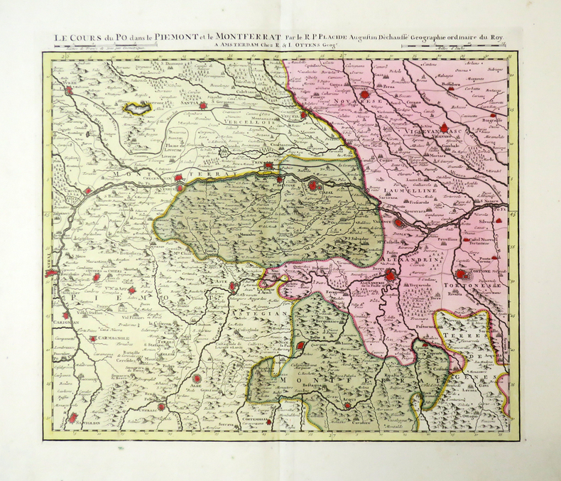
PLACIDE de SAINTE-HÉLÈNE (père).
Le Cours du Po.
Amsterdam, R. & I. Ottens, [circa 1735]. En 5 feuilles pouvant être jointes pour former une carte de 0,42 x 2,48 m.
Référence libraire : LBW-4481
|
|
|
PLAYFAIR (James)
Playfair's New Travelling map of Scotland. Price 4s. 6 d.
1821 emboitage éditeur avec son étiquette. 16 sections montées sur toile et pliées, formant une carte de 570 x 480 mm., aquarellée, Edinburgh Macredie, Skelty & co. 54, Princes street 1821
Référence libraire : 16324
|
|
|

 Recevoir par e-mail
 Télécharger en PDF
 Flux RSS
 Lien permanent


