|
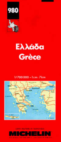
Michelin
Ellada/ Grece /Greece/ Greichenland 980
Paris: Michelin Travel Pubns 1989 Map. Fine. Soft cover. Fold out large scale map of Greece Scale 1: 700000 Place names in Greek with Roman alphabet transliteration. Legends in Greek FrenchEnglish and German This map is still useful in general terms but note the date it does NOT.therefore include the new highways. Michelin Travel Pubns paperback
Bookseller reference : 36405 ISBN : 206700980X 9782067009806
|
|
|
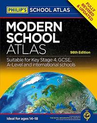
Philips Maps
Philips Modern School Atlas: 98th Edition Philips School Atlases
Philips 04/06/2015. UK ed. Hardcover. Used; Good. WE SHIP WITHIN 24 HRS FROM LONDON UK 98% OF OUR ORDERS ARE RECEIVED WITHIN 7-10 DAYS. We believe you will be completely satisfied with our quick and reliable service. All orders are dispatched as swiftly as possible! Buy with confidence! Greener Books. Philips hardcover
Bookseller reference : 3498815 ISBN : 1849073538 9781849073530
|
|
|
Harris, R Cole & Matthews, Geoffrey J
Atlas Historique Du Canada: Des Origines a 1800 French Edition
Montreal: Les Presses de L'Universite De Montreal 1987 Book. As New. Hardcover. First Thus. Canadian history and geography prior to 1800 illustrated with maps and diagrams. 198p.illus bibliographies A large format VERY heavy volume. 14.5x11x1.5" 5lbs 5 oz/ 2.4 kg. Les Presses de L'Universite De Montreal hardcover
Bookseller reference : 33118 ISBN : 276060800x 9782760608009
|
|
|
Levi, Peter
Atlas of The Greek World
New York: Facts on File 1980 Book. Fine. Hardcover. 1st US Edition. This book introduces the reader to the ancient Greeks their spiritual and mental world as well as the physical world their history and travels as well as their arts and sciences. It is impossible to understand Greek history or art without a strong sense of the prehistory the landscape the climate the geography and the conditions of life. Atlas of the Greek World sets the scene for this study and then through the use of an authoritative text maps and illustrations takes the reader through the history stopping to view 26 ancient sites and to comment on the achievements of this remarkable civilisation. Covers topics such as : The land in context. The geography of ancient Greece; The study of ancient Greece; The age of bronze. The palace civilizations of Crete and Mycenae; Mycenaean survivals; The Homeric world; The age of tyranny. The 8th-century renaissance; Archaic religious practice; The birth of city-states; The growth of literature; The age of Perikles. Athenian society in the 5th century; The Persian and Peloponnesian Wars; The classical revolution; The age of Alexander. New patterns in literature and religion; The rise of Macedon; The Alexandrian expansion; The Roman conquest; The fate of Hellenism. The classical impact of Hellenism; Post-classical revivals; Language : the principal inheritance.239p. illus bibliography index maps on endpapers. Facts on File hardcover
Bookseller reference : 30499 ISBN : 0871964481 9780871964489

|
|
|
PopOut Maps
London Bus and Underground PopOut Map PopOut Maps: Popout Double
PopOut Maps 01/27/2020. Map. Used; Good. WE SHIP WITHIN 24 HRS FROM LONDON UK 98% OF OUR ORDERS ARE RECEIVED WITHIN 7-10 DAYS. We believe you will be completely satisfied with our quick and reliable service. All orders are dispatched as swiftly as possible! Buy with confidence! Greener Books. PopOut Maps unknown
Bookseller reference : 5020134 ISBN : 191021888x 9781910218884

|
|
|
PopOut Maps
London Bus and Underground PopOut Map PopOut Maps: Popout Double
PopOut Maps 01/27/2020. Map. Used; Good. WE SHIP WITHIN 24 HRS FROM LONDON UK 98% OF OUR ORDERS ARE RECEIVED WITHIN 7-10 DAYS. We believe you will be completely satisfied with our quick and reliable service. All orders are dispatched as swiftly as possible! Buy with confidence! Greener Books. PopOut Maps unknown
Bookseller reference : 5020132 ISBN : 191021888x 9781910218884
|
|
|
PopOut Maps
London Bus and Underground PopOut Map PopOut Maps: Popout Double
PopOut Maps 01/27/2020. Map. Used; Good. WE SHIP WITHIN 24 HRS FROM LONDON UK 98% OF OUR ORDERS ARE RECEIVED WITHIN 7-10 DAYS. We believe you will be completely satisfied with our quick and reliable service. All orders are dispatched as swiftly as possible! Buy with confidence! Greener Books. PopOut Maps unknown
Bookseller reference : 5020133 ISBN : 191021888x 9781910218884
|
|
|
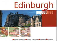
PopOut Maps
Edinburgh PopOut Map PopOut Maps: Double map
Heartwood Publishing 02/23/2022. 1. Map. Used; Good. WE SHIP WITHIN 24 HRS FROM LONDON UK 98% OF OUR ORDERS ARE RECEIVED WITHIN 7-10 DAYS. We believe you will be completely satisfied with our quick and reliable service. All orders are dispatched as swiftly as possible! Buy with confidence! Greener Books. Heartwood Publishing unknown
Bookseller reference : 5020475 ISBN : 1914515285 9781914515286
|
|
|
Terrain Maps
Tzia: 2018
map. Good. Access codes and supplements are not guaranteed with used items. May be an ex-library book. unknown
Bookseller reference : 960482001X.G ISBN : 960482001X 9789604820016
|
|
|
Collins Maps
Collins World Atlas: Paperback Edition
Collins 02/11/2016. 12th edition. Paperback. Used; Very Good. WE SHIP WITHIN 24 HRS FROM LONDON UK 98% OF OUR ORDERS ARE RECEIVED WITHIN 7-10 DAYS. We believe you will be completely satisfied with our quick and reliable service. All orders are dispatched as swiftly as possible! Buy with confidence! Greener Books. Collins paperback
Bookseller reference : 4518396 ISBN : 0008158517 9780008158514

|
|
|
Metro Maps
Greater Las Vegas Street Guide & Directory '07 Edition
spiral_bound. Good. Access codes and supplements are not guaranteed with used items. May be an ex-library book. unknown
Bookseller reference : 1887749829.G ISBN : 1887749829 9781887749824
|
|
|
Philip's Maps
Philip's World Atlas : Paperback
Octopus Publishing Group. Used - Very Good. Ships from the UK. Former library book; may include library markings. Used book that is in excellent condition. May show signs of wear or have minor defects. Octopus Publishing Group unknown
Bookseller reference : 42334342-20 ISBN : 1849075166 9781849075169
|
|
|
National Geographic Maps
Madrid Map National Geographic Destination City Map
map. Good. Access codes and supplements are not guaranteed with used items. May be an ex-library book. unknown
Bookseller reference : 1597754153.G ISBN : 1597754153 9781597754156

|
|
|
National Geographic Maps
Orlando Map National Geographic Destination City Map
map. Good. Access codes and supplements are not guaranteed with used items. May be an ex-library book. unknown
Bookseller reference : 159775076X.G ISBN : 159775076X 9781597750769

|
|
|
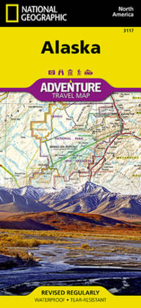
National Geographic Maps - Adventure
Alaska Map National Geographic Adventure Map 3117
map. Good. Access codes and supplements are not guaranteed with used items. May be an ex-library book. unknown
Bookseller reference : 1566957052.G ISBN : 1566957052 9781566957052
|
|
|
Collins Maps
Collins School World Atlas Collins School Atlas Collins Primary Atlas
Collins 02/14/2013. New edition. Paperback. Used; Very Good. WE SHIP WITHIN 24 HRS FROM LONDON UK 98% OF OUR ORDERS ARE RECEIVED WITHIN 7-10 DAYS. We believe you will be completely satisfied with our quick and reliable service. All orders are dispatched as swiftly as possible! Buy with confidence! Greener Books. Collins paperback
Bookseller reference : 2862902 ISBN : 0007484410 9780007484416

|
|
|
[RUSSO-JAPANESE WAR - TWO NEWSPAPER MAPS].
旅順包圍攻撃圖. 日露戰爭經過圖. Ryojun hōi kōgekizu. Nichiro Sensō keikazu. Pictorial Map of Seizure of Port Arthur AND Russo-Japanese War Development Map.
大阪. Osaka.: 大阪毎日新聞社. Ōsaka Mainichi Shinbunsha. Meiji 37 1904. Two black and white newspaper maps issued in the Ōsaka Mainichi Shinbunsha one pictorial with accompanying text and adverts printed on newsprint folded. 39.5 x 55cm Very good condition. This pictorial map of Port Arthur and Dalian was published on 4 July 1904 by the Osaka Mainichi Shinbun as a supplement. It shows Port Arthur encircled by Japanese naval vessels while Dalian is depicted as being occupied by Japanese troops. On the reverse there is an essay on the war accompanied by illustrations of Russian generals and a list of wounded soldiers who had been transported to the rear.<br><br>A second map detailing developments in the Russo-Japanese War was published by the same newspaper just days later on 8 August 1904. This map provides the dates of various battles along with a chronology of the movements of the Russian Vladivostok fleet and Japanese attacks on Port Arthur. These two maps are rare examples of the kind of information made available to the general public on a day-to-day basis during the war. . 大阪毎日新聞社. [Ōsaka Mainichi Shinbunsha]. unknown
Bookseller reference : 216797
|
|
|
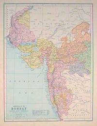
[WESTERN INDIA - MAP] BARTHOLOMEW, J. (ILLUS).
Presidency of Bombay Indore Agency Berar &c.
Edinburgh.: J. Bartholomew. circa1880s. Map 40.2 x 30.4 cms with printed colour and outline hand colour in very good condition. Handsome map with colonial interests attractively coloured. . J. Bartholomew unknown
Bookseller reference : 187528
|
|
|
[CHINA - MAP - WORLD WAR II].
Newsmap for the Armed Forces. 291st Week of the War - 173rd Week of U.S. Participation. Monday 9 April 1945.
New York.: Army Information Branch. Volume III No. 51F. 9 April1945. Folding colour map and six inset maps in a vertical panel 88 x 119 cms sheet and on the recto circular map of Europe smaller inset map of Asia and of the Ryukyu Islands descriptive text original folds in very good bright condition. Scarce Newsmap of "China Southeast Coast" from Shanghai to French Indochina with the islands of Formosa and Hainan. At the right edge are inset maps of the vicinities of Shanghai Wenchow Foochow Swatow Canton and Hong Kong. On the verso is a large map of the European theatre of operations centred on Berlin a map of the Pacific area noting the American occupation of Okinawa with a detailed map of this island. In unusually fine bright condition. . Army Information Branch. unknown
Bookseller reference : 194660

|
|
|
Margaret Cousins; Illustrator-Photographs and Maps
Story of Thomas Alva Edison #110 Landmark HB/PC
Random House 1965. Hardcover. Very Good. 7x5x1. Photographs and Maps. Rare Collectible Pictorial Cover Book. This book is in Good condition with a tight binding and mostly clean crisp pages. This is an ex-school library book with the expected library markings but they are not excessive. Outside pictorial covers are nice but show some soiling and wear. This book was NOT published with a Dust Jacket. Landmark Books Volumes 104-122 are only available in the picture cover format also these titles had virtually no trade sales with public and school libraries taking most of the books. Landmark Books and World Landmark Books are accurate in-depth stories for young people in the 9-15 year old range. These living histories were written by award-winning authors or by men and women who experienced the events first hand. Written during the 1950's and 1960's and illustrated either with two-color drawings or clear photographs the books are informative enjoyable and well worth reading and collecting. The Story of Thomas Alva Edison Landmark Book #110. Here is a colorful account of America's greatest inventor who was also one of American's most rugged individualists. Simply and clearly the author explains Edison's contributions to the electric light the telephone the phonograph the electric locomotive radio broadcasting motion pictures and many other aspects of our modern electrified world. Random House hardcover
Bookseller reference : 231008D
|
|
|
Margaret Cousins; Illustrator-Photographs and Maps
The Story of Thomas Alva Edison Landmark #110 HB/PC
Random House 1965. Hardcover. Excellent. 7x5x1. Photographs and Maps. Rare Collectible Pictorial Cover Book. This book is in Wonderful Excellent Unused condition with One Exception- it was bound upside down! So of course this has no effect on your ability to read this great book in great condition!- just flip it over! Book is in Very Good Plus to Excellent condition with a tight binding and clean crisp internal pages. Inside text is unread and unused! There is a stamp from "Colonial Press" on the first end page but No other writing or markings in the book. Outside pictorial covers are Very Nice! This is a great book but as stated you just need to flip it over to read! Very Hard to Find as a Non-Library Book in this condition! This book was NOT published with a Dust Jacket. Landmark Books Volumes 104-122 are only available in the picture cover format also these titles had virtually no trade sales with public and school libraries taking most of the books. Landmark Books and World Landmark Books are accurate in-depth stories for young people in the 9-15 year old range. These living histories were written by award-winning authors or by men and women who experienced the events first hand. Written during the 1950's and 1960's and illustrated either with two-color drawings or clear photographs the books are informative enjoyable and well worth reading and collecting. The Story of Thomas Alva Edison Landmark Book #110. Here is a colorful account of America's greatest inventor who was also one of American's most rugged individualists. Simply and clearly the author explains Edison's contributions to the electric light the telephone the phonograph the electric locomotive radio broadcasting motion pictures and many other aspects of our modern electrified world. Random House hardcover
Bookseller reference : 230929D
|
|
|
Philips Maps
Philips Essential School Atlas Philips World Atlas
Philips 06/13/2019. Paperback. Used; Good. WE SHIP WITHIN 24 HRS FROM LONDON UK 98% OF OUR ORDERS ARE RECEIVED WITHIN 7-10 DAYS. We believe you will be completely satisfied with our quick and reliable service. All orders are dispatched as swiftly as possible! Buy with confidence! Greener Books. Philips paperback
Bookseller reference : 4215310 ISBN : 1849075190 9781849075190
|
|
|
Collins Maps
Collins Childrens Picture Atlas
hardcover. Good. Access codes and supplements are not guaranteed with used items. May be an ex-library book. hardcover
Bookseller reference : 0008320322.G ISBN : 0008320322 9780008320324

|
|
|
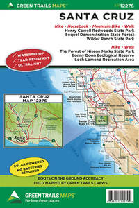
Maps Green Trails
Santa Cruz CA No. 1227S Green Trails Maps
map. Good. Access codes and supplements are not guaranteed with used items. May be an ex-library book. unknown
Bookseller reference : 1680514725.G ISBN : 1680514725 9781680514728
|
|
|
Gecko Maps
The Lhasa Map - Tibet City Map 1:4000 - Traditional Tibetan Architecture and Townscape
map. Good. Access codes and supplements are not guaranteed with used items. May be an ex-library book. unknown
Bookseller reference : 3906593096.G ISBN : 3906593096 9783906593098
|
|
|
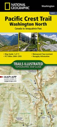
National Geographic Maps Trails Illustrated
Pacific Crest Trail: Washington North Map Canada to Snoqualmie Pass National Geographic Topographic Map Guide 1002
map. Good. Access codes and supplements are not guaranteed with used items. May be an ex-library book. unknown
Bookseller reference : 1566957087.G ISBN : 1566957087 9781566957083
|
|
|
Maps, Popout
Miami PopOut Map PopOut Maps
map. Good. Access codes and supplements are not guaranteed with used items. May be an ex-library book. unknown
Bookseller reference : 1845879171.G ISBN : 1845879171 9781845879174

|
|
|
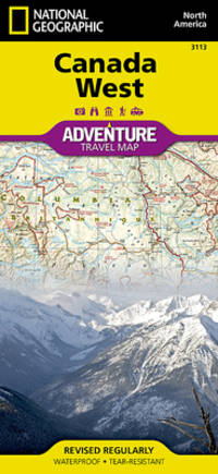
National Geographic Maps - Adventure
Canada West Map National Geographic Adventure Map 3113
map. Good. Access codes and supplements are not guaranteed with used items. May be an ex-library book. unknown
Bookseller reference : 1566956358.G ISBN : 1566956358 9781566956352
|
|
|
Philips Maps
Philips Junior School Atlas 10th Edition Philips Road Atlases
Philips. Hardcover. Used; Good. Simply Brit welcome to our online used book store where affordability meets great quality. Dive into a world of captivating reads without breaking the bank. We take pride in offering a wide selection of used books from classics to hidden gems ensuring theres something for every literary palate. All orders are shipped within 24 hours and our lightning fast-delivery within 48 hours coupled with our prompt customer service ensures a smooth journey from ordering to delivery. Discover the joy of reading with us your trusted source for affordable books that do not compromise on quality. 06/13/2019 Philips hardcover
Bookseller reference : 3137353 ISBN : 1849074941 9781849074940
|
|
|
Collins Maps
Short walks in the Lake District Collins Ramblers
Collins 04/10/2014. Second edition. Paperback. Used; Good. WE SHIP WITHIN 24 HRS FROM LONDON UK 98% OF OUR ORDERS ARE RECEIVED WITHIN 7-10 DAYS. We believe you will be completely satisfied with our quick and reliable service. All orders are dispatched as swiftly as possible! Buy with confidence! Greener Books. Collins paperback
Bookseller reference : 2083127 ISBN : 0007555016 9780007555017

|
|
|
[LINEN BACKED MAP OF CHINA]
China. Philips' Travelling Maps Cover Title.
no date. circa1920. Linen backed colour folding map of China insets of Peking and Environs and Hongkong and Canton in lower left corner. 54 x 63.8cm. Table of place names at upper left gives the cities that "By a recent ordinance of the Republic all 'Fu' 'Chow'' and 'Ting' cities have been nominally reduced to the rank of 'Hsien'. The following parallel list gives the 'Fu' cities the names of which have been officially changed together with the new form adapted." Map folds into a red cloth covered case with ribbon ties 19 x 10.3cm. Title and decoration printed in black on upper cover. Trifle foxed on linen backing a little insect damage case in a few small places otherwise a very good clean map. . hardcover
Bookseller reference : 161936

|
|
|
Various [Notes]; D'Oyly, George [and] Mant, Richard [Introductions, Tables, Indexes, Maps, Plans]
THE HOLY BIBLE ACCORDING TO THE AUTHORIZED VERSION . 3 Vol. Complete
Cambridge: The Society at the University Press 1830. Reprint Edition. Hardcover. <p>Quarto Three Volumes Complete. In Good condition. In full diced calf binding with gilt borders gilt inlay on board edges paneled spine with gilt bands gilt lettering on dark green labels. Marbled edges to text block. In all volumes boards show moderate shelf and edge wear with surface-level chipping to leather along board edges and in small areas on covers. Moderate scuffing and soiling visible on boards. Rubbing wear on all board edges which is heaviest along bottom edges. Bumping to fore corners with small areas of exposed board. Cracking to leather along joints and more lightly on labels. Splitting near the bottom of the front joint of Vol. I. Heads and tails of spines are lightly bumped; chipping to tail of Vol. III with shallow loss of material. Text block edges show light toning. Light scuffing and wear on text block edges. Sparse foxing present throughout all volumes which is heaviest on the plates and on pages near endpapers. Foxing is somewhat heavier in Vol. I than in the other volumes. Offsetting on pages opposite plates. Splitting at and around the hinges of all volumes the majority of which is mild. Heavier splitting affects the front hinge and an early gutter in Vol. III; signatures between these areas of splitting are loosely attached to binding. Black ink gift inscription on front flyleaf of Vol. II. Area of discoloration and wear on front flyleaf of Vol. I where an inscription has been removed. Names of former owners in black ink in the top corner of the first free endpaper in all volumes.</p> <br /> <br /> <p>CONTENTS: Vol. I Introductions to the Bible and the Old Testament Genesis through Esther; Vol. II Job through Malachi with The Apocryphal Books; Vol. III "Vol. II Part II" Introduction to the New Testament Matthew through Revelation with Indexes Tables List of Authors. All volumes unpaginated with numerous maps and illustrated plates.</p> <br /> <br /> <p>Oversized books. Additional postage necessary for expedited/international orders. Economy International shipping unavailable due to size/weight restrictions. For international/expedited customers please inquire for rates.</p> . 1402573. Special Collections. The Society at the University Press hardcover
Bookseller reference : 1402573

|
|
|
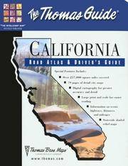
Thomas Brothers Maps
Thomas Guide 2001 California Road Atlas & Driver's Guide California Road Atlas and Driver's Guide
Thomas Brothers Maps 3/1/2001 12:00:00 AM. paperback. Acceptable. 0.9000 in x 10.9000 in x 8.9000 in. Thomas Brothers Maps paperback
Bookseller reference : 53IN3G002UP1 ISBN : 1581743319 9781581743319
|
|
|
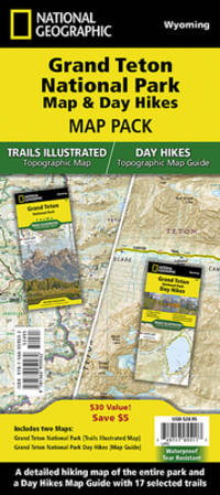
National Geographic Maps - Trails Illustrated
Grand Teton Day Hikes and National Park Map Map Pack Bundle National Geographic Trails Illustrated Map
map. Good. Access codes and supplements are not guaranteed with used items. May be an ex-library book. unknown
Bookseller reference : 1566959039.G ISBN : 1566959039 9781566959032
|
|
|
Maps, Nelles
Nelles Kauai Travel Map Including Ni'ihau
map. Good. Access codes and supplements are not guaranteed with used items. May be an ex-library book. unknown
Bookseller reference : 3886186792.G ISBN : 3886186792 9783886186792
|
|
|
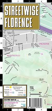
Streetwise Maps
Streetwise Florence Map - Laminated City Center Street Map of Florence Italy - Folding pocket size travel map
map. Good. Access codes and supplements are not guaranteed with used items. May be an ex-library book. unknown
Bookseller reference : 0935039651.G ISBN : 0935039651 9780935039658
|
|
|
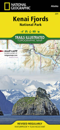
National Geographic Maps Trails Illustrated
Kenai Fjords National Park Map National Geographic Trails Illustrated Map 231
map. Good. Access codes and supplements are not guaranteed with used items. May be an ex-library book. unknown
Bookseller reference : 1566953855.G ISBN : 1566953855 9781566953856
|
|
|
Red Maps
Red Maps CHICAGO Street Map and City Guide
map. Good. Access codes and supplements are not guaranteed with used items. May be an ex-library book. unknown
Bookseller reference : 1892238853.G ISBN : 1892238853 9781892238856
|
|
|
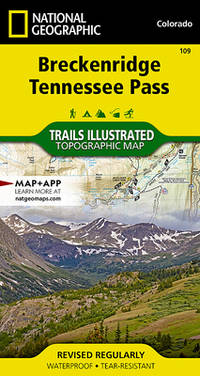
National Geographic Maps - Trails Illustrated
Breckenridge Tennessee Pass Map National Geographic Trails Illustrated Map 109
map. Good. Access codes and supplements are not guaranteed with used items. May be an ex-library book. unknown
Bookseller reference : 1566953227.G ISBN : 1566953227 9781566953221
|
|
|
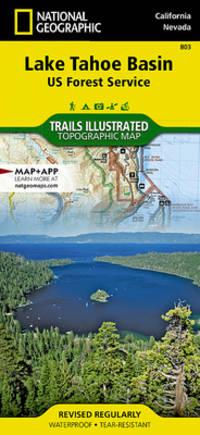
National Geographic Maps
National Geographic Trails Illustrated Map Lake Tahoe Basin USDA Forest Service
Trails are classified by use - hiking horse and hike mountain bike shared use or motorized - and includes a trail chart showing trail name location and allowed use. Trail mileage private land designation and information on general regulations safety Desolation Wilderness camping fishing and snow parks round out the usefulness of this map. It also includes bathymetric shading of the Lake Tahoe. Coverage includes Lake Tahoe Basin Management Unit Eldorado Humboldt-Toiyabe and Tahoe national forests. Desolation Granite Chief and Mt. Rose Wilderness Areas. Pacific Crest National Scenic Trail. Tahoe Rim Trail. Rubicon OHV Trail. Emerald Bay D.L. Bliss Ed Z'Berg Sugar Pine Burton Creek Donner Memorial Lake Tahoe Nevada and Washoe Lake state parks. Mt. Tallac Echo Summit Carson Pass Spooner Summit Mt. Rose Summit Brockway Summit. Towns: Truckee Tahoe City Homewood Tahoma South Lake Tahoe Zephyr Cove Incline Village Kings Beach Carson City. Includes UTM grids for use with your GPS unit and a trail mileage matrix. unknown
Bookseller reference : BIBUP61025-A31493 ISBN : 1566953340 9781566953344
|
|
|
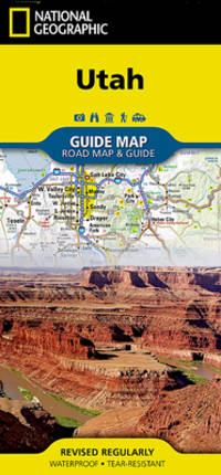
National Geographic Maps
Utah
- Waterproof - Tear-Resistant - Travel Map National Geographic's Utah Guide Map is designed to meet the needs of all travelers with by combining a detailed and accurate road map with and an expertly researched travel guide. Find your destination quickly using the user friendly index of cities and towns. Then plan your route on the comprehensive road map complete with road designations mileage markers and pinpointed national and state parks national forests campsites ski areas hospitals airports and other points of interest. Inset maps of Ogden Logan Salt Lake City Provo provide additional detail of these popular cities. While inset maps and travel information are given for Utah 12 Scenic Byway and Zion Arches and Bryce Canyon National Parks. An overview of popular points of interest a calendar of events and a national park service chart are all provided along with relevant contact information. Every State Guide Map is printed on durable synthetic paper making them waterproof tear-resistant and tough -- capable of withstanding the rigors of any kind of travel. Map Scale = 1:1314000 Sheet Size = 17.75"" x 24.75"" Folded Size = 4"" x 8.75"" unknown
Bookseller reference : BIBUP61025-A20040 ISBN : 1566957230 9781566957236
|
|
|
National Geographic Maps
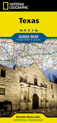
National Geographic Texas 2017 Map
- Waterproof - Tear-Resistant - Travel Map Expertly researched and loaded with helpful information National Geographic's Texas Guide Map is a must-have for travelers exploring ""The Lone Star State."" In addition to a state map inset maps provide detail on the Texas Panhandle and the cities of Dallas Fort Worth Houston Amarillo Abilene Lubbock Waco Laredo Beaumont El Paso Odessa-Midland McAllen Corpus Christi San Antonio and Austin. Cities and towns are easy to find with the map's helpful index and hundreds of attractions are noted. Road network designations are clear and distances in miles on major highways are shown. Additional information and maps feature the recreation activities available in Big Bend National Park and the attractions along the Hill Country scenic drive. The Alamo the Space Center Houston the San Antonio Riverwalk and Guadalupe Mountains National Park are just some of the many points of interest that are highlighted. A handy chart of park service sites and climate information are also included. Every State Guide Map is printed on durable synthetic paper making them waterproof tear-resistant and tough -- capable of withstanding the rigors of any kind of travel. Map Scale = 1:31680000 Sheet Size = 24.75"" x 17.75"" Folded Size = 4"" x 8.75"" unknown
Bookseller reference : BIBUP61025-A19915 ISBN : 156695729X 9781566957298
|
|
|
National Geographic Maps
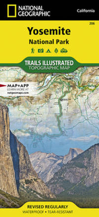
Yosemite National Park
Coverage includes Stanislaus National Forest Emigrant Wilderness Carson Iceberg Wilderness Toiyabe National Forest Hoover Wilderness Inyo National Forst Yosemite Wilderness Sierra National Forest Ansel Adams Wilderness. Detail on Yosemite Valley and Tuolumne Meadows. Includes UTM grids for use with your GPS unit. unknown
Bookseller reference : BIBUP61025-A39681 ISBN : 1566952999 9781566952996
|
|
|
National Geographic Maps
Madrid
• Waterproof • Tear-Resistant • Travel Map In addition to the easy-to-read map on the front the back includes: - Regional map - Points of interest - Airport diagram - Metro map - Inset map of Central Madrid - Multi-language legend Fold Size = 4.00 x 8.75 Sheet Size = 24.75 x 17.75 Scale = 1:7800 unknown
Bookseller reference : BIBUP61025-A30151 ISBN : 1597754153 9781597754156
|
|
|
National Geographic Maps
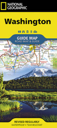
National Geographic Washington
unknown
Bookseller reference : BIBUP61025-A20047 ISBN : 1566957796 9781566957793
|
|
|
National Geographic Maps; National Geographic Maps - Trails Illustrated
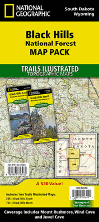
National Geographic Black Hills National Forest Map Pack Bundle
Waterproof Tear-Resistant Travel MapThe Black Hills National Forest Map Pack Bundle is the perfect companion for anyone planning a trip to the Black Hills of South Dakota. The two maps in this Map Pack Bundle cover the Black Hills National Forest in great detail and include all of the information needed for a memorable trip for the first time or the frequent visitor. The maps include trails with mileage between intersections numbered US Forest Service roads motorized trails as well as hundreds of points of interest such as campgrounds trail heads and boat ramps. ""Buy the Map Pack and save 15%!"" The Black Hills National Forest Map Pack includes: Map 238:: Black Hills South Black Hills National ForestMap 751:: Black Hills North Black Hills National ForestEvery Trails Illustrated map is printed on ""Backcountry Tough"" waterproof tear-resistant paper. A full UTM grid is printed on the map to aid with GPS navigation.""Map Scale = 1:70000Sheet Size = 37.75"" x 25.5""Folded Size = 4.25"" x 9.25"""""" unknown
Bookseller reference : BIBUP61025-A51244 ISBN : 159775398X 9781597753982
|
|
|
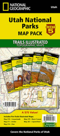
National Geographic Society Maps; National Geographic Maps - Trails Illustrated
National Geographic Utah National Parks Map Pack Bundle
Waterproof Tear-Resistant Topographic Map The five iconic national parks in the high desert of Utah are all provided in this single easy to purchase product. You get the maps for the best road trip of your life all while saving over 15%. Like all Trails Illustrated maps the Utah National Parks Bundle set is frequently revised and printed on waterproof tear-resistant material to stand up to all conditions. This detailed topographic recreation map bundle contains carefully researched trails campsites forest service roads and points-of-interests. Includes UTM grids for use with your GPS unit. Coverage includes the The Mighty 5 national parks of Utah: Arches Bryce Canyon Canyonlands Capitol Reef and Zion National Parks.""Map Scale = 1:35000 & 1:75000Sheet Size = 37.75"" x 25.5""Folded Size = 4.25"" x 9.25"""""" unknown
Bookseller reference : BIBUP61025-A55528 ISBN : 1597755974 9781597755979
|
|
|
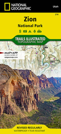
National Geographic Maps
Zion National Park
Covering all of Zion National Park our Trails Illustrated map contains detailed topography with shaded relief up-to-date trails roads and points of interest plus trail summaries and useful information to get the most from your visit. The North side of the map covers the popular Zion Narrows with a companion hiking timetable plus Kolob Canyons La Verkin Creek Trail Hop Valley Trail Wildcat Canyon the West Rim Trail and more. The South side of the map details the park headquarters Floor of the Valley Road East Rim Trail Telephone Canyon Trail and the Virgin River. Printed on durable waterproof tear-resistant and environmentally friendly material that will stand up to any outdoor condition. Both sides feature a UTM and Latitude/Longitude grid for use with a GPS plus compass rose scale bar and legend for easy interpretation. unknown
Bookseller reference : BIBUP61025-A39691 ISBN : 1566952972 9781566952972
|
|
|
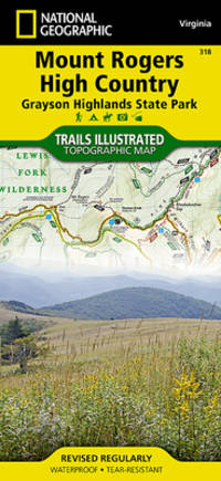
National Geographic Maps
Mount Rogers High Country
National Geographic's Trails Illustrated map of Mount Rogers High Country is a two-sided waterproof map designed to meet the needs of outdoor enthusiasts with unmatched durability and detail. This map was created in conjunction with local land management agencies and is loaded with valuable recreation information. Trails Illustrated maps are expertly researched and frequently updated. The maps are printed in the United States on durable synthetic paper making them waterproof tear-resistant and trail tough capable of going anywhere you do. The map is two-sided and can be folded to a packable size of 4.25 x 9.25; unfolded size is 26 x 38. Net proceeds from the sale of this map go to support the nonprofit mission of the National Geographic Society. Key Features: - Waterproof and tear-resistant - Clearly marked trails for hiking biking horseback riding ATV and more - Detailed topography and clearly defined color-coded boundaries of state parks national recreation areas wilderness areas marine sanctuaries and wildlife refuges - Hundreds of points-of-interest including scenic viewpoints campgrounds boat launches and canoe carry downs swimming areas fishing access points and more - UTM and Latitude/Longitude grid as well as selected waypoints and a scale bar for easy and accurate navigation. - Detailed road network - Useful travel information on parks and key trails - Important safety information and tips - Information about local organizations and land management agencies unknown
Bookseller reference : BIBUP61025-A28660 ISBN : 1566956641 9781566956642
|
|
|
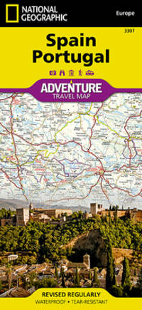
National Geographic Maps (Firm)
Spain Portugal
unknown
Bookseller reference : BIBUP61025-A39683 ISBN : 1566955394 9781566955393
|
|
 Receive by email
 Download as PDF document
 RSS feed


