|
National Geographic Maps
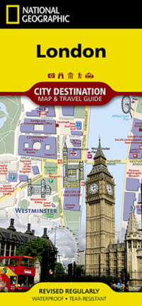
London
- Waterproof - Tear-Resistant - Travel Map National Geographic's City Destination map of London combines a city map and travel guide making it the ultimate traveling companion to this leading tourism destination. The reverse side presents an easy-to-read road map with hundreds of points of interest including 3D depictions of many top attractions like the London Eye Buckingham Palace and the Tower of London. Pinpointed are underground tube stops rail stations river bus stops theaters hotels places of worship notable buildings police stations hospitals parks pedestrian areas and other points of interest. Also displayed is a full map of the London underground. The front side has a regional map and descriptions of the city many popular attractions and the transit system. A user-friendly index of streets hotels and points of interest along with diagrams of Heathrow and Gatwick Airports will help you arrive at your destination quickly. An inset map of Hyde Park and Kensington provides details of this very popular area. With all of this specialized content this map is the perfect complement to National Geographic's London Traveler Guide. Every Destination Map is printed on durable synthetic paper making them waterproof tear-resistant and tough -- capable of withstanding the rigors of any kind of travel. Map Scale = 1:10700 Sheet Size = 24.75"" x 17.75"" Folded Size = 4"" x 8.75"" unknown
Bookseller reference : BIBUP61025-A15110 ISBN : 1566957826 9781566957823
|
|
|
National Geographic Maps
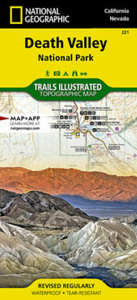
Death Valley National Park
This Trails Illustrated topographic map for Death Valley National Park which straddles the state lines of eastern California and western Nevada is the perfect recreational map for this dramatic park which encompasses the hottest driest and lowest places in the US. Within its three million acres you will find oceans of sand dunes dramatic snow-capped mountains spectacular geological formations and breathtaking views. The map includes the entire national park area with detailed trails and topographic information. The trails have been enhanced and road and trail mileage have been added to create a map that is an essential guide for the area. Includes UTM grids for use with your GPS unit. unknown
Bookseller reference : BIBUP61025-A41382 ISBN : 1566953219 9781566953214
|
|
|
National Geographic Maps (Firm)
Road Atlas United States Canada Mexico
Features clear detailed road maps of all 50 states plus Canada and Mexico. Maps show scenic routes historic sites and recreation areas. America's top 100 adventure destinations chosen by the editors of Adventure Magazine are profiled. More than 20 leading National Parks are described and mapped. Original. unknown
Bookseller reference : BIBUP61025-A41938
|
|
|
Benchmark; National Geographic Maps
New Mexico Road & Recreation Atlas
The new National Geographic Benchmark Recreation Atlases are an ideal recreation resource complete with accurate detailed topographic maps. They contain a wealth of robust travel information including campground locations state park maps sports and activity destinations museums hunting and fishing information historic sites and even climate details. Every feature is clearly labelled field-checked and verified and everything is organised for convenience and intuitive ease-of-use. The books feature a double laminated cover to prevent wear and tear. unknown
Bookseller reference : BIBUP61025-A51284
|
|
|
National Geographic Maps
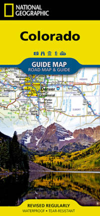
Colorado
- Waterproof - Tear-Resistant - Travel Map National Geographic's Colorado Guide Map is designed to meet the needs of travelers with detailed and accurate cartography and loads of helpful information about the state's many attractions. Cities and towns are easy to find with the map's helpful index. Highways roadways toll roads scenic routes and other roads are clearly designated. Distances in miles are noted on major highways so travelers can easily plan their best route. Hundreds of points of interest are shown along with national and state parks public campsites visitor information centers airports ski areas hospitals and more. Inset maps of Denver Colorado Springs Pueblo Fort Collins Mesa Verde National Park and Rocky Mountain National Park provide greater detail of key areas of the state. A map of the San Juan Skyway highlights one of Colorado's many scenic drives. The information provided about points of interest Denver and Rocky Mountain and Mesa Verde national parks will help you take advantage of many sites and recreation activities the state has to offer. A handy chart of park service sites and climate information are also included. Every State Guide Map is printed on durable synthetic paper making them waterproof tear-resistant and tough -- capable of withstanding the rigors of any kind of travel. Map Scale = 1:1584000 Sheet Size = 17.75"" x 20.75"" Folded Size = 4"" x 8.75"" unknown
Bookseller reference : BIBUP61025-A20046 ISBN : 156695777X 9781566957779
|
|
|
National Geographic Maps (Firm)
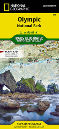
National Geographic Trails Illustrated Map Olympic National Park
• Waterproof • Tear-Resistant • Topographic Map Within the park there is detailed coverage of Mount Olympus Tshletshy Ridge Hurrican Ridge Huelsdonk Ridge Bailey Range camping areas facilities ranger stations nature trails waterfalls boat launches and much more. Also included are the Mount Skokomish Wilderness Ozette Lake Lake Pleasant Lake Crescent Lake Mills and Olympic National Forest. The map is full of detailed trail information points of interest trailheads picnic areas facitlities and more. Includes UTM grids for use with your GPS unit. Sheet Size = 25.50 x 37.75 Folded Size = 4.25 x 9.25 Scale = 1:100000 unknown
Bookseller reference : BIBUP61025-A23283 ISBN : 1566954029 9781566954020
|
|
|
Benchmark Maps & Atlases
Idaho Recreation Map
unknown
Bookseller reference : BIBUP61025-A42832
|
|
|
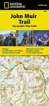
National Geographic Maps Trails Illustrated
John Muir Trail Topographic Map Guide
•Waterproof •Tear-Resistant •Topographic Map Guide National Geographic's Map Guide of the John Muir Trail is an indispensable tool for navigating one of the most famous trails in the United States. Expertly researched and created in partnership with local land management agencies this product provides detailed topographic maps interesting history a waypoint table information about resupply and bear safety and key points of interest you will encounter along the trail. Formatted to meet your needs while navigating this breathtaking and remote trail the maps within the guide are one-inch-equals-one-mile 1:63360 making it easy to calculate distances. Each map page has a trail profile that shows the elevation changes you will encounter. Also the John Muir Trail is highlighted and centered on each page so you can easily track your progress. The maps start at the northern terminus in Yosemite Valley and progress along the ridge of the Sierra Nevada past Devils Postpile and end at the highest point in the lower 48 on the top of Mount Whitney. Along the way you will pass through; Yosemite National Park Ansel Adams Wilderness Devils Postpile National Monument John Muir Wilderness Kings Canyon National Park and finally Sequoia National Park and Mount Whitney. All proceeds from the purchase of National Geographic maps help support the Society's vital exploration conservation scientific research and education programs. Download the GPX file of landmarks along the John Muir Trail. These landmarks match the ""Landmarks and Waypoints"" page in the John Muir Trail Topographic Map Guide.JohnMuirTrail.gpx unknown
Bookseller reference : BIBUP61025-A31584 ISBN : 1566956897 9781566956895
|
|
|
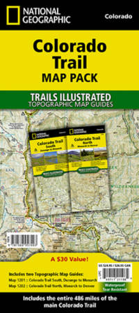
National Geographic Maps - Trails Illustrated
National Geographic Trails Illustrated Colorado Trail Map Pack
- Waterproof - Tear-Resistant - Topographic Maps In a state known for its trails The Colorado Trail is Colorado's premier long distance trail. Conceived in 1973 and completed in 1987 the trail runs 486 miles between Denver and Durango traversing some of the most spectacular scenery in the state. This Map Pack combines the entire standard route into a single easy to purchase product. Buy the Map Pack and save 15%! The Colorado Trail Map Pack includes: Map 1201:: Colorado Trail South Map 1202:: Colorado Trail North More convenient and easier to use than folded maps but just as compact and lightweight National Geographic's Topographic Map Guide booklets are printed on 'Backcountry Tough' waterproof tear-resistant paper with stainless steel staples. A full UTM grid is printed on the map to aid with GPS navigation. Map Scale = 1:75000 Folded Size = 4.25 x 9.38 unknown
Bookseller reference : BIBUP61025-A51245 ISBN : 1566957400 9781566957403
|
|
|
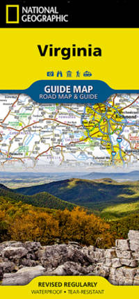
National Geographic Maps
National Geographic Virginia GuideMap
The front side is an easy-to-read road map with insets of: - Washington DC area - Charlottesville - Lynchburg - Roanoke - Southwest Virginia - Colonial National Historical Park The back includes: - Maps and information for Richmond and Hampton Roads - Information for Shenandoah National Park - Points of interest - Scenic drive - Park Service sites in Virginia unknown
Bookseller reference : BIBUP61025-A20048 ISBN : 1597750603 9781597750608
|
|
|
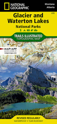
National Geographic Maps
National Geographic Trails Illustrated Map Glacier / Waterton Lakes National Parks
• Waterproof • Tear-Resistant • Topographic Map Waterton Lakes National Park includes Waterton Park Upper and Middle Waterton Lakes The Border Ranges Akamina Kishinena Provincial Park Blood Timber Reserve and more. Glacier National Park includes the entire national park area with detailed trails and topographic information. Includes the Lewis and Clark Range Many Glacier Lake McDonald Great Bear Wilderness Flathead National Forest Columbia Falls Horse Reservoir St. Mary Lake and much more. Includes UTM grids for use with your GPS unit. Sheet Size = 37.75 x 25.50 Folded Size = 4.25 x 9.25 Scale = 1:100000 unknown
Bookseller reference : BIBUP61025-A34306 ISBN : 1566953189 9781566953184
|
|
|
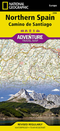
National Geographic Maps
Northern Spain
- Waterproof - Tear-Resistant - Travel Map National Geographic's Northern Spain AdventureMap is designed to meet the unique needs of adventure travelers with its durability and accurate information. This folded map provides global travelers with the perfect combination of detail and perspective highlighting hundreds of points of interest and the diverse and unique destinations within the country. The map includes the locations of cities and towns with a user-friendly index plus a clearly marked road network complete with distances and designations for major highways main roads and tracks and trails for those seeking to explore more remote regions. The front side of the Northern Spain map shows the eastern half of Northern Spain from its border with France on the north to the city of Tudela on the south. It continues west to Cangos de Onis and Palencia. The reverse side of the map stretches from Cangos de Onis and Leon to the region's western Atlantic coast. Every AdventureMap is printed on durable synthetic paper making them waterproof tear-resistant and tough -- capable of withstanding the rigors of international travel. Each is two-sided and can be folded to a packable size of 4.25"" x 9.25""; unfolded size is 26"" x 38"". Key Features: - Waterproof and tear-resistant - Accurate topography/terrain with a clearly labeled road network - Hundreds of points of interest including the locations parks and nature reserves protected lands historical and cultural attractions - Thousands of place names including towns and natural features; detailed place names index - Important travel networks including airports lighthouses ferry routes and rail lines - Updated regularly to ensure accuracy Proceeds from the sale of National Geographic maps go to support the National Geographic Society's vital exploration conservation research and education programs. ""Sheet Size = 37.75 x 25.50Folded Size = 4.25 x 9.25Scale = 1:380000"" unknown
Bookseller reference : BIBUP61025-A31489 ISBN : 1566955386 9781566955386
|
|
|
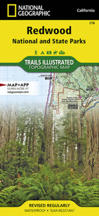
National Geographic Maps
Redwood National Park
Included are Prairie Creek Redwoods State Park Harry A Merlo State Recreation Area Humboldt Lagoons State Park Yurok Indian Reservation Smith River National Recreation Area Six Rivers National Forest Siskiyou Wilderness the North Fork Smith River Botanical Area the Broken Rib Botanical Area and Klamath National Forest. The trails have been enhanced and road and trail mileage have been added to create a more usable map. Includes UTM grids for use with your GPS unit. unknown
Bookseller reference : BIBUP61025-A31490 ISBN : 1566953197 9781566953191
|
|
|
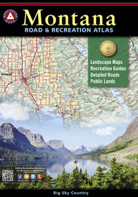
National Geographic Maps
Montana Road & Recreation Atlas
Montana is the crown jewel of the American West. Experience Big Sky Country with our completely new edition of Montana Road & Recreation Atlas. No other map product can better portray Montana's rugged peaks majestic rivers and expansive plains. Large-scale Landscape MapsTM reveal landforms with amazing realism and detail clearly showing the state's vast network of roads waterways and recreation landmarks. A 30-page Recreation Guide provides regional maps with public land detail and lists a wide range of outdoor activities. Arranged by category and boasting unequalled insight and detail it is the ideal tool for planning and - executing - Montana exploration. unknown
Bookseller reference : BIBUP61025-A53279 ISBN : 1734315075 9781734315073
|
|
|
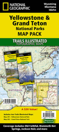
National Geographic Maps; National Geographic Maps - Trails Illustrated
National Geographic Yellowstone and Grand Teton National Parks Map Pack Bundle
• Waterproof • Tear-Resistant • Topographic Map Seeking the best combination of detailed maps and value for your trip to the Yellowstone and Grand Teton area then get our bundle pack. It includes both Yellowstone and Grand Teton National Park Trails Illustrated Maps providing you coverage of the entire region while saving you over 15%. Like all Trails Illustrated maps the Yellowstone Grand Teton Bundle set is frequently revised and printed on waterproof tear-resistant material to stand up to all conditions. Includes UTM grids for use with your GPS unit. Sheet Size = 37.75 x 25.00 Folded Size = 4.25 x 9.25 Scale = 1:126720 & 1:80000 unknown
Bookseller reference : BIBUP61025-A47423 ISBN : 1597754005 9781597754002
|
|
|
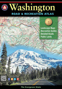
Benchmark Maps and Atlases
Washington Road and Recreation Atlas
First impressions of Washington-The Evergreen State-are those of verdant foliage huge trees and luxurious greenness. Its lasting impressions though are of proud snow-capped mountains frosty-jade rivers sapphire lakes and wonderful scenic panoramas. Benchmark's Washington Road & Recreation Atlas is the one guide needed to explore every corner of this magnificent state. Field-checked Landscape Maps show complete road detail classed by use and surface and the updated Recreation Guide has several recreation categories organized by region including the following: Wilderness Forest Service State parks State Lands Bureau of Reclamation Military lands BLM Tribal lands National parks and monuments Wilderness areas and State game management units. unknown
Bookseller reference : BIBUP61025-A53269 ISBN : 1734315016 9781734315011
|
|
|
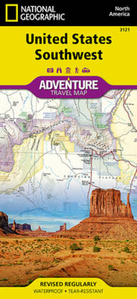
National Geographic Maps - Adventure
National Geographic United States Southwest
- Waterproof - Tear-Resistant - Travel Map There are few nations as vast and spectacularly diverse as the United States of America. From the Atlantic to the Pacific ""America the Beautiful"" offers boundless destinations and experiences for travelers seeking outdoor adventures small town delights or the excitement of urban culture. The United States Southwest Adventure Map will guide you through one of the most iconic and awe-inspiring regions on Earth. The states of Arizona and New Mexico contain Grand Canyon Petrified Forest and Saguaro National Parks Monument Valley Sonoran Desert and dozens of celebrated National Monuments Forests and Wilderness Areas. The map includes the cities of Phoenix Tucson Sedona Flagstaff Santa Fe and Albuquerque as well as the Navajo Apache Hopi and many other Indian Reservations. It covers the entire Four Corners Region including the southern halves of Utah and Colorado. There is simply no better map for exploring the Southwestern United States. National Geographic's US Adventure Maps provide the most authoritative and convenient travel maps available to plan and guide your USA Adventure. Each map delivers the perfect combination of detail and perspective highlighting travel routes topography and points of interest for those venturing beyond the city centers. Whether you're on a classic American road trip or planning a grand tour to visit several cities or national parks these maps offer the ultimate geographic resource as only National Geographic can provide. Every Adventure Map is printed on durable synthetic paper making them waterproof tear-resistant and tough -- capable of withstanding the rigors of international travel. Map Scale = 1:1300000 Sheet Size = 25.5"" x 37.75"" Folded Size = 4.25"" x 9.25"" unknown
Bookseller reference : BIBUP61025-A31567 ISBN : 156695715X 9781566957151
|
|
|
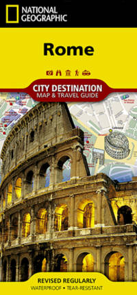
National Geographic Maps
National Geographic Destination City Map 2018 Rome
- Waterproof - Tear-Resistant - Travel Map One of the most visited places in the world for the past two millennia Rome has been an important city for Western Civilization as well for Christianity. Let National Geographic's City Destination map of Rome lead you on your exploration of this fascinating ancient destination. Combining an easy-to-read road map along with a travel guide this expertly researched map is unparalleled in its accuracy and content making it the ideal travel companion as well as the perfect complement to National Geographic's Rome Traveler Guide. The front side has a regional map and descriptions of the city many popular attractions and the transit system. A user-friendly index of streets hotels and points of interest along with a metro or Metropolitana map and a diagram of Fiumicino Airport will help you arrive at your destination quickly. An inset map of Vatican City provides details of this very popular area. The road map on the reverse side labels main secondary and one-way streets with a multi-language legend. In addition hundreds are popular and lesser known points of interest are pinpointed including metro stations places of worship theaters hotels hospitals police stations and notable buildings. Every Destination Map is printed on durable synthetic paper making them waterproof tear-resistant and tough -- capable of withstanding the rigors of any kind of travel. Map Scale = 1:9600 Sheet Size = 24.75"" x 17.75"" Folded Size = 4"" x 8.75"" unknown
Bookseller reference : BIBUP61025-A20039 ISBN : 1566957702 9781566957700
|
|
|
Benchmark Maps &. Atlases
Wyoming Road and Recreation Atlas
unknown
Bookseller reference : BIBUP61025-A51056
|
|
|
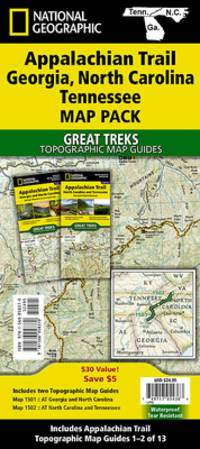
National Geographic Maps
National Geographic Trails Illustrated Map 2020 Appalachian Trail
- Waterproof - Tear-Resistant - Topographic Maps The Appalachian Trail AT Map Pack Bundle of Georgia North Carolina and Tennessee includes two Topographic Map Guides that cover the AT from the southern terminus at Springer Mountain to Damasus on the Tennessee-Virginia state line. The southernmost section of the AT offers some of most physically challenging but rewarding hiking along the entire trail including a more than 70 mile long section that passes through Great Smoky Mountains National Park. Each AT Topographic Map Guide includes detailed topographic maps at a scale of 1 inch = 1 mile. Each page is centered on the A.T. and overlaps with the adjacent pages so there is little chance of getting lost. Along the bottom of each page is a trail profile that shows the distance between shelters camping areas and trail access points. The map and trail profile provide a step by step visual guide to hiking the trail mile by rugged mile. The Topographic Map Guide is built for all levels of hiking enthusiasts from the day tripper to the multi month 'thru-hiker'. The front pages of the printed Topographic Map Guide include resupply information town inset maps camping options and much more. Buy the Map Pack and save over 15%! The Appalachian Trail: Georgia North Carolina Tennessee Map Pack Bundle includes: Map 1501:: Springer Mountain to Davenport Gap Georgia North Carolina Tennessee Map 1502:: Davenport Gap to Damascus North Carolina Tennessee More convenient and easier to use than folded maps but just as compact and lightweight National Geographic's Topographic Map Guide booklets are printed on 'Backcountry Tough' waterproof tear-resistant paper with stainless steel staples. A full UTM grid is printed on the map to aid with GPS navigation. Map Scale = 1:63360 Folded Size = 4.25 x 9.38 unknown
Bookseller reference : BIBUP61025-A51243 ISBN : 1566958377 9781566958370
|
|
|
National Geographic Maps; National Geographic Maps - Reference
World Decorator
National Geographic's World map is the standard by which all other reference maps are measured. The World map is meticulously researched and adheres to National Geographic's convention of making independent apolitical decisions based on extensive research using multiple authoritative source. The ""Decorator"" style World map uses a vibrant color palette that fills each country for easy identification and stunning shaded relief that will stand out as a beautiful piece of cartographic artistry. Drawn in the Winkel Tripel projection distortions are minimized and unlike many other World maps Greenland is show the same size as Argentina and not as the size of all of South America. Thousands of place names are carefully and artistically placed on the map to maintain legibility even in the heavily populated ares of Europe Asia and the Middle East. Details include clearly defined international boundaries cities physical features rivers and ocean floor features. Corner inset maps feature vegetation and land use and population density as well as the north and south polar regions. The map is encapsulated in heavy-duty 1.6 mil laminate which makes the paper much more durable and resistant to the swelling and shrinking caused by changes in humidity. Laminated maps can be framed without the need for glass so the fames can be much lighter and less expensive. ""Map Scale = 1:29802000Sheet Size = 46"" x 30.5"""" unknown
Bookseller reference : BIBUP61025-A53944
|
|
|
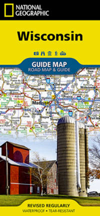
National Geographic Maps
National Geographic Wisconsin 2017 Map
- Waterproof - Tear-Resistant - Travel Map National Geographic's Wisconsin Guide Map provides travelers with the perfect combination of detail and perspective in a highly functional travel tool. Cities and towns are clearly indicated and easy to find in the user-friendly index. A complete road network of highways tollways and other roads along with distances noted in miles for major highways will help you find the route that's right for you. National and state parks public campsites visitor information centers airports ski areas hospitals and more are noted as well. A chart of park service sites and climate information will be particularly helpful to travelers taking in the many outdoor activities in Wisconsin. Inset maps of the cities of Madison Milwaukee Superior Appleton Oshkosh Racine-Kenosha Milwaukee Green Bay and Eau Claire provide greater detail of these urban centers. A handy combination of map and guidebook this map is also loaded with information on varied points of interest including St. Croix National Scenic Riverway Apostle Islands National Lakeshore and Great River Road a scenic byway along Route 35 between La Crosse and Prairie du Chien. Every State Guide Map is printed on durable synthetic paper making them waterproof tear-resistant and tough -- capable of withstanding the rigors of any kind of travel. Map Scale = 1:1267000 Sheet Size = 17.75"" x 24.75"" Folded Size = 4"" x 8.75"" unknown
Bookseller reference : BIBUP61025-A46675 ISBN : 156695732X 9781566957328
|
|
|
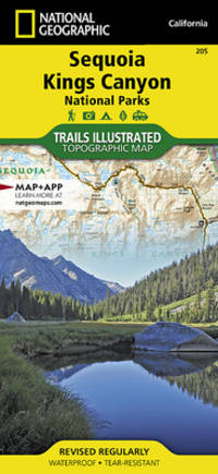
National Geographic Maps
Sequoia/Kings Canyon National Park
Some highlights of the map include: Highest Peak in Continental U.S. - Mt. Whitney; Sequoia Grove boundaries; Giant Sequoia National Monument; John Muir Golden Trout Jennie Lake and Monarch Wilderness Areas; John Muir Trail and Pacific Crest Trail. Includes UTM grids for use with your GPS unit. unknown
Bookseller reference : BIBUP61025-A39692 ISBN : 1566952980 9781566952989
|
|
|
Benchmark; National Geographic Maps
Utah Road & Recreation Atlas
The new National Geographic Benchmark Recreation Atlases are an ideal recreation resource complete with accurate detailed topographic maps. They contain a wealth of robust travel information including campground locations state park maps sports and activity destinations museums hunting and fishing information historic sites and even climate details. Every feature is clearly labelled field-checked and verified and everything is organised for convenience and intuitive ease-of-use. The books feature a double laminated cover to prevent wear and tear. unknown
Bookseller reference : BIBUP61025-A50465
|
|
|
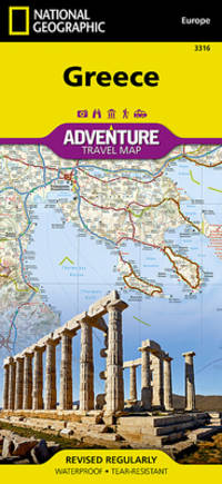
National Geographic Maps (Firm); National Geographic Maps - Adventure
Greece Adventure Travel Map
• Waterproof • Tear-Resistant • Travel Map National Geographic's Greece AdventureMap is designed to meet the unique needs of adventure travelers with its durability and accurate information. This folded map provides global travelers with the perfect combination of detail and perspective highlighting hundreds of points of interest and the diverse and unique destinations within the country. The front side of the Greece map shows the northern region of the country with Macedonia and Bulgaria to the north Albania to the west and Turkey to the east. There are insets detailing the islands of Kerkyra and Zakynthos. The reverse side of the map details the southern portion of Greece showing the islands down to Crete. The map includes the locations of cities and towns with a user-friendly index plus a clearly marked road network complete with distances and designations for major highways main roads and tracks and trails for those seeking to explore more remote regions. Every AdventureMap is printed on durable synthetic paper making them waterproof tear-resistant and tough — capable of withstanding the rigors of international travel. Each is two-sided and can be folded to a packable size of 4.25"" x 9.25""; unfolded size is 26"" x 38"". Key Features: - Waterproof and tear-resistant - Accurate topography/terrain with a clearly labeled road network - Hundreds of points of interest including the locations parks and nature reserves protected lands historical and cultural attractions - Thousands of place names including towns and natural features; detailed place names index - Important travel networks including airports lighthouses ferry routes and rail lines - Updated regularly to ensure accuracy Proceeds from the sale of National Geographic maps go to support the National Geographic Society's vital exploration conservation research and education programs. Sheet Size = 37.75 x 25.50 Folded Size = 4.25 x 9.25 Scale = 1:710000 unknown
Bookseller reference : BIBUP61025-A31090 ISBN : 1566956218 9781566956215
|
|
|
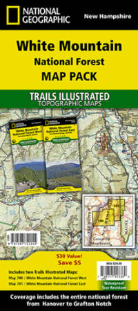
National Geographic Maps; National Geographic Maps - Trails Illustrated
National Geographic White Mountain National Forest Map Pack Bundle Map
• Waterproof • Tear-Resistant • Topographic Map Seeking the best combination of detailed maps and value for your trip to New Hampshire's White Mountains then get our bundle pack. It includes both Presidential Range and Franconia Notch/Lincoln Trails Illustrated Maps providing you coverage of the entire region while saving you over 15%. Like all Trails Illustrated maps the White Mountain Bundle set is frequently revised and printed on waterproof tear-resistant material to stand up to all conditions. Includes UTM grids for use with your GPS unit. unknown
Bookseller reference : BIBUP61025-A52503 ISBN : 159775224X 9781597752244
|
|
|
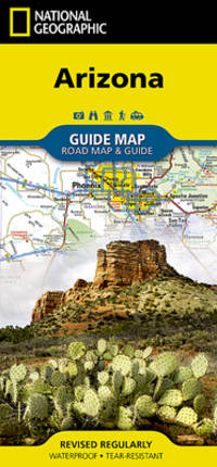
National Geographic Maps (Firm)
Arizona
The front side is an easy-to-read road map with insets of: - Bullhead City / Laughlin - Yuma - Flagstaff - Tucson - Downtown Phoenix - Saguaro National Park - Petrified Forest National Park The back includes: - Map and information about Phoenix - Map and information for Grand Canyon National Park - Points of interest - Scenic drive - Park Service sites in Arizona unknown
Bookseller reference : BIBUP61025-A17743 ISBN : 1597750867 9781597750868
|
|
|
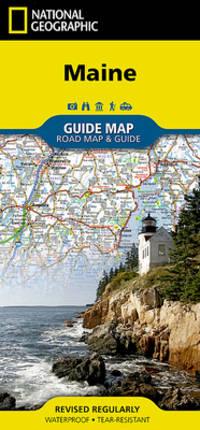
National Geographic Maps
National Geographic Guide Map Maine
• Waterproof • Tear-Resistant • Travel Map The front side is an easy-to-read road map with insets of: - Portland - Bangor - Lewiston / Auburn - Augusta The back includes: - Maps and information for Portland Freeport/Yarmouth and Bar Harbor - Information for Acadia National Park - Points of interest - Scenic drive - Park Service sites in Maine Fold Size = 4.00 x 8.75 Sheet Size = 17.75 x 24.75 Scale = unknown
Bookseller reference : BIBUP61025-A20050 ISBN : 1597753149 9781597753142
|
|
|
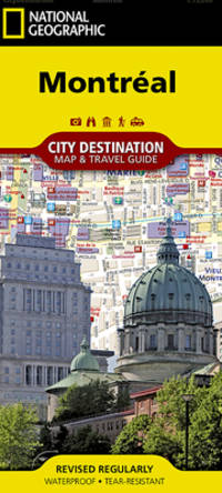
National Geographic Maps
Montréal DestinationMap City Map & Travel Guide
• Waterproof • Tear-Resistant • Travel Map In addition to the easy-to-read map on the front the back includes: - Regional map - Points of interest - Metro map - Airport diagrams for Montreal-Dorval and Montreal Mirabel International airports - Inset map of Vieux-Montreal Old Montreal - Multi-language legend Fold Size = 4.00 x 8.75 Sheet Size = 24.75 x 17.75 Scale = 1:15000 unknown
Bookseller reference : BIBUP61025-A30155 ISBN : 1597753122 9781597753128
|
|
|
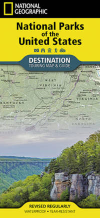
National Geographic Maps
National Geographic Destination Map 2018 National Parks of the United States
- Waterproof - Tear-Resistant - Travel Map National Geographic's Destination Map of National Parks of the United States highlights the nearly 400 magnificent parks across America. The country is represented in subtle earth-tones with shaded mountain relief and intricately drawn river systems. Photos capture some of the diverse landscapes preserved and protected by the national park system. A list of all park service units sorted by state is also included to help you find the closest park national monument or national historic site. Every Destination Map is printed on durable synthetic paper making them waterproof tear-resistant and tough -- capable of withstanding the rigors of any kind of travel. Map Scale = 1:5200000 Sheet Size = 37.75"" x 25.5"" Folded Size = 4.25"" x 9.25"" unknown
Bookseller reference : BIBUP61025-A31492 ISBN : 1566957516 9781566957519
|
|
|
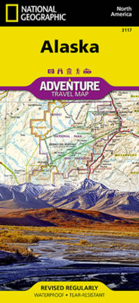
National Geographic Maps - Adventure
Alaska
- Waterproof - Tear-Resistant - Travel Map Alaska is a land so vast that is boggles the imagination. It is so large that it could easily contain the next three largest states: Texas California and Montana and still have room left over. Despite its large size Alaska has very few inhabitants making it the state with the lowest population density. Alaska is known for its dramatic diverse terrain of wide-open spaces mountains and forests with abundant wildlife and many small towns. A majority of Alaska sixty percent is owned and managed by the Federal Government. These lands are open to the public and offer a wide range of activities from sightseeing in Denali National Park to river-running and fishing on one of many wild rivers. Many vistors to Alaska choose to arrive via cruise ship through the famous Inside Passage. The Alaska Adventure Map shows all of these features and more from the temperate rain forest in the Pan Handle to the arctic tundra of the North Slope. This is a state of diverse and wide open spaces that are still truly wild. Alaska's most famous hotspots like Denali Anchorage the Inside Passage Klondike Gold Rush National Historical Park and many others are clearly marked on the map. The boundaries of National Parks National Forests Natural Reserves and Wildlife Refuges are all clearly marked. With such a wealth of content the map is an ideal complement to National Geographic's Inside Passage Destination Map or any other guidebook to the area. Every Adventure Map is printed on durable synthetic paper making them waterproof tear-resistant and tough -- capable of withstanding the rigors of international travel. Map Scale = 1:2250000 Sheet Size = 25.5"" x 37.75"" Folded Size = 4.25"" x 9.25"" unknown
Bookseller reference : BIBUP61025-A39695 ISBN : 1566957052 9781566957052
|
|
|
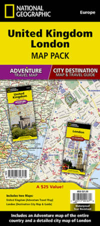
National Geographic Maps - Adventure
United Kingdom London
• Waterproof • Tear-Resistant • Travel Map The United Kingdom Adventure Map is combined with a London Destination City map in this Map Pack bundle. The United Kingdom map is filled with interesting places to visit throughout this historially rich country. From the White Cliffs of Dover through the heart of England all the way to the Shetland Islands of Scotland this map covers it all. Combine the Adventure Map of the United Kingdom with a beautifully detailed map of London and you have the perfect travel companion for your trip to this diverse island nation. The London Destination City map combines a finely detailed map with fascinating and practical travel information. The map features a large-scale city map richly layered with tourist and business travel locations and information. 3-D styled drawings provide you with instant identification of famous buildings and landmarks making orientation easy and creating a unique keepsake of the visit. Buy the Map Pack and save 15%! The United Kingdom London Map Pack includes: Adventure Map :: United Kingdom Destination City :: London Every Adventure Map and Destination City map is printed on durable synthetic paper making them waterproof tear-resistant and tough — capable of withstanding the rigors of international travel. All proceeds from the purchase of a National Geographic map help support the Society's vital exploration conservation scientific research and education programs. Map Scale = 1:825000 & 1:10700 Folded Size = 4.25"" x 9.25"" unknown
Bookseller reference : BIBUP61025-A54324 ISBN : 1597756172 9781597756174
|
|
|
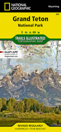
National Geographic Maps
Grand Teton National Park
National Geographic's Trails Illustrated Maps are the most detailed and up-to-date topographic recreation maps available for US National Parks National Forests and other popular outdoor recreation areas. A necessity for exploring the outdoors each map is printed on waterproof tear-resistant material. They also contain key safety and contact information GPS and compass coordinates Leave No Trace ethical guidelines and hundreds of points-of-interest including scenic viewpoints campgrounds boat launches swimming areas marine sanctuaries and wildlife refuges. Scale : 1:40000 Flat Size : 813 x 559 mm. unknown
Bookseller reference : BIBUP61025-A39699 ISBN : 1566954371 9781566954372
|
|
|
National Geographic Maps
National Geographic City Destination Washington D.C.
unknown
Bookseller reference : BIBUP61025-A20963 ISBN : 1566957303 9781566957304

|
|
|
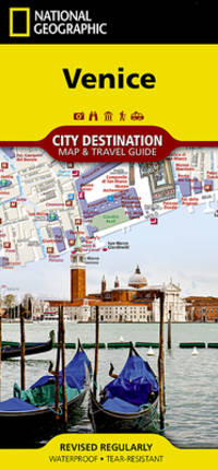
National Geographic Maps
National Geographic City Destination Map Venice
- Waterproof - Tear-Resistant - Travel Map Home to the gondola and Grand Canal Venice a popular tourist destination and international luxury destination. Covering this beautiful city's road and waterways with unparalleled detail National Geographic's City Destination map of Venice combines an easy-to-read street map with a travel guide. Displayed throughout the map are hundreds of points of interest including gondola stands water bus stations theaters hotels churches parks notable buildings. Many of the city's top attractions are depicted in 3D including Basilica di San Marco Galleria dell'Accademia and Santa Maria Gloriosa dei Frari. Inset maps cover the areas of Lido and Murano while a regional map shows the city's location in the heart of the Venetian Lagoon. A user friendly index of streets land and water features hotels and points of interest will help you find your destination and plan your route quickly. A comprehensive vaperetto water bus map and diagram of Marco Polo Airport will aid in your navigation into and around the city. Background information about the city its most popular attractions and transit system is also provided. Every Destination Map is printed on durable synthetic paper making them waterproof tear-resistant and tough -- capable of withstanding the rigors of any kind of travel. Map Scale = 1:6500 Sheet Size = 24.75"" x 17.75"" Folded Size = 4"" x 8.75"" unknown
Bookseller reference : BIBUP61025-A47203 ISBN : 1566957281 9781566957281
|
|
|
National Geographic Maps (Firm)
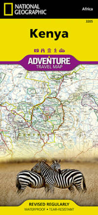
Kenya AdventureMap
National Geographic's Kenya AdventureMap is designed to meet the unique needs of adventure travelers with its durability and accurate information. Each folded map provides global travelers with the perfect combination of detail and perspective highlighting the areas terrain and best locations for adventure activities like snorkeling surfing fishing and more. AdventureMaps include hundreds of points of interest that highlight diverse and unique destinations within the country. The map includes the locations of thousands of cities and towns with a user-friendly index plus a clearly marked road network complete with distances and designations for major highways main roads and tracks and trails for those seeking to explore more remote regions. AdventureMaps are printed in the United States on a durable synthetic paper making it waterproof tear-resistant and tough capable of withstanding the rigors of international travel. The map is two-sided and can be folded to a packable size of 4.25 x 9.25; unfolded size is 26 x 38. Net proceeds from the sale of this map go to support the nonprofit mission of the National Geographic Society. Key Features: Waterproof and tear-resistant Detailed interpretive information and local travel tips Detailed topography complete with activity symbols ideal for exploring the country City overview maps Hundreds of points of interest including the location of World Heritage sites national parks and nature reserves aboriginal settlements and protected lands mines archeological sites wildlife parks and more Thousands of place names Important travel aids including airports lighthouses ferry routes and rail lines Developed in cooperation with local agencies Updated regularly to ensure accuracy unknown
Bookseller reference : BIBUP61025-A21159 ISBN : 1566956188 9781566956185
|
|
|
National Geographic Maps
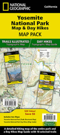
National Geographic Trails Illustrated Map 2020 Yosemite National Park Map & Day Hikes Map Pack Bundle
- Waterproof - Tear-Resistant - Topographic Maps Yosemite National Park has some of the most stunning landscapes in the world. This two title Map Pack Bundle helps explorers of all levels see everything this astounding park has to offer. The map pack includes an overview map that shows the entire park as well as a Day Hikes map guide. With this combination of maps visitors can feel comfortable planning a trip to a park with options for everyone from multi-day backpack trips to short hikes in Yosemite Valley. The Yosemite National Park Day Hikes Topographic Map Guide includes eighteen diverse hikes for all hiking enthusiasts from the easy 2.8 mile long Hetch Hetchy Valley Overlook to the strenuous 14.7 mile long Laurel Lake Trail with 3900' of elevation gain. Each hike has a detailed map a trail profile visualizing the changes in elevation and a short summary of the interesting features encountered along the trip. Buy the Map Pack and save 15%! The Yosemite National Park and Day Hikes Map Pack includes: Map 206:: Yosemite National Park Map 1704:: Yosemite National Park Day Hikes Every Trails Illustrated map is printed on 'Backcountry Tough' waterproof tear-resistant paper. National Geographic's Topographic Map Guide booklets are printed on 'Backcountry Tough' waterproof tear-resistant paper with stainless steel staples. A full UTM grid is printed on the map to aid with GPS navigation. Map Scale = 1:80000 Sheet Size = 25.5 x 37.75 Folded Size = 4.25 x 9.25 unknown
Bookseller reference : BIBUP61025-A47550 ISBN : 1566958369 9781566958363
|
|
|
National Geographic Maps - Trails Illustrated
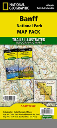
National Geographic Trails Illustrated Jasper National Park Map Pack
- Waterproof - Tear-Resistant - Topographic Maps Banff is Canada's first and most visited national park. Banff is one of the world's premiere destinations spanning a region of unparalleled majestic mountain scenery. This Map Pack combines two maps that cover Banff Yoho and Kootenay National Parks. All three national parks cover one of the most rugged areas in North America with mountain glaciers and breathtaking lakes. Buy the Map Pack and save 15%! The Banff National Park Map Pack includes: Map 901:: Banff North Banff and Yoho National Parks Map 900:: Banff South Banff and Kootenay National Parks Every Trails Illustrated map is printed on ""Backcountry Tough"" waterproof tear-resistant paper. A full UTM grid is printed on the map to aid with GPS navigation. Map Scale = 1:100000 Sheet Size = 37.75"" x 25.5"" Folded Size = 4.25"" x 9.25"" unknown
Bookseller reference : BIBUP61025-A51239 ISBN : 1566957389 9781566957380
|
|
|
National Geographic Maps
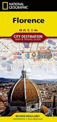
Florence
- Waterproof - Tear-Resistant - Travel Map Let National Geographic's City Destination map of Florence guide you as you explore this historic city that was the birthplace of the Renaissance and is still considered a world center for fashion art and culture. Featured on the map's front side is a clearly marked road network complete with designations for through routes main and secondary roads one way streets and pedestrian zones. Along with a multi-language legend hundreds of points of interest are pinpointed including notable buildings places of worship hotels theaters parking areas rail stations parks police stations and hospitals. Many of the city's top attractions are displayed with 3D images including Santa Maria del Fiore Palazzo Vecchio and Ponte Vecchio. The reverse side has a regional map showing the city's location on the heart of Tuscany. An insert map of Centro Storico provides extra detail of the remarkable city center. A user-friendly index of streets hotels and points of interest will ensure you find your destination quickly. A travel guide gives background information about the city its most popular destinations and an overview of the public transit system including a diagram of Amerigo Vespucci airport. With such an abundance of specialized content that is not available in traditional maps this destination map is the perfect complement to National Geographic's Florence and Tuscany Traveler Guide. Every Destination Map is printed on durable synthetic paper making them waterproof tear-resistant and tough -- capable of withstanding the rigors of any kind of travel. Map Scale = 1:6500 Sheet Size = 24.75"" x 17.75"" Folded Size = 4"" x 8.75"" unknown
Bookseller reference : BIBUP61025-A30144 ISBN : 1566957311 9781566957311
|
|
|
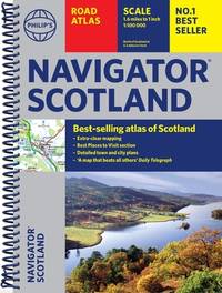
Philip's Maps
Philip's Navigator Scotland: The Best of Scotland: Spiral
unknown
Bookseller reference : BIBUP61025-A33240 ISBN : 1849077037 9781849077033
|
|
|
AI. Slusarouque Maps A. I.
Roadmap to lost mines and buried treasures of California
Van Nuys: Varna Enterprises 1971. Paperback. Very Good. Folded map. color both sides ; sheet 63 x 93 cm Varna Enterprises, paperback
Bookseller reference : 25-2035
|
|
|
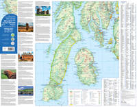
Collins Maps
Arran Bute And Kintyre Pocket Map: The Perfect Way To Explore The Firth Of Clyde
like new. unknown
Bookseller reference : 43577735 ISBN : 0008520631 9780008520632
|
|
|
Streetwise Maps
Streetwise Seattle Map - Laminated City Center Street Map of Seattle Washington - Folding pocket size travel map with monorail & streetcar lines
Used - Good. Used book that is in clean average condition without any missing pages. unknown
Bookseller reference : 17780509-6 ISBN : 0935039554 9780935039559

|
|
|
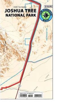
Tom Harrison Maps
Joshua Tree National Park Recreation Map Tom Harrison Maps
map. Good. Access codes and supplements are not guaranteed with used items. May be an ex-library book. unknown
Bookseller reference : 187768953X.G ISBN : 187768953X 9781877689536
|
|
|
EL. Sparks; Lt.-Col. Sir Morgan Crofton, maps E. L.
Liaison 1914: A Narrative of the Great Retreat
London: William Heinemann 1932. Hardcover. Very good. Hardcover. Sixth printing. xxix 577pp index; 14 maps. Name on front free endpaper scattered pencil underlining to text notes on half of rear endpaper some spotting to rear board else very good in publisher's red cloth. William Heinemann hardcover
Bookseller reference : 69128

|
|
|
AaZ Maps
Bristol A-Z Pocket Street Map
Paperback. Like New. paperback
Bookseller reference : GOR014539205 ISBN : 0008560471 9780008560478

|
|
|
PopOut Maps
Barcelona PopOut Map - handy pocket-size pop up Barcelona city map Popout Maps
Compass Maps. 3rd edition. Map. Used; Good. Simply Brit welcome to our online used book store where affordability meets great quality. Dive into a world of captivating reads without breaking the bank. We take pride in offering a wide selection of used books from classics to hidden gems ensuring theres something for every literary palate. All orders are shipped within 24 hours and our lightning fast-delivery within 48 hours coupled with our prompt customer service ensures a smooth journey from ordering to delivery. Discover the joy of reading with us your trusted source for affordable books that do not compromise on quality. 01/17/2014 Compass Maps unknown
Bookseller reference : 4269383 ISBN : 0711600301939 0711600301
|
|
|
A-Z Maps
Norwich A-Z Pocket Street Map
Paperback / softback. New. Navigate your way around Norwich with detailed street maps from A-Z paperback
Bookseller reference : A9780008657543 ISBN : 0008657548 9780008657543

|
|
|
Collins Maps
Collins Route 66 Touring Map: Plan your adventure across America
map. Good. Access codes and supplements are not guaranteed with used items. May be an ex-library book. unknown
Bookseller reference : 0008609179.G ISBN : 0008609179 9780008609177

|
|
|
Maps - History - Strass, Friedrich
Neuester Strom der Zeiten oder bildliche Darstellung der Weltgeschichte von den aeltesten Zeiten bis zum Ende des achtzehnten Jahrhunderts.
1817. Vienna Geistinger 1817. 71 : 148 cm. Manyfolded contemporary coloured engraving. Contemporary mounted on linen. Interesting historical map giving an broad overview of the development of the history from ancient times until the 18th century. Friedrich Strass 1766-1846 was a teacher at the monastery of Berge near Magdeburg. His "Strom der Zeiten" got a great populariety and was admired also from the foreign countries. - As mostly browned. unknown
Bookseller reference : 11715AB
|
|
 Receive by email
 Download as PDF document
 RSS feed


