|
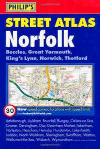
Philip's Maps
Philip's Street Atlas Norfolk: Pocket Edition
Paperback. Acceptable. paperback
Bookseller reference : GOR007166382 ISBN : 184907206X 9781849072069
|
|
|
Collins Maps
Whisky Map of Scotland Collins Pictorial Maps
Paperback. Very Good. paperback
Bookseller reference : GOR007117642 ISBN : 0007513305 9780007513307

|
|
|
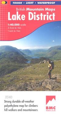
Harvey Maps
Lake District BMC British Mountain Map
Paperback. Very Good. paperback
Bookseller reference : GOR006484368 ISBN : 1851374671 9781851374670
|
|
|
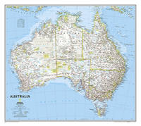
National Geographic Maps
National Geographic Australia Wall Map - Classic 30.25 x 27 in National Geographic Reference Map
Natl Geographic Society Maps 2019-11-10. 2019. map. New. 3.10x3.10x37.25. Buy with confidence. Excellent Customer Service & Return policy. Natl Geographic Society Maps unknown
Bookseller reference : DADAX0792280997 ISBN : 0792280997 9780792280996
|
|
|
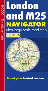
Philip's Maps
Philip's London and M25 Navigator Road Map
Paperback. Very Good. paperback
Bookseller reference : GOR005314289 ISBN : 1849072523 9781849072526
|
|
|
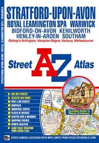
AaZ maps
Stratford-upon-Avon & Warwick A-Z Street Atlas A-Z Street Atlas S.
Paperback. Very Good. paperback
Bookseller reference : GOR005157039 ISBN : 1843487462 9781843487463
|
|
|
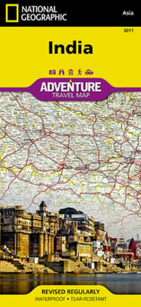
National Geographic Maps - Adventure
India
NATL GEOGRAPHIC MAPS. New. Special order direct from the distributor NATL GEOGRAPHIC MAPS unknown
Bookseller reference : ING9781566955966 ISBN : 1566955963 9781566955966
|
|
|
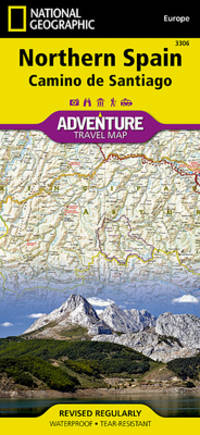
National Geographic Maps - Adventure
Northern Spain National Geographic Adventure Map 3306
National Geographic Maps. New. Special order direct from the distributor National Geographic Maps unknown
Bookseller reference : ING9781566955386 ISBN : 1566955386 9781566955386
|
|
|
Philip's Maps
Philip's Atlas of the World
Hardback. Very Good. hardcover
Bookseller reference : GOR002695849 ISBN : 0540057428 9780540057429

|
|
|
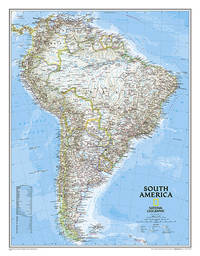
National Geographic Maps
National Geographic South America Wall Map - Classic 23.5 x 30.25 in National Geographic Reference Map
Natl Geographic Society Maps 2017-07-30. 2017. map. Used: Good. 3.00x3.00x43.00. Buy with confidence. Excellent Customer Service & Return policy. Natl Geographic Society Maps unknown
Bookseller reference : SONG0792281071 ISBN : 0792281071 9780792281078
|
|
|
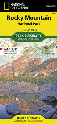
Trails Illustrated Maps
Rocky Mountain National Park National Geographic Trails Illustrated Map
National Geographic 2022-01-01. 2022. map. New. 4.33x0.16x9.25. Buy with confidence. Excellent Customer Service & Return policy. National Geographic unknown
Bookseller reference : DADAX1566953421 ISBN : 1566953421 9781566953429
|
|
|
Philip's Maps
Philip's Children's Picture Atlas
Paperback. Very Good. paperback
Bookseller reference : GOR001380413 ISBN : 0540089605 9780540089604

|
|
|
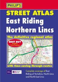
Philip's Maps
East Riding and Northern Lincolnshire Street Atlas
Paperback. Very Good. paperback
Bookseller reference : GOR001660405 ISBN : 0540081469 9780540081462
|
|
|
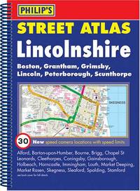
Philip's Maps
Philip's Street Atlas Lincolnshire: Spiral Edition
Paperback. Very Good. paperback
Bookseller reference : GOR002333819 ISBN : 0540090824 9780540090822
|
|
|
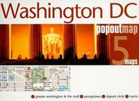
Compass Maps, Ltd
Compass Maps Popoutmap Washington Dc: 5 Maps
Brand: Compass Maps Ltd 2009-10-14. map. Used: Good. 5.50x0.25x4.25. Buy with confidence. Excellent Customer Service & Return policy. Brand: Compass Maps Ltd unknown
Bookseller reference : SONG1845877640 ISBN : 1845877640 9781845877644
|
|
|
Benchmark Maps
Benchmark Maps Nevada Road & Recreation Atlas Benchmark Road & Recreation Atlas
Benchmark Maps 2019-11-01. paperback. Good. 10x0x15. Benchmark Maps paperback
Bookseller reference : 0929591690-3-35710048 ISBN : 0929591690 9780929591698
|
|
|
Compass International Maps
Atlanta International Maps International Maps
map. Good. Access codes and supplements are not guaranteed with used items. May be an ex-library book. unknown
Bookseller reference : 1845876059.G ISBN : 1845876059 9781845876050

|
|
|
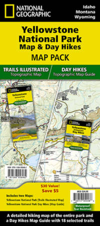
National Geographic Maps - Trails Illustrated
Yellowstone Day Hikes and National Park Map Map Pack Bundle National Geographic Trails Illustrated Map
National Geographic 2023-01-01. 2023. map. New. 9.00x0.55x4.50. Buy with confidence. Excellent Customer Service & Return policy. National Geographic unknown
Bookseller reference : DADAX1566958466 ISBN : 1566958466 9781566958462
|
|
|
[MAPS -- AUTOMOBILE & BICYCLE TRAVEL].
Wincarnis motor & cyclist map of England. Various sections. . . .
London & Norwich UK: Coleman & Co. Ltd. John Bartholomew & Co. Fletcher & Son Ltd. Litho ca. 1910. Sixteen parts. 64 pp unpaginated. double-page colour-lithograph maps throughout sized 9.5 x 7.2 when unfolded. Self-printed colour lithograph softcovers decorated title cover on front of each installment Wincarnis tonic advertisement in full colour on back cover edgewear thumbing minor chipping to a few fore-edges & corners still a G set. First edition thus of this uncommon and complete set of promotional maps for automobile travelers and bicyclists in Edwardian England whose drivers and riders were often fueled by the “delicious tonic and restorative recommended by over 8000 medical men.†The 16 maps featuring sections from London to Cornwall South Wales to Manchester and Lincolnshire to Yorkshire offered an accurate and compact set of travel maps documenting main roads secondary roads “other roads typically nearly impassable local lanes & livestock paths railways and rivers. Wincarnis was first introduced as a medicinal treatment in the Victorian era was a liqueur derived from a mix of secret herbs & spices meat extract malt extract infused with cloves nutmeg and citrus and although not openly marketed as alcoholic featured a significant 17-18% alcohol content. Therapeutic use was widely encouraged and severe motoring and bicycle accidents often included drivers and riders under the influence. Following the 1914 Parliamentary “Commission on Patent Medicines†investigation numerous changes and rules were changed regarding marketing and sales of such products as well as curtailing of hyping the “Restorative†properties. Worldcat locates 2 sets 1 undated - Hartley Library; 1 set misdated -- Wellcome; See: Drinking for Health: Proprietary Tonic Wines Chapter 10 Drinking in Victorian and Edwardian Britain: Beyond the Spectre of the Drunkard National Library of Medicine 2018. Coleman & Co., Ltd., John Bartholomew & Co., Fletcher & Son, Ltd. Litho, paperback
Bookseller reference : 63113
|
|
|
[AUTOMOBILE TRAVEL -- LONG ISLAND, NEW YORK MAPS].
Hammond’s new road map of Long Island New York. Special features: quality of roads road names city and village street names interurban electric lines. . . .
New York: C.S. Hammond & Co. Schum Bros. Stationers and Printers 1913. 12mo. 3.5 x 7.5 double-sided colour lithograph map which folds out to 25.25 x 16.5 in. on 28 x 17.75 in. sheet very light dustsoiling slight shelfwear very slight age toning along the folds. Original printed gray-blue pocket portfolio folder blue lettering on recto & verso added affixed label of Schum Bros. over imprint minor age toning still a VG bright clean map. First edition thus of this very scarce Brass Era automobile travel map depicting Manhattan and portions of Long Island from Brooklyn across to Smithtown and Great River. Verso Map includes Long Island fro Great River up to Darlington across to Truman Beach and Bridgehampton with two inset maps: “Contination of North Shore†and “Continuation of South Shore†with “Good Roads†and “Fair Roads†differentiated as well as depiction of the Long Island Railway line and red dots tracing the electric interurban lines. As early as 1906 Hammond & Co. had produced a map for Good Roads enthusiasts and motorists but this updated issue documenting the improved roads was issued in 1913 and then regularly from 1914-1925. No copies in Worldcat. C.S. Hammond & Co., Schum Bros., Stationers and Printers, unknown
Bookseller reference : 63117
|
|
|
[MAPS -- IRELAND]. WALKER, J.[ohn], WALKER, C.[harles], & [Alexander].
Walker’s Ireland. 15-panel dissected hand-coloured engraved map.
London: J.&C. Walker 9 Castle Street Published by Longman & Co. ca. 1844. 16mo. 3.5 x 5 in. folding out to 13.25 x 16.5 in. dissected 15-panel hand-coloured steel-engraved map linen-backed w/ 3 leaf folding population and mileage distance chart from Dublin by County mounted on front pastedown. Dark gray-green publisher’s cloth portfolio pocket binding decorative borders in blind gilt lettering stamped on front cover a NF copy. First edition thus of this very scarce dissected pocket map of Ireland published against the backdrop of the full impact of the Great Potato Famine which from 1841-1851 resulted in the diaspora and death of nearly 30% of the Irish population and as reflected in the mileage table mounted with the map the population in 1845 had already dropped from 8.2 million in 1841 to 7.7 million by 1844 and it would plummet further to below 6.5 million by 1851. The bulk of these emigrated to the United States Canada and the United Kingdom resulting in the fact that Ireland’s current population still resides below the high of 1841 and nearly 38 million Irish-Americans claim descent from the successive waves of migration much of which channeled through New York’s Lower East Side and the Bowery in the 19th-Century. John Walker 1787-1873 was a British mapmaker engraver lithographer hydrographer draughtsman and publisher publishing nautical charts and geographical maps with his brothers Charles and Alexander in their firm J.&C. Walker located at 9 Castle Street Holborn from 1841-1847 and moving to 37 Castle St. in 1848 where they remained to 1875. Much of their work was published under the auspices of the Society for the Diffusion of Useful Knowledge or S.D.U.K. Worldcat locates 1 copy Yale. J.&C. Walker, 9 Castle Street, Published by Longman & Co., hardcover
Bookseller reference : 63111
|
|
|
Collins Maps
Short walks in the Cotswolds
Collins 2014-04-01. 2. paperback. Used: Good. 0.40x4.60x7.00. Buy with confidence. Excellent Customer Service & Return policy. Collins paperback
Bookseller reference : SONG0007555008 ISBN : 0007555008 9780007555000

|
|
|
Philip's Maps
2025 Philip's Big Road Atlas of Britain & Ireland: A3 Spiral Binding Philip's Road Atlases
Paperback. Very Good. paperback
Bookseller reference : GOR014355930 ISBN : 1849076642 9781849076647
|
|
|
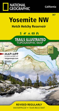
National Geographic Maps - Trails Illustrated
Yosemite NW: Hetch Hetchy Reservoir Map National Geographic Trails Illustrated Map 307
National Geographic Maps 1/1/2019 12:00:01 AM. map. Very Good. 0.3500 in x 7.4000 in x 4.0600 in. National Geographic Maps unknown
Bookseller reference : mon0000943405 ISBN : 1566954126 9781566954129
|
|
|
Collins Maps
Collins Handy Road Atlas Scotland: A5 Paperback
Harpercollins Publishers 2025. Paperback / Softback. New. new ed edition. 72 pages. 5.83x0.18x8.27 inches. Harpercollins Publishers paperback
Bookseller reference : __0008725519 ISBN : 0008725519 9780008725518
|
|
|
[AUTOMOBILE TRAVEL -- MAPS]. LYNCH, FCC. (Dir.); STEWART, Charles & CORY, WW. (Minister & Dep. Minister). F. C. W. W.
Sectional map indicating main automobile roads between Canada & United States: Atlantic Sheet; Great Lakes Sheet; Middle West Sheet; Pacific Sheet. . . .
Ottawa ONT: Natural Resources Intelligence Service 1928-1929. Four large folding colour maps. atlas folio w/ largest sized 45 x 35 in. w/ each sheet including an index map indicating there are 4 in total with outlines fold creases as issued minor age toning to fore-edges a few minor closed tears at fold creases still a VG set of maps. Early printing of this four sheet map depicting the automobile roads connecting Canada and the United States during the 1920’s as the Good Roads Movement rapidly expanded through the Northern Country following World War I. These maps depict the burgeoning highway and national road system which had been fostered by urban centers attempting to convince rural municipalities to replace their seasonal dirt roads with those of gravel or crushed stone and facilitate much greater movement of agricultural and manufacturing products across the continent and with the U.S. The Atlantic map stretches from the maritime provinces down to Washington D.C. and over to Niagara Falls and Buffalo NY; The Middle West map documents the main automobile roads and highways from Port Albert to Port Arthur and South from Denver to St. Louis indicating provincial federal and state roads and highways; The Great Lakes section tracks the extensive network of roads and highways surrounding the Great Lakes including those in Iowa Kentucky Wisconsin New York and the Canadian provinces of Quebec and Ontario; while the Pacific Map records the highways from San Francisco to Denver and up through Alberta and over to British Columbia. Uncommon with all four maps present. See: J.I. Little Confronting Rural Localism: The Good Roads Movement in Quebec’s Eastern Townships 1897-1920 Social History/Histoire sociale Vol. 57 No. 117 May 2024. Natural Resources Intelligence Service, unknown
Bookseller reference : 62600
|
|
|
[AVIATION -- MAPS].
BEA international route maps. . . .
London & Paris: British European Airways 1949. 4to. 20 pp unpagianted. colour-illustrated maps and red & black text throughout. Self-printed colour-illustrated maps w/ ad for BP Aviation Service and Anglo-Iranian Oil Co. Ltd. on back cover Dunlop tire ad verso of front center crease fold as issued w/ original BEA sleeve from the library of Archibald Angus MacDonald 1892-1977 stepson of famed southern California oil man William F. Byrne as well as oil company and drilling equipment owner and manager of MacDonald & Burns Oil Producers. First edition of this surprisingly scarce BEA route map book issued following World War II and prior to the establishment of the Western US UK and French Zones into the Federal Republic of German and the Soviet Zone into the German Democratic Republic East Germany. In 1946 BEA was established to feed short commuter flights across Europe and until 1950 used a fleet of Douglas DC-3 aircraft based out of Croydon and Northold Airports moving to Heathrow in 1950. No copies in Worldcat. British European Airways, unknown
Bookseller reference : 62765
|
|
|
Philip's Maps
Ordnance Survey South Yorkshire Street Atlas
Philip's 05/07/1999 00:00:01. paperback. Good. 1.1991 in x 18.3860 in x 12.5904 in. Ex-library book usual markings. Well read with some wear but still very useable. Light foxing. Philip's paperback
Bookseller reference : mon0000530869 ISBN : 0540076694 9780540076697
|
|
|
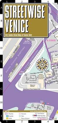
Streetwise Maps
Streetwise Venice Map - Laminated City Center Street Map of Venice Italy: Folding Pocket Size Travel Map with Water Bus
Streetwise Maps. Fol Lam Ma. Map. Used; Very Good. Simply Brit welcome to our online used book store where affordability meets great quality. Dive into a world of captivating reads without breaking the bank. We take pride in offering a wide selection of used books from classics to hidden gems ensuring theres something for every literary palate. All orders are shipped within 24 hours and our lightning fast-delivery within 48 hours coupled with our prompt customer service ensures a smooth journey from ordering to delivery. Discover the joy of reading with us your trusted source for affordable books that do not compromise on quality. 02/01/2011 Streetwise Maps unknown
Bookseller reference : 4158746 ISBN : 1931257493 9781931257497
|
|
|
Compass Maps
Chicago International Maps International Maps
paperback. Good. Access codes and supplements are not guaranteed with used items. May be an ex-library book. paperback
Bookseller reference : 1845876075.G ISBN : 1845876075 9781845876074

|
|
|
Compass Maps
Bristol PopOut Miniguides
paperback. Good. Access codes and supplements are not guaranteed with used items. May be an ex-library book. paperback
Bookseller reference : 1845876997.G ISBN : 1845876997 9781845876999
|
|
|
[MAPS -- WALL PULL-DOWN CASE]. ATWOOD, Wallace W.[alter] (Ed.).
Atwood Regional-Political Series seven pull-down map quarter-sawn oak wall case: Asia including U.S.S.R. in Europe; South America; Europe; United States; Africa; Australia and the Far East; North America.
Chicago IL: Published by A.J. Nystryom & Co. Maps Globes Charts 1934. Seven large linen-backed colour lithograph maps sized from 43.5 x 72 in. to 51.5 x 60 in. all mounted on their original spring-loaded rollers wooden pull dowel & metal ring pull some creasing minor edgewear creasing soot soiling to the lower margin averaging about 6-7 in. due to exposure when rolled “Europe†and “United States†with faint tidemark & discoloration at left margin some minor creasing wear all preserved in the original A.J. Nystrom quarter-sawn oak wall bracket sized 58.5 x 15.25 x 3.25 in. all pull-down maps firmly secured in their steel brackets preserving 6 of the 7 original labels on the edge of the pull-down dowels still a VG- set of maps in their original configuration. First editions thus of this complete and exceptional example of the Atwood/A.J. Nystrom Regional-Political Series Map Case reflecting the many geographical and political changes between World War I and World War II. Such changes are reflected in the appearance of Manchoukuo the Japanese controlled rump state established in Manchuria in 1932 by the Japanese Empire and also depicting Korea still as Chosen. The Europe map depicts the East Prussia still controlled by the Weimar Republic and then after Hitler ascended to power; while Africa still retains much of the colonial powers as shown in the Belgian Congo Anglo-Egyptian Sudan French Equatorial Africa and even Beuchuanaland. The Australia and the Far East Map clearly defines the Japanese United States British & Australian mandates across the South Pacific. Atwood 1872-1949 was a noted geographer and educator who was a member of both the New Jersey and Wisconsin Geological Surveys served in the US Geological Survey served as professor of Physiography at Harvard and later from 1920-1946 when he produced these maps was President of Clark University and Head of its School of Geography. No similar complete sets located in Worldcat. Published by A.J. Nystryom & Co., Maps, Globes, Charts, unknown
Bookseller reference : 61915
|
|
|
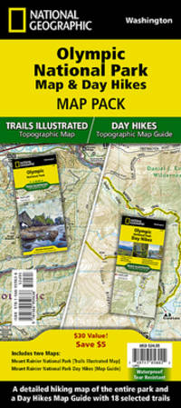
National Geographic Maps - Trails Illustrated
Olympic Day Hikes & National Park Map Pack Bundle National Geographic Trails Illustrated Map
map. Good. Access codes and supplements are not guaranteed with used items. May be an ex-library book. unknown
Bookseller reference : 1566959632.G ISBN : 1566959632 9781566959636
|
|
|
Collins Maps
Scotland Touring Map
Collins 03/13/2014. New edition. Map. Used; Very Good. WE SHIP WITHIN 24 HRS FROM LONDON UK 98% OF OUR ORDERS ARE RECEIVED WITHIN 7-10 DAYS. We believe you will be completely satisfied with our quick and reliable service. All orders are dispatched as swiftly as possible! Buy with confidence! Greener Books. Collins unknown
Bookseller reference : 4695061 ISBN : 000754541x 9780007545414

|
|
|
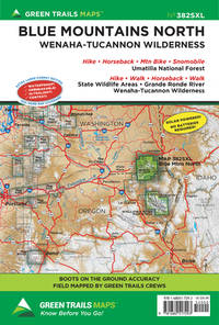
Maps, Green Trails
Blue Mountains North OR No. 382SXL Green Trails Maps 382SXL
map. Good. Access codes and supplements are not guaranteed with used items. May be an ex-library book. unknown
Bookseller reference : 1680517295.G ISBN : 1680517295 9781680517293
|
|
|
A-Z Maps
London A-Z Visitors Map
Sheet map folded. New. New Book; Fast Shipping from UK; Not signed; Not First Edition; Clear and easy-to-read map of central London and surrounding area. Contains detailed mapping presented in a handy compact format. This attractive map ideal for both tourists and residents and fully updated has an extensive area of c unknown
Bookseller reference : ria9780008581794_inp ISBN : 0008581797 9780008581794

|
|
|
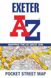
A-Z Maps
Exeter A-Z Pocket Street Map
Sheet map folded. New. New Book; Fast Shipping from UK; Not signed; Not First Edition; Navigate your way around Exeter with detailed street maps from A-Z unknown
Bookseller reference : ria9780008657413_inp ISBN : 0008657416 9780008657413
|
|
|
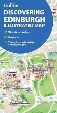
Collins Maps
Discovering Edinburgh Illustrated Map
Sheet map folded. New. New Book; Fast Shipping from UK; Not signed; Not First Edition; Explore new places with dependable maps from Collins. This brand new edition retains the delightful water-colour mapping with individual paintings of all the main sights and landmarks. unknown
Bookseller reference : ria9780008663476_inp ISBN : 0008663475 9780008663476
|
|
|
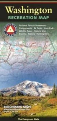
Benchmark Maps
Washington Recreation Map
Sheet map folded. New. New Book; Fast Shipping from UK; Not signed; Not First Edition; The Washington Recreation Map is a folded map version of the Recreation Guide pages within Benchmark's Washington Road & Recreation Atlas. unknown
Bookseller reference : ria9780783499680_inp ISBN : 078349968x 9780783499680
|
|
|
Jacana Maps
Garden Route Guide: From Still Bay to Storms River
Jacana Media. 3rd Revised edition. Paperback. Used; Very Good. Simply Brit welcome to our online used book store where affordability meets great quality. Dive into a world of captivating reads without breaking the bank. We take pride in offering a wide selection of used books from classics to hidden gems ensuring theres something for every literary palate. All orders are shipped within 24 hours and our lightning fast-delivery within 48 hours coupled with our prompt customer service ensures a smooth journey from ordering to delivery. Discover the joy of reading with us your trusted source for affordable books that do not compromise on quality. 07/01/2006 Jacana Media paperback
Bookseller reference : 3664382 ISBN : 1770091467 9781770091467
|
|
|
Jacana Maps
Garden Route Guide: From Still Bay to Storms River
Jacana Media 07/01/2006. 3rd Revised edition. Paperback. Used; Very Good. WE SHIP WITHIN 24 HRS FROM LONDON UK 98% OF OUR ORDERS ARE RECEIVED WITHIN 7-10 DAYS. We believe you will be completely satisfied with our quick and reliable service. All orders are dispatched as swiftly as possible! Buy with confidence! Greener Books. Jacana Media paperback
Bookseller reference : 4521609 ISBN : 1770091467 9781770091467
|
|
|
[MAPS -- PICTORIAL PUZZLE MAP]. WHITE, W.[illiam] F.[letcher].
Map of United States products - resources. . . No. 630.
New York: Platt & Munk Co. Inc. 1959. Oblong folio. 15 x 11 in. Approx. 75 pieces puzzle pictorial map illustration of 48 state products. Colour-illustrated box w/ label affixed on front cover announcing “Now includes Alaska the 49th State! but puzzle w/o additional image of Alaska red white & blue ribbing fore-edges minor scuffing 1 corner w/ tear & old scotch tape repair w/ former ownership marking of “Kathy†on lid still a VG copy and publisher’s ad for “Let’s Fly Away with Mother Goose†laid-in. Later printing of this surprisingly scarce pictorial map puzzle originally issued by Platt & Munk in 1932 featuring the artwork depicting Sequoia trees & fruits in California mining & sheep in Utah cattle & sheep in Montana hogs corn & wheat in Nebraska and citrus cotton oil & cattle in Texas. White 1884-1948 was an artist who trained & lived in Brooklyn NY and spent much of his later career through World War II as an instructor in fashion design and art renderings at the 5th Avenue Fashion Art Design School which preceded FIT and also featured other instructors such as Louis A. Eisele. Platt & Munk Co., Inc., unknown
Bookseller reference : 61207
|
|
|
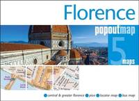
Maps, PopOut
Florence PopOut Map: Handy pocket size pop up city map of Florence
map. Good. Access codes and supplements are not guaranteed with used items. May be an ex-library book. unknown
Bookseller reference : 1845879813.G ISBN : 1845879813 9781845879815
|
|
|
A-Z Maps
A -Z Birmingham Hidden Walks
Paperback / softback. New. New Book; Fast Shipping from UK; Not signed; Not First Edition; Discover hidden gems around Birmingham with 20 walking routes. Featuring 20 walks in and around the city including lesser-known circuits and details on popular walks. Accompanied by guided walking instructions and written b paperback
Bookseller reference : ria9780008496302_inp ISBN : 0008496307 9780008496302

|
|
|
[GOLDEN GATE INTERNATIONAL EXPOSITION -- PICTORIAL MAPS/WOMEN ARTISTS] TAYLOR [WHITE], Ruth; [BURROUGHS, Walter (Man. Ed.) & TI
Official guide book Golden Gate International Exposition World’s Fair. . . A cartograph of Treasure Island in San Francisco Bay: Golden Gate International Exposition. . . .
San Francisco CA: San Francisco Bay Exposition 1939. 8vo. 116 pp. With oblong folio. 19.25 x 16 in. colour pictorial map frontisp. detailed sections of island and exhibits in blue on verso fold creases numerous photo illustrations text maps diagrams stepped thumb tabs at outer fore-edge. Blue-cloth backed softcovers featuring the striking Art Deco cover art by Simon “Si†Vanderlaan 1904-1986 famed pin-up artist and illustrator who worked for Walt Disney studios during World War II minor scuffing very minor age toning shelfwear still VG bright copy from the library of Prof. Marvin Nathan. Revised 1939 edition of this excellent guide to the first year in 1939 of the Golden Gate International Exposition including “Cartograph†revealing all of the Art Deco architectural wonders and surrounding areas of Treasure Island. The pictorial maps were issued separately as well as with the “Official Guide Books.†Ruth Taylor White’s 1902-1985 delightful pictographic maps or cartographs included depictions of the Territory of Hawaii in which she had driven or traveled to every corner of the Islands and the Grand Canyon for her for her brother’s book “Grand Canyon Country.†Later Little Brown requested an entire atlas which was published as the very scarce Our U.S.A. “A gay geography.†Her cartographs influenced the style of American cartographic illustration for decades afterwards. See: Griffin Mapping Wonderlands: Illustrated Cartography pp. 192-193; Field MapCarte 29/364: Our U.S.A. A Gay Geography 2014. San Francisco Bay Exposition, paperback
Bookseller reference : 60959
|
|
|
Harvey Maps
Northumberland Coast Path Trail Map XT40
Harvey Maps 2023. Map. New. 1 pages. 9.53x7.80x0.28 inches. Harvey Maps unknown
Bookseller reference : __1851376682 ISBN : 1851376682 9781851376681
|
|
|
Cycle Maps UK
East Anglia Cycle Map 13
Cycle Maps UK 2023. Unknown Binding. New. 1st ed september 2023 edition. 2 pages. 8.27x5.91x0.79 inches. Cycle Maps UK unknown
Bookseller reference : __1904207812 ISBN : 1904207812 9781904207818
|
|
|
[AUTOMOBILE TRAVEL -- MAPS].
Travel Oregon Coast Highway U.S. 101: In all the World no drive like this no tolls in Oregon. . . .
Marshfield OR: Oregon Coast Highway Association 1938. 4to. 16 pp unpaginated. numerous text illustrations double-page centerfold map by T.J. Greene small closed tear minor creasing self-printed photo-illustrated colour-softcovers center crease and printed in double-columns for folding slight soiling front cover still VG- copy w/ small rubber stamp of Breakers Motor Apts. Crescent City California on front cover. First edition thus of this automobile and bus travel tour guide to the newly completed US Highway 101 which finally had completed paved highway and bridges including the iconic Yaquina Bay bridge designed by Conde B. McCullough. Throughout the 1930’s with substantial support from the WPA and PWA projects as well as the U.S. Bureau of Public Works the highway became a scenic continuous drive. Oregon Coast Highway Association, paperback
Bookseller reference : 60338
|
|
|
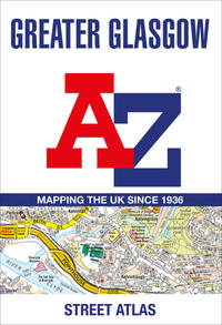
A-Z Maps
Greater Glasgow A-Z Street Atlas
Geographers’ A-Z Map Co Ltd 2023. Paperback. New. seventh edition edition. 288 pages. 11.69x7.91x0.51 inches. Geographers’ A-Z Map Co Ltd paperback
Bookseller reference : __0008560439 ISBN : 0008560439 9780008560430
|
|
|
AZ maps & A-Z Maps
Great Britain A-Z Road Atlas 2021 A4 Spiral
Geographers A-Z Map Co Ltd. Spiral-bound. Used; Good. Simply Brit welcome to our online used book store where affordability meets great quality. Dive into a world of captivating reads without breaking the bank. We take pride in offering a wide selection of used books from classics to hidden gems ensuring theres something for every literary palate. All orders are shipped within 24 hours and our lightning fast-delivery within 48 hours coupled with our prompt customer service ensures a smooth journey from ordering to delivery. Discover the joy of reading with us your trusted source for affordable books that do not compromise on quality. 06/11/2020 Geographers A-Z Map Co Ltd unknown
Bookseller reference : 3406204 ISBN : 0008388164 9780008388164
|
|
 Receive by email
 Download as PDF document
 RSS feed


