|
[CALIFORNIA -- MAPS]. [WHITE, Albert C., VINCENZ, Jean L.]
Land use district maps adopted by ordinance No. 2491 of the City of Fresno California. City Planning Commission. . . .
Fresno CA: City Planning Commission 1938. Oblong folio. 13.5 x 9.25 in. 17 blueprint maps variously numbered. w/ first map as the Key Map for the remainders. Stapled at gutter margin w/ protective green-tinted back softcover folded to provide reinforcement at spine from the library of George Reed Volker 1925-2018 former World War II pilot and urban planner in California New York and Washington State. First editions of these exceedingly scarce land use district zoning maps drawn up in 1938 after the passage of the 1937 Housing Act which unfortunately upended much of the spending not only by the WPA but also required any federal money to spent in “blighted†areas. These detailed maps show major streets demarcate singe family housing multi-family housing manufacturing and commercial bases for the community. Eventually the Public Housing which was built in Fresno during World War II began in West Fresno or “Chinatown first with the Sequoia Courts and later the Sierra Plaza followed by others. No copies located in Worldcat; See: Bibliography of Research Projects Reports W.P.A. Technical Series Research and Records Projects Bibliography No. 1 Feb. 2 1940 p. 53 Zoning Ordinance. City Planning Commission, paperback
Bookseller reference : 56963
|
|
|
[SHIPPING -- MAPS]. ROWAN, JF. (Exec. Secretary). J. F.
Household Goods Carriers’ Bureau agent mileage guide No. 4. Cancels mileage guide No. 3. Containing maps and charts of distances in miles for common contract and passenger carriers between points within the United States also. . . to and from points in Canada and Mexico. . . ; Supplement No. 10. . . cancels Supplement No. 9. . . Effective June 7 1947.
Washington D.C. & Chicago IL: Household Goods Carriers’ Bureau Rand McNally & Co. 1941; 1947. Two vols. 296 pp. including 22 large folding colour maps a few w/ minor toning to fore-edges some dustsoiling a few w/ minor tape repairs especially at a couple folds and near gutter margin. Quarter-green cloth over printed light green softcovers stapled as issued minor soiling some slight foxing & toning still VG copy; 9 3 pp. Stapled as issued minor toning light creasing at corners VG. First edition of this essential HHGCB mileage guide issued just weeks before Pearl Harbor and the entry of the United States into World War II. Originally established in 1936 after the passage of the Reed-Bulwinkle and Interstate Commerce Commission Acts the HHGCB organized to file the required mileage tariffs with the ICC and issued this guidebook. This mileage guide contained maps from the Rand McNally Co. together with charts to determine highway distances between principal points in the United States and allow transport charges to be computed. This guidebook offers an essential snapshot of not only the existing transportation network during World War II but also the vital routes of trucking goods across the country locally or into Canada and Mexico prior to the creation of the Interstate Highway System later authorized in 1956 by President Eisenhower. The supplement updated many of the mileage references following the War acknowledging the tremendous build-up of infrastructure during and in Post-War America. The HHGCB continued to operate in assorted consolidations and mergers until the 2007 decision eliminating all motor carrier rate bureaus. Worldcat locates 1 copy of No. 4 no copies located of Supplement No. 10 US Dept. of Transportation Library. Household Goods Carriers’ Bureau, Rand McNally & Co., paperback
Bookseller reference : 56936
|
|
|
[MAPS -- WASHINGTON & OREGON].
Sovereign Service. Swinging through the Sovereign Way “Fit for a King.†Oregon Washington.
Wichita KS & Chicago IL: Kanotex Refining Co. Derby Oil Co. Panhandle Refining Co. Eldorado Refining; Rand McNally 1940. 4to. which opens into 15 panel maps sized 19.75 x 26.5 in. map of Oregon-Washington in red & blue on verso w/ decorative borders U.S. map on recto Soverign Club information in sepia & yellow inset minor dampsoiling to 1 corner minor soiling edgewear still G copy. First edition of this scarce automobile travel map issued by the Sovereign Service gas stations and travel club on the eve of World War II for Washington & Oregon. Includes the 1940 census data within the Rand McNally issued map. No copies in Worldcat. Kanotex Refining Co., Derby Oil Co., Panhandle Refining Co., Eldorado Refining; Rand McNally, unknown
Bookseller reference : 56581
|
|
|
[MAPS - PORTLAND, OREGON]. BYINGTON, [Fred Fletcher] & BROWN, CA. (Cartographer). C. A.
Nonpareil indexed map of Portland Oregon. . . .
Portland OR: Published by Byington Printing Co. March 1952. 1 large folding map sized 21 x 23 printed in red & black inset map on verso of map as well as street and city guide index street traction system transportation information and zones. Map folds down into small printed portfolio w/ fold-over flap printed in red & black illust. of mill on front light toning still VG. First edition thus of this updated city map with postal zones and all of the motorcoach lines and electric trolley lines delineated. The map is of particular interest as showing Portland OR neighborhoods before the clearing and construction of Interstate-5 and the outlines of the destroyed city of Vanport. Destroyed in the 1948 flood Oregon’s second largest city had been originally constructed by Henry Kaiser outside of the Portland city limits in order to house a large influx of African-American workers largely barred by Oregon discriminatory laws. Byington 1862-1956 was a California printer who moved to Oregon following World War I would own and operate Byington Printing Co. until his death. No copies located in Worldcat. Published by Byington Printing Co., unknown
Bookseller reference : 56432
|
|
|
[OREGON -- MAPS]. GILHAM, [Fred Howes].
Gilham’s guide Oregon 1930. A simple accurate up-to-date index of Oregon for business firms. Every Oregon home should have one.
Portland OR: Gilham’s Guide 1930. 8vo. 91 1 pp. Maps throughout. Tan printed softcovers minor darkening and thumbing to fore-edges 1 small corner creased still a VG copy. First edition of this scarce automobile travel map guide to Oregon for travelers and businessmen. Supplied with an extended index the strip maps all offer auto roads and stage roads for buses as well as showing railroad lines. In addition ferries post offices Western Union Express Offices and much more are shown. In addition there are mileage maps for Washington & Oregon included as well. Gilham 1882-1949 was a lifetime Portland OR resident who published gravel guides and histories on the Pacific Northwest but after losing his business during the Great Depression went to work for the Jones Lumber Co. Gilham’s Guide, paperback
Bookseller reference : 56484
|
|
|
Davis, Paul M., And Hubert K. Clay ; Drawings By John F. Hubacek And Allen W. Hale, Many Photographs; Fold-Out Maps
History Of Battery "C" 148Th Field Artillery American Expeditionary Forces "Powder River To The Rhine
Colorado Springs: Paul M. Davis And Hubert K. Clay / Out West 1919. 1st Edition 1st Printing. Hardcover. Very Good. 255 Pp. Red Leather Spine Dark Red Cloth Boards Gilt. First Printing. Lightly Used Gilt Brilliant Fraying Along Bottom Edge Of Spine And At Upper Front Tip Tiny Frays At Two Lower Tips And At Top Edge Of Spine Hinges Tight No Marks. <br/> <br/> Paul M. Davis And Hubert K. Clay / Out West hardcover
Bookseller reference : 042710

|
|
|
Collins Maps
Ireland The Best: The insiderâs guide to Ireland
Paperback. Very Good. paperback
Bookseller reference : GOR009635208 ISBN : 0008248818 9780008248819

|
|
|
Collins Maps
2016 Collins France Big Road Atlas
Paperback. Very Good. paperback
Bookseller reference : GOR009431948 ISBN : 0008146586 9780008146580

|
|
|
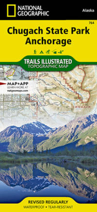
National Geographic Maps - Trails Illustrated
Chugach State Park Anchorage Map National Geographic Trails Illustrated Map 764
National Geographic 2023-01-01. 2023. map. New. 4.30x0.60x8.70. Buy with confidence. Excellent Customer Service & Return policy. National Geographic unknown
Bookseller reference : DADAX1566956781 ISBN : 1566956781 9781566956789
|
|
|
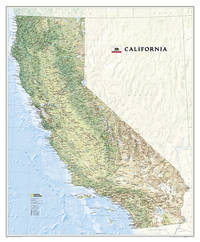
National Geographic Maps
National Geographic California Wall Map 33.5 x 40.5 in National Geographic Reference Map
National Geographic 2023-08-15. 2023. map. New. 2.20x32.99x40.00. Buy with confidence. Excellent Customer Service & Return policy. National Geographic unknown
Bookseller reference : DADAX1597752053 ISBN : 1597752053 9781597752053
|
|
|
National Geographic Maps
Sydney Map National Geographic Destination City Map
Natl Geographic Society Maps 2019-12-26. 2019. map. New. 4.00x0.30x9.00. Buy with confidence. Excellent Customer Service & Return policy. Natl Geographic Society Maps unknown
Bookseller reference : DADAX1597754021 ISBN : 1597754021 9781597754026

|
|
|
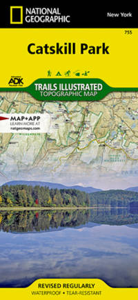
National Geographic Maps - Trails Illustrated
Catskill Park Map National Geographic Trails Illustrated Map 755
National Geographic 2023-01-01. 2023. map. New. 4.10x0.30x9.10. Buy with confidence. Excellent Customer Service & Return policy. National Geographic unknown
Bookseller reference : DADAX1566955882 ISBN : 1566955882 9781566955881
|
|
|
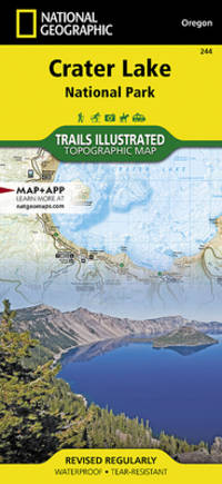
National Geographic Maps - Trails Illustrated
Crater Lake National Park Map National Geographic Trails Illustrated Map 244
National Geographic 2019-01-01. 2019. map. New. 4.10x0.30x9.00. Buy with confidence. Excellent Customer Service & Return policy. National Geographic unknown
Bookseller reference : DADAX1566953022 ISBN : 1566953022 9781566953023
|
|
|
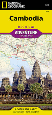
National Geographic Maps
Cambodia Map National Geographic Adventure Map 3024
Natl Geographic Society Maps 2022-01-01. 2022. map. New. 4.10x0.20x8.90. Buy with confidence. Excellent Customer Service & Return policy. Natl Geographic Society Maps unknown
Bookseller reference : DADAX1597756229 ISBN : 1597756229 9781597756228
|
|
|
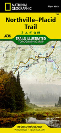
National Geographic Maps
Northville-Placid Trail Map National Geographic Trails Illustrated Map 736
Natl Geographic Society Maps 2023-01-01. 2023. map. New. 4.10x0.60x9.00. Buy with confidence. Excellent Customer Service & Return policy. Natl Geographic Society Maps unknown
Bookseller reference : DADAX1597756210 ISBN : 1597756210 9781597756211
|
|
|
Hema Maps
New Zealand Country Map by Hema
Hema Maps 2005. Cover lightly rubbed/bumped edges/corners lightly bumped/rubbed; map lightly creased/rubbed at folds; binding tight; cover edges and interior intact and clean except as noted. paperback. Good. Hema Maps paperback
Bookseller reference : 620827 ISBN : 0958209553 9780958209557

|
|
|
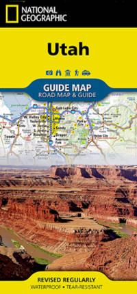
National Geographic Maps
Utah Map National Geographic Guide Map
Natl Geographic Society Maps. New. Special order direct from the distributor Natl Geographic Society Maps unknown
Bookseller reference : ING9781566957236 ISBN : 1566957230 9781566957236
|
|
|
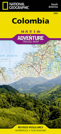
National Geographic Maps - Adventure
Colombia Map National Geographic Adventure Map 3405
National Geographic 2019-01-01. 2019. map. New. 4.25x0.16x9.25. Buy with confidence. Excellent Customer Service & Return policy. National Geographic unknown
Bookseller reference : DADAX1566956242 ISBN : 1566956242 9781566956246
|
|
|
Philip's Maps
Philip's Street Atlas Birmingham and West Midlands: Spiral Edition
Paperback. Very Good. paperback
Bookseller reference : GOR008717121 ISBN : 1849073716 9781849073714

|
|
|
[MAPS -- SOUTH AMERICA].
The new world school map of South America. . . .
Syracuse NY: Empire New England Company Inc. ca. 1920. Double Elephant folio. 51 x 59 in. Large colour-printed map dissected and mounted on linen backing brass grommets at upper fore-edge for hanging title stamped on verso minor edgewear at creases very minor lifting at seams minor dustsoiling to outer linen when folded still a VG exemplar. First edition thus of this scarce education map of post-World War I South American geography. The map details the principal railways water routes major cities steamship routes and geographical and political details. The Empire New England Company was active in upstate New York from about 1915 until the end of the 1920s selling educational supplies maps textbooks and more. The New World School Maps could be purchased individually or in cases which held between 6-10 individual maps for school uses according to company literature of the period. Worldcat locates 1 copy Buffalo & Erie County Public Library smaller size - 1931 ed. Empire New England Company, Inc., unknown
Bookseller reference : 52936
|
|
|
Merrill, John ; Boyes, Paul (Maps)
John Merrill's Favourite Walks
GB: Dalesman Publishing Co Ltd 1982. Bookplate. Book is in very good condition with minor signs of wear and/or age. 1st Edition. Paperback. VG. Dalesman Publishing Co Ltd Paperback
Bookseller reference : v022.022 ISBN : 0852066694 9780852066690
|
|
|
[MAPS -- NEW YORK, NEW JERSEY & PENNSYLVANIA]. MacNAIR, Henry.
A survey of the Empire Group with a complete distance table a compendious index of cities and post offices with populations and much statistical data. . . .
Boston: The Bullard Co. Inc. 1909. Large folding accordion-style folded map printed in red & black sized 41 x 38 in. which when entirely folded into covers measures 5.5 x 11.25 in. Original burgundy-coloured boards small lozenge map of New York & Pennsylvania on front cover some edgewear rubbing minor tidemark to upper fore-edge of 1 corner still VG- copy. Second edition revised of this scarce and well documented map showing good roads for automobile travel railroads canals new Erie Barge Canal Steamship lines ferries lighthouses electric railway lines and more. First published in 1908 and then again in 1910 MacNair drew from US government surveys State surveys and other original commercial sources. Worldcat locates 2 copies. The Bullard Co., Inc., hardcover
Bookseller reference : 52792
|
|
|
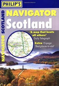
Philip's Maps
Philip's Navigator Scotland: A4 Spiral binding
Paperback. Acceptable. paperback
Bookseller reference : GOR007709937 ISBN : 1849072043 9781849072045
|
|
|
Maps, Popout
Dublin PopOut Map PopOut Maps
Paperback. Very Good. paperback
Bookseller reference : GOR007299979 ISBN : 1845879783 9781845879785

|
|
|
[AUTOMOBILE TRAVEL --MAPS].
Washington-Oregon highway Map. The leader gasoline 76. Union Oil Company.
Chicago: Rand McNally Co. ca. 1938. Large colour map 26.5 x 19.5 in. which folds into 12 sections w/ several inset colour maps on verso colour-illustrated Art Deco cover art of couple driving from the front & back advertising Triton Oil minor shelfwear some dustsoiling still VG map. First edition thus including large Highway map on one side of Washington & Oregon along with smaller inset maps for Portland Everett Salem Seattle Spokane and Tacoma before World War II. Rand McNally Co., unknown
Bookseller reference : 49584
|
|
|
Maps, Popout
Berlin PopOut Map PopOut Maps
Paperback. Very Good. paperback
Bookseller reference : GOR006810319 ISBN : 1845879775 9781845879778

|
|
|
Philip's Maps
Street Atlas London
Hardback. Acceptable. hardcover
Bookseller reference : GOR002602591 ISBN : 0540081582 9780540081585

|
|
|
Philip's Maps
Philip's World Atlas: Paperback Edition
Paperback. Acceptable. paperback
Bookseller reference : GOR006485227 ISBN : 0540090115 9780540090112

|
|
|
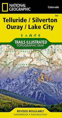
National Geographic Maps - Trails Illustrated
Telluride Silverton Ouray Lake City Map National Geographic Trails Illustrated Map 141
National Geographic 2023-01-01. 2023. map. New. 3.80x0.40x7.30. Buy with confidence. Excellent Customer Service & Return policy. National Geographic unknown
Bookseller reference : DADAX1566953405 ISBN : 1566953405 9781566953405
|
|
|
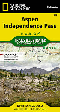
National Geographic Maps
Aspen Independence Pass Map National Geographic Trails Illustrated Map 127
Natl Geographic Society Maps 2023-12-12. 2023. map. New. 3.90x0.40x7.10. Buy with confidence. Excellent Customer Service & Return policy. Natl Geographic Society Maps unknown
Bookseller reference : DADAX1566953588 ISBN : 1566953588 9781566953580
|
|
|
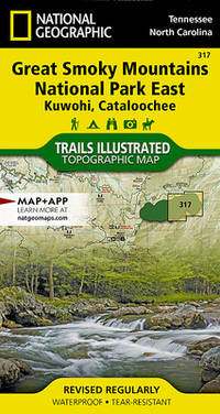
National Geographic Maps
Great Smoky Mountains National Park East: Clingmans Dome Cataloochee Map National Geographic Trails Illustrated Map 317
Natl Geographic Society Maps 2021-01-09. 2021. map. New. 4.10x0.30x7.25. Buy with confidence. Excellent Customer Service & Return policy. Natl Geographic Society Maps unknown
Bookseller reference : DADAX1566955017 ISBN : 1566955017 9781566955010
|
|
|
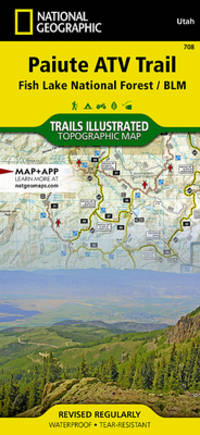
National Geographic Maps - Trails Illustrated
Paiute ATV Trail Map Fish Lake National Forest BLM National Geographic Trails Illustrated Map 708
National Geographic 2024-01-01. 2024. map. New. 4.10x0.20x8.80. Buy with confidence. Excellent Customer Service & Return policy. National Geographic unknown
Bookseller reference : DADAX1566953081 ISBN : 1566953081 9781566953085
|
|
|
Philip's Maps
Philip's Pocket Star Atlas
Paperback. Very Good. paperback
Bookseller reference : GOR005923318 ISBN : 1849072396 9781849072397

|
|
|
[MAPS -- GLOBES].
The global map.
Minneapolis MN: Global Map Co. ca. 1941. Oblong folio 22.5 x 11.25 in. Two rotating wheels each showing hemisphere projection maps which are attached to a thick brown base w/ printed labels on front cover original rivets still present printed paper label and instructions on verso some rubbing & edgewear minor foxing & scuffing still a G exemplar. First edition of this fascinating and scarce global map which allows the user to view steamship or airline distance routes as well as the principal railroads. The global map was designed so that opposite halves of the earth’s surface could be rotated and synchronized enabling continuous and accurate spherical relationships across any point on the rotating maps. The label on the back lists the area in square miles and population totals of the world. The map is dated to around 1941 because of the inclusion of Vichy France the government allowed by the Nazi occupiers after the fall of France in 1940. Global Map Co., unknown
Bookseller reference : 48041
|
|
|
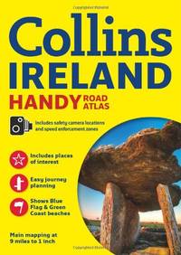
Collins Maps
Collins Handy Road Atlas Ireland International Road Atlases
Paperback. Very Good. paperback
Bookseller reference : GOR005059411 ISBN : 0007490526 9780007490523
|
|
|
Philip's Maps
Philip's Street Atlas Derbyshire: Spiral Edition
Paperback. Acceptable. paperback
Bookseller reference : GOR002291800 ISBN : 0540088447 9780540088447

|
|
|
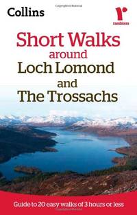
Collins Maps
Ramblers Short Walks around Loch Lomond and The Trossachs
Paperback. Very Good. paperback
Bookseller reference : GOR004798269 ISBN : 0007464541 9780007464548
|
|
|
National Geographic Maps - Trails Illustrated
Crater Lake National Park Map National Geographic Trails Illustrated Map 244
National Geographic 2019-01-01. 2019. map. Used: Good. 4.10x0.30x9.00. Buy with confidence. Excellent Customer Service & Return policy. National Geographic unknown
Bookseller reference : SONG1566953022 ISBN : 1566953022 9781566953023
|
|
|
Benchmark Maps
Washington Benchmark Road & Recreation Atlas
National Geographic Maps 2015-10-01. 2015. paperback. New. 11.00x0.25x15.25. Buy with confidence. Excellent Customer Service & Return policy. National Geographic Maps paperback
Bookseller reference : DADAX0929591984 ISBN : 0929591984 9780929591988

|
|
|
National Geographic Maps
Oregon Benchmark Road & Recreation Atlas
National Geographic Maps 2014-01-01. 2014. paperback. New. 11.00x0.25x15.25. Buy with confidence. Excellent Customer Service & Return policy. National Geographic Maps paperback
Bookseller reference : DADAX0929591623 ISBN : 0929591623 9780929591629

|
|
|
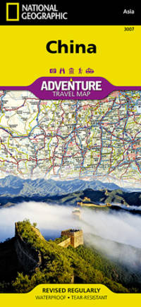
National Geographic Maps - Adventure
China Map National Geographic Adventure Map 3007
National Geographic 2019-01-01. 2019. map. New. 4.25x0.16x9.25. Buy with confidence. Excellent Customer Service & Return policy. National Geographic unknown
Bookseller reference : DADAX1566955920 ISBN : 1566955920 9781566955928
|
|
|
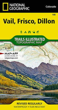
National Geographic Maps
Vail Frisco Dillon Map National Geographic Trails Illustrated Map 108
Natl Geographic Society Maps 2020-01-01. 2020. map. New. 4.25x0.50x7.50. Buy with confidence. Excellent Customer Service & Return policy. Natl Geographic Society Maps unknown
Bookseller reference : DADAX1566952816 ISBN : 1566952816 9781566952811
|
|
|
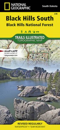
National Geographic Maps - Trails Illustrated
Black Hills South Map Black Hills National Forest National Geographic Trails Illustrated Map 238
National Geographic 2019-01-01. 2019. map. New. 4.50x0.50x9.25. Buy with confidence. Excellent Customer Service & Return policy. National Geographic unknown
Bookseller reference : DADAX1566953472 ISBN : 1566953472 9781566953474
|
|
|
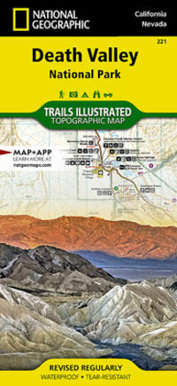
National Geographic Maps
Death Valley National Park Map National Geographic Trails Illustrated Map 221
National Geographic Maps 2023-01-01. 2023. map. New. 9.25x0.16x4.25. Buy with confidence. Excellent Customer Service & Return policy. National Geographic Maps unknown
Bookseller reference : DADAX1566953219 ISBN : 1566953219 9781566953214
|
|
|
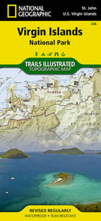
National Geographic Maps - Trails Illustrated
Virgin Islands National Park Map National Geographic Trails Illustrated Map 236
National Geographic 2020-01-01. 2020. map. New. 4.10x0.40x8.90. Buy with confidence. Excellent Customer Service & Return policy. National Geographic unknown
Bookseller reference : DADAX1566953464 ISBN : 1566953464 9781566953467
|
|
|
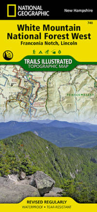
National Geographic Maps
White Mountain National Forest West Map Franconia Notch Lincoln National Geographic Trails Illustrated Map 740
Natl Geographic Society Maps 2020-01-01. 2020. map. New. 4.10x0.40x8.80. Buy with confidence. Excellent Customer Service & Return policy. Natl Geographic Society Maps unknown
Bookseller reference : DADAX1566954657 ISBN : 1566954657 9781566954655
|
|
|
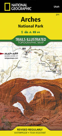
National Geographic Maps - Trails Illustrated
Arches National Park Map National Geographic Trails Illustrated Map 211
National Geographic 2022-03-30. 2022. map. New. 4.20x0.30x9.00. Buy with confidence. Excellent Customer Service & Return policy. National Geographic unknown
Bookseller reference : DADAX1566953278 ISBN : 1566953278 9781566953276
|
|
|
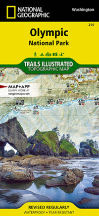
National Geographic Maps - Trails Illustrated
Olympic National Park Map National Geographic Trails Illustrated Map 216
National Geographic 2024-03-01. 2024. map. New. 4.10x0.30x8.90. Buy with confidence. Excellent Customer Service & Return policy. National Geographic unknown
Bookseller reference : DADAX1566954029 ISBN : 1566954029 9781566954020
|
|
|
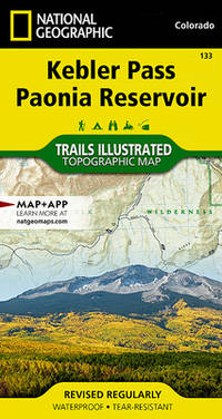
National Geographic Maps
Kebler Pass Paonia Reservoir Map National Geographic Trails Illustrated Map 133
Natl Geographic Society Maps 2019-01-01. 2019. map. New. 3.90x0.60x7.20. Buy with confidence. Excellent Customer Service & Return policy. Natl Geographic Society Maps unknown
Bookseller reference : DADAX1566953979 ISBN : 1566953979 9781566953979
|
|
|
National Geographic Maps - Trails Illustrated
Grand Mesa Map National Geographic Trails Illustrated Map 136
National Geographic 2019-01-01. 2019. map. New. 7.30x0.40x3.80. Buy with confidence. Excellent Customer Service & Return policy. National Geographic unknown
Bookseller reference : DADAX1566953847 ISBN : 1566953847 9781566953849
|
|
 Receive by email
 Download as PDF document
 RSS feed


