|
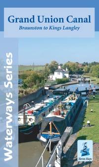
Heron Maps
Grand Union Canal: Braunston to Kings Langley
Paperback. Very Good. paperback
Bookseller reference : GOR004813006 ISBN : 1908851031 9781908851031
|
|
|
Philips Maps
Philips Junior School Atlas 10th Edition Philips World Atlas
Philips 06/13/2019. Paperback. Used; Very Good. WE SHIP WITHIN 24 HRS FROM LONDON UK 98% OF OUR ORDERS ARE RECEIVED WITHIN 7-10 DAYS. We believe you will be completely satisfied with our quick and reliable service. All orders are dispatched as swiftly as possible! Buy with confidence! Greener Books. Philips paperback
Bookseller reference : 5001519 ISBN : 184907495x 9781849074957
|
|
|
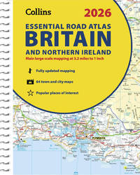
Collins Maps
2026 Collins Essential Road Atlas Britain and Northern Ireland: A4 Spiral Collins Road Atlas
Spiral bound. New. unknown
Bookseller reference : A9780008719234 ISBN : 0008719233 9780008719234
|
|
|
Collins Maps
Refugee Boy Edexcel GCSE 9-1 English Literature Text Guide: Ideal for home learning 2022 and 2023 exams Collins GCSE Grade 9-1 SNAP Revision
Collins 2022. Paperback. New. 5x0x8. Paperback. An unused unmarked and unblemished copy.; 100% Satisfaction Guaranteed! Ships same or next business day! Collins paperback
Bookseller reference : 132410300020 ISBN : 0008520313 9780008520311

|
|
|
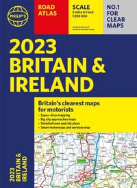
Philip's Maps
2023 Philip's Road Atlas Britain and Ireland
Paperback / softback. New. New Book; Fast Shipping from UK; Not signed; Not First Edition; Philip's is No. 1 in the UK for clear mapping and Road Atlases. The Philip's 2023 Road Atlas Britain and Ireland is the top of the range A4-sized paperback atlas featuring fully updated maps from the Philip's digital database. The map paperback
Bookseller reference : ria9781849076081_inp ISBN : 1849076081 9781849076081
|
|
|
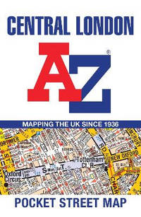
A-Z Maps
Central London A-Z Pocket Street Map
Sheet map folded. New. Navigate your way around Central London with detailed street maps from A-Z unknown
Bookseller reference : A9780008657475 ISBN : 0008657475 9780008657475
|
|
|
Philips Maps
Philips Drivers Atlas Britain: Paperback Philips Road Atlases
Philips 09/05/2019. Paperback. Used; Very Good. WE SHIP WITHIN 24 HRS FROM LONDON UK 98% OF OUR ORDERS ARE RECEIVED WITHIN 7-10 DAYS. We believe you will be completely satisfied with our quick and reliable service. All orders are dispatched as swiftly as possible! Buy with confidence! Greener Books. Philips paperback
Bookseller reference : 4648627 ISBN : 1849075085 9781849075084
|
|
|
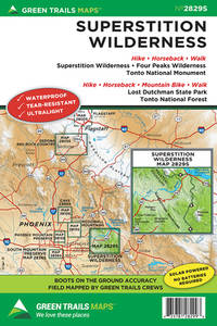
Maps, Green Trails
Superstition Wilderness AZ No. 2829S Green Trails Maps
Green Trails Maps. New. Special order direct from the distributor Green Trails Maps unknown
Bookseller reference : ING9781680514902 ISBN : 1680514903 9781680514902
|
|
|
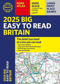
Philip's Maps
2025 Philip's Big Easy to Read Britain Road Atlas: A3 Paperback
Paperback / softback. New. <b>With the detail you need at a size you can read </b>the latest edition of <i>2025 Philip's Big Easy to Read Road Atlas of Britain is </i>super-clear super-sized and bang up-to-date in a large paperback format. paperback
Bookseller reference : A9781849076616 ISBN : 1849076618 9781849076616
|
|
|
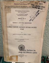
Spieker Edmund M.; Baker Arthur A. & Photographs & Maps
Geology and Coal Resources of the Salina Canyon District Sevier County Utah Contributions to Economic Geology 1927 Part II
Washington D. C.: Government Printing Office 1928. First Edition. Softcover. Fair. Unmarked internally but cover contains a number of company stamps and a catalog sticker. Spine is reinforced with clear tape. Right lower front corner of cover also is torn off. ; Book Description; Spine has staples. Pages are clean and not marred by notes or folds. Covers are square with minor wear. Ships Safe and Fast. ; U. S. Geological Survey Bulletin; Vol. 796C; 8vo 8" - 9" tall; 125-170 pages DW4. Government Printing Office unknown
Bookseller reference : 19004
|
|
|
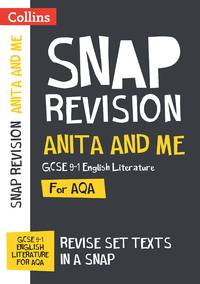
Collins Maps
Anita and Me AQA GCSE 9-1 English Literature Text Guide: Ideal for home learning 2022 and 2023 exams Collins GCSE Grade 9-1 SNAP Revision
Collins 2022. Paperback. New. 5x0x8. Paperback. An unused unmarked and unblemished copy.; 100% Satisfaction Guaranteed! Ships same or next business day! Collins paperback
Bookseller reference : 132404120082 ISBN : 0008520100 9780008520106
|
|
|
Wide World of Maps Inc
Pinal County Street And Road Atlas 2005 Edition
spiral_bound. Good. Access codes and supplements are not guaranteed with used items. May be an ex-library book. unknown
Bookseller reference : 1887749608.G ISBN : 1887749608 9781887749602
|
|
|
A-Z Maps
London A-Z Street Atlas
Paperback / softback. New. Navigate your way around London with this detailed easy-to-use and up-to-date A-Z Street Atlas. paperback
Bookseller reference : A9780008663490 ISBN : 0008663491 9780008663490
|
|
|
A-Z Maps
Big London A-Z Street Atlas
Spiral bound. New. Navigate your way around London with this detailed easy-to-use and up-to-date A-Z Street Atlas. unknown
Bookseller reference : A9780008663506 ISBN : 0008663505 9780008663506
|
|
|
Philip's Maps
Philip's Street Atlas Belfast Philip's Street Atlases
paperback. Good. Access codes and supplements are not guaranteed with used items. May be an ex-library book. paperback
Bookseller reference : 184907030X.G ISBN : 184907030X 9781849070300
|
|
|
Philip's Maps
Philips Street Atlas: Birmingham & West Midlands.
paperback. Good. Access codes and supplements are not guaranteed with used items. May be an ex-library book. paperback
Bookseller reference : 1849071403.G ISBN : 1849071403 9781849071406
|
|
|
Philip's Maps
Philip's Concise Atlas Britain: Spiral A5 Philips Road Atlas
paperback. Good. Access codes and supplements are not guaranteed with used items. May be an ex-library book. paperback
Bookseller reference : 1849073953.G ISBN : 1849073953 9781849073950
|
|
|
Philip's Maps
Philip's Scotland Road Map
paperback. Good. Access codes and supplements are not guaranteed with used items. May be an ex-library book. paperback
Bookseller reference : 1849074119.G ISBN : 1849074119 9781849074117
|
|
|
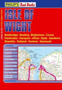
Philip's Maps
Philip's Red Books Isle of Wight
paperback. Good. Access codes and supplements are not guaranteed with used items. May be an ex-library book. paperback
Bookseller reference : 1849070806.G ISBN : 1849070806 9781849070805
|
|
|
Philip's Maps
Philip's Red Books Isle of Wight
paperback. Good. Access codes and supplements are not guaranteed with used items. May be an ex-library book. paperback
Bookseller reference : 1849073341.G ISBN : 1849073341 9781849073349
|
|
|
Philip's Maps
Philip's Essential School Atlas
paperback. Good. Access codes and supplements are not guaranteed with used items. May be an ex-library book. paperback
Bookseller reference : 1849074070.G ISBN : 1849074070 9781849074070
|
|
|
Philip's Maps
Philip's Street Atlas Glasgow and West Central Scotland
paperback. Good. Access codes and supplements are not guaranteed with used items. May be an ex-library book. paperback
Bookseller reference : 1849070172.G ISBN : 1849070172 9781849070171
|
|
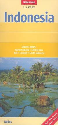
|
Nelles Maps
Indonesia Nelles Map
map. Good. Access codes and supplements are not guaranteed with used items. May be an ex-library book. unknown
Bookseller reference : 3865740413.G ISBN : 3865740413 9783865740410
|
|
|
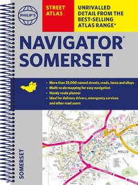
Philip's Maps
Philip's Street Atlas Navigator Somerset
Spiral bound. New. unknown
Bookseller reference : A9781849075886 ISBN : 1849075883 9781849075886
|
|
|
Gilluly, James (Chairman) & Other Illust. Illustrated by Fold-Out Maps
Origin of Granite
New York: Geological Soc. of America 1950. Second Printing. Hardcover. Good with no dust jacket. Unmarked except for previous owner's name on inside cover page. Slight weare on most corners. Guilded lettering starting to fade on spine. ; Book Description; Spine has no signs of creasing. Pages are clean and not marred by notes or folds. Covers are square with minor wear. Ships Safe and Fast. Published without Dust Jacket.; Conference Meeting of the Geological Society of America held in Ottawa Canada December 30 1947; Vol. 28; 8vo 8" - 9" tall; x pages; B000KTD5LM DD6. Geological Soc. of America hardcover
Bookseller reference : 29815
|
|
|
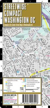
Streetwise Maps Inc
Streetwise Washington DC
map. Good. Access codes and supplements are not guaranteed with used items. May be an ex-library book. unknown
Bookseller reference : 1931257213.G ISBN : 1931257213 9781931257213
|
|
|
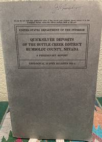
Roberts, Ralph J. & Maps
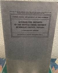
Quicksilver Deposits of the Bottle Creek District Humboldt County Nevada A Preliminary Report
Washington D. C.: Government Printing Office 1940. First Edition. Softcover. Good. Unmarked. USGS library pocket in back cover. ; Book Description; Spine has no signs of creasing. Pages are clean and not marred by notes or folds. Covers are square with minor wear. Ships Safe and Fast. ; Geological Survey Bulletin; Textbook; Vol. 922A; B&W Illustrations; 8vo 8" - 9" tall; 28 pages DC6. Government Printing Office unknown
Bookseller reference : 19073
|
|
|
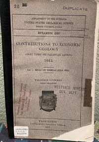
Lindgren, Waldemar & Maps
Contributions to Economic Geology 1911 Part I Short Papers and Preliminary Reports Part 1 Metals and Non Metals Except Fuels
Washington D. C.: Government Printing Office 1913. First Edition. Softcover. Fair with no dust jacket. Unmarked except for stamps and stickers on front cover. Spine is reinforeced with black tape and title is written on spine. Covers are worn on edges and have nicks and missing corners. Well bound otherwise. ; Book Description; Pages are clean and not marred by notes or folds. Covers are square with wear as noted. Ships Safe and Fast. ; U. S. Geological Survey Bulletin; Textbook; Vol. 530; B&W Illustrations; 8vo 8" - 9" tall; 400 pages DC4. Government Printing Office unknown
Bookseller reference : 18831
|
|
|
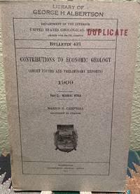
Campbell, Marius R. & Maps
Contributions to Economic Geology 1909 Part II -- Mineral Fuels Short Papers and Preliminary Reports
Washington D. C.: Government Printing Office 1911. First Edition . Softcover. Good. Unmarked except for stamps on front cover and on inside page. RENT or wear on top and bottom of spine edges. Fold out maps. ; Book Description; Spine has no signs of creasing. Pages are clean and not marred by notes or folds. Covers are square with minor wear. Ships Safe and Fast. ; United States Geological Survey Bulletin; Textbook; Vol. 431; B&W Illustrations; 8vo 8" - 9" tall; 254 pages DC3. Government Printing Office unknown
Bookseller reference : 18789
|
|
|
Roberts, Ralph J. & Maps
Quicksilver Deposits of the Bottle Creek District Humboldt County Nevada Strategic Minerals Investigations
Washington D. C.: Government Printing Office 1940. First Edition. Softcover. Very Good. Unmarked. ; Book Description; Spine has staples. Pages are clean and not marred by notes or folds. Covers are square with wear as noted. Ships Safe and Fast. fold outs in text; Geological Survey Bulletin; Textbook; Vol. 922A; 8vo 8" - 9" tall; 29 pages DC6. Government Printing Office unknown
Bookseller reference : 19072
|
|
|
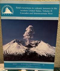
Chapin, Charles And Jiri Zedek, Editors & charts maps
Field Excursions to Volcanic Terranes in the Western United States Volume II Cascades and Intermountain West
Soccoro New Mexico: NM Bureau of Mines Min. Res 1989. Softcover. Very Good. Unmarked. ; Book Description; Spine has no signs of creasing. Pages are clean and not marred by notes or folds. Covers are square with minor wear. ; Memoir; Vol. 47; B&W Illustrations; 11 X 8.70 X 0.70 inches; 285 pages MS1. NM Bureau of Mines Min. Res unknown
Bookseller reference : 16204 ISBN : 9990089280 9789990089288
|
|
|
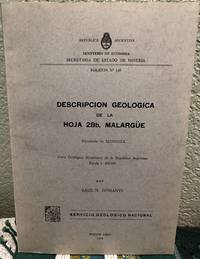
Dessanti, Raul N. & Maps & Illustrations Photos
Descripción Geológica de la Hoja 28b Malargüe Provincia de Mendoza
Buenos Aires: Servicio Geológico Nacional 1978. First Edition. Paperback. Very Good. Unmarked. ; Book Description; Spine has no signs of creasing. Pages are clean and not marred by notes or folds. Covers are square with minor wear. Ships Safe and Fast. Several folded plates in back. ; Bulletin No. 149; 8vo 8" - 9" tall; 50 pages DK4. Servicio Geológico Nacional paperback
Bookseller reference : 26677
|
|
|
Trakker Maps, Inc
Sarasota Bradenton Street Atlas
spiral_bound. Good. Access codes and supplements are not guaranteed with used items. May be an ex-library book. unknown
Bookseller reference : 0875305318.G ISBN : 0875305318 9780875305318
|
|
|
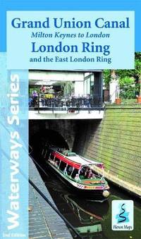
Heron Maps
Grand Union Canal: Milton Keynes to London and the London Ring
Paperback / softback. New. paperback
Bookseller reference : A9781908851307 ISBN : 1908851309 9781908851307
|
|
|
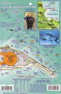
Franko Maps Ltd.
Avalon Underwater Park Santa Catalina Map & Kelp Forest Creatures Guide Franko Maps Laminated Fish Card
map. Good. Access codes and supplements are not guaranteed with used items. May be an ex-library book. unknown
Bookseller reference : 1931494649.G ISBN : 1931494649 9781931494649
|
|
|
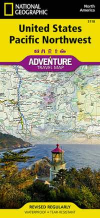
National Geographic Maps - Adventure
United States Pacific Northwest Map National Geographic Adventure Map 3118
map. Good. Access codes and supplements are not guaranteed with used items. May be an ex-library book. unknown
Bookseller reference : 1566957125.G ISBN : 1566957125 9781566957120
|
|
|
Outdoor Books & Maps
San Isabel National Forest Recreation Guide National Forest Series
paperback. Good. Access codes and supplements are not guaranteed with used items. May be an ex-library book. paperback
Bookseller reference : 0930657144.G ISBN : 0930657144 9780930657147

|
|
|
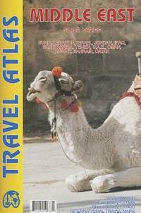
International Travel maps
Middle East ITM Atlas Scale Varies
paperback. Good. Access codes and supplements are not guaranteed with used items. May be an ex-library book. paperback
Bookseller reference : 1553410866.G ISBN : 1553410866 9781553410867
|
|
|
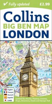
Collins Maps
London Big Ben Map
map. Good. Access codes and supplements are not guaranteed with used items. May be an ex-library book. unknown
Bookseller reference : 0007452438.G ISBN : 0007452438 9780007452439
|
|
|
Benchmark Maps
Arizona Road and Recreation Atlas - 12th Edition 2021 Benchamrk Maps
paperback. Good. Access codes and supplements are not guaranteed with used items. May be an ex-library book. paperback
Bookseller reference : 1734315040.G ISBN : 1734315040 9781734315042
|
|
|
Garry Egger MPH PhD Maps
Health Promotion Strategies and Methods Australia Healthcare Medical Medical
paperback. Good. Access codes and supplements are not guaranteed with used items. May be an ex-library book. paperback
Bookseller reference : 1743071833.G ISBN : 1743071833 9781743071830

|
|
|
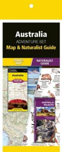
National Geographic Maps
Australia Adventure Set: Map & Naturalist Guide
pamphlet. Good. Access codes and supplements are not guaranteed with used items. May be an ex-library book. unknown
Bookseller reference : 1583559957.G ISBN : 1583559957 9781583559956
|
|
|
Mapas Naturismo
Costa Rica Road Map Naturismo 1:500K English & Spainish
map. Good. Access codes and supplements are not guaranteed with used items. May be an ex-library book. unknown
Bookseller reference : 3981126947.G ISBN : 3981126947 9783981126945
|
|
|
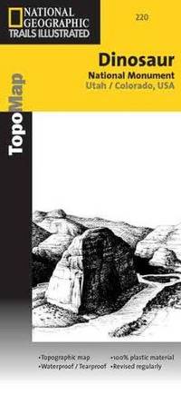
National Geographic Maps
Dinosaur National Monument UT CO Trails Illustrated Map #220 Trails Illustrated - Topo Maps USA by National Geographic Maps 2009-01-01
map. Good. Access codes and supplements are not guaranteed with used items. May be an ex-library book. unknown
Bookseller reference : 0925873209.G ISBN : 0925873209 9780925873200
|
|
|
WWII [AMERICAN US.], MAPS U. S.
9 World War II Maps EUROPEAN THEATER OF OPERATIONS
1943. Archive of 9 large World War II Maps these maps were used by US troops during the liberation of Europe. RARE ORIGINAL WORLD WAR TWO VINTAGE ALLIED FORCES EUROPEAN THEATER OF OPERATIONS Maps of German cities and one of Paris France. Comes from a WW2 US Army Soldier. These 69 original maps are mostly in very good condition and as follows: <br /> <br /> Magdeburg Germany map - US Army Air Map of Magdeburg "First Edition" Sheet M.53 1:250000. 1943. With handwriting in upper right corner. 30x26"<br /> KasselGermany map- US Printed Map of Kassel region of Germany. "Emergency Road Map." Color. First Edition. sheet L52 Based on 1938 map supplemented by other sources collected during the war. 22x28"<br /> Dusseldorf Germany map- same as above but faded and with some highlighting some writing. sheet k52<br /> Hanover Germany map- same as above sheet L53. Printed 1943.<br /> Berlin Germany map- similar to above but "Army/Air" not Emergency Road. Sheet N53. Published by War Office 1943<br /> Halle Germany map- Halle Saale is a city in the southern part of the German state Saxony-Anhal. Sheet M52. "War and Navy Department Agencies only. Not for sale or distribution." 1943. <br /> Wernigerode Germany- town in the district of Harz Saxony-Anhalt German 19x24. Sheet 4130. FIrst Edition. US "Published by War Office 1944." B&W. exposed to water. Hardened. y<br /> Julich Germany- town in the district of Düren in the federal state of North Rhine-Westphalia Germany "Published by War Office 1944." G.S.G.S. No. 4507. 35x30"<br /> Paris France map - 42x34 - U.S. 1944. The Liberation of Paris took place from 19 August 1944 until the German garrison surrendered on 25 August 1944. Paris had been ruled by Nazi Germany since the signing of the Second Compiègne Armistice on 22 June 1940. unknown
Bookseller reference : 14434

|
|
|
WWII [GERMAN], MAPS
Collection of 10 German-made WWII-era maps of cities and Factories
1944. Collection of 10 German-made WWII-era maps. Circa 1939-1945. All printed in German sometimes with foreign translations. Includes arial bombing maps of Chesterfield Tube Works Great Britain Dec. 1942 showing a geographical arial photograph of the factory area and an overlay of roads bridges and potential targets. The German forces tried to bomb Chesterfield and the railway tracks nearby where the Tube Works produced important cylinders and compressors for the war effort. Instead their bomb fell on a golf course 4 miles away doing no harm. Bears the warning: "Nur fur den Diensfgebrauch" or "For Internal Use Only." 12"x12.5" 2 pg<br /> <br /> Also includes a "Map of the Former Czechoslovakia" In German: "Karte der ehemaligen Tschechoslowakei". The German occupation of Czechoslovakia lasted from1938 to 1945 beginning with the Nazi annexation of the northern and western border regions known collectively as the Sudetenland under terms outlined by the Munich Agreement. Hitler's pretext for this effort was the alleged privations suffered by the ethnic German population living in those regions. Czechoslovakia was finally liberated with the Allied Victory in 1945. Map in black and white with red elevations. Bears the large tage at the top: "Sondersausgabe!" or "Special Edition!" Also includes a map of a Czech city which played an important part in World War II History. Situated at the very end of the Sudentenland the borders of the Third Reich were literally on Plzen's outer limits. Occupied by Nazi forces starting in 1939 and divided by the loyalties of its half-German population Plzen was finally liberated with the rest of Czechoslovakia in 1945. The map is written in German with Czech translation of each heading. It has seen substantial use and the key has been cut out of the upper left side. 37"x27"<br /> <br /> Koln - German map - Near mint condition. 22x17". Translates to "Cologne" which is a city in Germany.<br /> <br /> Umgebung von Wein - German. 44x34"<br /> <br /> "Deutschesreich" translates to "German Empire"- western half- 56x42" extra large German map - over outline map - no date<br /> <br /> Frankreich - same as German Empire. Shows paris and london. <br /> <br /> Italien - same as above.<br /> <br /> "Blatt Sudost" Translates to "Southeast Sheet" - Ubersichtskarte translates to "Overview Map" - 56x42". Color. Attractive gold pink and blue. 1:1000000.See photos. no date. Very nice condition on printed side. unknown
Bookseller reference : 14430

|
|
|
WWII [Eastern European], MAPS
Archive of 6 European World War II Maps
1939. Archive of 6 large original World War II Maps these maps were used by US troops during the liberation of Europe. RARE ORIGINAL WORLD WAR TWO VINTAGE ALLIED FORCES EUROPEAN THEATER OF OPERATIONS Czech Republic cities and one Map of Hamburg - German . Comes from a WW2 US Army Soldier. These 6 original maps came from a US soldier that was in European theatre in WWII they are mostly in very good condition and as follows: <br /> <br /> Mesto Tepla Czech Republic - size 19x24".<br /> Plzen Czech Republic 4151 - size24x19". Black and white with green overlay. <br /> Horsovsky Tyn Czech Republic 4150 - size24x19"<br /> Kralovice KraloviceCzech Republic 4051 - <br /> Czechoslovakia promotional map dated 1938. a very arge map size 34x22"<br /> Hamburg - German map. size 28x24". dated 1939 in print. <br /> <br /> All maps are original and have some folds and wrinkling overall in Good Condition. unknown
Bookseller reference : 14433
|
|
|
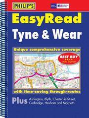
Philip's Maps
Easyread Tyne and Wear
Philip's. Used - Good. Ships from UK in 48 hours or less usually same day. Your purchase helps support Sri Lankan Children's Charity 'The Rainbow Centre'. Ex-library so some stamps and wear but in good overall condition. 100% money back guarantee. We are a world class secondhand bookstore based in Hertfordshire United Kingdom and specialize in high quality textbooks across an enormous variety of subjects. We aim to provide a vast range of textbooks rare and collectible books at a great price. Our donations to The Rainbow Centre have helped provide an education and a safe haven to hundreds of children who live in appalling conditions. We provide a 100% money back guarantee and are dedicated to providing our customers with the highest standards of service in the bookselling industry. Philip's unknown
Bookseller reference : Z1-W-012-00460 ISBN : 0540089060 9780540089062
|
|
|
Philip's Maps
Philip's Illustrated World Atlas
Paperback. Very Good. paperback
Bookseller reference : GOR006305966 ISBN : 0540058610 9780540058617
|
|
|
Philip's Maps
Philip's Street Atlas: East Kent
Paperback. Very Good. paperback
Bookseller reference : GOR005053804 ISBN : 0540079790 9780540079797

|
|
 Receive by email
 Download as PDF document
 RSS feed


