4 361 résultats
1925réf. 49705Pittsburgh PA & Port Arthur TX: Gulf Refining Co. ca. 1925. Folio. 11.5 x 14.25 in. 5 large oversize folding leaves of typed descriptions measurements specifications; mounted 7 linen-backed photo leaves 2 folding -- w/ 39 images printed on 34 silver gelatin photos. Original split-pin post-binder blue silk red cloth corners brass split pins minor edgewear rubbing minor fraying to corners first typed leaf w/ creasing minor closed tears still a VG exemplar from the library of John W. Jackson former Marketing & Sales executive with Gulf Oil Corporation Tulsa OK. This spectacular packaging catalogue for Gulf Oil Company petroleum products in the 1920s provides an incomparable photographic reference for all of the available products their dimensions sizes specific directions about tin lithograph colours as well as the cardboard and wooden shipping crates. Gulf Oil Corporation was initially organized in May 1901 by J.M. Guffy Andrew W. Mellon and others. By 1907 they had built a 400-mile pipeline from Port Arthur to the Glenn Pool Field in Oklahoma and started refining Oklahoma crude by 1907. By the 1920s this integrated Oil Company had built service stations across the country sold Good Gulf Gasoline and actively promoted automobile travel with Gulf Maps marketing promotions and more. This catalogue begins with photos of 1 5 10 and 25 lb. tins of Gulf Supreme Grease Transmission Grease Red Top Axle Grease Gulf Petrol-atum Gulf High Pressure Grease and Gulf Lubricant with all of the product tins carefully sized by stack showing their side graphics sizes lids and lid configurations. The oil cans include Tractor Oil Auto Oil Harvester Oil Gulf Motorcycle Oil small illustration of 1920s era motorcycle with Gulf Logo and even the blank tin soldered cans of assorted sizes. Of particular interest are the images of all the specialty products Gulf Oil was marketing during the Flapper Era including Venom pesticide & bug killer in glass bottles with screw-top tin lids & corks; Gulf Gas-o-Clenz cans in 1/2 pint 1 pint 1 quart and 1 gallon sizes; Gulf Gleam Cans Gulf Jelly Clens tubes Gulf Grease tubes and more. The last group of photos show all of the varieties of Gulf Venom Jelly-Clenz Gulf Pressure Grease Gulf Gleam cardboard and wooden packaging complete with printed labels lithograph labels Venom hand-sprayers and packaging and crates in assorted sizes and amounts. These types of photographic sales catalogues for the Petroleum industry are quite scarce and often unique items. Gulf Refining Co., hardcover
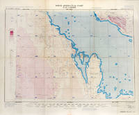
réf. 113506London War Office Geographical section 1951. . First edition GSGS 4622 Sheet 2547; Coloured printed map of Bahrain and Qatar on single sheet with extensive legend printed on reverse size: 62.5 x 77 cm; scale 1:1000000 text in English a little faded along folds a very good copy. First edition of the 1951 issue of the R.A.F. Aeronautical map of Bahrain and Qatar. The War office issued the R.A.F. series alongside a separate US Airforce Series: the R.A.F. series only covers Europe Africa Arabia and up to the end of 1951 had only covered Britain the east coast of Africa and this sheet of Arabia. The odd selection of this region aside from east Africa is made clearer by looking at the content of the map. The map does not show the 'delineation of international boundaries' or 'danger zones' but the topography largely the elevation and depression of the terrain with indications of marshy areas. The only indicated features other than towns and roads are of oil fields and pipelines. In 1941 Britain had gained control of much of Iraq's oil after the Anglo-Iraqi War and sought to expand its influence. The allies had seen the strategical benefits of Bahrain and after the discovery of oil in the region in 1932 it became even more pertinent to grow relations with the entire Middle Eastern command moving from Bushehr in Iran to Bahrain in 1935. But after the war relations had soured with the 1947 anti-Jewish riots in Manama Bahrain largely in reaction to Britain's disastrous orchestration of the Partition of Palestine. At the same time Iran had sought to break free of British control of their oil and in March 1951 voted to nationalise their oil production: in response Britain boycotted Iranian exports. It was in that same month that this map was finalised and published in July in the midst of the tense negotiations Iran was conducting with both Britain and the USA. In 1951 Britain was clearly searching for new regions to extract oil from and this map is captivating evidence of the fractious relationship Britain had fostered with the state of the Arabian Gulf. [London], War Office, Geographical section, 1951. unknown
1700réf. 17344Amsterdam, de Wit, 1675 (recte um 1700). Ca. 49,5 cm x 57 cm. [4 Warenabbildungen]
4to. (4) pp. With 2 woodcut vignettes. Sewn. Extremely scarce pamphlet on a naval battle in the Mediterranean near Cabo de Gata (Andalusia). It describes the destruction of a ship of corsairs from Algiers by the Spanish vessel "San Pedro" on 7 January 1621, killing 70 men. The victory proved important for the Spaniards, as the surviving corsairs provided them with useful intelligence, including information regarding the deployment of 30 Algerian vessels in the area, all seeking to rob other ships. However, the Ottomans were ignorant of any Royal Navy galleys which the Spanish suspected in the area, rather presuming them near Mallorca or Sardinia. - Large Jesuit woodcut vignette to the otherwise blank final page. Somewhat browned. Near-contemporary foliation in ink (205-206), suggesting the work was originally part of a larger volume. No copies traceable in libraries worldwide. Not in OCLC.
Colour-printed map, 889 x 632 mm. Scale 1:250,000. First edition. A rare, large full-colour geological map of Palestine, sheet 3, partly revised from aerial photographs by the Geological Section. The key lists era and type of rock, from Precambrian grey and red granites to Neogene sandstones and recent dune deposits, and illustrates both known and predicted fault lines across the earthquake-prone region. However, geology was evidently not the sole concern: international and district boundaries are noted along with railways, various roads, wadis, Arab and Jewish villages individually marked, monasteries and convents, khirba ruins and tell mounds, and sheikhs' tombs. This provides a holistic and detailed map showing Palestinian human settlements, water cycles, geological deposits, and transport corridors during the Mandate period. - Fully and professionally backed in cloth.
4to. 8 pp. With 2 woodcut vignettes. Sewn. First Portuguese edition. Exceedingly rare account of an attack on an Ottoman corn vessel by Spanish forces in the port of Tangier in Morocco. Essentially an encomium of Domingo Pignatelli and the 42 men who approached the Ottoman ship under heavy fire. Simultaneously published in Spanish in the Gaceta de Madrid. - Near-contemporary foliation in ink (77-80), suggesting the work was originally part of a larger volume. Slightly browned. BGUC Misc. 24, 488. Palau 66444. Not in OCLC.
Large 4to. XIX, (1), 396 pp. With engraved frontispiece (W. I. Thomson pinx., E. Mitchell sculp.), engr. folding map, and 4 engr. plates (2 folding). Later marbled half calf with giltstamped red spine label. First edition, dedicated to the travel writer Elizabeth Craven (Margravine of Brandenburg-Ansbach, formerly wife of the Earl of Berkeley, and friend of Horace Walpole). Griffiths travelled the Orient in 1785 in Greek disguise. His journey took him via Constantinople and Chios, Smyrna, Sardis, Konia, and Taurus to Syria, Antioch, and Aleppo. In Mascat, Oman, he gives a rather baffled account of an oriental dance ("nautch"). - Some browning due to paper, but well-preserved. An untrimmed copy. Atabey 530. Blackmer 755 (wanting half-title). Weber II, 607 (counting 2 plates only). Gay 3573. Graesse III, 155. OCLC 4951921.
1840Small folio. (4), XII, (3)-172 pp. With engraved portrait frontispiece, engraved title page, 85 steel engravings (after William H. Bartlett) and 1 map. Splendid contemporary giltstamped green morocco with fillets, dentelle border, and a central pointillé ornament adorned with flower buds. Spine, leading edges and inner dentelle attractively gilt. All edges gilt. Third edition. The British travel writer Julia S. H. Pardoe (1806-62), who, suffering from consumption, had been taken south early in her youth, accompanied her father to Constantinople in 1835 and was famous for her literary reports on Portugal and the Near East even as a child. "Since Lady Mary Wortley Montagu probably no woman has acquired so intimate a knowledge of Turkey [... Her] works, written [...] in a pleasant and graceful style, attracted a large share of notice, and, as popular history, may still be read with pleasure" (DNB). - First published in 1838 with only 78 plates; later editions were published under the title "Picturesque Europe" (1854 and 1874). The pretty views are engraved after William Henry Bartlett (1809-54), whose series of oriental and American topography were then very popular (cf. Thieme/B. II, 554). - Occasionally slightly browned or foxed (more so in four plates). Binding insignificantly rubbed at corners and raised bands, otherwise very nicely preserved. BLC 246, 438. DNB 15, 201, 5. Cf. Aboussouan 711 (first ed. 1838). Weber I, 1151 (1850).
Engraved map (30 x 48 cm), hand-coloured in outline. Scottish map of the Arabian Peninsula. Old library ink stamp on verso. Al-Qasimi 232.
Large 4to. Altogether 6 pp. on 4 ff. In German, to a "dear doctor and friend": "[...] I should like to see you and your dear wife again before my departure [...]" (letter of 12 April; with punched holes in left margin [not touching text]). - "I arrived here 3 days ago after 4 weeks in Bad Hall - without any noticeable results [...]" (letter of 3 September). - "I took Anne Marie from Fetan, where she spent the summer, back to St. Blasien. She has not had the care she needs, but looks well altogether and is happy, though I am not [...]" (letter of 28 September). - "Thank you for your kind letter; I hope that you and your dear wife will do me the honour of dining with me on Saturday at 1 PM [...]" (letter of 6 October). - On stationery with printed address.
1828réf. 13090Paris, 1828. Folio (43 x 33 cm). Mit 50 Stahlstichen (gest. Titel m. Vign., 2 Karten, 36 auf Taf. mont. Ansichten sowie 10 mont. Vignetten). 65 S. Ldr. d. Zeit m. Blind- u. Resten v. Goldprägung. Kopfgoldschnitt.
Small folio (280 x 212 mm). 5 issues. Original illustrated wrappers. Five issues of Aramco World. In November 1949 the Arabian American Oil Company launched "Aramco World" as an interoffice newsletter that linked the company's U.S. offices with "the field" - primarily Dhahran, in the Eastern Province of Saudi Arabia. The journal quickly grew into a monthly (later bi-monthly) educational magazine featuring historical, geographical and cultural articles that helped the American employees and their families appreciate an unfamiliar land. - The present collection comprises vol. 3, nos. 2, 4, and 11; vol. 5, no, 10, and vol. 6, no. 7. - Heads of spine somewhat worn. Interior in excellent condition.
Educational material on Saudi Arabia, comprising 1 book, 1 Arabian flag, 2 Arabian coins, 2 Arabian stamps, 1 string of worry beads, 24 study posters (17" x 22") and 1 study guide in a cardboard container (33 x 27 x 4.5 cms). Book: Theodore O. Phillips. Getting to Know Saudi Arabia. Illustrated by Haris Petie. NY, Coward-McCann, 1963, 5th impression, revised 1969. 8vo. 64 pp. Original illustrated wrappers. Remarkable educational kit issued by Aramco to teachers throughout the U.S. from late 1969 into the early 1970s. In the words of a contemporary Aramco advertisement, "The multi-media 'You Discover Saudi Arabia Kit' is designed to allow teachers to introduce into the classroom by sight and touch, as well as the printed word, many facets of Aramco's operations in Saudi Arabia and some of the economic-sociologial aspects of life in that country". The kit includes a miniature flag of Saudi Arabia, sample coins, stamps, and worry beads, as well as an introductory booklet on Saudi Arabia and extensive information on the country, its geography, history, and culture, spread out on 24 folding instructional posters. While the book is directed at juvenile audiences, the posters and the study guide that accompanies them appear designed to be used in junior and senior college classes. Containing a wealth of information for expats, the set was also made available to university graduates considering a career in the oil industry. This specimen, in its original box shipped in December 1969 with a label stating, "This Comes to You Through The Instructor", is addressed to Thomas J. Paccillo (1946-2000) of New Brunswick, New Jersey, a '69 Monmouth graduate. - A very finely preserved example. OCLC 2959261.
90 x 128 mm - 203 x 283 mm. 12 original photographs: 9 black-and-white, 3 in colour. Several photos with mounted or loosely inserted English captions. Interesting set of photographs showing Bahrain politicians, landmarks and city views. With images of Sheikh Esa ben Salman Al Khalifa, as well as Bahrain ministers attending official meetings. The largest photograph depicts the Sitra water desalination plant, including a row of inflatable booms protecting the facility from an oil slick. - The remaining pictures include a group photograph of employees of the Bahrain Cultural Centre, a minaret, a souk, and an aerial view of Al-Manama City with the prominent Ministry of Information.
8vo. XVI, 512 pp. With engraved title vignette, folding engraved map, and 4 engraved plates. Contemporary marbled boards. All edges red. First edition, conceived as a continuation of Bergk's volume on Egypt. The map shows Syria; the plates depict Arabic costumes, household tools, and views of Haleb, Mecca, and Medina. The title vignette shows Mt. Sinai. Also discusses the history , topography, climate, illnesses etc. of the Arabian Peninsula (with chapters on the Nejd, Arabia Felix and Yemen, etc.). - Some browning. From the library of the Kalksburg Jesuit college with their shelfmark label on pastedown. Kayser I, 32. Holzmann/B. I, 2892. Hamberger/Meusel XXII/1, 216. OCLC 257668994. Not in Macro, Atabey or Blackmer.
Folio (242 x 344 mm). 14 tables on double-page-spreads (15 ff.). Original printed wrappers. Rare report on the regulation and organisation of the Hajj produced under the auspices of the Administration Sanitaire de l'Empire Ottoman for the Hejaz region. The detailed statistics on the numbers and origins of the pilgrims, their ships and ports of embarkation, their travel routes, etc., were published annually between 1896 and 1914. - A light dampstain to the inner margin of lower wrapper, backstrip starting to split. OCLC 73048636. ZDB-ID 2444067-X.
1290 x 780 mm. Lithographed with some lighthouses highlighted in purple. Scale 1:883,200. Serial no. 1588. New edition of the U.S. Navy's 1899/1931 hydrographic map of the Gulf of Oman, immediately east of the Musandam Peninsula to Karachi, showing depths and lighthouses on the coasts of Oman and Iran. Marked as 8th edition, March 1948, reprinted April 1951. - Stamp of Northwest Instrument Co., Inc., Agents, Seattle, in lower margin. Well preserved.
Standard issue, 710 x 860 mm. Scale 1:71,920. Nautical chart of the Red Sea from Mersa Denebh to Kunfida in Saudi Arabia, and from Abú Dara to Trinkitat in Sudan, prepared by the British Admiralty. With six inset maps of Lith, Jelajil, and Kunfida, as well as Khor Delwen, Khor Shinab, Mersa Ar-Rakiyaí, as well as four mountain views. - The chart shows a vast portion of the Red Sea, featuring the Farsan Bank and the Suakin Group, as well as dangerous reefs covering large parts of the shores. Among the most prominent labelled cities are Jiddah, Lith, and Kunfida in Saudi Arabia, as well as Port Sudan and Suakin in Sudan. - The British Admiralty has produced nautical charts since 1795 under the auspices of the United Kingdom Hydrographic Office (HO). Its main task was to provide the Royal Navy with navigational products and service, but since 1821 it has also sold charts to the public. The present chart was composed after Admiralty surveys of the 19th century; it was first published in 1873 and saw several corrections up to 1937. - With a single fold. A few manuscript notes. Captioned in print and in a former collector's hand on verso.
Standard issue, 710 x 860 mm. No scale information. Nautical chart of the Red Sea between Trinkitat in Sudan and Hodeida in Saudi Arabia, prepared by the British Admiralty. With three inset maps of Khor Nohud, Gizán, and the Disei Village Bay, as well as a view of Jabal at Tair Island. - The chart shows the Farasan Islands as well as the Dahlak Archipelago and the Zubair Group. Among the most prominent labelled cities are Loheiya, Hodeida, Gizán, and Massawa. Other interesting details include an Egyptian military station at Mount Keren, an Italian post near the Arafale craters, the Husna-l Majis Hill Fort, and the Sheikh's Tomb near Hali Point in Saudi Arabia. - The British Admiralty has produced nautical charts since 1795 under the auspices of the United Kingdom Hydrographic Office (HO). Its main task was to provide the Royal Navy with navigational products and service, but since 1821 it has also sold charts to the public. The present chart was composed after Admiralty surveys of the 19th century; it was first published in 1873 and saw several corrections up to 1936. - With a single fold. A few manuscript notes. Captioned in print and in a former collector's hand on verso. Brown smudge near left margin; faint marginal flaws.
2 topographic maps, colour-printed. Scale 1:500,000. 820 x 640 mm and 770 x 648 mm. Compiled from 1930s surveys and produced by the British 512 (Army Field Survey) Company, Royal Engineers, for use in the Persian war theatre, these consecutive maps cover the south-western area of Iraq, including Rutba and Fallujah, with parts of Saudi Arabia, Jordan, and Syria (approximately the area between 31° and 33°30' N and 39° and 44° E). - Previously folded. Marked "Iraq Desert Sheet 1" and "Sheet 2". Generally well preserved.
3 volumes (Moharam 1369, Alqueda 1370, Moharam 1371). 32, 18 pp. 26, (2) pp. 26, (2) pp. Illustrated coloured printed wrappers. Staple-bound. Three rare issues of the Egyptian monthly "The Islamic World", published by the Egyptian journalist Mahmoud Abul Faid El Menoufi (1882-1972) in Arabic as well as (for features in the early issues) in English and French. El-Menoufi founded several Sufi-leaning Islamic periodicals through which he campaigned against the British occupation of Egypt. - The three issues at hand contain, inter alia: 1) Moharam 1369 (October 1949): an article in Arabic with statistics for the 1369 pilgrimage, articles in English ("Medina and the Mosque of the Prophet") and French ("Introduction au Livre de l'Existence"). - 2) Alqueda 1370 (August 1951): an illustrated article in Arabic about the pilgrimage of the late Muhammad Labib al-Battanuni in the year 1327 (1909), described in his book "Al-Rihlat al-Hijaziyya". - 3) Moharam 1371 (October 1951): an article in Arabic on the performance of the 'Umrah and Hajj pilgrimages, with a paragraph on the visit to Mecca by King Abdulaziz Ibn Saud for the performance of an 'Umrah and the return of Prince Faisal from his official visit to London. - Some fraying to wrappers; old rust stains from staples. A well-preserved ensemble of a very rare periodical. OCLC 459477009.
8vo. 18 pp. With a colour-printed folding map. Wrappers stapled as issued. First official publication of the famous exchange of letters written between 1915 and 1916, between the Sharif of Mecca, Husayn bin Ali, and Sir Henry McMahon, British High Commissioner in Egypt, concerning the future political status of the lands under the Ottoman Empire. A special controversy concerned Palestine: Great Britain's pledged support for Arab independence in the region was not to be realized, and the correspondence went on to haunt Anglo-Arab relations for many decades thereafter. Unofficial excerpts from the letters had been circulated in the press as early as 1923; excerpts appeared in the 1937 Peel Commission Report, and the correspondence was unofficially published in George Antonius's 1938 book "The Arab Awakening". - A few slight edge flaws; corner loss to lower wrapper, but still very good copy. Cmd. 5957.
18 instalments, plus 1 duplicate. 8vo. Original wrappers. A selection of instalments of the magazine: New Outlook, an Tel Aviv-based monthly devoted to Israeli and Middle Eastern affairs and the promotion of Israeli-Palestinian dialogue and peace. It includes articles on politics, poetry, agriculture, meteorology, the Cold War, education, music, education, economy, etc. covering all countries in the Middle East and from both Jewish and Arab perspectives. - A very good set. - The collection includes the followings numbers: Volume I. No. 2. August 1957. Volume I. No. 3. September 1957. Volume I. No. 4. October 1957. Volume I. No. 5. November/December 1957. Volume I. No. 7. February 1958. Volume I. No. 8. March 1958. Volume I. No. 9. April 1958. Volume II. No. 2. October 1958. Volume II. No. 3/4. November 1958. Volume II. No. 5. January 1959. Volume II. No. 6. February 1959. Volume III. No. 9. September 1960 (2 copies). Volume IV. No. 1. October 1960. Volume IV. No. 3. January 1961. Volume IV. No. 4. February 1961. Volume XI. No. 8. October 1968. Volume XII. No. 1. January 1969. Volume XVIII. No. 3. March/April 1975.
Large 8vo. 2 parts in one vol. (4), XV, (1 blank), 599, (1); (2), 60, (2 blank) pp. With 3 maps (of which 2 folding) and 82 views of coastal profiles on 52 plates. Blue cloth with title information in yellow on front cover and spine, the supplement has been separately inserted (loose at the end of the vol.). - With: [Navigation - Red Sea - Navy Pilot]. Supplement No. 7 - 1977 to Red Sea and Gulf of Aden Pilot (11th edition, 1967) corrected to 4th March, 1977. Whenever reference is made to the pilot this supplement must be consulted. London, United Kingdom Hydrographic Office, 1977. With 2 folding maps (double-sided on the same leaf) and 4 views of coastal profiles on 3 pages. Grey/blue back wrapper; the two quires, map and back wrapper are held together by two metal staples. The essential standard sailing directions for the Red Sea and Gulf of Aden, corresponding with zone NP64 on the official Admiralty charts. These nautical works - the pilots and the charts - are published by the United Kingdom's Hydrographic Office, which provides necessary hydrographic and marine geospatial data to all kinds of maritime organisations across the world. The publications are not only used by the British Royal Navy, but can also be found on board the majority of international merchant ships. The data provided in the pilots and other publications are compliant with SOLAS (the Safety of Life at Sea treaty) guidelines and are updated constantly in weekly "Notices to Mariners", and in supplements to and new editions of the pilots whenever necessary. - The present copy is the 11th edition (1967) of the pilot with sailing directions and other information on the weather, currents, radar ranges etc. relating to the Red Sea and Gulf of Aden, including the supplement issued in 1977. It includes a foreword by the Hydrographer of the Navy, Rear-Admiral George Stephen Ritchie (1914-2012), who served most of his Naval career in the Surveying Service providing the raw data for the Hydrographic Office. The introduction clearly states that with the publication of this volume the previous edition and its supplements are cancelled, since the most up-to-date information has been compiled in the new edition and the weekly "Notices to Mariners" that appear after the publication of the 11th edition. The 11th edition of 1967 and its 1977 supplement were made redundant with the publication of the 12th edition in 1980. Each subsequent edition of the pilot supersedes the last, which have appeared infrequently depending on newly available information since the mid-19th century until the present day. - Binding slightly rubbed and faded, first two pages are printed on red/pink paper, edges of the volume are very slightly soiled. Fore-edge of the supplement is slightly frayed. Overall in good condition.
Oblong folio (305 x 220 mm). 12 ff. 40 silver gelatin photographs mounted on leaves; sizes range from 177 x 120 mm to 85 x 65 mm. Contemporary plaid cloth with a small brass label on front cover, saddle-stitched binding. Unique photograph album of early Zionist military presence in British Mandatory Palestine, focussing on the Hapoel companies: a sports movement that in the early 1930s was developed into an organizational labour militia intended to stand up against revisionist and right-wing movements as well as against communists. Promoted by David Ben-Gurion, they served as an executive-political arm of the Histadrut until the 1960s. - The photographs show numerous scenes of training and daily life: both male and female soldiers pose in uniform, eat their lunches, hold athletic competitions such as tug-of-war and wheelbarrow races on the beach, meet in the canteen, and line up in formation. Largely presenting an idyllic picture of soldier life, scenes of more serious military drills include soldiers scaling high walls and practicing their army crawl, grappling, and sniper positioning. A handful of early photos also give glimpses of political events in the 1930s: two speeches are shown, one of Ben-Gurion, the other of Hapoel leaders with a military guard, and a packed street scene of what appears to be a parade, judging by the rows of onlookers clustered on balconies. - The brass dedication label on the upper cover is engraved in Hebrew "To Samuel, from the commanders of the Hapoel companies. Haifa, Kiryat Haim, 13-30 August 37". Occasional fading to photographs, but quite well preserved.