[Saudi Arabia - Freemasonry].MareMagnum
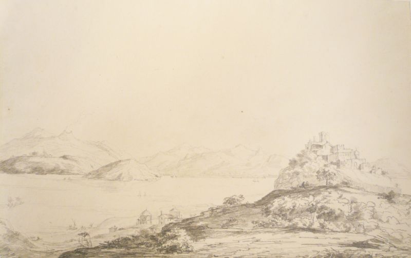
Castello di Ischia. Bleistift.
1824réf. 1702361824. Verso bezeichnet mit "Castello di Ischia, 1824" Auf festem Velin. 25,5 x 39,5 cm (blattgoß).
Kunstantiquariat Joachim Lührs · Allemagne1 250,00 €
4 361 résultats
13 original colour photographs (87 x 109 mm) and 6 original black-and-white photographs (75 x 104 mm), the latter captioned in English on verso. The bulk mounted on cardboard carriers. Inserted in protective sleeves in a green synthetic folder. Rare images of a Masonic society: private collection of photographs from a meeting of the Arabian Shriners in Saudi Arabia. The Shriners are seen in group pictures, alone or alongside their wives. Other pictures show the premises of the venue as well as the celebratory banquet. - In addition, the set comprises 6 black-and-white photographs, including group pictures of Westerners wearing Arabian attire, an image of the walls of the royal palace in Riyadh, a picture of the outskirts of Jeddah, and a view of the desert. - A unique survival.
8vo. With portraits of His Majesty King Saud Ben Abdulaziz and Prince Faisal Ben Abdulaziz, and 10 maps, including 2 folding. Original publisher’s decorated wrappers. The annual report of the Ministry of Agriculture of the Kingdom of Saudi Arabia for the fiscal year 1382–1383 AH, with text in Arabic and English. The most important topic is hydrology, including the Abha Dam project, the related Wadi Jizan and Irrigation project and the Al-Qatif water drainage project. Other topics covered include locust control, fertilizers, soil quality etc. The results of many tests are displayed on 10 maps. - With library stamps. Some minor stains and a small tear to the wrappers, but internally in very good condition.
4to. (6), 59, (2) pp. each in English and Arabic. With numerous black-and-white and colour photographic illustrations. Original printed wrappers. Stapled. Illustrated report on the activities of Aramco for 1951 - the year of the completion of the Dammam-Riyadh railroad as well as of the discovery of the Sufaniya and Uthmaniyah oil fields. The personal copy of Aramco official Robert King Hall, a director of training, with his handwritten ownership to title-page. - The report discusses petroleum operations and facilities, industrial training of employees, the construction of pipelines, plants, tanks and loading facilities, as well as roads and housing. It points out the merit of Aramco medical facilities, as well as the progress of Saudi infrastructure. Further, the report includes well statistics and a double-page illustration showing two camels and a bedouin admiring an Aramco oil rig. - Extremities slightly rubbed. Cf. OCLC 2416997.
560 x 430 mm. Colour lithograph, signed "Ibrahim K.". Mounted on styrofoam board. Bilingual safety poster in Arabic and English. - Traces of folds.
100 x 74 mm and 95 x 70 mm. Two Douglas DC-3 aircraft (registrations N720A and N726A) in their 1950s or early 1960s Aramco livery.
Large 8vo. 12 vols. Original printed wrappers. Monumental, exceedingly useful bibliography of Arabic literature and works relating to Arabia published in the West in the 19th century. Arranged by subject covering the Quran and its tradition (an entire volume), the Proverbs, Kalîlah, Loqmân, Barlaam, ´Antar, Syntipas, Oriental Tales, Mahomet, etc. Four volumes are dedicated to the 1001 Nights alone. - Edges slightly brittle as always, but very well preserved. Untrimmed, uncut copy in the publisher's original wrappers. Besterman 455.
8vo. (4), 176 pp. With woodcut title-vignette, 45 numbered and several unnumbered woodcut illustrations in the text. Later half calf with giltstamped spine and spine-title. First edition. - A classic of falconry, this pocket-sized manual is a supplement to the second volume of the ornithological textbook "Leçons élémentaires sur l'histoire naturelle des oiseaux" (1862-63) by the French zoologist Chenu (1808-79) and the ornithologist Des Murs (1804-94). The illustrations show various kinds of falcons, as well as their training and typical flight paths, sometimes displaying specific parts of the birds' bodies like wings and claws in detail. Figure no. 5 ("Faucon sur une Gazelle") is copied from the plate of "Goshawk and Gazelle" by Joseph Wolf, which forms the frontispiece to Richard F. Burton's 1852 work "Falconry in the Valley of the Indus". - Ownership of Charles Henry Stanley Garton (b. 1920), dated Kingswood, 24 February 1942, to front pastedown. Paper evenly browned throughout; tiny marginal tear to p. 29f. Partly uncut copy. Harting 200. Schwerdt I, 109. Thiébaud 192. Souhart 100. OCLC 944664144.
1824réf. 1702361824. Verso bezeichnet mit "Castello di Ischia, 1824" Auf festem Velin. 25,5 x 39,5 cm (blattgoß).
Folio. (4). 67, (1 blank) pp. With a woodcut coat of arms of the province of Friesland on the title-page, 1 woodcut headpiece, 1 woodcut tailpiece (plus 2 repeats) and 4 woodcut decorated initials (2 series). Set in roman and italic types with a few words of Hebrew. Modern boards, covered with grey paper, red and blue sprinkled edges. First and only edition of an inaugural lecture by Samuel Hendrik Manger (1735-1791), appointed ordinary professor of oriental languages and of Hebrew antiquities at the University of Franeker in 1760. Partly under the influence of the orientalist Albert Schultens, Manger valued Arabic studies for the insights they gave into Old Testament scholarship. In his present inaugural lecture, he discusses the controversial expedition to Palestine that several scholars were planning to make in that year. It shows his interest in archaeological research carried out in expeditions instigated by the German scholar Johann David Michaëlis. Manger believed they would inaugurate a new era in Biblical scholarship. - In very good condition and with very large margins, with only some minor marginal foxing in the title-page and an occasional unobtrusive small stain. STCN (3 copies); for the author: Biografisch lexicon voor de geschiedenis van het Nederlands protestantisme I, pp. 155-156; NNBW IX, col. 644.
Small 8vo. VI, (2), 125, (3), 92 pp. Later 19th century leather with giltstamped title to spine, both boards and spine with gilt armorial lion crest of the Ducs de Luynes. Leading edges, inner dentelle gilt; marbled endpapers. First edition of Petermann's manual of Arabic in a French master binding for the Duc de Luynes. Issued as part IV of the author's "Porta Linguarum Orientalium" for private study, this also contains a selection of Arabic reading pieces. - Some foxing throughout, otherwise beautifully preserved. From the library of the Ducs de Luynes at the Château de Dampierre. Vater/Jülg 27. OCLC 27870350.
42 x 100 cm. Five-tone lithographic map with illustration by Harraz. Constant ratio linear horizontal scale 1:7,500,000. Road map also showing railways, populated places, boundaries, rivers, wadis, and possible flood areas. Includes inset map: Diagrammatic map of the Arab world. Folded. First edition of this large, decorative map, showing the highways that linked countries under Arabian influence in the early 1970s. It stretches as far north as Turkey, south to the Sudan, west to Mauritana and east beyond the Strait of Hormuz, capturing the whole of the Arabian Gulf including Kuwait, Bahrain, Muscat, Oman, Saudi Arabia and the People's Republic of Southern Yemen. The verso contains an index of main travel routes through these various countries. - The United Arab Republic, as it is here referred to, was formed through a political union of Egypt and Syria. It was instigated by the Egyptian Prime Minister Gamal Abdel Nasser (1918-1970) and was seen as an expression of pan-Arab sentiment. Syria broke aways from the union in 1961 (and is here shown as an independent country), but Egypt continued to use the name until 1972. The People's Republic of Yemen, the only communist state to be established in the Arab world, was formed in late 1967, to last until 1990. - Some nicks and small tears, a single mark to the covers, a 1 cm tear on the left side of the map. In very good condition for a fragile map. Scarce: LibraryHub does not locate any holdings whilst Worldcat adds just eight institutional copies worldwide. OCLC 5403988.
1931Large 8vo. VI, 309, (3) pp. With 20 half-tone plates, folding plan of Mecca, and plan of the Haram. Original blue cloth. First edition of the English translation of a book on the holy city of Mecca by the Dutch orientalist and professor Christiaan Snouck Hurgronje (1857-1936). The book is divided into four large chapters, dealing respectively with daily life, family life, learning and the Jâwah in Mecca. Each chapter is illustrated with several photographs, mostly portraits, depicting among others a physician, a merchant with his slave, a bride and groom, pilgrims and the doorkeeper of the Kaabah, and also including a view of the Masjid al-Haram mosque. The book closes with an index and two maps, one showing Mecca. During his travels Snouck Hurgronje took many pictures of the holy city and its inhabitants, which made him the first western photographer in the city. In 1888 he published two volumes in German entitled "Mekka" describing his travels, to which a "Bilder-Atlas zu Mekka" was added in 1888. The present translation is based on the second of the two German volumes from 1888, "which seems likely to appeal to a wider public" (p. V), thus representing a Mecca from nearly fifty years earlier. The two maps included in the first German volume are included here as well, and the 21 reproductions of photographs are a selection from the photographs in the "Bilder-Atlas". - Binding only slighty worn at the top and bottom of the spine. Interior slightly browned, but otherwise a very good copy, clean and well-preserved, with both the text and plates in very good condition. Macro 1238. D. van der Wal, Christiaan Snouck Hurgonje: the First Western Photographer in Mecca, 1884-1885 (2011). OCLC 1088989. Cf. Fück 231.
8vo. (14), 242 pp. With a frontispiece, 3 maps in text (including 1 double-page) and 32 plates with reproductions of 109 photographs. Green cloth with illustrated dust jacket. First edition, second impression, of an account of the Arabs living in the marshes of southern Iraq, written by Wilfred Thesiger (1910-2003), who stayed with them from 1951 to 1958. "From my recollections, helped by my diaries, I have tried to give a picture of the marshes and of the people who live there. Recent political upheavals in Iraq have closed this area to visitors. Soon the marshes will probably be drained; when this happens, a way of life that has lasted for thousands of years will disappear" (Introduction). In 25 chapters Thesiger describes his experience in the marshes. The book is illustrated with over 100 photographs showing the people, their homes, boats, horses and kettle, and some common activities like fishing, preparing food and making homes and buildings out of water reed. Thesiger also wrote "Arabian Sands", published in 1959. - In very good condition. Dust-jacket only slightly worn at head and foot of the spine. For the author see: A. Maitland, Wilfred Thesiger: The Life of the Great Explorer (2011).
Hand-coloured engraved map (355 x 290 mm). Matted. Striking full color example of Tirion's detailed map. The map is highly detailed, including a number of the major roads and caravan routes, including those leading to Mekka and Medina. Two monument-style cartouches contain the title at upper right and three distance scales opposite. "This map shows a great advance on the others by showing the true extent of Turkish power. It has a curious mountain system, dividing the Peninsula into smaller regions" (Tibbets). Although it is mainly based on Delisle's map through de Fer, the map contains much original data. - Very well preserved. Tibbetts 250. Al Ankary p. 330. Al-Qasimi 160.
Hand-coloured engraved map (355 x 290 mm). Striking full-colour example of Tirion's detailed map. The map is highly detailed, including a number of the major roads and caravan routes, including those leading to Mekka and Medina. Two monument-style cartouches contain the title at upper right and three distance scales opposite. "This map shows a great advance on the others by showing the true extent of Turkish power. It has a curious mountain system, dividing the Peninsula into smaller regions" (Tibbets). Although it is mainly based on Delisle's map through de Fer, the map contains much original data. - Very well preserved. Tibbetts 250. Al Ankary p. 330. Al-Qasimi 160.
Hand-coloured engraved map (355 x 290 mm). Striking full color example of Tirion's detailed map. The map is highly detailed, including a number of the major roads and caravan routes, including those leading to Mekka and Medina. Two monument-style cartouches contain the title at upper right and three distance scales opposite. "This map shows a great advance on the others by showing the true extent of Turkish power. It has a curious mountain system, dividing the Peninsula into smaller regions" (Tibbets). Although it is mainly based on Delisle's map through de Fer, the map contains much original data. - Very well preserved. Tibbetts 250. Al Ankary p. 330. Al-Qasimi 160.
Hand-coloured engraved map (350 x 285 mm). "The Arabian Peninsula appears a smaller version of Tirion's 1731 map with fewer details and no information on roads" (Al Ankary). Two monument-style cartouches contain title and three distance scales. - Very well preserved. Tibbetts 253. Al Ankary p. 340. Al-Qasimi 164. McMinn 48.
Hand-coloured engraved map (380 x 320 mm). Striking map of the Arabian Peninusla featuring the geographical features known to the ancients. Decorated with a vignette and 9 medallions depicting camels in the upper right corner. An interesting and highly decorative map. Al Ankary 293. Al-Qasimi 129. Not in Tibbetts.
Large folding map (60 x 90.5 cm), printed in colour, depicting the Kingdom of Saudi Arabia and its main roads. With on the right the title in both Arabic and English and a table with the distances from one city to another. Printed on two sides, one side with the map in English and the other in Arabic. Bilingual road map of the Arabian Peninsula for Aramco employees. Focused on Saudi Arabia, the map shows the main roads, as well as surfaced roads, trails, roads under constructions and even proposed roads. A list titled "hints for survival" mentions extremely logical traffic rules such as "come to a complete stop at stop signs and observe stop-and-go signals" and "observe speed laws in the community where you live as well as on the highway". Placing common traffic rules under the header "hints for survival" makes one fear the worst for Saudi Arabian traffic in this period. The Arabic side of the map contains the same "hints" as well as a list of road signs in Arabic and English. A table lists the distance in kilometres from several towns and cities to some of the major cities: Buraidah, Dhahran, Dammam, Hofuf, Jeddah, Mecca, Medina, Riyadh and Ta'if. - In very good condition.
4to. (3) pp., final blank page. With woodcut illustration on the title-page. Sewn. Scarce account of a naval battle in the Mediterranean that took place near Cap de Begur (Catalonia) between a Spanish vessel and a ship of corsairs from Algiers in April 1623. The latter, carrying "50 Turcs, 4 captured Christians, a black Moorish woman, and a Mallorcan renegade", went up in flames. Allegedly the copy of a letter by a soldier of the Spanish Armada. The illustration shows the Ottoman vessel features 11 sailors at the helms wearing turbans. - Slightly dampstained. Near-contemporary foliation in ink (137-138), suggesting the work was originally part of a larger volume. Palau 61131. Not in OCLC.
4to. 8 pp. With woodcut title vignette. Printed sheet folded into a pamphlet, unsewn and unbound. Rare Portuguese account of one of several unsuccessful 18th century attempts by Muslim forces to recapture Oran. This operation took place in March of 1754, more than two decades after the Spanish conquest of the city in 1732. Oran was repeatedly attacked by Algerian and Ottoman forces, but remained under Spanish rule until 1792. - Uncut and untrimmed. BGUC Misc. 24, 459. OCLC 27754498.
Hand-coloured lithograph. 380 x 555 mm. Fine image of a Rough-Legged Buzzard, from John Gould's monumental "Birds of Great Britain" (London, 1862-1873, 5 vols.). Joseph Wolf (1820-99) "was the first bird artist to understand and use the new freedom of style that lithography allowed [...] He introduced natural settings and a feeling of motion into his paintings. Early training in lithography and art [...] opened the door to Wolf's development into one of the first and finest true bird artists. He breathed life into the stiff 'bird on a perch' portrayals so characteristic of bird art of the day. Wolf liked especially to paint birds of prey and game birds, with their subtle browns and grays" (Cornell University Library). Fine Bird Books 102. Nissen IVB 372. Sauer 23. Wood 365. Zimmer 261.
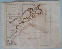
1789réf. 3818Appearing in the March 1789 issue of the American Museum magazine this engraving is the second American version of Franklin's famous chart of the Gulf Stream printed in America. Both American versions were preceded by English and French printings. The Chart of the Gulf Stream accompanies Franklin's "Remarks upon the navigation from Newfoundland to New York." p. 213 in the magazine. Franklin prepared the chart in 1768 while serving in London as a deputy postmaster general for mail service to and from the American colonies. It was Franklin's cousin Timothy Folger of Nantucket who provided him with a practical seafarer's knowledge of the Gulf Stream and its importance in trans-Atlantic crossings. The previous American publication of the chart was in 1786 in The Transactions of the American Philosophical Society. This updated version provides a more accurate depiction of the North American coast. State boundary lines are partially indicated. One curious boundary delineation in the chart has a portion of the District of Maine extending over the northern boundaries of New Hampshire and part of Vermont. References: Wheat & Brun Maps & Charts Published in America before 1800: 723. Condition: Folded as issued with misfolding along one fold line. Light to occasionally moderate soiling. Edge roughness primarily at upper left edge. ICN 7794.1 Mathew Carey
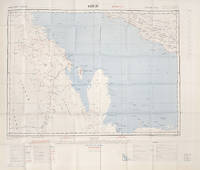
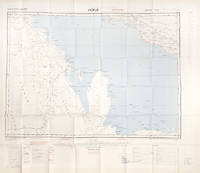
réf. 112618London War Office printed for D. Survey WO and AM by Balding and Mansell Ltd. 1957. . Coloured double-sided map of the Arabian Gulf on 1 sheet printed on silk; edition I-GSGS; sheet size: 64 x 72.5 cm; scale 1:1000000 text in English very slight fading to outer margin otherwise near fine. An excellent example of a double-sided coloured escape map of the Arabian Gulf showing the UAE and Oman to recto and Qatar to verso. With a key to topographical features railways main roads and important settlements including the tribal and official names of provinces and a useful Arabic-English glossary translating key terms such as 'Bir' for 'Well' 'Ain' for Spring' 'Qasr' for 'Fort/Castle'. The recto extends from Kumzat in the North to Hafit in the South and Abu Dhabi in the West to al-Qasbiyat in the East showing the six remaining emirates of Dibai Dubai Sharja Ajman Umm al-Qaiwan Ras al-Khaima and Fujaira. The verso runs South from Ras es Safaniya to Ei Abd and from Awania in the West to Rudaim in the East including the principal settlements of Jubail Bahrein Hofuf showing Doha Wakra and Lusail on the Qatar Peninsular. [London], War Office, printed for D. Survey (WO and AM) by Balding and Mansell Ltd., 1957. unknown
réf. 112628London War Office printed for D. Survey WO and AM by Balding and Mansell Ltd. 1957. . Coloured double-sided map of the Arabian Gulf on 1 sheet printed on silk; edition I-GSGS; sheet size: 64 x 72.5 cm; scale 1:1000000 text in English slight fading to creases otherwise near fine. An excellent example of a double-sided coloured escape map of the Arabian Gulf showing the UAE and Oman to recto and Qatar to verso. With a key to topographical features railways main roads and important settlements including the tribal and official names of provinces and a useful Arabic-English glossary translating key terms such as 'Bir' for 'Well' 'Ain' for Spring' 'Qasr' for 'Fort/Castle'. The recto extends from Kumzat in the North to Hafit in the South and Abu Dhabi in the West to al-Qasbiyat in the East showing the six remaining emirates of Dibai Dubai Sharja Ajman Umm al-Qaiwan Ras al-Khaima and Fujaira. The verso runs South from Ras es Safaniya to Ei Abd and from Awania in the West to Rudaim in the East including the principal settlements of Jubail Bahrein Hofuf showing Doha Wakra and Lusail on the Qatar Peninsular.Arabian Gulf Fabric Map of Hofuf and Bandar Abbas 1957 [London], War Office, printed for D. Survey (WO and AM) by Balding and Mansell Ltd., 1957. unknown