31.730 risultati
1944rif. 70121Washington DC: Army Map Service 1944. Third edition color map 44 x 32 in. 50 miles to 1 in. scale; Includes roads railroads places of possible delay and places with available lodging. Two insets for the eastern and western extremities; two closed tears at top edge not reaching border a little bit of creasing one old fold withdraw stamps from the University of Chicago Library on verso very good. "Prepared under the direction of the Chief of Engineers by the Army Map Service ; reproduced . from pulls of a Survey of India 1942 edition map. Army Map Service unknown books
1947rif. 70125Washington DC: Army Map Service 1947. Tri-color map 25 x 38 in. 1:250k scale; showing roads settlements elevation etc.; some short closed tears at edges one old fold University of Chicago discard stamps on verso very good. While Conakry is present on the map the focus is on the greater region stretching out into Sierra Leone. University of Minnesota only in OCLC. Army Map Service unknown books
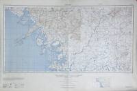
1943rif. 70141Washington DC: Army Map Service 1943. First edition broadside topographical map 24 x 20 in. 1:100000 scale printed in blue and black; a detailed map with a legend including hedges ruins warehouses fences telephone lines etc. Fine. AMS T614 Sheet XIV. OCLC lists one copy at the National Library of Indonesia. Army Map Service unknown books
1944rif. 70216New York: Army Information Branch 1944. Large broadsheet approx. 35" x 47" one side with three maps printed in red and black of the Eastern Front Europe and the Pacific and four photographs of the front showing the Bombing of Cassio and German landmines; the verso with a large relief map of North Burma. Old fold edgewear and some chipping to corners and small holes good and sound. Together with: Newsmap for the armed forces. 276th week of the war - 158th week of U. S. participation. Monday 25 December 1944 - Week of 13 December to 20 December. Volume III No. 36 F. Large broadsheet approx. 35" x 47" one side with 4 maps illustrating the siege of Budapest the Pacific theater the German advance on the western front and Mindoro; the verso with a large relief map of South Burma and Thailand. Old fold light toning otherwise near fine. These two issues placed together create a contiguous map of Burma the western edge of Thailand including Bangkok and the Eastern edge of India into Calcutta. Part info newsletter part propaganda Newsmap was established by the U.S. government to provide up-to-date information on the state of the war and improve the morale of the military. Army Information Branch unknown books
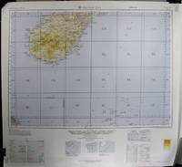
1962rif. 70451Washington DC: Army Map Service 1962. Seveth edition broadside map; 26 x 28 in. 1:1000000 scale; showing roadways settlements and elevation light creasing at lower border else fine. Published under the schema for the International Map of the World. The IMW was the cartographical brain child of Albrecht Penck who in the late 19th century conceived of a series of maps uniformly produced that would cover the whole of the Earth's land mass. To accomplish this the planet was divided into 2500 segments and each segment was to be produced independently by various governments and NGOs. The project was envisioned to be strictly apolitical but this meant that buy-in was slow for governmental bodies and the lack of thematic information frustrated potential contributors in industry and led to University of Wisconsin cartographer Arthur Robinson declaring the resulting maps "cartographic wallpaper." When government agencies did contribute they did so as here in service to a baldly political interest in a given region. Army Map Service unknown books
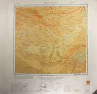
1950rif. 70445Washington D.C.: Army Map Service 1950. First edition broadside map 16 x32 in. 1:1000000 scale; showing roads boundaries settlements boundaries elevation etc.; fine. Dalanzadgad is a city in south-central Mongolia. This map was produced as part of the International Map of the World project. The project was the cartographical brain child of Albrecht Penck who in the late 19th century conceived of a series of maps uniformly produced that would cover the whole of the Earth's land mass. To accomplish this the planet was divided into 2500 segments and each segment was to be produced independently by various governments and NGOs. The project was envisioned to be strictly apolitical but this meant that buy-in was slow for governmental bodies and the lack of thematic information frustrated potential contributors in industry and led to University of Wisconsin cartographer Arthur Robinson declaring the resulting maps "cartographic wallpaper." When government agencies did contribute they did so as here in service to a bald political interest in a given region. Army Map Service unknown books
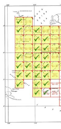
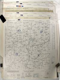
1944rif. 70378Washington DC: Army Map Service 1944. First edition 23 color broadside maps each about 22 x 20 in.; 1:200000 scale covering the western section of the series from XI-XII 42-43 to XXVII-XXVIII 48-49 lacking XI-XII 44-45 XIII-XIV 44-45 XIII-XIV 50-51 XV-XVI 42-43 XV-XVI 44-45 XVII-XVIII 42-43 XVII-XVIII 44-45 and XIV-XX 44-45. Geographical region covered is the west coast From Kuching to Soekamara and some outlying islands. Each map is numbered in marker on the bottom left margin otherwise clean and near fine. The Army Map Service was the primary map producing body of the US Military through WWII. Service cartographers many of them women recruited after Pearl Harbor produced 40000 maps covering 400000 miles between 1941 and 1945. LoC Their work formed the basis of silk escape maps provided to soldiers. Army Map Service unknown books
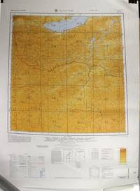
1964rif. 70441Washington DC: Army Map Service 1964. Second edition first printing color broadside maps 28¾" x 22"; 1:1000000 scale; displaying boundaries roadways settlements and elevations; fine. Ulan-Ude is a Russian city close to the Mongolian border near Lake Baikal. This map was produced as part of the International Map of the World project. The project was the cartographical brain child of Albrecht Penck who in the late 19th century conceived of a series of maps uniformly produced that would cover the whole of the Earth's land mass. To accomplish this the planet was divided into 2500 segments and each segment was to be produced independently by various governments and NGOs. The project was envisioned to be strictly apolitical but this meant that buy-in was slow for governmental bodies and the lack of thematic information frustrated potential contributors in industry and led to University of Wisconsin cartographer Arthur Robinson declaring the resulting maps "cartographic wallpaper." When government agencies did contribute they did so as here in service to a bald political interest in a given region. Army Map Service unknown books
1945rif. 70449Washington D.C.: Army Map Service 1945. 9 broadside maps approx. 22½" x 20" 1:250000 scale; showing roadways trainlines borders settlements and elevation a few maps soiled but otherwise largely fine. Includes the following maps: Li-Hsien H-49-P; Chao-T'ung G-48-B; Kuei-Ting Kan-Ch'i G-48-L; En-Shih H-49-H; Lang-Chung H-48-D; Pa-Chung H-48-E; Wu-Shih-Chiang F-49-T; Lai-Feng H-49-N; Peng-Shui H-49-M. Covering portions of the border area between China and Vietnam and sections of Szechuan Province. The Army Map Service was the primary map producing body of the US Military through WWII. Service cartographers many of them women recruited after Pearl Harbor produced 40000 maps covering 400000 miles between 1941 and 1945. Their work formed the basis of the many silk escape maps provided to soldiers. Army Map Service unknown books
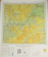
1963rif. 70465Washington DC: Army Map Service 1963. 10 color broadside maps showing various regions of regions ranging from Xinjiang up to Mongolia Northeast USSR and the Yellow Sea; sizes ranging between 24.5 x 21.5 in. to 26 x 32 in. 1:1000000 scale; showing roadways settlements and elevation one map with smudged printing else all largely fine. This group includes the following maps first edition unless otherwise stated: Wen-Ch'eng NM 51 2nd ed; Nan-T'ung NI 51 6th ed.; O-Chi-Na Ho NK 47; Ha-Erh-Pin HarbinNL 52 2nd ed.; Ch'eng-Hua NL 45; Zeya NN 52 3rd ed.; Ha-Mi Kumil NK46; Hobsogol NM 47; Jirgalanta Kobdo NM 46; Ch'ieh-Mo Charchan Bazar NJ 45. A scattered sampling of maps from the International Map of the World. The IMW was the cartographical brain child of Albrecht Penck who in the late 19th century conceived of a series of maps uniformly produced that would cover the whole of the Earth's land mass. To accomplish this the planet was divided into 2500 segments and each segment was to be produced independently by various governments and NGOs. The project was envisioned to be strictly apolitical but this meant that buy-in was slow for governmental bodies and the lack of thematic information frustrated potential contributors in industry and led to University of Wisconsin cartographer Arthur Robinson declaring the resulting maps "cartographic wallpaper." When government agencies did contribute they did so as here in service to a baldly political interest in a given region. Army Map Service unknown books
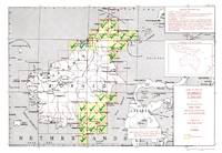
1945rif. 70379Washington DC: Army Map Service 1945. 23 broadside color maps; each about 22.25 x 20 in. 1:250.000 scale covering two separate regions: North Borneo including part of Brunei and Southeast Borneo from Samarinda to Kualakapuas and inland to Boentok. All maps in fine condition. Maps included are: NB-49 X; NB-50 I J O P Q R S V W; NA-50-D; SA-50-C D G H I M N O S T U; SB-50-A. The Army Map Service was the primary map producing body of the US Military through WWII. Service cartographers many of them women recruited after Pearl Harbor produced 40000 maps covering 400000 miles between 1941 and 1945. LoC Their work formed the basis of silk escape maps provided to soldiers. Army Map Service unknown books
1972rif. 69264Washington D.C.: Headquarters Department of the Army 1972. 4to pp. xi 1 257 1; 17 color maps 3 in pocket inside back cover pocket 5 folding; very good sound and clean in original pictorial wrappers. The information appearing in the abstracts is supported by 36 appendixes comprised of charts tables maps and texts of military political economic and sociological nature. The maps provide the regional geographic picture of Peninsular Southeast Asia as well as the political and economic aspects of Burma Cambodia Laos and Thailand. Headquarters, Department of the Army unknown books
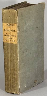
1817rif. 66691London: printed for the author. Sold by Longman and Co. Baldwin and Co.; Law and Whittaker; Black Parbury and Allen; Egerton; Westley and Parrish; and all other booksellers 1817. First edition 8vo pp. xxx 2 608; uncut and largely unopened; original drab paper-covered boards printed paper label on spine; label slightly chipped affecting 2 letters corners bumped front joint starting; all else very good and sound. Includes sections on Waterloo The Reduction of Algiers The Battle of Albuera Operations in the Eastern Seas Java The Capture of Martinique Corunna Capture Off Santo Domingo Egypt Mahratta War etc. Includes a lengthy list of subscribers including the Dukes of Kent Cumberland and Cambridge the Duke of Wellington Sir Stamford Raffles and many other naval and military figures. printed for the author. Sold by Longman and Co. Baldwin and Co.; Law and Whittaker; Black, Parbury, and Allen; Egerton; Westley unknown books
1834rif. 66736London: by Authority: printed by William Clowes 1834. 12mo pp. 70 2; original pink paper-covered boards with cream paper shelfback; soiled and rubbed two flat wax marks on upper board but the binding is firm and the textblock clean. Ownership signature of G. W. Fordyce on upper board and free end paper with a note "Ensign HM 74th Regt. of Foot" which was part of the Highland Light Infantry. "Bound by J. Smith 49 Long Acre" printed on upper pastedown. An unusual example of a book in boards signed by the binder. The text replaces that of 1823 per the General Order of March 1 1834 which is printed on p. 3. BL McGill National Library of Ireland and 2 in Germany in OCLC. by Authority: printed by William Clowes unknown books
1941rif. 58616Washington D.C.: Government Printing Office 1941. 8vo pp. 34; 9 folding tables and maps; fine in original printed gray wrappers; together with: Marshall G. C. Biennial report of the Chief of Staff of the United States Army July 1 1941 to June 30 1943 Washington D.C.: G.P.O. 1943; pp. v 1 56; 6 folding maps printed in color 19 folding graphs charts and tables; fine in original printed gray wrappers. These reports summarize important events affecting the U.S. Army between July 1 1939 to June 30 1943. "It is a record of what was done and why it was done . This report is based on messages current reports and official records of the War Department which are sufficiently complete to form an accurate picture" Foreword. George Catlett Marshall Jr. 1880-1959 rose through the United States Army to become Chief of Staff under presidents Franklin D. Roosevelt and Harry S. Truman then served as Secretary of State and Secretary of Defense under Truman. As Secretary of State Marshall advocated a U.S. economic and political commitment to post-war European recovery including the Marshall Plan that bore his name. In recognition of this work he was awarded the Nobel Peace Prize in 1953. Government Printing Office unknown books
1845rif. 55586Washington: C. Alexander printer 1845. Second edition with additions following the first edition printed earlier the same year in Pittsburgh; 8vo pp. 24; removed from binding; corner torn from the title page not affecting any letterpress. Published by authority of the War Department. American Imprints 45-5716; Howes S-86; Sabin 76388. C. Alexander, printer unknown books
1863rif. 51386Mobile: S. H. Goetzel 1863. First edition 16mo 3 parts in 1; pp. 2 ii 220; 104; 47 1; 97-108 Bugle Signals; xiv index 2 ads; 38 engraved plates 8 folding; original paper-covered boards rebacked in blue cloth sometime in the 20th century; boards worn text occasionally dampstained and foxed without the front free endpaper and hinges with old archival paper repair; but in all a good sound and compelling copy of a poorly made book. Parrish & Willingham 5116. S. H. Goetzel unknown books
1962rif. 28582Washington D.C.: G.P.O. 1962. 10 volumes 4to original beige printed wrappers; a few filing rubberstamps but in all a near fine and complete set of the Army's bibliographic survey made art the request of the Office of the Chief of Research and Development on the space programs of the USSR the U.S. the U.K. and France covering the period 1957 to 1962 from pre-Sputnik to John Glenn. Several illustrations mostly folding. In a new blue cloth clamshell box red morocco label on spine. G.P.O. unknown books
1887rif. 287950Buffalo NY: Matthews Northrup & Co 1887. Soft Cover. Very Good binding. A timeline of the battles of the Civil War with statements of Union casualties for each. With a description of St. Louis and its attractions at the rear; published by the Illinois Central Railroad Co. and dedicated to the Grand Army of the Republic. Folding map of the Illinois Central Railroad System with an 11 cm closed tear along a fold; color illustrated with a close-up of St. Louis within the map. Chromolithographically decorated on the folding covers stapled at the bottom edge. A wallet style binding with slight soiling to the covers previous owner's name in pencil and minor toning to the title page. Very Good binding. Matthews, Northrup & Co unknown books
1943rif. 208530Raritan Arsenal 1943 1943-01-01. Paperback. Very Good. 0x0x0. Light green paper wraps. Front cover has a "Classification Cancelled" sticker attached and a 82nd Artillery Division stamp beneath. Clean has a good binding no notations. 183 pages. Minor wear. S.U. Raritan Arsenal, 1943 paperback books
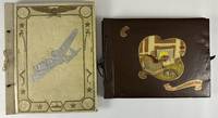
1945rif. 12886Various locations mainly Texas Oklahoma and Arkansas 1945. Two albums. Album I: 24 leaves illustrated with twenty-four original photographs over two dozen postcards mostly photographic original letters and military documents and a large quantity of ephemeral items. Folio. Contemporary cream cloth decoratively stamped on front board in gilt and silver string tied. Album II: 11 leaves illustrated with ninety-eight photographs in mounting corners six loose photos and a couple of ephemeral items. Oblong folio. Contemporary brown cloth decoratively stamped on front board in gilt yellow and red string tied. Overall minor wear. Very good condition. A pair of annotated vernacular photograph album / scrapbooks compiled by Lt. Erma J. Frazier and her mother during her wartime service in the U.S. Army Nurse Corps. Frazier served in the Nurse Corps at various hospitals in the Trans-Mississippi West at Camp Swift in Bastrop Texas; Fort Sam Houston in San Antonio Texas; Okmulgee Oklahoma; and Camp Robinson Arkansas. Frazier hailed from East Brady Pennsylvania and worked as a Registered Nurse at the nearby Kittanning Hospital before she entered military service. She enlisted in early 1945 and served throughout the conclusion of the Second World War. The present albums record her service time in unusual detail with a mixture of original photographs picture postcards original military documents a few manuscript letters and various ephemeral items. The first album was compiled by Frazier's mother who inscribes the first page: "I dedicate this book to my daughter Erma Jean Eberhart Frazier who entered the Armed Services on March 17 1945 as a 2nd Lt. in the Nurse Army Corps a Camp Swift Texas." This album focuses mainly on Frazier's time at Camp Swift and Okmulgee Oklahoma. This album contains the lion's share of the ephemera including a patch the floral corsage she wore on the day she left for service military paperwork and forms and various newspaper clippings. The military paperwork includes enlistment documents including her "Application for Appointment" a manuscript postcard from the director of the Red Cross describing Frazier as a "professional qualified for military service" Army documents on qualifications for nurses and more. Other ephemera includes letters and cards received by her at Camp Swift a page of five pressed "Flowers from Texas" each preserved in a small plastic bag shipping tags from packages of clothing sent home by Frazier a couple of church programs a page of ten small postcards from her visit to Austin a menu from Brooke General & Convalescent Hospital at Fort Sam Houston some greeting cards and so forth. The photographs include portraits of Frazier from 1943 and 1944 while a nursing student; eight pictures of Frazier and other soldiers at Camp Swift; and eight shots of Frazier fellow soldiers and their barracks and administration buildings at Okmulgee Oklahoma. The second album was compiled by Frazier herself who provides a manuscript title on the inside front cover: "Memories of the Army Nurse Corps." There are also two photographs inscribed in the first person "Me on arrival at G.G.H." and "side entrance to my barracks G.G.H.". This album is almost entirely comprised of captioned photographs particularly valuable for identifying numerous fellow soldiers serving with Frazier. The images emanate from the last three locations at which Frazier served which she lists on the inside front cover: Brooke General Hospital at Fort Sam Houston Glennon General Hospital in Okmulgee and Regional Hospital at Camp Robinson Arkansas. Perhaps Frazier felt her mother's album largely focused on Camp Swift sufficiently memorialized here time there. The photographs are presented in chronological order and include portraits of dozens of men and women with whom Frazier served or patients served by Frazier often accompanied by informative and sometimes humorous manuscript captions on the album leaves or directly on the images. The photos also picture the hospitals themselves and include a handful of images taken during leisure time on base. A unusually informative pair of World War II-era albums and scrapbooks preserving the service of a highly-qualified Army nurse from Pennsylvania serving in the American West during the last year of the war. unknown books
1974rif. 84832Winters: Konocti Books 1974. First edition. Single long sheet folded twice 8 1/2 x 5 1/2 inches closed. Fine. Poems memorializing SLA members Camilla Hall and Patricia “Mizmoon” Soltysik killed in the 1974 shoot-out with LA police. Winters: Konocti Books unknown books
1919rif. 008941Washington D.C.: War Department Government Printing Office 1919. Book. Near Fine. Hardcover. First Edition. 8vo - over 7¾" - 9¾" tall. 437 pages with over 100 maps many fold-out photographs charts tables and plans. Near Fine cloth a bit dulled bottom edge of rear cover with paint smudges. With RARE errata slip laid in. Uncommon in such lovely collectible condition. War Department, Government Printing Office Hardcover books
1863rif. 006939United States Army 1863. Book. Very Good. One PageFolded. 8 1/4" x 10 1/2". One sheet of paper backed with an attached second sheet two horizontal folds one vertical fold fragile yet Very Good sheets separating at folds. light age toning. Discharge papers for Thomas Fulford a private in Company B 64th Regiment Infantry Indiana Volunteers dated Sept. 30 1863 at St. Louis Mo by reason of Surgeon's Certificate of Disability. In left margin handwritten in red ink "Phthisis-hereditary-developed by exposure. He is unfit for the Invalid Corps". Signed at bottom "By Order of Maj. Gen. Schofield" and then signed "J.K. Hudson" with more writing below illegible. Stamped in red ink "paid by Robert Smith St. Louis Oct. 2 1863 Paymaster U.S.A." Also another stamp faint with just the word Ohio at right side above top fold. Verso bears handwritten "Discharge Certificate of Thomas F. Fulford Late of Co. B 64th Regt. Indiana Vols. Infantry". Private Fulford went on to live to the age of 68 fathering 8 children. At his death in 1899 his obituary referred to him as "well known old soldier of Washington Township". Major General John McAllister Schofield 1831 -1906 held major commands during the Civil War and later served as U.S. Secretary of War under Presidents Andrew Johnson and Ulysses S. Grant and Commanding General of the United States Army. United States Army unknown books
1899rif. 005593Paris: Charles Carrington 1899. Book. Very Good. Cloth. First Edition. 8vo - over 7¾" - 9¾" tall. pp. xx 422. Title page printed in red and black. Out of a sequence of 1000 unnumbered copies. Very Good rebound in dark blue cloth gilt. Slight weakness to joints prior owner blind stamp title page slight browning. Charles Carrington Hardcover books