Mann, PtolemyBiblio.com
345 résultats
2024réf. __0903696746Hurtwood Pr Ltd 2024. Hardcover. New. 208 pages. 11.50x9.25x9.09 inches. Hurtwood Pr Ltd hardcover
réf. 62323Paris chez Cardin Besongne 1640 - reprint en fac-simile - Loge Astrologique de France 1985 In-12 xix-465pp. un des 300 exemplaires numerotes unknown
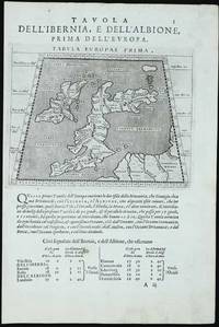
réf. 11760Venice: 1597. No binding. Very Good. 135 x 170 mm. printed on a leaf of text light paper imperfection in the text below otherwise in good condition. A new edition of Ptolemy's 'Geography' was edited by Giovanni Antonio Magini 1555-1617 a noted geographer from Padua. Published in Venice a second edition appeared in 1598 from which this appears. It contains this Ptolemaic map of the British Isles with that of the Iberian peninsula on the verso. The neatly engraved copper plates are attributed to Girolamo Porro 1520-1604 also from Padua. The atlas was first published in a smaller format in Venice 1596. It was closely copied in the following year by Petrus Keschedt in Cologne in a work which contained a whole new set of engraved plates. Many references incorrectly state that the two editions contain the same plates. Magini famously produced the first atlas of Italy which was published posthumously by his son Fabio in 1620. Nordenskiöld 1979 no. 227; Nordenskiöld 1889 p. 27; Phillips 1909- no. 405; Shirley 2004 T.Ptol 12b; Tooley's Dictionary 1999-2004. 1597 unknown
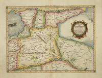
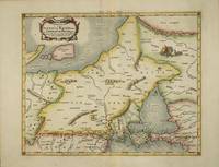
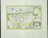
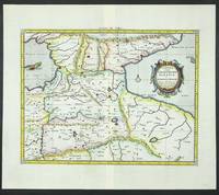
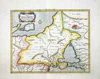
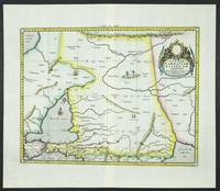
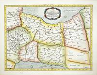
réf. 4017Utrecht: Francois Halma. 1578-c.1695. No binding. Very Good. 350 x 460 mm. a fine example in modern wash colour. From Gerard Mercator's edition of 'Claudii Ptolemaei Tabulae Geographicae Orbis Terrarum'. It was in 1578 that one of the world's greatest cartographers put out an edition of the earliest surviving geographical treatise. This map is centred on Armenia and shows the Black Sea and Caspian Sea to the west and east respectively. Koeman Me 5; Nordenskiold 234; Phillips P.L. Atlases 384; Shirley BL T.Ptol-11a & 11k; Van der Krogt P. Atlantes 1:501. Francois Halma. 1578-[c.1695] unknown
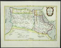
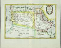
réf. 5206Utrecht: Francois Halma. 1578-c.1695. No binding. Very Good. 310 x 470 mm. in fine modern wash colour and in good condition. From Gerard Mercator's edition of 'Claudii Ptolemaei Tabulae Geographicae Orbis Terrarum'. It was in 1578 that one of the world's greatest cartographers put out an edition of the earliest surviving geographical treatise. This map shows the northern half of Africa with the equator displayed prominently. The source of the Nile River is also highlighted with a mountain range feeding two large lakes. An interesting feature is the Niger River in 'Libya' which is prominent across the map with its source in numerous lakes. During its course to the sea it disappears under a mountain range arising the other side. Although Mercator is most renowned today for the projection he popularised and for first using the term 'atlas' for a collection of maps he devoted much of his life to his Ptolemaic maps. The maps were beautifully engraved as nearly as possible to their original form and are the most decorative of Ptolemaic maps. Koeman Me 5; Nordenskiold 234; Phillips P.L. Atlases 384; Shirley BL T.Ptol-11a & 11k; Van der Krogt P. Atlantes 1:501. Francois Halma. 1578-[c.1695] unknown
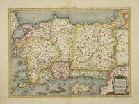
réf. 4025Utrecht: Francois Halma. 1578-c.1695. No binding. Very Good. 340 x 460 mm. a fine example in recent wash colour in good condition. From Gerard Mercator's edition of 'Claudii Ptolemaei Tabulae Geographicae Orbis Terrarum'. It was in 1578 that one of the world's greatest cartographers put out an edition of the earliest surviving geographical treatise. This map shows Ptolemaic Asia Minor or modern day Turkey. A prominent Cyprus is found as are the Greek Islands of Lesbos and Rhodes. Koeman Me 5; Nordenskiold 234; Phillips P.L. Atlases 384; Shirley BL T.Ptol-11a & 11k; Van der Krogt P. Atlantes 1:501. Francois Halma. 1578-[c.1695] unknown
réf. 4019Utrecht: Francois Halma. 1578-c.1695. No binding. Very Good. 350 x 430 mm. in recent wash colour in good condition. From Gerard Mercator's edition of 'Claudii Ptolemaei Tabulae Geographicae Orbis Terrarum'. It was in 1578 that one of the world's greatest cartographers put out an edition of the earliest surviving geographical treatise. This map shows north eastern Europe and Russia. With an attractive scene of a camp upper right. The map extends southwards to the Black Sea. Koeman Me 5; Nordenskiold 234; Phillips P.L. Atlases 384; Shirley BL T.Ptol-11a & 11k; Van der Krogt P. Atlantes 1:501. Francois Halma. 1578-[c.1695] unknown
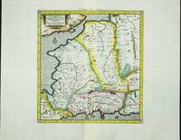
réf. 4032Utrecht: Francois Halma. 1578-c.1695. No binding. Very Good. 340 x 400 mm. a fine example in modern wash colour. From Gerard Mercator's edition of 'Claudii Ptolemaei Tabulae Geographicae Orbis Terrarum'. It was in 1578 that one of the world's greatest cartographers put out an edition of the earliest surviving geographical treatise. Ptolemy's image of France as seen through the eyes of Mercator. Koeman Me 5; Nordenskiold 234; Phillips P.L. Atlases 384; Shirley BL T.Ptol-11a & 11k; Van der Krogt P. Atlantes 1:501. Francois Halma. 1578-[c.1695] unknown
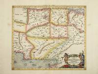
réf. 4023Utrecht: Francois Halma. 1578-c.1695. No binding. Very Good. 350 x 470 mm. a fine example in modern wash colour. From Gerard Mercator's edition of 'Claudii Ptolemaei Tabulae Geographicae Orbis Terrarum'. It was in 1578 that one of the world's greatest cartographers put out an edition of the earliest surviving geographical treatise. This map centres on India although there is not much of a peninsula. Its presence can be determined by the Indus and Ganges Rivers on the left and right respectively. Sri Lanka can be seen at the bottom of the map. Koeman Me 5; Nordenskiold 234; Phillips P.L. Atlases 384; Shirley BL T.Ptol-11a & 11k; Van der Krogt P. Atlantes 1:501. Francois Halma. 1578-[c.1695] unknown
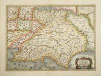
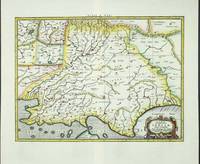
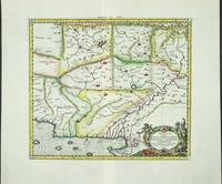
réf. 4022Utrecht: Francois Halma. 1578-c.1695. No binding. Very Good. 350 x 400 mm. a fine example in recent wash colour in good condition. From Gerard Mercator's edition of 'Claudii Ptolemaei Tabulae Geographicae Orbis Terrarum'. It was in 1578 that one of the world's greatest cartographers put out an edition of the earliest surviving geographical treatise. This map centres on present day Pakistan with the Indus River prominent. Upper right can be seen the Himalayan Mountains. Koeman Me 5; Nordenskiold 234; Phillips P.L. Atlases 384; Shirley BL T.Ptol-11a & 11k; Van der Krogt P. Atlantes 1:501. Francois Halma. 1578-[c.1695] unknown
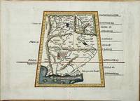
réf. 8022Lyon: Melchoir and Gaspar Treschel. 1522-35. No binding. Good. 315 x 450 mm. with recent wash colour two minor stitch holes due to binding both repaired otherwise in good condition. An attractive map of Ptolemaic Pakistan and Afghanistan. It is projected in a trapezoidal style with extensive rivers and mountain ranges. With Latin text on the verso. Laurent Fries produced the woodblocks for this 1535 edition of Ptolemy's Geography. By now Fries whose maps were first issued in the 1522 edition had died. The wood blocks found their way into the possession of Melchoir and Gaspar Treschel. For this edition published in Lyon the brothers asked Michael Servetus to re-edit the text. Karrow 1993 28.24; Nordenskiold 1979 209; Pastoureau 1984 Ptolemee E 1535; Shirley 2004 T.Ptol 7d. Melchoir and Gaspar Treschel. 1522-[35] unknown
réf. 6091Amsterdam: R & J Wetstenii & G Smith. 1578-1730. No binding. Very Good. 340 x 480 mm. a fine example in recent wash colour. Gerard Mercator's edition of Ptolemy's 'Geography' is highly acclaimed; he spent much of his life studying the work and even engraved the plates himself. The 'Geographia' is the earliest surviving geographical treatise. Much of Mercator's efforts were spent projecting Ptolemy's geography onto the projection which bears his name. Mercator is one of the world's greatest cartographers and the 'Claudii Ptolemaei Tabulae Geographicae Orbis Terrarum' was first published in 1578. This map of the Lower Nile River in Egypt is in the third state with the addition of a latitude and longitude grid illustrating the projection. Koeman Me 5; Nordenskiold 234; Phillips P.L. Atlases 384; Shirley BL T.Ptol-11a & 11k; Van der Krogt P. Atlantes 0913A:1.2. R & J Wetstenii & G Smith. 1578-[1730] unknown
réf. 6095Amsterdam: R & J Wetstenii & G Smith. 1578-1730. No binding. Very Good. 350 x 460 mm. a fine example in recent wash colour. Gerard Mercator's edition of Ptolemy's 'Geography' is highly acclaimed; he spent much of his life studying the work and even engraved the plates himself. The 'Geographia' is the earliest surviving geographical treatise. Much of Mercator's efforts were spent projecting Ptolemy's geography onto the projection which bears his name. Mercator is one of the world's greatest cartographers and the 'Claudii Ptolemaei Tabulae Geographicae Orbis Terrarum' was first published in 1578. This map is centred on Armenia and shows the Black Sea and Caspian Sea to the west and east respectively. It is in the third state with the addition of a latitude and longitude grid illustrating the projection. Koeman Me 5; Nordenskiold 234; Phillips P.L. Atlases 384; Shirley BL T.Ptol-11a & 11k; Van der Krogt P. Atlantes 1:501. R & J Wetstenii & G Smith. 1578-[1730] unknown
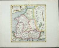
réf. 6086Amsterdam: R & J Wetstenii & G Smith. 1578-1730. No binding. Very Good. 360 x 460 mm. a fine example in recent wash colour. Gerard Mercator's edition of Ptolemy's 'Geography' is highly acclaimed; he spent much of his life studying the work and even engraved the plates himself. The 'Geographia' is the earliest surviving geographical treatise. Much of Mercator's efforts were spent projecting Ptolemy's geography onto the projection which bears his name. Mercator is one of the world's greatest cartographers and the 'Claudii Ptolemaei Tabulae Geographicae Orbis Terrarum' was first published in 1578. This map of south eastern Europe is centred on the River Danube and is in the third state with the addition of a latitude and longitude grid illustrating the projection. Koeman 1967-70 Me 5; Nordenskiold 1979 234; Phillips 1909- 384; Shirley 2004 T.Ptol-11a & 11k; Tibor 1987 73; Van der Krogt P. 1997-2010 1:501. R & J Wetstenii & G Smith. 1578-[1730] unknown
réf. 6085Amsterdam: R & J Wetstenii & G Smith. 1578-1730. No binding. Very Good. 350 x 430 mm. in recent wash colour and very good condition. Gerard Mercator's edition of Ptolemy's 'Geography' is highly acclaimed; he spent much of his life studying the work and even engraved the plates himself. The 'Geographia' is the earliest surviving geographical treatise. Much of Mercator's efforts were spent projecting Ptolemy's geography onto the projection which bears his name. Mercator is one of the world's greatest cartographers and the 'Claudii Ptolemaei Tabulae Geographicae Orbis Terrarum' was first published in 1578. This map of north eastern Europe and Russia is in the third state with the addition of a latitude and longitude grid illustrating the projection. With an attractive scene of a camp upper right. The map extends southwards to the Black Sea. Koeman 1967-70 Me 5; Nordenskiold 1979 234; Phillips P.L. 1909- 384; Shirley 2004 T.Ptol-11a & 11k; Van der Krogt P. 1997-2004 1:501. R & J Wetstenii & G Smith. 1578-[1730] unknown
réf. 6092Amsterdam: R & J Wetstenii & G Smith. 1578-1730. No binding. Very Good. 310 x 460 mm. a fine example in recent wash colour. Gerard Mercator's edition of Ptolemy's 'Geography' is highly acclaimed; he spent much of his life studying the work and even engraved the plates himself. The 'Geographia' is the earliest surviving geographical treatise. Much of Mercator's efforts were spent projecting Ptolemy's geography onto the projection which bears his name. Mercator is one of the world's greatest cartographers and the 'Claudii Ptolemaei Tabulae Geographicae Orbis Terrarum' was first published in 1578. This map shows the northern half of Africa with the equator displayed prominently is in the third state with the addition of a latitude and longitude grid illustrating the projection. The source of the Nile River is also highlighted. Koeman Me 5; Nordenskiold 234; Phillips P.L. Atlases 384; Shirley BL T.Ptol-11a & 11k; Van der Krogt P. Atlantes 1:501. R & J Wetstenii & G Smith. 1578-[1730] unknown
réf. 6101Amsterdam: R & J Wetstenii & G Smith. 1578-1730. No binding. Very Good. 350 x 470 mm. a fine example in recent wash colour. Gerard Mercator's edition of Ptolemy's 'Geography' is highly acclaimed; he spent much of his life studying the work and even engraved the plates himself. The 'Geographia' is the earliest surviving geographical treatise. Much of Mercator's efforts were spent projecting Ptolemy's geography onto the projection which bears his name. Mercator is one of the world's greatest cartographers and the 'Claudii Ptolemaei Tabulae Geographicae Orbis Terrarum' was first published in 1578. This map centres on India although there is not much of a peninsula. Its presence can be determined by the Indus and Ganges Rivers on the left and right respectively. Sri Lanka can be seen at the bottom of the map. It is in the third state with the addition of a latitude and longitude grid illustrating the projection. Not in Gole; Koeman Me 5; Nordenskiold 234; Phillips P.L. Atlases 384; Shirley BL T.Ptol-11a & 11k; Van der Krogt P. Atlantes 1:501. R & J Wetstenii & G Smith. 1578-[1730] unknown
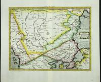
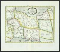
réf. 6096Amsterdam: R & J Wetstenii & G Smith. 1578-1730. No binding. Very Good. 340 x 460 mm. a fine example in recent wash colour. Gerard Mercator's edition of Ptolemy's 'Geography' is highly acclaimed; he spent much of his life studying the work and even engraved the plates himself. The 'Geographia' is the earliest surviving geographical treatise. Much of Mercator's efforts were spent projecting Ptolemy's geography onto the projection which bears his name. Mercator is one of the world's greatest cartographers and the 'Claudii Ptolemaei Tabulae Geographicae Orbis Terrarum' was first published in 1578. This map of Persia or modern day Iran is in the third state with the addition of a latitude and longitude grid illustrating the projection. Ala'i Cyrus. 2003. 'Mapping Persia: A brief introduction' in IMCoS Journal 94 pp. 5-22; Koeman Me 5; Nordenskiold 234; Phillips P.L. Atlases 384; Shirley BL T.Ptol-11a & 11k; Van der Krogt P. Atlantes 1:501. R & J Wetstenii & G Smith. 1578-[1730] unknown
réf. 6080Amsterdam: R & J Wetstenii & G Smith. 1578-1730. No binding. Very Good. 340 x 400 mm. a fine example in recent wash colour. Gerard Mercator's edition of Ptolemy's 'Geography' is highly acclaimed; he spent much of his life studying the work and even engraved the plates himself. The 'Geographia' is the earliest surviving geographical treatise. Much of Mercator's efforts were spent projecting Ptolemy's geography onto the projection which bears his name. Mercator is one of the world's greatest cartographers and the 'Claudii Ptolemaei Tabulae Geographicae Orbis Terrarum' was first published in 1578. This map of France is in the third state with the addition of a latitude and longitude grid illustrating the projection. Koeman 1967-70 Me 5; Nordenskiold 234; Phillips P.L. Atlases 384; Shirley 2004 T.Ptol-11a & 11k; Van der Krogt P. Atlantes 1:501. R & J Wetstenii & G Smith. 1578-[1730] unknown
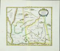
réf. 6099Amsterdam: R & J Wetstenii & G Smith. 1578-1730. No binding. Very Good. 350 x 410 mm. a fine example in recent wash colour. Gerard Mercator's edition of Ptolemy's 'Geography' is highly acclaimed; he spent much of his life studying the work and even engraved the plates himself. The 'Geographia' is the earliest surviving geographical treatise. Much of Mercator's efforts were spent projecting Ptolemy's geography onto the projection which bears his name. Mercator is one of the world's greatest cartographers and the 'Claudii Ptolemaei Tabulae Geographicae Orbis Terrarum' was first published in 1578. This map focuses on the region covering part of the silk route to China. Along this path rode much of Asia's spices to Europe. It is adorned with camels and camps of traders en route. It is in the third state with the addition of a latitude and longitude grid illustrating the projection. Koeman Me 5; Nordenskiold 234; Phillips P.L. Atlases 384; Shirley BL T.Ptol-11a & 11k; Van der Krogt P. Atlantes 1:501. R & J Wetstenii & G Smith. 1578-[1730] unknown
réf. 6100Amsterdam: R & J Wetstenii & G Smith. 1578-1730. No binding. Very Good. 350 x 400 mm. a fine example in recent wash colour. Gerard Mercator's edition of Ptolemy's 'Geography' is highly acclaimed; he spent much of his life studying the work and even engraved the plates himself. The 'Geographia' is the earliest surviving geographical treatise. Much of Mercator's efforts were spent projecting Ptolemy's geography onto the projection which bears his name. Mercator is one of the world's greatest cartographers and the 'Claudii Ptolemaei Tabulae Geographicae Orbis Terrarum' was first published in 1578. This map centres on present day Pakistan with the Indus River prominent. Upper right can be seen the Himalayan Mountains. It is in the third state with the addition of a latitude and longitude grid illustrating the projection. Koeman Me 5; Nordenskiold 234; Phillips P.L. Atlases 384; Shirley BL T.Ptol-11a & 11k; Van der Krogt P. Atlantes 1:501. R & J Wetstenii & G Smith. 1578-[1730] unknown
réf. 6094Amsterdam: R & J Wetstenii & G Smith. 1578-1730. No binding. Very Good. 360 x 460 mm. a fine example in recent wash colour. Gerard Mercator's edition of Ptolemy's 'Geography' is highly acclaimed; he spent much of his life studying the work and even engraved the plates himself. The 'Geographia' is the earliest surviving geographical treatise. Much of Mercator's efforts were spent projecting Ptolemy's geography onto the projection which bears his name. Mercator is one of the world's greatest cartographers and the 'Claudii Ptolemaei Tabulae Geographicae Orbis Terrarum' was first published in 1578. This map focuses on the Caucasus and modern day Russia is in the third state with the addition of a latitude and longitude grid illustrating the projection. It displays the Crimean Peninsula lower left and the Caspian Sea lower right. Koeman Me 5; Nordenskiold 234; Phillips P.L. Atlases 384; Shirley BL T.Ptol-11a & 11k; Van der Krogt P. Atlantes 1:501. R & J Wetstenii & G Smith. 1578-[1730] unknown
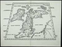
réf. 7407Lyon: 1522-41. No binding. Very Good. 295 x 410 mm. in very good condition. A very attractive early map of the British Isles projected in a trapezoidal style with rivers and towns noted with Latin text on the verso. The author of the map is Laurent Fries a physician and geographer from Alsace. It is derived from that of Martin Waldseemuller published in Strasbourg in 1513. First published in 1522 by now Lorenz Fries had died. The blocks found their way into the possession of Melchoir and Gaspar Treschel. This edition was published in Lyon but printed in Vienne. Karrow 1993 16 c. 28/2; Nordenskiold Collection 1979 211 no. 1; Pastoureau 1984 Ptolemee F 1541 no. 2; Shirley 1991 nos. 15 & 30; Shirley 2004 T.Ptol 7g. 1522-[41] unknown
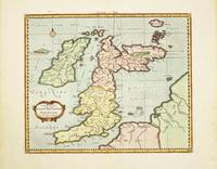
réf. 10520Amsterdam: R & J Wetstenii & G Smith. 1578-1730. No binding. Very Good. 340 x 400 mm. recent wash colour in good condition. Gerard Mercator's edition of Ptolemy's 'Geography' is highly acclaimed; he spent much of his life studying the work and even engraved the plates himself. The 'Geographia' is the earliest surviving geographical treatise. Much of Mercator's efforts were spent projecting Ptolemy's geography onto the projection which bears his name. Mercator 1512-94 is one of the world's greatest cartographers and the 'Claudii Ptolemaei Tabulae Geographicae Orbis Terrarum' was first published in 1578. This map of the British Isles is in the third state with the addition of a latitude and longitude grid illustrating the projection. Provenance: Doreen Green 1999. Koeman Me 5; Nordenskiold 234; Phillips P.L. Atlases 384; Shirley BI 123; Shirley BL T.Ptol-11a & 11k; Van der Krogt P. Atlantes 0901:1.2. R & J Wetstenii & G Smith. 1578-[1730] unknown
réf. 9641Amsterdam: 1578-1695. No binding. Very Good. 340 x 460 mm. in full recent wash colour good condition. Gerard Mercator's edition of Ptolemy's 'Geography' is highly acclaimed; he spent much of his life studying the work and even engraved the plates himself. The 'Geographia' is the earliest surviving geographical treatise. Much of Mercator's efforts were spent projecting Ptolemy's geography onto the projection which bears his name. Mercator is one of the world's greatest cartographers and the 'Claudii Ptolemaei Tabulae Geographicae Orbis Terrarum' was first published in 1578. This map of Persia or modern day Iran is in the scond state before the addition of a latitude and longitude grid illustrating the projection. Ala'i Cyrus. 2003. 'Mapping Persia: A brief introduction' in IMCoS Journal 94 pp. 5-22; Koeman Me 5; Nordenskiold 234; Phillips P.L. Atlases 384; Shirley BL T.Ptol-11a; Van der Krogt P. Atlantes 1:501. 1578-[1695] unknown