JM Ashmand Claudius Ptolemy J MBiblio.com

296 résultats
réf. 658618765Rowman & Littlefield Publishers Incorporated . Papeback. New. Rowman & Littlefield Publishers, Incorporated unknown
2008réf. ABE-1712239321266Dorling Kindersley 2008 Superb copy of a stunning book. Award winning architect and historian Ptolemy Dean has packed so much into this heavy and large sized book. Clean and tight no owner marks looks new and unread. 1st Edition. Hardcover. As New. Dorling Kindersley hardcover
réf. 1108063667.Gpaperback. Good. Access codes and supplements are not guaranteed with used items. May be an ex-library book. paperback
réf. PJH25659Ashgate 1999. Near Fine in publishers cloth in VG very slighty edgeworn dustjacket. 204pp. Illustrated throughout. 1st edition. ISBN 1840142936 Ashgate 1999 hardcover
2017réf. 131308Ann Arbor MI: William L. Clements Library 2017. hardcover dust jacket. 8.75 x 11 inches. hardcover dust jacket. 230 pages. "A handsome and well-illustrated book on a worthwhile subject at a reasonable price. Graffagnino Austin Ptolemy and Dunnigan shed light on sixteen fascinating figures whose contribution to our understanding of American History is inestimable and often underrated. I have a hard time finding fault with The Pioneer Americanists except to wish it were twice as long." - William Butts Manuscripts The Pioneer Americanists is a captivating look at the lives and careers of eight generations of outstanding Americanists prior to 1900. Here are autobiographical and contemporary biographical sketches of White Kennett Isaiah Thomas James Lenox Joseph Sabin John Carter Brown Lyman Copeland Draper George Brinley Jr. and the other noteworthy specialists who created and nurtured the Americana field from the late seventeenth through the nineteenth centuries. Illustrations from the remarkable collections of the William L. Clements Library and other leading institutional archives complement the texts to provide a panoramic window on the early story of Americana appreciation collecting and description. Anyone with a professional or avocational interest in antiquarian Americana will find The Pioneer Americanists a fascinating treasury of information enlightenment and inspiration. William L. Clements Library unknown
réf. 45118797-nnew. unknown
réf. 46530570-nnew. unknown
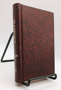
1786réf. 019210London UK: M. Sibley 1786. Second Edition. Hardcover. Very Good. 219pp; Handsomely rebound in textured maroon boards with gilt titling to spine boards square clean & bright previous owner's name to title page pages lightly age-toned text unmarked binding is tight VG condition. Scarce antique volume on astrology originally written in Greek by Claudius Ptolemy c. 100-170s AD a Greco-Roman mathematician astronomer astrologer geographer and music theorist. This edition translated by John Whalley 1653-1724 "professor of physic and astrology and others" but with a reputation as a notorious Irish quack. The original Greek title was Tetrabiblos the Latin title was Quadripartitum and the volume is also known as Apotelesmatika. M. Sibley hardcover
réf. 1108063659.Gpaperback. Good. Access codes and supplements are not guaranteed with used items. May be an ex-library book. paperback
réf. 46661161-nnew. unknown
réf. 0754639266.Ghardcover. Good. Access codes and supplements are not guaranteed with used items. May be an ex-library book. hardcover
réf. 1405329637.Ghardcover. Good. Access codes and supplements are not guaranteed with used items. May be an ex-library book. hardcover
réf. 39726Philadelphia University of Pennsylvania Press 1997. . 8vo. pp.x310 grey cloth silver lettering; slight dusting to upper edge of text block otherwise near-fine in a very good unclipped dust-jacket which is lightly creased. Philadelphia, University of Pennsylvania Press, 1997. hardcover
2008réf. 042267London: Dorling Kindersley 2008. 1st Edition. Hardcover. As New/No Dust Jacket. quarto. 1st printing. An unread book in an as new condition. Dorling Kindersley hardcover
2024réf. __0903696746Hurtwood Pr Ltd 2024. Hardcover. New. 208 pages. 11.50x9.25x9.09 inches. Hurtwood Pr Ltd hardcover
réf. 62323Paris chez Cardin Besongne 1640 - reprint en fac-simile - Loge Astrologique de France 1985 In-12 xix-465pp. un des 300 exemplaires numerotes unknown
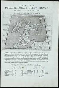
réf. 11760Venice: 1597. No binding. Very Good. 135 x 170 mm. printed on a leaf of text light paper imperfection in the text below otherwise in good condition. A new edition of Ptolemy's 'Geography' was edited by Giovanni Antonio Magini 1555-1617 a noted geographer from Padua. Published in Venice a second edition appeared in 1598 from which this appears. It contains this Ptolemaic map of the British Isles with that of the Iberian peninsula on the verso. The neatly engraved copper plates are attributed to Girolamo Porro 1520-1604 also from Padua. The atlas was first published in a smaller format in Venice 1596. It was closely copied in the following year by Petrus Keschedt in Cologne in a work which contained a whole new set of engraved plates. Many references incorrectly state that the two editions contain the same plates. Magini famously produced the first atlas of Italy which was published posthumously by his son Fabio in 1620. Nordenskiöld 1979 no. 227; Nordenskiöld 1889 p. 27; Phillips 1909- no. 405; Shirley 2004 T.Ptol 12b; Tooley's Dictionary 1999-2004. 1597 unknown
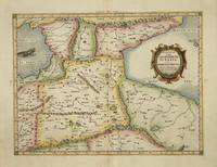
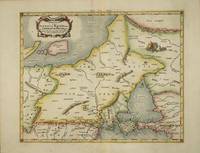
réf. 4017Utrecht: Francois Halma. 1578-c.1695. No binding. Very Good. 350 x 460 mm. a fine example in modern wash colour. From Gerard Mercator's edition of 'Claudii Ptolemaei Tabulae Geographicae Orbis Terrarum'. It was in 1578 that one of the world's greatest cartographers put out an edition of the earliest surviving geographical treatise. This map is centred on Armenia and shows the Black Sea and Caspian Sea to the west and east respectively. Koeman Me 5; Nordenskiold 234; Phillips P.L. Atlases 384; Shirley BL T.Ptol-11a & 11k; Van der Krogt P. Atlantes 1:501. Francois Halma. 1578-[c.1695] unknown
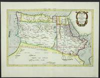
réf. 5206Utrecht: Francois Halma. 1578-c.1695. No binding. Very Good. 310 x 470 mm. in fine modern wash colour and in good condition. From Gerard Mercator's edition of 'Claudii Ptolemaei Tabulae Geographicae Orbis Terrarum'. It was in 1578 that one of the world's greatest cartographers put out an edition of the earliest surviving geographical treatise. This map shows the northern half of Africa with the equator displayed prominently. The source of the Nile River is also highlighted with a mountain range feeding two large lakes. An interesting feature is the Niger River in 'Libya' which is prominent across the map with its source in numerous lakes. During its course to the sea it disappears under a mountain range arising the other side. Although Mercator is most renowned today for the projection he popularised and for first using the term 'atlas' for a collection of maps he devoted much of his life to his Ptolemaic maps. The maps were beautifully engraved as nearly as possible to their original form and are the most decorative of Ptolemaic maps. Koeman Me 5; Nordenskiold 234; Phillips P.L. Atlases 384; Shirley BL T.Ptol-11a & 11k; Van der Krogt P. Atlantes 1:501. Francois Halma. 1578-[c.1695] unknown
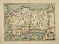
réf. 4025Utrecht: Francois Halma. 1578-c.1695. No binding. Very Good. 340 x 460 mm. a fine example in recent wash colour in good condition. From Gerard Mercator's edition of 'Claudii Ptolemaei Tabulae Geographicae Orbis Terrarum'. It was in 1578 that one of the world's greatest cartographers put out an edition of the earliest surviving geographical treatise. This map shows Ptolemaic Asia Minor or modern day Turkey. A prominent Cyprus is found as are the Greek Islands of Lesbos and Rhodes. Koeman Me 5; Nordenskiold 234; Phillips P.L. Atlases 384; Shirley BL T.Ptol-11a & 11k; Van der Krogt P. Atlantes 1:501. Francois Halma. 1578-[c.1695] unknown
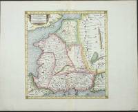
réf. 4019Utrecht: Francois Halma. 1578-c.1695. No binding. Very Good. 350 x 430 mm. in recent wash colour in good condition. From Gerard Mercator's edition of 'Claudii Ptolemaei Tabulae Geographicae Orbis Terrarum'. It was in 1578 that one of the world's greatest cartographers put out an edition of the earliest surviving geographical treatise. This map shows north eastern Europe and Russia. With an attractive scene of a camp upper right. The map extends southwards to the Black Sea. Koeman Me 5; Nordenskiold 234; Phillips P.L. Atlases 384; Shirley BL T.Ptol-11a & 11k; Van der Krogt P. Atlantes 1:501. Francois Halma. 1578-[c.1695] unknown
réf. 4032Utrecht: Francois Halma. 1578-c.1695. No binding. Very Good. 340 x 400 mm. a fine example in modern wash colour. From Gerard Mercator's edition of 'Claudii Ptolemaei Tabulae Geographicae Orbis Terrarum'. It was in 1578 that one of the world's greatest cartographers put out an edition of the earliest surviving geographical treatise. Ptolemy's image of France as seen through the eyes of Mercator. Koeman Me 5; Nordenskiold 234; Phillips P.L. Atlases 384; Shirley BL T.Ptol-11a & 11k; Van der Krogt P. Atlantes 1:501. Francois Halma. 1578-[c.1695] unknown
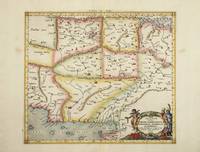
réf. 4023Utrecht: Francois Halma. 1578-c.1695. No binding. Very Good. 350 x 470 mm. a fine example in modern wash colour. From Gerard Mercator's edition of 'Claudii Ptolemaei Tabulae Geographicae Orbis Terrarum'. It was in 1578 that one of the world's greatest cartographers put out an edition of the earliest surviving geographical treatise. This map centres on India although there is not much of a peninsula. Its presence can be determined by the Indus and Ganges Rivers on the left and right respectively. Sri Lanka can be seen at the bottom of the map. Koeman Me 5; Nordenskiold 234; Phillips P.L. Atlases 384; Shirley BL T.Ptol-11a & 11k; Van der Krogt P. Atlantes 1:501. Francois Halma. 1578-[c.1695] unknown
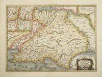
réf. 4022Utrecht: Francois Halma. 1578-c.1695. No binding. Very Good. 350 x 400 mm. a fine example in recent wash colour in good condition. From Gerard Mercator's edition of 'Claudii Ptolemaei Tabulae Geographicae Orbis Terrarum'. It was in 1578 that one of the world's greatest cartographers put out an edition of the earliest surviving geographical treatise. This map centres on present day Pakistan with the Indus River prominent. Upper right can be seen the Himalayan Mountains. Koeman Me 5; Nordenskiold 234; Phillips P.L. Atlases 384; Shirley BL T.Ptol-11a & 11k; Van der Krogt P. Atlantes 1:501. Francois Halma. 1578-[c.1695] unknown
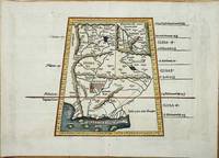
réf. 8022Lyon: Melchoir and Gaspar Treschel. 1522-35. No binding. Good. 315 x 450 mm. with recent wash colour two minor stitch holes due to binding both repaired otherwise in good condition. An attractive map of Ptolemaic Pakistan and Afghanistan. It is projected in a trapezoidal style with extensive rivers and mountain ranges. With Latin text on the verso. Laurent Fries produced the woodblocks for this 1535 edition of Ptolemy's Geography. By now Fries whose maps were first issued in the 1522 edition had died. The wood blocks found their way into the possession of Melchoir and Gaspar Treschel. For this edition published in Lyon the brothers asked Michael Servetus to re-edit the text. Karrow 1993 28.24; Nordenskiold 1979 209; Pastoureau 1984 Ptolemee E 1535; Shirley 2004 T.Ptol 7d. Melchoir and Gaspar Treschel. 1522-[35] unknown