345 résultats
1948réf. 310LE CAIRE. IMPRIMERIE DE L'IFAO. 1948. IN-8 BROCHE DE VI + 84 PAGES, COUVERTURE GRISE, TITRE IMPRIME EN ROUGE ET NOIR. ILLUSTRE DE 14 FIGURES ET DE 16 PLANCHES HORS-TEXTE DONT 2 REPLIEES. (SUPPLEMENT AUX ANNALES DU SERVICE DES ANTIQUITES DE L' EGYPTE. CAHIER NUMERO 12). BEL EXEMPLAIRE.
2019réf. __1783274204Boydell and Brewer 2019. Hardcover. New. 385 pages. 9.50x6.50x1.25 inches. Boydell and Brewer hardcover

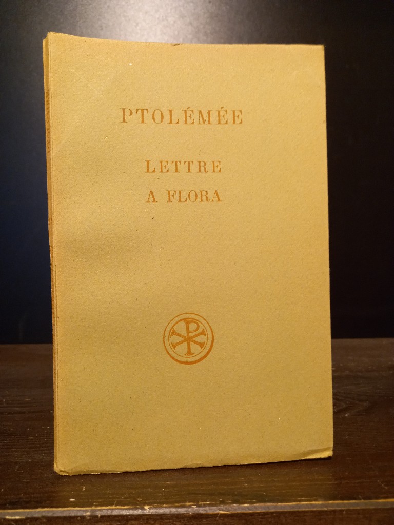
1955réf. 2143888Paris: Éditions du Cerf ohne Jahr (ca. 1955). 100, (4) Seiten. Unbeschnitten. 8° (19,5 x 13 cm). Orig.-Broschur. [Softcover / Paperback].
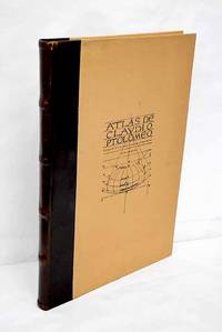
1983réf. 3638099Valencia.: Vicent García. 1983. Hardcover. Falta el facsimil con los mapas . Good. 46 cm. 1 v. il. col. map. col. Encuadernación en tapa dura de editorial holandesa. Libro de estudios del facsimil. Introducción por Víctor Navarro Brotóns ; traducción y notas por Angel Aguirre Alvarez Víctor Navarro Brotóns y Enrique Rodríguez Galdeano. Tít. de la cub. : Atlas de Claudio Ptolomeo . Falta el facsimil con los mapas . ISBN: 8485094352 v.1 Geografía del mundo antiguo. Geografía regional en general. Geografía universal 913.1"01" Mapas. Atlas geográficos. Globos terráqueos 912100:528.9:091.07 Vicent García. hardcover
1535réf. M6976Lyons: Melchior & Gaspar Trechsel c. 1535. Very Good;. Notes: No text on verso. This is based on Waldseemuller's map Norwich 286 with borders and ornaments by Holbein and Graf. The reissued map includes six kings seated on their thrones a rhinoceros a cyclops and two oxen. "As northern Africa was better known than southern Africa at that period it has more geographical information in the interior. Various kingdoms are described with a multitude of coastal names and as with the southern part . these are placed within the coastline. The Mediterranean and Red Seas are prominently featured as well as a number of islands on the northwest coast -- Madeira the Canaries etc. -- which at that time were already well known to the Portuguese in their initial efforts to discover a route to the Indies." Norwich Size : 320x400 mm 12.60x15.75 Inches Coloring: Black & White Reference: Norwich 286 Category: Maps Africa North; Melchior & Gaspar Trechsel unknown
2026réf. LRB1008121Paris: Editions Recreasoft 2026 Rilegatura rigida. Lingua: Italiano. Circa 882 pagine. Italiano : Ristampa su richiesta. Edizione originale : 1599. Opera fondamentale della tradizione geografica tolemaica con le esposizioni e le introduttioni di Girolamo Ruscelli e la descrizione universale di Gioseppe Rosaccio. L'ouvrage réunit un important ensemble de cartes géographiques gravées sur cuivre des index et un apparat savant qui témoignent de l'intérêt renaissant pour la cosmographie la géographie ancienne et la représentation du monde. L'édition est recherchée pour la richesse de ses cartes et pour sa place dans l'histoire de la géographie italienne. Immagini del libro non contrattuali English : Print-on-demand reprint. Original edition : 1599. A fundamental work in the Ptolemaic geographical tradition with the expositions and introductory material by Girolamo Ruscelli and the universal description by Gioseppe Rosaccio. The volume brings together an important series of engraved maps indexes and scholarly apparatus reflecting Renaissance interest in cosmography ancient geography and the representation of the world. This edition is especially valued for the quality and number of its maps and for its place in the history of Italian geography. Book images are non-contractual. Editions Recreasoft. Softcover. New. Editions Recreasoft paperback
2026réf. LRB1012711Paris: Editions Recreasoft 2026 Langue : Latin. Environ 476 pages. Printed on premium paper. Français : Réimpression à la demande. Édition originale : 1525. Édition latine des huit livres de la Géographie de Claude Ptolémée accompagnée des cartes gravées qui ont fait la renommée de cet atlas fondamental de la cartographie de la Renaissance. L'ouvrage présente un texte en double colonne un titre dans un encadrement gravé et un ensemble de cartes dont la plupart sont numérotées avec un intérêt particulier pour les premières représentations de l'Amérique dans l'histoire de la cartographie. Ensemble recherché pour l'étude de la géographie antique de la transmission humaniste du texte ptoléméen et de l'illustration cartographique du XVIe siècle. Images du livre non contractuelles English : Print-on-demand reprint. Original edition : 1525. Latin edition of the eight books of Claudius Ptolemy's Geography accompanied by the engraved maps that made this Renaissance atlas a landmark in the history of cartography. The work features text in double columns a title within an engraved architectural border and a set of maps most of which are numbered with particular interest for the early depictions of America in the history of mapmaking. A desirable item for the study of ancient geography the humanist transmission of Ptolemaic texts and 16th-century cartographic illustration. Book images are non-contractual. Editions Recreasoft. Softcover. New. Editions Recreasoft paperback
1985réf. 72190Franklin Center PA: The Franklin Library 1985. Franklin Library Limited Edition. Leather Bound. Very Good. 1085pp. Octavo 24 cm Full brown leather with four raised bands. Gilt stamped title on spine. Gilt stamped designs on the spine and covers. All edges gilt. Moire endpapers. Silk ribbon page-marker. Text in English. Previous owner's circular blind embossed stamp is present on many of the preliminary and terminal pages and on several of the pages throughout the text as well-otherwise this is a nice clean and sharp copy. Published exclusively for subscribers to the 25th Anniversary Limited Edition of The Great Books of the Western World. The Franklin Library unknown books
1985réf. 72190Franklin Center PA: The Franklin Library 1985. Franklin Library Limited Edition. Leather Bound. Very Good. 1085pp. Octavo 24 cm Full brown leather with four raised bands. Gilt stamped title on spine. Gilt stamped designs on the spine and covers. All edges gilt. Moire endpapers. Silk ribbon page-marker. Text in English. Previous owner's circular blind embossed stamp is present on many of the preliminary and terminal pages and on several of the pages throughout the text as well-otherwise this is a nice clean and sharp copy. Published exclusively for subscribers to the 25th Anniversary Limited Edition of The Great Books of the Western World. The Franklin Library unknown
2026réf. LRB559885Paris: Editions Recreasoft 2026 Sprache: Deutsch. Ca. 506 Seiten. Deutsch : Nachdruck auf Anfrage. Originalausgabe : 1912-13. Wissenschaftlich bedeutende Ausgabe eines klassischen astronomischen Textes des Claudius Ptolemäus in deutscher Bearbeitung. Das Werk bietet einen wichtigen Zugang zur antiken Astronomie zur Überlieferungsgeschichte und zur philologischen Erschließung der ptolemäischen Schriften. Besonders interessant für Sammler Historiker der Naturwissenschaften und Leser mit Interesse an der Geschichte der Astronomie. Buchbilder sind unverbindlich English : Print-on-demand reprint. Original edition : 1912-13. Scientifically important edition of a classical astronomical text by Claudius Ptolemy in German form. The work provides a valuable introduction to ancient astronomy to the transmission of the text and to the philological study of the Ptolemaic writings. Of particular interest to collectors historians of science and readers interested in the history of astronomy. Book images are non-contractual. Editions Recreasoft. Softcover. New. Editions Recreasoft paperback
2026réf. LRB1017693Paris: Editions Recreasoft 2026 Langue : Latin. Environ 458 pages. Printed on premium paper. Français : Réimpression à la demande. Édition originale : 1540. Édition latine monumentale de la Géographie de Ptolémée revue et enrichie par Sebastian Münster. L'ouvrage présente huit livres consacrés à la description du monde antique et moderne accompagnés de cartes gravées sur bois et de notices explicatives imprimées sur le premier feuillet de chaque carte. C'est un témoignage majeur de la géographie humaniste de la Renaissance et de l'histoire de la cartographie. Images du livre non contractuelles English : Print-on-demand reprint. Original edition : 1540. Monumental Latin edition of Ptolemy's Geography revised and expanded by Sebastian Münster. The work contains eight books on the description of the ancient and modern world with woodcut maps and explanatory texts printed on the first leaf of each map. It is a major witness to Renaissance humanist geography and the history of cartography. Book images are non-contractual. Editions Recreasoft. Softcover. New. Editions Recreasoft paperback
2026réf. LRB1010972Paris: Editions Recreasoft 2026 Lingua: Italiano. Circa 734 pagine. Italiano : Ristampa su richiesta. Edizione originale : 1562. Celebre edizione veneziana della Geografia di Tolomeo rivista e annotata da Giuseppe Moleti. L'opera riunisce il testo geografico classico con un insieme di carte incise su rame qui nella tradizione delle edizioni italiane del Rinascimento. Grande interesse per la storia della cartografia delle scienze esatte e dell'editoria umanistica del XVI secolo. Immagini del libro non contrattuali English : Print-on-demand reprint. Original edition : 1562. Celebrated Venetian edition of Ptolemy's Geography revised and annotated by Giuseppe Moleti. The work brings together the classical geographical text with a set of copper-engraved maps here in the tradition of Italian Renaissance editions. Of major interest for the history of cartography the exact sciences and sixteenth-century humanist publishing. Book images are non-contractual. Editions Recreasoft. Softcover. New. Editions Recreasoft paperback
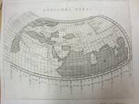
1597réf. M7073Venice 1597. Very Good; a tear in the lower margin not effecting the map. Notes: Ptolemaic map following the classical format. The Indian Ocean is landlocked with a continuous coastline joining Africa to South East Asia. Toprobana present day Sri Lanka is a very large island in the Indian Ocean and the Indian sub-continent is completely missing although the Ganges river is shown. The Mediterranean is well depicted but greatly exaggerated in length. In Africa the Nile is shown originating in mountains below the Equator. Finely engraved in the Italian style with a stippled sea by Girolamo Porro. The map is on a full sheet of Italian text. Italian text on verso. Size : 138x178 mm 5.43x7.01 Inches Coloring: Black & White Reference: Shirley #193. Category: Maps World; unknown
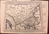
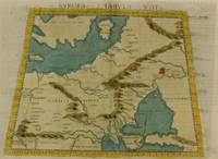
1513réf. M8825Strasburg: Martin Waldseemuller c. 1513. Excellent. Notes: StolenA fine and strong impression of this rare map of Eastern Europe from the 1513 edition of Waldseemüller's modern atlas Geographia. The verso is blank. The watermark is similar to fleur de lis sitting on a multi headed star. Large Ptolemaic map depicting Europe and Balkan from the Adriatic Sea to the Black Sea. The Atlas ' GEOGRAPHIE OPUS NOVISSIMA TRADUCTIONE E GRECORUM ARCHETYPIS ' one of the most important edition of Ptolemy Atlases.was published by Johannes Schott in Strasburg 1513. Size : 434x618 mm 17.09x24.33 Inches Coloring: Black & White Category: Maps Europe Greece Macedonia; Maps Europe Balkans; Maps Europe Romania; Maps Europe Hungary; Martin Waldseemuller unknown
1813réf. 1346487Paris: Chez Henri Grand 1813 1816. First French Edition. Hardcover. Octavo Two Volumes. In Very Good condition. Bound in full 20th-century red library bindings with gilt lettering to spine. Boards show mild shelf wear and soiling. Very mild age toning to text blocks. Facing text in Greek and French. Contains mathematical diagrams. Shelved in Case 10. 1346487. Shelved Dupont Bookstore. Chez Henri Grand hardcover books
1813réf. 1346487Paris: Chez Henri Grand 1813 1816. First French Edition. Hardcover. Octavo Two Volumes. In Very Good condition. Bound in full 20th-century red library bindings with gilt lettering to spine. Boards show mild shelf wear and soiling. Very mild age toning to text blocks. Facing text in Greek and French. Contains mathematical diagrams. Shelved in Case 10. 1346487. Shelved Dupont Bookstore. Chez Henri Grand hardcover
1574réf. M7264Venice: Ruscelli c. 1574. Very Good;. Notes: Italian text on verso. Girolamo Ruscelli 1518–1566 was an Italian mathematician and cartographer active in Venice during the early 16th century. Ruscelli is best known for his important revision of Ptolemy's Geographia published posthumously in 1574. Size : 190x265 mm 7.48x10.43 Inches Coloring: Hand Colored Category: Maps Russia; Maps Europe Ukraine; Maps Europe Poland Lithuania; Ruscelli unknown
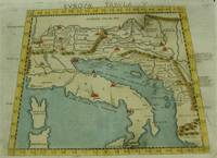
1574réf. M7262Venice: Ruscelli c. 1574. Very Good;. Notes: Italian text on verso. An early map of Italy the Adriatic Sea. Croatia Dalmatia Slovenia and Serbia beautifully hand coloured. Girolamo Ruscelli 1518–1566 was an Italian mathematician and cartographer active in Venice during the early 16th century. Ruscelli is best known for his important revision of Ptolemy's Geographia published posthumously in 1574. Size : 186x266 mm 7.32x10.47 Inches Coloring: Hand Colored Category: Maps Europe Italy; Maps Europe Balkans; Ruscelli unknown
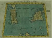
1574réf. M7263Venice: Ruscelli c. 1574. Very Good;. Notes: Italian text on verso. Early map of Sicily Malta and Sardinia beautifully hand coloured. Girolamo Ruscelli 1518–1566 was an Italian mathematician and cartographer active in Venice during the early 16th century. Ruscelli is best known for his important revision of Ptolemy's Geographia published posthumously in 1574. Size : 190x265 mm 7.48x10.43 Inches Coloring: Hand Colored Category: Maps Mediterranean Islands; Ruscelli unknown
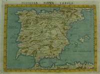
1561réf. M7270Venice: Ruscelli c. 1561. Very Good;. Notes: Italian text on verso. An early map of the Iberian Peninsula including Spain and Portugal beautifully hand coloured. Girolamo Ruscelli 1518–1566 was an Italian mathematician and cartographer active in Venice during the early 16th century. Ruscelli is best known for his important revision of Ptolemy's Geographia published posthumously in 1574. Size : 195x265 mm 7.68x10.43 Inches Coloring: Hand Colored Category: Maps Europe Spain;Maps Europe Portugal; Ruscelli unknown
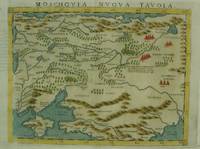
1574réf. M7269Venice: Ruscelli c. 1574. Very Good;. Notes: An early and fine map of European Russia beautifully hand coloured. Italian text on verso. Girolamo Ruscelli 1518–1566 was an Italian mathematician and cartographer active in Venice during the early 16th century. Ruscelli is best known for his important revision of Ptolemy's Geographia published posthumously in 1574. Size : 190x260 mm 7.48x10.24 Inches Coloring: Hand Colored Category: Maps Europe Ukraine; Maps Russia; Ruscelli unknown
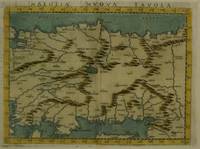
1574réf. M7280Venice: Ruscelli c. 1574. Very Good;. Notes: Italian text on verso. Girolamo Ruscelli 1518–1566 was an Italian mathematician and cartographer active in Venice during the early 16th century. Ruscelli is best known for his important revision of Ptolemy's Geographia published posthumously in 1574. Size : 189x260 mm 7.44x10.24 Inches Coloring: Hand Colored Category: Maps Asia Near East Turkey; Ruscelli unknown
1998réf. SKU0228145Princeton University Press 1998-10-19. Paperback. Good. Textbook May Have Highlights Notes and/or Underlining BOOK ONLY-NO ACCESS CODE NO CD Ships with Tracking Princeton University Press paperback
1998réf. Q-0691002606Princeton University Press 1998-10-19. Paperback. New. In shrink wrap. Looks like an interesting title! Princeton University Press paperback
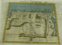
1574réf. M7260Venice: Ruscelli c. 1574. Very Good;. Notes: Italian text on verso. Girolamo Ruscelli 1518–1566 was an Italian mathematician and cartographer active in Venice during the early 16th century. Ruscelli is best known for his important revision of Ptolemy's Geographia published posthumously in 1574. Size : 189x261 mm 7.44x10.28 Inches Coloring: Hand Colored Category: Maps Africa North Egypt;Maps Africa North; Ruscelli unknown