346 résultats
2002réf. Q-0691092591Princeton University Press 2002-01-15. Paperback. New. New. In shrink wrap. Looks like an interesting title! Princeton University Press paperback
2001réf. x-0691092591Princeton Univ Pr 2001. Paperback. New. 216 pages. 10.00x7.00x0.75 inches. Princeton Univ Pr paperback
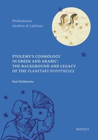
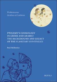
réf. 65014, Brepols, 2024 Hardback, 479 pages, Size:178 x 254 mm, Illustrations:10 b/w, 4 tables b/w., Language(s):English, Arabic.* NEW ISBN 9782503607177.
réf. 024392870X.Gpaperback. Good. Access codes and supplements are not guaranteed with used items. May be an ex-library book. paperback
réf. BN383845Ptolemy's Cosmology in Greek and Arabic. The Background and Legacy of the Planetary Hypotheses Ptolemy's Cosmology in Greek and Arabic. The Background and Legacy of the Planetary Hypotheses Ptolemy Paul Hullmeine ed unknown
2002réf. 0691092591_usedPrinceton University Press 2002-01-15. Paperback. Like New. 10x7x1. Princeton University Press paperback
2002réf. 0691092591_newPrinceton University Press 2002-01-15. Paperback. New. 10x7x1. Princeton University Press paperback
réf. 65014Brepols 2024. Hardback 479 pages Size:178 x 254 mm Illustrations:10 b/w 4 tables b/w. Languages:English Arabic. NEW ISBN 9782503607177. Summary Ptolemy's Almagest 2nd century AD is the most influential work of ancient and medieval astronomy. This work however does not tell us the full story about its author's views of the heavens. After completing the Almagest Ptolemy turned his attention to a physical investigation of celestial motions. The result is the Planetary Hypotheses a bold attempt to provide a celestial physics that coheres with the mathematical account of astronomical observations in his Almagest. This book provides the first complete critical edition and English translation of the Arabic version of the Planetary Hypotheses which is lost for the most part in its original Greek. It furthermore provides an extensive commentary on the whole work which situates the Planetary Hypotheses within the context of its time and investigates philosophical ideas central to the work. These include the epistemic value of mathematics relative to natural philosophy and the shape number and dynamics of the celestial bodies. The book also investigates the influence of the Planetary Hypotheses on a wide range of medieval Arabic astronomical and philosophical works from the 9th to the 13th century AD. The upshot is to establish the Planetary Hypotheses as a crucial text for understanding the history of philosophy and science from Greek antiquity to the Arabic Middle Ages TABLE OF CONTENTS I Introduction II Astronomy Natural Philosophy and the Physical Reality of the Celestial Bodies III The Dynamics of Celestial Motions IV Conclusion V The Arabic Version of the Planetary Hypotheses: Edition and Translation VI Commentary Glossary Bibliography Index Brepols 2024 hardcover
réf. 0691092591.Gpaperback. Good. Access codes and supplements are not guaranteed with used items. May be an ex-library book. paperback
2002réf. DADAX0691092591Princeton University Press 2002-01-15. New Ed. paperback. New. 7.00x0.50x10.00. Buy with confidence. Excellent Customer Service & Return policy. Princeton University Press paperback
réf. 1024022943.Ghardcover. Good. Access codes and supplements are not guaranteed with used items. May be an ex-library book. hardcover
réf. 1024026698.Gpaperback. Good. Access codes and supplements are not guaranteed with used items. May be an ex-library book. paperback
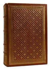
1985réf. 87932Franklin Center Pennsylvania: The Franklin Library 1985. Hardcover. Fine. 24 cm x 17 cm 1085 pp. Bound in full leather with AEG and ribbon insert. Moire end papers. This volume was published by The Franklin Library exclusively for subscribers as part of the 25th Anniversary Limited Edition of The Great Books of the Western World series. Includes Notes from the Editors pamphlet. The Franklin Library hardcover
1985réf. 204502Franklin Center Pennsylvania: Franklin Library 1985. First Edition; First Printing. Hardcover. Near Fine Leather Bound. Printed on archival paper with gilded edges. The endsheets are of moire fabric with a silk ribbon page marker. Smyth sewing and concealed muslin joints to ensure the highest quality binding. This book is in full leather with hubbed spines.; Great Books of the Western World. Franklin Library hardcover
1896réf. 000021169Glasgow: Hay Nisbet and Co. 1896. later edition. hardcover. Poor. Octavoapprox. 5 3/8" by 7 7/8" flexible brown leather covers xxvii 5 246 1 pages. Title page browned but the rest of the text is clean and unmarked. Repairs with linen tape at hinges as well as internally. Titling on paper spine label very faded. Mottling on covers damaged area at foot of spine and bottom of rear cover; no text is affected by the damage. 092717B Hay Nisbet and Co. hardcover
réf. 1016987803.Ghardcover. Good. Access codes and supplements are not guaranteed with used items. May be an ex-library book. hardcover
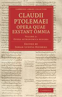
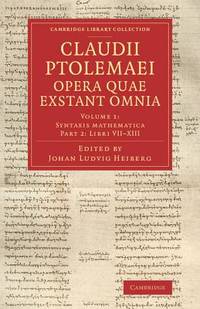
2014réf. mon0000002258Cambridge University Press 2014. Paperback. Very Good. Edges show some very very light shelf wear. Otherwise brand new. Cambridge University Press paperback
2014réf. mon0000015809Cambridge University Press 2014. Paperback. Very Good. Covers show some light flaring and shelf wear. Cambridge University Press paperback
1562réf. 220508Venice: Vincenzo Valgrisi 1562. hardcover. very good-. Venice: Vincenzo Valgrisi 1562. 2 parts with separate pagination. Short thick 4to bound in 19th century vellum with red edges. Features 64 double page maps: 27 Ptolemaic maps showing the ancient world as Ptolemy knew it including one world map 37 "modern" maps with two world maps and several woodcut diagrams illustrations and decorative initials. Text in Latin. Staining throughout affecting some of the maps. Title page cropped .5" at right margin. Bookplate of Otto Orren Fisher and ink inscription of Charles Singer. Giuseppe Moleto Josephus Moletius 1531-1588 was an Italian mathematician who based the text of this edition on the 1525 translation by Wilibald Pirckheimer. Moleto's draws upon Ruscelli's enlarged maps of his 1561 edition which in turn were based upon those by Jacopo Gastaldi. Moleto has also included some of Girolamo Ruscelli's innovations from his own edition: the double hemisphere world map and "Carta Marina Nuova Tavola" a rare sea chart of the world. Also from Ruscelli is a revised version of the Zeno map of the Arctic first published in 1558. The Zeno map describes the purported journey of the author's ancestors in the 1390s to Greenland Iceland the mythical islands of Frisland and Icaria and what is now thought to be Newfoundland and Labrador. While Zeno shows Greenland connected to Norway Ruscelli updated the map by eliminating this land bridge. Despite its inaccuracies and inclusion of mythical lands the Zeno map persisted as the prevailing map of the Arctic and Greenland for many years. Six other New World maps include the South American continent Brazil Central America and the Baja Peninsula the eastern coast of North America Cuba and Hispaniola. Moleto juxtaposes the Ptolemaic maps with the contemporary offering easy comparison between ancient and new. Claudius Ptolemy 90-168 CE was a Roman geographer and mathematician living in Egypt who compiled his knowledge and theories about the world's geography into one seminal work. Although his maps did not survive his mathematical projections and location coordinates did. During the Renaissance revival of Greek and Roman works "Geographia" was rediscovered by monks and based upon Ptolemy's detailed instructions the maps were recreated. The first printed edition of "Geographia" with maps was published in Bologna in 1477. A rare and exciting edition for any collector. Vincenzo Valgrisi unknown books
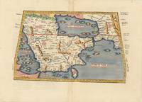
réf. 62979Vienna 1525-1541. Original woodcut Ptolemaic map of the Arabian Peninsula 40 x 55.5 cm with later hand-colouring; Latin title text and additional woodcut decorations to verso. Some minimal discrete paper repairs to upper portion of centrefold generally a very good copy. Early Ptolemaic woodblock map of the Arabian Peninsula here called Arabia Felix. The map is presented on a trapezoidal projection with parallels and meridians forerunners of lines of longitude and latitude enumerated in the borders. The map shows the Arabian Peninsula wider in the southeast and shows a somewhat distorted shape for the Arabian Gulf. Details include topography the major towns while the rivers and many islands are imaginary. This map is based on the slightly larger map from 1513 published in "Ptolemy's Geographia". The atlas was reprinted in 1520 1522 1525 1535 and 1541. This wood block was cut in 1525 for the publisher J.Grünninger. This being the variant of 1541 now without the banner title and wood cut ornaments on the verso. [Vienna, 1525-1541]. unknown
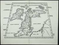
réf. 7407Lyon: 1522-41. No binding. Very Good. 295 x 410 mm. in very good condition. A very attractive early map of the British Isles projected in a trapezoidal style with rivers and towns noted with Latin text on the verso. The author of the map is Laurent Fries a physician and geographer from Alsace. It is derived from that of Martin Waldseemuller published in Strasbourg in 1513. First published in 1522 by now Lorenz Fries had died. The blocks found their way into the possession of Melchoir and Gaspar Treschel. This edition was published in Lyon but printed in Vienne. Karrow 1993 16 c. 28/2; Nordenskiold Collection 1979 211 no. 1; Pastoureau 1984 Ptolemee F 1541 no. 2; Shirley 1991 nos. 15 & 30; Shirley 2004 T.Ptol 7g. 1522-[41] unknown
1562réf. 220508Venice: Vincenzo Valgrisi 1562. hardcover. very good-. Venice: Vincenzo Valgrisi 1562. 2 parts with separate pagination. Short thick 4to bound in 19th century vellum with red edges. Features 64 double page maps: 27 Ptolemaic maps showing the ancient world as Ptolemy knew it including one world map 37 "modern" maps with two world maps and several woodcut diagrams illustrations and decorative initials. Text in Latin. Staining throughout affecting some of the maps. Title page cropped .5" at right margin. Bookplate of Otto Orren Fisher and ink inscription of Charles Singer. Giuseppe Moleto Josephus Moletius 1531-1588 was an Italian mathematician who based the text of this edition on the 1525 translation by Wilibald Pirckheimer. Moleto's draws upon Ruscelli's enlarged maps of his 1561 edition which in turn were based upon those by Jacopo Gastaldi. Moleto has also included some of Girolamo Ruscelli's innovations from his own edition: the double hemisphere world map and "Carta Marina Nuova Tavola" a rare sea chart of the world. Also from Ruscelli is a revised version of the Zeno map of the Arctic first published in 1558. The Zeno map describes the purported journey of the author's ancestors in the 1390s to Greenland Iceland the mythical islands of Frisland and Icaria and what is now thought to be Newfoundland and Labrador. While Zeno shows Greenland connected to Norway Ruscelli updated the map by eliminating this land bridge. Despite its inaccuracies and inclusion of mythical lands the Zeno map persisted as the prevailing map of the Arctic and Greenland for many years. Six other New World maps include the South American continent Brazil Central America and the Baja Peninsula the eastern coast of North America Cuba and Hispaniola. Moleto juxtaposes the Ptolemaic maps with the contemporary offering easy comparison between ancient and new. Claudius Ptolemy 90-168 CE was a Roman geographer and mathematician living in Egypt who compiled his knowledge and theories about the world's geography into one seminal work. Although his maps did not survive his mathematical projections and location coordinates did. During the Renaissance revival of Greek and Roman works "Geographia" was rediscovered by monks and based upon Ptolemy's detailed instructions the maps were recreated. The first printed edition of "Geographia" with maps was published in Bologna in 1477. A rare and exciting edition for any collector. Vincenzo Valgrisi unknown
réf. 1605204390.Ghardcover. Good. Access codes and supplements are not guaranteed with used items. May be an ex-library book. hardcover
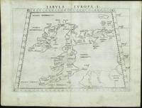
réf. 11742Venice: 1561. No binding. Good. FIRST EDITION FIRST ISSUE. 190 x 255 mm. light even toning otherwise in good condition. The first edition first issue of Girolamo Ruscelli's Ptolomaic map of the British Isles published in his edition of Ptolemy's 'Geographia' 1561. The border contains figures of latitude and longitude the 'G' in the corners most likely standing for the Latin 'gradus' for degrees. This map is one of two that were engraved on the same plate. Note how the plate mark runs off the top of the map. Girolamo Ruscelli c.1504-66 edited the Latin text for this quarto edition of Claudius Ptolemy's classic work 'Geographia' which included newly engraved copper plates engraved by the brothers Giulio fl.1540-88 and Livio c.1520-76 Sanuto. The work was published by Vincenzo Valgrisi in Venice. Provenance: Clive A. Burden Ltd.; private English collection. Nordenskiold 1979 216; Shirley 1991 67; Shirley 2004 T.Ptol 10a; Tooley's Dictionary. 1561 unknown
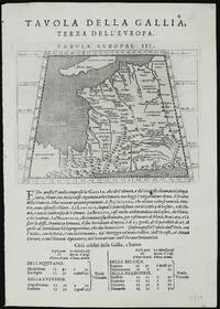
réf. 11329Venice: 1596-98. No binding. Good. Two maps 135 x 175 mm. each set on a leaf of text in good condition. A new edition of Ptolemy's 'Geography' was edited by Giovanni Antonio Magini 1555-1617 a noted geographer from Padua. Published in Venice a second edition appeared in 1598 from which this appears. It contains this Ptolemaic map of France with that of Germany on the verso. The neatly engraved copper plates are attributed to Girolamo Porro 1520-1604 also from Padua. The atlas was first published in a smaller format in Venice 1596. It was closely copied in the following year by Petrus Keschedt in Cologne in a work which contained a whole new set of engraved plates. Many references incorrectly state that the two editions contain the same plates. Magini famously produced the first atlas of Italy which was published posthumously by his son Fabio in 1620. Nordenskiöld 1979 no. 227; Nordenskiöld 1889 p. 27; Phillips 1909- no. 405; Shirley 2004 T.Ptol 12b; Tooley's Dictionary 1999-2004. 1596-[98] unknown