346 résultats
1972réf. 010314PARIS CLUB DU LIVRE PHILIPPE LEBAUD 1972 Un fort volume grand in-folio de 206 pges , dans sa très belle reliure éditeur plein cuir havane , dos plat , motifs de frises grecs inscrustés sur les plats et médaillon en cuir sur le premier plat , tête doré et bien complet de bsa chemise et de sa boite bordurée , ouvrage comportant 20 lithographies originales en couleurs de Jean PICART LE DOUX , tirage à 300 ex. numérotés , un des 225 sur Rives signé par l' artiste , très bon exemplaire . PORT POUR LA FRANCE 20 ? ET POUR L' U.E. 28 ? Très bon Couverture rigide
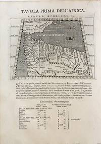
1598réf. M8434Venice: G. Fratelli; G.A. Magini c. 1598. Very Good. Notes: Ptolemaic Map of the North west part of Africa Morocco Tabula Aphricae I Plate 1 from "Geografia cioe Descrittione Universale della Terra" published by Magini c.1598. Text in Italian. Size : 140x173 mm 5.50x6.80 Inches Coloring: Black & White Category: Maps Africa North; Maps Africa West; G. Fratelli; G.A. Magini unknown
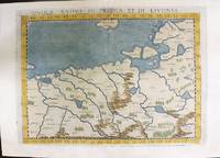
1574réf. M11141Venice: Ruscelli c. 1574. Very Good. Notes: Italian text on verso. Map of Prussia Poland Lithuania part of of Estonia and the Baltic Region. Girolamo Ruscelli 1518–1566 was an Italian mathematician and cartographer active in Venice during the early 16th century. Ruscelli is best known for his important revision of Ptolemy's Geographia published posthumously in 1574. Size : 190x263 mm 7.48x10.35 Inches Coloring: Hand Colored Category: Maps Europe Poland Lithuania; Ruscelli unknown
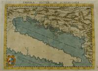
1574réf. M7268Venice: Ruscelli c. 1574. Very Good;. Notes: Italian text on verso. Girolamo Ruscelli 1518–1566 was an Italian mathematician and cartographer active in Venice during the early 16th century. Ruscelli is best known for his important revision of Ptolemy's Geographia published posthumously in 1574. Size : 190x261 mm 7.48x10.28 Inches Coloring: Hand Colored Category: Maps Europe Balkans; Ruscelli unknown
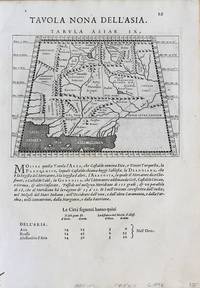
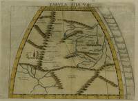
1598réf. M8430Venice.: G. Fratelli; G.A. Magini c. 1598. Very Good. Notes: Ptolemaic Map of Tabula Asiae IX Plate 9 from "Geografia cioe Descrittione Universale della Terra" published by Magini c.1598. Text in Italian. Size : 140x173 mm 5.50x6.80 Inches Coloring: Black & White Category: Maps Asia Central Afghanistan Pakistan; Maps Asia Central Turkmenistan Uzbekistan Tajikistan Kyrgyzstan Kazakhstan; Maps Asia Central India & Sri Lanka / Ceylon; G. Fratelli; G.A. Magini unknown
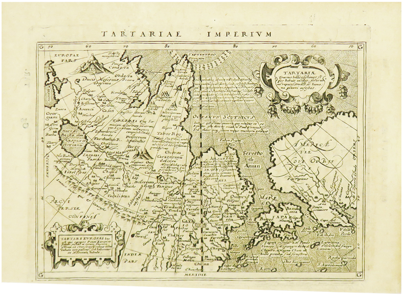
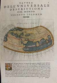
1597réf. M7336Venice: Gio. Battista & Giorgio Galignani c. 1597. Very Good;. Notes: Text in Italian. From Magini's "Geografia cioe Descrittione Universale della Terra". The first edition of this map was printed with Latin text with the later issues printed in Italian. "This quarto edition of Ptolemy was edited by the distinguished Italian geographer Giovanni Magini who also published as part of the same work the first reduced-size version of Mercator's atlas. The four world maps -- one ancient and three modern engravings -- are all by Girolamo Porro neatly copying other earlier works." Shirley Size : 135x175 mm 5.31x6.89 Inches Coloring: Hand Colored Reference: Shirley 193; Phillips 405. Category: Maps World; Gio. Battista & Giorgio Galignani unknown
1598réf. M8431Venice: G. Fratelli; G.A. Magini c. 1598. Very Good. Notes: Ptolemaic Map of Tabula Asiae X Plate 10 from "Geografia cioe Descrittione Universale della Terra" published by Magini c.1598. Text in Italian. Size : 140x173 mm 5.50x6.80 Inches Coloring: Black & White Category: Maps Asia Central Afghanistan Pakistan; Maps Asia Central India & Sri Lanka / Ceylon; G. Fratelli; G.A. Magini unknown
1617réf. LBW-1964[Arnhem, Joannes Jansson, 1617]. 129 x 170 mm.
1525réf. 56635Strasbourg. 1525. Originalt tresnitt. Arkets størrelse : 535 cm X 395 cm. Latin. Latinsk tekst. Bretten noe gulnet et par brunpletter.Med Kypros.Map of Palestine Mesopotamia and Babylonia in present day Middle East.Relief shown pictorially.Includes names of places and natural features.Descriptive text within ornamental borders on verso.Appears in the author's Geographia translated by Willibald Pirckheimer with annotations by Joannes Regiomontanus. Argentoragi i.e. Strasbourg : Iohannes Grieningerus communibus Iohannis Koberger impensis excudebat anno a Christi Natiuitate 1525 tertio Kalendas Apriles. Boston Public Library. unknown
2001réf. 81701Planeta–De Agostini 2001. Planeta–De Agostini unknown
1513réf. 54087Strasbourg. 1513. Originalt tresnitt. Arkets størrelse : 60 cm X 425 cm. Norsk. “Martin Waldseemüller a highly accomplished scholar of geography merged the science of mapmaking and the art of printing in his 1513 atlas one of the most groundbraking documents in the history of cartography. He intended this atlas as a new edition of Ptolemy’s Geographia but included the addition of 20 modern maps which were not based upon the tradition of Ptolemy. Waldseemüller’s use of a quadratic plane projection was also a noteworthy advance.”Martin Waldseemüller 1470-1520.Liten rift ved nedre marg. Et lite ormehull i venstre marg. Et par slitasjer i øvre marg. unknown
1541réf. 15881Vienna 1541. Very good condition. The second map to show just southern Africa; it is based on the Waldseemuller modern map of southern Africa and derived from Ptolemy. Decoratively illustrated with African kings serpents an elephant and a Christian soldier riding a sea monster towards Madagascar. Three large rivers arise from a mountain range labeled 'Fontes Nili' source of the Nile other mountain ranges and coastal towns named in Latin or Portuguese. With the figure of the King of Portugal riding a sea monster towards Madagascar. Based on the slightly larger map from 1513 published in "Ptolemy's Geographia". The atlas was reprinted in 1520 1522 1525 1535 and 1541. This wood block was cut in 1525 for the publisher J.Grünninger. This being the variant of 1541 now without the banner title but title in letter type and blank verso. From the last edition of Ptolemy's "Geography" with maps by Laurens Fries and the text edited by Michael Servetus. Servetus was accused of heresy and burnt at the stake. Calvin ordered that copies of the book should be burnt with him although this copy seems to have eluded the flames. Wood block map with early hand color. Blank on the verso with the number 39 at the lower right corner. Image size: 16 7/8 x 13". Paper size: 21 1/4 x 15". Strengthened on the verso very faint browning at middle of center fold otherwise very good. Betz p. 55-56. Tooley "Map Collectors' Circle No. 30 Printed Maps of the Continent of Africa Part II" p. 61-62. Karrow "Mapmakers of the Sixteenth Century" unknown
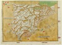
1486réf. 1271161486. Ulm: Johann Reger 1486. Original woodcut map hand-colored printed on a double-page sheet 570 x 407 mm with a central vertical fold verso blank. Upper margin closely trimmed with some loss of the printed border but no loss of the map central fold reinforced on verso a little inkwash and light soiling in the margins; a strong impression with bright contemporary coloring. Matted. § A "modern" map of the Iberian Peninsula Spain and Portugal by the 15th century German cartographer Nicolas Germanus who updated Ptolemy's Geography to show contemporary kingdoms and place names with towns marked by small circles and mountain ranges with brown ridges. The engraving was done by Johannes de Armsheim the first woodcut artist to sign his maps on this map his mark is the backwards "N" in the woodcut text. The map was first published by Lienhart Holle in his atlas of 1482 possibly a ruinous venture as Holle went bankrupt soon afterwards and the sheets and plates were bought by Johann Reger who reissued the atlas in 1486. The two issues can be distinguished by the coloring of the sea: a blue was in 1482 a tan wash in 1486. unknown books
1486réf. 1271161486. Ulm: Johann Reger 1486. Original woodcut map hand-colored printed on a double-page sheet 570 x 407 mm with a central vertical fold verso blank. Upper margin closely trimmed with some loss of the printed border but no loss of the map central fold reinforced on verso a little inkwash and light soiling in the margins; a strong impression with bright contemporary coloring. Matted. § A "modern" map of the Iberian Peninsula Spain and Portugal by the 15th century German cartographer Nicolas Germanus who updated Ptolemy's Geography to show contemporary kingdoms and place names with towns marked by small circles and mountain ranges with brown ridges. The engraving was done by Johannes de Armsheim the first woodcut artist to sign his maps on this map his mark is the backwards "N" in the woodcut text. The map was first published by Lienhart Holle in his atlas of 1482 possibly a ruinous venture as Holle went bankrupt soon afterwards and the sheets and plates were bought by Johann Reger who reissued the atlas in 1486. The two issues can be distinguished by the coloring of the sea: a blue was in 1482 a tan wash in 1486. unknown
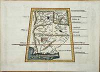
réf. 8022Lyon: Melchoir and Gaspar Treschel. 1522-35. No binding. Good. 315 x 450 mm. with recent wash colour two minor stitch holes due to binding both repaired otherwise in good condition. An attractive map of Ptolemaic Pakistan and Afghanistan. It is projected in a trapezoidal style with extensive rivers and mountain ranges. With Latin text on the verso. Laurent Fries produced the woodblocks for this 1535 edition of Ptolemy's Geography. By now Fries whose maps were first issued in the 1522 edition had died. The wood blocks found their way into the possession of Melchoir and Gaspar Treschel. For this edition published in Lyon the brothers asked Michael Servetus to re-edit the text. Karrow 1993 28.24; Nordenskiold 1979 209; Pastoureau 1984 Ptolemee E 1535; Shirley 2004 T.Ptol 7d. Melchoir and Gaspar Treschel. 1522-[35] unknown
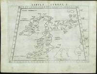
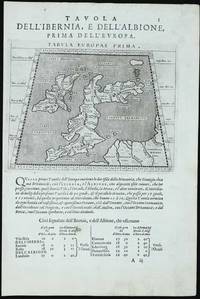
réf. 11742Venice: 1561. No binding. Good. FIRST EDITION FIRST ISSUE. 190 x 255 mm. light even toning otherwise in good condition. The first edition first issue of Girolamo Ruscelli's Ptolomaic map of the British Isles published in his edition of Ptolemy's 'Geographia' 1561. The border contains figures of latitude and longitude the 'G' in the corners most likely standing for the Latin 'gradus' for degrees. This map is one of two that were engraved on the same plate. Note how the plate mark runs off the top of the map. Girolamo Ruscelli c.1504-66 edited the Latin text for this quarto edition of Claudius Ptolemy's classic work 'Geographia' which included newly engraved copper plates engraved by the brothers Giulio fl.1540-88 and Livio c.1520-76 Sanuto. The work was published by Vincenzo Valgrisi in Venice. Provenance: Clive A. Burden Ltd.; private English collection. Nordenskiold 1979 216; Shirley 1991 67; Shirley 2004 T.Ptol 10a; Tooley's Dictionary. 1561 unknown
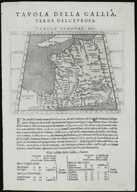
réf. 11329Venice: 1596-98. No binding. Good. Two maps 135 x 175 mm. each set on a leaf of text in good condition. A new edition of Ptolemy's 'Geography' was edited by Giovanni Antonio Magini 1555-1617 a noted geographer from Padua. Published in Venice a second edition appeared in 1598 from which this appears. It contains this Ptolemaic map of France with that of Germany on the verso. The neatly engraved copper plates are attributed to Girolamo Porro 1520-1604 also from Padua. The atlas was first published in a smaller format in Venice 1596. It was closely copied in the following year by Petrus Keschedt in Cologne in a work which contained a whole new set of engraved plates. Many references incorrectly state that the two editions contain the same plates. Magini famously produced the first atlas of Italy which was published posthumously by his son Fabio in 1620. Nordenskiöld 1979 no. 227; Nordenskiöld 1889 p. 27; Phillips 1909- no. 405; Shirley 2004 T.Ptol 12b; Tooley's Dictionary 1999-2004. 1596-[98] unknown
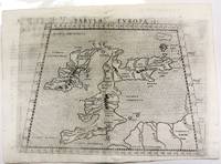
réf. 11760Venice: 1597. No binding. Very Good. 135 x 170 mm. printed on a leaf of text light paper imperfection in the text below otherwise in good condition. A new edition of Ptolemy's 'Geography' was edited by Giovanni Antonio Magini 1555-1617 a noted geographer from Padua. Published in Venice a second edition appeared in 1598 from which this appears. It contains this Ptolemaic map of the British Isles with that of the Iberian peninsula on the verso. The neatly engraved copper plates are attributed to Girolamo Porro 1520-1604 also from Padua. The atlas was first published in a smaller format in Venice 1596. It was closely copied in the following year by Petrus Keschedt in Cologne in a work which contained a whole new set of engraved plates. Many references incorrectly state that the two editions contain the same plates. Magini famously produced the first atlas of Italy which was published posthumously by his son Fabio in 1620. Nordenskiöld 1979 no. 227; Nordenskiöld 1889 p. 27; Phillips 1909- no. 405; Shirley 2004 T.Ptol 12b; Tooley's Dictionary 1999-2004. 1597 unknown
1574réf. M11040Venice c.1574. Very Good. Notes: Map of the British Isles United Kingdom based on Ptolemy's map. Girolamo Ruscelli 1518–1566 was an Italian mathematician and cartographer active in Venice during the early 16th century. Ruscelli is best known for his important revision of Ptolemy's Geographia published posthumously in 1574. Size : 190x262 mm 7.48x10.31 Inches Coloring: Black & White Category: Maps Europe United Kingdom; unknown
1574réf. M7277Venice: Ruscelli c. 1574. Very Good;. Notes: Italian text on verso. Girolamo Ruscelli 1518–1566 was an Italian mathematician and cartographer active in Venice during the early 16th century. Ruscelli is best known for his important revision of Ptolemy's Geographia published posthumously in 1574. Size : 190x260 mm 7.48x10.24 Inches Coloring: Hand Colored Category: Maps Asia Central Tibet & Himalayas; Maps Asia Far East China; Ruscelli unknown
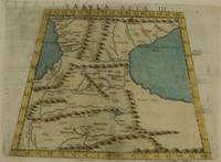
1574réf. M7273Venice: Ruscelli c. 1574. Very Good;. Notes: Italian text on verso. Girolamo Ruscelli 1518–1566 was an Italian mathematician and cartographer active in Venice during the early 16th century. Ruscelli is best known for his important revision of Ptolemy's Geographia published posthumously in 1574. Size : 192x264 mm 7.56x10.39 Inches Coloring: Hand Colored Category: Maps Asia Middle East Caucasus.; Ruscelli unknown
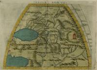
1574réf. M7276Venice: Ruscelli c. 1574. Very Good;. Notes: Italian text on verso. Girolamo Ruscelli 1518–1566 was an Italian mathematician and cartographer active in Venice during the early 16th century. Ruscelli is best known for his important revision of Ptolemy's Geographia published posthumously in 1574. Size : 191x266 mm 7.52x10.47 Inches Coloring: Hand Colored Category: Maps Asia Central Turkmenistan Uzbekistan Tajikistan Kyrgyzstan Kazakhstan; Maps Asia Central Afghanistan Pakistan; Maps Asia Central India & Sri Lanka / Ceylon; Ruscelli unknown
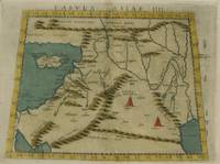
1574réf. M7274Venice: Ruscelli c. 1574. Very Good;. Notes: Italian text on verso. Girolamo Ruscelli 1518–1566 was an Italian mathematician and cartographer active in Venice during the early 16th century. Ruscelli is best known for his important revision of Ptolemy's Geographia published posthumously in 1574. Size : 192x266 mm 7.56x10.47 Inches Coloring: Hand Colored Category: Maps Asia Middle East Holy Land & Palestine;Maps Asia Middle East Jordan Syria Lebanon;Maps Asia Near East Turkey; Ruscelli unknown
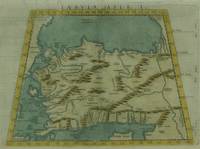
1574réf. M7271Venice: Ruscelli c. 1574. Very Good;. Notes: Italian text on verso. Girolamo Ruscelli 1518–1566 was an Italian mathematician and cartographer active in Venice during the early 16th century. Ruscelli is best known for his important revision of Ptolemy's Geographia published posthumously in 1574. Size : 190x266 mm 7.48x10.47 Inches Coloring: Hand Colored Category: Maps Asia Near East Turkey; Ruscelli unknown