Ptolemy; Girolamo RuscelliBiblio.com
346 résultats
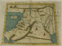
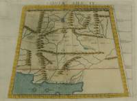
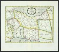
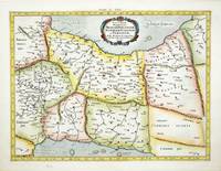
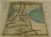
1574réf. M7273Venice: Ruscelli c. 1574. Very Good;. Notes: Italian text on verso. Girolamo Ruscelli 1518–1566 was an Italian mathematician and cartographer active in Venice during the early 16th century. Ruscelli is best known for his important revision of Ptolemy's Geographia published posthumously in 1574. Size : 192x264 mm 7.56x10.39 Inches Coloring: Hand Colored Category: Maps Asia Middle East Caucasus.; Ruscelli unknown
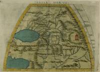
1574réf. M7276Venice: Ruscelli c. 1574. Very Good;. Notes: Italian text on verso. Girolamo Ruscelli 1518–1566 was an Italian mathematician and cartographer active in Venice during the early 16th century. Ruscelli is best known for his important revision of Ptolemy's Geographia published posthumously in 1574. Size : 191x266 mm 7.52x10.47 Inches Coloring: Hand Colored Category: Maps Asia Central Turkmenistan Uzbekistan Tajikistan Kyrgyzstan Kazakhstan; Maps Asia Central Afghanistan Pakistan; Maps Asia Central India & Sri Lanka / Ceylon; Ruscelli unknown
1574réf. M7274Venice: Ruscelli c. 1574. Very Good;. Notes: Italian text on verso. Girolamo Ruscelli 1518–1566 was an Italian mathematician and cartographer active in Venice during the early 16th century. Ruscelli is best known for his important revision of Ptolemy's Geographia published posthumously in 1574. Size : 192x266 mm 7.56x10.47 Inches Coloring: Hand Colored Category: Maps Asia Middle East Holy Land & Palestine;Maps Asia Middle East Jordan Syria Lebanon;Maps Asia Near East Turkey; Ruscelli unknown
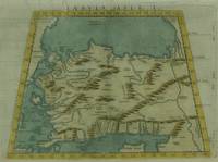
1574réf. M7271Venice: Ruscelli c. 1574. Very Good;. Notes: Italian text on verso. Girolamo Ruscelli 1518–1566 was an Italian mathematician and cartographer active in Venice during the early 16th century. Ruscelli is best known for his important revision of Ptolemy's Geographia published posthumously in 1574. Size : 190x266 mm 7.48x10.47 Inches Coloring: Hand Colored Category: Maps Asia Near East Turkey; Ruscelli unknown
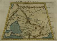
1574réf. M7272Venice: Ruscelli c. 1574. Very Good;. Notes: Italian text on verso. Map of the ancient region of Asiatic Sarmatia. Girolamo Ruscelli 1518–1566 was an Italian mathematician and cartographer active in Venice during the early 16th century. He was also an alchemist writing pseudonymously as Alessio Piemontese. Claudius Ptolemy better known mononymously as Ptolemy was a Greco-Roman mathematician astronomer astrologer geographer and music theorist who wrote about a dozen scientific treatises three of which were important to later Byzantine Islamic and Western European science. Size : 188x262 mm 7.40x10.31 Inches Coloring: Hand Colored Category: Maps Russia; Ruscelli unknown
1574réf. M7278Venice: Ruscelli c. 1574. Very Good;. Notes: Italian text on verso. Girolamo Ruscelli 1518–1566 was an Italian mathematician and cartographer active in Venice during the early 16th century. Ruscelli is best known for his important revision of Ptolemy's Geographia published posthumously in 1574. Size : 188x264 mm 7.40x10.39 Inches Coloring: Hand Colored Category: Maps Asia Central Afghanistan Pakistan; Ruscelli unknown
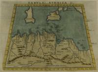
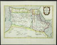
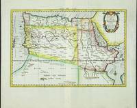
1574réf. M7259Venice: Ruscelli c. 1574. Very Good;. Notes: Italian text on verso. Girolamo Ruscelli 1518–1566 was an Italian mathematician and cartographer active in Venice during the early 16th century. Ruscelli is best known for his important revision of Ptolemy's Geographia published posthumously in 1574. Size : 190x253 mm 7.48x9.96 Inches Coloring: Hand Colored Category: Maps Africa North; Maps Mediterranean Islands; Ruscelli unknown
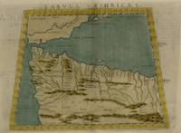
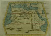
1574réf. M7258Venice: Ruscelli c. 1574. Very Good;. Notes: Italian text on verso. Girolamo Ruscelli 1518–1566 was an Italian mathematician and cartographer active in Venice during the early 16th century. Ruscelli is best known for his important revision of Ptolemy's Geographia published posthumously in 1574. Size : 187x262 mm 7.36x10.31 Inches Coloring: Hand Colored Category: Maps Africa North; Ruscelli unknown
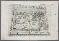
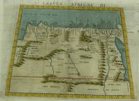
1574réf. 005867Venice: Vincenzo Valgrisi 1574. 1574 Edition. Engraving on Copper. Very Good. Double-page copperplate engraved map with letterpress text. Image: 26 x 19 cm. Sheet: 34 x 24 cm. A highly decorative and historically significant 16th-century map of North and Northeast Africa derived from Ptolemy’s 2nd-century geography. The map was published in the 1574 edition of Geographia edited by Girolamo Ruscelli and printed in Venice by Vincenzo Valgrisi. This is “Tabula Africae III” the third of Ptolemy’s Africa maps focusing on: Libya Egypt Cyrenaica Thebes and parts of Arabia Prominent classical sites including: Alexandria Cyrene Memphis Thebes Ptolemais Ammonis templum Mountain chains rivers and desert regions in stylized Renaissance form The map features Latin titling and classical toponyms while the verso contains the original Italian commentary explaining the geography cities and coordinates. CONDITION: Very good. Strong impression with clear platemark. Central fold as issued. Mild age toning and minor wear to margins. Backed at top center. Verso complete with full letterpress text Tavola Terza d’Africa Antica. Note: only this 1574 edition contains Vincenzo Valgrisi's elaborate printer's emblem showing: A lion leaping or attacking a smaller animal often interpreted as a fox and a large bird resembling an ostrich standing nearby. Vincenzo Valgrisi unknown
1574réf. M7260Venice: Ruscelli c. 1574. Very Good;. Notes: Italian text on verso. Girolamo Ruscelli 1518–1566 was an Italian mathematician and cartographer active in Venice during the early 16th century. Ruscelli is best known for his important revision of Ptolemy's Geographia published posthumously in 1574. Size : 189x261 mm 7.44x10.28 Inches Coloring: Hand Colored Category: Maps Africa North Egypt;Maps Africa North; Ruscelli unknown
1561réf. M7261Venice: Ruscelli 1561. Very Good;. Notes: Italian text on verso. Girolamo Ruscelli 1518–1566 was an Italian mathematician and cartographer active in Venice during the early 16th century. Ruscelli is best known for his important revision of Ptolemy's Geographia published posthumously in 1574. Size : 188x165 mm 7.40x6.50 Inches Coloring: Hand Colored Category: Maps Africa North; Ruscelli unknown
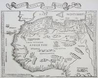
1535réf. M6976Lyons: Melchior & Gaspar Trechsel c. 1535. Very Good;. Notes: No text on verso. This is based on Waldseemuller's map Norwich 286 with borders and ornaments by Holbein and Graf. The reissued map includes six kings seated on their thrones a rhinoceros a cyclops and two oxen. "As northern Africa was better known than southern Africa at that period it has more geographical information in the interior. Various kingdoms are described with a multitude of coastal names and as with the southern part . these are placed within the coastline. The Mediterranean and Red Seas are prominently featured as well as a number of islands on the northwest coast -- Madeira the Canaries etc. -- which at that time were already well known to the Portuguese in their initial efforts to discover a route to the Indies." Norwich Size : 320x400 mm 12.60x15.75 Inches Coloring: Black & White Reference: Norwich 286 Category: Maps Africa North; Melchior & Gaspar Trechsel unknown
réf. 2013671539.Gpaperback. Good. Access codes and supplements are not guaranteed with used items. May be an ex-library book. paperback
réf. 6096Amsterdam: R & J Wetstenii & G Smith. 1578-1730. No binding. Very Good. 340 x 460 mm. a fine example in recent wash colour. Gerard Mercator's edition of Ptolemy's 'Geography' is highly acclaimed; he spent much of his life studying the work and even engraved the plates himself. The 'Geographia' is the earliest surviving geographical treatise. Much of Mercator's efforts were spent projecting Ptolemy's geography onto the projection which bears his name. Mercator is one of the world's greatest cartographers and the 'Claudii Ptolemaei Tabulae Geographicae Orbis Terrarum' was first published in 1578. This map of Persia or modern day Iran is in the third state with the addition of a latitude and longitude grid illustrating the projection. Ala'i Cyrus. 2003. 'Mapping Persia: A brief introduction' in IMCoS Journal 94 pp. 5-22; Koeman Me 5; Nordenskiold 234; Phillips P.L. Atlases 384; Shirley BL T.Ptol-11a & 11k; Van der Krogt P. Atlantes 1:501. R & J Wetstenii & G Smith. 1578-[1730] unknown
réf. 9641Amsterdam: 1578-1695. No binding. Very Good. 340 x 460 mm. in full recent wash colour good condition. Gerard Mercator's edition of Ptolemy's 'Geography' is highly acclaimed; he spent much of his life studying the work and even engraved the plates himself. The 'Geographia' is the earliest surviving geographical treatise. Much of Mercator's efforts were spent projecting Ptolemy's geography onto the projection which bears his name. Mercator is one of the world's greatest cartographers and the 'Claudii Ptolemaei Tabulae Geographicae Orbis Terrarum' was first published in 1578. This map of Persia or modern day Iran is in the scond state before the addition of a latitude and longitude grid illustrating the projection. Ala'i Cyrus. 2003. 'Mapping Persia: A brief introduction' in IMCoS Journal 94 pp. 5-22; Koeman Me 5; Nordenskiold 234; Phillips P.L. Atlases 384; Shirley BL T.Ptol-11a; Van der Krogt P. Atlantes 1:501. 1578-[1695] unknown
réf. 5206Utrecht: Francois Halma. 1578-c.1695. No binding. Very Good. 310 x 470 mm. in fine modern wash colour and in good condition. From Gerard Mercator's edition of 'Claudii Ptolemaei Tabulae Geographicae Orbis Terrarum'. It was in 1578 that one of the world's greatest cartographers put out an edition of the earliest surviving geographical treatise. This map shows the northern half of Africa with the equator displayed prominently. The source of the Nile River is also highlighted with a mountain range feeding two large lakes. An interesting feature is the Niger River in 'Libya' which is prominent across the map with its source in numerous lakes. During its course to the sea it disappears under a mountain range arising the other side. Although Mercator is most renowned today for the projection he popularised and for first using the term 'atlas' for a collection of maps he devoted much of his life to his Ptolemaic maps. The maps were beautifully engraved as nearly as possible to their original form and are the most decorative of Ptolemaic maps. Koeman Me 5; Nordenskiold 234; Phillips P.L. Atlases 384; Shirley BL T.Ptol-11a & 11k; Van der Krogt P. Atlantes 1:501. Francois Halma. 1578-[c.1695] unknown
réf. 6092Amsterdam: R & J Wetstenii & G Smith. 1578-1730. No binding. Very Good. 310 x 460 mm. a fine example in recent wash colour. Gerard Mercator's edition of Ptolemy's 'Geography' is highly acclaimed; he spent much of his life studying the work and even engraved the plates himself. The 'Geographia' is the earliest surviving geographical treatise. Much of Mercator's efforts were spent projecting Ptolemy's geography onto the projection which bears his name. Mercator is one of the world's greatest cartographers and the 'Claudii Ptolemaei Tabulae Geographicae Orbis Terrarum' was first published in 1578. This map shows the northern half of Africa with the equator displayed prominently is in the third state with the addition of a latitude and longitude grid illustrating the projection. The source of the Nile River is also highlighted. Koeman Me 5; Nordenskiold 234; Phillips P.L. Atlases 384; Shirley BL T.Ptol-11a & 11k; Van der Krogt P. Atlantes 1:501. R & J Wetstenii & G Smith. 1578-[1730] unknown
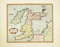
réf. 10520Amsterdam: R & J Wetstenii & G Smith. 1578-1730. No binding. Very Good. 340 x 400 mm. recent wash colour in good condition. Gerard Mercator's edition of Ptolemy's 'Geography' is highly acclaimed; he spent much of his life studying the work and even engraved the plates himself. The 'Geographia' is the earliest surviving geographical treatise. Much of Mercator's efforts were spent projecting Ptolemy's geography onto the projection which bears his name. Mercator 1512-94 is one of the world's greatest cartographers and the 'Claudii Ptolemaei Tabulae Geographicae Orbis Terrarum' was first published in 1578. This map of the British Isles is in the third state with the addition of a latitude and longitude grid illustrating the projection. Provenance: Doreen Green 1999. Koeman Me 5; Nordenskiold 234; Phillips P.L. Atlases 384; Shirley BI 123; Shirley BL T.Ptol-11a & 11k; Van der Krogt P. Atlantes 0901:1.2. R & J Wetstenii & G Smith. 1578-[1730] unknown
1675réf. 14546Paris, Guillaume Desprez, 1675 ; in-16 ; plein veau havane granité, dos à nerfs décoré et doré, titre doré, roulette sur les coupes (reliure de l'époque) ; (36) (titre, Epistre, Préface et Table), 457 pp., (1) p. de Privilège, 59 figures et schémas dont 13 hors-texte.
réf. 0366555499.Ghardcover. Good. Access codes and supplements are not guaranteed with used items. May be an ex-library book. hardcover
réf. 033223066X.Ghardcover. Good. Access codes and supplements are not guaranteed with used items. May be an ex-library book. hardcover
réf. 0365971189.Gpaperback. Good. Access codes and supplements are not guaranteed with used items. May be an ex-library book. paperback
réf. 50491549like new. unknown
réf. 50489752like new. unknown
réf. ria9781024022940_inpHardcover. New. New Book; Fast Shipping from UK; Not signed; Not First Edition; Syntaxis Mathematica Volume 1 by Ptolemy Ptolemy is a seminal work in the history of mathematics and astronomy. Originally written in Greek this volume presents Ptolemy's systematic treatment of mathematical astronomy offering insi hardcover