Sanson, KevinBiblio.com

980 results
ref. 46662661-nnew. unknown
2014ref. 1-3838178408Presses Académiques Francophones 2014. Paperback. New. 212 pages. French language. 8.66x5.91x0.48 inches. Presses Académiques Francophones paperback
1692ref. 31056Paris/Amsterdam Hubert Jaillot 1692. 585x885 cm. Kobberstukket Danmarkskort med Nordtyskland Skåne Halland og Blekinge i fuld håndkolorering med 2 store barok-kartoucher titelkartouche & målestokskartouche. Lille revnedannelse i foldningen øverst og nederst. nederste bladkant repareret uden tab. På kraftigt papir sammensat af to pladetryk. Dette store Jaillot-kort er det største af det 17.århundredes Danmarkskort udfærdiget med forlæg i Sanson's Danmarkskort i mindre format. "Jaillot-typen" er kendt for den pukkelryggede fremstilling af Jylland. - Bramsen gengiver trykket fra 1674 og omtaler p. 114 at kartouchen med en kvinde på en sky først forekommer 1696. Her foreligger både kvinden skyen og dateringen 1692. unknown
1691ref. 43500Amsterdam Huguetan & Mortier 1691. 56x85 cm. Large engraved map of Terra Sancta with original colours in outline. With two large engraved cartouches. Small repairs to lower part of centerfold. This is Jaillot's large version of Sanson's map of Palaestine divided into tribes. unknown
1704ref. 48770Amsterdam Franciscus Halma 1704. Folio. 455 x 29 cm. Contemp. full blindtooled Dutch vellum. Raised bands. Spine ends with tears some cracking along fronthinge but not loose. Vellum at frontcover a bit soiled. Egraved titlepage Coxis del. ianen fecit. Printed titlepage in red/black with an engraved vignette. 15119511 pp. 1 engraved plate with portrait and coat of arms. 4 large folded engraved maps. Light yellowing to margins of textleaves but maps and text fine and clean. 3 of the maps engraved by F. Halma. The maps are the Francois Halma reissues of Sanson's maps from 1683. hardcover
1897ref. 38358Paris: Lib. agricole de la Maison rustique 1897. Fine. Lib. agricole de la Maison rustique Paris 1897 11.50 x 18.50 cm relié Third edition. Full black cloth binding smooth spine minor epidermis damage to boards two small lacks to one joint an ink stain affecting the margins but not the text. Work illustrated with 34 figures in the text. Lib. agricole de la Maison rustique hardcover
1888ref. 34050Paris: Lib. agricole de la raison rustique 1888. Fine. Lib. agricole de la raison rustique Paris 1888-1893 11.50 x 18.50 cm 5 volumes reliés Third edition with some parts in first edition as revised and corrected. The first volume is part of the third printing of the third edition the following volumes are part of the second printing. Half red shagreen bindings spines with five raised bands set with gilt fillets and showing minor rubbing on some volumes spines decorated with gilt floral motifs three joints with slight lacks at heads blind fillet frames on red cardboard boards boards of first volume discolored contemporary bindings. Work illustrated with figures in the text. Some foxing. Rare. Lib. agricole de la raison rustique hardcover
1859ref. 30434Marseille: Imp. & Lithographie Vve Marius Olive 1859. Fine. Imp. & Lithographie Vve Marius Olive Marseille 1859 16 x 24.50 cm broché The first edition published in a small number of copies. Autograph inscription from M. de Pongerville at head of front cover. A small tear at head of spine light foxing to covers handsome interior condition. Rare. Imp. & Lithographie Vve Marius Olive unknown
1680ref. 024707London: William Berry 1680. .Kingdoms and States which are found there at present/Described by Sanson/Corrected and amended By William Berry =Kopftitel; Text der figürlich reich verzierten Kartusche oben rechts: Asia Divided into its Principall Regions in which may be seen the extent of the Empires Monarchies Kingdoms and States which at present divide Asia/To the Most serene and Most Sacred Majesty of Charles II./By the Grace of God King of Great Britain France and Ireland/This Map of Asia is humbly Dedicated and Presented By Your Majesties Loyal Subject and Servand William Berry; Text der reich verzierten Kartusche links oben: Scale es folgen Maßstäbe verschiedener Länder/London/Sold by William Berry at the Sign of the Globe between Charing-Cross and White-Hall/1680; SW-Kupferstich-Landkarte nach Nicolas Sanson d'Abbeville gestochen von William Berry; ca. 51 x 39 cm; Falzspuren einige Tintenflecken hauptsächlich ausserhalb des Druckbildes mässige Lichtverfärbung; professionell hinter Glas gerahmt in schwarzem Holzrahmen; äußerst selten; for description in other languages of this extremely rare map please don't hesitate to contact me. . Gut. Landkarte. William Berry unknown
2004ref. H-405-5902004. Paperback. Good. Former library book. Different cover. Different publisher. Ammareal gives back up to 15% of this item's net price to charity organizations. paperback
2005ref. X-343-635STE ECRIVAINS 2005. Paperback. Good. Former library book. Different cover. Ammareal gives back up to 15% of this item's net price to charity organizations. STE ECRIVAINS paperback
1647ref. 75287Paris Uten år. 1647-1665. 4to. Samtidig helskinnbind med opphøyde ryggbånd og ryggforgylling. Ryggen rebacked med bruk av den gamle ryggstripen. Håndkolorert gravert dobbeltsidig tittelblad og dedikasjonsblad. Upaginert. 30 bl. Med 12 dobbeltsidige håndkolorerte kart. 4to. Contemporary full calf with raised bands spine gilt. Spine rebacked by using of the old spine. Handcoloured doublepage title and handcoloured doublepage dedication. Not paginated. 30 leaves. With 12 doublepage handcoloured copper engraved maps. Chez Pierre Mariette. Fransk. “Nicolas Sanson le fils 1625 - 1648. Son of Nicolas and his intended heir prevented by his premature death from gunshot wounds. Only three known works. L’Europe 12 maps ca. 1648 compiled by N. Sanson fils engraved by A. Peyrounin theoretically published by Nicolas fils himself but may have been published posthumously by his father republished by Mariette 1660 1665. Tooley’s Dictionary of mapmakers. Revised edition. hardcover
1752ref. 54049Amsterdam. Uten år. 1752. Originalt kobberstikk. Arkets størrelse : 175 cm X 164 cm. Fransk. Med en brett.Fra 'La Science des Personnes de Cour d'Epee et de Robe' by Z. Chatelain. unknown
1950ref. 158225Rome: Unitalia Film / IFE 1950. Collection of 14 vintage oversize promotional brochures for Italian and international actresses. Each brochure features a one-page biography in Italian and a full-page black-and-white photograph of each actress. Actresses represented are Sylvana Mangano Isa Miranda Annamaria Gerrero Yvonne Sanson Alida Valli Delia Scala Ingrid Bergman Silvana Pampanini Lea Padovani Lucia Bose Eleanora Rossi Gina Lollobrigida Carla Del Poggio and Anna Magnani. 11 x 14.25 inches folded once vertically as issued with a company statement on the verso. Very Good plus overall some with light toning and foxing and a few with short tears. Unitalia Film / IFE unknown
ref. H32ca. 1750. 30 mal 21 cm. Gefalt. Karte. unknown
1650ref. 011592Paris 1650. No Binding. Very Good/No Jacket. R Cordier. 1650 Normanie. Engraved by R Cordier. A fine and detailed province map with the english coast included. All important place names are shown. Original outline colour. very slight discoloration. otherwise good condition. 385 x 515 mm framed and glazed unknown
1990ref. Alibris.0038416Surrey Beatty and Sons. 1990. Hard cover. Fine in fine dust jacket. 336 p. illustrations bibliography index. . You will obtain a current view of the knowledge of the biology conservation and care of koalas from this book. The range of topics i comprehensive and a substantial body of new information is included. There is a substantial reassessment of the phylogenetic affinities of the koala; several contributions reviewing the dynamics and status of natural populations; reassessments of our knowledge of diet; a substantial review of digestion which sheds new light on digestive function in hind gut fermenters; the first description of the social system in natural populations of koalas; new information on the endocrine control of reproduction; a substantial body of information on the impact of Chlamydia on koalas; and papers on management. The text includes 31 papers from experienced scientists who have worked in their respective fields. This reference volume emanantes from the Third National Symposium sponsored by the World Koala Research Corporation held in February 1988. Surrey Beatty and Sons hardcover
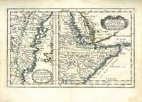
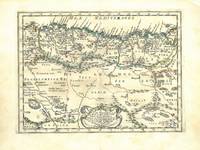
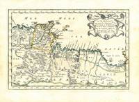
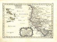
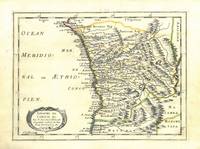
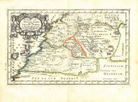
1656ref. 78509Uten sted. Paris 1656. Tverr4to. Arkets størrelse : 335 cm X 245 cm. Med samtidig grensekolorering. Fransk. Nicolas Sanson 1600-1667 blir regnet for å være grunnleggeren av fransk kartografi. Kommer fra atlaset “L’Afrique” med flere senere utgivelser. unknown
1656ref. 78507Uten sted. Paris 1656. Tverr4to. Arkets størrelse : 335 cm X 245 cm. Med samtidig grensekolorering. Fransk. Nicolas Sanson 1600-1667 blir regnet for å være grunnleggeren av fransk kartografi. Kommer fra atlaset “L’Afrique” med flere senere utgivelser. unknown
1656ref. 78505Uten sted. Paris 1656. Tverr4to. Arkets størrelse : 335 cm X 245 cm. Med samtidig grensekolorering. Fransk. Nicolas Sanson 1600-1667 blir regnet for å være grunnleggeren av fransk kartografi. Kommer fra atlaset “L’Afrique” med flere senere utgivelser. unknown
1656ref. 78504Uten sted. Paris 1656. Tverr4to. Arkets størrelse : 335 cm X 245 cm. Med samtidig grensekolorering. Fransk. Nicolas Sanson 1600-1667 blir regnet for å være grunnleggeren av fransk kartografi. Kommer fra atlaset “L’Afrique” med flere senere utgivelser. unknown
1656ref. 78503Uten sted. Paris 1656. Tverr4to. Arkets størrelse : 335 cm X 245 cm. Med samtidig grensekolorering. Fransk. Nicolas Sanson 1600-1667 blir regnet for å være grunnleggeren av fransk kartografi. Kommer fra atalset “L’Afrique” med flere senere utgivelser. unknown
1656ref. 78506Uten sted. Paris 1656. Tverr4to. Arkets størrelse : 335 cm X 245 cm. Med samtidig grensekolorering. Fransk. Nicolas Sanson 1600-1667 blir regnet for å være grunnleggeren av fransk kartografi. Kommer fra atlaset “L’Afrique” med flere senere utgivelser. unknown
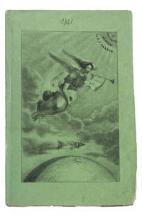
1841ref. 93KAS1RPK7OLParis 1841. 8vo. De Boulé et Comp. for Ledoyen Original green wrappers in a protective plastic wrapper with a large lithographed plate on the front showing a dirigible flying over the globe underneath a floating angel who is blowing a trumpet with the motto "Conquête de l'aire". With a large folding lithographed plate 40 x 235 cm of the dirigible and a smaller woodcut of the same dirigible on p. 5. 31 1 blank pp. First edition of this very rare early and remarkable brochure on navigation in the air and the dirigible manoeuvrable balloon. The brochure introduces a new project to build a dirigible in the shape of a fish. The cost was estimated at 30.000 francs and was to be financed by the issue of 300 shares of 100 francs. The work explains the expected profits and the workings of the dirigible in order to entice patrons. It is an early example of such a project as the first powered and steerable airship that was able to take flight was invented in 1852 eleven years after the publication of the present work. This curious brochure therefore offers a fascinating insight into the history of aviation.The fish dirigible is shown in detail on the large folding plate. It was proposed to ascend the balloon being in equilibrium by means of wings to obtain propulsion by four small paddle-wheels and to steer by means of a large triangular rudder. It was approximately 25 meters long and 12 meters high and operated from a basket hanging underneath like in a hot air balloon. It was invented by bookseller and author Alexandre-Jacques Sanson 1789-1862 and his father. The dirigible was never built but the Sansons nevertheless published a number of other works elaborating on the same subject in the following years: Navigation atmosphérique. Explications complémentaires sur le système 1845; Explication du système de navigation aérienne 1848 and Solution du problème de la navigation aérienne principes preuves et moyens 1850. The present work ends with a letter by the aeronaut Jules-François Dupuis-Delcourt 1802-1864 giving permission to use some of his data in the brochure and offering his blessing to the project.The wrappers are somewhat creased with tears at the head and foot of the spine. The folding plate has browned. Otherwise in good condition.l Tissandier p. 34; WorldCat 457418223 907812680 1141280150 13 copies. unknown
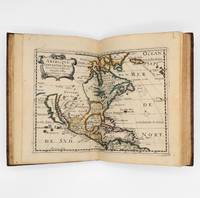
1657ref. 375003Paris: Chez L'Autheur 1657. 15 engraved double-page maps hand colored in outline. 4 40 of 42 unpaginated text leaves lacks final two leaves of text. 4to. Contemporary mottled calf gilt raised spine bands repairs at joints. Lacks final two leaves of text after the map of Brazil. 15 engraved double-page maps hand colored in outline. 4 40 of 42 unpaginated text leaves lacks final two leaves of text. 4to. First edition of important and quite handsome 17th-century French atlas of the Americas. This atlas was first published in 1657 and stands as a beautiful cartographic record of America for the 17th century. Sanson was official cartographer to the King. The maps include detailed charts of North South and Central America the West Indies Canada Mexico Florida and the southeast and a map of New Mexico showing most of the Spanish southwest territory with California depicted as an island. An impressive and detailed atlas for the time. The maps are titled as follows: 1 Americque Septentriole 2 Le Canada ou Nouvelle France &c. 3 La Floride 4 Audience de Mexico 5 Audience de Guadalajara Nouveau Mexique Californie &c. 6 Audience de Guatimala 7 Les Isles Antilles &c. 8 Amerique Meridionale 9 Terre Ferme Nouveau royme de Grenade &c. 10 Guiane divisee en Guiane et Caribane 11 Le Perou et le cours de la rivre Amazone 12 Le Chili 13 Le Brasil 14 Le Paraguay subdivise en ses principales parties suivant les dernieres relaons 15 Destroit de Magellan Terre et Isles Magellanicques &c. Sabin 76708; Phillips Atlases 1151; Streeter sale 68 undated edition; Leighley California as an Island plate 9 Chez L'Autheur unknown