Sanson, Nicolas; Jaillot, Alexis-HubertBiblio.com
980 results
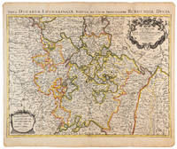
1710ref. 009140Amsterdam: Pierre Mortier 1710 Cooper engraving 46.5 x 61.5 cm on paper measuring 54.0 x 64.5 cm with original color in outline minor spotting and creasing remnants of centerfold. A good copy of a map of the Duchy of Lorraine and surrounding territories published in Amsterdam by Pierre Mortier to illustrate events of the War of the Spanish Succession. Pierre Mortier unknown
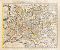
1710ref. 009147Amsterdam: Petrus Schenck 1710 Cooper engraving 46.5 x 58.0 cm on paper measuring 51.0 x 63.5 cm with original outline coloring flattened expertly restored and backed with archival tissue paper. The Latin title in the top border reads: "Russiae Albae sive Moscoviae delineatio Geographica accurata et nova…". A good copy of a Moscovie map published in Amsterdam by Petrus Schenck. Petrus Schenck unknown
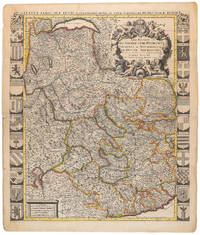
1710ref. 009139Amsterdam: Pierre Mortier 1710 Cooper engraving 58.0 x 50.5 cm on paper measuring 63.0 x 54.0 cm with original color in outline minor spotting and creasing remnants of centerfold paper slightly frayed at edges. A good copy of an uncommon map of Savoy and Piedmont published in Amsterdam by Pierre Mortier to illustrate events of the War of the Spanish Succession. Surrounded by twenty-two coats of arms representing various provinces. Pierre Mortier unknown
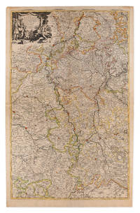
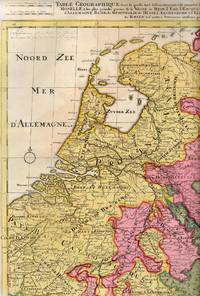
1710ref. 009148Amsterdam: Pierre Mortier 1710 Cooper engraving on two joined sheets measuring 59.5 x 95.5 cm with original outline coloring expertly cleaned and flattened. A good copy of a map of western Germany published in Amsterdam by Pierre Mortier to illustrate events of the War of the Spanish Succession. The first state with "2. Carte de la Meuse" added in manuscript. Pierre Mortier unknown
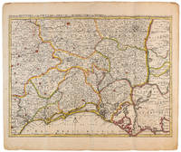
1710ref. 009141Amsterdam: Pierre Mortier 1710 Cooper engraving 44.5 x 59.5 cm on paper measuring 54.0 x 64.0 cm with original color in outline minor spotting and creasing remnants of centerfold. A good copy of a map of south-central France the Cévennes Vivarais Occitania published in Amsterdam by Pierre Mortier to illustrate events of the War of the Spanish Succession. Pierre Mortier unknown
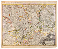
1710ref. 009138Amsterdam: Pierre Mortier 1710 Cooper engraving 50.5 x 60.5 cm on paper measuring 54.0 x 63.0 cm with original color in outline minor spotting and creasing remnants of centerfold paper slightly frayed at edges. A good copy of an uncommon map of the province of Namur a region of the Spanish Netherlands published in Amsterdam by Pierre Mortier to illustrate events of the War of the Spanish Succession. Pierre Mortier unknown
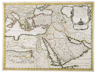
1654ref. G1ADV7RKD7B6Paris 1654. Engraved map 42 x 56 cm coloured in outline. Map of the Turkish Empire showing Ottoman possessions in the Balkans Eastern Mediterranean Egypt and Arabia - marking topography and settlements.l Al Ankary 59; Al-Qasimi 60; Tibbetts 99. unknown
ref. GTC3777Texas Parks and Wildlife Press. Signed by both Sanson and Meinzer 1st ed.; fine condition DJ fine condition. Texas Parks and Wildlife Press unknown
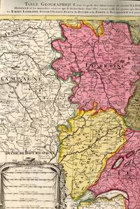
1700ref. BB614331700. unknown. gebraucht gut gefaltete Landkarte mit Mittelfalz Papier altersbedingt etwas fleckig und gebräunt sonst GUTES EXEMPLAR. 442 x 575 cm. Blatt: 535 x 605 cm. l'Archevesche et l'Elctorat de Mayence et le Palatinat du Rhein Lorraine Suisse l'Alsace Sueve la Duche et la Comte de Bourgogne et d'autres Provinces voisines de France et Italie. Altkolorierter Kupferstich um 1700 Für Ihre Zufriedenheit versenden wir mit DHL und ausschließlich mit Trackingcode für eine sichere Sendungsverfolgung! Weitere Angebote unter antiquariat-kastanienhof unknown
1710ref. BB614341710. unknown. gebraucht gut gefaltete Landkarte mit Mittelfalz Papier altersbedingt etwas fleckig und gebräunt sonst GUTES EXEMPLAR. 445 x 575 cm. du Rhein Meuse Moselle et les plus grandes parties de le Weser le Mein l'Ems l'Escault l'Issel et les autres rivieres qui fe dechargent dans elles comme aussi les Provinces d'Allemagne Basse de Westphalie de Hesse l'Archeveche et l'Elctorat de Cologne et de Treves avec les parties de Majence et le Palatinat du Rhein et d'autres Provinces voisines. Altkolorierter Kupferstich um 1710 Blatt: 535 x 605 cm Für Ihre Zufriedenheit versenden wir mit DHL und ausschließlich mit Trackingcode für eine sichere Sendungsverfolgung! Weitere Angebote unter antiquariat-kastanienhof unknown
1812ref. 006820Paris: Chez Jean Md d'Estampes 1812 Engraving 59 x 90 cm old color. The first edition of this map was published in 1674 by Hubert Jaillot under the title "La Russie Blanche ou Moscovie divisee suivant l'étendue des Royaumes Duches." It was incorporated into numerous atlases by Jaillot and his successors until approximately 1720 when it became evidently outdated. However around 1812 it was reissued likely to illustrate the French-Russian war. Chez Jean Md d'Estampes unknown
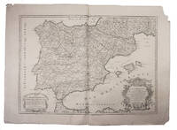
1708ref. E7GCJJB1RUYXParis 1708. Hubert Jaillot Engraved map on 2 assembled sheets 55.5 x 78 cm engraved by Cordier. With title in decorated cartouche on the bottom right corner scales and privilege in decorated cartouche on the bottom left corner and a few lines coloured in green. Large map of Spain and Portugal this state with a privilege for 20 years granted in 1708. Engraved by Cordier after the map by Nicolas Sanson.Strengthened fold damaged corners but map in very good condition.l Cf. Pastoureau Jail. II A map 91. unknown
1678ref. 200041AG1678. Paris Sanson d'Abbeville 1678. Original hand-coloured engraving. Plate Size: 53.6 cm x 41.7 cm. Sheet Size: 61.8 cm x 46.5 cm. Original map. In very good condition. Faint signs of browning to map. Minor paper imperfections to the outer margins. Small stain to map near centre-fold. A richly detailed map showing the northern part of Portugal. Relief on map depicted pictorially and border inlaid with longitudinal and latitudinal details The map is dominated by three rivers: the Tajo Tagus in the south the Douro and the Minho further north. The Spanish kingdom and regions such as Leon are included and the great city of Salamanca can be seen. The lower part of the map runs out before the Tagus estuary empties into the Atlantic at Lisbon. The ornamental title cartouche is in the lower right corner of the map. Off the coast is a large warship flying the coat-of-arms Kingdom of Portugal and the Algarves. The sails of the boat carry Latin text commemorates the commercial and maritime exploits of King John IV in Africa Arabia Ethiopia Persia India and Brazil. Nicolas Sanson 20 December 1600 7 July 1667 was a French cartographer termed by some the creator of French geography in which he's been called the "father of French cartography." The French school of Geography was unprecedented in its attention to precision and scientific detail and discarded much of the decorative embellishments of previous maps as irrelevant. From Sanson's time in the second half of the seventeenth century until the latter part of the eighteenth century French geographical conceptions were more influential than those put forward by any other nation. He was tutor to Louis XIII and Louis XIV. Sanson published over 300 maps. In 1692 Hubert Jaillot collected Sanson's maps in an Atlas nouveau. Wikipedia unknown
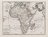
1595ref. 100047AG1595. Paris / London / Antwerp and other places of print c.1595 - 1851. Some stunning examples of hand-coloured copper-engravings plus one manuscript map Tuckey / Congo - Zaire. All of these maps in very good / excellent condition. This collection presents itself for becoming an amazing a meaningful starting-point for an Africana-Collection decoration for a Safari-Lodge interior-design for an Africana-themed library etc. etc. The price includes worldwide free shipping per DHL Express-Courier 2-3 day-delivery. Ask for complete list and images and please also inquire about our amazing book-collection of Africana which would be a great match for this collection of vintage maps. unknown
ref. 73602Paris Pierrr Mariette 1656/ca. 1950. 13 x 17.5 cm 26 x 30 cm Rahmen vergoldet unter Passepartout Min. gebrauchspurig sonst tadell. Handkolorierte Faksimile. - Nicolas Sanson der Ältere auch: Nicolas Sanson d’Abbeville 1600 in Abbeville Frankreich- 1667 in Paris französischer Kartograph. Er gilt als der Vater der Geographie in Frankreich.In den Jahren 1618 bis 1667 schuf Sanson etwa 300 einzelne Karten sowie Atlanten und illustrierte Texte. Er wurde zum Geographe Ordinaire du Roy königlicher Kartenmacher ernannt und unterrichtete die Könige Ludwig XIII. und Ludwig XIV. in Geographie. 010 Paris, Pierrr Mariette, 1656/ca. 1950 unknown
1719ref. E7CG2ENMSWHRParis: Hubert Jaillot 1719. Engraved map on 2 assembled sheets 54.5 x 88 cm. With title in decorated cartouche signed F.C. in upper right corner and scalebars in decorated cartouche in the lower left corner. Coloured in outline. Large map of the Pyrenees a mountain range on the border between France and Spain after Nicolas Sanson 1600-1675. Apparently printed from the original plates differing from the map issued in Mortier's "Jaillot-Atlas".Very good copy slightly browned.l Pastoureau Jail. II C map 166. Hubert Jaillot, unknown
1650ref. 24869London 1650. 1 vols. 13" x 8 3/4. Contemporary. hand-coloring. Fine condition. 1 vols. 13" x 8 3/4 ". unknown
ref. 83285Berlin : Hasselberg’sche Verlagshandlung ohne Jahr. demi-percaline. SANSON H.Geheimnisse des Schaffots. Memoiren der Scharsricher-Familie Sanson 1685-1847. 1. 2.und 3. Bd. in 1 Band. Berlin Hasselberg’sche Verlagshandlung ohne Jahr 190x130mm 199 190 191 Seiten Halbperkalin. No hidden customs fees for orders shipped to the U.S.A with a value of up to 800 USD PDDP shipping we pay the VAT in advance Hasselberg’sche Verlagshandlung unknown
1862ref. 1862SansonEXECUTIONS IN FRANCE Sept Générations d'Exécuteurs 1688-1847: Mémoires des Sanson mis en ordre rédigés et publiés par H. Sanson. Paris: Dupray de la Mahérie 1862-1863. Six volumes each complete with half-title and probably large-paper copies but IV 67/68 with partial loss in lower blank. Tall 8vo unusually clean with hardly any spotting; gilt-stamped leather spines with matching black boards. First edition of this apocryphal memoir of the Sanson family based on family diaries and correspondence by the journalist D'Olbreuse detailing all the major executions from the late 17th century thru middle 19th century. The most famous member of the family is Charles-Henri Sanson 1739–1806 who served as the chief executioner of Paris during the French Revolution. He executed thousands of people—including King Louis XVI Marie Antoinette Danton and Robespierre. He was also closely involved in testing and adopting the guillotine as a more humane method of execution. The family's tenure ended in 1847 when Charles-Henri's grandson Henri-Clément Sanson was dismissed from office and arrested after pawning the family's official guillotine to cover mounting debts and gambling losses. Tulard 1316 - Fierro 1315. Dupray de la Mahérie hardcover
2011ref. G0197264832I4N00British Academy 2011. Hardcover. Very Good. May have limited writing in cover pages. Pages are unmarked. ~ ThriftBooks: Read More Spend Less.Dust jacket quality is not guaranteed. British Academy hardcover
ref. 1916-25Paris H. Jaillot 1692. Alt grenzkolorierte Kupferstichkarte von 2 Platten. 64 5 x 99 cm Blattgr. Breitrandiges Exemplar. Äußere Ränder etwas gebräunt kleiner Randeiniß sonst gut erhalten. Großformatige Karte von Guillaume Sanson 1633-1703 die das Gebiet von Deggendorf bis Wagram und von Kromeríz/Kremsier bis Veszprém/Weissbrünn mit dem Neusiedler See Newsidler See zeigt. Aus dem Verlag von Alexis-Hubert Jaillot um 1632-1712 der eng mit Sanson zusammenarbeitete. Paris, H. Jaillot 1692. unknown
ref. #[63428]Map of North Holland with Tessel island. Large cartouche on the left with title dedication and explanation concerning the scales adopted for this map. The title is printed from a different plate. Titled: 'PARTIE SEPTENTIONALE DU COMTÉ DE / HOLLANDE. / Dressée sur les Memoires les plus Nouveaux. / Par le S.r SANSON Geographe ordinaire du Roy.' // 'Presenté A MONSEIGNEUR LE DAUPHIN / Par son tres-humple tres-Obeissant et tres fidele Serviteur / Alexis Hubert Iaillot.' On the bottom of the scales: 'A Paris chez H. Iallot joignant kes grands Augustins aux deux Globes. / Avec Privilege du Roy pour Vingt Ans. / 1699' last number '9'in pen and brown ink. In fact the original plate does not show the last number which was supposed to be added in a second moment. l Etching and engraving on paper trimmed to plate mark partially hand coloured; total: 431 x 564 mm; pasted on thick paper some losses of paper some stains corners with pinholes and further damages. Folding line in the middle top part of the folding damaged. unknown
1844ref. 274131J.-b. baillière 1844. Etat Passable couverture défraîchie bords abimés texte frais qq rousseurs en marge le prix tient compte de l'état absence page titre tome V. in8. 1844. Relié. 715750 pages. J.-b. baillière unknown
1957ref. 79200MAUGARD 1957. Broché. Etat moyen. in-8. . MAUGARD unknown
1655ref. 56109Paris. 1655. Attractive map of Morocco and parts of Algeria. Maps by Sanson in original colour are rare. Nicolas Sanson was founder of the French school of mapmakers at a time when the leadership in European cartography passed from the Low Countries to France. Copper engraving. Very good condition. Some light browning to the centre fold. Attractive water mark. Original colour. Size: 53 x 40 cm. 21 x 15½ inches unknown