997 résultats
1650réf. 24869London 1650. 1 vols. 13" x 8 3/4. Contemporary. hand-coloring. Fine condition. 1 vols. 13" x 8 3/4 ". unknown
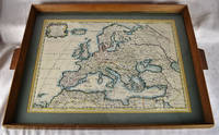
1650réf. 2312280001Petrum Mariette: Lutetiae Parisiorum 1650. First Edition. Maps. Very Good. Ancient Europe : The Roman Empire Fine hand-colored double-page engraved map of Roman provinces of Europe. Mounted in wood frame with wooden side handles. Dimensions of mounted image: 40 x 56 cm. 53 x 69.5 cm in frame. Latin province names cities seas. This is an oversized or heavy book which requires additional postage for international delivery outside the US. Petrum Mariette: Lutetiae Parisiorum unknown
1713réf. 215454Amsterdam: Mortier Pieter 1713. unbound. very good. Map. Engraving with original hand outline. Image measures 14.5" x 18.75". Rare map of Paphlagonia an ancient region of northern Anatolia present-day Turkey along the southern coast of the Black Sea. Highlighting the capital city of Sinope this map depicts the region as defined by Strabo: bound by the Parthenius River in the west extending to the Hays river in the east. Sanson depicts the region comprising the Kingdom of Pontus during the rule of Mithridates IV. Neighboring historical regions of Gallatia and Bithynia et Pontus are labeled. Full original margins light scattered foxing. Based on earlier plates by Sanson. This map appeared in "Atlas Antiquus Sacer Ecclesiasticus et Profanus" published in Amsterdam by Pieter Mortier. Nicolas Sanson 1600-1667 who is considered the founder of the French school of cartography. In reaction to the prevailing trend of Dutch lavishness Sanson favored minimal details focusing rather on accurate cartography than ornament. Pierre Mortier 1661-1711 was a Dutch cartographer engraver and printseller who worked in Amsterdam. He used advanced Dutch printing methods to produce high quality editions of contemporary French maps by cartographers such as De L'Isle Sanson Jaillot de Fer and De Wit. His greatest feat was the nautical atlas "Le Neptune Francois" or "Suite de Neptune Francois" considered to contain the most beautiful examples of cartographic art. After his death his widow Amelia continued publishing in partnership with her brother-in-law David until her death in 1719. This map was published during Amelia's tenure at the firm. Mortier, Pieter unknown
1988réf. BN528811Sand & Tchou 1988. 1988. Hardcover. Atlas du monde 1665 de Nicolas Sanson d'Abbeville Atlas du monde 1665 de Nicolas Sanson d'Abbeville Mireille Pastoureau et Nicolas Sanson Sand & Tchou hardcover
2003réf. BN528626JMG Editions 2003. 2003. Le Plaisir De Tuer Le Plaisir De Tuer Sanson Charly und Richard Bessière JMG Editions unknown
2014réf. BN582237Bouquins 2014. 2014. Softcover. Berlin Berlin David Sanson Bouquins paperback
2004réf. BN579761De Vecchi Editions 2004. 2004. Softcover. Le comte de Saint-Germain Le comte de Saint-Germain Richard Bessière et Charly Sanson De Vecchi Editions paperback
réf. BN105048STE ECRIVAINS. Softcover. Le rêve de lumière Le rêve de lumière STE ECRIVAINS paperback
réf. BN105021Softcover. Les yeux bleus - la non-voyance vous écrit Les yeux bleus - la non-voyance vous écrit paperback
réf. BN105020Softcover. La place verte - roman La place verte - roman paperback
réf. 23929361-nnew. unknown
réf. 41445142-nnew. unknown
réf. 45381745like new. unknown
réf. 25075089-nnew. unknown
réf. 20123360-nnew. unknown
réf. 20123360like new. unknown
réf. 14357382-nnew. unknown
réf. H32ca. 1750. 30 mal 21 cm. Gefalt. Karte. unknown
réf. 36637Milano: Rizzoli 1974. First edition primo edizione hardback. Folio 41cm x 35cm 164pp. Colour frontispiece 44 colour plates tavole 132 text figures. Original green cloth dustwrapper green cloth slipcase. The book is in excellent condition; the dustwrapper is very good short closed tear to the front panel some light fraying of the extremities; the slipcase is good to very good some rubbing. A magnificent production with the text pages printed on hand-made paper and the plates printed on cardstock. Text in Italian. Milano: Rizzoli, 1974. hardcover
1828réf. 11433MADRID: Imprenta de Verges 1828. Primera edición.- 4º.- Plena pasta española doble tejuelo y dorados en el lomo.- 5 tomos.- I: VIII.- 479 páginas.- II: 392 páginas.- 1 hoja de Advertencia.- III: 402 páginas.- 1 hoja Erratas.- IV: 372 páginas.- V: 396 páginas.- 2 hojas Erratas. . Palau 271872 Imprenta de Verges hardcover
réf. 1178214176.Gpaperback. Good. Access codes and supplements are not guaranteed with used items. May be an ex-library book. paperback
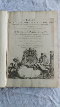
réf. 007346Paris Book. Good. Full-Leather. Elephant Folio - over 15 - 23" tall. 106 geographical tables. This copy has tables from various editions with printing dates from 1663 to 1741. The majority of tables date from 1663-1698. Most are in French but many also in Latin. The plates show different versions of the geographical tables. Please inquire for more details. The majority of tables are 20 inches some tables are 16 inches and are pasted on blank pages. The leather binding is worn at the top and bottom of spine and on corners and edges. Hardcover
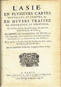
1662réf. 6235Paris: Chez L'autheur 1662. Book. Good. Full-Leather. 4to - over 9¾" - 12" tall. 104 pages. Text only lacking all maps. Sound leather binding a little war at the top of the spine. No publication date assumed 1662. Chez L'autheur Hardcover
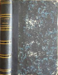
1866réf. 16718FURNÉ JOUVET ET Cie GAUTHIER-VILLARS 1866. coins usagés ensemble prorpe. in12. 1866. reliure editeur demi basane. 514 pages. semaine scientifique andré sanson FURNÉ JOUVET ET Cie GAUTHIER-VILLARS unknown
réf. 0807172774.Gpaperback. Good. Access codes and supplements are not guaranteed with used items. May be an ex-library book. paperback