Sanson, Henri,Biblio.com
917 résultats
réf. 46624209like new. unknown
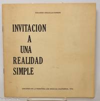
1974réf. 343576Los Angeles: Ediciones de la Frontera 1974. Pamphlet. 20 pages staplebound pamphlet. 8.75x8.5 in. Author's presentation inscription on title page: "Para Enrique mi buen amigo y profesor con el aprecio de su ex-alumno signed Eduardo Arguello Sanson." Covers dustsoiled bottom corner bumped. Scarce book of poems by the Nicaraguan-born writer. WorldCat lists only four locations three in the US one in the UK as of January 2026. Ediciones de la Frontera unknown
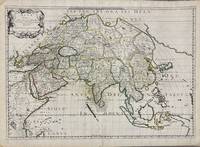
1650réf. 005908Paris: Pierre Mariette 1650. First state. Loose Sheet. Very good. Hand colored map on laid paper. Sheet Measurements: 600mm x 440 mm; Plate Measurements: 563mm x 392mm. Antique map titled "Asia Vetus" Ancient Asia by Nicolas Sanson first published circa 1650. Considered a significant piece of cartographic history marking the shift of mapmaking excellence from Amsterdam to Paris in the 17th century. Map Condition: center fold with light reinforcement ancient remains of dried adhesive to corners lower left corner shows small area of paper thinning and some disruption to text very light toning in spots. Discrete prior owner notations in pencil to verso. Please examine photographs for condition in general. Pierre Mariette unknown
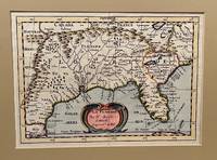
1734réf. 22619Utrecht 1734. Full-title: La Floride. Par N. Sanson d' Abbeville Geogr. Ordre du Roy. Copper engraved double-page hand colored map. Neat pencil writing on verso "Henri Du Sauzet 1734". Image size 7" x 9 7/8". Tipped in double-mat. Fold line down center else a fine copy. The map covers southern states and coastline from Secotan in Virginia to Planuco in Mexico. Showing political and administrative boundaries major cities towns villages rivers mountains drainage etc. Nicolas Sanson 1600 – 1667 was a French cartographer who served under two kings in matters of geography. He has been called the "father of French cartography." Henri Du Sauzet 1686/87 - 1754 was a bookseller/publisher in Amsterdam during the early to mid-eighteenth century. unknown
réf. 1333160763.Gpaperback. Good. Access codes and supplements are not guaranteed with used items. May be an ex-library book. paperback
réf. 0974948101.Gpaperback. Good. Access codes and supplements are not guaranteed with used items. May be an ex-library book. paperback
réf. 0483167223.Ghardcover. Good. Access codes and supplements are not guaranteed with used items. May be an ex-library book. hardcover
réf. 0364632410.Ghardcover. Good. Access codes and supplements are not guaranteed with used items. May be an ex-library book. hardcover
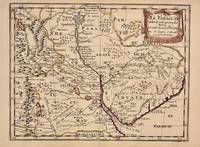
1657réf. 326341Paris 1657. unbound. Map. Original outline coloring. Sheet measures 8 3/4" x 12 1/8". Image measures 8" x 10 5/8". Paris: Nicolas Sanson 1657. This rare 17th century map by Nicolas Sanson with original color depicts the region showing present day Paraguay Uruguay with parts of Brazil and Argentina. Mountains are rendered pictorially and cities rivers and notations describing indigenous populations are labeled. In very good condition. Nicolas Sanson 1600-1667 is considered the founder of the French school of cartography. In reaction to the prevailing trend of Dutch lavishness Sanson favored minimal details focusing rather on accurate cartography than ornament. unknown
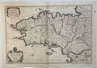
1693réf. 324404Paris: Alexis-Hubert Jaillot 1693. Map. Engraving with hand colored outline. Image measures 21" x 31" This large 17th century double-page map features the Brittany region of France. Cities towns abbeys government buildings rivers ports and harbors are labeled. Mountains forests and wetlands are depicted pictorially. The attention to detail in topography and population centers hints at the abundance of the region known for its production of Muscadet wine cheese boar seafood and other agricultural products. Executed by Nicolas Sanson in dedication to his son this map was published by Alexis-Hubert Jaillot in Paris and later reproduced in Amsterdam by Jaillot and Pierre Mortier. This early edition is scarce and hard to find. In very good condition with some offsetting to left side and a spot in the right margin. Nicolas Sanson 1600-1667 is considered the founder of the French school of cartography. In reaction to the prevailing trend of Dutch lavishness Sanson favored minimal details focusing rather on accurate cartography than ornament. Alexis-Hubert Jaillot unknown
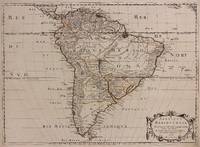
1650réf. 309461Paris: Pierre Mariette 1650. unbound. Abraham Peyrounin. Map. Engraving with original outline color. Image measures 15 3/4" x 21 3/4" This exceptionally fine map of South America covers the continent in fine detail. Coastlines are extensively labeled and mountains beautifully rendered in profile. The Orinoco and Amazon Rivers as well as Rio de la Plata are prominently rendered. Sanson refrains from drawing a southern coastline to Tierra del Fuego and the relatively unknown Amazon region is depicted in minimal detail. Sanson does however include the mythical lake "Lac de Parime" and the city of gold "Manoa del Dora" between the Orinoco and Amazon rivers. Nice dark impression. In very good condition. Minor dampstain to lower margin not affecting the image and some faint stains near the center of the map - otherwise clean and bright. Hard to find. Nicolas Sanson 1600-1667 is considered the founder of the French school of cartography. In reaction to the prevailing trend of Dutch lavishness Sanson favored minimal details focusing rather on accurate cartography than ornament. Pierre Mariette unknown
1683réf. 297468Paris 1683. unbound. Map. Copper engraving with hand coloring. Image measures 7 5/8 x 11 1/4 inches. This map published in Paris in Afrique en plusieurs cartes is one of Sanson's small atlas maps of depicting various African regions. This map offers extensive detail on the cities of North Africa as well as topographical and geographical features with mountains beautifully rendered in profile. Nicolas Sanson 1600-1667 is considered the founder of the French school of cartography. In reaction to the prevailing trend of Dutch lavishness Sanson favored minimal details focusing rather on accurate cartography than ornament. This map is a fine example of his work. unknown
1663réf. 283501Paris 1663. unbound. very good. Map. Hand-colored engraving. 15" x 23". This map of Sicily from the 17th century shows the entire island as well as the southwesternmost tip of the Italian peninsula. The names of the surrounding bodies of water are named in Latin and rivers mountains lakes and towns are noted on the map. Nicolas Sanson 1600-1667 is considered the founder of the French school of cartography. In reaction to the prevailing trend of Dutch lavishness Sanson favored minimal details focusing rather on accurate cartography than ornament. This map is a fine example of his work. unknown
1648réf. 251162Paris 1648. unbound. Map. Engraving with hand outline color. Image measures 14.5 x 21.5 inches. This map of Switzerland centers on Lucerne covering approximately the area from Lake Constance south to Lake Como in Italy. Published in 1648 the map dates to the period of the Old Swiss Confederacy. Furthermore it predates by only a few years the Swiss Peasant War of 1653 a siege of Lucerne and Bern that demonstrated the significance of the rural population to the confederacy's stability. Hand-colored outlines on the map indicate the various independent states that made up the confederacy. A title cartouche with elaborate scrollwork adorns the lower right corner of the map. The map is in good condition with full margins and no chips or tears. Wear to lower margin. Nicolas Sanson 1600-1667 is considered the founder of the French school of cartography. In reaction to the prevailing trend of Dutch lavishness Sanson favored minimal details focusing rather on accurate cartography than ornament. This map demonstrates the skill that made him such a valuable asset to the French monarchy. unknown
réf. 215370Amsterdam: Pierre Mortier. unbound. very good. Map. Engraving with hand outline. Image measures 13 3/4" x 22 1/2". Rare map of Galatia an ancient region of northern Anatolia present-day Turkey along the southern coast of the Black Sea. Published circa 1705 this map is centered on Ankara and shows provinces inhabited by Trocmi Tectosages and Tolistobogi - three Celtic tribes who inhabited the region from the 3rd century BC. Neighboring historical regions of Paphlagonia Pontus Phyrgia Cappadocia and Lycaonia are labeled. Mountains and cities are depicted pictorially. The map shows major roads connecting cities throughout the region. A decorative cartouche features lively figures celebrating with percussion and wind instruments. Full original margins minor offsetting. Based on earlier plates by Sanson. This map appeared in "Atlas Antiquus Sacer Ecclesiasticus et Profanus" published in Amsterdam by Pieter Mortier. Nicolas Sanson 1600-1667 who is considered the founder of the French school of cartography. In reaction to the prevailing trend of Dutch lavishness Sanson favored minimal details focusing rather on accurate cartography than ornament. Pierre Mortier 1661-1711 was a Dutch cartographer engraver and printseller who worked in Amsterdam. He used advanced Dutch printing methods to produce high quality editions of contemporary French maps by cartographers such as De L'Isle Sanson Jaillot de Fer and De Wit. This map is a lovely example of his work. Pierre Mortier unknown
1696réf. 206066Amsterdam: Alexis-Hubert Jaillot 1696. unbound. very good. Map. Engraving with hand outline. Image measures 23" x 35". Stunning map showing the vast extent of the German Empire including parts of Poland Bohemia Hungary Austria Croatia Italy France and the Netherlands. Exquisite and subtle coloring beautifully detailed. Based on a plate by Nicolas Sanson reworked and published in "Atlas Nouveau" by Jaillot. Severe toning due to early acid backing chipping to edges and corners and some tears. Priced as is. Alexis-Hubert Jaillot 1632--1712 was a French sculptor engraver publisher and cartographer. He served as official geographer to King Louis XIV and worked with other prominent mapmakers of the period such as Nicolas Sanson He is best known for his Atlas Nouveau of 1674. Alexis-Hubert Jaillot unknown
1723réf. 209708Amsterdam: Mortier Pieter 1723. unbound. very good. Map. Engraving with hand outline. Image measures 14" x 18.75". Beautifully detailed map showing the area between the the Black and Caspian Seas including modern day Russia Georgia Azerbaijan Armenia and Turkey. Full original margins have minor stains. Based on the plates by Nicolas Sanson 1600-1667 who is considered the founder of the French school of cartography. In reaction to the prevailing trend of Dutch lavishness Sanson favored minimal details focusing rather on accurate cartography than ornament. Mortier, Pieter unknown
1723réf. 202384Amsterdam: Mortier Pieter II 1723. unbound. very good. Map. Engraving with hand coloring. Image measures 14.5" x 19.25". Includes parts of modern day Morocco Algeria Tunisia and Libya. Nicolas Sanson 1600-1667 is considered the founder of the French school of cartography. In reaction to the prevailing trend of Dutch lavishness Sanson favored minimal details focusing rather on accurate cartography than ornament. Large decorative title cartouche. Map is in good condition with ample margins. Staining along centerfold. Chipped near edges along centerfold. Mortier, Pieter II unknown
réf. 0259030171.Gpaperback. Good. Access codes and supplements are not guaranteed with used items. May be an ex-library book. paperback
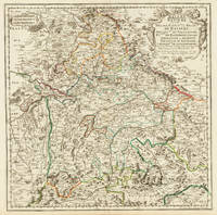
1703réf. 32775Paris 1703. Tadelloses Exemplar. 420 by 420mm 16½ by 16½ inches. Original antiker Kupferstich in zeitgenössischem Grenzkolrit. Dargestellt wird der bayrische Kreis um 1650 im Norden von Eger bis nach dem benachbarten Insbruck im Süden. Im Westen noch mit Ulm a.d. Donau und im Osten bis Linz. Die einzelnen Bezirksämter u. Bistümer deutlich durch das schöne Grenzkolorit herausgearbeitet. Zeigt Ober- u. Niederbayern sowie die Oberpfalz. Rechts oben große dekorative Rollwerkstitelkartusche links oben kleiner Meilenzeiger. Gestochen von R. Cordier. Nicolas Sanson der Ältere 20. Dezember 1600 in Abbeville Frankreich; 7. Juli 1667 in Paris war ein französischer Kartograph. Seine Vorfahren stammten aus Schottland. In den Jahren 1618 bis 1667 schuf Sanson etwa 300 einzelne Karten sowie Atlanten und illustrierte Texte. Seine Arbeit wurde von seinen Söhnen Nicolas Sanson 1626 Schottland; 27. August 1648 in Paris Adrien Sanson 1708 und Guillaume Sanson 1703 seinem Neffen Pierre Duval 1619; 1683 seinem Enkel Pierre Moulard Sanson 1730 und Gilles Robert de Vaugondy 1688; 1766 fortgeführt. Wikipedia Speculum Orbis/Loeb San.VA53 unknown
2025réf. __1382052901OUP Oxford 2025. Paperback. New. 5.12x0.59x7.28 inches. OUP Oxford paperback
réf. 0428884288.Ghardcover. Good. Access codes and supplements are not guaranteed with used items. May be an ex-library book. hardcover
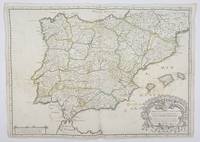
1658réf. 356952Paris.: Tavernier. 1658. Dampstain cover mot of the image also some coffee spots otherwise good. 42.5x57.2x.01 cm. Image size 41x55.5 to neatline. An uncommon map of Spain and Portugal with outline color. weight: 0.1 lb. Engraved by Melchior Tavernier. Tavernier. unknown
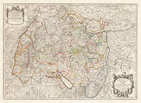
1710réf. 37419Paris: Hubert Jaillot 1710. In ausgezeichnetem Zustand. 803 by 560mm 31½ by 22 inches. Kupferstichkarte in zeitgenössischem Grenzkolorit. Mit großer prächtiger allegorischer Kartusche sowie Meilenzeiger mit Legende. Erschienen im großen AtlasAtlas Nouveau contenant. von Nicolaus Sanson u. Hubert Jaillot. Dargestellt wird der schwäbische Kreis im Norden mit dem benachbarten Franken u. im Süden bis zum Bodensee. Im Osten noch mit Teilen von Bayern der Westen mit dem angrenzenden Frankreich. Das Kartenbild sorgfältig u. übersichtlich ausgearbeitet. Der Atlas Nouveau. entstand als Auftragsarbeitet für Ludwig XIV. und nahm einen Zeitraum von über 10 Jahren in Anspruch. Die Karten gelten bis heute noch als eine Meisterleistung der französischen Kartographie des 17.Jahrhunderts. Als Geburtsjahr Jaillots wird das Jahr 1632 angenommen da in seiner Sterbeurkunde sein Alter mit 80 Jahren angegeben war. Der Geburtsort war Avignon-lès-Saint-Claude damals ein kleiner Weiler in der Exklave der Freigrafschaft Burgund die dazu gehörte Spanisches Königreich. Jaillot hatte seit seiner Kindheit ein großes Talent für Kunst und Design. Bildhauerei lernte er bei seinem Bruder Pierre-Simón. Als Folge der französisch-spanischen Konflikte wurde ihre Heimatstadt verwüstet und so gingen die beiden Brüder 1657 nach Paris. Dort erlangten sie bald einen gewissen Ruf und den Titel „Sculpteur du Roy. 1665 heiratete Jaillot in die Kartenverlegerfamilie Berey ein. Nach dem Tod seines Schwagers Nikolaus II. Berey 16401667 kaufte er die Berey-Kartensammlung von seiner Schwägerin. Dadurch erhielt er eine wertvolle Grundlage die er sofort vermarkten konnte ohne jemals selbst eine Karte erstellt zu haben. Jaillot stieg zu einem günstigen Zeitpunkt in das Kartengeschäft ein. Anfang 1668 gewann Ludwig XIV. den ersten seiner Réunionskriege und es begann eine Zeit in der Frankreich sein Territorium kontinuierlich erweiterte. Es entwickelte sich eine große Nachfrage nach Karten die die französischen Triumphe und die neuen Grenzen sowie bevorstehende Expansionspläne darstellten.Zu Jaillots Kartensammlung gehörten auch Druckplatten die von Pierre Duval 16191683 Neffe von Nicolas Sanson erstellt und ursprünglich an Nicolas Berey verkauft wurden. Doch Duval der auch seine eigenen Karten veröffentlichte weigerte sich seine alten Karten nachzudrucken. Auf dem Höhepunkt des Streits mit Duval rekrutierte Jaillot Ende 1670 Nicolas Sansons Söhne Guillaume und Adrien als Kartenmacher und Geschäftspartner. Mit ihnen konnte er neue Karten mit dem prestigeträchtigen Namen Sansons vermarkten. Sein erster Atlas aus dem Jahr 1681 Atlas Nouveau wurde ein so großer kommerzieller Erfolg dass andere Verlage begannen plagiierte Kopien zu verbreiten.Jaillot bemühte sich um königliche Schirmherrschaft und widmete viele seiner Kartenausgaben dem König. Schließlich wurde er am 20. Juli 1686 zum Géographe du Roy ernannt und erhielt eine jährliche Rente von 600 Livres. Dieser Titel sowie die protektionistische und kontrollierende Gesetzgebung ermöglichten es ihm sich erfolgreich gegen seine Plagiatoren zu wehren.Seit dem frühen 18. Jahrhundert gab Jaillot immer weniger Karten aus. Die Nachfrage nach zeitnah aktualisierten Karten nahm zu und er war immer weniger in der Lage auf die Anforderungen des Marktes zu reagieren. Jüngere Konkurrenten waren gut ausgebildete Geographen wie Guillaume Delisle die die Kartierung selbst durchführen konnten. Im Laufe der Zeit übergab Jaillot das Geschäft an seinen Sohn Bernard Jean-Hyacinthe.Alexis Hubert Jaillot starb am 2. November 1712 im Alter von 80 Jahren in Paris. Er wurde im Convent des Grands-Augustins beigesetzt. WikipediaNicolas Sanson der Ältere 20. Dezember 1600 in Abbeville Frankreich; 7. Juli 1667 in Paris war ein französischer Kartograph. Seine Vorfahren stammten aus Schottland. Zwischen 1618 und 1667 schuf Sanson rund 300 Einzelkarten sowie Atlanten und illustrierte Texte.Seine Arbeit wurde von seinen Söhnen Nicolas Sanson 1626 Schottland; 27. August 1648 in Paris Adrien Sanson 1708 und Guillaume Sanson 1703 seinem Neffen Pierre Duval 1619; 1683 ausgeführt. sein Enkel Pierre Moulard Sanson 1730 und Gilles Robert de Vaugondy 1688; 1766 führten weiter. Wikipedia Hubert Jaillot unknown
1696réf. 23767Amsterdam: Covens 1696 -1700. Other. In very good to excellent condition. A small tear at the left side. 392 by 517mm 15½ by 20¼ inches. 392 by 517mm 15½ by 20¼ inches. Copper engraving uncolored as published. Covens unknown