Jaillot, Alexis-Hubert & Sanson, NBiblio.com
917 résultats
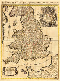
1693réf. 17484Paris: H. Jaillot 1693. Other. In very good condition. 757 by 582mm 29¾ by 23 inches. 757 by 582mm 29¾ by 23 inches. Copper-engraving handcolored in outline when published. Minor offsetting of the old outline colors to the paper. Printed around 1693 by Hubert Jaillot in Paris printed from two plates and published in his great atlas the Atlas Noveau.. Large and decorative map of England by the French cartographer Nicolaus Sanson and Hubert Jaillot. Published in the 'Atlas Noveau.' this atlas was a masterpiece in the French cartography in the 17th century. The atlas was specially designed for Louis XIV and due of the very large size of the plates most maps were printed from two plates it took Hubert Jaillot over 12 years to complete the 'Atlas Noveau.'. England is very detailled shown on the map as well the various counties are shown in engraved territory borders. The maps are rich in detail with many cities and place names rivers mountains castles etc. The map is ornated with a very large fine allegoric title cartouche with coat of arms in the upper right corner as well a decorative cartouche with a milage scale in the lower left corner. H. Jaillot unknown
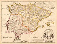
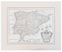
1704réf. 19604Paris: N. Sanson 1704. Other. In very good condition a slightly creasing in the lower part of the centrefold with minor tiny spots. 410 by 525mm 16¼ by 20¾ inches. 410 by 525mm 16¼ by 20¾ inches. Copper engraving hand colored in outline when published. Interesting and detailed map of Antique Spain with Portugal and the Balearic Islands by the French cartographer Nicolaus Sanson d´Abbeville. The map provides us a lot of information of the various place names of cities and small towns the rivers mountains and also engraved borders of the various Spanish provinces. The map impresses with the geographic exactness which is typical for the French cartographer Nicolaus Sanson. In the decorative cartouche which is in shape of a seashell we find the altered date 1704 which is a relatively late edition for maps by N. Sanson. The map is probably published in a French composit atlas around this date. N. Sanson unknown
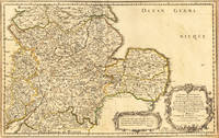
1654réf. 17463Paris: N. Sanson 1654. Other. In very good condition. 365 by 580mm 14¼ by 22¾ inches. 365 by 580mm 14¼ by 22¾ inches. Copper-engraving handcolored in outline when published. Fine and strong impression of this early decorative mid-seventeenth century map of this English regional map covering the area Chester Darbing Nottingham. by the famous French cartographer Nicolaus Sanson. Very detailled and naming many cities and villages as well many places along the coastline. Showing prominently the eastern part of central England. In the lower right corner with a large floral title cartouche and milage scale. N. Sanson unknown
réf. 1332514030.Gpaperback. Good. Access codes and supplements are not guaranteed with used items. May be an ex-library book. paperback
1954réf. 1440Aerovoz revista mensual organo oficial de la federacion aerea nacional de cuba director calixto sanchez white 4 anos desde enero de 1954 hasta junio de 1957 director macario fernandez coleccion en 2 volumenes.en muy buen estadorevista ilustrada.es una revista muy rara sobre la aviacion cubana de la republica.con interesantes articulos y resenas historicas y de la actualidad. Talleres editorial puga,guanabacoa hardcover
1710réf. 13749441710. A map of Spain by French cartographer Nicolas Sanson 1600-1667 in a later Italian edition dated 1710. In Excellent condition with even age toning. Double matted. Mat: w 28.25 in. x h 23.5; Map: w 24.25 in. x h 19 in. Shelved at DuPont. 1374944. Arts & Antiques. unknown
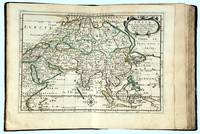
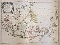
1662réf. 16493Paris: chez l’Autheur 1662. SECOND EDITION. Complete with 17 double-page engraved maps hand-colored in outline. Contemporary mottled calf corner edges neatly repaired interior has some minor dampstaining mainly on text and on blank verso of maps last blank leaf torn on lower fore-edge. A contemporary signature on first blank leaf. Similar to L’Amerique this atlas of the continent of Asia was first printed in 1652 and reprinted here with a new title page. The maps are all dated 1652 with only one dated 1653 and do not include the address of Mariette. The atlas features maps of India Persia China Japan the Maldives Arabia and the Philippines among others. Just prior to publication of this series of works which also included atlases of Europe and Africa Sanson formed a partnership with Pierre Mariette an engraver and printseller. Pursuant to their contract Sanson drew the maps and Mariette engraved and printed them. Each maintained possession of half of the plates and they were allowed to exchange and/or buy from one another. Some bore the address of Sanson others Mariette. But Sanson allowed Mariette to store his plates and Mariette without prior agreement started placing his address on Sanson’s plates. In time a lawsuit which had been prosecuted was settled when both died and their respective sons took over the business. This atlas is a fine examples of French mapping by the foremost French cartographer of the seventeenth century. Sanson 1600-1667 “Geographe Ordinaire du Roi” to Louis XIII is considered the founder of French cartography and is generally acknowledged as the originator of the great age of French cartography. chez l’Autheur unknown
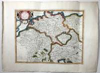
1696réf. H40716Rome: Giovannie Giacomo de Rossi 1696. Very good. Sheet measures 27.5 x 20.5 inches map itself measures 20 x 16 inches. Very good some curving and bending from having been stored rolled up but no creases or tears light toning and mildest foxing. Period hand coloring and handsome cartouche. Italian edition of the French mapmaker's map of Germany and Bohemia. Giovannie Giacomo de Rossi unknown
réf. 0520399005.Gpaperback. Good. Access codes and supplements are not guaranteed with used items. May be an ex-library book. paperback
1654réf. 6117740.1 x 56 cm original outline hand-colour copper engraving. EXTREMELY RARE map probably from ''Cartes generales de toutes les parties du monde' . Condition: with folds as issued with water stains and professionally repaired tear on lower left margin not affecting plate. Reference: Quirino p. 83; BMC Printed Maps XII col.867; Cat.Nat.mar.Mus.271 map 15; Nordenskiöld 275 vol.1 map 17; pastoureau Sanson V map 12. Pierre Mariette, Paris.
1696réf. 9749Scarce original hand-colored engraving by Sanson published in Pierre Mortier's Atlas Nouveau or Atlas Novum ad usum serenissimi. Image size is approximately 23 x 18.75 in 58.5 x 47.5 cm; page size is 24.75 x 21 in 63 x 53.5 cm. Some minor staining and toning to edges not affecting the image.
réf. 1528365852.Ghardcover. Good. Access codes and supplements are not guaranteed with used items. May be an ex-library book. hardcover
1696réf. 16269Paris: Alexis Hubert Jaillot 1696. Copper-engraved map with full original colour and gold embellishment in excellent condition. A stunning map of Normandy by Alexis Jaillot an exceptional example with gilt embellishments. One of the most important figures in French cartography Nicolas Sanson initiated the great school of French geographers. Born in Abbeville in 1600 Sanson established his first printing house in Paris in 1638. He soon became geographer to the king establishing himself as one of the most influential cartographers on the Continent. He was succeeded by his sons Adrien and Guillaume and by his son-in-law Pierre Duval who continued to publish a wealth of maps using Sanson's name. At the close of the seventeenth century Sanson's plates were purchased by the influential cartographer Alexis Hubert Jaillot who continued to publish his maps and atlases under Sanson's title. This stunning map of Normandy is based on Sanson's map published in 1650 but was redrawn and enlarged by Jaillot. It shows the provinces of Normandy as well as the northern tip of Brittany and part of the English Channel. Both Jersey and Guernsey are included as is Mont St. Michel off the coast of St. Malo. In keeping with all of Sanson's and Jaillot's superb maps forests rivers and towns are meticulously identified and named. The map includes an ornate cartouche in the upper section as well as a scale and key. Tooley Maps & Map-Makers pp. 40-41. Alexis Hubert Jaillot unknown
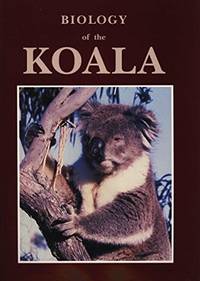
1991réf. 30970Sydney Chipping Norton: Surrey Beatty & Sons / World Koala Research Corporation 1991. c1990 for 91 ed. Hardback large tall quarto dustjacket very good condition in very good dustjacket three colour plates black & white photos & plates black & white drawings figures tables frontispiece drawing front & rear endpaper minimal foxed spots edges few tiny pinhead marks pastedowns. Heavy 1.4 Kg and extra postage may be requested to destinations outside Australia. 336 pp. This fascinating comprehensive and substantial book gives a current view of the biology conservation and care of koalas. There is a reassessment of the phylogenetic affinities of the koala; several contributions reviewing the dynamics and status of natural populations; reassessments of our knowledge of diet; a substantial review of digestion which sheds new light on digestive function in hind gut fermenters; the first description of the social system in natural populations of koalas; new information on the endocrine control of reproduction; a substantial body of information on the impact of Chlamydia on koalas; and papers on management. The text includes 31 papers from experienced scientists who have worked in their respective fields. This reference volume emanates from the Third National Symposium sponsored by the World Koala Research Corporation held in February 1988. Surrey Beatty & Sons / World Koala Research Corporation hardcover
1670réf. 9482Scarce map engraving outlined in original color from Sanson's Cartes Generales de Toutes les Parties du Monde. The image measures approximately 19.75 x 16.5 in 50 x 42 cm; page measures 23.25 x 17.5 in 59 x 44.5 cm. Pierre Mariette
1692réf. 001000Paris: Chez H. Jaillot 1692. First edition thus. Map. Good/No jacket as issued. Large double page copper engraved map 23" x 34 1/2". Contains wide margins and a decorative cartouche. Hand-colored boundaries and cartouche. General age-toning with minor browning. Nicely framed in modern rope effected matte gold frame 32" x 42" with gilt bordered white mat and acrylic glaze. A good copy of this scarce map. All text in French Printed just 9 years after the Ottomans besieged Vienna. Extra shipping may apply for foreign orders. Chez H. Jaillot unknown
1652réf. 010748twParis: Sanson. Very Good. 1652. A very rare map from Nicolas Sanson. Imprint bears the date of 1652 although it is possible that this copy came from an atlas in the later 1600s. Light toning and edgewear with one corner slightly chipped. Light soil on lower margin. Hand-colored boundaries. Map borders measure 14" x 20 3/4". California is shown as an island and Terre Australe is a vague line encircling the Antarctic. Terre de Iesso is the name given to the land mass northwest of North America. Sanson 1600-1667 published many map versions of the world and is known as "the father of French cartography." ; 16 1/2" x 22 1/4" . Sanson unknown
1954réf. mon0000050986London 1954-01-01. Hardcover. Very Good. 2.5980 cent in x 18.3860 cent in x 13.1900 cent in. Complete with dust wrapper. Rare. London hardcover
réf. 0805917675.Gunknown_binding. Good. Access codes and supplements are not guaranteed with used items. May be an ex-library book. unknown
réf. 1021186929.Gpaperback. Good. Access codes and supplements are not guaranteed with used items. May be an ex-library book. paperback
réf. 3838178408.Gpaperback. Good. Access codes and supplements are not guaranteed with used items. May be an ex-library book. paperback
réf. 6131577927.Gpaperback. Good. Access codes and supplements are not guaranteed with used items. May be an ex-library book. paperback
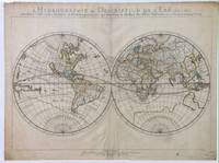
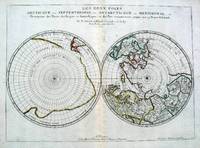
1657réf. 5033Paris 1657. Par N. Sanson d'Abbeville Geographe ordre du Roy. Spence 3017 lists a slightly different title but undoubtedly the same map. 53x38 cms. Period outline color central fold very good condition. A double hemisphere map to the North and South poles. The North pole is connected to Greenland and Spitzbergen but there is little other detailed coastline in the polar area. Europe Russia and Canada are delineated. The South pole is based on the great unknown Southland of Magellan. The tip of S. America is shown and a large land mass which encompasses the whole of the hemisphere but nothing else. unknown
1652réf. 14178Paris: Sanson 1652. Double hemisphere world map showing the rivers and water bodies of the world. Original outline color. 20 3/4 x 15 3/4". Depicts Australia prior to Tasman's discoveries and labels North Australia "Beach" according to Marco Polo and California as an island. References: Shirley R.W. World 394. Sanson unknown
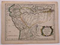
1657réf. W2347Paris: Chez Sanson 1657. Image is 8 1/8 inches by 11 inches on a folded sheet measuring 9 inches by 12 13/16 inches. Original hand-colored copper-engraved map from Sanson's atlas of maps of the Americas: L'Amerique en Plusieurs Cartes. It is a map of the Viceroyalty of Peru that displays the Amazon River and its many tributaries. Nicolas Sanson 1600-1667 was the official geographer for the king of France. His map of Peru and the Amazon became the standard that was copied by almost all geographers/cartographers--even reproduced by Bion for his 1700 treatise on globes. Cintra and Oliveira argue that Sanson's map was a scientific one that holds up well even when compared to 21st century maps of the region. The map is in about very good condition: clean with bright original outline color; minimal foxing ; some edgewear and soiling in the margins. . First Edition. Single Sheet. Very Good-. 8 1/8 inches by 11 Inches. Map. Chez Sanson