Nicolas Sanson d'Abbeville / I SomerBiblio.com
979 Ergebnisse
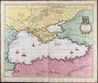
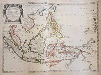
1654Best.-Nr. 6117740.1 x 56 cm original outline hand-colour copper engraving. EXTREMELY RARE map probably from ''Cartes generales de toutes les parties du monde' . Condition: with folds as issued with water stains and professionally repaired tear on lower left margin not affecting plate. Reference: Quirino p. 83; BMC Printed Maps XII col.867; Cat.Nat.mar.Mus.271 map 15; Nordenskiöld 275 vol.1 map 17; pastoureau Sanson V map 12. Pierre Mariette, Paris.
1696Best.-Nr. 9749Scarce original hand-colored engraving by Sanson published in Pierre Mortier's Atlas Nouveau or Atlas Novum ad usum serenissimi. Image size is approximately 23 x 18.75 in 58.5 x 47.5 cm; page size is 24.75 x 21 in 63 x 53.5 cm. Some minor staining and toning to edges not affecting the image.
Best.-Nr. 1166040631.Gpaperback. Good. Access codes and supplements are not guaranteed with used items. May be an ex-library book. paperback
Best.-Nr. 0353804282.Ghardcover. Good. Access codes and supplements are not guaranteed with used items. May be an ex-library book. hardcover
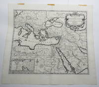
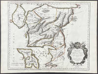
1707Best.-Nr. 23156Amsterdam: Pierre Mortier. Very Good with No dust jacket as issued. c.1707. Map. 3 pieces of brown paper tape along upper blank margin.; No date c. 1707. We think this map is possibly from "Le Sainte Bible" edited by David Martin Amsterdam 1707. Dimensions of sheet: 508 x 451mm. Dimensions of printed area: 439 x 368mm. Uncoloured. Copperplate engraved map. Elaborate cartouche. Centrefold. With inset map at lower left "Campemens des Israelites dans le Desert". "The first Pieter Mortier was an 18th-century mapmaker and engraver who was born in Leiden the son of a political refugee from France. He travelled to Paris in 1681-1685 then returned to Amsterdam where he operated as a bookseller from 1685 until 1711. He won the privilege in 1690 of publishing maps and atlases by French publishers in Amsterdam for the Dutch market. He used this privilege to win a similar set of privileges for printing an "illustrated print bible" in 1700." - Wikipedia entry on Pieter or Pierre Mortier accessed October 2021. NB: This map will be posted rolled in a mailing tube. . Pierre Mortier unknown
Best.-Nr. 1528365852.Ghardcover. Good. Access codes and supplements are not guaranteed with used items. May be an ex-library book. hardcover
1696Best.-Nr. 16269Paris: Alexis Hubert Jaillot 1696. Copper-engraved map with full original colour and gold embellishment in excellent condition. A stunning map of Normandy by Alexis Jaillot an exceptional example with gilt embellishments. One of the most important figures in French cartography Nicolas Sanson initiated the great school of French geographers. Born in Abbeville in 1600 Sanson established his first printing house in Paris in 1638. He soon became geographer to the king establishing himself as one of the most influential cartographers on the Continent. He was succeeded by his sons Adrien and Guillaume and by his son-in-law Pierre Duval who continued to publish a wealth of maps using Sanson's name. At the close of the seventeenth century Sanson's plates were purchased by the influential cartographer Alexis Hubert Jaillot who continued to publish his maps and atlases under Sanson's title. This stunning map of Normandy is based on Sanson's map published in 1650 but was redrawn and enlarged by Jaillot. It shows the provinces of Normandy as well as the northern tip of Brittany and part of the English Channel. Both Jersey and Guernsey are included as is Mont St. Michel off the coast of St. Malo. In keeping with all of Sanson's and Jaillot's superb maps forests rivers and towns are meticulously identified and named. The map includes an ornate cartouche in the upper section as well as a scale and key. Tooley Maps & Map-Makers pp. 40-41. Alexis Hubert Jaillot unknown
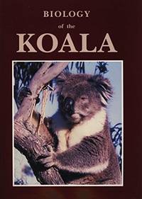
1991Best.-Nr. 30970Sydney Chipping Norton: Surrey Beatty & Sons / World Koala Research Corporation 1991. c1990 for 91 ed. Hardback large tall quarto dustjacket very good condition in very good dustjacket three colour plates black & white photos & plates black & white drawings figures tables frontispiece drawing front & rear endpaper minimal foxed spots edges few tiny pinhead marks pastedowns. Heavy 1.4 Kg and extra postage may be requested to destinations outside Australia. 336 pp. This fascinating comprehensive and substantial book gives a current view of the biology conservation and care of koalas. There is a reassessment of the phylogenetic affinities of the koala; several contributions reviewing the dynamics and status of natural populations; reassessments of our knowledge of diet; a substantial review of digestion which sheds new light on digestive function in hind gut fermenters; the first description of the social system in natural populations of koalas; new information on the endocrine control of reproduction; a substantial body of information on the impact of Chlamydia on koalas; and papers on management. The text includes 31 papers from experienced scientists who have worked in their respective fields. This reference volume emanates from the Third National Symposium sponsored by the World Koala Research Corporation held in February 1988. Surrey Beatty & Sons / World Koala Research Corporation hardcover
1670Best.-Nr. 9482Scarce map engraving outlined in original color from Sanson's Cartes Generales de Toutes les Parties du Monde. The image measures approximately 19.75 x 16.5 in 50 x 42 cm; page measures 23.25 x 17.5 in 59 x 44.5 cm. Pierre Mariette
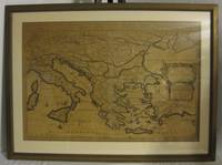
1692Best.-Nr. 001000Paris: Chez H. Jaillot 1692. First edition thus. Map. Good/No jacket as issued. Large double page copper engraved map 23" x 34 1/2". Contains wide margins and a decorative cartouche. Hand-colored boundaries and cartouche. General age-toning with minor browning. Nicely framed in modern rope effected matte gold frame 32" x 42" with gilt bordered white mat and acrylic glaze. A good copy of this scarce map. All text in French Printed just 9 years after the Ottomans besieged Vienna. Extra shipping may apply for foreign orders. Chez H. Jaillot unknown
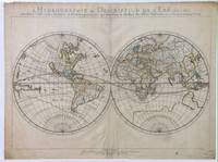
1652Best.-Nr. 010748twParis: Sanson. Very Good. 1652. A very rare map from Nicolas Sanson. Imprint bears the date of 1652 although it is possible that this copy came from an atlas in the later 1600s. Light toning and edgewear with one corner slightly chipped. Light soil on lower margin. Hand-colored boundaries. Map borders measure 14" x 20 3/4". California is shown as an island and Terre Australe is a vague line encircling the Antarctic. Terre de Iesso is the name given to the land mass northwest of North America. Sanson 1600-1667 published many map versions of the world and is known as "the father of French cartography." ; 16 1/2" x 22 1/4" . Sanson unknown
1954Best.-Nr. mon0000050986London 1954-01-01. Hardcover. Very Good. 2.5980 cent in x 18.3860 cent in x 13.1900 cent in. Complete with dust wrapper. Rare. London hardcover
Best.-Nr. 2013728395.Gpaperback. Good. Access codes and supplements are not guaranteed with used items. May be an ex-library book. paperback
Best.-Nr. 2013728387.Gpaperback. Good. Access codes and supplements are not guaranteed with used items. May be an ex-library book. paperback
Best.-Nr. 2329225229.Gpaperback. Good. Access codes and supplements are not guaranteed with used items. May be an ex-library book. paperback
Best.-Nr. 2013728409.Gpaperback. Good. Access codes and supplements are not guaranteed with used items. May be an ex-library book. paperback
Best.-Nr. 2012936229.Gpaperback. Good. Access codes and supplements are not guaranteed with used items. May be an ex-library book. paperback
1906Best.-Nr. 119566Paris: Imprimerie Nationale 1906. 1st . Unbound. Very Good. 10" x 12.75. B/w Engraving Unknown Artist. 10" x 12.75" b/w engraving as shown; faint stamp on reverse. Louis Joseph Sanson was a French surgeon and ophthalmologist. Imprimerie Nationale unknown
Best.-Nr. 1018329129.Gpaperback. Good. Access codes and supplements are not guaranteed with used items. May be an ex-library book. paperback
Best.-Nr. 1015563791.Ghardcover. Good. Access codes and supplements are not guaranteed with used items. May be an ex-library book. hardcover
Best.-Nr. 1015568653.Gpaperback. Good. Access codes and supplements are not guaranteed with used items. May be an ex-library book. paperback
Best.-Nr. 1104771187.Gpaperback. Good. Access codes and supplements are not guaranteed with used items. May be an ex-library book. paperback
Best.-Nr. 1020932449.Ghardcover. Good. Access codes and supplements are not guaranteed with used items. May be an ex-library book. hardcover
Best.-Nr. 1015798438.Ghardcover. Good. Access codes and supplements are not guaranteed with used items. May be an ex-library book. hardcover
Best.-Nr. 1018319352.Ghardcover. Good. Access codes and supplements are not guaranteed with used items. May be an ex-library book. hardcover