Sanson, HBiblio.com

979 Ergebnisse
Best.-Nr. 1018319352.Ghardcover. Good. Access codes and supplements are not guaranteed with used items. May be an ex-library book. hardcover
Best.-Nr. 0805917675.Gunknown_binding. Good. Access codes and supplements are not guaranteed with used items. May be an ex-library book. unknown
Best.-Nr. 0543952754.Gpaperback. Good. Access codes and supplements are not guaranteed with used items. May be an ex-library book. paperback
Best.-Nr. 0543952711.Gpaperback. Good. Access codes and supplements are not guaranteed with used items. May be an ex-library book. paperback
Best.-Nr. 0543952614.Gpaperback. Good. Access codes and supplements are not guaranteed with used items. May be an ex-library book. paperback
Best.-Nr. 101559025X.Ghardcover. Good. Access codes and supplements are not guaranteed with used items. May be an ex-library book. hardcover
Best.-Nr. 1021186929.Gpaperback. Good. Access codes and supplements are not guaranteed with used items. May be an ex-library book. paperback
Best.-Nr. 3838178408.Gpaperback. Good. Access codes and supplements are not guaranteed with used items. May be an ex-library book. paperback
Best.-Nr. 6131577927.Gpaperback. Good. Access codes and supplements are not guaranteed with used items. May be an ex-library book. paperback
Best.-Nr. 3861957876.Gpaperback. Good. Access codes and supplements are not guaranteed with used items. May be an ex-library book. paperback
Best.-Nr. 3847270141.Ghardcover. Good. Access codes and supplements are not guaranteed with used items. May be an ex-library book. hardcover
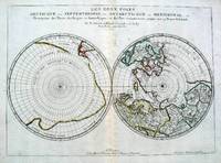
1657Best.-Nr. 5033Paris 1657. Par N. Sanson d'Abbeville Geographe ordre du Roy. Spence 3017 lists a slightly different title but undoubtedly the same map. 53x38 cms. Period outline color central fold very good condition. A double hemisphere map to the North and South poles. The North pole is connected to Greenland and Spitzbergen but there is little other detailed coastline in the polar area. Europe Russia and Canada are delineated. The South pole is based on the great unknown Southland of Magellan. The tip of S. America is shown and a large land mass which encompasses the whole of the hemisphere but nothing else. unknown
1652Best.-Nr. 14178Paris: Sanson 1652. Double hemisphere world map showing the rivers and water bodies of the world. Original outline color. 20 3/4 x 15 3/4". Depicts Australia prior to Tasman's discoveries and labels North Australia "Beach" according to Marco Polo and California as an island. References: Shirley R.W. World 394. Sanson unknown
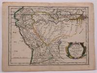
1657Best.-Nr. W2347Paris: Chez Sanson 1657. Image is 8 1/8 inches by 11 inches on a folded sheet measuring 9 inches by 12 13/16 inches. Original hand-colored copper-engraved map from Sanson's atlas of maps of the Americas: L'Amerique en Plusieurs Cartes. It is a map of the Viceroyalty of Peru that displays the Amazon River and its many tributaries. Nicolas Sanson 1600-1667 was the official geographer for the king of France. His map of Peru and the Amazon became the standard that was copied by almost all geographers/cartographers--even reproduced by Bion for his 1700 treatise on globes. Cintra and Oliveira argue that Sanson's map was a scientific one that holds up well even when compared to 21st century maps of the region. The map is in about very good condition: clean with bright original outline color; minimal foxing ; some edgewear and soiling in the margins. . First Edition. Single Sheet. Very Good-. 8 1/8 inches by 11 Inches. Map. Chez Sanson
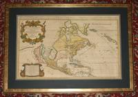
Best.-Nr. 89167Amsterdam Hubert Jaillot Chez Pierre Mortimer et Company. 1692. Copper-engraved map. Engraved surface 34 x 22 inches. Framed with glass and double dark-green and blue mounts. Overall 44 x 33 inches. In very good condition. Stunning large early map of America. Beautifully coloured states and islands with both cartouches and border also coloured. With vertical centre fold/crease. The map lines up in the middle but is slightly offset at top and bottom. A couple of very light minor spots around the main cartouche else map surface is lovely and bright and clean. No offsetting or darkening. A stunning map. With two decorative cartouches with scale. With later hand-colouring. Jaillot's oversized map of North America notable for the large island of California poised off the West Coast first published in 1674. Tooley notes rather critically: “Jaillot who succeeded to Sanson's business makes a rehash of his maps. California is copied from Sanson's map of 1656. The remainder of the map is based on that of 1669. Jaillot retains the 5 lakes with two open at their western ends. He shows New Sweden and New Amsterdam. Curiously he omits Montreal but does insert a few French Missions round the Great Lakes. Large handsome titlepiece with arms of the Dauphin natives and indigenous fauna.” The map was reissued many times and its “long life was to in part to the expense of production for it continued in use long after its geographical information became out of date.” Tooley 37 Plate 44; McLaughlin 55. Amsterdam, Hubert Jaillot, Chez Pierre Mortimer et Company. 1692 unknown
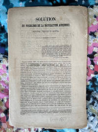
1850Best.-Nr. 1240111.28Ledoyon Paris 1850. Good. Two ballooning pamphlets/flyers: Sanson's "Solution du probleme de la navigation aerienne" and: Lettre-Journel de Paris November 19 1870 with an account of a military balloon flight with a manuscript letter attached with stamp and corresponding verso text excised but with a "Par Ballon Monte" cancellation hand stamp and London-received postal hand stamp intact: an early airmail letter; from Wikipedia: "Historically balloons were used to transport mail from Paris during the Siege of Paris of 1870-1871. About 66 unguided mail balloons were released from Paris ." Few such letters have survived. Ledoyon, Paris
Best.-Nr. 92217Paris Sanson d'Abbeville Nicolas Ca 1660. In ivory mount. Mount size 16 x 13.5 inches 40.5cm x 35cm Engraved size 28cm x 22cm 11 x 8.5 inches In very good condition. Laid Down. Paris Sanson d'Abbeville, Nicolas Ca 1660 unknown
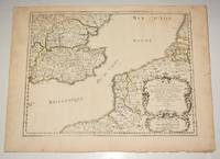
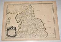
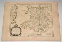
Best.-Nr. 90474PARIS Chez l’Auteur 1654. Title cartouche to lower right corner. Blank on verso. In good condition. Some light tanning on edges with a few faint foxing marks. A few small nicks lower margin edge. With original outline hand colouring. Engraved Size 17.5 x 23 inches Nicolas Sanson 1600-1667 sometimes called Nicolas Sanson d'Abbeville or Sanson d'Abbeville was the most important French cartographer of the 17th century. Tooley called Sanson "the founder of the French school of cartography." He began making maps in the late 1620s and in the 1630s he was working with Melchior Tavernier. Later Sanson worked in concert with the print publisher Pierre Mariette with whom he published his great atlas: Cartes générales de toutes les parties du monde 1658. After Sanson's death in 1667 his son Guillaume carried on the business in partnership with Alexis Hubert Jaillot. Guillaume established himself as a very important French mapmaker in his own right. PARIS Chez l’Auteur 1654. unknown
Best.-Nr. 90476PARIS Chez l’Auteur 1654. Title cartouche to lower left corner. Blank on verso. In good condition. Some light tanning on edges with a few faint foxing marks. A few hole top of centre fold on map. Small neatly repair tear lower margin and small hole top margin. With original outline hand colouring. Engraved Size 17.5 x 23 inches Nicolas Sanson 1600-1667 sometimes called Nicolas Sanson d'Abbeville or Sanson d'Abbeville was the most important French cartographer of the 17th century. Tooley called Sanson "the founder of the French school of cartography." He began making maps in the late 1620s and in the 1630s he was working with Melchior Tavernier. Later Sanson worked in concert with the print publisher Pierre Mariette with whom he published his great atlas: Cartes générales de toutes les parties du monde 1658. After Sanson's death in 1667 his son Guillaume carried on the business in partnership with Alexis Hubert Jaillot. Guillaume established himself as a very important French mapmaker in his own right. PARIS Chez l’Auteur 1654. unknown
Best.-Nr. 90477PARIS Chez l’Auteur 1658. Title cartouche to lower left corner. Blank on verso. In good condition. Some light tanning on edges with a few faint foxing marks. With original outline hand colouring. Engraved Size 17.5 x 23 inches Nicolas Sanson 1600-1667 sometimes called Nicolas Sanson d'Abbeville or Sanson d'Abbeville was the most important French cartographer of the 17th century. Tooley called Sanson "the founder of the French school of cartography." He began making maps in the late 1620s and in the 1630s he was working with Melchior Tavernier. Later Sanson worked in concert with the print publisher Pierre Mariette with whom he published his great atlas: Cartes générales de toutes les parties du monde 1658. After Sanson's death in 1667 his son Guillaume carried on the business in partnership with Alexis Hubert Jaillot. Guillaume established himself as a very important French mapmaker in his own right. PARIS Chez l’Auteur 1658 unknown
Best.-Nr. 90475PARIS Chez l’Auteur 1654. Title cartouche to lower right corner. Blank on verso. In good condition. Some light tanning on edges with a few faint foxing marks. With original outline hand colouring. Engraved Size 17.5 x 23 inches Nicolas Sanson 1600-1667 sometimes called Nicolas Sanson d'Abbeville or Sanson d'Abbeville was the most important French cartographer of the 17th century. Tooley called Sanson "the founder of the French school of cartography." He began making maps in the late 1620s and in the 1630s he was working with Melchior Tavernier. Later Sanson worked in concert with the print publisher Pierre Mariette with whom he published his great atlas: Cartes générales de toutes les parties du monde 1658. After Sanson's death in 1667 his son Guillaume carried on the business in partnership with Alexis Hubert Jaillot. Guillaume established himself as a very important French mapmaker in his own right. PARIS Chez l’Auteur 1654. unknown
1705Best.-Nr. 3903Attractive original hand-color. Pin-head size stain just south of Mississippi delta please see image. An otherwise very nice clean copy. Paper size: 8 1/4 x 12 1/4 in 210 x 310 mm. Image size: 7 x 9.8 in 178 x 250 mm. ; All shipments through USPS insured Priority Mail.
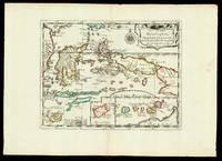
1652Best.-Nr. 17601Paris: chez l'autheur 1652. 265 by 370mm. 10.5 by 14.5 inches. Maps""Les Isles Molucques; Celebes Gilolo &c. Sanson's Moluccas Engraved chart with contemporary hand-colour in outline. Detailed map of the island east of Borneo in Southeast Asia with an inset of Banda and the Moluccas. Published in Sanson's 'L'Asie en Plusieurs Cartes.' 1652. Nicolas Sanson 1600-1667 began to make maps to supplement his study of history and a map of Ancient Gaul made early in his career brought him to the attention of Cardinal Richelieu. This foothold in the French court allowed him to rise to the position of geographe du roi teaching both Louis XIII and Louis XIV. Louis XIII even made him a counsellor of state. Sanson produced an atlas 'Cartes Generales de Toutes les Parties du Monde' which contained important maps of the post roads and waterways of France. He also produced two major maps of North America: 'Amerique Septentrionale' 1650 was the first map to show the Great Lakes in a recognisable form aided by Sanson's access to The Jesuit Relations a collection of accounts by French missionaries to the area. The map was drawn on a sinusoidal projection which Sanson was the first to use. In 1656 he made 'Le Canada ou Nouvelle France' which showed the Great Lakes in greater detail and included accurate representations of the Hudson Bay area the Delaware and the Gulf of Saint Lawrence. chez l'autheur, unknown
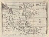
1700Best.-Nr. 5097Sanson being d'Abbeville Geograph du Roy. Map covers North America with a small amount of South America included. Has California as an island. 9 3/4 x 7 1/2 inches. Chez Paul Marret
1832Best.-Nr. 104565Imprenta De Repulles. Very Good. 1832. Second Edition. Hardcover. Leatherbound. 1832. Some wear to the bindings. 5 volume set complete. Spanish language. Madrid Imprenta de Repulles. Marbled endpapers. Second Edition. ; 8vo 8" - 9" tall . Imprenta De Repulles hardcover