SANSON, NicolasBiblio.com

888 résultats
1700réf. 54035Amsterdam: 1700. Map of Germany divided into regions which at the time extended over much of the Low Countries. Maps by Sanson in original colour are rare. Nicolas Sanson was founder of the French school of mapmakers at a time when the leadership in European cartography passed from the Low Countries to France. This map was published in Brion's treatise on globes. Nicolas Brion was a famous French mathematical and scientific instrument maker. L'Usage des Globes. Copper engraving. Fine condition. Original colour. Size: 23.5 x 18.5 cm. unknown
1700réf. 58299Description de tout l'Univers 1700 published by F.Halma Amsterdam. Nicolas Sanson was founder of the French school of mapmakers at a time when the leadership in European cartography passed from the Low Countries to France. Copper engraving. Fine condition. Original colour with gold leaf highlights. Size: 17 x 18.5 cm. unknown
1700réf. 54023Nicolas Bion: L'Usage des Globes. Amsterdam: Francois Halma. 1700. Attractive map of Morocco the Saharan hinterland and the Canary Islands. Handsome title cartouche at top left. Much of the charm of early maps of Africa lies in how they show the interior of the continent which was not explored until the 19th century. Maps by Sanson in original colour are rare. Nicolas Sanson was founder of the French school of mapmakers at a time when the leadership in European cartography passed from the Low Countries to France. This map was published in Brion's treatise on globes. Nicolas Brion was a famous French mathematical and scientific instrument maker. Copper engraving. Very good condition. Faint library stamp right margin. Original colour. Size: 28 x 17 cm. 11 x 6½ inches. unknown
1657réf. 56721Histoire et Geographie de l'Amerique. 1657. Attractive map of Paraguay. Title cartouche at top right. Maps by Sanson in original colour are rare. Nicolas Sanson was founder of the French school of mapmakers at a time when the leadership in European cartography passed from the Low Countries to France. Copper engraving. Fine condition; very light offsetting. Original outline colour. Size: 28.5 x 21.5 cm. 11 x 8½ inches unknown
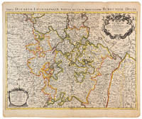
1689réf. 52354Paris. 1689. The map covers the area from the Moselle in NW to Worms in SE. ornamental cartouche at lower left. Copper engraving. Good condition though map is slightly discolured and stained. Original colour. Size: 56 x 43 cm. unknown
1655réf. 56109Paris. 1655. Attractive map of Morocco and parts of Algeria. Maps by Sanson in original colour are rare. Nicolas Sanson was founder of the French school of mapmakers at a time when the leadership in European cartography passed from the Low Countries to France. Copper engraving. Very good condition. Some light browning to the centre fold. Attractive water mark. Original colour. Size: 53 x 40 cm. 21 x 15½ inches unknown
1700réf. 54377Nicolas Bion: L'Usage des Globes. Amsterdam: Francois Halma. 1700. An armillary sphere perused by three scholars at a table. Nicolas Sanson was founder of the French school of mapmakers at a time when the leadership in European cartography passed from the Low Countries to France. This map was published in Bion's treatise on globes. Nicolas Bion was a famous French mathematical and scientific instrument maker. Size: 125 x 175 mm. Copper engraving. Original colour. Mounted size: 295 x 360 mm. Fine condition. unknown
1700réf. 54043Nicolas Bion: L'Usage des Globes. Amsterdam: Francois Halma. 1700. Map showing north-east South America from Trindad to the mouth of the Amazon - modern day Guyana and Surinam. Several large fictitious lakes make up much of the unexplored interior. Maps by Sanson in original colour are rare. Nicolas Sanson was founder of the French school of mapmakers at a time when the leadership in European cartography passed from the Low Countries to France. This map was published in Bion's treatise on globes. Nicolas Bion was a famous French mathematical and scientific instrument maker. Copper engraving. Very good condition. Small 1cm. very faint library stamp on border not affecting map. Original colour. Size: 27.5 x 20 cm. 11 x 8 inches. unknown
1700réf. 54022Nicolas Bion: L'Usage des Globes. Amsterdam: Francois Halma. 1700. Attractive map of north eastern Africa including Egypt and northern Libya. Much of the charm of early maps of Africa lies in how they show the interior of the continent which was not explored until the 19th century. Maps by Sanson in original colour are rare. Nicolas Sanson was founder of the French school of mapmakers at a time when the leadership in European cartography passed from the Low Countries to France. This map was published in Brion's treatise on globes. Nicolas Brion was a famous French mathematical and scientific instrument maker. Copper engraving. Very good condition. Darkened edges to margins. Faint inkstamp on right margin not affecting map. Original colour. Size: 27 x 17 cm. 10½ x 6½ inches. unknown
1953réf. ZB691256Paris: Presses Universitaires de France 1953. 366 pp. rebound in buckram hardcover ex library else text and binding clean and tight. - If you are reading this this item is actually physically in our stock and ready for shipment once ordered. We are not bookjackers. Buyer is responsible for any additional duties taxes or fees required by recipient's country. Paris: Presses Universitaires de France hardcover
1680réf. 024707London: William Berry 1680. .Kingdoms and States which are found there at present/Described by Sanson/Corrected and amended By William Berry =Kopftitel; Text der figürlich reich verzierten Kartusche oben rechts: Asia Divided into its Principall Regions in which may be seen the extent of the Empires Monarchies Kingdoms and States which at present divide Asia/To the Most serene and Most Sacred Majesty of Charles II./By the Grace of God King of Great Britain France and Ireland/This Map of Asia is humbly Dedicated and Presented By Your Majesties Loyal Subject and Servand William Berry; Text der reich verzierten Kartusche links oben: Scale es folgen Maßstäbe verschiedener Länder/London/Sold by William Berry at the Sign of the Globe between Charing-Cross and White-Hall/1680; SW-Kupferstich-Landkarte nach Nicolas Sanson d'Abbeville gestochen von William Berry; ca. 51 x 39 cm; Falzspuren einige Tintenflecken hauptsächlich ausserhalb des Druckbildes mässige Lichtverfärbung; professionell hinter Glas gerahmt in schwarzem Holzrahmen; äußerst selten; for description in other languages of this extremely rare map please don't hesitate to contact me. . Gut. Landkarte. William Berry unknown
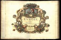
1647réf. 75287Paris Uten år. 1647-1665. 4to. Samtidig helskinnbind med opphøyde ryggbånd og ryggforgylling. Ryggen rebacked med bruk av den gamle ryggstripen. Håndkolorert gravert dobbeltsidig tittelblad og dedikasjonsblad. Upaginert. 30 bl. Med 12 dobbeltsidige håndkolorerte kart. 4to. Contemporary full calf with raised bands spine gilt. Spine rebacked by using of the old spine. Handcoloured doublepage title and handcoloured doublepage dedication. Not paginated. 30 leaves. With 12 doublepage handcoloured copper engraved maps. Chez Pierre Mariette. Fransk. “Nicolas Sanson le fils 1625 - 1648. Son of Nicolas and his intended heir prevented by his premature death from gunshot wounds. Only three known works. L’Europe 12 maps ca. 1648 compiled by N. Sanson fils engraved by A. Peyrounin theoretically published by Nicolas fils himself but may have been published posthumously by his father republished by Mariette 1660 1665. Tooley’s Dictionary of mapmakers. Revised edition. hardcover
1752réf. 54049Amsterdam. Uten år. 1752. Originalt kobberstikk. Arkets størrelse : 175 cm X 164 cm. Fransk. Med en brett.Fra 'La Science des Personnes de Cour d'Epee et de Robe' by Z. Chatelain. unknown
réf. 83285Berlin : Hasselberg’sche Verlagshandlung ohne Jahr. demi-percaline. SANSON H.Geheimnisse des Schaffots. Memoiren der Scharsricher-Familie Sanson 1685-1847. 1. 2.und 3. Bd. in 1 Band. Berlin Hasselberg’sche Verlagshandlung ohne Jahr 190x130mm 199 190 191 Seiten Halbperkalin. No hidden customs fees for orders shipped to the U.S.A with a value of up to 800 USD PDDP shipping we pay the VAT in advance Hasselberg’sche Verlagshandlung unknown
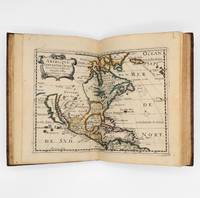
1657réf. 375003Paris: Chez L'Autheur 1657. 15 engraved double-page maps hand colored in outline. 4 40 of 42 unpaginated text leaves lacks final two leaves of text. 4to. Contemporary mottled calf gilt raised spine bands repairs at joints. Lacks final two leaves of text after the map of Brazil. 15 engraved double-page maps hand colored in outline. 4 40 of 42 unpaginated text leaves lacks final two leaves of text. 4to. First edition of important and quite handsome 17th-century French atlas of the Americas. This atlas was first published in 1657 and stands as a beautiful cartographic record of America for the 17th century. Sanson was official cartographer to the King. The maps include detailed charts of North South and Central America the West Indies Canada Mexico Florida and the southeast and a map of New Mexico showing most of the Spanish southwest territory with California depicted as an island. An impressive and detailed atlas for the time. The maps are titled as follows: 1 Americque Septentriole 2 Le Canada ou Nouvelle France &c. 3 La Floride 4 Audience de Mexico 5 Audience de Guadalajara Nouveau Mexique Californie &c. 6 Audience de Guatimala 7 Les Isles Antilles &c. 8 Amerique Meridionale 9 Terre Ferme Nouveau royme de Grenade &c. 10 Guiane divisee en Guiane et Caribane 11 Le Perou et le cours de la rivre Amazone 12 Le Chili 13 Le Brasil 14 Le Paraguay subdivise en ses principales parties suivant les dernieres relaons 15 Destroit de Magellan Terre et Isles Magellanicques &c. Sabin 76708; Phillips Atlases 1151; Streeter sale 68 undated edition; Leighley California as an Island plate 9 Chez L'Autheur unknown
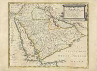
réf. 62978Paris Chez Pierre Mariette 1654. Original copper-engraved map of the Arabian Peninsula 43.5 x 59 cm with contemporary outline colour refreshed and adorned with a large columnar style title cartouche. A dark impression. Paper has been washed and strengthened due to foxing. Rare map of the Arabian Peninsula first published in 1654 and one of the first large maps focused specifically on the Arabian Peninsula. Sanson's map of the Arabian Peninsula continued to influence maps of the region throughout the latter part of the 17th century. Here Arabia is divided into three regions: Arabia Petraea the northwestern area encompassing the Sinai Peninsula and Jordan Arabia Deserta the northernmost area just south of the Tigris and Euphrates rivers and Arabia Felix by far the largest territory covering most of the peninsula and extending from the holy cities of Mecca and Medina in the northwest to the coasts of the Arabian Sea and the Gulf of Oman. There is great detail of mountains and rivers although there are clear geographical errors such as the exaggerated extent of the mountain ranges. Numerous villages are depicted including stopping places on the pilgrimage to Mecca Iathreb Badrahenen Gioffa and Cadaid among others as well as towns that appeared for the first time on a map of Arabia Hagair Hadrama Salamia and Iamama. Bahrain is demarcated along the northwestern shore of the Arabian Gulf. Nicolas Sanson was to bring about the rise of French cartography although the fierce competition of the Dutch would last until the end of the century. His success was partly owing to the partnership with the publisher Pierre Mariette. In 1644 the latter had purchased the business of Melchior Tavernier and helped Sanson with financial support in producing the maps. In 1657 Pierre Marriette died however his son also named Pierre co-published Les Cartes Générales de toutes les parties du Monde the following year. It was the first folio French produced world atlas. Tibbetts 98; Ankary p.98 Paris, Chez Pierre Mariette, 1654. unknown
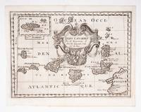
réf. 53608c.1700. Original engraved map 19 x26.5 cm. overall sheet size 22 x 29 cm. of the Canaries with inset of Madeira. Central vertical fold. [c.1700] unknown
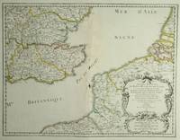
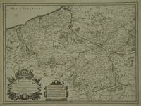
réf. 28812Paris: Sanson. 1654. 36.6 x 48 cm. Original outline colour. Double page map of the south east England shown with the adjacent coastline of France and Belgium. Title cartouche to lower right corner. Blank on verso. Wear to centrefold with some loss Paris: (Sanson). 1654 unknown
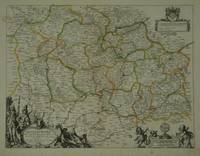
réf. 28798Paris: Pierre Mariette. c. 1658. 37.4 x 49.5 cm. Original outline colour. Double page map of Maine northern France. Title cartouche to lower left corner dedication cartouche to Christophe de Justel to upper right corner with the coat of arms of his family. Blank on verso. Small tears without loss to left and lower margins. Light stains to lower margin otherwise in good condition. Paris: Pierre Mariette. [c. 1658] unknown
réf. 30600Paris: Jaillot. 1689. 43.1 x 57 cm. Original outline colour. Single page folio map of southern Flanders and Artois. Blank on verso. Small tear without loss at upper edge just touching image. Small section of upper margin missing though not affecting map. Small brown spot to centre of lower edge. Paris: Jaillot. 1689 unknown
réf. 48297Paris Lutetiae Parisiorum Sumptibus et Impensis Autoris 1647. 3 ouvrages en 1 volume. 1. 2 feuillets blancs. 8 feuillets. 246 pages. 2. 13 feuillets. 283 pages. 3. 2 feuillets blancs. Page de titre. Carte gravée. 11 feuillets. 2 feuillets blancs. 15x9 Cm. Plein veau de l'époque. Dos à nerfs orné et doré un peu frotté. Pièce de titre doré. Charnières fendues. Petits accidents aux coiffes. Rousseurs et quelques taches. Les deux premiers ouvrages sont des critiques très rares du "Pharum Gallia Antiquae" de Philippe Labbé que Sanson rectifie sur plusieurs points. À la suite on trouve une courte description de la Judée accompagnée d'une belle carte dépliante. Bon exemplaire comportant l'exlibris gravé d'Henri Liébaux. Paris, Lutetiae Parisiorum Sumptibus et Impensis Autoris, 1647. unknown
1650réf. 24869London 1650. 1 vols. 13" x 8 3/4. Contemporary. hand-coloring. Fine condition. 1 vols. 13" x 8 3/4 ". unknown
1710réf. 009140Amsterdam: Pierre Mortier 1710 Cooper engraving 46.5 x 61.5 cm on paper measuring 54.0 x 64.5 cm with original color in outline minor spotting and creasing remnants of centerfold. A good copy of a map of the Duchy of Lorraine and surrounding territories published in Amsterdam by Pierre Mortier to illustrate events of the War of the Spanish Succession. Pierre Mortier unknown
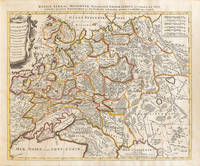
1710réf. 009147Amsterdam: Petrus Schenck 1710 Cooper engraving 46.5 x 58.0 cm on paper measuring 51.0 x 63.5 cm with original outline coloring flattened expertly restored and backed with archival tissue paper. The Latin title in the top border reads: "Russiae Albae sive Moscoviae delineatio Geographica accurata et nova…". A good copy of a Moscovie map published in Amsterdam by Petrus Schenck. Petrus Schenck unknown
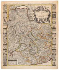
1710réf. 009139Amsterdam: Pierre Mortier 1710 Cooper engraving 58.0 x 50.5 cm on paper measuring 63.0 x 54.0 cm with original color in outline minor spotting and creasing remnants of centerfold paper slightly frayed at edges. A good copy of an uncommon map of Savoy and Piedmont published in Amsterdam by Pierre Mortier to illustrate events of the War of the Spanish Succession. Surrounded by twenty-two coats of arms representing various provinces. Pierre Mortier unknown