Sanson, NicolasBiblio.com
888 résultats
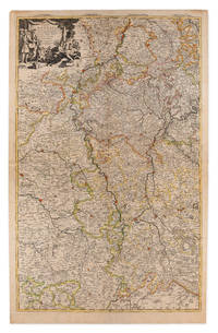
1710réf. 009148Amsterdam: Pierre Mortier 1710 Cooper engraving on two joined sheets measuring 59.5 x 95.5 cm with original outline coloring expertly cleaned and flattened. A good copy of a map of western Germany published in Amsterdam by Pierre Mortier to illustrate events of the War of the Spanish Succession. The first state with "2. Carte de la Meuse" added in manuscript. Pierre Mortier unknown
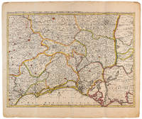
1710réf. 009141Amsterdam: Pierre Mortier 1710 Cooper engraving 44.5 x 59.5 cm on paper measuring 54.0 x 64.0 cm with original color in outline minor spotting and creasing remnants of centerfold. A good copy of a map of south-central France the Cévennes Vivarais Occitania published in Amsterdam by Pierre Mortier to illustrate events of the War of the Spanish Succession. Pierre Mortier unknown
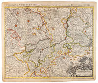
1710réf. 009138Amsterdam: Pierre Mortier 1710 Cooper engraving 50.5 x 60.5 cm on paper measuring 54.0 x 63.0 cm with original color in outline minor spotting and creasing remnants of centerfold paper slightly frayed at edges. A good copy of an uncommon map of the province of Namur a region of the Spanish Netherlands published in Amsterdam by Pierre Mortier to illustrate events of the War of the Spanish Succession. Pierre Mortier unknown
1812réf. 006820Paris: Chez Jean Md d'Estampes 1812 Engraving 59 x 90 cm old color. The first edition of this map was published in 1674 by Hubert Jaillot under the title "La Russie Blanche ou Moscovie divisee suivant l'étendue des Royaumes Duches." It was incorporated into numerous atlases by Jaillot and his successors until approximately 1720 when it became evidently outdated. However around 1812 it was reissued likely to illustrate the French-Russian war. Chez Jean Md d'Estampes unknown
réf. 73602Paris Pierrr Mariette 1656/ca. 1950. 13 x 17.5 cm 26 x 30 cm Rahmen vergoldet unter Passepartout Min. gebrauchspurig sonst tadell. Handkolorierte Faksimile. - Nicolas Sanson der Ältere auch: Nicolas Sanson d’Abbeville 1600 in Abbeville Frankreich- 1667 in Paris französischer Kartograph. Er gilt als der Vater der Geographie in Frankreich.In den Jahren 1618 bis 1667 schuf Sanson etwa 300 einzelne Karten sowie Atlanten und illustrierte Texte. Er wurde zum Geographe Ordinaire du Roy königlicher Kartenmacher ernannt und unterrichtete die Könige Ludwig XIII. und Ludwig XIV. in Geographie. 010 Paris, Pierrr Mariette, 1656/ca. 1950 unknown
1990réf. Alibris.0038416Surrey Beatty and Sons. 1990. Hard cover. Fine in fine dust jacket. 336 p. illustrations bibliography index. . You will obtain a current view of the knowledge of the biology conservation and care of koalas from this book. The range of topics i comprehensive and a substantial body of new information is included. There is a substantial reassessment of the phylogenetic affinities of the koala; several contributions reviewing the dynamics and status of natural populations; reassessments of our knowledge of diet; a substantial review of digestion which sheds new light on digestive function in hind gut fermenters; the first description of the social system in natural populations of koalas; new information on the endocrine control of reproduction; a substantial body of information on the impact of Chlamydia on koalas; and papers on management. The text includes 31 papers from experienced scientists who have worked in their respective fields. This reference volume emanantes from the Third National Symposium sponsored by the World Koala Research Corporation held in February 1988. Surrey Beatty and Sons hardcover
1713réf. 215454Amsterdam: Mortier Pieter 1713. unbound. very good. Map. Engraving with original hand outline. Image measures 14.5" x 18.75". Rare map of Paphlagonia an ancient region of northern Anatolia present-day Turkey along the southern coast of the Black Sea. Highlighting the capital city of Sinope this map depicts the region as defined by Strabo: bound by the Parthenius River in the west extending to the Hays river in the east. Sanson depicts the region comprising the Kingdom of Pontus during the rule of Mithridates IV. Neighboring historical regions of Gallatia and Bithynia et Pontus are labeled. Full original margins light scattered foxing. Based on earlier plates by Sanson. This map appeared in "Atlas Antiquus Sacer Ecclesiasticus et Profanus" published in Amsterdam by Pieter Mortier. Nicolas Sanson 1600-1667 who is considered the founder of the French school of cartography. In reaction to the prevailing trend of Dutch lavishness Sanson favored minimal details focusing rather on accurate cartography than ornament. Pierre Mortier 1661-1711 was a Dutch cartographer engraver and printseller who worked in Amsterdam. He used advanced Dutch printing methods to produce high quality editions of contemporary French maps by cartographers such as De L'Isle Sanson Jaillot de Fer and De Wit. His greatest feat was the nautical atlas "Le Neptune Francois" or "Suite de Neptune Francois" considered to contain the most beautiful examples of cartographic art. After his death his widow Amelia continued publishing in partnership with her brother-in-law David until her death in 1719. This map was published during Amelia's tenure at the firm. Mortier, Pieter unknown
réf. BN105048STE ECRIVAINS. Softcover. Le rêve de lumière Le rêve de lumière STE ECRIVAINS paperback
réf. BN105021Softcover. Les yeux bleus - la non-voyance vous écrit Les yeux bleus - la non-voyance vous écrit paperback
réf. BN105020Softcover. La place verte - roman La place verte - roman paperback
1988réf. BN528811Sand & Tchou 1988. 1988. Hardcover. Atlas du monde 1665 de Nicolas Sanson d'Abbeville Atlas du monde 1665 de Nicolas Sanson d'Abbeville Mireille Pastoureau et Nicolas Sanson Sand & Tchou hardcover
2003réf. BN528626JMG Editions 2003. 2003. Le Plaisir De Tuer Le Plaisir De Tuer Sanson Charly und Richard Bessière JMG Editions unknown
réf. 46402374-nnew. unknown
2014réf. BN582237Bouquins 2014. 2014. Softcover. Berlin Berlin David Sanson Bouquins paperback
2004réf. BN579761De Vecchi Editions 2004. 2004. Softcover. Le comte de Saint-Germain Le comte de Saint-Germain Richard Bessière et Charly Sanson De Vecchi Editions paperback
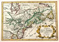
1705réf. M11241Amsterdam c.1705. Very Good. Notes: A reduced version of the most influential 17th century maps of the French and English colonies in North America. The map not only shows details of the Great Lakes but also it is a great source for Indian tribal names and locations. Two names Aouentsiouaeron and Attiouandarons appear here for the first time. Lake Superior and Michigan Lac du Puans are left open-end to the west. It is engraved by Anthony d'Winter. Size : 207x300 mm 8.15x11.81 Inches Coloring: Hand Colored Reference: Burden #575; Kershaw #138. Category: Maps Canada East; Maps North America Great Lakes; unknown
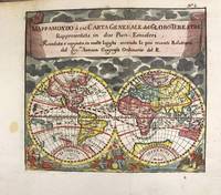
1697réf. M11198Antwerp Belgium: Jan Duren c.1697. Very Good. Notes: Rare miniature World map. California is depicted as an island. There are symbols for the four continents: dangerous America strong Europe exotic Asia and wild Africa. Size : 140x160 mm 5.51x6.30 Inches Coloring: Hand Colored Reference: Shirley #553. Category: Maps World; Jan Duren unknown
réf. 14357382-nnew. unknown
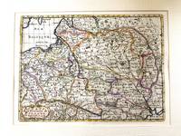
1683réf. M11172Paris c.1683. Very Good. Notes: French map showing Poland and the surrounding region. Nicolas Sanson 1600–1667 was a renowned French cartographer termed by some as the "father of French cartography." His works are known for their incorporation of the most up to date information of the time and their clean modern style. Size : 188x256 mm 7.40x10.08 Inches Coloring: Hand Colored Category: Maps Europe Poland Lithuania; unknown
réf. 23929361-nnew. unknown
réf. 41445142-nnew. unknown
réf. 41445142like new. unknown
réf. 45381745like new. unknown
réf. 25075089-nnew. unknown
réf. 34013180-nnew. unknown