2094 risultati
rif. 838a CONSTANTINOPLE 1784 FORMAT 8,5 CM SUR 11,5 CM ; 138 pages pour le tome 1, 110 pages pour le tome 2
1876rif. 31711Falaise Typographie E. Trolonge 1876 In-8 deuxième édition, 429 pp. Impression Particulière de cet ancien Ambassadeur . assez Rare , reliure sobre mais en bon état
1860rif. GR748Vindobonae (Vienne) C. Gerold, 1860. 2 vol. in-8o, X+607, 608 p. Texte grec. Rel. 1/2 basane contemp., dos lisse. Rare.
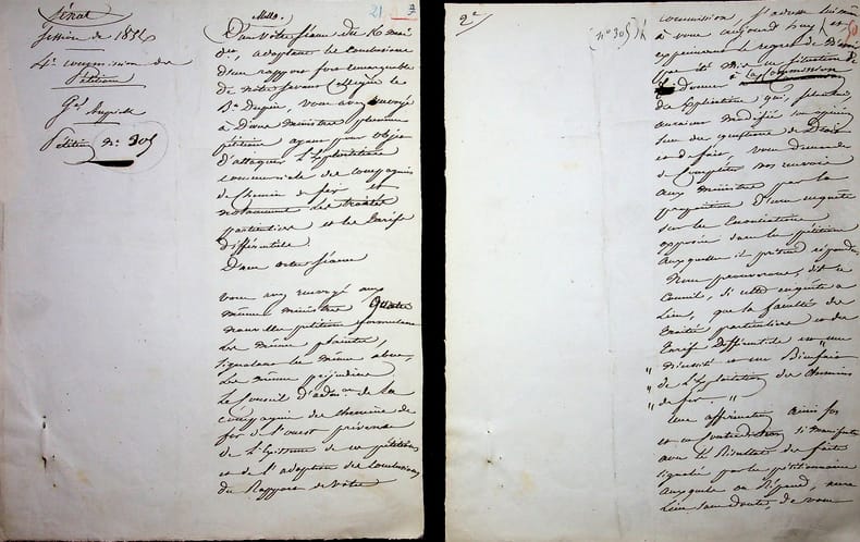
rif. 018365Jacques Aupick (1789-1857), général, homme politique, beau-père de Baudelaire, ministre plénipotentiaire à Constantinople. Manuscrit autographe signé, juin 1856, 7p in-4. Texte vraisemblablement lu au Sénat quand il était sénateur à propos de l'exploitation commerciale des chemins de fer. [426]
rif. 186972Cambridge-Londres, J. Mawman, 1822 2 vol. in-8, XX-835 pp. en numérotation continue, demi-basane havane, dos lisses ornés de filets dorés et de fleurons à froid, tranches marbrées (reliure de l'époque). Dos insolés, début de fente aux mors, rousseurs.
1851rif. 2262PARIS. LIBRAIRIE ARCHEOLOGIQUE DE VICTOR DIDRON. 1851. IN-4 (25 X 28,5 X 4 CENTIMETRES ENVIRON) DE 316 PAGES, ENTIEREMENT MONTE SUR ONGLET, RELIURE D'EPOQUE 1/2 CHAGRIN NOIR, DOS LISSE ORNE DE FILETS ET DE CAISSONS DORES, TITRE DORE. ILLUSTRE DE 20 PLANCHES HORS TEXTE SOUS SERPENTE. EDITION ORIGINALE. PETITS DEFAUTS EXTERIEURS SANS GRAVITE, SINON BON EXEMPLAIRE.
1986Very Good Very Good English Original bdg. Dust wrapper. In special slip-case. 4to. (38 x 27 cm). In English. 224 p. Istanbul. Gateway to splendour. An introduction to the Ottoman architectural heritage in Istanbul. Large format interior and exterior views of Ottoman mosques, Topkapi Palace, and Bosporus villas are accompanied by informative text. Many original architectural line drawings (plans, sections and elevations) by the noted architect Sedad Hakki Eldem are also included. 26 by 36 cms., 224 pages (135 color plates, about 40 drawings). A very heavy volume.
2003New New English Original bdg. Dust wrapper. 4to. (34 x 24 cm). In Turkish. 2 volumes set: (735 p.), b/w and color ills. Dersaadet'in fotografçilari. 19. yüzyil Istanbulunda fotograf: Öncüler, stüdyolar, sanatçilar. 2 volumes set. The photographers of Constantinople. Pioneers, studios and artists from 19th century Istanbul. Vol. 1: Texts and photographs: Istanbul photographers of the 1850"s exhibiting in London, Paris and Brussels; Ottoman court photographers; and studios and artists that made their mark. Vol. 2: The Album: the imperial family; statesmen, celebrities and court officials; memories of a vanished world; costumes; professions and street sellers; everyday life; palaces and other edifices; the sea and Istanbul; panoramas; bibliography and index.
2009New English Original cloth bdg. In publisher's special slip-case. Folio. (45 x 35 cm). In Turkish. [14] p. text, 50 color plates. Limited Edition: 1000 copies were printed. Istanbul minyatürleri.
1909Very Good Turkish, Ottoman (1500-1928) Original color map on cloth. A little foxing on cloth. Very good. Folded. Oblong atlas folio. (66 x 72 cm). In Ottoman script. Scale: 1/210.000. Ottoman sanjaks in Albania, Macedonia and Greece. A rare Ottoman map of Balkans with Turkish place names for the period of pre-Balkan Wars, (1912-1913). Very important for onomastics and historical geography.
1909Very Good Turkish, Ottoman (1500-1928) Original color map on cloth. A little foxing on cloth. Very good. Folded. Oblong atlas folio. (66 x 72 cm). In Ottoman script. Scale: 1/210.000. Ottoman sanjaks in Balkans, Bulgaria. A very detailed map of Old Zagora. A rare Ottoman map of Balkans with Turkish place names for the period of pre-Balkan Wars, (1912-1913). Very important for onomastics and historical geography. Extremely rare.
1909Very Good Turkish, Ottoman (1500-1928) Original color map on cloth. A little foxing on cloth. Very good. Folded. Oblong atlas folio. (66 x 72 cm). In Ottoman script. Scale: 1/210.000. Ottoman sanjaks in Balkans, Bulgaria. A very detailed map of Plovdiv and Haskovo. A rare Ottoman map of Balkans with Turkish place names for the period of pre-Balkan Wars, (1912-1913). Very important for onomastics and historical geography. Extremely rare.
1909Very Good Turkish, Ottoman (1500-1928) Original color map on cloth. A little foxing on cloth. Very good. Folded. Oblong atlas folio. (66 x 72 cm). In Ottoman script. Scale: 1/210.000. Ottoman sanjaks in Balkans, Bulgaria. A very detailed map of Plovdiv. A rare Ottoman map of Balkans with Turkish place names for the period of pre-Balkan Wars, (1912-1913). Very important for onomastics and historical geography. Extremely rare.
1909Very Good Turkish, Ottoman (1500-1928) Original color map on cloth. A little foxing on cloth. Very good. Folded. Oblong atlas folio. (66 x 72 cm). In Ottoman script. Scale: 1/210.000. Ottoman sanjaks in Balkans, Macedonia. A very detailed map of Old Zagora. A rare Ottoman map of Balkans with Turkish place names for the period of pre-Balkan Wars, (1912-1913). Very important for onomastics and historical geography. Extremely rare.
1918Very Good French Original b/w map. Oblong: 57x66 cm. In French. Folded. It includes for pieces: Title, structure physique de la region, Thessalie and main part which shows the area from Ohrida Lake on the west to Golf of Thessaloniki on the east. [MAP] Mission antipaludique de l'Armee d'Orient: Carte des indices endemiques Macedoine, Thessalie, Serbie meridionale, confins albanais 1917 et 1918.
1993Fine Fine English Original bdg. Dust wrapper. Folio. (34 x 25 cm). In English and Turkish. [8], 451, [1] p., color and b/w ills. [4], 460 p., color and b/w ills. The role of the Dadian family in Ottoman social, economic and political life.= Dadyan Ailesi'nin Osmanli toplum, ekonomi ve siyaset hayatindaki rolü.
1990New New English Original bdg. Dust wrapper. Folio. (33 x 23 cm). Edition in English. [viii], 744 p., color and b/w ills. Contents: Preface.; Abbreviations.; Introduction.; The social-political and cultural factors on which the westernization movement is based.; Bali Kalfa.; Kirkor Amira Balian., Senekerim Amira Balian.; Garabed Amira Balian.; Nigoghos Bey Balian.; Agop Bey Balian.; Sarkis Bey Balian.; Simon Bey Balian., Levon Bey Balian.; Documents.; Footnotes.; Index.; Bibliography., Errata. First Edition in English of this great history of an Armenian family which produced imperial architects under six Ottoman sultans from the 18th through the end of the 19th century and created many of the finest Turkish buildings in and around Istanbul, including the Dolmabahçe Palace. ARCHITECTURE Armenian culture Ottoman art Pera Istanbul Constantinople History of art Biography.
1993Fine Fine English Original bdg. Dust wrapper. 4to. (34 x 25 cm). In English and Turkish. [4], 460 p., color and b/w ills. The role of the Dadian family in Ottoman social, economic and political life. = Dadyan Ailesi'nin Osmanli toplum, ekonomi ve siyaset hayatindaki rolü.
1894Very Good Turkish, Ottoman (1500-1928) Original color lithograph map. Folded. Oblong folio. (35 x 52 cm). In Ottoman script (Old Turkish with Arabic letters). It shows Sudan and West Africa, Atlas Ocean shores, Sahra Desert, and other parts of Africa. Scale: 1:15.000.000. A very detailed and attractive map. Slightly fading. Otherwise a very good copy. Dated Hegira: 1310 = [Gregorian 1894]. Taken from his attractive atlas titled "Yeni cografya atlasi. [i.e. New Geographical Atlas]". The cartographer, Ali Seref, or Hafiz Ali Seref (or Esref) Pasha (1840-1907) was an Ottoman soldier and mapmaker who was schooled in Paris as a cartographer around 1862. While in Paris he published his first atlas with 22 maps, called the Yeni atlas. Upon his return to Istanbul, he became the chief cartographer at the Matbaa-i Amire Printing Press in Beyazit. Chipping on extremities. Slight foxing. Overall a good copy. Not in OCLC.; Not in TBMM Map Collection.
1876Very Good German Original color map on cloth. A little foxing on cloth. Very good. Folded. Oblong folio. (45 x 51 cm). In German. Shows N. Enyed, Zalathna, Mediasch, Hermannstadt, Hatszeg, Petroseni, Ôzt River, etc. Scale: 1/300,000. Sibiu (Sibiiu - Hermannstadt - Nagyszeben) is a city in Romanian Transylvania. The city straddles the Cibin River, a tributary of the river Olt. The first official record referring to the Sibiu area comes from 1191 when Pope Celestine III confirmed the existence of the free prepositure of the German settlers in Transylvania, the prepositure having its headquarters in Sibiu, named Cibinium at that time. In the 14th century, it was already an important trade center. As of the year 1376, the craftsmen were divided into 19 guilds. Sibiu became the most important ethnic German city among the seven cities that gave Transylvania its German name Siebenbürgen (literally "Seven Citadels"). It was home to the Universitas Saxorum (Community of the Saxons), a network of pedagogues, ministers, intellectuals, city officials, and councilmen of the German community forging an ordered legal corpus and political system in Transylvania since the 1400s. During the 18th and 19th centuries, the city became the second -and then the first most important center of Transylvanian Romanian ethnics. The first Romanian-owned bank had its headquarters here (The Albina Bank), as did the ASTRA (Transylvanian Association for Romanian Literature and Romanian's People Culture). After the Romanian Orthodox Church was granted status in the Habsburg Empire from the 1860s onwards, Sibiu became the Metropolitan seat, and the city is still regarded as the third-most important center of the Romanian Orthodox Church. Between the Hungarian Revolution of 1848 and 1867 (the year of the Ausgleich), Sibiu was the meeting-place of the Transylvanian Diet, which had taken its most representative form after the Empire agreed to extend voting rights in the region (Source: Wikipedia). A sheet of the collection of 'The general map of Central Europe'. appeared in the years between 1873-1876 with the work of Joseph Ritter von Scheda, (1815-1888) who was a general, geographer, and cartographer.
1911Very Good Turkish, Ottoman (1500-1928) Original color map on cloth. Oblong atlas folio. (49 x 60 cm). Toponyms in Turkish with Arabic letters. In Ottoman script. Scale: 1/25.000. [MAP of ISTANBUL / CONSTANTINOPLE] Küçükköy, Petnahor, Makriköy, Kagidhane [Kagithane]. A rare Istanbul map including some old Byzantine toponyms.
1910Very Good Turkish, Ottoman (1500-1928) Original color litographed plate. 18x41 cm. In Ottoman script (Turkish with Arabic letters). Two-paged plate. A rare color lithographed plate from Mehmed Esref's 'Muhtasar Umûmî Atlas'. A very detailed plate showing Europe's and the US' demographic structure in 1922 with very attractive detailed statistical schemes. Besides the usual demographic scheme, there are 28 European states on the plate: Germany, France, Spain, Russia (Soviets), England, Italy, Poland, Romania, Holland, Norway, Estonia, Czechoslovakia, Austria, Switzerland, Lithuania, Yugoslavia, Portugal, The United States of America, Hungary, Sweden, Denmark, Latvia, Belgium, Greece, Finland, Avrupa-yi Türkî [i.e. Turkey in Europe], Albania. Mehmed Esref (1846-1912) was a Turkish / Ottoman military cartographer and educator in the Ottoman military school [Mekteb-i Harbiye] active in the first part of the 20th century, and he prepared and published many separate maps and atlases more besides this one.
1913Very Good Russian First Edition of this early Byzantine study for the third classes of the Historical and Philological Faculty of St. Petersburg University. Original 1/3 leather bdg. with completely marbled boards. Stains on first pages. Otherwise a good copy. Roy. 8vo. (23 x 16 cm). In Russian. [2], [4], 128 p. Ex-library stamp on colophon. Essays on the history of Byzantium. Class III.
1949Very Good Armenian Original half bound leather bdg. Large demy8vo. (22 x 15,5 cm). In Armenian. 675 p. Prior to Soviet rule, the Dashnaksutiun had governed the First Republic of Armenia. The Socialist Soviet Republic of Armenia was founded in 1920. Diaspora Armenians were divided about this: supporters of the nationalist Dashnaksutiun did not support the Soviet state, while supporters of the Armenian General Benevolent Union (AGBU) were more positive about the newly founded Soviet state. From 1828 with the Treaty of Turkmenchay to the October Revolution in 1917, Eastern Armenia had been part of the Russian Empire and partly confined to the borders of the Erivan Governorate. After the October Revolution, Bolshevik leader Vladimir Lenin's government announced that minorities in the empire could pursue a course of self-determination. Following the collapse of the empire, in May 1918 Armenia, and its neighbors Azerbaijan and Georgia, declared their independence from Russian rule and each established their respective republics. After the near-annihilation of the Armenians during the Armenian Genocide and the subsequent Turkish-Armenian War, the historic Armenian area in the Ottoman Empire was overrun with despair and devastation. A number of Armenians joined the advancing 11th Soviet Red Army. Afterward, Turkey and the newly proclaimed Soviet republics in the Caucasus negotiated the Treaty of Kars, in which Turkey resigned from its claims to Batumi to Georgia in exchange for the Kars territory, corresponding to the modern-day Turkish provinces of Kars, Igdir, and Ardahan. The medieval Armenian capital of Ani, as well as the cultural icon of the Armenian people Mount Ararat, were located in the ceded area. Additionally, Joseph Stalin, then acting Commissar for Nationalities, granted the areas of Nakhchivan and Nagorno-Karabakh (both of which were promised to Armenia by the Bolsheviks in 1920) to Azerbaijan. From 12 March 1922 to 5 December 1936, Armenia was a part of the Transcaucasian SFSR (TSFSR) together with the Georgian SSR and the Azerbaijan SSR. The policies of the first Soviet Armenian government, the Revolutionary Committee (Revkom), headed by young, inexperienced, and militant communists such as Sarkis Kasyan and Avis Nurijanyan, were implemented in a highhanded manner and did not take into consideration the poor conditions of the republic and the general weariness of the people after years of conflict and civil strife. Such was the degree and scale of the requisitioning and terror imposed by the local Cheka that in February 1921 the Armenians, led by former leaders of the republic, rose up in revolt and briefly unseated the communists in Yerevan. The Red Army, which was campaigning in Georgia at the time, returned to suppress the revolt and drove its leaders out of Armenia. Convinced that these heavy-handed tactics were the source of the alienation of the native population to Soviet rule, in 1921 Moscow appointed an experienced administrator, Alexander Miasnikian, to carry out a more moderate policy and one better attuned to Armenian sensibilities. With the introduction of the New Economic Policy (NEP), Armenians began to enjoy a period of relative stability. Life under the Soviet rule proved to be a soothing balm in contrast to the turbulent final years of the Ottoman Empire. The Armenians received medicine, food, as well as other provisions from the central government and extensive literacy reforms were carried [.] Only one copy is located in OCLC: 782028953 (National Library of Israel - Jewish National Library).