2.094 Ergebnisse
2017New English Original bdg. HC. Oblong large folio. (31 x 45 cm). In English and Turkish. [198] p., color maps, 4 maps in end-pocket. Istanbul PTT Museum Collections map catalog.= Istanbul PTT Müzesi Koleksiyonlari harita katalogu. Prep. by Kenan Bozgeyik, Selahattin Ekinci, Makbule Akyol. 3000 copies were printed. Contents: Catalogue of maps, sketchs and graphics.; Maps: Ottoman era: Turkish (Old script), Foreign languuage.; Turkish Republic era: Postal maps, road maps, maps of medical department, maps of civilian administration.; Plans and schemas.; Statistical maps.; Graphics.; Military maps: Anatolia, Rumelia, Outside of Turkey.; Additional.; Today PTT [Turkish Post Office].
1650Very Good Latin Original map. Oblong 4to. (25 x 34,5 cm). In Latin. From 'Mercator Atlas'. A very good copy. A detailed and decorative engraved map. B/w. Including Europae Pars (Thrace) and Black Sea, Aegean and Mediterranean, and with all ancient toponyms and names of regions including Cyprus and Syriae (Syria). Could not be find map-maker and being from which book. An early and decorative map of Asia Minor.
2015As New English Original creme leather bdg. with special design. A Byzantine saint gilt under the window of front cover. Mint. 4to. (30 x 24 cm). In English and Turkish. [8], 282 p., 186 numerous color figures. Tatlarin: Wall paintings of churches no. I and no. II.= I ve II no'lu kiliselerin duvar resimleri. Tatlarin underground city, which was one of the most important underground cities of the Cappadocia region, could only be discovered in 1975 because its original entrance had collapsed and had gone underground to be opened to the visits of tourists in 1991. The toilet in it demonstrates that toilets were being used in Anatolia around 3000 years ago. There are many food storage areas and churches within it. It is believed to have been used as a center for religious or military purposes judging by the large size of its rooms. Only two floors of the Tatlarin underground city which has spread over a pretty large area can be visited currently, however works continue to open the other floors to visits as well. Although there is a large number of churches around and within the Tatlarin underground city which is near the Acýgöl district of the Nevþehir province a major part of them have collapsed due to natural causes. This book includes wall paintings of two of those churches, No. 1 and 2.
2017New Turkish Original imitation leather bdg. Oblong elephant folio. (24 x 50 cm). In Turkish. 664 p., color ills. Alman mavileri, 1913-1914. 1. Dünya Savasi öncesi Istanbul haritalari. Istanbul maps pre- 1. World War. Second Edition.
Best.-Nr. 109632sd A Limoges, Chez Eugène Ardant et C. Thibaut - Série "Bibliothèque religieuse, morale, littéraire, pour l'enfance et la jeunesse" - Ouvrage rare, sans date - Nouvelle édition, soigneusement revue - Publié avec approbation de S. E. Le Cardinal-Archevêque de Bordeaux - In-quarto (17x27cm environ), pleine percaline violette, décor doré sur les plats - 200 pages - Avec une gravure en frontispice, sous serpente
1966258 pages. "On the adbication of Nicholas II Russia's new rulers found themselves confronted by a host of problems, two of which were particularly urgent. What was to be the new government's relationship to its rival in power, the Petrograd Soviet, and what was to be its position on the war and on the aims for which Russia was fighting? To a large degree the answer to the first question depended on the Provisional Government's response to the second. This in turn depended on a third: how did the Tsar's successors conceive of Russia's role and place in Europe? Expressed in the terms of 1917, should the nation still struggle for Constantinople and the reassertion of Russian preponderance in the Balkans? Or should the Russian people fight now only in defense of the revolution and for the democratic principles it proclaimed?" - from Abstract. A dissertation presented to the Faculty of the Graduate School of Yale University in Candidacy for the Degree of Doctor of Philosophy. Average wear. Green boards with gilt lettering upon spine. Binding intact. Book
2009New English Paperback. Pbo. 4to. (30 x 21 cm). In Turkish. Color and b/w ills. 11 volumes set: (Vol. 1: 217 p., 9-11 May 1997. Vol. 2: 335 p., 8-10 May 1998. Vol. 3: 504 p., 28-30 May 1999. Vol. 4: 495 p., 5-7 May 2000. Vol. 5: 279 p., 11-13 May 2001. Vol. 6: 415 p., 10-12 May 2002. Vol. 7: 448 p., 10-12 May 2003. Vol. 8: 352 p., 7-9 May 2004. Vol. 9: 672 p., 13-15 May 2005. Vol. 10: 512 p., 12-14 May 2006. Vol. 11: 240 p., 21-22 May 2010). Tarihi, kültürü ve sanatiyla Eyüpsultan Sempozyumu. Tebligler. I-XI. 11 volumes set.
1993New English Original bdg. HC. 4to. (29 x 21 cm). In Turkish. 8 volumes set: (558 p.; 568 p.; 568 p.; 568 p.; 568 p.; 568 p.; 568 p.; 568 p.), color and b/w ills. Dünden bugüne Istanbul ansiklopedisi. [= Encyclopedia of Istanbul from past to present]. 8 volumes set. First Edition. One of best reference on Istanbul, Constantinople. CONSTANTINOPLE Istanbul Urban history Byzantium Ottoman history Archeology Onomastics Ottoman society Ottoman Court Ottoman State Scutari Chalcedonia Galata Pera Beyoglu The Bosphorus Social history Judaica Armenians Turkish and Islamic art History of art Architecture.
2000New New English Original binding with original dust wrapper. 3 volumes set in special slip case. Large 4to. (43 x 33 cm). [xi], 1182 p. in total. 2400 postcards. Born in 1852 in Kalucz, a town on the eastern border of the Austro-Hungarian Empire, Max Fruchtermann came to Istanbul in 1867 and two years later opened a picture framing shop in the city. Having decided to have the first Ottoman Postcard Series printed at Breslau in 1895, he ensured through his cards, which number in the millions, that the name "Turkey and the multifarious images associated with it" spread throughout the entire world from Canada to New Zeland. In 1966 when Fruchtermann's daughter-in-law Anna, before closing down the establishment, sold her remaining stock (subsequently realized to number around 600,000) to a secondhand dealer for 2500 liras, she probably never imagined the importance of her father-in-law's postcards. They are not simply photographs of landscape panoramas monumental buildings and people of the time. They are individual documents that reflect in their human types and cross-sections of everyday life the noteworthy political incidents of the late 19th and early 20th centuries and the ethnic and cultural diversity embodied in the Ottoman identity. As such they have acquired significance far in excess of original expectations. It always comes as a pleasant surprise to collectors to see that ordinary objects left to us from the past, and usually assumed to be of mere functional value, in time acquire special significance. For us, however, far more than a pleasant surprise these postcards are a door opening up on our recent history. The places, incidents and types that Fruchtermann saw and appraised with his own eyes have been given new life and brought together as a whole thanks to this study and up-to-date treatment by Mert Sandalci.
Best.-Nr. FO0582 albumen photographs c. 1875 mounted on strong paper recto/verso, photos dimensions 20x 25 cms. Humidity light stains on the frames not affecting the photos, light undulation on the paper.
1819Best.-Nr. PHO-1795Paris, Imprimerie Royale, Delaunay libraire, 1819, 1 vol.in 8, 460 pp., une planche dépliante, relié demi chagrin, dos lisse orné avec titre, tranches jaunes, ex-libris manuscrit
1800Best.-Nr. PHO-2259Paris, Dentu. An VIII (1800) 2 volumes en 1 tome in-8 (20x12,5cm), XII-168pp.-169-416 pp., plein veau marbré époque, dos lisse orné avec pièce de titre grenat, tranches marbrées, début de fente, frottements, les cartes sont absentes
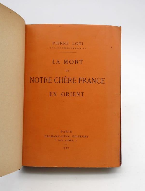
Best.-Nr. 18342Paris, Calmann Lévy, 1920. In-12, 295 pp., demi-chagrin rouge, dos à nerfs, couverture conservée (dos insolé, petites épidermures, quelques minuscules déchirures, petits manques et taches à la couverture ).
1829Best.-Nr. 32308Paris Moutardier 1829 Demi chagrin à coins récent, couvertures conservées, traces d'humidité claires sur les deux volumes planche dépliante ( vue de Constantinople ) et 2 gravures pour le premier volume et trois gravures coloriées pour le second , l'ouvrage, probablement longtemps resté broché a eu du mal à rentrer entre les plats d'une reliure moderne néanmoins d'aspect tout à fait correct Traduit de l'Anglais Par Nettement . IV - 369 + 314 - 4 ff catalogue éditeur )Chahine, guide Du livre orientaliste (2933 ) donne ce livre en 3 volumes en 2 tomes sans en préciser La pagination
1862Best.-Nr. PHO-915Paris, Didier et Cie., 1862. relié demi-percale , dos à nerfs avec auteur et titre ,IV, 556 pp., quelques rousseurs et un cahier bruni sinon bon exemplaire dans une reliure solide.
1936Very Good Turkish Original manuscript map of Alexandria Port and its immediate hinterland. Folio. (33 x 41 cm). In Turkish (Modern). Folded. No scale. The manuscript shows Alexandria Port and the Palace of the King Farouk of Egypt, customs shores, ports and harbors, locations of the British ships, radio station, location of SS Ramlah, strait, Great Pass (?), waterfront for the lumber ships, sea current zones and probably entrance and exit routes etc. A very detailed map, decorated with ships. Some repairs with tape, tears, foxing and stains. Overall a good copy.
1909Very Good French This attractive color lithographed map shows the Imperial Ottoman territories in the Balkan Peninsula, Anatolia, also North African shores and Maghreb countries, Egypt and Vilayet de Tripoli (Libya) and Liva de Benghasi. It has small views with a small scale of Tripoli, Europe, Egypt, and Nubia with the Arabian Peninsula. This map reflects the territories and situation of the last period of the Ottoman Empire soon after the Second Constitutional Era in 1908. Inside the red lines in this map shows the Ottoman territories in 1909 with its maximum extent, just before the Balkan Wars, (1912-1913). In Europe, Western Thrace territories up to Montenegro including Adrianople are within the borders of the Empire. E. Nardin was a French cartographer who prepared more than sixty maps in the early 19th century, especially mapping Middle Eastern, North African, Sub-Saharan African areas. Original color lithograph folded map in its original wrappers. Oblong double elephant folio. (77x95 cm). Wrappers dimensions: (21,5x14 cm). In French. Echelle 1/4.165.000 (Scale). Only two copies in OCLC. Extremely rare. No date.
1920Very Good Turkish, Ottoman (1500-1928) Original color map on cloth. Oblong atlas folio. (44 x 58 cm). Scale: 1/200.000. Toponyms in Ottoman script /Turkish with Arabic letters). Shows southwest of the Gallipoli Peninsula [and the Hellespont], Edremid Gulf, Tenedos, and North Aegean shores of Anatolia]. Folded. This is one of the series of the Bonn projection maps which are the first map series in modern techniques in Turkey and the Ottoman Empire. In order to produce these maps covering Turkish territory, Reconnaissance Branch was incorporated into The Mapping Commission. The maps were produced in the datum based on the latitude and longitude of the Ayasofya Mosque in equal area Bonn Projection. The field works for the 123 sheets covering the country were conducted by 76 staff. The production was completed in 18 years starting from east-west. Fieldworks continued without stopping except in the years 1914 and 1920. This map series called also reconnaissance maps contributed a lot to producing 1:25.000 scale maps. Hegira: 1336 = Gregorian: 1920. Not description on map-maker. Extremely rare.
1915Very Good Turkish, Ottoman (1500-1928) Original chromolithograph folded map. Oblong atlas folio. (49 x 65 cm). In Ottoman script. Repaired with a band in the contemporary period from its backside. Set including 4 sheets. Other sheets are Basrah, Bagdad, and Qut al-Amare. This is the first sheet including 'Samawah'. Rare. Scale is 1/500.000. Samawah city was settled by the Arab tribe of Banu Quda'a around the 3rd century AD. It is built on both sides of the Euphrates river; there are four bridges in the center of town for crossing between the two sides. The west bank of the city contains the commercial heart of the city and includes the old town and the Jewish quarter, Agd al Yahood. The west bank is the site of the covered market Suq Al Masgoof, which dates to the Ottoman period. The area surrounding the market is the old city with its Byzantine maze of crowded markets and streets. The eastern side of the city including 'Qushla' has a more modern feel and contains a number of estates of apartment blocks built during the 1970s and 1980s, As Samawah Stadium, which is home to the local Muthanna football team Samawa FC, as well as technical colleges and the polytechnic. There too is Al Qushla, the historic "Ottoman Barracks". The most famous attraction of Samawah in the ruins of the ancient Sumerian city of Uruk which dates to 4000 BC. This was the largest city in Sumer, extending over 2 km2. Uruk was not only the largest conurbation of the first urban civilization on earth, but it is also the place where the first written script was discovered, the oldest dating back to 3300 BC. The palm groves of Samawah: Samawah is built on both sides of the Euphrates and is surrounded by hundreds of palm groves that give it a tropical feel, especially in the southern and northern suburbs. These groves provide cool respite from the scorching heat of Mesopotamia and were the inspiration for the famous Iraqi folk song "The Palm of Samawah".
1926Very Good Turkish, Ottoman (1500-1928) Original map of Kars Fortress. Oblong: 45x57 cm. In Ottoman script. Scale: 1/21000. [PLAN OF KARS FORTRESS] Kars Kal'asi plâni (Based on 1898 discoveries and 1908 practice). A very detailed plan in Ottoman script of Kars Fortress and is environment. Some red markings. Extremely rare.
1900Very Good German Original b/w city plan. Atlas folio. (58x47 cm). In German. Folded. [CITY PLAN of BRAILA -IBRAIL-] Stadtplan von Braila. Scale (Masstab): 1/10.000. No cartographer. 33 descriptive articles on bottom-right corner of the plan. Slightly chipped at extremities of paper and soiling. It shows Braila and Donau. Braila (Turkish: Ibrail) is a city in Muntenia, eastern Romania, a port on the Danube and the capital of Braila County. There's some Ottoman manuscript including translations of the German descriptive text on the plan, and also "'Ibrail' sehir plâni" written on verso in Ottoman script. Extremely rare.
1882Very Good Turkish, Ottoman (1500-1928) First and Only Edition of this extremely rare first user guide for the Ottoman market for a sewing machine manufactured by the Singer Company. This richly illustrated user guide in Ottoman Turkish, printed for "28 K" model (manufactured in 1882) of Singer sewing machines includes numerous diagrams showing the parts of the machine and threading the needle, sewing techniques, using the belt wheel and foot pedal, measuring techniques, the thickness of needles and threads, and how to detect and avoid counterfeits of the brand. In Ottoman Empire, Singer sewing machines were initially started to be offered for sale in Constantinople and Smyrna (today's Istanbul and Izmir) in the 1880s, soon after Isaac Merritt Singer & Company was incorporated with Edward B. Clark, Attorney-at-law from New York in 1851. The company opened its first dealer/dealership in the last period of the Imperial Ottoman at Cadde-i Kebîr [i.e. Istiklâl Street] in Pera, and became the first foreign company to open a dealer/dealership and issue an invoice in Turkey. As the first company to use the "direct marketing" method, Singer went to mountain villages in Turkey, together with its salespersons, instructors, and technicians, who were in charge of showing and informing people on how to use Singer sewing machines, for many years. Singer was the first company to prepare user's guides, to provide extensive service, to initiate the practice of "Guarantee Coupon", to deliver training on sewing - embroidery, and to introduce gas stoves and ovens to Turkish people. In addition, Schneidertempel (Tailors Synagogue), which was founded in 1894 by Mayer Schönman, who was the tailor of Sultan Abdulhamid II in the Ottoman palace, and the head of the tailor's guild at that time, broke the monopoly of male tailors in the Ottoman Empire and led the way for every woman to do sewing at home. At the beginning of the 20th century, free sewing courses for women started to be organized by Singer in Turkey. Furthermore, Singer played a role in the history of all leading garment-industry brands of Turkey. (Source: Official Singer Website - History). ABOUT ZELLICH PRINTING HOUSE: Antonio Zelic (Zellich) of Brela was one of many Dalmatians who left his homeland in pursuit of a better life during the 19th century. However, instead of going west, he set out toward the East, to the Ottoman imperial capital - Istanbul. Upon arrival in the city on the Bosphorus, Zelic found employment at the first lithographic print house founded by Henri Cayol in the Ottoman Empire. In 1869, Zelic opened his own lithographic print house called "Zellich and Sons" (A. Zellich et fils). His descendants continued his work with great success, and the Zellich Print House, now known as "Zellich Brothers" (Zellich frères), became one of the most renowned in the Empire. The Zellich Brothers won recognition due to the high quality of their products, and, above all, the amazing beauty of their postcards and posters. Their crowning achievement was an order for the printing of the Ottoman Turkish Lira banknotes in 1914. The Zellichs received many Ottoman and international awards, including medals conferred by the Pope, the Persian shah, and the Serbian king.". (Source: Documentary film "Zelic- Printers to the Empire", Levantineheritage). Original illustrated wrappers. Roy. 8vo. (24 x 16 cm). In Ottoman script (Old Turkish with Arabic letters, pre-1928). 24 p., [24] unnumbered b/w engraved ills. Heavily stains on top of the pages, a trace of folding. Overall a good copy. Özege 15450.; Only one institutional copy in the Library of Congress according to the WorldCat: OCLC 125421484.
2011New English Paperback. 4to. (28 x 22 cm). In English and Turkish. 120 p., b/w photos. Istanbul: A selection of Collection Point Hotel. For the first time, tells his photos with stories.= Istanbul: Point Hotel Koleksiyonundan seçmeler. Fotograflarini ilk kez öykülerle anlatti. Signed by Ara Güler.
1923Very Good English Original b/w portolan chart. Folded. A little foxing and some pencil markings and notes in Ottoman script in its period. Oblong double elephant folio. (70 x 102 cm). In English. Bosphorus to Kerempeh from the Russian survey of 1834 with additions and corrections by Commander W. J. L. Wharton., R. N. 1872-80. It's written 'London published according to Act of Parliament at the Hydrographic Office of the Admiralty Jare. 16th 1854. Also shows Killa Bay (Shile Bay) from a survey by Lieut. Comm. W. R. Pristen and the midshipmen of H. M. S. Royal Sovereign, 1920. Topography partly from a Turkish map. Up side of map, engraved a view from sea of entrance of the Bosphorus, Rumili (sic. Rumeli) Lighthouse and environment with several hills. And also shows Amastra (Ancient Amastris) from Russian surveys, 1834-41; Kosku Bay from a surbey by Capt. Spratt R. N. 1854; and Sungul Bay (Zonguldak) from the Heraclee Companys plans to 1915. A rare navigation chart.