2 104 résultats
1992New English Original bdg. Hardbound in setalux cloth and in special and original slipcase. Large 4to. (36.5 x 26 cm). Color and b/w ills. 132 p. This beautiful book on the Byzantine and Ottoman architectural heritage of Istanbul contains detailed images of the city's domed structures accompanied by an illuminating essay by Prof. Semavi Eyice on the historical development of the city's spaces since the earliest days.
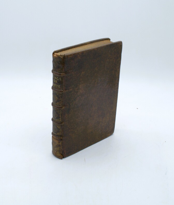
réf. 041231770 Neuchatel Au dépends de la Société Typographique. 17 x 10 cm - 204187 pgs - plein veau marbré avec titre estampé en or sur de dos dos lisse avec fleuron dans la caissons estampée en or - coiffe usée autrement bel exemplaire l'intérieur est très bien petite fente en bas du mors suppérieur en bas 1770 Neuchatel Au dépends de la Société Typographique unknown
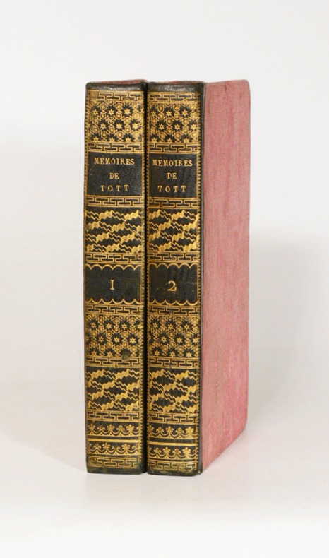
1823réf. 30930C. H. F. Hartmann. Good with no dust jacket. Hardcover. Books rebound in brown marbled boards. Gilt bands and lettering to spines. Ex-library copy with usual stamps. Spines has some edgewear with colour flecking off in places. Corners edgeworn. Some foxing. Ink initials to inner covers.; V1: XII 316 pp. ; V2: 317-750; 2 Volumes in 1 COMPLETE; 1-2; 750 pages . 1823. C. H. F. Hartmann hardcover
1912Very Good Turkish, Ottoman (1500-1928) A very attractive chromo-lithograph map on paper. Oblong: 26,5x37,5 cm. In Ottoman script (Old Turkish with Arabic letters). Light foxing and fading on margins and printed area. A very detailed and fine double hemisphere map of the northern and southern skies, showing the various constellations, together with a third map showing the zodiacs on one paper. On the bottom margin, it's written 'Printed in the 549 Numbered Press', and 'Dersaadet...'. This map seems to be influenced (or, a direct translation) from the map of the sky of Sir Francis Baily, (1774-1844), who was one of the leading English Astronomers of the first part of the 19th Century. He is most famous for his observations of "Baily's beads" during a total eclipse of the Sun. Baily was also a major figure in the early history of the Royal Astronomical Society, as one of the founders and as the president four times. After a tour in the unsettled parts of North America in 1796-1797, his journal of which was edited by Augustus de Morgan in 1856, he entered the London Stock Exchange in 1799. The successive publication of Tables for the Purchasing and Renewing of Leases (1802), of The Doctrine of Interest and Annuities (1808), and The Doctrine of Life-Annuities and Assurances (1810), earned him a high reputation as a writer on life-contingencies; he amassed a fortune through diligence and integrity and retired from business in 1825, to devote himself wholly to astronomy. He had already, in 1820, taking a leading part in the foundation of the Royal Astronomical Society. In 1827, the Society awarded him its Gold Medal for preparation of the Astronomical Society's Catalogue of 2881 stars. He was instrumental in the reform of the Nautical Almanac in 1829. In 1837, he recommended to the British Association and later worked extensively on the reduction of Joseph de Lalande's and Nicolas de Lacaille's catalogues containing about 57,000 stars. He also supervised the compilation of the British Association's Catalogue of 8377 stars (published 1845) and revised the catalogues of Tobias Mayer, Ptolemy, Ulugh Beg, Tycho Brahe, Edmund Halley and Hevelius. His notice of Baily's Beads, during an annular eclipse of the sun on May 15 1836, at Inch Bonney in Roxburghshire, started the modern series of eclipse-expeditions. Very rare.
1885Very Good English Fine and attractive original panoramic photograph of Constantinople, Istanbul, printing-out paper, 4-part, buildings captioned and credits in negatives in French. 70x9 cm. A dark print. This panoramic photograph was taken by Gülmez Freres inside Robert College. Robert College was founded in Bebek by Christopher Robert, a wealthy American philanthropist, and Cyrus Hamlin, a missionary devoted to education in 1863. The Gülmez Frères were three brothers, of Armenian origin, who established a photography studio in Istanbul, Turkey in 1870. A short time later, they took photos for the Ottoman court and Sultan Abdulhamid II.
1869Good Turkish, Ottoman (1500-1928) Original wrappers. Tear on the upper left side of front cover, chippings on extremities. A good copy. Roy. 8vo. (24 x 17 cm). In Bulgarian. 107 p. First and only edition of this scarce early book in Bulgarian, printed in Constantinople (Macedonian Printing House) on the history of the Archbishopric of Ohrid, also known as the Bulgarian Archbishopric of Ohrid, which was an autocephalous Eastern Orthodox Church established following the Byzantine conquest of Bulgaria in 1018 by lowering the rank of the autocephalous Bulgarian Patriarchate due to its subjugation to the Byzantines. In 1767, the Archbishopric's autocephaly was abolished, and the Archbishopric was placed under the tutelage of the Patriarchate of Constantinople. 13 copies in OCLC: 793578483, 48911077.
1939Very Good French In contemporary 1/3 black leather bdg. Demy 8vo. (24 x 17 cm). In French and Turkish. 46, 31 p., x numerous b/w plates of Ottoman registers. 46 p. in Turkish (Modern); 31 p. in French. "Les metayers-serfs et quelques centres d'exploitation sous le regime du etayage servile: Quelle a ete l'importance de la main d'oeuvre servile sous l'Empire Ottoman, surtout aux epoques ou, selon toutes les apparences, le continengt d'esclaves introduits a ete le plus eleve dans les diverses branches de l'activite economique en particuler et en general dans la vie politique et militaire du pays?...". From the first etude: "The sharecroppers and some exploitation centers under the regime of servile shoring: What was the importance of servile labor under the Ottoman Empire, especially at times when, in all appearances, the continence of slaves introduced was highest in the various branches of economic activity in Europe particularly and in general in the political and military life of the country?...". Signed and inscribed by Barkan, (1903-1979) in Ottoman script, to Ibrahim Fazil Pelin, (1886-1944), as "Hocamiz Fazil Beyefendiye saygilarimla". Barkan was a Turkish economical historian, also one of the most important economist. Barkan, is primarily a scientist who has brought innovation to the understanding of history and examination in Turkey. He noticed more with his researches in the field of Turkish economic history; The 'Tahrir registries' were first studied systematically by him. He has revealed their importance in terms of agricultural, social and demographic. His researches were usually on the 16th century. First and Only Edition.
1924Abundant black and white illustrations and reproductions of photos. Features: The Hunting of Gonzales - An adventure of Senor Ramon Torres, a Captain of Rurales - the famous mounted police of Mexico; Adrift on an Ice-Floe - Lieut. Commander Fitzhugh Green provides a photo-illustrated account of the amazing fashion in which a primitive Eskimo extricated himself from a predicament which would assuredly spelt death for a white man; An Englishwoman in Upper Egypt - Part II - Winifred S. Blackman's photo-illustrated account of the three winters she spent with the local people of Upper Egypt; Fraser's Price - The tale of an angered railroad engineer; The Three Angleteers - Part V (conclusion) of the trouble and adventures of three English wanderers in Constantinople and Athens; "Remember the Mortons" - A stirring story of an episode in the Matabele rebellion of 1895; Salvage Extraordinary - An Indian planter's account of an odd affair on the Brahmaputra River in Assam, including photo of five elephants pushing a stranded steamer; The Head-Hunters of Sepik - Part III - Beatrice Grimshaw explored the Sepik River of New Guinea and dealt with the local cannibals - article with photos; Where Everyone is Wealthy - The Osage Indians of Oklahoma come up with the strangest ways to divest themselves of their wealth earned from local oil - article with photos; "Grip" and I - Part III - Count Nils Cronstedt spares a condemned bull-terrier which rewards him by saving him multiple times while he served in West Africa as Commander of H.M.S. Heron and Assistant Marine Superintendant in Northern Nigeria; "Old White Face" - Allen Borders of Montana relates a terrifying cougar experience; To Afghanistan in Disguise - Part III - The story of a British officer's remarkable journey - disguised as an Oriental - across a large part of India and finally into forbidden Afghanistan and beyond, living among the natives; "Captain Jed" - a tale of the whalers of New Bedford, MA, involving the "Cap'n Jed" and the "Wanderer" - very few men have ever fought a 'right' whale single-handed and lived to tell the tale; Python and Lion in Nyassaland - after visiting a witch-doctor for poisoning the author is attacked first by a great python, then a lion!; Photo of a Manchurian man 7 feet and 3 inches tall; Photo of a veritable forest of masts at Lowestoft, the Suffolk fishing port, during the height of herring season; and more. 88 pages plus 24 pages of nice vintage ads. Clean and unmarked with light wear. A quality copy of this excellent vintage issue. Book
1890réf. 3754PARIS LIBRAIRIE DE FIRMIN-DIDOT & CIE. 1890. FORT VOLUME IN-4 (22 X 29 X 6 CENTIMETRES ENVIRON) DE (6) + IV + 779 ET (1) PAGES, RELIURE D'EPOQUE 1/2 CHAGRIN ROUGE, DOS A CINQ NERFS ORNE D’UN RICHE DECOR DE FLEURONS DORES, TITRE ET TRANCHES DORES, PLATS DE PERCALINE ROUGE ENCADREE DE FILETS A FROID, ARMES DOREES DE LA VILLE DE PARIS AU CENTRE DU PLAT SUPERIEUR (PRIX MUNICIPAL D’EXCELLENCE). EDITION ORIGINALE. PETITES TRACES D’USURE EXTERIEURE SANS GRAVITE, SINON BEL EXEMPLAIRE.
1664réf. PHO-1635Paris, Claude Barbin, 1664. In-4, relié plein veau marbré époque, dos à nerfs orné avec titre, une coiffe manque et accroc à la coiffe en pied, le frontispice manque, réparation au dernier caisson, tache d’encre pages 86-91, quelques feuillets brunis.
1785réf. 0045381785 Amsterdam, sans nom d'éditeur [Paris], 1785. Quatre tomes reliés en deux volumes in-8 (132 X 201 mm) demi-chevrette vert lierre, dos lisse cloisonné de grecques et filets dorés, compartiments ornés à la grotesque, titre doré (reliure de l'époque). Tome I : XL pages (dont titre), 203 pages - Tome II : (2) ff. de faux-titre et titre, 220 pages - Tome III : (2) ff. de faux-titre et titre, 180 pages - Tome IV : (2) ff. de faux-titre et titre, 152 pages. Ex-libris collé sur le premier contreplat de chaque volume. Quelques épidermures, frottements aux plats, cerne de mouillure très claire en marge des 10 premiers feuillets du tome III, pointes de rousseurs très éparses.
1999New English Original bdg. In original special publisher's box. Folio. (43 x 35 cm). In English. 266 p., color ills. In English. This book places the reader in the midst of the extraordinary architectural spaces created by Sinan through the medium of the lens of Ahmet Ertug, whose camera focuses on the astonishing vision and creative talent of that architect as he strove to develop and perfect his innovative architectural designs. The main text is by Prof. Dogan Kuban, a leading architectural historian and recognized specialist on Sinan. 30 by 41 cms., 266 pages (97 large-format color plates). Hardbound in Japanese cloth and presented in a slipcase.
1919Good Greek, Modern (post 1453) Original booklet. Cr. 8vo. (20 x 14 cm). In Greek (Modern). 8 p. Heavily stains on pages, tear on lower spine and lower right cover, staple rusted. Fair copy. Extremely rare pamphlet of the regulations of "the Maronite Brotherhood, or Enosis" which consists of 27 articles in modern Greek. The Maronites constitute a Christian group whose members adhere to the Syriac Maronite Church with the largest population around Mount Lebanon in Lebanon. The Maronite Church is an Eastern Catholic sui iuris particular church which is in full communion with the Pope and the Catholic Church, with the right of self-governance under the Code of Canons of the Eastern Churches, one of more than a dozen individual churches which are in full communion with the Holy See. The Maronites derive their name from the Syriac Christian Saint Maron, some of whose followers migrated to the area of Mount Lebanon from their previous place of residence which was located around the area of Antioch, and established the nucleus for the Syriac Maronite Church. Saint Maron sent Saint Abraham, often referred to as the Apostle of Lebanon, to convert the non-Christian native population to Maronite Christianity. The name of the Adonis River was changed to Abraham's river by the inhabitants after Saint Abraham preached there. Mass emigration to the Americas at the outset of the 20th century, due to famine mainly resulting from Ottoman blockades and confiscations during World War I, which killed an estimated one third to one half of the population during the Lebanese Civil War between 1975-1990 and the low fertility rate greatly decreased their numbers in the Levant. Maronites today form more than one-quarter of the total population in the Republic of Lebanon. All Lebanese presidents have been Maronites as part of a tradition that persists as part of the National Pact, by which the Prime Minister has historically been a Sunni Muslim and the Speaker of the National Assembly has historically been a Shi'i Muslim. Enosis is the movement of various Greek communities that live outside Greece, for incorporation of the regions they inhabit into the Greek state. Widely known is the case of the Greek-Cypriots for the union of Cyprus into Greece. The idea of enosis is related to the Megali Idea, an irredentist concept of a Greek state which dominated Greek politics following the creation of the modern Greek state in 1830. The Megali Idea was a project which called for the annexation of all ethnic Greek lands, parts of which had participated in the Greek War of Independence in the 1820s but were unsuccessful and remained under foreign rule. In 1821, several parts of Western Thrace rebelled against Ottoman rule, participating in the Greek War of Independence. During the Balkan Wars, Western Thrace was occupied by Bulgarian troops and in 1913 Bulgaria gained Western Thrace under the terms of the Treaty of Bucharest. Following World War I, Western Thrace was withdrawn from Bulgaria under the terms of the 1919 Treaty of Neuilly and put temporarily under Allied management before being given to Greece at the San Remo conference in 1920. Following the conclusion of World War I, Greece began the occupation of Smyrna and surrounding areas of Western Anatolia in 1919 at the invitation of the victorious Allies of World War I, particularly David Lloyd George the British Prime Minister. The occupation was given official status in the 1920 Treaty of Sèvres, with Greece being awarded most of Eastern Thrace and a mandate to govern Smyrna and its hinterland. Smyrna was declared a protectorate in 1922. However, the attempted Enosis failed when the new Turkish Republic prevailed in the resulting Greco-Turkish War of 1919-1922, after which most Anatolian Christians who had not already fled during the war were forced to relocate to Greece in the 1923 population exchange treaty executed between Greece and Turkey. Not located in OCLC.
2000New English Original bdg. HC. In special publisher's box. Folio. (41 x 30 cm). In English. 257 p., 107 numerous color plts. Chora: The scroll of heaven. Photos by Ahmet Ertug. First Edition. The building that was originally the Monastery of the Holy Savior in Chora is regarded as one of the most sublime examples of Byzantine art because of its early 14th century mosaics and frescoes. The level of artistic achievement attained in the Chora frescoes parallels the Pre-Renaissance movement that began in Italy and heralds the advent of a new style in Byzantine art. Chora: The Scroll of Heaven takes the reader on a scholarly and artistic journey that delves all the details of this jewel-like structure. The book's text was written by Cyril Mango, one of the most respected names today in the field of Byzantine art history, while its photographs were taken by Ahmet Ertug, an internationally recognized architect and photographer. The photographs appearing in the book were exhibited at the International Byzantine Congress held in Paris in 2002, where they received many accolades. The exhibition was repeated at the Japan Foundation in Tokyo during August 2003 and at the New York Art Institute in May 2004. 30 by 41 cms., hardbound covered with Japanese cloth, presented in a slipcase. BYZANTIUM Byzantine art Architecture Constantinople Istanbul Kariye Church Mosque History of art Mosaic Christian art Icon.
1913Fine Turkish, Ottoman (1500-1928) Original wrappers. Cr. 8vo. (20 x 14 cm). In Ottoman script (Old Turkish with Arabic letters). 120 p., ills. and many plans, one folded map (50x67 cm) of the Galata quarter surrounded by the Bosphorus and the Golden Horn of Constantinople, including Genoese and Byzantine architectural buildings. First edition of this rare and the early book on old Genoese and Byzantine buildings in the Galata quarter of Constantinople, written by Turkish art historian Celal Esat Arseven (1876-1972). The Galata quarter first appeared in Late Antiquity as Sykai or Syca. By the time the Notitia Urbis Constantinopolitanae has compiled in ca. 425 AD, it had become an integral part of the city as its 13th region. According to the Notitia, it featured public baths and a forum built by Emperor Honorius, a theatre, a portico street, and 435 mansions. It is also probable that the settlement was enclosed by walls in the 5th century. In the 11th century, the quarter housed the city's Jewish community, which numbered some 2,500 people. In 1171, a new Genoese settlement in the area was attacked and nearly destroyed. In 1233, during the subsequent Latin Empire (1204-1261), a small Catholic chapel dedicated to St. Paul was built in place of a 6th-century Byzantine church in Galata. This chapel was significantly expanded in 1325 by the Dominican friars, who officially renamed it the Church of San Domenico, but local residents continued to use the original denomination San Paolo. In 1407, Pope Gregory XII, in order to ensure the maintenance of the church, conceded indulgences to the visitors of the Monastery of San Paolo in Galata. The building is known today as the Arap Camii (Arab Mosque) as per its conversion into a mosque a few years later (between 1475 and 1478) under the rule of Ottoman Sultan Mehmed II with the name Galata Camii. In 1261, the quarter was retaken by the Byzantines, but Emperor Michael VIII Palaiologos granted it to the Genoese in 1267 in accordance with the Treaty of Nymphaeum. This rare book includes the history and the plans of the buildings such as the Arap Mosque (Church of San Domenico) (1325), Galata Tower (1348), Church of Saint Benoit (1427), Zülfaris Synagogue (1823), Church of Saints Peter and Paul (1843), Camondo Steps (1880), St. George's Austrian High School (1882), Ashkenazi Synagogue (1900), Italian Synagogue (1931), Neve Shalom Synagogue, etc. ABOUT THE AUTHOR: Celal Esat Arseven was a Turkish art professor and historian. Born the son of a pasha in Istanbul, Celal Esat Arseven graduated from Besiktas Military School in 1888 and studied drawing at a fine arts school for a year before going to military college. He continued writing and painting while in the army, from which he resigned in 1908. In the years before World War I, he worked at the humor magazine Kalem with Cemil Cem, one of the great early caricaturists of Turkey. Arseven was a writer and artist of diverse talents. In 1918, he wrote a libretto for one of the first Turkish operas and went on to write several musical plays performed at the Istanbul municipal and state theaters. In addition to being an accomplished watercolorist, he was also a professor of architecture and municipal planning at the Istanbul Fine Arts Academy from 1924 to 1941. He published a five-volume art encyclopedia between 1943 and 1954, and many books on Turkish painting and architecture throughout his lifetime. Before his death, he was awarded a doctoral degree by Istanbul University. He was also a delegate to the Turkish Grand National Assembly during its seventh and eighth sessions. (Sources: And, Metin. "Opera and Ballet in Modern Turkey." In The Transformation of Turkish Culture: The Atatürk Legacy, edited by Günsel Renda and C. Max Kortepeter. Princeton, NJ: Kingston Press, 1986). Özege 5112.; TBTK 4748.
2013New Turkish Original illustrated bdg. HC. 4to. (32 x 23 cm). In Turkish. 3 volumes set: (440 p., 1 folded color panorama of Istanbul; 442-875, [5] pp., 1 folded color panorama of Istanbul, 877-1289, [8] pp., 1 folded color panorama of Istanbul, b/w and color plates and photos. 20. Yüzyil'dan 21. Yüzyil'a Necip Bey Haritalari'ndan günümüze öncesi ve sonrasi Istanbul. 3 volumes set. [In special box]. First and Only Edition. Best and only reference on Nedjib [Necip] Bey maps.
réf. 8225Paris, Ladvocat et Cie, 1837 pour les 4 premiers volumes et 1839 ( 3* edition ) pour le cinquieme. 5 volumes in-8° broches 402 pages, 396 pages, 406 pages, 384 pages et 372 pages. Il manque l'Atlas. Les dos des couvertures papier sont en mauvais etat, l'interieur est frais, les a-plat sont tres corrects.
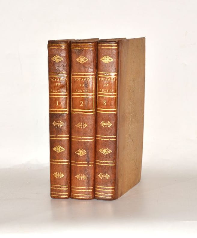
1813réf. 0056291813 Paris, Buisson, Arthus, 1813. Trois volumes in-8 (205 X 133 mm) demi-basane fauve, dos lisse cloisonné de filets dorés et orné de fleurons dorés, pièces de titre cuir de Russie fauve, tranches mouchetées en rouge (Reliure de l'époque). Tome I : (2) ff. de faux-titre et titre, XVI pages, 400 pages, 2 cartes dépliantes - Tome II : (2) ff. de faux-titre et titre, 514 pages, 3 cartes dépliantes - Tome III : (2) ff. de faux-titre et titre, 432 pages. Frottements à un plat, quelques habiles restaurations à la reliure, petit manque de papier en fond de cahier des feuillets de faux-titre, titre et plan du tome II, petit cerne de mouillure claire en tête de quelques feuillets du tome II, sans atteinte au texte ni au dessin, reports bruns aux premier et dernier feuillets de chaque ouvrage.
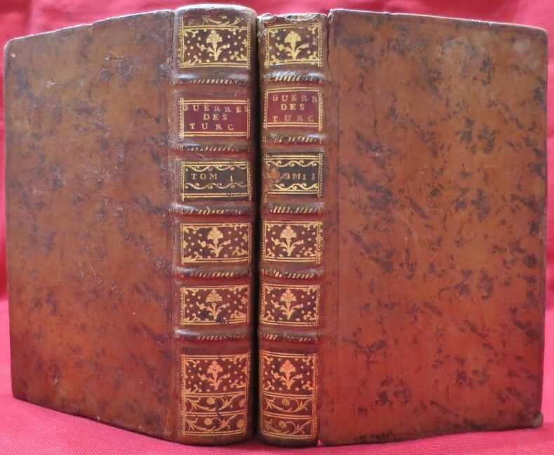
réf. 109210A Paris, Chez la Veuve Desaint, libraire, rue du Foin Saint Jacques, 1777, 2 volumes in-12 de 175x105 mm environ,Tome I : 1f.blanc, 128-384 pages, 2ff. (table, errata), - Tome II : 1f.blanc, faux-titre, titre, 367 pages, 2ff. ( table, approbation et privilège), reliures pleine basane marbrée fauve, dos à 5 nerfs portant titres et tomaisons dorés sur pièce titre rouge et verte pour la tomaison, ornés de caissons à fleurons et motifs dorés, coupes dorées, gardes marbrées, tranches rouges. Petits manques de cuir sur une coiffe, sur les coupes et sur la tomaison du tome II, coins émoussés, des épidermures et frottements sur le cuir, déchirure sans manque sur la page de faux-titre (restaurée).
1904réf. 29427Constantinople Imprimerie Du Levant Hérald 1904 In-8 Un portrait - 209 pp - probablement l'exemplaire de l'auteur ou d'un membre de sa famille, il existe une autre édition, c'est un livre de poésies et de souvenirs d'un Ambassadeur qui participa à la conférence de la Haye ( voir notre référence 29428 ) ; Un chapitre du livre est consacré à cette conférence
1911Very Good Greek, Modern (post 1453) Original wrappers. Large 8vo. (21 x 16 cm). In Greek (Modern). 21 p. First and only edition of this exceedingly rare and one of the earliest church regulations of the Greek Orthodox community of Attalia [Antalya]. Attalia was not a large urban center or major trading hub, but neither was the Greek Community marginal, and it was well integrated into the regional economy. It was different from other areas in Asia Minor due to a combination of factors ranging between demography, geography, local Orthodox leadership, and the city's social milieu. In contrast to the West-coast cities and many villages in Asia Minor with Orthodox majorities, Attalia's population was only about one-third Orthodox. The main area of difference in Antalya was the Community leadership, which was key to the maintenance of cordial relationships between Christians and Muslims, and the secular and ecclesiastical elements of Orthodox leadership in Antalya tended to cooperate for collective benefit. Throughout this period, a local elite managed to control education and other Community institutions, perpetuating an identity that was compatible with the local Ottoman context. In this last period, the Greek Community printed several books and tractates including a brief history of Antalya and this "regulation book" in the Meli Printing House, which was the only printing house of the Greek Community in Antalya. Only one institutional copy is located in OCLC 1030075331 (Suna Kiraç Library of the Koç University).
1930Very Good Turkish, Ottoman (1500-1928) Original pictorial wrappers. Chromo-lithographed photo-montage collage cover with seven b/w photos of African buildings and natives, and a red map of Africa. Complete in wrappers and folded huge Africa map (size: 57 x 82 cm). Cover size: 28.5 x 20.5 cm. In Turkish. Scale: 1/20,000,000. A very rare chromo-lithographed Africa map, prepared for the geography lessons about foreign countries in Turkey in 1930. The map shows the territories of the African continent, which was still politically under European colonialism as of the 1930s. It includes Rio de Oro (Spanish territory), Fas [i.e. Morocco], Algeria, Sahara, Cameroon (French territories), Trabulus [i.e. Libya] as Italian territory; and Liberia, Egypt, East Sudan, Eritre [i.e. Eritrea], Habesistan [i.e. Ethiopia], Somali, Kenya, Belgian Kongo, Angola, Mozambique and South African land including Rhodesia (equivalent in the territory to modern Zimbabwe), Transvaal, The Orange Free State [Oranje-Vrystaat], Natal and Kap [Cape] with Madagascar. An extra panel for the same scale map showing the Suez Canal, Nile Delta, and North Egypt in the lower-left corner. Duran studied in Istanbul and Paris. He worked as a geography teacher in various high schools and afterward he undertook the positions of lecturer and administrator in Ankara Gazi Education Institute for a time. He was known for his writings on various topics and particularly for his works on geography. Born in the imperial period, Duran conducted the first cartographic studies of the Republic of Turkey after the transition to the Republican administration. Sealed. Slight foxing. Otherwise a fine copy. Not in OCLC.
1800Very Good French Original decorated map. Hand-coloured. Oblong elephant folio. (54 x 76 cm). In French. Shows Greece, Archipelago, Isle de Candie, Asia Minor (Western side), and East Mediterranean. Delisle od de l'Isle was a French cartographer known for his popular and accurate maps of Europe and the newly explored Americas. At 27, Delisle was admitted into the French Académie Royale des Sciences, an institution financed by the French state. After that date, he signed his maps with the title of "Géographe de l'Académie". Five years later, he moved to the Quai de l'Horloge in Paris, a true publishing hub where his business prospered. Delisle's progress culminated in 1718 when he received the title of Premier Géographe du Roi. He was appointed to teach geography to the Dauphin, King Louis XIV's son, a task for which he received a salary. Again, his father's reputation as a man of science probably helped the younger Delisle. Historian Mary Sponberg Pedley says, 'once authority was established, a geographer's name might retain enough value to support two or three generations of mapmakers'. Delisle's case, it could be said that his accomplishments surpassed his father's. Up to that point, he had drawn maps not only of European countries, such as Italy, Spain, Germany, Great Britain, Poland, and regions such as the Duchy of Burgundy, but he had also contributed to the empire's claims to recently explored continents of Africa and the Americas. Like many cartographers of his day, Delisle did not travel with the explorers. He drew maps mostly in his office, relying on a variety of data. The quality of his maps depended on a solid network to provide him first-hand information. Given his family's and his own reputation, Delisle had access to fairly recent accounts of travellers who were returning from the New World, which gave him an advantage over his competitors. Being a member of the Académie, he also kept current with recent discoveries, especially in astronomy and measurement. When he could not confirm the accuracy of a source, he would indicate it clearly on his maps. For instance, his Carte de la Louisiane shows a river that the baron of Lahontan claimed he discovered. As no one else could validate it, Delisle noted a warning to the viewer that it might not exist. (Source: Wikipedia). Tooley, p.43.
1909Very Good Turkish, Ottoman (1500-1928) Original color map on cloth. A little foxing on cloth. Very good. Folded. Oblong atlas folio. (66 x 72 cm). In Ottoman script. Scale: 1/210.000. Ottoman sanjaks in Albania and Greece. A rare Ottoman map of Balkans with Turkish place names for the period of pre-Balkan Wars, (1912-1913). Very important for onomastics and historical geography. Written 'Paris -French meridian- was accepted as the 0 meridian'. The Paris meridian is a meridian line running through the Paris Observatory in Paris, France-now longitude 2°20'14.03" east. It was a long-standing rival to the Greenwich meridian as the prime meridian of the world. Personal stamp of Muhiddin Pasha on cloth, under the printed descriptive texts. It's from the collection of him. Hasan Muhiddin Pasha [Çanga], (1866-1944), who was a lieutenant in Hedjaz Army of the Ottoman Empire in 1887. After he suppressed the rebellion in Yemen, 1891, his rank was promoted to the 'major'. After the Imam Yahya rebellion in Yemen, 1904, he prepared a report for the Ottoman government. He also took part in Ethiopia, Sudan, Yemen, Arabian Peninsula for various military duties. After promotion to division command, he was provincial president of CHP (Republican People's Party). He was a very important politic and diplomatic figure for the last period of Ottoman and early Republican Turkey. Not in Tooley. Extremely rare.
1909Very Good Turkish, Ottoman (1500-1928) Original color map on cloth. A little foxing on cloth. Very good. Folded. Oblong atlas folio. (66 x 72 cm). In Ottoman script. Scale: 1/210.000. Ottoman cities in Bulgaria. A rare Ottoman map of Balkans with Turkish place names for the period of pre-Balkan Wars, (1912-1913). Very important for onomastics and historical geography. Written 'Paris -French meridian- was accepted as the 0 meridian'. The Paris meridian is a meridian line running through the Paris Observatory in Paris, France-now longitude 2°20'14.03" east. It was a long-standing rival to the Greenwich meridian as the prime meridian of the world. Personal stamp of Muhiddin Pasha on cloth, under the printed descriptive texts. It's from the collection of him. Hasan Muhiddin Pasha [Çanga], (1866-1944), who was a lieutenant in Hedjaz Army of the Ottoman Empire in 1887. After he suppressed the rebellion in Yemen, 1891, his rank was promoted to the 'major'. After the Imam Yahya rebellion in Yemen, 1904, he prepared a report for the Ottoman government. He also took part in Ethiopia, Sudan, Yemen, Arabian Peninsula for various military duties. After promotion to division command, he was provincial president of CHP (Republican People's Party). He was a very important politic and diplomatic figure for the last period of Ottoman and early Republican Turkey. Not in Tooley. Extremely rare.