ESAD EFENDI (ES'AD EFENDI) - SCARCE CONSTANTINOPLE IMPRINT.Livre Rare Book

2,094 results
1828ref. 51526Constantinople, Matbaa-i Amire, 1828 (1243 h.). Small 4to. (22 x 16 cm.). Contemp. full calf. with flap. A tear in the flap. Rebacked. Blindtooling to covers and a medaillon on front and back. Covers a bit rubbed. 3,4,259 pp. A small burnmark in inner margins of the last 8 leaves, otherwise internally clean and fine. Printed arabic types in Turkish/ Ottoman Turkish.
1916Very Good Turkish, Ottoman (1500-1928) Contemporary red cloth. Roy. 8vo. (24 x 16 cm). In Ottoman script (Old Turkish with Arabic letters). [1], 229, [1] p., many b/w and color ills., 30 chromo-lithographed maps. Wear and fading on spine, some ex-library stamps on the colophon and several blank pages, ownership ink inscription and signature on the first page-overall a good copy. First edition of this rare Ottoman atlas for the primary schools in the late Ottoman Empire, including beautiful 30 chromo-lithographed maps of the Ottoman land according to administrative regions (provinces) and richly illustrated with b/w plates of the cities and provinces in the Middle East. Map list: 1. World map 2. Complete Imperial Ottoman 3. Arabian Peninsula 4. Anatolia 5. Asia Minor 6. Marmara and Black Sea 7. Aegean (The Archipelago) 8. Demography of Anatolia and Syria, Libya, etc 9. Administrative map of Anatolia 10. Map of mines of Anatolia 11. Agricultural map of the Imperial Ottoman 12. Arabian Peninsula 13. Map of the Edirne Vilayat [Adrianople Province of the Ottoman Empire] 14. Map of the Bosphorus 15. Map of the Hüdavendigâr Vilayat [Brusa Province] 16. Maps of Izmit and Biga Sanjaks 17. Map of Aydin Vilayat and Mentese Sanjak 18. Map of the Konya Vilayat 19. Maps of the Adana Vilayat and the Mediterranean Sea 20. Maps of the Erzurum and Ankara Vilayats 21. MAps of Kastamonu Vilayat and Bolu Sanjak 22. Map of the Trebizond Vilayat 23. Maps of the Van and Bitlis Vilayats 24. Maps of the Sivas and Harput Vilayats 25. Maps of the Bagdad and Basrah Vilayats 26. Map of the Mosul Vilayat and Day al-Zor Sanjak 27. Map of the Aleppo Vilayat and Urfa Sanjak 28. Map of the Syria and Beirut Vilayats 29. Map of the Arabia 30. Maps of the Yemen vilayat and Asir Sanjak. This atlas was printed four times for the different classes of the early Turkish / Ottoman schools, during World War 1 (two times in 1916) and the National Struggle (two times in 1921). Geylangil was born in Istanbul in 1887 and studied in Aleppo and Baghdad. Geylangil, who also studied economic geography, taught geography at many schools, including Galatasaray High School. Until his death, he wrote 14 books on geography, most of which were geographical atlases. In 1941, he was among the founding members of the Turkish Geographical Society. Özege 23216.; TBTK 11481.; We couldn't find any copy of this edition worldwide.
1868Very Good Turkish, Ottoman (1500-1928) Contemporary quarter leather bdg. Rebacked boards. Foolscap 8vo. (18 x 12 cm). In Ottoman script (Old Turkish with Arabic letters). 220 p. Very rare early book of the concise biographies of 137 people who served as admirals in the Ottoman Empire between 1352 and 1853, written by Mehmed Izzet Pasha (d. 1853), son of Turkish admiral Abdullah Râmiz Pasha (d. 1813). Ceridehâne Printing House was founded for publishing Ceride-i Havâdîs [i.e. The Journal of News], which was the first semi-official newspaper in the Ottoman Empire. This journal was published from 1840 to 1877 and was founded by William Nosworthy Churchill (1796-1846), a British-born journalist who moved to Turkey aged 19. He was the cause of a diplomatic incident that resulted in the temporary severance of diplomatic relations between Britain and the Ottoman Empire. Babinger p. 323/2.; Özege 6951.; Library of Congress. Karl Süssheim Collection, no. 1336., OCLC: 11810438, 880485954.
1839Very Good Turkish, Ottoman (1500-1928) Original newspaper taken from a volume. Folio. (42,5 x 28 cm). In Ottoman script (Old Turkish with Arabic letters). [5] p. Extremely rare early issue of this first official newspaper of the Ottoman Empire after the proclamation of Reform (Tanzîmât) in 1839, informed Daguerre's new and weird invention ("photography" as it would be called in the 1850s) to the Ottoman peoples and readers. The article reads: "It is the talk of the town, steam engines have been able to run on rails in factories in recent years. Meanwhile, a man carefully focused on his thoughts so much and the craft turned into a strange art, and finally, a coquettish mirror (surface) appeared. This skillful Frenchman named Daguerre drew the lines of objects by reflecting the sunlight with the methods of the different science of art he learned, drew the contours of the objects, and gave 20 years secretly and openly to the formation of this strange art. Finally, he reached the goal and this event won the appreciation and admiration of everyone. This is to say, the image of the object, in the form of a large or small box free from light, is pictured inside by passing through the glass in front of it. In order for the reflected picture to be captured on a surface, some chemicals must be prepared. Daguerre has achieved this mix based on his experience. This substance applied on the plate is called iodine. After the plate is kept in the vapor of the iodine for a few minutes, it is immediately placed in the dark box, and the image passing through the window of the box is pictured for five minutes. Considering that some of the things that should be hidden are captured like this, it will be understood what a valuable invention this is...". In the continuation of the article, it is written that an Englishman named Talbot (Henry Fox Talbot) found the same thing with almost the same processes (!), but Daguerre had taken pictures before. Takvim-i Vekâyi was the first fully Turkish-language newspaper. It was launched in 1831 by Sultan Mahmud II, taking over from the Moniteur ottoman as the Official Gazette of the Ottoman Empire. With the beginning of the Tanzimat reform period, Takvim-i Vekayi produced versions in multiple language editions. It ceased publication in 1878, resuming in 1891-2, before being closed again. It resumed in 1908 until around 1922. In the 1831-1878 period it published a total of 2119 issues - an average of slightly less than one a week.
1651ref. 73622Londini: ex officina Rogeri Danielis 1651. First edition folio pp. 8 393 11; Greek and Latin text in parallel columns; woodcut device on title page; woodcut ornaments woodcut and factotum initials; early 19th-century roan-backed speckled paper-covered boards; edges worn old library stamp on title page occasional toning; good sound and relatively clean. First edition of the letters of Photius edited by Richard Montague recommended by the publisher as an important historical source for the schism between the Eastern and the Western churches and based on the 9th-century Barocci manuscript in the Bodleian Library. Brunet IV 624; Wing P-2136. ex officina Rogeri Danielis unknown
1651ref. 73622Londini: ex officina Rogeri Danielis 1651. First edition folio pp. 8 393 11; Greek and Latin text in parallel columns; woodcut device on title page; woodcut ornaments woodcut and factotum initials; early 19th-century roan-backed speckled paper-covered boards; edges worn old library stamp on title page occasional toning; good sound and relatively clean. First edition of the letters of Photius edited by Richard Montague recommended by the publisher as an important historical source for the schism between the Eastern and the Western churches and based on the 9th-century Barocci manuscript in the Bodleian Library. Brunet IV 624; Wing P-2136. ex officina Rogeri Danielis unknown books
1720ref. PHO-9761720, à Paris chez Jean Baptiste Coignard , In-12,7ffnch - 398pp- relié plein veau brun, dos à nerfs orné, pièce de titre (petit manque) , tranches mouchetées , coiffes arasées , coins usés(Reliure de l'époque).
New English Paperback. Pbo. 4to. (31 x 22 cm). In Turkish. B/w and color ills. and original b/w Ottoman documents. 1000 copies were printed. Vol. 1: Hatt-i Hümâyûn, 1577-1804. 372 p.; Vol. 2: Ilmühaber 1, 1667-1871. [xxx], 494 p.; Vol. 3: Mâi Lezîz defterleri 1, 1791-1794. 402 p.; Vol. 4: Mâi Lezîz defterleri 2, 1791-1794.; Vol. 5: Ilmühaber 2, 1710-1841. 398 p.; Vol. 6: Ilmühaber 3, 16016-1898. 404 p.; Vol. 7: Ilmühaber 4, 1856-1928. [xvii], 342 p.; Vol. 8: Mâi Lezîz defterleri 3, 1794-1797. [xix], 407 p.; Vol. 9: Mâi Lezîz defterleri 4, 1798-1802. [xvii], 398 p.; Vol. 10: Mâi Lezîz defterleri 5, 1801-1806. [xviii], 394 p.; Vol. 11: Kirkçesme sulari 1. [xxxvi], 436 p.; Vol. 12: Kirkçesme sulari 2, 1811-1921. [xxxviii], 402 p.; Vol. 13: 19. ve 20. yüzyillarda Istanbul sulari. 301 p.; Vol. 14: Su hukuku ve teskilâti, Gülfettin Çelik. 223 p.; Vol. 15: Mâi Lezîz defterleri 6, 1806-1813. [xxvii], 399 p.; Vol. 16: Mâi Lezîz defterleri 7, 1813-1817. [xxv], 379 p.; Vol. 17: Mâi Lezîz defterleri 8, 1817-1823. [xxiv], 385 p.; Vol. 18: Mâi Lezîz defterleri 9, 123-1826. [xxiv], 342 p.; Vol. 19: Mâi Lezîz defterleri 10, 1817-1829. [xxiv], 319 p.; Vol. 20: Mâi Lezîz defterleri 11, 1829-1838. [xxv], 364 p.; Vol. 21: Halkali sulari 1, 1837-1905. [xxvii], [1], ]301 p.; Vol. 22: Halkali sulari 2, 1843-1913. [xxx], 297 p.; Vol. 23: Avrupa Yakasi sulari 1, 1603-1826. [xxxviii], 326 p.; Vol. 24: Avrupa Yakasi sulari 2, 1577-1842. [xxxvi], 323 p.; Vol. 25: Avrupa Yakasi sulari 3, 1574-1831. [xLv], 3998 p.; Vol. 26: Suyolcu 1, 1717-1925. [xxiv], 309 p.; Vol. 27: Su kesif defteri 1, 1842-1862. [xxvi], 333 p.; Vol. 28: Su kesif defteri 2, 1847-1872. [xxvi], 334 p.; Vol. 29: Su kesif defteri 3, 1862-1876. [xxxii], 374 p.; Vol. 30: Bogaziçi ve Taksim sulari 1, 1836-1908. [xxviii], 339 p.; Vol. 31: Bogaziçi ve Taksim sulari 2, 1813-1928. [xLi], 338 p.; Vol. 32: Su tahrirleri, 1655-1807. [xLix], 278 p.; Vol. 33: Suyolcu 2, 1871-1921. [xxxv], 309 p.; Vol. 34: Suyolcu 3, 1684-1876. 335 p. Everything on water systems, water management, water supplying in Istanbul City based on original Ottoman archival documents and their transcriptions order in modern Turkish as in chronological order after the Conquest of Istanbul (Constantinople), in 1453. Also including The Roman, The Byzantine Era on it. [Istanbul Constantinople Constantinopolis Constantinopla Constantinopolin Konstantinopel Water supplying system Fountain Fountains History of art Turkish and Islamic art Ottoman arts Fine arts Khumayoun Humayoun Ottoman Empire The Ottoman State Constantinus Hadrianus Canalisation Canalization Engineering Arc Wtaer supply Canal Channel Drainage Dam Barrage Dike Aqueduct Pool Pond Receiver Sewer Cesspool Scales Grate Ways Water way Waterway Waterways Masjid Fountain for ablutions Charitable fountain Bath Hammam Hamam Assignment Allocating Distrubition Well Pit Sink Letting flow Conducting line Municipality Mayoralty Townhall Parish Ward Quarter District Harbour Narbor Port Haven Seaport Estuary Arm of the Sea The Golden Horn Lodging Settling Cistern Tank Registering Recording Enrolment Development Prosperity].
1921Very Good Turkish, Ottoman (1500-1928) An extremely rare litho propaganda map published as an extra supplement to the Tercümân-i Hakîkat [i.e. The Translator of Truth] newspaper just before the proclamation of Republic in Turkey in 1923 by Mustafa Kemal Atatürk (1881-1938), showing the front in West Anatolia during the War of Independence (or National Struggle) between 1919-1922 against Greek forces. The upside of the map between the note as title 'Gift to the readers of 'Tercümân-i Hakîkat', Mustafa Kemal Atatürk's portrait among decorated heroic lithographed drawings. In the lower right corner, can be seen legends of the map, scale, and mapmaker's signature. Tercümân-i Hakîkat was a daily newspaper published in Istanbul between 1878-1921 during the Ottoman Empire. Tercüman-i Hakîkat, the most important newspaper published during the reign of Sultan Abdülhamid II, was founded by novelist Ahmed Midhat Efendi, (1844-1912). In the beginning, most of the articles were written by Ahmed Midhat Efendi. It was an encyclopedic newspaper with the aim of inculcating and educating reading habits among the Turks and it played an important role in the training of many famous Ottoman journalists. Its first issue was published on June 26, 1878. After Ahmed Midhat's death in 1913, the newspaper changed owners, and the last issue was published on February 11, 1921. Ibrahim Alaettin Gövsa, (1889-1949), was an Ottoman / Turkish journalist, educator, and intellectual who supported the War of Independence the most. This propaganda map published in Tercümân-i Hakîkat, during the war in 1920 or 1921, is a propaganda tool that calls on the literate people belonging to a certain class, especially those living in Istanbul, to support the war, and aims to spread the word that Turkey is winning the war. Original lithograph map. 50x35,5 cm. In Ottoman script (Turkish with Arabic letters). Scale: 1: 250.000. Occasionally foxing and slight stains on paper, folded traces. Otherwise a very good copy.
1735ref. PHO-674Paris, Charles J.-B. Delespine fils, 1735.T1(4), xvi, (2), 470 pp., ( 22) .T2(3), 521 pp., (14) .T3(6), 558 pp., (17).T4(6), 572 pp., (16).T5 (5), 613 pp., (15). T6 (4) 615 pp., (17) 6 volumes in-12, veau moucheté, dos à nerfs orné avec pièce de titre et tomaison, tranches marbrées (Reliure de l'époque), défauts d’usage, manque au dos , charnières fendues , coiffes arasées .
1801ref. PHO-1355Paris, H. Agasse, an 9 [1801]-1807. 6 vol. in-8 (207 x 134 mm) sans l’Atlas ,xx-392pp.-1f. , 2ff.-377pp.1f. , 2ff.-iv-369pp.-1f.,2ff.-456pp.-1f.,2ff.-xv-485pp.,2ff.-522pp.-1f., relié demi veau, dos lisse richement orné,tranches marbrées (Reliure de l'époque), quelques frottements .
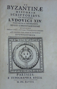
1648ref. HI246Parisiis, e typographia regia -curante Sebastiano Cramoisy- 1648. Folio, 1f, 59, 12, 220,, 161, 191, 1f. En-tetes, initiales decorees, pages de titre, culs-de-lampe, grandes vignettes graves sur cuivre. Textes grec et latin. Rel. plein veau contemp., ecusson de cardinal au milieu des plats, roulette doree, ex-libris grave, dos a nerfs decore, exemplaire propre, non-lave.
1899Very Good Turkish, Ottoman (1500-1928) Fine brown quarter leather bdg., brown boards with decorative embossing. Roy. 8vo. (24 x 17 cm). In Ottoman script (Old Turkish with Arabic script). 176 p., 33 unnumbered b/w plates of views of the Middle Eastern cities, Kaiser and queen's portraits, ills. of their maritime voyages, a general view of Beirut, a panorama of Jerusalem (in two pages), The Government House and Lake Tiberia in Beirut, a general view of Jaffa, churches and castles and Masjid-i Aksa of Jerusalem, Idlib, the interior of the Umayyad Mosque in Jerusalem, The Government House of Jaffa, Beirut - Damascus railways, street views and architectural buildings from Damascus, the market place of Jaffa, Bethlehem and the church, views of Trablus-Sam [i.e. Tripolis], ruins of Baalbek, and other numerous b/w photos, published for only this book. Slight stains on pages, a modern repair on a leaf with tape, otherwise a very good copy. Bound together with "Eski Sevda" which is a compilation of Turkish tales. First and only edition of this richly illustrated scarce and uncommon book was printed for the German Emperor Wilhelm II and his wife Augusta Victoria, the commemoration of the construction of Alman Çesmesi [i.e. German Fountain] in Constantinople, and the first anniversary of the Wilhelm II's travel to the Ottoman Empire in 1898. The fountain's design was drawn by the architect Spitta and constructed by the architect Schoele with the German architect Carlitzik and Italian architect Joseph Anthony, working on the project. The fountain was built in Germany and then transported piece by piece to Istanbul, reassembled in its current site, and officially opened on January 27, 1901, on the birthday of German Emperor Wilhelm II. Wilhelm II's voyage to the Levant in 1898 was a state visit that the German Emperor undertook in the Ottoman Empire between 25 October and 12 November 1898. The Kaiser started his journey to the Ottoman Eyalets with Istanbul on 16 October 1898; then he went by yacht to Haifa on 25 October. After visiting Jerusalem and Bethlehem, the Kaiser went back to Jaffa to embark on Beirut, where he took the train passing Aley and Zahlé to reach Damascus on 7 November. This book is richly illustrated including many views of the cities of this voyage's destinations like Jerusalem, Damascus, Beirut (Beirut), Jafa, Baalbek, etc. On 10 November, Wilhelm went to visit Baalbek before heading to Beirut to board his ship back home on 12 November. His visit spurred interest in the German Templer colonies in Palestine. One of the Kaiser's traveling companions, Colonel Joseph von Ellrichshausen, initiated the formation of a society for the advancement of the German settlements in Palestine, named the Gesellschaft Zur Förderung der Deutschen Ansiedlungen in Palästina, in Stuttgart. It enabled the settlers to acquire land for new settlements by offering them low-interest loans. A subsequent second wave of German settlers founded Wilhelma (named after the Kaiser, now called Bnei Atarot) in 1902 near Lod, Walhalla (1903) near the original Jaffa colony, followed by Bethlehem of Galilee (1906). The German Settlement Society successfully encouraged some of the Templars to return to the official, national Protestant Church. The non-Templar colony of Waldheim (now Alonei Abba) was subsequently founded next to Bethlehem of Galilee in 1907 by proselytized Templers now affiliated with the Old-Prussian State Church. The visit resulted in the highest-profile political event in the life of Theodor Herzl, considered the founder of Zionism. Through the efforts of William Hechler, via Frederick I, Grand Duke of Baden, Herzl publicly met Wilhelm II three times during the voyage, once in Istanbul (on 15 October 1898) and twice in Palestine (29 October and 2 November). The meetings significantly advanced Herzl's and Zionism's legitimacy in Jewish and world opinion. (Wikipedia). Only one copy in OCLC (Library of Congress. Karl Süssheim Collection, no. 1300) 900684728. Özege 7023
1909Very Good Turkish, Ottoman (1500-1928) Extremely rare huge chromo-lithograph map in 24 sheets mounted on canvas, showing a large zone including Midyat (Mardin), Mosul, Mt. Cilo (Resko-Buzul) on the southeast; Kahta (Adiyaman), Munzur Mt., Divrigi (Sivas) on the west; the Black Sea on north and Turkish borders to Armenia, Azerbaijan on the east, and to Russia on the northeast. In addition shows in separate little portions, roads, mountains and hills, lakes, and telegraph and post ways and borders in that zone. Not in any libraries and any collection. An attractive map with its huge size and decorative surface. Several toponyms are underlined in red ink. Otherwise a very good example. Original folded map mounted on canvas. 118x112 cm. In Ottoman script (Turkish with Arabic letters). Scale: 1/630.000.
ref. 18941110Leather bound album with 72 large format albumen photographs mounted dos-a-dos on tab-mounted card leaves; leaves measure 10.5 x 14 inches 268 X 322 mm images all measure approximately 8 x 10 inches 200 x 250 mm; album cover detached back strip perished; cards are a little wavy as is often the case with albumen photos; images are all clear with good tone. Also included is a typescript list of the photos with brief descriptions by the collector who purchased them on tour May and June 1890. The first twenty-four photos are from Greece all taken in Athens with the exception of a view of the port of Piraeus and two of Greeks in native dress. A few are signed "Rhomaides" and a few others appear to have the small Rhomaides credit scratched from the plate. The Benaki Musuem and the historical collections of the National Bank of Greece identify ten of the photos as the work of Constantine and Aristotle Romaidis Rhomaides probably the most prolific Greek photographers of the late nineteenth and early twentieth centuries; three other photos have either the Rhomaides name or its ghost. The remaining forty-eight are scenes in Constantinople Istanbul and the neighboring shores of the Bosporus. All but seven are signed as the work of Pascal Sebah 1823-1886 or that of his successor Policarpe Joaillier 1848-1904 working as Sebah and Joaillier. hardcover books
1606ref. 1395728Augustae Vindelicorum Augsburg: Exeudebat Christophor Mangus Christoph Mang 1606. Hardcover. Quarto 28 555 35 pages. In Good minus condition. Bound in full vellum. Spine has handwritten ink titling. Tearing and partially detached vellum from spine and loose end band at tail end of spine. Boards have moderate yellowing and soiling. Textblock has tears to pastedowns minor worming scattered on some pages throughout not impacting the text; light age toning moderate foxing and stains scattered throughout. Title page has 2 blue stamps and 1 brown stamp. Red ink along the edges. Text in Latin. Shelved in Room A. VD17 no: 23:230865S; USTC no: 2014301; OCLC no: 80468668. 1395728. Special Collections. Exeudebat Christophor Mangus [Christoph Mang] hardcover
1606ref. 1395728Augustae Vindelicorum Augsburg: Exeudebat Christophor Mangus Christoph Mang 1606. Hardcover. Quarto 28 555 35 pages. In Good minus condition. Bound in full vellum. Spine has handwritten ink titling. Tearing and partially detached vellum from spine and loose end band at tail end of spine. Boards have moderate yellowing and soiling. Textblock has tears to pastedowns minor worming scattered on some pages throughout not impacting the text; light age toning moderate foxing and stains scattered throughout. Title page has 2 blue stamps and 1 brown stamp. Red ink along the edges. Text in Latin. Shelved in Room A. VD17 no: 23:230865S; USTC no: 2014301; OCLC no: 80468668. 1395728. Special Collections. Exeudebat Christophor Mangus [Christoph Mang] hardcover books
1588ref. PHO-2120Paris, Hierosme de Marnes & la Veuve Guillaume Cavellat, 1588. Petit in-4 (21,6 × 15,5 cm), [12] ff., 468 pp., [1] f. (achevé d’imprimer, marque de l’imprimeur au verso). Basane fauve mouchetée du XVIIe siècle, dos à cinq nerfs orné, titre doré, tranches mouchetées, reliure un peu usée, frottements et épidermures, petit manque au dos, charnière fendillée, très légères rousseurs, infimes trous de vers marginaux.
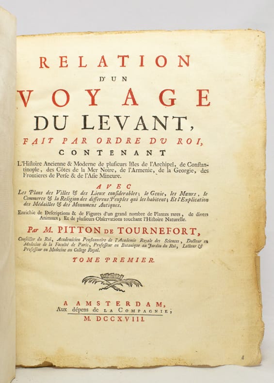
1718ref. 17654Amsterdam, Aux dépens de la Compagnie, 1718. Deux tomes en un volume in-4° de [28]-188; [2]-208-[16] pages, demi-basane blonde, dos lisse orné de filet doré, pièce de titre en papier cartonné, non rogné.
ref. 003395Paris, Firmin Didot, 1827 8 livrets in-12 (15,5 x 9,7 cm), cartonnages gaufrés d'éditeur de différentes couleurs, nom de chaque ville inscrit au centre du premier plat, 36 pages chacun, illustrés d'une lithographie au début, soigneusement coloriée à la main à l'époque.
1875Very Good French Contemporary 1/4 leather bdg. with marbled boards. Small 4to. (27 x 19 cm). 23 p. (11 p. in Ottoman script (Old Turkish with Arabic letters; 12 p. in French), with rare 4 folded maps. A very good copy. First and only edition of this extremely rare bilingual book in French and Ottoman Turkish, including the first records on the formation and characteristics of storms to explain how storms and hurricanes occurred, which route they followed, and how they were conveyed to the regions that need to be warned by telegraph, for the vessels sailing in the seas, by French expert Coumbary who was founded the Rasathâne-i Âmîre [i.e. Ottoman Imperial Observatory]. Both the original French and Turkish translations of the work were published together in one volume. The work also included four maps which were drawn for this work only. The first map shows the movement of a storm that occurred on March 8, 1865, the second one shows the occurrence between the Tropic Cancer and Capricorn whirlwinds, storms in the Atlas and Indian oceans, the movements in the Bay of Bengal, the storms in different directions in the China Sea, the Gulfstream, Grönland, and Azores. The second observatory in the Ottoman era was established for meteorology. Before this center was established, beginning from the Reformation (1839), many meteorological observatories were built by foreigners in various cities such as Istanbul, Smyrna, Trebizond, Tekirdag, and Merzifon both as private and public establishments. The very first known temperature readings are the meteorological observations made by the Priest Dalmas at the St. Benôit monastery between 1839-1847. Later William Lane, an Englishman who came to Istanbul during the Crimean War, made observations at the British Cemetery at Haydarpasa. W. Noe, director of the Mekteb-i Fünûn-u Sahane made observations at the house in Kalyoncukulluk where he lived until the Beyoglu Fire in 1848; and finally, it is known that French engineer Ritter, who was invited by the government for waterworks in Kuruçesme (1856-1860) also conducted meteorological observations. Observations on precipitation and humidity conducted between 1875-1892 by an amateur observer on the Thomson Farm in Erenköy are invaluable on the subject of Istanbul's climate. These observations have been published in Budapest in 1928. Excellent observations on heat, pressure, and humidity, made in the summer residence of the Russian ambassador on Büyükada have also been published, in Annales St. Petersburg. In 1858, the French government established the first observatory communicating data over the telegraph, and in 1863, by compiling meteorological data in France, the French National Meteorological Network started operations. In 1868, upon the recommendation of the French government, the Rasathane-i Âmire was founded to convey meteorological forecasts to certain centers by telegraph. Instruments were purchased from leading European factories, and operations started on top of a hill 74 meters high on Pera. The first director was Mr. Aristide Coumbray, who came to Istanbul to renovate the telegraph network. (Instruments commissioned from France were set up at Mr. Coumbary's home, which stood at the garden of the Swedish Embassy. The observatory was later moved after its offices were prepared.) Coumbary represented Turkey in the first international meteorology congress, convened in Wien five years later in 1873. Rasathane-i Âmire worked by the same system as the National Meteorology Center in France. In the observation books of 1868 (August-November), names of affiliated stations are given to us Soulina, Köstence (Constantia), Varna, Burgaz, Valona, Elbasan, Durazzo, and Beirut. Later, stations in Izmir, Diyarbakir, Baghdad, and Fao were also added. The observatory founded by Aristide Coumbary in 1868 in Istanbul, operated until the end of the First World War. Özege 5735.; TBTK 7688, 10862.; Not in OCLC.
1865Very Good Turkish, Ottoman (1500-1928) In contemporary Ottoman quarter burgundy leather bdg. with red boards. Gilt lettering of the title with some decorative elements and four raised bands to the spine. Large roy. 8vo. (25 x 16 cm). In Ottoman script. 2 volumes set: (310 p.; 264 p). Hadikatû'-l cevâmî. 2 volumes set. [= Hadiqatul-gewami = The garden of the mosques]. Occasionally foxing on boards, slight stains on paper. Otherwise a very good copy. First edition of this rare monumental two-volume set in which an inventory is kept of almost all architectural buildings such as mosques, masjids, fountains, schools, and lodges in Ottoman Istanbul and its surroundings, built since Sultan Mehmet II up to 1768, in a traveler style, by Ayvansarayî, who was hafiz and janissary sekban who lived in the 18th century. "This excellent book has an extremely important place in the literature not only in terms of architectural works and topography but also as a historical source of Constantinople". (Hammer). Long recognized by Turkish scholars as a unique source of Istanbul's architecture and urban form, the text, which was started in 1182 (1768-69) and completed in 1195/1780 and revised and enlarged between 1248/1832-33 and 1253/1838 by Ali Sati, son of Mahmud Efendi, one of the judges of Medina, contains separate descriptions of each of Istanbul's more than 800 mosques, plus accounts of its madrasahs, tombs, tekkes and other monuments. The annotations place each of these buildings within the city's urban plan and provide biographical information about the patrons, architects, and other personalities mentioned in the text. Ayvansarayi's original text, which survives in a number of manuscript copies, was enlarged in the 1830s by Ali Sati Efendi, whose reworking was published in print in 1865 and has thus become the best-known version of the Hadika. (Crane). The author, who first visited the mosques and masjids inside the city walls in a topographic order, then examined the ones outside the city walls, then discussed Eyüp, Galata, both sides of the Bosphorus, Üsküdar (Scutari), Kadiköy (Khalkedon) mosques and masjids. After giving the name of the building in each article, if a mosque was transformed from the church, he noted this issue and recorded the name of the person who had it built. If known, he also indicates where this person's grave is located. Detailed info about the restoration of the architectural building has been restored. And he gives detailed information on additional facilities such as a public fountain, sebil, school, madrasah, and in some cases the people who lie in its burial ground, with brief information about the foundation of this charitable building. Hegira 1281 = Gregorian 1865. Özege 6565.; Thirteen copies in the US libraries according to the OCLC.
1912Very Good Bulgarian Original blue cloth bdg. with embossing. Slightly stains on boards and toned on pages. Otherwise a very good copy. 12mo. (16,5 x 12 cm). In Bulgarian. 1230, [2] p. [HOLY BOOK IN BULGARIAN PRINTED IN TSARIGRAD (CONSTANTINOPLE)] Bibliia sirech sveshtenoto pisanie na Vetkhiia i Noviia zavet: Viarno i tochno prevedena ot pûrvoobraznoto. [.] In 1840 5,000 copies of the first complete translation of the New Testament were printed in Smyrna by the British and Foreign Bible Society. A second edition which was printed in Smyrna in 1850 was an almost exact reprint of the 1840 edition. A third edition followed in 1853 with 15,000 copies. The fourth edition was published in 1857 in Bucharest, and for the first time civil characters type was used. In 1859, two more editions were published. In 1866, a new "pocket" edition with text revised by Elias Riggs and Dr. Albert Long was printed in Constantinople. The New Testament was revised and reprinted a total of nine times. In the period from 1840 to 1860 the Eastern (Tarnovo) dialect was adopted as literary Bulgarian language and the Macedonian dialect, in which the New Testament had been translated, was widely rejected. By 1858 Neofit Rilski had finished large portion of the Old Testament. Riggs met with Neofit Rilski and discussed a possible revision of the Bulgarian New Testament to remove the Macedonian dialect elements. Neofit objected the revision, so Riggs took the translation and returned to Constantinople. In January 1859 Riggs invited the Bulgarian teacher Hristodul Kostovich to help him with the revision. In 1862 Long and Riggs visited the noted Bulgarian writer and poet Petko Rachov Slaveykov in Tryavna. Slaveykov agreed to help with the translation and began the work on the revising of Neofit's New Testament at once. Long joined the revision of the New Testament into the Eastern dialect in 1863 and later assisted with the translation of the Old Testament. In June 1871, after more than 12 years of revision and translation, 36,000 copies of the complete Bible translation in Bulgarian were published in Constantinople. The translation came to be known as the "Tsarigrad (Constantinople) Edition". Tsarigrad [or; Tsargrad, Tzargrad, Czargrad] Tsargrad is a Slavic name for the city or land of Constantinople, the capital of the Eastern Roman (Byzantine) Empire, and present-day Istanbul in Turkey. A physical copy of this edition is not located in OCLC. For digital register: OCLC 181122059.
1790ref. 21667Constantinople, de l’Imprimerie du palais de France, mars 1790 ; in-4°, demi-veau havane, dos à faux nerfs et titre doré (reliure un peu postérieure); XXXII, 462 pp., [1]f. de Faute à corriger.
1612ref. 9681Geneva: Oliva Pauli Stephani 1612. Folio in 6s pp. xxxii cols. 1624 104 ff. xii. Title page printed in red and black large woodcut olive-tree title device Schreiber 34 woodcut head- and tailpieces and initials Greek and Latin text in double column some spotting and browning at intervals largely due to paper qualityl later sheep circa 1700 minor wear abrasions to covers and wear to headcaps. A couple of ink library stamps St Patricks Collge Maynooth. Ownership inscription of Antoine Pericaud probably the Lyons-based antiquary author and translator 1782-1867. Engraved armorial bookplate to verso of title. Second edition overall and the first bilingual edition of the Myriobiblon combining David Hosechels recension of the original Greek text 1601 with Andreas Schotts 1606 Latin translation. A powerful and capable statesman and churchman Photios a 9th century Patriarch of Constantinople was also at the centre of intellectual life in the Byzantine capital. His Bibliotheca or Myrobiblon supposedly written just before Photios undertook a dangerous diplomatic mission and dedicated to his brother Tarasius as a consolation in case he should fail to return is an account of some 280 books read and reviewed many of them classical works which have since been lost and for which this is the most important surviving record. Reynolds and Wilson credit him with inventing the book review Scribes and Scholars third ed. p. 62. Renouard Annales de l'imprimerie des Estienne 197 no.21 also noting copies dated 1611; further copies traced dated 1613; Schreiber The Estiennes 275. Book ] Oliva Pauli Stephani, unknown