2000Fine English Paperback. Roy. 8vo. (23 x 16 cm). In Turkish. 304, 16 sayfa, 16 color and b/w plts. Seyr-i sefain öncesi ve sonrasi. SOCIAL HISTORY Corporate history Ottoman culture Ship Navigation Trasportation Istanbul Constantinople.
2009New English Paperback. Pbo. 4to. (29 x 24 cm). In English and Turkish. 64 p., color ills. [Painter's Istanbul].= Ressamlarin Istanbul'u. 18 Mart - 11 Nisan 2009. [Exhibition catalogue]. 1000 copies were printed.
réf. 12921In 8 carré brioché, jaquette illustrée en couleurs. Faux-titre, titre, 152 pages, illustrations en couleurs hors-texte plus la couverture de Nicolas MARKOVITCH. Photos dans le texte et à pleine page. Edition Alpine Les grandes escales septembre 1935. Très bon état
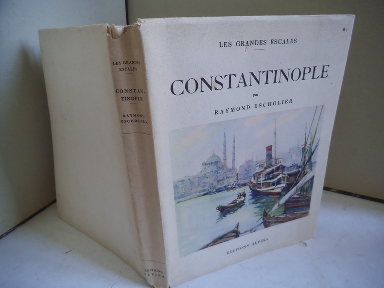
réf. 054006Paris Editions Alpina 1935 in 8 (22x17) 1 volume reliure demi basane bleu, dos lisse orné de petits cercles et d'un croissant dorés, couverture illustrée conservée, 152 pages, avec de nombreuses illustrations tirées en héliogravure, dont hors-texte, et 5 aquarelles hors-texte de Nicolas Markovitch (dont une sur la couverture). Collection "Les grandes escales". Bel exemplaire ( Photographies sur demande / We can send pictures of this book on simple request )
réf. 11975Paris, Alpina, 1935,in-8 , 152 pages, illustrations en noir et aquarelles de Nicolas Markovitch, broché, couverture illustrée rempliée leg.defraichie,, bon exemplaire de la collection "Les grandes escales"
1828réf. 51526Constantinople Matbaa-i Amire 1828 1243 h. Small 4to. 22 x 16 cm. Contemp. full calf. with flap. A tear in the flap. Rebacked. Blindtooling to covers and a medaillon on front and back. Covers a bit rubbed. 34259 pp. A small burnmark in inner margins of the last 8 leaves otherwise internally clean and fine. Printed arabic types in Turkish/ Ottoman Turkish. First edition. Esad Effendi Turkish historian born 1790 dead 1848. The work deals with the armed forces hydrology etc. unknown
1828réf. 51526Constantinople, Matbaa-i Amire, 1828 (1243 h.). Small 4to. (22 x 16 cm.). Contemp. full calf. with flap. A tear in the flap. Rebacked. Blindtooling to covers and a medaillon on front and back. Covers a bit rubbed. 3,4,259 pp. A small burnmark in inner margins of the last 8 leaves, otherwise internally clean and fine. Printed arabic types in Turkish/ Ottoman Turkish.
2010New English Paperback. Pbo. Roy. 8vo. (24 x 17.5 cm). B/w and color ills. 250 p. In English. "Accessing and discussing the underground world beneath ¿stanbul is truly an ambitious enterprise. Suprisingly few archaelogical excavations have taken place for various reasons and most of the serious work conducted by scientists devoted to the issue of Istanbul's subterranean features has been left incomplete. Archeologists, eho found the acquisition of sponsorship easy for excavations and research conducted on the historical sites of the Hittites, Urartus, Sumerians, and Lycians, appear to have faced great financial difficulties when it came to exploring Istanbul's hidden depths. Consequently, we do not really have a good account of what is hidden in the subterranean world of the city. Despite the hundreds of different resources available to us, somehow they are never quite sufficient enough to guide us to that world as we follow the footsteps of history; this is mainly due to the continual construction work that changes the layout with each passing day. Even street names change regularly and every day more underpasses, overpasses, bridges, and viaducts are being constructed in the city. This means, therefore, it is inevitable that researchers will lose these traces of history and the hope they have of finding valuable information. This has been my experience and I decided to write this book in order to help others find their path and not endure the difficult experiences I have encountered. Istanbul is truly a boundless ocean. This is not a history book merely telling the story of Istanbul. We could call it a tribute to the remains of the many civilisations that have been sleeping under the city for many centuries.".
2015Fine English Original bdg. HC. 4to. (32 x 32 cm). In Turkish. 920 p., ills. Hane'lerden Numarali Ev'lere. Osman Nuri Ergin'den 1927 Istanbul'u bina ve arazi cetvelleri. ARCHITECTURE Turkish and Islamic art Ottoman culture Turkish house Istanbul Constantinople Social history.
2014New English Original bdg. HC. 4to. (29 x 25 cm). In Turkish. 746 p., color and b/w ills. Sehir sokak hafiza: Kuyulu'dan Biçki Yurdu'na Osman Nuri Ergin ile Istanbul sokak adlari. ISTANBUL Constantinople Local history Osman Nuri Ergin Urban history Onomastics Street names Turkish language Etymology.
2003New English Paperback. Pbo. Roy. 8vo. (24 x 17 cm). In English. 296 p. From Istanbul to Jerusalem. The itinerary of a young Turkish Jew.
1920Fine Fine English Paperback. Pbo. Dust wrapper. 4to. (27 x 22 cm). In German. 24, [2], [1], [71] p. (26 p. text; 1 folding panorama of Constantinople; and b/w plates). Alt-Konstantinopel. Hundertzehn photographische Aufnahmen der Stadt und ihrer Bau-und Kunst-Denkmaler mit alten Ansichten und Planen sowie einer geschictlichen Einleitung von Dr. Ernst Diez, einer Stadt-uund Kulturbeschreibung uund kunstgeschichtlichen Erlauterungen von Dr. Heinrich Glück
2017New Turkish Paperback. Cr. 8vo. (20 x 14 cm). In Turkish. [xii], 371 p., b/w ills. Genç Türkiye insa edilirken: Atatürk'ün mimarinin anilari, (1927-1940, 1953-1955). Translated into Turkish Güven Göktan Uçer. Memoirs of Egli, German architect in the early Republican Turkey. Translated from an unpublished German manuscript. Ernst Arnold Egli war österreichisch-schweizerischer Architekt und Stadtplaner in Wien und Zürich. Egli lebte lange in der Türkei, wo er den Großteil seines gebauten Werkes schuf. Er war 1924-27 Assistent von Clemens Holzmeister an der Wiener Akademie und kam auf dessen Empfehlung 1927 in die Türkei. Beider Arbeit beeinflusste maßgeblich den kemalistischen Aufbau des neuen Ankara in den Jahren 1927-1938. Von Mustafa Kemal Pascha ausdrücklich mit der Entwicklung einer modernen Architektur für den Schulbau beauftragt, prägte er die Moderne in der Türkei wesentlich. 1936-1937 errichtete er einige Bauten in der Atatürk-Waldfarm in Ankara.
2017As New Turkish Paperback. Mint. Cr. 8vo. (20 x 14 cm). In Turkish. [xii], 371 p., b/w ills. Genç Türkiye insa edilirken: Atatürk'ün mimarinin anilari, (1927-1940, 1953-1955). Translated into Turkish Güven Göktan Uçer. Memoirs of Egli, German architect in the early Republican Turkey. Translated from an unpublished German manuscript. Ernst Arnold Egli war österreichisch-schweizerischer Architekt und Stadtplaner in Wien und Zürich. Egli lebte lange in der Türkei, wo er den Großteil seines gebauten Werkes schuf. Er war 1924-27 Assistent von Clemens Holzmeister an der Wiener Akademie und kam auf dessen Empfehlung 1927 in die Türkei. Beider Arbeit beeinflusste maßgeblich den kemalistischen Aufbau des neuen Ankara in den Jahren 1927-1938. Von Mustafa Kemal Pascha ausdrücklich mit der Entwicklung einer modernen Architektur für den Schulbau beauftragt, prägte er die Moderne in der Türkei wesentlich. 1936-1937 errichtete er einige Bauten in der Atatürk-Waldfarm in Ankara.
1934Very Good French Original decorative and pictorial cloth bdg. Demy 8vo. (21,5 x 11 cm). In French. 314 p., 200 unnumbered ills., plates and folded maps with panoramic views. The best and early guide of Ankara city, the capital of Turkish Republic. Second French Edition. Ernest Mamboury was a professor of Mekteb-i Sultânî (Lycee Galatasaray) in the Ottoman and Republican periods, Turkey. He worked on in particular Byzantine art and architecture in Istanbul, Ankara, and Turkey's historical buildings in various cities.
1951Very Good French Original pictorial grey cloth bdg. Cr. 8vo. (20 x 12,5 cm). Edition in French. 630, [2] p, 300 unnumbered illustrations, 6 folded maps and plans. First French edition of this comprehensive and attractive Istanbul guide written by Mamboury, who is a Swiss scholar renowned for his works on the historic structures in Turkish cities, particularly on Byzantine art and architecture in Istanbul.
1898Very Good Turkish, Ottoman (1500-1928) Original color map. Folded. Atlas folio. (82 x 57 cm). In Ottoman script. Scale: 1/400000. A clean copy. Including Azerbaijan, Dagestan, Mahaçkala, Tbilisi, Yerevan, Darband, et alli. A fine map of Caucasus and shores of Caspian Sea. Extremely rare.
1916Very Good Turkish, Ottoman (1500-1928) Original color map. Folded. Oblong atlas folio. (50 x 60 cm). In Ottoman script. Scale: 1/200.000. [MAP of EAST ANATOLIA - ERZERON] [Erzurum:] Oltu, Artvin, Hasankale, Ispir. This is one the serie of the Bonn projection maps which are the first map series in modern techniques in Turkey and the Ottoman Empire. This is one the serie of the Bonn projection maps which are the first map series in modern techniques in Turkey and the Ottoman Empire. In order to produce these maps covering Turkish territory, Reconnaissance Branch was incorporated into The Mapping Commission. The maps were produced in the datum based on the latitude and longitude of Ayasofya Mosque in equal area Bonn Projection. The field works for the 123 sheets covering the country were conducted by 76 staff. The production was completed in 18 years starting from east west. Field works continued without stopping except in years 1914 and 1920. This map series called also reconnaissance maps contributed a lot to producing 1:25.000 scale maps. Not in Ataturk Library and TBMM Library.
1912Very Good Turkish, Ottoman (1500-1928) Original chromolithograph folded map mounted on cloth. A good copy. Oblong atlas folio. (47 x 60 cm). In Ottoman script. Scale: 1/200.000. Shows Vathy, Arkioi, Leipsoi, Nekaria, Patmos, Kos, and Fournoi Islands in Greek archipelago with Smyrna shores at east. A decorative and rare map.
1913Very Good Turkish, Ottoman (1500-1928) Original color map on cloth. Folded. Wrinkled on paper. Stains on cloth. 12 sheets on paper. Oblong atlas folio. (50 x 60 cm). In Ottoman script.[MAP of ALEXANDRETTA] Iskenderun - Tayakadin. It shows villages and settlements in Tayakadin of Iskenderiye. Scale: 1/25.000. Hegira: 1329 = Gregorian: 1913. This is one the serie of the Bonn projection maps which are the first map series in modern techniques in Turkey and the Ottoman Empire. In order to produce these maps covering Turkish territory, Reconnaissance Branch was incorporated into The Mapping Commission. The maps were produced in the datum based on the latitude and longitude of Ayasofya Mosque in equal area Bonn Projection. The field works for the 123 sheets covering the country were conducted by 76 staff. The production was completed in 18 years starting from east west. Field works continued without stopping except in years 1914 and 1920. This map series called also reconnaissance maps contributed a lot to producing 1:25.000 scale maps. Not description on map-maker. A very detailed map. Extremely rare.
1917Very Good Turkish, Ottoman (1500-1928) Original color map. Folded. Oblong atlas folio. (50 x 60 cm). In Ottoman script. Shows Eastern and Southeastern parts of Anatolia; Maras, Elbistan, Birecik and Kilis areas. Hegira: 1333 = Gregorian: 1917. Not description on map-maker.
1916Very Good Turkish, Ottoman (1500-1928) Original color map. Folded. Oblong atlas folio. (50 x 60 cm). In Ottoman script. [MAP of EAST ANATOLIA and ARTVIN] Oltu, Artvin, Ispir, Hasankale. Shows Artvin, Ispir, Hasankale and Kars city. Scale: 1/200.000. This is one the serie of the Bonn projection maps which are the first map series in modern techniques in Turkey and the Ottoman Empire. In order to produce these maps covering Turkish territory, Reconnaissance Branch was incorporated into The Mapping Commission. The maps were produced in the datum based on the latitude and longitude of Ayasofya Mosque in equal area Bonn Projection. The field works for the 123 sheets covering the country were conducted by 76 staff. The production was completed in 18 years starting from east west. Field works continued without stopping except in years 1914 and 1920. This map series called also reconnaissance maps contributed a lot to producing 1:25.000 scale maps. Hegira: 1332 = Gregorian: 1916. Not description on map-maker.
1914Very Good Turkish, Ottoman (1500-1928) Original color map. Folded. Oblong atlas folio. (50 x 60 cm). In Ottoman script. [MAP of EAST ANATOLIA] Hozat, Dersim. Shows Eastern parts of Anatolia; Dersim-Horat and border of Erzincan city; Divrigi; Harput (Kharpout); Kilis; and Munzur Mountains, et alli. Scale: 1/200.000. Hegira: 1330 = Gregorian: 1914. Not description on map-maker.
1914Good Turkish, Ottoman (1500-1928) Original color map. Folded. Tears in margins. Slightly stained. Otherwise a good copy. Oblong atlas folio. (50 x 60 cm). In Ottoman script. [MAP of EAST BLACK SEA] Artvin, Rize, Oltu. Shows Artvin and Georgian borders, Rize (Rizeon - Rizunda - Rizini) and Oltu cities and regions. Scale: 1/200.000. Hegira: 1330 = Gregorian: 1914. This is one the serie of the Bonn projection maps which are the first map series in modern techniques in Turkey and the Ottoman Empire. In order to produce these maps covering Turkish territory, Reconnaissance Branch was incorporated into The Mapping Commission. The maps were produced in the datum based on the latitude and longitude of Ayasofya Mosque in equal area Bonn Projection. The field works for the 123 sheets covering the country were conducted by 76 staff. The production was completed in 18 years starting from east west. Field works continued without stopping except in years 1914 and 1920. This map series called also reconnaissance maps contributed a lot to producing 1:25.000 scale maps. Not description on map-maker. Extremely rare.
1920Very Good Turkish, Ottoman (1500-1928) Original color map. Folded. Oblong atlas folio. (50 x 60 cm). In Ottoman script. [MAP of EAST BLACK SEA] Trabzon, Giresun, Erzincan, Ispir. Shows Trebizond, Cerasonte, Erzingan (Eriza), Suspiritis (Sper) of Erzurum (Erzeron city); mostly Black Sea shores of Trabzon and Giresun. . Scale: 1/200.000. This is one the serie of the Bonn projection maps which are the first map series in modern techniques in Turkey and the Ottoman Empire. In order to produce these maps covering Turkish territory, Reconnaissance Branch was incorporated into The Mapping Commission. The maps were produced in the datum based on the latitude and longitude of Ayasofya Mosque in equal area Bonn Projection. The field works for the 123 sheets covering the country were conducted by 76 staff. The production was completed in 18 years starting from east west. Field works continued without stopping except in years 1914 and 1920. This map series called also reconnaissance maps contributed a lot to producing 1:25.000 scale maps. Hegira: 1336 = Gregorian: 1920. Not description on map-maker. Extremely rare.