2 090 résultats
1899Very Good Turkish, Ottoman (1500-1928) Fine brown quarter leather bdg., brown boards with decorative embossing. Roy. 8vo. (24 x 17 cm). In Ottoman script (Old Turkish with Arabic script). 176 p., 33 unnumbered b/w plates of views of the Middle Eastern cities, Kaiser and queen's portraits, ills. of their maritime voyages, a general view of Beirut, a panorama of Jerusalem (in two pages), The Government House and Lake Tiberia in Beirut, a general view of Jaffa, churches and castles and Masjid-i Aksa of Jerusalem, Idlib, the interior of the Umayyad Mosque in Jerusalem, The Government House of Jaffa, Beirut - Damascus railways, street views and architectural buildings from Damascus, the market place of Jaffa, Bethlehem and the church, views of Trablus-Sam [i.e. Tripolis], ruins of Baalbek, and other numerous b/w photos, published for only this book. Slight stains on pages, a modern repair on a leaf with tape, otherwise a very good copy. Bound together with "Eski Sevda" which is a compilation of Turkish tales. First and only edition of this richly illustrated scarce and uncommon book was printed for the German Emperor Wilhelm II and his wife Augusta Victoria, the commemoration of the construction of Alman Çesmesi [i.e. German Fountain] in Constantinople, and the first anniversary of the Wilhelm II's travel to the Ottoman Empire in 1898. The fountain's design was drawn by the architect Spitta and constructed by the architect Schoele with the German architect Carlitzik and Italian architect Joseph Anthony, working on the project. The fountain was built in Germany and then transported piece by piece to Istanbul, reassembled in its current site, and officially opened on January 27, 1901, on the birthday of German Emperor Wilhelm II. Wilhelm II's voyage to the Levant in 1898 was a state visit that the German Emperor undertook in the Ottoman Empire between 25 October and 12 November 1898. The Kaiser started his journey to the Ottoman Eyalets with Istanbul on 16 October 1898; then he went by yacht to Haifa on 25 October. After visiting Jerusalem and Bethlehem, the Kaiser went back to Jaffa to embark on Beirut, where he took the train passing Aley and Zahlé to reach Damascus on 7 November. This book is richly illustrated including many views of the cities of this voyage's destinations like Jerusalem, Damascus, Beirut (Beirut), Jafa, Baalbek, etc. On 10 November, Wilhelm went to visit Baalbek before heading to Beirut to board his ship back home on 12 November. His visit spurred interest in the German Templer colonies in Palestine. One of the Kaiser's traveling companions, Colonel Joseph von Ellrichshausen, initiated the formation of a society for the advancement of the German settlements in Palestine, named the Gesellschaft Zur Förderung der Deutschen Ansiedlungen in Palästina, in Stuttgart. It enabled the settlers to acquire land for new settlements by offering them low-interest loans. A subsequent second wave of German settlers founded Wilhelma (named after the Kaiser, now called Bnei Atarot) in 1902 near Lod, Walhalla (1903) near the original Jaffa colony, followed by Bethlehem of Galilee (1906). The German Settlement Society successfully encouraged some of the Templars to return to the official, national Protestant Church. The non-Templar colony of Waldheim (now Alonei Abba) was subsequently founded next to Bethlehem of Galilee in 1907 by proselytized Templers now affiliated with the Old-Prussian State Church. The visit resulted in the highest-profile political event in the life of Theodor Herzl, considered the founder of Zionism. Through the efforts of William Hechler, via Frederick I, Grand Duke of Baden, Herzl publicly met Wilhelm II three times during the voyage, once in Istanbul (on 15 October 1898) and twice in Palestine (29 October and 2 November). The meetings significantly advanced Herzl's and Zionism's legitimacy in Jewish and world opinion. (Wikipedia). Only one copy in OCLC (Library of Congress. Karl Süssheim Collection, no. 1300) 900684728. Özege 7023
1988réf. LFA-126739823N° 49 (Octobre 1988) 66 pages, format 205 x 285 mm, illustré, broché couverture couleurs, bon état
1998réf. LFA-126739945N° 151 (Janvier 1998) 66 pages, format 220 x 295 mm, illustré, broché couverture couleurs, bon état
1922Very Good Turkish, Ottoman (1500-1928) Original color map. 65,5x63 cm. In Ottoman script. This rare and decorative Gallipoli map including Hellespont, Gallipoli Peninsula, Suvla Bay, Seddülbahir, and Tenedos, the places of Gallipoli Aar in 1915 (Dardanelles Campaign) during World War 1, separated two map views. Seddulbahir and Suvla Bay at north and Straight, Peninsula, and its shores with Tenedos (now Bozcaada) at the southwest of the map. It's a very detailed and rare map printed with the series of "History of the Dardanelles Campaign" after the seven years of war. The Gallipoli campaign, also known as the Dardanelles campaign, the Battle of Gallipoli or the Battle of Çanakkale (Turkish: Çanakkale Savasi, or, Muharebâti), was a military campaign in the First World War that took place on the Gallipoli peninsula (Gelibolu in modern Turkey), from 17 February 1915 to 9 January 1916. The Entente powers, Britain (with Anzacs), France, and Russia, sought to weaken the Ottoman Empire, one of the Central Powers, by taking control of the Turkish straits.
1901Very Good French Original autograph letter signed (ALS) by P.pon "[We hereby declare that Ms. L. Cassinelli occupied our house located in Pera Rue, Hodja Ali No 19. On December 1, 1887, and left him on September 30, 1899. That during all time, he did not pay me the tax... P. pon de la succession de feu le Comte A. de Camondo. [i.e. On behalf of the succession of Count A[braham Salomon] Camondo, (1781-1873)]. Probably it's signed by his advocate of Moise de Camondo. Recipient is not defined. Letter indicates one of Camondo family's houses in Pera, Constantinople. 26,5x21 cm. Completely in French. 14 lines. On a paper watermarked "William Brown & Co., London". William Brown and Co. were located in London in this 'St. Mary Axe, and 40 to 41, Old Broad Street, London, E.C.' address according to Grace's guide to British industrial industry; they worked on 'Lithographic and Letterpress Printers'. 1887 Registered as a Limited Company. Count Moïse de Camondo, (1860-1935), was an Ottoman Empire-born French banker and art collector. He was a member of the prominent Camondo family. As a child, Camondo moved with his family from their home in Constantinople, Ottoman Empire, to Paris around 1869, where he grew up and continued the career of his father, Nissim de Camondo (1830-1889), as a banker. He was born into a Sephardic Jewish family that owned one of the largest banks in the Ottoman Empire, established in France since 1869. Starting in 1911, he completely rebuilt the family's Parisian mansion on the Parc Monceau in order to house his collection of 18th-century French furniture and artwork. Working closely with the architect René Sergent, he created a palatial home conforming to certain 18th-century traditions, even planning the room dimensions to match exactly the objects in his collection. The entryway is inspired by the Petit Trianon of Versailles. The home includes a kosher kitchen with separate sections for meat and dairy. The dining room includes a beautifully-carved green marble fountain in the shape of a shell, with a dolphin spigot for the ritual washing of hands before eating a meal. Some highlights of his collection include a French silver service that had been ordered by Russian Empress Catherine the Great, a set of Buffon porcelain (with exact reproductions of ornithological drawings) from the Sèvres manufacturer, and perhaps the only existing complete set of Gobelin royal tapestry sketches. He married Irène Cahen d'Anvers, daughter of Louis Cahen d'Anvers, in 1891. They separated in August 1897 after her affair with de Camondo's stable master, Count Charles Sampieri, whom she would later marry and divorce. The children, Nissim and Beatrice, remained with de Camondo. The mansion was completed in 1914, but his son did not reside there very long, as he rejoined the French Army to fight in The Great War. It had been de Camondo's great hope that his son, whom he adored, would take over the family empire. Following Nissim's death in 1917, de Camondo closed all banking activities. He largely withdrew from society and devoted himself primarily to his collection and to hosting dinners for a club of gourmets at regular intervals. Camondo died in 1935, and the museum opened the following year. He donated the home to Paris's Decorative Arts society as a museum (Musée Nissim de Camondo) in honor of the loss of his son Nissim in World War I. In addition to the collection, the meticulously-restored service areas, elevator, and woodwork of the mansion are noteworthy. During the German occupation of France during World War II, his daughter Béatrice, his son-of-law Léon Reinach, and their children (Fanny and Bertrand) were deported from France and died in the Auschwitz concentration camp. As a result, the de Camondo family died out.
1923Very Good English Paperback. Pbo. Cr. 8vo. (19 x 13 cm). In Ottoman script. 66, [2] p. Regulations of masonic lodge of Grand Orient de Turquie Or .:. Constantinople. (Türkiye Masrik-i âzami). Roumi: 1339. = Gregorian: 1923. Özege: 21693. First Edition. Türkiye Mas .:. A .:. ale'l-umûm maha .:. hakkinda câri nizâmnâme-i umûmisi.
Very Good English Paperback. Pbo. Cr. 8vo. (19 x 13 cm). In Ottoman script. 44 p. Regulations of masonic lodge of Grand Orient de Turquie Or .:. Constantinople (Türkiye Masrik-i âzami). Özege: 21830. First Edition. Türkiye Mas .:. A .:. nin kavanin-i esasiyesi ve nizamât-i umûmiyesi.
1917Very Good Turkish, Ottoman (1500-1928) Original color map. Folded. Oblong atlas folio. (50 x 60 cm). In Ottoman script. Shows Southeastern parts of Asia Minor and Syria; Siverek, Sard (Iraq) and Ras Al-Ayn (Rasulayn - Resualyn) in Syria. Hegira: 1333 = Gregorian: 1917. Not description on map-maker. Scale: 1: 200.000. This is one the serie of the Bonn projection maps which are the first map series in modern techniques in Turkey and the Ottoman Empire. In order to produce these maps covering Turkish territory, Reconnaissance Branch was incorporated into The Mapping Commission. The maps were produced in the datum based on the latitude and longitude of Ayasofya Mosque in equal area Bonn Projection. The field works for the 123 sheets covering the country were conducted by 76 staff. The production was completed in 18 years starting from east west. Field works continued without stopping except in years 1914 and 1920. This map series called also reconnaissance maps contributed a lot to producing 1:25.000 scale maps. According to Türkezer & Çobanoglu: History of Mapping in Turkey-1:200.000 Scale Maps, last cartographer of Diyarbakir regio is M. Sait Malatyali. No his biographic material and info in 'Savaslarda Haritacilar'. Rare.
1890Very Good Turkish, Ottoman (1500-1928) Original manuscript document including notes the types and numbers of the rare books, photo albums and their languages, probably taken by the royal librarian of the Ottoman Yildiz Palace in the period. 21,5x13,5 cm. In Ottoman script (Old Turkish with Arabic letters). 1 p. No signature. Letterhead of "Yildiz Sarayi Alîsi Kütübhâne-i Hümâyûn-i Cenâb-i Mülûkâne" [i.e. Library of HM, Yildiz Palace].
2025réf. LFA-126750398Une revue de 130 pages, format 220 x 285 mm, illustrée, brochée couverture couleurs, publiée en 2025, bon état
1998réf. LFA-126712785Publication trimestrielle de "La Diana", Société Historique et Archéologique du Forez : 94 pages, format 170 x 250 mm, brochée, illustrée
1910Very Good Greek, Modern (post 1453) Paperback. Demy 8vo. (21 x 14 cm). In Greek (Modern). 79 p. Not in OCLC. The Metropolis of Chalcedon is an ecclesiastical territory (diocese) of the Ecumenical Patriarchate of Constantinople. Christianity spread in Chalcedon during the 2nd century AD. The city was initially the see of a bishopric before being promoted to a metropolis at 451 AD, at the time of the Fourth Ecumenical Council. It is one of the four remaining active Greek Orthodox Church metropolises of the Ecumenical Patriarchate in Turkey today and the only one surviving in Asia Minor (Anatolia). During the 14th century, the metropolitan see remained vacant, due to the Ottoman conquest of the region. However, it was reorganized in the 15th century, possibly after the Fall of Constantinople and the subsequent incorporation of the Ecumenical Patriarchate into the millet system of the Ottoman society. The first recorded metropolitan of that time was Joseph, in 1477. In the following years, the jurisdiction of the metropolis was extended to the east. During the late 17th century the see of the diocese was transferred to Kuzguncuk (Ermoulianai, Chrysokeramos), where it remained until 1855. At that period a number of monasteries were established, like the one of Saint Panteleimon, which was declared Stauropegic. The metropolitan of Chalcedon was one of the five Elder metropolitans from the wider region of Constantinople, the other being those of nearby Herakleia, Cyzicus, Nicaea, and Nicomedia. Following an Ottoman decree of 1757, they had to be always present in the Holy Synod of the Ecumenical Patriarchate and had direct access to the Ottoman Sultan, to whom they announced the election of the new Ecumenical Patriarch. From the mid-19th century, the local metropolis prospered thanks to the significant population increase and economic development of the local Orthodox population. In 1855 the see of the metropolitan returned to Chalcedon during the primateship of Metropolitan Gerasimos. Moreover, the newly erected church of Saint Euphemia became the new cathedral. The metropolitan mansion was built near the cathedral in 1902. This is the first and only known printed regulation book of the Greek Community in Chalcedonia (Kadiköy). Extremely rare.
1876Very Good German Original color map on cloth. A little foxing on cloth. Very good. Folded. Oblong folio. (45 x 51 cm). In German. Shows N. Enyed, Zalathna, Mediasch, Hermannstadt, Hatszeg, Petroseni, Ôzt River, etc. Scale: 1/300,000. Sibiu (Sibiiu - Hermannstadt - Nagyszeben) is a city in Romanian Transylvania. The city straddles the Cibin River, a tributary of the river Olt. The first official record referring to the Sibiu area comes from 1191 when Pope Celestine III confirmed the existence of the free prepositure of the German settlers in Transylvania, the prepositure having its headquarters in Sibiu, named Cibinium at that time. In the 14th century, it was already an important trade center. As of the year 1376, the craftsmen were divided into 19 guilds. Sibiu became the most important ethnic German city among the seven cities that gave Transylvania its German name Siebenbürgen (literally "Seven Citadels"). It was home to the Universitas Saxorum (Community of the Saxons), a network of pedagogues, ministers, intellectuals, city officials, and councilmen of the German community forging an ordered legal corpus and political system in Transylvania since the 1400s. During the 18th and 19th centuries, the city became the second -and then the first most important center of Transylvanian Romanian ethnics. The first Romanian-owned bank had its headquarters here (The Albina Bank), as did the ASTRA (Transylvanian Association for Romanian Literature and Romanian's People Culture). After the Romanian Orthodox Church was granted status in the Habsburg Empire from the 1860s onwards, Sibiu became the Metropolitan seat, and the city is still regarded as the third-most important center of the Romanian Orthodox Church. Between the Hungarian Revolution of 1848 and 1867 (the year of the Ausgleich), Sibiu was the meeting-place of the Transylvanian Diet, which had taken its most representative form after the Empire agreed to extend voting rights in the region (Source: Wikipedia). A sheet of the collection of 'The general map of Central Europe'. appeared in the years between 1873-1876 with the work of Joseph Ritter von Scheda, (1815-1888) who was a general, geographer, and cartographer.
1916Very Good Turkish, Ottoman (1500-1928) Original color map. Folded. Oblong atlas folio. (50 x 60 cm). In Ottoman script. [MAP of EAST ANATOLIA] Malatya - Divrigi, Mancinik, Adiyaman, Harput. Shows Malatya, Adiyaman and Kharpout region; Firat River (Euphrates), Yazi Düzü, Erguvan etc. Scale: 1/200.000. This is one the serie of the Bonn projection maps which are the first map series in modern techniques in Turkey and the Ottoman Empire. In order to produce these maps covering Turkish territory, Reconnaissance Branch was incorporated into The Mapping Commission. The maps were produced in the datum based on the latitude and longitude of Ayasofya Mosque in equal area Bonn Projection. The field works for the 123 sheets covering the country were conducted by 76 staff. The production was completed in 18 years starting from east west. Field works continued without stopping except in years 1914 and 1920. This map series called also reconnaissance maps contributed a lot to producing 1:25.000 scale maps. Hegira: 1332 = Gregorian: 1916. Not description on map-maker. According to Türkezer & Çobanoglu: History of Mapping in Turkey-1:200.000 Scale Maps, cartographer of this map is Kambay, Cemal.
1922Very Good Turkish, Ottoman (1500-1928) Original Ottoman manuscript historical document. 28x21,5 cm. In Ottoman script (Old Turkish with Arabic letters). 10 lines on 1 p. Signed, and three Ottoman stamps. During the Haydarpasa Fire in 1922, the warning about the Jewish resident of Beyoglu Vitali Efendi's house on Haydarpasa, Mandira Street, where the windows were broken and they were not fitted. The aforementioned warning was prepared by Vitali Efendi's tenant "Abulafya". Transcription in Turkish: "Dersaadet Kâtîb-i Adlîligi Memûriyet-i Valâsina: Efendim, Beyoglu'nda, Tozkoparan'da Bahar Apartmani'nda mukîm Mösyö Vitali Bahar'in Haydarpasa'da, Mandira Sokagi'nda 80 numero ile mudkîm bir bab hanesinde müstecîren ikâmet etmekteyim. Geçen hafta vuku' cevelân harikte, harikin tesîrâti ile hanenin pencerelerinde mevcut camlar kirilip harap olmustur. Kendisine...". The fire in Haydarpasa 1922 came to be known in history as "the Fire of Haydarpasa Çayir", because it broke out in one of the houses in Çayirbasi and spread further. It broke out on July 29, 1922.
1920Very Good French Original color map on cloth. Oblong folio. (42 x 53 cm). In Ottoman script. [MAP] Büyükada, Maltepe ve Adalar. [Feuille of Sedef Island and South of Prinkipo, Marmara Sea]. 6th sheet of set.
1914Very Good French Original color map on cloth. Oblong large folio. (49 x 58 cm). In Ottoman script. [MAP] Kocaeli-Izmit Körfezi. Gökbüze, Derince, Dilburnu, Hersek Gölü. [Izmit Bay, Dilburnu, Gökbüke, Derince, Marmara Sea]. Scale: 1/50.000.
1910Very Good Turkish, Ottoman (1500-1928) Original color map on cloth. Oblong eephant folio. (64 x 573 cm). Toponyms in Ottoman script. [MAP of BALKANS] Filibe [Plovdiv]. A very detailed map. Shows Plovdiv and mountains, rivers around it. Extremely rare.
1909Very Good Turkish, Ottoman (1500-1928) Original color map on cloth. A little foxing on cloth. Very good. Folded. Oblong atlas folio. (50 x 67 cm). In Ottoman script. Scale: 1/300.000. Map of Ottoman Kayseri printed in its period. No publisher and map-maker. Physical geography of Kayseri city and its around. It shows Kayseri, Sultan Sazligi, mountains and hills, Malatya borders, etc.
1946Near Fine Turkish Paperback. Cr. 8vo. (20 x 14 cm). In Turkish. 238, [1] p., portraits, facsimiles, and other b/w plates. First and Only Edition of this rare early book on the secret activities of M. M. Group [i.e. "Mim Mim Group'] in Istanbul during the Armistice and the Turkish War of Independence (1919-1922). Signed copy. Mim Mim Group was an intelligence group service which was officially recognized by the Turkish Grand National Assembly (TBMM). Enver and Talat Pashas were involved in its enterprise. OCLC 1085195655.
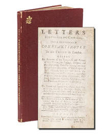
1735réf. 10011London: Printed for George Spavan 1735. First Edition. Hardcover. Very good. Octavo. 4.625 x 7.125 inches. 2 blanks 86 2 blanks pp. A British account of 18th-century Constantinople by an anonymous author "a gentleman" from the retinue of George Hay the 8th Earl of Kinnoul British ambassador to Constantinople 1729-1737. Title page professionally reinforced at an early date. Very good. Rebound in red textured cloth titled in gilt on spine with gilt monogram to upper cover all edges gilt. Classical archaeologist Henry Schroder Robinson's copy with his ex libris label affixed to front pastedown; inscribed to Robinson on front free endpaper "To Henry / the Bibliophile / as a token of appreciation / from / The Gennadius Library / June 30 1969". Text bright and unmarked binding square and tight. Very scarce with three copies appearing in libraries worldwide OCLC and no auction records. The Gennadius Library is located within the American School of Classical Studies at Athens. Printed for George Spavan hardcover
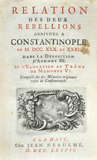
réf. 86461The Hague Jean Neaulme 1737. . First edition first issue; Small 8vo 15.5 x 10.5; iv 164 viiiadspp. title printed in red and black with engraved device small stain to title light waterstain to inner upper margin bound in later green morocco backed marbled boards spine gilt lettered very good. This account describes the two rebellions which broke out during the unsettled period following the victories of Nadir Kuli Khan of Persia against Turkey during September 1730 and which brought to and end the 'Tulip Period'. On the 20th of that month a minor riot developed into a full scale insurrection and Sultan Ahmet III was forced to abdicate in favour of his nephew Mahmoud I. The janissaries were led by one of their own an Albanian by the name of Patrona Halil and for two months the empire was in the hands of the insurgents. They were eventually overthrown by the Grand Vizier the Mufti and Aga of the Janissaries with the help of the Khan of the Crimea and Patrona and 7000 of his supporters were put to death. The first issue has the title printed in red and black as here. Atabey 1026; Blackmer 1407. The Hague, Jean Neaulme, 1737. hardcover
réf. 9033Leipzig, 1905. In 12 percaline rouge de l’éditeur, XXIV-275 pp.
réf. 19372Londres et Parois, Fisher, Son & Cie, s.d. 3 séries en 1 vol. in-4, XLII-60 pp. 30 (sur 32) pl. + 58 pp. 31 (sur 32) pl. + 54 pp. 32 pl., demi-basane havane (dos manquant, reliure défraîchie, rousseurs et taches, 3 planches manquantes).
réf. LFA-126714582Un document de 30 planches photographies, format 235 x 175 mm, broché, s.d. (première moitié du XXe siècle), bon état