Container Atlas: A Practical Guide to Container Architecture
2010A clean, unmarked book with a tight binding. 256 pages. Many color photos. 9 1/2"w x 12"h.

Bookshop Pistil Books Online · États-Unis139,08 €
1 751 résultats
1876Very Good German Original color map on cloth. Folded. A good copy. Oblong folio. (45 x 51 cm). In German. [MAP] O.14. Brussa. [Southern Brussa - Gönen - Manias Göl -Lake-, Anatolien, Abulonia Göl -Lake-]. Shows Abhuitis See, Artynia See, Kirmisli Kasaba, etc. A sheet of the collection of 'The general map of Central Europe'. appeared in the years between 1873-1876 with the work of Joseph Ritter von Scheda, (1815-1888) who was a general, geographer and cartographer.
1876Very Good German Original color map on cloth. Chipped on folded places. Otherwise a clean copy. Oblong atlas folio. (46 x 52 cm). Scale: 1/300.000. Toponyms in German. Shows Saraybosna (Sarajevo), and its around, Travnik, Kladanj, G. Yakuf, Konjiva, Gorazda, Mostar et alli. A sheet of the collection of 'The general map of Central Europe'. appeared in the years between 1873-1876 with the work of Joseph Ritter von Scheda, (1815-1888) who was a general, geographer and cartographer.
1876Very Good German Original color map on cloth. Chipped on folded places. It needs repair. Oblong atlas folio. (46 x 52 cm). Toponyms in German. Shows Durach (Durazzo) and its around, Musakija at south, western shores of Albania, Elbasan, and three bays (Drin Golf etc). A sheet of the collection of 'The general map of Central Europe'. appeared in the years between 1873-1876 with the work of Joseph Ritter von Scheda, (1815-1888) who was a general, geographer and cartographer.
1876Very Good German Original color map on cloth. Chipped on folded places. Otherwise a clean copy. Oblong atlas folio. (46 x 52 cm). Toponyms in German. Shows Brood area and its around, Djakovo, Tuzla etc. A sheet of the collection of 'The general map of Central Europe'. appeared in the years between 1873-1876 with the work of Joseph Ritter von Scheda, (1815-1888) who was a general, geographer and cartographer.
1876Very Good German Original color map on cloth. Chipped on folded places. Otherwise a clean copy. Oblong atlas folio. (46 x 52 cm). Toponyms in German. Shows Krusevac and its around in Serbia. A sheet of the collection of 'The general map of Central Europe'. appeared in the years between 1873-1876 with the work of Joseph Ritter von Scheda, (1815-1888) who was a general, geographer and cartographer.
1876Very Good German Original color map on cloth. Chipped on folded places. Oblong atlas folio. (46 x 52 cm). Toponyms in German. [MAP of WEST WALLACHIA - CRAIOVA] N.10. Kraiova. A sheet of the collection of 'The general map of Central Europe'. appeared in the years between 1873-1876 with the work of Joseph Ritter von Scheda, (1815-1888) who was a general, geographer and cartographer.
1876Very Good German Original color map on cloth. Chipped on folded places. It needs repair. Oblong atlas folio. (46 x 52 cm). Toponyms in German. Shows Kastoria area in Greece. A sheet of the collection of 'The general map of Central Europe'. appeared in the years between 1873-1876 with the work of Joseph Ritter von Scheda, (1815-1888) who was a general, geographer and cartographer.
1876Very Good German Original color map on cloth. Chipped on folded places. Oblong atlas folio. (46 x 52 cm). Toponyms in German. A sheet of the collection of 'The general map of Central Europe'. appeared in the years between 1873-1876 with the work of Joseph Ritter von Scheda, (1815-1888) who was a general, geographer and cartographer.
1925Very Good Turkish, Ottoman (1500-1928) Original color map. Very good and clean. Atlas folio. (73 x 59 cm). In Ottoman script. Map of New United States, Canada, Alaska; and South America. Scale: 1/35000000. Hegira: 1341 = Gregorian: 1925. Mehmed Neset Bey was born in Scutari, Istanbul. He served as colonel in World War 1 and Turkish National Struggle. He was a military origin map-maker. (Source: Savaslarda haritacilar, Harita Genel Komutanligi, Ank., 2017). Extremely rare.
1894Very Good Turkish, Ottoman (1500-1928) Original color chromo-lithograph map. Folded. Oblong folio. (40 x 50 cm). In Ottoman script. Color lithograph. An attractive map which shows Austria-Hungary land with Venice Bay and North Italy. Scale: 1:3.500.000. Dated Hegira: 1310 = [Gregorian 1894]. This uncommon map of Austria-Hungary in Ottoman script was published in an atlas, 'Yeni cografya atlasi', which was issued in Istanbul in the late 19th century. Ali Seref Pasa or Hafiz Ali Esref. He was a soldier, who was schooled in Paris as a cartographer around 1862. Already in Paris, he published his first atlas with 22 maps, called 'Yeni atlas'. Upon his return to Istanbul, he became a chief cartographer at the Matbaa-i Amire Printing Press in Beyazit, which was the successor of the Muteferrika press from 1727. Among others, he translated the large Kiepert map of Anatolia to Ottoman. He died in 1907, leaving his large project of a gigantic map of Anatolia in 100 sheets unfinished. Ali's name is often misunderstood or even listed as two different people: Ali Seref Pasa and Hafiz Ali Esref. Until the surname law adopted on June 21, 1934, Turks did not have surnames. They were born with one first name and were until adulthood described only as sons or daughters of their parent's names. Later they were given titles such as Effendi (Sir), Bey (Chief), or Hanim (Madam) for higher classes, or they were given names according to their work or class. The names were not inherited by children until 1934 when the surname law was enforced. The mapmaker Ali received names Seref, the honorable, and Pasa, the dignitary. He was also known as Hafiz, the memorizer of the Qur'an and Esref, Proud. So Ali Seref Pasa would have a meaning 'Honourable Dignitary Ali, and Hafiz Ali Esref, Memorizer of Qur'an, Proud Ali. Daruttibaa - Matbaa-I Amire Printing Press: The first press in the Muslim world, called Daruttibaa, was founded in Istanbul by Ibrahim Muteferrika in 1727, with permission of Sultan Ahmet III. It was located in Muteferrika's house. The first book was published in 1729 and until 1742 sixteen other works followed. After Muteferrika's death, the press was suppressed for printing, as printed books were considered dangerous. In 1796 the press was purchased by the government and moved to Uskudar in Istanbul, and in 1831 finally to Beyazit, where it was renamed to Matbaa-i Amire in 1866. The press was closed in 1901 and was reopened in 1908 under the name 'Âmire' In 1927 the name changed to State Printing House. The press still exists and is known for publishing school and educational books. Extremely rare. Not in OCLC.; Not in TBMM Map Collection.
1894Very Good Turkish, Ottoman (1500-1928) Original color chromo-lithograph map. Folded. Oblong folio. (40 x 50 cm). In Ottoman script. Color lithograph. It Portugal and Spain with Gibraltar and North African shores. Scale: 1:3.500.000. Dated Hegira: 1310 = [Gregorian 1894]. OTTOMAN MAP of SPAIN & PORTUGAL] Ispanya & Portekiz: Sâye-i Türkiye Hazret Gazi Sultan Abdülhamid Hân-i Sâni'de Maarif Umûmiye Nezâret-i Celîlesi ruhsatiyle Haset tarafindan Fransa Cemiyet-i Cografya âzâlarindan mütesekkil komisyona mahsûs tanzîm edilmis oldugu son atlasinin tercümesi olarak bu def'a Erkân-i Umûmiyye Dairesi Besinci Fen Subesi'ne me'mûr piyade mirlivâlarindan saâdetlü Ali Seref Pasa maarifetleriyle tersîm ettirilmistir. This uncommon map of Spain and Portugal in Ottoman script was published in an atlas, 'Yeni cografya atlasi', which was issued in Istanbul in the late 19th century. Ali Seref Pasa or Hafix Ali Esref. He was a soldier, who was schooled in Paris as a cartographer around 1862. Already in Paris he published his first atlas with 22 maps, called 'Yeni atlas'. Upon his return to Istanbul he became a chief cartographer at the Maatbaa-i amire Printing Press in Beyazit, which was the successor of the Muteferrika press from 1727. Among others he translated the large Kiepert map of Anatolia to Ottoman. He died in 1907, leaving his large project of a gigantic map of Anatolia in 100 sheets unfinished. Ali's name is often misunderstood or even listed as two different people: Ali Seref Pasa and Hafiz Ali Esref. Until the surname law adopted on June 21, 1934, Turks did not have surnames. They were born with one first name and were until the adulthood described only as sons or daughters of their parent's names. Later they were given titles such as Effendi (Sir), Bey (Chief) or Hanim (Madam) for higher classes, or they were given names according to their work or class. The names were not inherited by children until 1934, when the surname law was enforced. The map maker Ali received names Seref, the honourable, and Pasa, the dignitary. He was also known as Hafiz, the memorizer of Qur'an and Esref, Proud. So Ali Seref Pasa would have a meaning 'Honourable Dignitary Ali, and Hafiz Ali Esref, Memorizer of Qur'an, Proud Ali. Daruttibaa - Matbaa-I Amire Printing Press: The first press in the Muslim world, called Daruttibaa, was founded in Istanbul by Ibrahim Muteferrika in 1727, with a permission of Sultan Ahmeet III. It was located in Muteferrika's house. The first book was published in 1729 and until 1742 sixteen other works followed. After Muteferrika's death, the press was supressed for printing, as printed books were considered dangerous. In 1796 the press was purchased by the government and moved to Uskudar in Istanbul, and in 1831 finally to Beyazit, where it was renamed to Matbaa-i Amire in 1866. The press was closed in 1901 and was reopened in 1908 under the name 'Âmire' In 1927 the name changed to State Printing House. The press still exists and is known for publishing school and educational books. Extremely rare. Not in OCLC.; Not in TBMM Map Collection.
1880Very Good French Original color map on cloth. Folded. Oblong atlas folio. (48 x 63 cm). Toponyms in German. It shows Sinop and Samsun city with their shores to 'Schwarzes Meer' and their hinterlands. [MAP] A IV. Sinob. Black Sea shores, Pontus Euxinus.
2010A clean, unmarked book with a tight binding. 256 pages. Many color photos. 9 1/2"w x 12"h.
1972réf. 2091502135303156Company Conservation and Repair Committee 1972. Soft Cover. Fine. Volume: 1 Company Conservation and Repair Committee paperback
2000réf. 2091502135421360Nagano City Sairakuji Temple 2000. Soft Cover. Fine. Number of books: 1 (Nagano City) Sairakuji Temple paperback
1981réf. 2091502135420630Goshogawara City Aomori Prefecture 1981. Soft Cover. Fine. Number of books: 1 Goshogawara City, Aomori Prefecture paperback
réf. 2091502135419430Niigata Prefecture Daisenji Temple N.A. Soft Cover. Fine. Number of books: 1 (Niigata Prefecture) Daisenji Temple paperback
1991réf. 2091502135418014Nagano-shi 1991. Soft Cover. Fine. Number of books: 1 Nagano-shi paperback
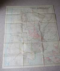
1913réf. 4073London: Waterlow & Sons London 1913. First Edition. Map. Good Condition/No Dust Jacket. 1st Edition. Large coloured folding paper map measuring approximately 120cm x 100cm reverse is blank. There are closed repaired tears to edges and folds with very minor holes in the center of the odd folds as is usual for this map. Overall this scarce map is in very good clean condition. Colours are still bright. Quantity Available: 1. Shipped Weight: Under 1 kilogram. Category: Geography & Maps; Railways. Pictures of this item not already displayed here available upon request. Inventory No: 4073. . London: Waterlow & Sons
1994réf. 6330102München (u.a.): Schirmer Mosel 1994. 7 S., 264 Taf. m. blattgr. fotogr. schw./w. Abb. 30cm x 27cm
1998réf. 2091502135306155Choenji 1998. Soft Cover. Fine. Volume: 1 Choenji paperback
19304 vols., sm. 8vo., First Editions, on laid paper, with very numerous plates, tops lightly dust-soiled, third volume with neat contemporary signature on front free endpaper; original cloth, upper boards and backstrips lettered in black, second volume in unclipped dustwrapper, a very good, bright, clean set. Published by Architectural Press for the Society for the Protection of Ancient Buildings. Contains illustrations of more than 300 bridges. COMPLETE SETS ARE SCARCE.
1942Very Good French Scarce color lithographed tourist map of Syria and Lebanon, showing international boundaries, transportation, archaeological, historical, and military ruins, water features, distances between places and populated places. Relief is shown by hachures, bathymetric tints, and spot heights. Includes 28 attractive drawings in red of tourist sites in Syria and Lebanon: Damas, Palmyre, Afqa, Hama, Homs, Meyrouba, Saida, Beit ed-Dins, Djebail, Led Cedres, Krak des Chevaliers, Massiaf, Antioche, Deir Smane, El Goilla, Aleppo, etc. "Relief is shown by contours and spot heights. Includes 28 drawings of tourist sites in Syria and Lebanon, listing the city. "7 -49". On lower right margin.'". Free French Forces was the government-in-exile led by Charles de Gaulle during the Second World War, and its military forces, that continued to fight against the Axis powers as an Allied nation, following the Fall of France. Set up in London in June 1940, it organized and supported the Resistance in Occupied France, and established a foothold within several French colonies in Africa. Original color lithograph map of Syria and Lebanon. 57x72 cm., on sheet 63x84 cm. In French. Scale: 1:1.000.000. Edition of May 1942.
réf. Lehtimäki, Kristina ed.In Pristine Condition. unknown
197240 pages. Illustrated in black and white. Features: Discovery - Gold Town in the Atlin District of B.C.; The Collector's Page; Edward Dossetter's Queen Charlottes - he was a photographer who travelled the northwest coast in the late 1870s; The 1913 Liberty Nickel; Billy Ballou - The Forgotten Expressman; Canadiana - spitoons/cuspidors; The Cliff Dweller; Letters from the North-West - Part II - A.R. Dyre was a young North West Mounted Police Constable from 1882 to 1885; Our Vanishing Heritage - false front buildings; Gagnon and His Flying Machine - was he the first to make a vertical free (helicopter) flight in 1907?. Unmarked with average wear. A sound vintage copy. Book