144 resultados
1854ref. 189965Washington D. C.: A.O.P. Nicholson Printer 1854. Hardcover. Good heavy shelfwear to covers cloth spine torn foxing spots and age toning. Black cloth boards with gilt lettering textured stamped design; unpaginated 44 maps and plans many of them folded. Contents: Illustrations accompanying the report of the Commissioner of the General Land Office -- Illustrations accompanying the report of the Commissioner of Public Buildings -- Illustration accompanying the report on the National Hospital for the Insane -- Illustrations accompanying the report of the Colonel of Topographical Engineers -- Illustration accompanying the report of the Chief of Ordnance and Hydrography. "December 4 1854. Read and ordered to be printed; and that 10000 copies in addition to the usual number be printed for the use of the Senate."- title page. A.O.P. Nicholson, Printer hardcover
1880ref. 59333No. place, no date, ca. 1880. Imperial folio. (72 x 49,5 cm.). Contemp. full cloth. Titlelabel with gilt lettering on upper cover. Containing 9 double-folio plates printed in blue, each measuring 70 x 94 cm.
1880ref. 59333No. place no date ca. 1880. Imperial folio. 72 x 495 cm. Contemp. full cloth. Titlelabel with gilt lettering on upper cover. Containing 9 double-folio plates printed in blue each measuring 70 x 94 cm. hardcover
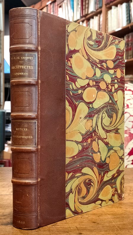
1899ref. 5157Lyon, Bernoux et Cumin, 1899 ; grand in-8 ; demi-chagrin maroquiné havane, dos à nerfs orné de caissons à froid, titre doré, plats de couverture conservés (reliure de l'époque) ; IX (1bl.), 436 pp., (2) ff. de tables ; 2 dessins de Philibert de l'Orme en frontispice et 20 portraits photographiques hors-texte, nombreuses signatures en fac-similé.
1899ref. 2104260233xbvkParis, Imprimerie Nationale - Octave Doin Éditeur, 1er Janvier 1899. XLVI, 1.176 pages; with many thousand names of all and everyone related to the French Navy and extensvie Index. - Gently gilt decorated and -titled heavy dark-green grained half-morocco binding of the period over 4 raised bands, with blind-tooled panels, all edges gilt and marbled endpapers; small-4to.(ca. 26 x 18 x 6 cm; ca. 2 kg.).
1900Very Good German Original b/w city plan. Atlas folio. (58x47 cm). In German. Folded. [CITY PLAN of BRAILA -IBRAIL-] Stadtplan von Braila. Scale (Masstab): 1/10.000. No cartographer. 33 descriptive articles on bottom-right corner of the plan. Slightly chipped at extremities of paper and soiling. It shows Braila and Donau. Braila (Turkish: Ibrail) is a city in Muntenia, eastern Romania, a port on the Danube and the capital of Braila County. There's some Ottoman manuscript including translations of the German descriptive text on the plan, and also "'Ibrail' sehir plâni" written on verso in Ottoman script. Extremely rare.
1899112 Pages. Features: Adventures of Louis De Rougemont - part IX; Holy Week Procession in Seville (includes photos of Nazarene's in costumes similar to those of Klansmen); My Texan Elopement -John H. Jones impersonates Miss Sally Steddem; A Naturalist in Cannibal-Land - adventures of Captain H. Cayley-Webster in the cannibal islands of the South Seas (with photos of Cayley-Webster); Jinkers and Jinkering - photo-illustrated article shows how buildings are moved by horses and oxen in Western New South Wales; My Klondike Mission - Lilian Agnes Oliver of Chicago set out for the Klondike to raise money to support her invalid husband - a photo-illustrated account; Through Pygmy-Land - Part I - photo-illustrated article by Albert B. Lloyd; The Heroes of Niagara - a series of graphic narratives, each illustrated by a photo of the hero and his apparatus; "Dago" - eminent actor Kyrle Bellew relates a remarkable mining incident - with photos; The Martyrs of Ku-Cheng - photo-illustrated article on the slaughter of Christian missionaries in the interior of China and the decapitating retribution; My First Leopard - by Walter H. Bone; Round the World in a Home-Made Boat - Joshua Slocum and the 'Spray'; Wolves in a Blizzard - Mr. and Mrs. E. Howard in North-West Canada; My Cycle Ride to Khiva - part II - an account of a remarkable bicycle ride across the deserts of Kara-kum and Kizil-kum by Robert L. Jefferson, F.R.G.S.; Attacked by Leeches - W. Harcourt-Bath describes a horrible jungle; Incredible photos of dozens of prisoners on treadmill in the great prison of Rangoon; Photo of dead Armenian heroes in Samsoun; and more. Average wear. Complete and intact. Few pencil markings. A sound vintage copy of this wonderful issue. Book
1802ref. 15907Nismes, Veuve Belle, An X-1802 ; in-4 ; veau marbré, dos lisse à faux-nerfs, décoré dans le style de Bozérian, titre doré, roulette décorative dorée d'encadrement des plats, roulette sur les coupes (rel. de l'époque) ; XXIX, 588 pp., 1 tableau dépliant h.t. et 1 pl. gravée sur cuivre par Savin.
1894Very Good Turkish, Ottoman (1500-1928) Original color map. Folded. Oblong folio. (35 x 52 cm). In Ottoman script. Color lithograph. It shows Sudan and West Africa, Atlas Ocean shores, Sahra Desert, and other parts of Africa. Scale: 1:15.000.000. A very detailed and attractive map. Slightly fading. Otherwise a very good copy. Dated Hegira: 1310 = [Gregorian 1894]. [EARLY OTTOMAN MAP of SUDAN] Sudan. Sâye-i Türkiye Hazret Gazi Sultan Abdülhamid Hân-i Sâni'de Maarif Umûmiye Nezâret-i Celîlesi ruhsatiyle meshur Haset tarafindan Fransa Cemiyet-i Cografya âzâlarindan mütesekkil komisyona mahsûs tanzîm edilmis oldugu son defaki atlasinin tercümesi olarak bu def'a Erkân-i Umûmiyye Dairesi Besinci Fen Subesi'ne me'mûr piyade mirlivâlarindan saâdetlü Ali Seref Pasa ve rifatlubinbasi fütûvvetlü Muhyiddin Efendi maarifetleriyle tertib ettirilmistir. Ali Seref Pasa or Hafix Ali Esref. He was a soldier, who was schooled in Paris as a cartographer around 1862. Already in Paris he published his first atlas with 22 maps, called 'Yeni atlas'. Upon his return to Istanbul he became a chief cartographer at the Maatbaa-i amire Printing Press in Beyazit, which was the successor of the Muteferrika press from 1727. Among others he translated the large Kiepert map of Anatolia to Ottoman. He died in 1907, leaving his large project of a gigantic map of Anatolia in 100 sheets unfinished. Ali's name is often misunderstood or even listed as two different people: Ali Seref Pasa and Hafiz Ali Esref. Until the surname law adopted on June 21, 1934, Turks did not have surnames. They were born with one first name and were until the adulthood described only as sons or daughters of their parent's names. Later they were given titles such as Effendi (Sir), Bey (Chief) or Hanim (Madam) for higher classes, or they were given names according to their work or class. The names were not inherited by children until 1934, when the surname law was enforced. The map maker Ali received names Seref, the honourable, and Pasa, the dignitary. He was also known as Hafiz, the memorizer of Qur'an and Esref, Proud. So Ali Seref Pasa would have a meaning 'Honourable Dignitary Ali, and Hafiz Ali Esref, Memorizer of Qur'an, Proud Ali. Daruttibaa - Matbaa-I Amire Printing Press: The first press in the Muslim world, called Daruttibaa, was founded in Istanbul by Ibrahim Muteferrika in 1727, with a permission of Sultan Ahmeet III. It was located in Muteferrika's house. The first book was published in 1729 and until 1742 sixteen other works followed. After Muteferrika's death, the press was supressed for printing, as printed books were considered dangerous. In 1796 the press was purchased by the government and moved to Uskudar in Istanbul, and in 1831 finally to Beyazit, where it was renamed to Matbaa-i Amire in 1866. The press was closed in 1901 and was reopened in 1908 under the name 'Âmire' In 1927 the name changed to State Printing House. The press still exists and is known for publishing school and educational books. Extremely rare. Not in OCLC.; Not in TBMM Map Collection.
1897Very Good Turkish, Ottoman (1500-1928) Original engraved map on the silk handkerchief made in Yildiz Palace for the 'Iane Sergisi' [i.e. Exhibition of the Social Assistance] in the period of Sultan Abdülhamid II. In its decorative frame. Frame size: 53,5x53,5 cm; map size: 38x38 cm. In Ottoman script. Scale: 1/600.000. Several minimal splits, minor foxing, and slight stains on cloth. Otherwise in good condition. A rare and decorative 1897 silk handkerchief map of the Greco-Turkish War in 1897, which was the only war in which the Ottoman army was victorious during the reign of Abdulhamid 2, is a fine example of Ottoman / Turkish cartographic textiles made in Ottoman court (Yildiz Palace textile workshops). This beautiful map depicts an attractive war scene from the 1313 Greek War on the upper half, and it's engraved a map of Balkan & Greek lands on its lower half. War painting has 'Melona' signature in Ottoman script. The map shows Thessaloniki [i.e. Salonica] Bay on the west; Yanya [i.e. Ioanna] Vilayat on the east; lands of Greece, Galos Bay, Uzi Strait on the south and Dimetoka and Avalonia areas in the Serefiye, Ergiri sanjaks on the north in its period. Written on the map, "Baht-i himâye-yi feyzvâne-i cenâb-i hilâfetpenâhide evlad-i süheda ve mecrûhin-i asakir-i sâhâne", [i.e. It was printed for the "Iane Sergisi" (i.e. The Social Help Exhibition) in the high memory of our soldiers who were martyred and veterans in the Greek War under the patronage of the Sultan.]. The Greco-Turkish War of 1897, also called the Thirty Days' War and known in Greece as the Black '97 (Mauro '97), or the Unfortunate War (Atychis polemos), was a war fought between the Kingdom of Greece and the Ottoman Empire. Its immediate cause was the question over the status of the Ottoman province of Crete, whose Greek majority long-desired union with Greece. Despite the Ottoman victory on the field, an autonomous Cretan State under Ottoman suzerainty was established the following year (as a result of the intervention of the Great Powers after the war), with Prince George of Greece and Denmark as its first High Commissioner. This was the first war effort in which the military and political personnel of Greece were put to test since the Greek War of Independence in 1821. For the Ottoman Empire, this was also the first war effort in which the reorganized military personnel were put to test. The Ottoman army was under the guidance of a German military mission led by Colmar Freiherr von der Goltz, who had reorganized it after the defeat in the Russo-Turkish War (1877-1878). The conflict proved Greece was wholly unprepared for war. Plans, fortifications and weapons were non-existent, the mass of the officer corps was unsuited to its tasks, and training was inadequate. As a result, the numerically superior, better organized, equipped and led Ottoman forces pushed the Greek forces south out of Thessaly. Almost all of the aids made to the families or disabled people of those who were martyred in the 1897 Ottoman-Greek War (such as printing this map) were made within the framework of the donations of "Evlâd-i Süheda and Malûlîn-i Guzât-i Asâkir-i Sahane". People and citizens of all classes and beliefs, including members of the Ottoman court, ministers, bureaucrats, civil servants, merchants and tradesmen, participated in this aid campaign at the end of the 19th, beginning of the 20th century. Not in OCLC.
1895Very Good Turkish, Ottoman (1500-1928) Original color map. Folded. Oblong folio. (35 x 52 cm). In Ottoman script. Color lithograph. A very detailed and attractive Ottoman map of America. Scale: 1:12.000.000. Otherwise a very good copy. Slightly chipped extremities. Dated Hegira: 1311 = [Gregorian 1895]. Ali Seref Pasa or Hafiz Ali Esref. He was a soldier, who was schooled in Paris as a cartographer around 1862. Already in Paris he published his first atlas with 22 maps, called 'Yeni atlas'. Upon his return to Istanbul he became a chief cartographer at the Maatbaa-i amire Printing Press in Beyazit, which was the successor of the Muteferrika press from 1727. Among others he translated the large Kiepert map of Anatolia to Ottoman. He died in 1907, leaving his large project of a gigantic map of Anatolia in 100 sheets unfinished. Ali's name is often misunderstood or even listed as two different people: Ali Seref Pasa and Hafiz Ali Esref. Until the surname law adopted on June 21, 1934, Turks did not have surnames. They were born with one first name and were until the adulthood described only as sons or daughters of their parent's names. Later they were given titles such as Effendi (Sir), Bey (Chief) or Hanim (Madam) for higher classes, or they were given names according to their work or class. The names were not inherited by children until 1934, when the surname law was enforced. The map maker Ali received names Seref, the honourable, and Pasa, the dignitary. He was also known as Hafiz, the memorizer of Qur'an and Esref, Proud. So Ali Seref Pasa would have a meaning 'Honourable Dignitary Ali, and Hafiz Ali Esref, Memorizer of Qur'an, Proud Ali. Daruttibaa - Matbaa-I Amire Printing Press: The first press in the Muslim world, called Daruttibaa, was founded in Istanbul by Ibrahim Muteferrika in 1727, with a permission of Sultan Ahmeet III. It was located in Muteferrika's house. The first book was published in 1729 and until 1742 sixteen other works followed. After Muteferrika's death, the press was supressed for printing, as printed books were considered dangerous. In 1796 the press was purchased by the government and moved to Uskudar in Istanbul, and in 1831 finally to Beyazit, where it was renamed to Matbaa-i Amire in 1866. The press was closed in 1901 and was reopened in 1908 under the name 'Âmire' In 1927 the name changed to State Printing House. The press still exists and is known for publishing school and educational books. Extremely rare. Not in OCLC.; Not in TBMM Map Collection.
1868Very Good Turkish, Ottoman (1500-1928) Contemporary quarter leather bdg. Rebacked boards. Foolscap 8vo. (18 x 12 cm). In Ottoman script (Old Turkish with Arabic letters). 220 p. Very rare early book of the concise biographies of 137 people who served as admirals in the Ottoman Empire between 1352 and 1853, written by Mehmed Izzet Pasha (d. 1853), son of Turkish admiral Abdullah Râmiz Pasha (d. 1813). Ceridehâne Printing House was founded for publishing Ceride-i Havâdîs [i.e. The Journal of News], which was the first semi-official newspaper in the Ottoman Empire. This journal was published from 1840 to 1877 and was founded by William Nosworthy Churchill (1796-1846), a British-born journalist who moved to Turkey aged 19. He was the cause of a diplomatic incident that resulted in the temporary severance of diplomatic relations between Britain and the Ottoman Empire. Babinger p. 323/2.; Özege 6951.; Library of Congress. Karl Süssheim Collection, no. 1336., OCLC: 11810438, 880485954.
1869ref. 116154Morel 1869 Paris, se vend chez A. Morel, librairie-éditeur, Bibliothèque de l'Architecture (série des Etudes d'Architecture Historique), 4 volumes en demi-chagrin vert de deux teintes différentes selon la série à laquelle le volume appartient, environ 45x35 cm, 1869 (première série), 1880 (deuxième série). Première série :Tome I : 44 p.- 112 planches. Tome II : 85 planches (dont la 18 bis). Seconde série : Tome 1 : 3 p. - 105 planches. Tome 2 : 95 planches. Des frottements sur les reliures, des taches sur les plats, coins émoussés, des rousseurs. Bon état pour le reste.
1854ref. 48328Zürich, Meyer und Zeller, (1854-) 1879. 4to. Contemporary halfcalf. Gilt spine, gilt letterinf. Fronthinge weakening. 1. Bericht (title without year): pp. (66-) 100 - 2.: pp. (110-) 155 - 3.: X,(73-) 116 - 4.: 34,(2) pp. - 5.: (4),(131-) 188 pp. - 6.: VIII,(245-) 320 pp. - 7.: (2),(4),69,(2),XII,(2) pp. - 8.: VIII,58 pp. and 85 lithographed plates, each with numerous illustr., 2 views (complete). Siebenter berich has 2 titlepages, the first: ""Résultat des Recherches exécutées dans les Lacs de la Suisse Occidentale depuis l'année 1866 decrit par V. Gross, F.-A. Forel et Edm. de Fellenberg"". The second: ""Pfahlbauten. Siebenter Bericht. Von Ferdinand Keller"". A few minor brownspots, internally clean.The work was published in ""Mittheilungen der antiquarischen Gesellschaft in Zürich"", Bde IX,,XII,,XIII,,XIV,.XV,,XIX, a. XX. The work has successively belong to three well-known Danish archaeologist: Georg Sarauw, Axel Steensberg and J. Troels-Smith with their names on front free endpaper.Troels-Smith is internatonally known as one of the pioneers in Pollen Analysis, especially with his work ""Pollenanalytische Untersuchungen zu einigen Schweizerischen Pfahlbauproblemen"" founded on his excavations on the ""Pfahlbauten"".
1854ref. 48328Zürich Meyer und Zeller 1854- 1879. 4to. Contemporary halfcalf. Gilt spine gilt letterinf. Fronthinge weakening. 1. Bericht title without year: pp. 66- 100 - 2.: pp. 110- 155 - 3.: X73- 116 - 4.: 342 pp. - 5.: 4131- 188 pp. - 6.: VIII245- 320 pp. - 7.: 24692XII2 pp. - 8.: VIII58 pp. and 85 lithographed plates each with numerous illustr. 2 views complete. Siebenter berich has 2 titlepages the first: "Résultat des Recherches exécutées dans les Lacs de la Suisse Occidentale depuis l'année 1866 decrit par V. Gross F.-A. Forel et Edm. de Fellenberg". The second: "Pfahlbauten. Siebenter Bericht. Von Ferdinand Keller". A few minor brownspots internally clean.The work was published in "Mittheilungen der antiquarischen Gesellschaft in Zürich" Bde IXXIIXIIIXIV.XVXIX a. XX. The work has successively belong to three well-known Danish archaeologist: Georg Sarauw Axel Steensberg and J. Troels-Smith with their names on front free endpaper.Troels-Smith is internatonally known as one of the pioneers in Pollen Analysis especially with his work "Pollenanalytische Untersuchungen zu einigen Schweizerischen Pfahlbauproblemen" founded on his excavations on the "Pfahlbauten". First edition of this pioneer work in Swiss archaeology exposing in a long series of reports his finds in the Swiss lakes the Swiss lake Dwellings - describing the Swiss "Urbevölkerung" with their Stake Buildings and the rich finds around these in the Swiss lakes. unknown
1820ref. 3657Couverture rigide Etablissement lithographique du Comte de Lasteyrie 1820 Paris 29,5x22,5 cm
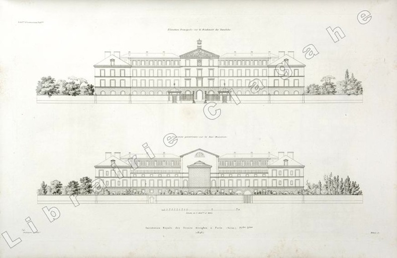
1846ref. 19809(Paris, 1846) ; in folio, toile vert foncé, double encadrement de filets dorés maigre et gras, tranches dorées, titre doré en long ; papier de garde multicolore peigné (reliure de l’époque); [4], 6 planches gravées de plans des bâtiments et des jardins situés au N°56 du boulevard des Invalides à Paris.
1880ref. 0267-05[ca. 1880]. [Album of views in Egypt]. 40 lose Orig.-Albumen-Photographien auf Kartons kasch. 21,5 x 27,5 cm. (Plattengr.). Ln.-Flügelmappe d. Zt. m. Deckelgoldprägung.
1831Very Good Turkish, Ottoman (1500-1928) Original manuscript autograph handwritten document sealed 'Hüsrev Mehmed' sent to (and responded by) Serkâtib Mustafa. Written in special paper with 'ahar'. 39x21 cm. In Ottoman script. Slightly tear on folded place and slightly stains. Otherwise a very good manuscript paper. The document was written in accordance with the Ottoman state correspondence tradition prior to modernization. However, it is an indication of modernization that it is written to the serkâtib of Humâyûn (head clerk of the Ottoman / Turkish court) and not to the Sultan directly. The importance of this document is that it has many hints of modernization movements of the last period of Empire, depiction of the division of the first modern Ottoman army (Asakir-i Mansure-i Muhammediye) that's before one year of Egyptian Campaign by Koca Husrev Pasha and before eight years of proclamation of Reform (Tanzimat) and after only 22 years of Turkish Magna Carta (Sened-i Ittifak). Husrev Pasha was 'serasker' (commandant and head) of Assakir-i Mansure-i Muhammediye Army in that year. Husrev's text starts as 'Devletlü, inayetlü, atufetlü, oglum.." in 'Elqab'. In the Ottoman diplomacy, first person who used 'oglum' [i.e. my son] in elqab of the documents was Koca Hüsrev Pasha. (Source: Osmanli Arsiv Belgeleri, Orhan Sakin). Koca Hüsrev Pasha (Khosrew Pasha) was an Ottoman Kapudan Pasha ("Grand Admiral") of the Ottoman Navy and statesman who reached the position of Grand Vizier rather late in his career, between 2 July 1839 and 8 June 1840 in the reign of Abdülmecid I. However, during the 1820s, he occupied key administrative roles in the fight against regional warlords, the reformation of the army, and the reformation of Turkish attire. In 1801, Hüsrev Pasha commanded the 6,000 Ottoman troops who assisted the British in removing the French from Rashid (Rosetta). For this, he was made governor of Egypt Eyalet (province), in which position he was charged with assisting Hüseyin Pasha in the killing or imprisoning the surviving leaders of the Mamluks. Many of these were freed by or fled with the British, while others held Minia between Upper and Lower Egypt. [.] He was later made governor again by Muhammad Ali for 2 days [.] After Diyarbekir and Salonica, in 1806 he was governor of Bosnia Eyalet, before being reappointed as governor of Salonica in 1808. Hüsrev Pasha held the rank of Kapudan Pasha of the Ottoman Navy from 1811 to 1818. He was then appointed governor of the Eyalet of Trabzon twice, during which time he conducted for the Black Sea region of Turkey the struggle the central Ottoman state was waging against local feudal rulers (Derebeys). During the Greek War of Independence, he was appointed Kapudan Pasha again in the end of 1822. In 1826, Husrev Pasha played vital roles both in the Auspicious Incident (the annihilation of the Janissary Corps in 1826) and in the formation of the new "Mansure Army" modeled after those of European Powers. Appointed as seraskier (commander the army) of the Mansure in May 1827, Husrev reformed and disciplined the corps. Himself ignorant of modern military methods, he assembled a staff of foreign experts and other personnel to assist him, the "Seraskeriye", which constituted the first staff in Ottoman history. Due to his early championing of military reform and virtual control over the new Ottoman army, Husrev was able to install many of his protégés in senior military positions. Husrev Pasha was also instrumental for the near-abandonment of the turban and the adoption of the fez as a universal headgear for Muslim men of the Ottoman Empire (excluding the religious classes) under Sultan Mahmud II. (Wikipedia). Möltke talks about him in famous book includes his personal letters as 'he is more powerful than sultan'. Following the suppression of the Janissaries in 1826, Sultan Mahmud II transferred the functions of the old Agha of the Janissaries to the seraskier.