1.090 resultados
196228 pages, illustrated, plan, chronology. eng
1988ref. 1304434(Hannover, Niedersächsisches Verwaltungsamt, 1988). 4to. 144 S. m. zahlreichen, teils farbigen Abbildungen, Rissen u. Plänen. (Arbeitshefte zur Denkmalpflege in Niedersachsen 7). OKart.
1930ref. 1038748Jan. - Juli 1930). OKart. (gering fleckig).
197948 pages, illustrated, plans. eng
198360 pages, illustrated, plans, list of owners. eng
1999Illustrated, plan of the garden. eng
1975ref. 1128404(Köln, 1975). 4to. 153 S. m. sehr zahlr. teils farb. Abb., Karten u. Plänen. (Landeskonservator Rheinland: Arbeitsheft 9). OKart.
1911ref. 1097301Wien, Schroll, 1911. 4to. 141, 206 S. m. 281 Textabb., 33 Taf. OBr. (Umschl. angestaubt u. fleckig, unaufgeschnitten).
1988ref. LFA-126719813Un ouvrage de 296 pages, format 230 x 305 mm, illustré, broché couverture couleurs, publié en 1988, bon état
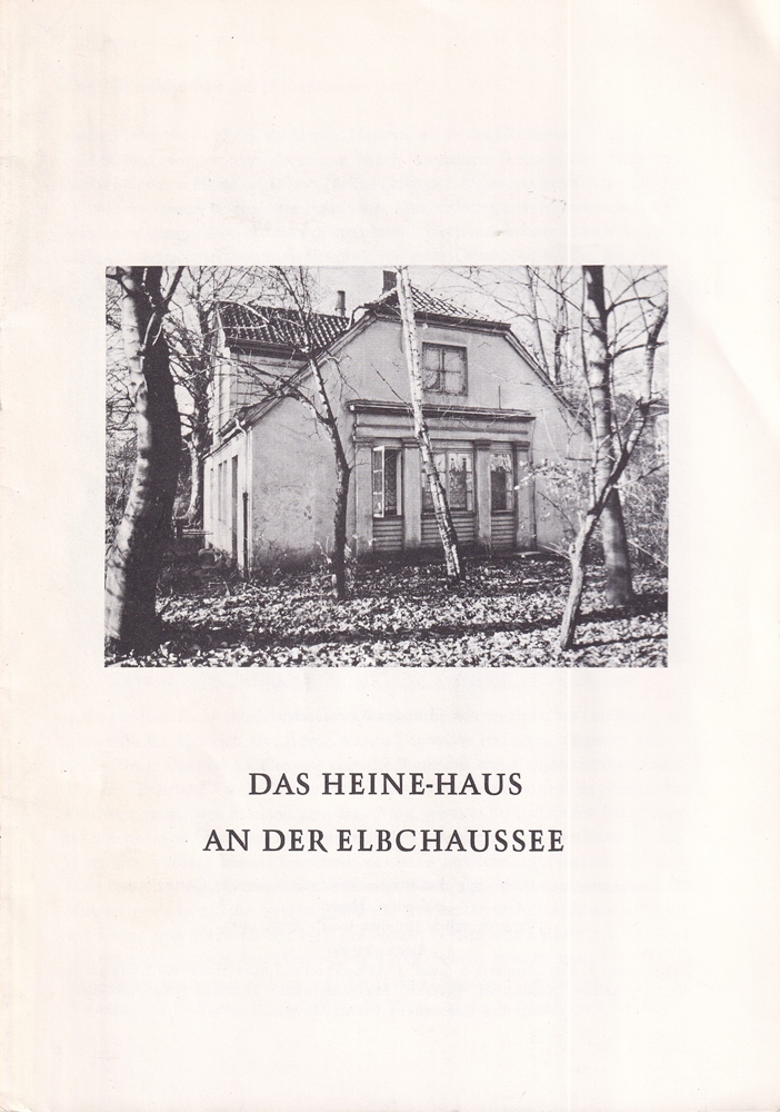
1979ref. 10636(Hamburg, 1979). 16 nn. S. Mit 10 Abb. u. 1 Schriftprobe S. Heines. Geheftet.
1988ref. DEMO011166IChicago: Olendorf Graphics 1988 . First edition. Hardcover. fine /fine. Bill OLENDORF. Oblong 8vo 141 pages pictorial white cloth. Dean Foods variant: distributed for Dean Foods Company with hand-pulled serigraph print limited and signed by Olendorf. Olendorf's sketches were made with Bic metal0tipped pens. Olendorf Graphics hardcover
1911Very Good Greek, Modern (post 1453) Original wrappers. Large 8vo. (21 x 16 cm). In Greek (Modern). 21 p. First and only edition of this exceedingly rare and one of the earliest church regulations of the Greek Orthodox community of Attalia [Antalya]. Attalia was not a large urban center or major trading hub, but neither was the Greek Community marginal, and it was well integrated into the regional economy. It was different from other areas in Asia Minor due to a combination of factors ranging between demography, geography, local Orthodox leadership, and the city's social milieu. In contrast to the West-coast cities and many villages in Asia Minor with Orthodox majorities, Attalia's population was only about one-third Orthodox. The main area of difference in Antalya was the Community leadership, which was key to the maintenance of cordial relationships between Christians and Muslims, and the secular and ecclesiastical elements of Orthodox leadership in Antalya tended to cooperate for collective benefit. Throughout this period, a local elite managed to control education and other Community institutions, perpetuating an identity that was compatible with the local Ottoman context. In this last period, the Greek Community printed several books and tractates including a brief history of Antalya and this "regulation book" in the Meli Printing House, which was the only printing house of the Greek Community in Antalya. Only one institutional copy is located in OCLC 1030075331 (Suna Kiraç Library of the Koç University).
1936Very Good Turkish Original manuscript map of Alexandria Port and its immediate hinterland. Folio. (33 x 41 cm). In Turkish (Modern). Folded. No scale. The manuscript shows Alexandria Port and the Palace of the King Farouk of Egypt, customs shores, ports and harbors, locations of the British ships, radio station, location of SS Ramlah, strait, Great Pass (?), waterfront for the lumber ships, sea current zones and probably entrance and exit routes etc. A very detailed map, decorated with ships. Some repairs with tape, tears, foxing and stains. Overall a good copy.
1909Very Good Turkish, Ottoman (1500-1928) Original color map on cloth. A little foxing on cloth. Very good. Folded. Oblong atlas folio. (50 x 67 cm). In Ottoman script. Scale: 1/300.000. Map of Ottoman Kayseri printed in its period. No publisher and map-maker. Physical geography of Kayseri city and its around. It shows Kayseri, Sultan Sazligi, mountains and hills, Malatya borders, etc.
1910Very Good Turkish, Ottoman (1500-1928) Original color map on cloth. Oblong eephant folio. (64 x 573 cm). Toponyms in Ottoman script. [MAP of BALKANS] Filibe [Plovdiv]. A very detailed map. Shows Plovdiv and mountains, rivers around it. Extremely rare.
1920Very Good French Original color map on cloth. Oblong folio. (42 x 53 cm). In Ottoman script. [MAP] Büyükada, Maltepe ve Adalar. [Feuille of Sedef Island and South of Prinkipo, Marmara Sea]. 6th sheet of set.
1914Very Good French Original color map on cloth. Oblong large folio. (49 x 58 cm). In Ottoman script. [MAP] Kocaeli-Izmit Körfezi. Gökbüze, Derince, Dilburnu, Hersek Gölü. [Izmit Bay, Dilburnu, Gökbüke, Derince, Marmara Sea]. Scale: 1/50.000.
1979ref. H0296Moulins, Éditions des Cahiers Bourbonnais & du Centre, 1979 ; grand in-8, 192 pp., reliure d'éditeur plein Skivertex, vert émeraude, dos lisse. Important ouvrage sur le Bourbonnais et l'Auvergne. Nombreuses illustrations en noir et blanc (photographies de G. Guillemin, bois de F. Dubreuil). Très bon état.
1916Very Good Turkish, Ottoman (1500-1928) Original color map. Folded. Oblong atlas folio. (50 x 60 cm). In Ottoman script. [MAP of EAST ANATOLIA] Malatya - Divrigi, Mancinik, Adiyaman, Harput. Shows Malatya, Adiyaman and Kharpout region; Firat River (Euphrates), Yazi Düzü, Erguvan etc. Scale: 1/200.000. This is one the serie of the Bonn projection maps which are the first map series in modern techniques in Turkey and the Ottoman Empire. In order to produce these maps covering Turkish territory, Reconnaissance Branch was incorporated into The Mapping Commission. The maps were produced in the datum based on the latitude and longitude of Ayasofya Mosque in equal area Bonn Projection. The field works for the 123 sheets covering the country were conducted by 76 staff. The production was completed in 18 years starting from east west. Field works continued without stopping except in years 1914 and 1920. This map series called also reconnaissance maps contributed a lot to producing 1:25.000 scale maps. Hegira: 1332 = Gregorian: 1916. Not description on map-maker. According to Türkezer & Çobanoglu: History of Mapping in Turkey-1:200.000 Scale Maps, cartographer of this map is Kambay, Cemal.
1910Very Good Greek, Modern (post 1453) Paperback. Demy 8vo. (21 x 14 cm). In Greek (Modern). 79 p. Not in OCLC. The Metropolis of Chalcedon is an ecclesiastical territory (diocese) of the Ecumenical Patriarchate of Constantinople. Christianity spread in Chalcedon during the 2nd century AD. The city was initially the see of a bishopric before being promoted to a metropolis at 451 AD, at the time of the Fourth Ecumenical Council. It is one of the four remaining active Greek Orthodox Church metropolises of the Ecumenical Patriarchate in Turkey today and the only one surviving in Asia Minor (Anatolia). During the 14th century, the metropolitan see remained vacant, due to the Ottoman conquest of the region. However, it was reorganized in the 15th century, possibly after the Fall of Constantinople and the subsequent incorporation of the Ecumenical Patriarchate into the millet system of the Ottoman society. The first recorded metropolitan of that time was Joseph, in 1477. In the following years, the jurisdiction of the metropolis was extended to the east. During the late 17th century the see of the diocese was transferred to Kuzguncuk (Ermoulianai, Chrysokeramos), where it remained until 1855. At that period a number of monasteries were established, like the one of Saint Panteleimon, which was declared Stauropegic. The metropolitan of Chalcedon was one of the five Elder metropolitans from the wider region of Constantinople, the other being those of nearby Herakleia, Cyzicus, Nicaea, and Nicomedia. Following an Ottoman decree of 1757, they had to be always present in the Holy Synod of the Ecumenical Patriarchate and had direct access to the Ottoman Sultan, to whom they announced the election of the new Ecumenical Patriarch. From the mid-19th century, the local metropolis prospered thanks to the significant population increase and economic development of the local Orthodox population. In 1855 the see of the metropolitan returned to Chalcedon during the primateship of Metropolitan Gerasimos. Moreover, the newly erected church of Saint Euphemia became the new cathedral. The metropolitan mansion was built near the cathedral in 1902. This is the first and only known printed regulation book of the Greek Community in Chalcedonia (Kadiköy). Extremely rare.
1917Very Good Turkish, Ottoman (1500-1928) Original color map. Folded. Oblong atlas folio. (50 x 60 cm). In Ottoman script. Shows Southeastern parts of Asia Minor and Syria; Siverek, Sard (Iraq) and Ras Al-Ayn (Rasulayn - Resualyn) in Syria. Hegira: 1333 = Gregorian: 1917. Not description on map-maker. Scale: 1: 200.000. This is one the serie of the Bonn projection maps which are the first map series in modern techniques in Turkey and the Ottoman Empire. In order to produce these maps covering Turkish territory, Reconnaissance Branch was incorporated into The Mapping Commission. The maps were produced in the datum based on the latitude and longitude of Ayasofya Mosque in equal area Bonn Projection. The field works for the 123 sheets covering the country were conducted by 76 staff. The production was completed in 18 years starting from east west. Field works continued without stopping except in years 1914 and 1920. This map series called also reconnaissance maps contributed a lot to producing 1:25.000 scale maps. According to Türkezer & Çobanoglu: History of Mapping in Turkey-1:200.000 Scale Maps, last cartographer of Diyarbakir regio is M. Sait Malatyali. No his biographic material and info in 'Savaslarda Haritacilar'. Rare.
1922Very Good Turkish, Ottoman (1500-1928) Original color map. 65,5x63 cm. In Ottoman script. This rare and decorative Gallipoli map including Hellespont, Gallipoli Peninsula, Suvla Bay, Seddülbahir, and Tenedos, the places of Gallipoli Aar in 1915 (Dardanelles Campaign) during World War 1, separated two map views. Seddulbahir and Suvla Bay at north and Straight, Peninsula, and its shores with Tenedos (now Bozcaada) at the southwest of the map. It's a very detailed and rare map printed with the series of "History of the Dardanelles Campaign" after the seven years of war. The Gallipoli campaign, also known as the Dardanelles campaign, the Battle of Gallipoli or the Battle of Çanakkale (Turkish: Çanakkale Savasi, or, Muharebâti), was a military campaign in the First World War that took place on the Gallipoli peninsula (Gelibolu in modern Turkey), from 17 February 1915 to 9 January 1916. The Entente powers, Britain (with Anzacs), France, and Russia, sought to weaken the Ottoman Empire, one of the Central Powers, by taking control of the Turkish straits.
1916Very Good Turkish, Ottoman (1500-1928) Contemporary red cloth. Roy. 8vo. (24 x 16 cm). In Ottoman script (Old Turkish with Arabic letters). [1], 229, [1] p., many b/w and color ills., 30 chromo-lithographed maps. Wear and fading on spine, some ex-library stamps on the colophon and several blank pages, ownership ink inscription and signature on the first page-overall a good copy. First edition of this rare Ottoman atlas for the primary schools in the late Ottoman Empire, including beautiful 30 chromo-lithographed maps of the Ottoman land according to administrative regions (provinces) and richly illustrated with b/w plates of the cities and provinces in the Middle East. Map list: 1. World map 2. Complete Imperial Ottoman 3. Arabian Peninsula 4. Anatolia 5. Asia Minor 6. Marmara and Black Sea 7. Aegean (The Archipelago) 8. Demography of Anatolia and Syria, Libya, etc 9. Administrative map of Anatolia 10. Map of mines of Anatolia 11. Agricultural map of the Imperial Ottoman 12. Arabian Peninsula 13. Map of the Edirne Vilayat [Adrianople Province of the Ottoman Empire] 14. Map of the Bosphorus 15. Map of the Hüdavendigâr Vilayat [Brusa Province] 16. Maps of Izmit and Biga Sanjaks 17. Map of Aydin Vilayat and Mentese Sanjak 18. Map of the Konya Vilayat 19. Maps of the Adana Vilayat and the Mediterranean Sea 20. Maps of the Erzurum and Ankara Vilayats 21. MAps of Kastamonu Vilayat and Bolu Sanjak 22. Map of the Trebizond Vilayat 23. Maps of the Van and Bitlis Vilayats 24. Maps of the Sivas and Harput Vilayats 25. Maps of the Bagdad and Basrah Vilayats 26. Map of the Mosul Vilayat and Day al-Zor Sanjak 27. Map of the Aleppo Vilayat and Urfa Sanjak 28. Map of the Syria and Beirut Vilayats 29. Map of the Arabia 30. Maps of the Yemen vilayat and Asir Sanjak. This atlas was printed four times for the different classes of the early Turkish / Ottoman schools, during World War 1 (two times in 1916) and the National Struggle (two times in 1921). Geylangil was born in Istanbul in 1887 and studied in Aleppo and Baghdad. Geylangil, who also studied economic geography, taught geography at many schools, including Galatasaray High School. Until his death, he wrote 14 books on geography, most of which were geographical atlases. In 1941, he was among the founding members of the Turkish Geographical Society. Özege 23216.; TBTK 11481.; We couldn't find any copy of this edition worldwide.
1940ref. 286509Colonial Williamsburg Foundation 1940. Very Good binding. A Question and Answer booklet on Virginian history and government prepared for the Colonial Williamsburg Foundation's 'Department of Exhibition Buildings.' Text typewritten on the recto with a typewritten title page and paper label on the front cover. Some shelfwear and wear to the paper label. Red paper portfolio with three hole clasps. 83 ff. Very Good. Very Good binding. [Colonial Williamsburg Foundation] unknown
1996ref. LFA00d92Revue de la Société pour la Protection des Paysages et de l'Esthétique de la France : 90 pages, format 210 x 160 mm, illustrée