1.090 resultados
1996ref. LFA00d92Revue de la Société pour la Protection des Paysages et de l'Esthétique de la France : 90 pages, format 210 x 160 mm, illustrée
1997ref. LFA00d96Revue de la Société pour la Protection des Paysages et de l'Esthétique de la France : 90 pages, format 210 x 160 mm, illustrée
1948Very Good Arabic Original chromo-lithograph map in brown tones. On a special paper with an ongoing blindstamped "Regestre Robur" during the borders. Folded. 70x100 cm. In Arabic. Scale: 1 /1.000.000. Chipped on margins, split on folded traces. Slight discoloration and one stain on lower margin. Otherwise a good copy. An attractive and detailed map of Syria shows the capital (as Aleppo n that map), other cities like Damascus, Raqqa, Homs, Latakia, Ayn al-Arab, Idlib, Hama, Deir Ez-Zor, Jarabulus, et alli. And it shows Turkey on the north (as Turkey containing Hatay and Alexandrette), The Mediterranean shores of the land as well as Lebanon and Palestine (and Jerusalem) on the west, Sharq al-Urdun (Jordan) and Iraq on the south and east. It's very detailed on showing the roads spread throughout the land like railways and ancient roads from the Roman period. Additionally this roads can be followed to the other Arabic countries and regions on the map. This map was calligraphed by Kamel Al-Baba, (1905-1991), who was a Lebanese contemporary / modern calligrapher. He is the son of famous calligrapher Mokhtar Al-Baba. Cannot be found in WorldCat.; Not in Library of Congress Map Collection. Very scarce.
1916Very Good Turkish, Ottoman (1500-1928) Original color map. 50x60 cm. In Ottoman script. Scale: 1/200000. Ottoman map of Eastern Anatolia. Bargiri, Hoy, Baskal'a, Malazgird. It shows Lake Erçek located on the east of Lake Van which is an endorheic salt lake in Van Province in eastern Turkey, about 30 kilometres; on north side, Bargiri place where the oldest district of Van city; on east, Turkish and Azerbaijani and Iranian borders and Hoy city of the West Azerbaijan; and on west, map shows Malazgird [Malazgirt]. This is one the serie of the Bonn projection maps which are the first map series in modern techniques in Turkey and the Ottoman Empire. In order to produce these maps covering Turkish territory, Reconnaissance Branch was incorporated into The Mapping Commission. The maps were produced in the datum based on the latitude and longitude of Ayasofya Mosque in equal area Bonn Projection. The field works for the 123 sheets covering the country were conducted by 76 staff. The production was completed in 18 years starting from east west. Field works continued without stopping except in years 1914 and 1920. This map series called also reconnaissance maps contributed a lot to producing 1:25.000 scale maps.
1995Fine Turkish Paperback. Cr. 8vo. (20 x 14 cm). In Turkish. 22 p., color ills. Süleyman Sah ve Ibni Melek.
1987Fine Fine English Original bdg. Dust wrapper. Large demy 8vo. (22 x 18 cm). In English, Azerbaijani (Cyrillic script), and Russian. 136, [3] p., 100 numerous colo and b/w plates. The architectural monuments of Sheki.= Seki'nin me'marliq abideleri.= Arxitekturnie pamiatniki Seki.
1994Minor shelfwear. Minor bumping to 1 corner. Faint foxing. Dustjacket is protected in mylar. ; 1.18 x 10.79 x 8.5 Inches; 360 pages; Roman architecture is extraordinarily rich, both in terms of the techniques and materials used and in the variety of buildings constructed, many of which are still visible today. Roman Buildings places emphasis on the technical aspects of that architecture, following the process of building through each stage, from quarry to standing wall, from tree to roof timbers. The author examines the different techniques involved in building in brick and in stone and wood, and how these materials were obtained or manufactured. He also discusses interior decoration and looks at the practical aspects of water supply, heating and roads. Each type of building required special tools and these are described, using both surviving examples and modern parallels. The Romans constructed many spectacular feats of engineering, producing magnificent monuments such as the Pantheon and Pont du Gard. This book looks at these large-scale public buildings but also at more modest homes and shops. The result is a thorough and systematic examination of Roman building, with over 750 illustrations, including the author's own drawings. Roman Buildings contains a foreword by Professor Michael Fulford.
1954No marks or inscriptions to contents and no creasing to covers. A very clean very tight booklet with lightly foxed unmarked boards and no bumping to corners. 22pp. Very concise history of York's old churches and forty two photographs of some of these.
1988xiv, 366 pages. Subject index. Title index. "Will be of interest and use not only to architectural and urban historians and to historic preservationsists, as well as those concerned with various aspects of the local history of New York City." - from page xiv. Usual library markings. Moderate wear. Binding tight. A sound copy. Book
1942Very Good German n modern aesthetic full leather bdg. Folio. (32 x 24 cm). Bilingual in German and Turkish. 103, [1] p., b/w plates. Includes exhibition booklet (15 pp., b/w ills.), and text of the speech of German ambassador (Franz von Papen) for this exhibition (4 pp.). "The New German Architectural Exhibition opened in Ankara Exhibition House between 31st January and 15th February 1943 was one of the exhibitions opened during World War II. This exhibition occupied a distinctive place on the public agenda due to its size and effect in media on that date. A great number of Turkish authorities, foreign diplomatic representatives, and journalists attended the exhibition, which was opened with great efforts, and the leading role of the German Ambassador in Ankara, Franz von Papen, and such a situation caused the exhibition to attract attention. Even though the civil architectural and engineering works stopped completely in Germany during the War and some of the projects were draft and incomplete, they tried to be exhibited to give the impression of Nazi Germany's "great power" with the aim of propaganda. In Turkey's press, great praises were presented in writings towards the magnificence and architects of German architecture. Not only axis powers but also allied powers tried to attract the attention of the Turkish Government and the public agenda in Turkey using propaganda methods. As a result of such attempts, the UK opened exhibitions in 1944 on English architecture in Ankara first and then in Istanbul. Similar praises spent for German architecture were also presented to that of the UK. At this point, it may be stated that as for the War, Turkey followed a policy of active neutrality, Turkish media also followed the same policy." (Source: Küçük, Evren: An Example of Nazi Germany's Propaganda in Turkey: German Architectural Exhibitions in Ankara and Istanbul).
1954ref. 40482ABLondon, Pitman, 1954. 4°, XIV, 257 S. mit zahlr. s/w-Illustr. (teilw. zum Ausklappen), Bau- und Entwurfszeichungen, Grundrißdarstellungen, Schaubildern etc., Text: englisch, heller original Leineneinband mit goldener Rückenbeschriftung und Deckel-Verlagssignet, Erstausgabe / First Edition der helle Einband stellenw. minimal berieben, schöner Architektenstempel auf der Vorsatzseite unten, sonst ein schönes, textsauberes Exemplar
1921ref. R100038406Non Renseigné. 1921. In-12. Broché. Bon état, Couv. convenable, Dos satisfaisant, Intérieur frais. Dos vert. bon état.. . . . Classification : 251.32-Edifices
20009 pages, illustrated. eng
1974Foxing to end papers. No other marks or inscriptions. No creasing to covers or to spine. A very clean very tight copy with bright unmarked boards and no bumping to corners. 96pp. The history of Exmoor churches and chapels followed by an A-Z gazzetteer.
1975170 pages. Archival black and white photos. Includes: The British Indian Department and the Frontier in North America, 1755-1830; The B.C. Mills Prefabricated System - The Emergence of Ready-made Buildings in Western Canada. Prior owner's small inkstamped name inside front cover else clean and unmarked with moderate wear. A sound copy. Book
1977ref. 14739Dowden Hutchinson & Ross 1977 hardback book and dust jacket in near fine condition. Hardcover. Fine/Fine. Dowden, Hutchinson & Ross hardcover
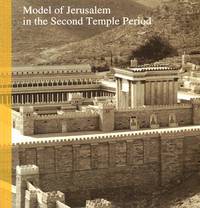
1992ref. 211422Jerusalem: Israel Museum and Holland Tourism 1992. 114 pages illustrations some colour; 22 cm. Firm binding clean inside copy. . 1st. Paperback. Fine. 8vo. Collectible. Israel Museum and Holland Tourism Paperback
1969359 pages. Index. Bibliography. Black and white photographic plates. First published in Danish in 1956. Originally intended as a course in tonal and technical design of the organ and organ history, but was supplemented with content on organ architecture and the location of the organ. - from Foreword. Chapters include: The Proportions of Sound; The Acoustics of Buildings, The Organ Pipes, The Stops of the Organ; The Technical and Tonal Design of an Organ Werk; The Organ in the Middle Ages; The West European Organ Types; The Organ Facade; The Location of the Organ; The Organ Reform Movement; Maintenance - Rebuilding - New Instruments. Rebound in sturdy yellow library buckram. Usual library markings. A sound working copy of this esteemed reference. Book
200012 pages, illustrated, glossary, bibliography. eng
19788vo, 184 pages with 36 illustrations in colour and over 250 in black and white. eng
2000ref. 22053teNeues Verlag GmbH + Co KG, 2000. 400 Seiten Taschenbuch
1995ref. 1125559835Hamilton : Bermuda National Trust 1995. Book. Near Fine. Soft cover. 1st Edition. 4to - over 9¾ - 12" tall. pictorial paper cover 6 xi 93 p. : ill. maps ; 29 cm. 28 cm. Bermuda's architectural heritage series 1 Includes bibliographical references p. 76-89 and index. Bermuda National Trust Paperback
1982Much illustrated, occasionally in colour. 96 pages. Wear to cover extremities. Crease to top corner of front cover and following few pages.
1912Very Good Turkish, Ottoman (1500-1928) A very attractive chromo-lithograph map on paper. Oblong: 26,5x37,5 cm. In Ottoman script (Old Turkish with Arabic letters). Light foxing and fading on margins and printed area. A very detailed and fine double hemisphere map of the northern and southern skies, showing the various constellations, together with a third map showing the zodiacs on one paper. On the bottom margin, it's written 'Printed in the 549 Numbered Press', and 'Dersaadet...'. This map seems to be influenced (or, a direct translation) from the map of the sky of Sir Francis Baily, (1774-1844), who was one of the leading English Astronomers of the first part of the 19th Century. He is most famous for his observations of "Baily's beads" during a total eclipse of the Sun. Baily was also a major figure in the early history of the Royal Astronomical Society, as one of the founders and as the president four times. After a tour in the unsettled parts of North America in 1796-1797, his journal of which was edited by Augustus de Morgan in 1856, he entered the London Stock Exchange in 1799. The successive publication of Tables for the Purchasing and Renewing of Leases (1802), of The Doctrine of Interest and Annuities (1808), and The Doctrine of Life-Annuities and Assurances (1810), earned him a high reputation as a writer on life-contingencies; he amassed a fortune through diligence and integrity and retired from business in 1825, to devote himself wholly to astronomy. He had already, in 1820, taking a leading part in the foundation of the Royal Astronomical Society. In 1827, the Society awarded him its Gold Medal for preparation of the Astronomical Society's Catalogue of 2881 stars. He was instrumental in the reform of the Nautical Almanac in 1829. In 1837, he recommended to the British Association and later worked extensively on the reduction of Joseph de Lalande's and Nicolas de Lacaille's catalogues containing about 57,000 stars. He also supervised the compilation of the British Association's Catalogue of 8377 stars (published 1845) and revised the catalogues of Tobias Mayer, Ptolemy, Ulugh Beg, Tycho Brahe, Edmund Halley and Hevelius. His notice of Baily's Beads, during an annular eclipse of the sun on May 15 1836, at Inch Bonney in Roxburghshire, started the modern series of eclipse-expeditions. Very rare.
1995ref. 2090502113716778Not Available 1995. Soft Cover. Fine. The book is in fine condition. Not Available paperback