453 résultats
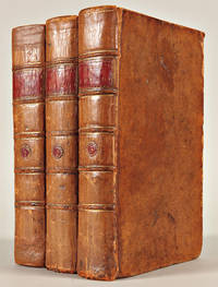
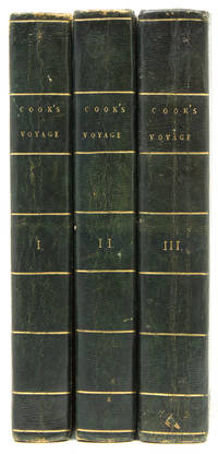
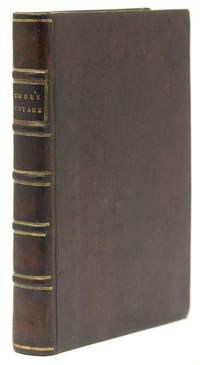
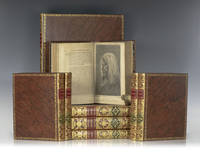
1773réf. 112342London: W. Strahan and T. Cadell 1773 1777 1784. Rare first edition set of the official accounts of Captain James Cook's voyages "the foundation of modern knowledge of the Pacific and a cornerstone of the literature of travel and exploration" Beddie 648 1216 1543; Hill 782 358 361. Nine volumes altogether. Quarto bound in full calf with morocco spine labels elaborate gilt titles to the spine front and rear panels raised bands. Large folio atlas bound in the same manner. The First Voyage is comprised of three volumes edited by John Hawkesworth. "An Account of the Voyages. for making Discoveries in the Southern Hemisphere. In the Dolphin the Swallow and the Endeavour." The Second Voyage includes two volumes published in 1777: "A Voyage Towards the South Pole and Round the World. Performed in His Majesty's Ships Resolution and Adventure In the Years 1772 1773 1774 and 1775". First edition. Portrait frontispiece and 63 plates and charts several folding or double-page. The Third Voyage was published in 1784: "A Voyage to the Pacific Ocean. Undertaken by the command of His Majesty for making Discoveries in the Northern Hemisphere. To determine The Position and Extent of the West Side of North America; its Distance from Asia; and the Practicability of a Northern Passage to Europe." Four volumes first edition. The text with 24 plates and charts as called for with two large folding maps and 61 plates. An exceptional set. Captain Cooks Voyages are an iconic symbol of discovery and served not only to contribute to many diverse fields of knowledge but also to inspire many who followed after him. "He was really the first scientific navigator" Hill and the only explorer during this time to lead three circumnavigations. The knowledge accumulated during these explorations greatly expanded the awareness of the worlds geography and his writings maps and drawings significantly aided in future navigations making sea travel much more certain and educating the general public. Cooks first voyage sailed from England in 1768 rounded Cape Horn and continued westward to arrive in Tahiiti in April of 1769 where the Royal Society had engaged Cook to observe the transit of Venus across the Sun. He then sailed to New Zealand mapping the complete coastline and then travelling to Australia where his expedition became the first recorded Europeans to encounter the eastern coastline. The voyage was fraught with many perils including being nearly ship-wrecked on the Great Barrier Reef and losing many of the crew to malaria in modern day Indonesia but they were able to finally sail past the Cape of Good Hope and return to England in 1771. Cooks second voyage took place between 1772-1775 with a mission to search for the hypothetical Terra Australis. Cook crossed the Antarctic Circle for the first time in history and thought he disproved the existence of the "Great Southern Continent." He actually almost reached Antarctica on one occasion but then turned towards Tahiti for supplies. In Cooks third voyage 1776-79 his aim was to search for the North-West Passage through the American continent. He charted the American west coast from Northern California through the Bering Straight. "Cook was the first navigator to accurately map the coast and by carrying away a collection of furs he introduced the fur trade to the English and American traders whose subsequent expeditions were based upon his discoveries no other contemporaneously printed source narrative is of comparable importance" Eberstadt. On this voyage he also discovered the Hawaiian Islands which he named the Sandwich Islands. Cook died during this third voyage on the Hawaiian islands. With the publication of the first two voyages and his dramatic death in Hawaii James Cook became a national hero. So eagerly awaited was his account of the third voyage that it was sold out a few days after publication. Among his accomplishments Cook discovered New Caledonia Norfolk Island the Isle of Pines Sandwich Land Hawaii and rediscovered and charted numerous other lands. He was the first to survey New Zealand where he spent six months. He was also a pioneer in regard to the health of his men. On his second voyage Cook lost only one man out of 118 in a voyage of more than 1000 days one of the first to conquer scurvy. As a commander an observer and a practical physician his merits were equally great. He won the affection of those who served under him by sympathy kindness and unselfish care of others which were as noteworthy as his gifts of discovery and intellect. W. Strahan and T. Cadell hardcover books
1785réf. 35359London: H. Hughs for G. Nicol and T. Cadell 1785. 4 volumes text: 3 volumes 4to 12 5/8 x 9 5/8 inches;atlas: 1 volume folio 23 1/2 x 17 inches. Text: engraved medallion vignettes on titles 1 folding letterpress table. Atlas: 87 engraved plates plans maps and charts 1 folding 1 double-page and including the 24 small format plates usually found in the text here on unfolded full sheets. Extra-illustrated with very rare and possibly unique impressions of the 24 engraved plates on wove paper watermarked 1801 bound into the text. Original paper-covered boards expertly rebacked to style with contemporary brown paper. All contained within dark blue morocco-backed boxes. A fine unsophisticated set of the third edition of the third voyage with the plates in their most desirable form: all the plates usually found in the text volumes are here bound unfolded and uncut in the atlas volume. In addition this set extra-illustrated with a duplicate set of those plates being unrecorded 1801 impressions on wove paper. "The famous accounts of Captain Cook's three voyages form the basis for any collection of Pacific books. In three great voyages Cook did more to clarify the geographical knowledge of the southern hemisphere than all his predecessors had done together. He was really the first scientific navigator and his voyages made great contributions to many fields of knowledge . Cook's third voyage was organized to seek the Northwest Passage and to return the islander Omai to Tahiti. Officers of the crew included William Bligh James Burney James Colnett and George Vancouver. John Webber was appointed artist to the expedition. After calling at Kerguelen Island Tasmania New Zealand and the Cook Tonga and Society Islands the expedition sailed north and discovered Christmas Island and the Hawaiian Islands which Cook named the Sandwich Islands. Cook charted the American west coast from Northern California through the Bering Strait as far north as latitude 70 degrees 44 minutes before he was stopped by pack ice. He returned to Hawaii for the winter and was killed in an unhappy skirmish with the natives over a boat. Charles Clarke took command and after he died six months later the ships returned to England under John Gore. Despite hostilities with the United States and France the scientific nature of this expedition caused the various governments to exempt these vessels from capture. The voyage resulted in what Cook judged his most valuable discovery - the Hawaiian Islands" Hill. The typography of the third edition is similar to the second edition which is generally considered superior to the first: Hughs took over the printing from Strahan and re-set all the text. In addition the third edition includes the first appearance of William Wales's "A Defence of the Arguments advanced in the introduction to Captain Cook's last Voyage against the existence of Cape Circumcision" vol.III pp.557-564. This fine set in boards comprises the rarest and most desirable form of the third voyage with the 24 plates intended for the text volumes to be bound uncut and unfolded into the atlas. Thus plates which are generally severely trimmed close or into the image to fit into the text are here on full sheets with wide margins. An early owner of this set however has extra-illustrated his text with early 19th century impressions of those plates. This issue of the duplicate set of plates appears unrecorded being on wove paper watermarked 1801. That the plates were added is confirmed by the fact that the plates are tipped-in rather than sewn or guarded into the text. Cf. Beddie 1543; cf. Forbes Hawaiian National Bibliography 62; cf. Lada-Mocarski 37; cf. Printing and the Mind of Man 223; cf. Sabin 16250. H. Hughs for G. Nicol and T. Cadell unknown books
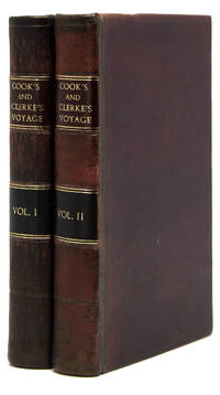
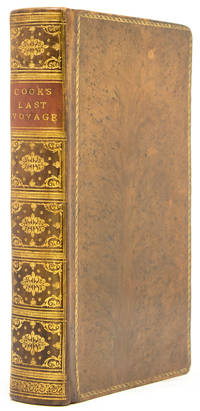
1777réf. 25578London: W. Strahan and T. Cadell 1777. 2 volumes quarto. 11 x 9 inches. Engraved portrait of Cook by J. Basire after Wm. Hodges 63 engraved plates maps and charts 15 folding 16 double-page 1 folding letterpress table. A few plates trimmed close as usual. Contemporary calf covers with decorative borders tooled in blind expertly rebacked to style spine with raised bands in six compartments red and black morocco labels in the second and fourth the others with a repeat decoration in gilt First edition of Cook's second voyage on which he was directed to circumnavigate the globe as far south as possible to search for any southern continent. "Cook earned his place in history by opening up the Pacific to western civilization and by the foundation of British Australia. The world was given for the first time an essentially complete knowledge of the Pacific Ocean and Australia and Cook proved once and for all that there was no great southern continent as had always been believed. He also suggested the existence of antarctic land in the southern ice ring a fact which was not proved until the explorations of the nineteenth century" Printing and the Mind of Man p.135. "The success of Cook's first voyage led the Admiralty to send him on a second expedition described in the present work which was to circumnavigate the globe as far south as possible in search of any southern continents . the men of this expedition became the first to cross the Antarctic Circle. Further visits were made to New Zealand and on two great sweeps Cook made an astonishing series of discoveries and rediscoveries including Easter Island the Marquesas Tahiti and the Society Islands Niue the Tonga Islands the New Hebrides New Caledonia Norfolk Island and a number of smaller islands. Rounding Cape Horn on the last part of the voyage Cook discovered and charted South Georgia after which he called at Cape Town St. Helena and Ascension and the Azores . This voyage produced a vast amount of information concerning the Pacific peoples and islands proved the value of the chronometer as an aid to finding longitude and improved techniques for preventing scurvy" Hill p.123 "This the official account of the second voyage was written by Cook himself . In a letter dated June 22nd 1776 to his friend Commodore William Wilson Cook writes: - 'The Journal of my late Voyage will be published in the course of the next winter and I am to have the sole advantage of the sale. It will want those flourishes which Dr. Hawkesworth gave the other but it will be illustrated and ornamented with about sixty copper plates which I am of the opinion will exceed every thing that has been done in a work of this kind; . As to the Journal it must speak for itself. I can only say that it is my own narrative .'" Holmes pp.35-36. Beddie 1216; Hill 2004 358; Holmes 24; Printing and the Mind of Man 223; Rosove 77.A1. W. Strahan and T. Cadell unknown books
1773réf. 25577London: printed for W. Strahan and T. Cadell 1773. 3 volumes quarto. 11 x 8 5/8 inches. 51 engraved plates maps and charts 41 folding. Some small repaired tears. Contemporary calf gilt border to covers expertly rebacked to style spine with raised bands in six compartments red and green morocco lettering pieces in the second and fourth compartments the others with a repeat decoration in gilt period marbled endpapers Provenance: Earl Fitzwilliam Milton House Cambridgeshire book label armorial bookplate The Fitzwilliam set of the first edition first issue of Hawkesworth's account of the most important mid-18th century English voyages of exploration to the southern hemisphere including the official account of Cook's first voyage. A fascinating narrative intended to "embellish England's prestige as a maritime power" Hill and describing events that were to be major factors in the shaping of Pacific exploration. The first volume contains accounts edited by Hawkesworth of the voyages of Byron Wallis and Carteret with the remaining volumes dedicated wholly to Cook's first voyage. "The first voyage under . Captain Cook's command on the Endeavour was primarily of a scientific nature. The expedition was to sail to Tahiti in order to observe the transit of Venus across the disk of the sun to determine the earth's distance from the sun and also to carry on the geographical discovery that John Byron had started. Entering the Pacific around Cape Horn Cook reached Tahiti in 1769 and carried out the necessary astronomical observations . Sir Joseph Banks and Daniel C. Solander carried out extensive ethnological and botanical research. Leaving Tahiti in July Cook discovered named and charted the Society Islands and then heading southwest explored New Zealand which resulted in . a detailed survey of the country. Cook then headed toward Australia and discovered and charted the eastern coast for 2000 miles naming the area New South Wales . Both Australia and New Zealand were annexed by the British as a result of this voyage which began in 1768 and ended in 1771. Cook had charted upwards of 5000 miles of coastline under great difficulties. Cook's discoveries won him prominence promotion and the opportunity to sail again. They also ensured John Hawkesworth's position in maritime literary history as the official chronicler of Cook's first voyage. Hawkesworth an eminent London author was chosen by Lord Sandwich and commissioned by the Admiralty to prepare these narratives for publication . He was expected to add polish to the rough narratives of sea men and to present the accounts in a style befitting the status of the voyages as official government expeditions intended to embellish England's prestige as a maritime power" Hill. This copy is bound without the "Directions for placing the cuts" or the "Chart of the Strait of Magellan" in vol. I both not required in the earliest issues. Beddie 648; Hill p.139; Holmes 5; Sabin 30934. printed for W. Strahan, and T. Cadell unknown books
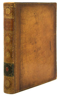
1785réf. 19946London: H. Hughs for G. Nicol and T. Cadell 1785. 4 volumes Text: 3 vols. quarto 11 3/8 x 9 1/4 inches; Atlas vol. of plates: 1 vol. large folio 22 x 16 inches. Text: Engraved medallion vignette on each title 1 folding letterpress table 24 engraved maps coastal profiles and charts 13 folding. Atlas vol.: 63 engraved plates plans and maps one double-page one folding. Text: contemporary calf expertly rebacked at an early date incorporating the original labels; atlas: expertly bound to style in half speckled calf over contemporary marbled paper-covered boards spine in eight compartments with raised bands each band flanked by triple gilt fillets red morocco lettering-piece in the second compartment green morocco in the fourth the others with simple repeat decoration in gilt A fine copy of the second and best edition of the official account of Cook's third and last voyage including images of and text on the exploration of Hawaii and the west coast of America Canada and Alaska. "The famous accounts of Captain Cook's three voyages form the basis for any collection of Pacific books. In three great voyages Cook did more to clarify the geographical knowledge of the southern hemisphere than all his predecessors had done together. He was really the first scientific navigator and his voyages made great contributions to many fields of knowledge" Hill. The typography of the second edition text of the third voyage is generally considered superior to the first Hughs took over the printing from Strahan and re-set all the text. Contemporary support for this view is reported by Forbes who quotes an inscription in a set presented by Mrs. Cook to her doctor Dr. Elliotson which notes ".the second edition being much superior to the first both in paper & letterpress." "Cook's third voyage was organized to seek the Northwest Passage and to return the islander Omai to Tahiti. Officers of the crew included William Bligh James Burney James Colnett and George Vancouver. John Webber was appointed artist to the expedition. After calling at Kerguelen Island Tasmania New Zealand and the Cook Tonga and Society Islands the expedition sailed north and discovered Christmas Island and the Hawaiian Islands which Cook named the Sandwich Islands. Cook charted the American west coast from Northern California through the Bering Strait as far north as latitude 70 degrees 44 minutes before he was stopped by pack ice. He returned to Hawaii for the winter and was killed in an unhappy skirmish with the natives over a boat. Charles Clarke took command and after he died six months later the ships returned to England under John Gore. Despite hostilities with the United States and France the scientific nature of this expedition caused the various governments to exempt these vessels from capture. The voyage resulted in what Cook judged his most valuable discovery - the Hawaiian Islands" Hill pp.61-62. Cf. Beddie 1543; cf. Forbes Hawaiian National Bibliography 62; cf. Lada-Mocarski 37; cf.Printing and the Mind of Man 223; cf. Sabin 16250. H. Hughs for G. Nicol and T. Cadell unknown books
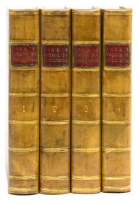
1784réf. 21446London: W. & A. Strahan for G. Nicol and T. Cadell 1784. 4 volumes. Text: 3 vols. quarto 11 3/16 x 9 inches; Atlas: 1 vol. large folio 23 1/2 x 17 inches. Text: 1p. publisher's advertisements at end of vol.III. 1 folding letterpress table 24 engraved maps coastal profiles and charts 14 folding extra-illustrated with a duplicate folding engraved "Chart of the NW Coast of America and NE Coast of Asia" which is also present in the atlas. Atlas vol.: 63 engraved plates plans and maps one double-page one folding uncut. Text: contemporary tree calf expertly rebacked to style the flat spines divided into six compartments by double fillets enclosing a neo-classical roll red/brown morocco lettering-piece in the second compartment green morocco label with onlaid disc of red/brown morocco with volume number the remaining compartments elaborately tooled in gilt with stylised foliage cornerpieces around various large centrally-place tools; Atlas: expertly bound to style in half calf over marbled paper-covered boards the flat spine elaborately tooled in gilt uniform to the text. A fine set of the first edition of the official account of Cook's third and last voyage: a cornerstone among travel and voyage literature on the exploration of Hawaii and the northwest coast of America Canada and Alaska. This copy particularly desirable with the plates in the atlas uncut. "The famous accounts of Captain Cook's three voyages form the basis for any collection of Pacific books. In three great voyages Cook did more to clarify the geographical knowledge of the southern hemisphere than all his predecessors had done together. He was really the first scientific navigator and his voyages made great contributions to many fields of knowledge" Hill. "Cook's third voyage was organized to seek the Northwest Passage and to return the islander Omai to Tahiti. Officers of the crew included William Bligh James Burney James Colnett and George Vancouver. John Webber was appointed artist to the expedition. After calling at Kerguelen Island Tasmania New Zealand and the Cook Tonga and Society Islands the expedition sailed north and discovered Christmas Island and the Hawaiian Islands which Cook named the Sandwich Islands. Cook charted the American west coast from Northern California through the Bering Strait as far north as latitude 70 degrees 44 minutes before he was stopped by pack ice. He returned to Hawaii for the winter and was killed in an unhappy skirmish with the natives over a boat. Charles Clarke took command and after he died six months later the ships returned to England under John Gore. Despite hostilities with the United States and France the scientific nature of this expedition caused the various governments to exempt these vessels from capture. The voyage resulted in what Cook judged his most valuable discovery - the Hawaiian Islands" Hill. Beddie 1543; Forbes Hawaiian National Bibliography 85; Hill 2004 361; Lada-Mocarski 37; cf.Printing and the Mind of Man 223; Sabin 16250. W. & A. Strahan for G. Nicol and T. Cadell unknown books
1777réf. WRCAM54751London 1777. Two volumes. xviii26021; 4607pp. including errata leaf plus large folding map. Quarto. Contemporary speckled calf rebacked with original gilt leather labels preserved raised bands corners renewed. Minor shelf wear one contemporary and one modern bookplate on pastedowns institutional bookplates on verso of titlepages. Minor occasional foxing some penciled marginalia and underlining to text. Very good. Forster's important account of Cook's second voyage and an essential component of the record of that great expedition. Forster and his father John Reinhold served as official botanists during the expedition. When the Admiralty decided to prevent the elder Forster from contributing to the official report George produced his own publication preceding the official account by several weeks. The Admiralty commissioned Cook to undertake his second voyage in the wake of the great success of the first expedition. The purpose of the second voyage was to circumnavigate the globe as far to the south as possible searching for any southern land masses previously unknown. Cook proved that "Terra Australis" which was supposed to lie between South America and New Zealand was nonexistent; but the party became the first to traverse the Antarctic Circle and discovered and rediscovered islands in the Pacific. "For all the controversy A VOYAGE ROUND THE WORLD is an interesting and important account that complements the official one with facts and astute observations on the human side of the voyage" - Rosove. Davidson describes this account as "an important work and a necessary supplement to the official account." HILL 625. BEDDIE 1247. HOLMES 23. SABIN 25130. SPENCE 464. DAVIDSON pp.61-62. ROSOVE ANTARCTIC 132. hardcover books
1784réf. WRCAM54194London: Printed by W. and A. Strahan for G. Nichol and T. Cadell 1784. Three quarto text volumes plus large folio atlas. Text: Twenty-four engraved maps coastal profiles and charts thirteen folding; folding letterpress table. Atlas: Sixty-three engraved plates charts and maps including one folding map and one double- page map. Text: Contemporary speckled calf gilt ruled expertly rebacked in matching gilt calf with gilt leather labels all edges painted red. 20th-century bookplates on front pastedowns. Light offsetting from plates light tanning and scattered faint foxing. Atlas: Expertly bound to style in half calf and marbled boards spines gilt black morocco label. Contemporary ink inscription on verso of final plate. Marginal light foxing and dust soiling. A very good set. A lovely set of the first edition of Cook's Third Voyage with a note of presentation in the atlas volume by Captain James King: "Thomas Venables The gift of Captain King." King was the author of the third text volume in the set and the preparer of Cook's journals that comprise the first two text volumes. Venables was probably a member of an ancient Cheshire landowning family later involved in early Australian settlement. King began Cook's final expedition as the expedition's astronomer and as a lieutenant on the Resolution but by the end of the expedition had been promoted to command of the Discovery and second-in-command. "At the time of Cook's death at Hawaii 14 February 1779 King was on shore in charge of the observatory. He had with him only a few men but was reinforced by some of a boat's crew who had been rowing off the mouth of the bay before the disturbance with the Hawaiians began. This brought the number of the party up to twenty-four and fortifying themselves in a neighbouring heiau or open-air temple they succeeded in repelling the attack of the Hawaiians until they were relieved two hours later by the ships' boats" - DNB. 6/10/2019 "Cook's third voyage was organized to seek the Northwest Passage and to return the islander Omai to Tahiti. Officers of the crew included William Bligh James Burney James Colnett and George Vancouver. John Webber was appointed artist to the expedition. After calling at Kerguelen Island Tasmania New Zealand and the Cook Tonga and Society Islands the expedition sailed north and discovered Christmas Island and the Hawaiian Islands which Cook named the Sandwich Islands. Cook charted the American west coast from Northern California through the Bering Strait as far north as latitude 70 degrees 44 minutes before he was stopped by pack ice. He returned to Hawaii for the winter and was killed in an unhappy skirmish with the natives. Charles Clarke took command and after he died six months later the ships returned to England under John Gore. Despite hostilities with the United States and France the scientific nature of this expedition caused the various governments to exempt these vessels from capture. The voyage resulted in what Cook judged his most valuable discovery - the Hawaiian Islands" - Hill. An excellent set of one the great Pacific voyages inscribed by one of its ultimate commanders and the partial author of the present published account Capt. James King. BEDDIE 1543. FORBES 62. HILL 361. HOWES C729a "aa." LADA-MOCARSKI 37 later issue. PRINTING AND THE MIND OF MAN 223. SABIN 16250. STREETER SALE 3478. REESE BEST OF THE WEST 14. DNB online. Printed by W. and A. Strahan for G. Nichol and T. Cadell hardcover books
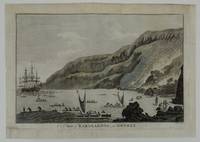
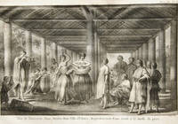
1785réf. 267711785. Very Good. Engraving of A View of Karakakooa in Owyhee. Remargined paper size 15 1/4 x 10 3/4 inches 38.5 x 27.3 cm. Professionally remargined and laid down on tissue by Green Dragon bindery. We think the first edition of this engraving was created by John Webber engraved by W. Byrne and published in the atlas plate 68 to accompany "A Voyage to the Pacific Ocean London: W. and A. Strahan for G. Nicol 1784." This example is smaller lightly tinted and rather than being engraved by Byrne is marked "Taylor sculp" lower right. In pencil it is marked on rear "opposite p. 577 Cooks' Voyages 1785 edition". We have been unable to trace to our satisfaction exactly where this engraving was published. It is nonetheless a famous scene and desirable to those who collect voyages Hawaii and the location where Captain Cook eventually died. unknown books
1796réf. WRCAM46432Philadelphia: W. Woodward for B. Johnson 1796. 252pp. 12mo. Modern pink paper boards printed paper label. Light dampstaining and soiling to text heavier in some places. Good plus. "Faithfully abridged from the quarto edition." An abridged children's version of Captain James Cook's third and final voyage on which he was murdered by natives. The third voyage was undertaken to continue the British survey of the Pacific but most particularly to search for a northwest passage from the western side. Sailing in 1776 the expedition called at Kerguelen Island Tasmania New Zealand and the Cook Tonga and Society islands then sailed north and discovered Christmas Island and the Hawaiian Islands. They then thoroughly explored and charted the Northwest Coast from the Bering Straits along the coast of Alaska and Canada as far south as present northern California. Returning to Hawaii in 1778 the expedition was at first received warmly; but after departing and being forced to return to repair a mast trouble developed which led to a tragic series of events in which the great navigator was killed. Relatively scarce with fewer than ten copies listed in ESTC. EVANS 30276. ESTC W37314. FORBES 257. REESE BEST OF THE WEST 14 ref. W. Woodward, for B. Johnson hardcover books
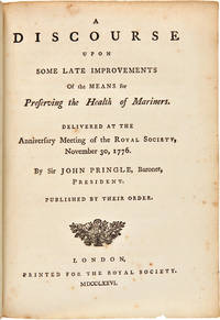
1776réf. WRCAM36096London: Printed for the Royal Society 1776. 444pp. Half title. Small quarto. 20th-century three- quarter calf and marbled boards gilt label. Leaf C4 signed C3 a cancel as usual. Occasional minor foxing ink stain on p.2. Very good bound with five other works by Pringle see below. One of the most significant of all the printed works relating to Cook's voyages and their importance. This is the extremely rare first appearance in print of Cook's epoch- making account of the successful measures taken against scurvy on his first two voyages. There were several later versions and translations but the original edition of this milestone publication has long been acknowledged as a major rarity. The paper on scurvy was read to the Royal Society by its president Sir John Pringle in the absence of Cook himself then just beginning his final voyage as the year's Copley medal award winner and immediately published in this form. Pringle's long presentation address quoting directly from Cook and other sources is followed by Cook's paper and an extract from a letter by Cook to Pringle written from Plymouth Sound in July 1776. The paper subsequently appeared in the official account of the second voyage and in the PHILOSOPHICAL TRANSACTIONS of the Royal Society. In 1783 a series of six of Pringle's discourses at the annual presentations of the Copley medal was published in one volume. "In Pringle's discourse on preserving the health of mariners he includes the first printing of Captain Cook's important paper entitled: 'The Method taken for preserving the Health of the Crew of His Majesty's Ship the Resolution during her late Voyage round the World.' In this paper which Cook communicated to Pringle President of the Royal Society Cook describes the supplies carried on the voyage and his maintenance of the cleanliness of his ship and crew. It was included by Pringle in his discourse commemorating Cook's receipt of the Copley medal" - Norman sale. The winning of the battle against scurvy was one of the most important achievements in the general field of exploration. It made possible the major voyages that followed. As Robert Hughes so aptly put it in THE FATAL SHORE "malt juice and pickled cabbage put Europeans in Australia as microchip circuitry would put Americans on the moon." This copy is very appropriately accompanied by five other Royal Society discourses of the period. A DISCOURSE. is here bound chronologically with five other Pringle first editions: 1 A DISCOURSE ON THE DIFFERENT KINDS OF AIR. 1774. 2 A DISCOURSE ON THE TORPEDO. 1775. 3 A DISCOURSE ON THE ATTRACTION OF MOUNTAINS. 1775. 4 A DISCOURSE ON THE INVENTION AND IMPROVEMENTS OF THE REFLECTING TELESCOPE. 1778. 5 A DISCOURSE ON THE THEORY OF GUNNERY. 1778. The Streeter-Norman copy of the DISCOURSE.FOR PRESERVING THE HEALTH OF MARINERS was also bound with these five additional works by Pringle. STREETER SALE 2410. NORMAN SALE 378. GARRISON-MORTON 2156 3714. BEDDIE 1290. HOLMES 20. KROEPELIEN 1065. Printed for the Royal Society hardcover books
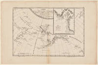
1785réf. WRCAM29328Paris 1785. Map 18 x 12 inches. Single vertical fold through center four- inch tape repair near bottom edge. Minor browning at edges. Very good. Archival matting and protected with Mylar sheet. This is the general map of the Northwest Coast from the atlas volume of the first French edition of Cook's third and final voyage. The Aleutian Islands are shown in particular detail while the entrance to the natural harbor of Nootka is displayed in an inset. FORBES 90 ref. unknown books
1784réf. WRCAM43625Dublin 1784. Three volumes. 8xcviii421; 14549; 11559pp. plus frontispiece portrait eighteen folding maps and charts seven folding plates and folding table. Contemporary calf spines gilt leather labels. Extremities lightly worn slight wear to spine ends and hinges first volume expertly rebacked with original spine laid down. Minor occasional foxing. A very good set. First Dublin edition of the official account of Cook's third and final voyage including text on the exploration of Hawaii and the west coasts of America Canada and Alaska. The third voyage was undertaken to continue the British survey of the Pacific but most particularly to search for a northwest passage from the western side. Sailing in 1776 the expedition called at Kerguelen Island Tasmania New Zealand and the Cook Tonga and Society islands then sailed north and discovered Christmas Island and the Hawaiian Islands. They then thoroughly explored and charted the Northwest Coast from the Bering Straits along the coast of Alaska and Canada as far south as present northern California. Returning to Hawaii in 1778 the expedition was at first received warmly; but after departing and being forced to return to repair a mast trouble developed which led to a tragic series of events in which the great navigator was killed. However the expedition pressed on under Clerke and then Gore and explored the coasts of Siberia and Kamchatka before returning to England in 1780. Forbes calls this work "arguably the single most important book on the Hawaiian islands." The Dublin edition was issued both with and without the plates; this copy is the issue with the plates which is considerably more desirable and difficult to come by. HOWES C729a. SABIN 16250. BEDDIE 1546. London edition: HILL 361. FORBES 62. LADA-MOCARSKI 37. REESE BEST OF THE WEST 14 ref. hardcover books
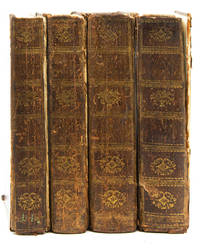
1774réf. WRCAM15266Paris 1774. Four volumes. ivxvi2xxxii388pp. plus sixteen folding maps and plates; 2536pp. plus sixteen maps and plates mostly folding; 2394pp. plus seventeen maps and plates mostly folding; viii367pp. plus three maps and plates two folding. Quarto. Modern half mottled calf and marbled boards spines gilt leather labels. Some scattered foxing and tanning. Overall very good. The first French edition after the original English edition of the previous year. Hawkesworth was commissioned by the Admiralty to edit this collection of voyages which includes Cook's first voyage to Tahiti to observe the transit of Venus across the sun determine the distance between the sun and the earth and continue Byron's explorations. During this voyage Cook visited Tahiti and made the necessary calculations named and charted the Society Islands explored and surveyed New Zealand and charted the eastern coast of Australia naming it New South Wales finally returning to England in 1771. Other narratives are of Byron's voyage to the Gilbert and Tuamoto Islands Wallace's discovery of Tahiti and Moorea and Carteret's discovery of Pitcairn Island after his separation from Capt. Wallis in a storm. The handsome plates depict the natives landscapes and seascapes and the maps show the routes of the ships and areas charted. An early and important compilation. This French edition is not listed in Hill. Sabin calls for only 361 pages in the fourth volume and states that the French editions "should be accompanied by an Atlas entitled: CARTES ET FIGURES a Paris Chez Saillant et Nyon. M.DCC.LXXIV. 4to." The NUC makes no mention of an atlas but the set cited there is imperfect lacking the third volume. SABIN 30940. hardcover books
1773réf. WRCAM18891London 1773. with: Cook James: A VOYAGE TOWARDS THE SOUTH POLE AND ROUND THE WORLD.IN THE YEARS 1772 1773 1774 AND 1775. London. 1784. with: Cook James: A VOYAGE TO THE PACIFIC OCEAN. London. 1784-85. with: Kippis Andrew: THE LIFE OF CAPTAIN JAMES COOK. London. 1788. Ten volumes all together including atlas volume. Text volumes: Large quarto. Contemporary calf expertly rebacked. Atlas: Large folio. Modern three-quarter calf and contemporary boards expertly rebacked in a complementary manner. Boards slightly worn particularly at edges. Upper right corner of upper board of second volume of third voyage chipped. Light foxing and dampstaining in some volumes particularly in margins. Some paper restoration on some plates in the atlas particularly in corners. Armorial bookplates. Overall very good. A complete set of Cook's three voyages being the second and best edition of the first voyage the first edition of the second voyage and a mixed set of the third voyage volumes one and two are from the second edition volume three from the first edition with the plates of the third voyage bound in an atlas lacks the rare "Death of Cook" plate as usual and with Kippis' biography of Cook. The first voyage describes Cook's explorations of New Zealand Australia Tahiti and other islands. The second voyage describes his southern voyages in search of a southern continent. The third is his north Pacific explorations of Alaska the Northwest Coast and Hawaii where the great navigator met his death. Of equal importance as a text of exploration a cartographic source for the numerous maps and charts included in the work and a visual source of the engravings of fauna flora and inhabitants of the Pacific. In all the entire set contains more than 200 maps and plates. HILL 782 783. HOWES C729a 3rd voyage. HOLMES 5 24 47. BEDDIE 650 1216 1552. LADA-MOCARSKI 37 3rd voyage. MITCHELL LIBRARY COOK BIBLIOGRAPHY passim. FORBES 62 3rd voyage. ROSOVE ANTARCTIC 77 2nd voyage. hardcover books
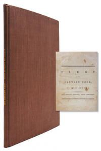
1784réf. 318236London: Printed and Sold by J.Jackson and J. Dodsley 1784. Fourth Edition. 25 pp. 4to. Modern brown buckram. Fourth Edition. 25 pp. 4to. SIGNED. Signed "Anna Seward" at the bottom of the last page. Seward wasknbown as the Swan of Litchfield. She remained single and recently scholars have argued she was a lesbian. ESTC T95493 Printed and Sold by J.Jackson and J. Dodsley unknown books
1784réf. 310843Dublin: Chamberlaine W. Watson Potts Williams Cross Jackson Moncriefe et al. 1784. First Dublin edition. With engraved portrait frontispiece and folding appendix table. 8 xcviii 421; 14 549; 12 559 pp. 3 vols. 8vo. Near contemporary straight grained black morocco over marbled boards. Some shelfwear to boards internally clean. First Dublin edition. With engraved portrait frontispiece and folding appendix table. 8 xcviii 421; 14 549; 12 559 pp. 3 vols. 8vo. First Dublin edition of the official account of Cook's final voyage the issue without plates and maps. Beddie 1546; Forbes 72; Howes C-729a; Sabin 16250 Chamberlaine, W. Watson, Potts, Williams, Cross, Jackson, Moncriefe, et al. unknown books
1790réf. 310846London: Printed for Alex. Hogg at the King's-Arms No. 16 Paternoster-Row; and sold by all Booksellers and news-carriers in town and country 1790. An entire new edition taken from the original journals as published in quarto by government at a most extravagant price. The whole now revised corrected and improved and published on reasonable terms by Capt. John Hogg late of the Royal Navy. Illustrated with 115 engravings. Without large folding map charting the three voyages. 4 vols. 8vo. Contemporary full tree calf. Lacking folding chart of voyage hhinges loose on several two covers detached internally very good. Booklabels of J. Sellick Bookseller Binder Plymouth. An entire new edition taken from the original journals as published in quarto by government at a most extravagant price. The whole now revised corrected and improved and published on reasonable terms by Capt. John Hogg late of the Royal Navy" Illustrated with 115 engravings. Without large folding map charting the three voyages. 4 vols. 8vo. Not in Beddie. Published in 80 weekly parts from 1784 to 1786. This scarce edition is revised from that of 1785 ESTC cites four copies only two of which are complete: a complete copy in the National Library of Ireland; a copy in a private collection; a copy at the Boston Athenaeum in fact an incompete copy of the 6 volume ed of 1795; and a copy at St. John's University which is vol 4 only. ESTC T206666; not in Beddie cf. 21 & 22 Printed for Alex. Hogg at the King's-Arms, No. 16 Paternoster-Row; and sold by all Booksellers and news-carriers in town and cou unknown books
1782réf. 310848London: G. Robinson J. Sewell and J. Debrett 1782. First edition. Engraved folding map and 21 engraved plates. x 358 2 pp; 6 347 pp. Half-title volume 1 instructions to binder at end of volume 1. 2 vols. 8vo. Modern morocco. Faint foxing occasional toning neat repair to bound edge of title and half title a few small neat repairs to folding map with small tape ghost to bottom edge of same some mostly marginal worming at middle of vol 2 very good. First edition. Engraved folding map and 21 engraved plates. x 358 2 pp; 6 347 pp. Half-title volume 1 instructions to binder at end of volume 1. 2 vols. 8vo. Cook's Third Voyage. First edition of this account of Cook's final voyage. "Ellis was a surgeon's mate during Cook's third voyage first on the Discovery and later on the Resoultion and gives quite a good history of this expedition. This account was published two years before the official narrative . It appears that needing money Ellis sold his narrative to a bookseller for fifty guineas. The fine plates are among the earliest published on the Hawaiian Islands Alaska and the Northwest" Hill. The plates include eight of Hawaii two of Alaska and three of the Northwest Coast. Beddie 1599; Forbes 41; Hill 555; Howes E-122; Sabin 22333 G. Robinson, J. Sewell, and J. Debrett unknown books
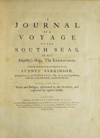
1773réf. 310853London: Printed for Stanfield Parkinson 1773. First edition with the very rare "Explanatory Remarks" by Fothergill and postscript. Complete with frontispiece and 27 engraved plates including 1 map. xxiv 22 212 2 pp. Imperial 4to. Contemporary tree calf finely rebacked with gilt spine to period style. Fine. First edition with the very rare "Explanatory Remarks" by Fothergill and postscript. Complete with frontispiece and 27 engraved plates including 1 map. xxiv 22 212 2 pp. Imperial 4to. With The Rare Explanatory Remarks by Fothergill. First edition of this important account of Cook's first voyage based on the journal of Parkinson who had been engaged by Sir Joseph Banks to serve as natural history draughtsman aboard the Endeavour. Parkinson died of dysentery on the homeward voyage and his account was transcribed and published by his brother Stanfield Parkinson who was forced by injunction to delay publication until Hawkesworth's official account appeared. "Parkinson made numerous drawings of botanical and other subjects including landscapes and portraits of native chiefs . Banks spoke highly of his 'unbounded industry' in making for him a much larger collection of drawings than he anticipated. His observations too were valuable and the vocabularies of South Sea languages given in his journal are of great interest" Hill. This copy includes the rare "Explanatory Remarks" by John Fothergill a Parkinson family friend who mediated an agreement between Stanfield Parkinson and Banks both of whom laid claim to the journal which would allow for the publication of the book. When Stanfield Parkinson included a scurrilous preface attacking Banks and misrepresenting his actions an offended Fothergill purchased the remaining copies inserting into them these 22 pages of remarks which sought to set the record straight. In 1784 he brought out a new edition of Parkinson's account which included the remarks but copies of the first edition which include them are scarce on the market. Beddie 712; Hill 1308; Holmes 7; Howgego C173; Du Rietz 944; Sabin 58787 Printed for Stanfield Parkinson unknown books
1783réf. 310851Hartford: Nathaniel Pattern 1783. First edition lacking the map as in almost all copies. 208 pp. 1 vols. 8vo. Contemporary sheep over boards finely rebacked with period spine to style. Highest quality conservation repairs to edges of first four leaves of text and to corner margins on last two leaves. Very good copy in a handsome binding. First edition lacking the map as in almost all copies. 208 pp. 1 vols. 8vo. Rare. "This is not only the first American book on the Northwest Coast but also the first American book on Hawaii" Streeter. Ledyard is distinguished in many respects he was the only American to sail on Cook's third voyage which explored Alaska and discovered Hawaii. He was also in the boat that carried Cook ashore on the morning of his death. Indeed this work contains a detailed account of Cook's death "distinguished by its evident authority" Hill. The purpose of Cook's third voyage was twofold. Ostensibly it was to return Omai to his homeland in French Polynesia but the main purpose was to search for the Northwest Passage. The Resolution and Discovery departed Plymouth in 1776 and made their way via the Cape to New Zealand and Tahiti. It was from there that Cook discovered Hawaii which he regarded as his greatest achievement. The boats then proceeded to the Pacific Northwest and commenced their search for a route to the Atlantic. They returned to Hawaii for the winter of 1778-9. Their initial warm welcome soon wore off and tensions between the Hawaiians and the British resulted in Cook being killed on the shore of Kealakekua Bay on February 14 1779. Charles Clerke assumed command of the expedition and proceeded north once again to pursue the voyage's objective. The two ships returned to England in 1780. A Connecticut native after the voyage Ledyard remained in England until 1782 when he was posted to the North American station - the Revolutionary War was ongoing. He promptly deserted and returned to Hartford where this account was published. This work preceded Rickman's by a matter of months though in fact Ledyard made "liberal use of the first English edition of Rickman's account in his own narrative" Hill. This is not to deride Ledyard unnecessarily; in addition to his account of Cook's death his keen observations on the fur trade in the Pacific northwest are of great value. Ledyard's account is one of the rarest works on Cook's third's voyage and Hill confirms that "only a few copies still have the map." It was wanting in both the Streeter and Brooke-Hitching copies. Beddie 1603; Evans 17998; Sabin 39691; Forbes 52; Hill 991; Howes L-181 "d"; Lada-Mocarski 36; Smith 5797; Streeter Sale VI:3477 Nathaniel Pattern unknown books
1785réf. 310841London: W. Strahan and T. Cadell 1785. Third edition. Large folding general chart of the expedition folding chart of the Island of Otaheite and 9 folding plates. lvi 362; 10 447; 8 416; 6 429 3 pp. 4 vols. 8vo. Modern calf over marbled paper boards. Occasional foxing and minor offset a very clean copy. Third edition. Large folding general chart of the expedition folding chart of the Island of Otaheite and 9 folding plates. lvi 362; 10 447; 8 416; 6 429 3 pp. 4 vols. 8vo. Cook's first voyage. Third edition of this chronicle of important English south-seas expeditions including Cook's monumental first voyage which is covered in volumes 2-4. The aim of Cook's first voyage was to sail to Tahiti to observe the transit of Venus; having done so Cook left Tahiti and discovered the Society Islands explored New Zealand at great length as well as the eastern coast of Australia which he charted for 2000 miles and named New South Wales. The expedition lasted from 1768-1771 and resulted in the annexation of both Australia and New Zealand by Britain won Cook fame and led to his two subsequent voyages. Beddie 665; ESTC T165111 W. Strahan and T. Cadell unknown books
1781réf. 310852Dublin: Price Whitestone Chamberlain et al. 1781. First Dublin edition. Complete with 5 engraved plates including frontispiece plate of the Death of Cook and large folding map. 4 xlvii 1 396 pp. 1 vols. 8vo. Contemporary calf rebacked to style marbled endpapers. Occasional spotting and dustsoiling better than very good. First Dublin edition. Complete with 5 engraved plates including frontispiece plate of the Death of Cook and large folding map. 4 xlvii 1 396 pp. 1 vols. 8vo. First Dublin edition. The first Dublin edition of the first full account in English of Cook's third and final voyage. Rickman was a second lieutenant aboard the Discovery. "It provides an important supplement to the official account of the Third Voyage published in 1784" Forbes. Howes R-276 "aa"; Forbes 36; Wickersham 6555a; Davidson p 64; Kroepelien 1078; Beddie 1608 Price, Whitestone, Chamberlain, et al. unknown books
1788réf. 310845London: Printed for G. Nicol and G. G. J. and J. Robinson 1788. First edition. Frontispiece portrait. xvi 527 1 pp. 1 vols. 4to. Contemporary speckled calf boards with later morocco spine. Light foxing and offsetting to frontispiece some toning and scattered foxing but a clean copy overall. First edition. Frontispiece portrait. xvi 527 1 pp. 1 vols. 4to. FIRST BIOGRAPHY OF COOK. The first edition of this highly influential first English biography of Cook by the Anglican clergyman Kippis one of the leading biographers of his day. In addition to describing the three great voyages in depth Kippis also deals with Cook's earlier experiences including his duties aboard the Mercury during the siege of Quebec and his Newfoundland and Labrador surveys. Most of Samwell's narrative of Cook's death is included as well. While Kippis did not appear to be entirely insensitive to the long-term effects of European contact with Pacific peoples he championed Cook's humanitarian cultural and intellectual mission in the circumnavigation of the globe. In a study of European exploration of the Pacific Lynne Withey concluded that this volume by Kippis became a prominent justification for the involvement of Europeans in the Pacific islands for years after Cook's death Withey 406-407. The second appendix includes "The Moral an Ode" by the British poet novelist and religious dissenter Helen Maria Williams an old family friend of Kippis. Hill 935; Sabin 37954; Beddie 32; Holmes 69; Kroepelien 647; Lada-Mocarski 40; Howes K179 "aa."; Forbes 149. Provenance: John Thornhill armorial bookplate; The Beaufoy Library bookplate Printed for G. Nicol and G. G. J. and J. Robinson unknown books
1778réf. 5440Paris: Hôtel de Thou 1778. Very Good/Attractive set of the French-language version of Cook's account of his second expedition A Voyage towards the South Pole and Round the World London 1777. This astonishing journey from 1772 to 1775 went around the globe as far south as possible to explore the existence or not of a postulated southern landmass. In the course of the voyage Cooks ships Resolution and Adventure crossed deeply into Antarctic waters ultimately turned back by ice barriers. Zig-zagging through the South Pacific Cooks ships also visited Easter Island the Marquesas Tahiti the Society Islands Niue the Tonga Islands the New Hebrides New Caledonia Norfolk Island Palmerston Island South Sandwich Islands and South Georgia many of which Cook named in the process. This French edition of his report was published close on the heels of the English version in two distinct formats a five-volume quarto and a six-volume octavo with a quarto atlas containing the extraordinary set of 66 engraved plates after William Hodges. The French translator Jean-Baptiste-Antoine Suard incorporated into the text a great deal of material from the rival account of the voyage that Johann Reinhold Forster published under guise of his son Georg based on a draft of Cooks own journal. In English Forsters account was published separately. A fine set. Six volumes octavo 20 cm and atlas volume in quarto 27 cm. Text volumes bound in cat's paw calf; six-panel spines tooled in gilt with red leather title labels lettered in gilt. Marbled endleaves. Minimal wear. Atlas volume bound separately in contemporary speckled calf with black leather title label. 65 copper-engraved plates including double-page folding "Carte de l'Hemisphere Austral" portraits scenes botanical representations plans and other maps. Excellent condition throughout. References: Mitchell Library p. 52; Sabin 16249 4to ed. Hôtel de Thou hardcover books