Hammacher, Abraham MarieBiblio.com

28 034 résultats
réf. 0025477102.Ghardcover. Good. Access codes and supplements are not guaranteed with used items. May be an ex-library book. hardcover
réf. 0704380390.Gpaperback. Good. Access codes and supplements are not guaranteed with used items. May be an ex-library book. paperback
réf. 0819706922.Gpaperback. Good. Access codes and supplements are not guaranteed with used items. May be an ex-library book. paperback
réf. 1577996704.Ghardcover. Good. Access codes and supplements are not guaranteed with used items. May be an ex-library book. hardcover
réf. 0141001437.Gpaperback. Good. Access codes and supplements are not guaranteed with used items. May be an ex-library book. paperback
réf. 0130601527.Ghardcover. Good. Access codes and supplements are not guaranteed with used items. May be an ex-library book. hardcover
réf. A9780192806727Paperback / softback. New. Subtle is the Lord is recognized as the definitive scientific biography of Albert Einstein written by an award-winning physicist turned historian who knew Einstein personally in the last years of his life. Pais illuminates the man through his science with authority precision and liveliness. paperback
réf. A9781560007371Paperback / softback. New. paperback
réf. A9780804755184Hardback. New. This is a study of how the Breslau Jewish community the third largest and one of the most affluent in Germany coped with Nazi persecution from 1933 until its liquidation in 1943. hardcover
1990réf. 555811Feldheim Pub 1990. FIRST EDITION. Hardcover. Like New/Like New. First Edition Later Printing. Published by Feldheim Pub 1990. Octavo. Hardcover. Book is like new. Dust jacket is like new. Feldheim Pub hardcover
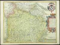
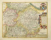
réf. 4227Antwerp: 1573-80. No binding. Very Good. 380 x 490 mm. in full modern wash colour. Abraham Ortelius' map of Bavaria Germany is derived from the large scale of Peter Apian 1561. First published in the ""Theatrum Orbis Terrarum"" in the first 'Additamentum' 1573. This example bears German text to the verso and comes from the 1580 edition which can be determined from the pagination. Van den Broecke M. 110. 1573-[80] unknown
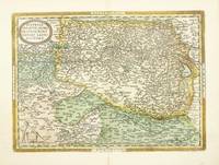
réf. 4070Antwerp: 1570-87. No binding. Very Good. 340 x 460 mm. in early wash colour. With a small colour smudge in the lower left margin otherwise a superb example. Abraham Ortelius' fine map of Austria published in the first edition of his extremely important atlas the 'Theatrum Orbis Terrarum' 1570. This example is with French text and comes from the 1587 edition. This is an example of the second state according to Van den Broecke. Koeman C. Atlantes Ort 1A-1D 27; Van den Broecke M. #105. 1570-[87] unknown
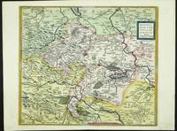
réf. 5581Antwerp: 1573-1602. No binding. Very Good. 370 x 420 mm. early wash colour in good condition. The map centres on Mansfeld in Saxony to the west is the city of Halle. It is derived from the work of Stella in 1561 and was published in Abraham Ortelius' 'Theatrum Orbis Terrarum' the first modern atlas from 1573. This example with Spanish text to the verso was published in 1602 and is in the second state of three. Karrow 72/7.2 & 55/2; Van der Broecke 39. 1573-[1602] unknown
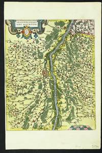
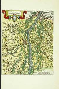
réf. 5174Antwerp: c.1584. No binding. Good. 305 x 245 mm. in fine early wash colour narrow margins to left where detached from accompanying plate otherwise in good condition. According to Meurer the source for this map is Daniel Speckel's three-sheet map of Elsas. Speckel 1536-89 is identified on the map as the source. He was a native of Strasbourg and an engraver by profession. He was also a fortress engineer and architect. He travelled extensively building various fortresses in Hungary Vienna and The Netherlands. Abraham Ortelius here employs him to produce a map of the region around Strasbourg for the 'Theatrum Orbis Terrarum' which was first issued in 1584. Van den Broecke M. 112b; Karrow 1/132; Meurer pp. 243-4; Norton 'Daniel Speklin: map-maker and architect' in 'Mapline' 21 pp. 1-2. c.1584 unknown
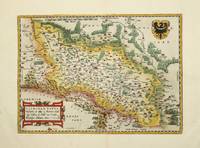
réf. 4706Antwerp: 1570-88. No binding. Very Good. 280 x 390 mm. modern wash colour in good condition. This map of Silesia is derived from that of Martin Helwig 1516-74 published in 1561 as stated in the title. It survives in just the one known example at the Badische Landesbibliothek Karlsruhe Germany. Helwig was a native of Silesia being born in Neisse his diary survives in the University Library of Wroclaw. It is present day south western Poland and displays both CrakawKrakow in the east and Breslaw Wroclaw in the centre. This Abraham Ortelius version was first published in the initial edition of the 'Theatrum Orbis Terrarum' in 1570. This example was issued in the Spanish text edition of 1588 with the pagination 54 to the verso. Karrow p. 38.1; Meurer p. 163; Van den Broecke M. #102. 1570-[88] unknown
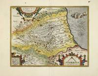
réf. 4709Antwerp: 1590-98. No binding. Very Good. 330 x 425 mm. recent wash colour in good condition. The map is derived from that of Natale Bonifacio 1538-92 which was published in Rome in 1587. Three years later Abraham Ortelius used the map for his 'Theatrum'. This example with French text to the verso comes from the 1598 edition. Van den Broecke no. 138; Meurer p. 118. 1590-[98] unknown
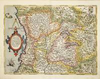
réf. 4704Antwerp: 1570-79. No binding. Good. 360 x 480 mm. in modern wash colour with very minor water stain to portion of side margins not effecting the image otherwise in good condition. This fine map of the majority of Northern Italy centred on the Republic of Milan was published in the first edition of Abraham Ortelius' Theatrum Orbis Terrarum' in 1570 the first modern atlas. It is derived from the work of Giovan Giorgio Settala a native of Milan. His only surviving map is of the Duchy of Milan and only two examples survive; the Biblioteca Istituto Geograficao Militare Italiano Florence and the British Library. This example was issued in the Latin text edition of 1579 with the pagination 61 to the verso although van den Broecke does not record it. It is derived from a map by Johannes Septala's. Karrow p. 478-9; Meurer p. 237; Van den Broecke M. no. 125. 1570-[79] unknown
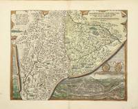
réf. 4085Antwerp: 1570-87. No binding. Very Good. 340 x 440 mm. in fine early wash colour. This is the earlier prefered plate of Salzburg in Abraham Ortelius' 'Theatrum Orbis Terrarum'. It includes a fine birds-eye view of the town. Van den Broecke M. #107; Karrow 68/1 pp. 475-7. 1570-[87] unknown
réf. 5593Antwerp: 1584-1608. No binding. Good. 305 x 205 mm. in fine modern wash colour narrow margins to left where detached from accompanying plate otherwise in good condition. According to Meurer the source for this map is Daniel Speckel's three-sheet map of Elsas. Speckel 1536-89 is identified on the map as the source. He was a native of Strasbourg and an engraver by profession. He was also a fortress engineer and architect. He travelled extensively building various fortresses in Hungary Vienna and The Netherlands. Abraham Ortelius here employs him to produce a map of the region around Strasbourg for the 'Theatrum Orbis Terrarum' which was first issued in 1584. Van den Broecke M. 112b; Karrow 1/132; Meurer pp. 243-4; Norton 'Daniel Speklin: map-maker and architect' in 'Mapline' 21 pp. 1-2. 1584-[1608] unknown
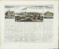
réf. 4310Amsterdam: 1714. No binding. Very Good. 145 x 260 mm. with fine recent wash colour on a folio sheet with two further views either side in good condition. An attractive view of Stockholm from the north with description of the form of government in Sweden in the early eighteenth century. The view is flanked by views of the Royal Place and Government House. It accompanied the encyclopaedic seven volume 'Atlas Historique' by the Chatelain family over a period of years. Zacharie Chatelain d.1723 was a bookseller and publisher in Amsterdam. He had two sons that joined him in the business Henri Abraham Chatelain 1684-1743 and Zacharie Chatelain 1690-54. The work was published between 1705 and 1720 each volume being re-issued at various times leading to a very complicated bibliographical history. The descriptive text discussed the history structure and genealogy of all parts of the world and was provided by the French geographer Nicolas Gueudeville. The maps in the work were largely derived from the French cartographer Guillaume de l'Isle. Koeman 1967-70 II pp. 33-8; Shirley 2004 T.Chat-1a; Tooley's Dictionary 1999-2004; Van Waning 2010. 1714 unknown
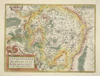
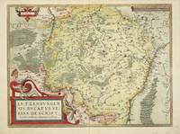
réf. 4686Antwerp: 1579-88. No binding. Very Good. 370 x 500 mm. with recent wash colour in good condition. This is the only map of Luxembourg in the famous Abraham Ortelius ""Theatrum Orbis Terrarum"". It first appeared in the 1579 edition and this example with Spanish text to the verso is from the 1588 edition. The map was originally drawn by Jacques Surhon for which he received 500 Livres in payment from Charles V in 1551. It was however never published. Van den Broecke M. 60.2; Van der Vekene 102B. 1579-[88] unknown
réf. 3030Antwerp: 1573-79. No binding. Very Good. 380 x 490 mm. with fine recent wash colour with Latin text on the verso in good condition. Very attractive and detailed map of this wealthy region of southern Germany from Abraham Ortelius' 'Theatrum Orbis Terrarum'. The map is derived from Philipp Apian's large scale map of the region published in 1561. Van den Broecke M. 110; Karrow 8/2; Meurer pp. 106-7. 1573-[79] unknown
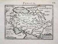
réf. 4953Amsterdam: 1595. No binding. Good. 80 x 110 mm. in good condition. This map is from the rarer first series of plates to Abraham Ortelius' miniature edition of his folio .Theatrum Orbis Terrarum'. It was first published in 1577. This is a map of Persia or present day Iran. Ala'i Cyrus. 2003. 'Mapping Persia: A brief introduction' in IMCoS Journal 94 pp. 5-22; 1595 unknown
réf. 4685Antwerp: 1579-80. No binding. Very Good. 370 x 500 mm. in fine wash colour. This is the only map of Luxembourg in the famous Abraham Ortelius ""Theatrum Orbis Terrarum"". It first appeared in the 1579 edition and this example comes from the German edition published the following year. The map was originally drawn by Jacques Surhon for which he received 500 Livres in payment from Charles V in 1551. It was however never published. Van den Broecke M. 60.1; Van der Vekene 102A. 1579-[80] unknown
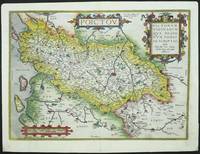
réf. 5619Antwerp: 1579-88. No binding. Good. 360 x 510 mm. in fine recent wash colour slight loss to lower corners repaired otherwise in good condition. This map of the Poitou region of western France is derived from the lost original by Pierre Rogier published in Paris by Francois Desprez. Meurer p. 224; Van den Broecke M. 38.1. 1579-[88] unknown